forest biome. one of the largest most ecologically complex systems biological communities dominated...
TRANSCRIPT

Forest Biome

Forest Biome One of the largest most ecologically complex systems Biological communities dominated by trees and woody vegetation Classified according to numerous characteristics
seasonality being the most widely used.
Three Distinct Groups:1. Tropical
2. Temperate
3. Boreal forests (tiaga) vary depending on zones climate
Requires abundance of soil & water Found in moist climates Temperatures require at least a warm season; if not warm year round
Today our forest biomes are being cut down, and at an alarming rate. Everyday, hundreds of species of plants and animals are disappearing from our planet.

Six Classifications
1. Low-Latitude Rainforest
2. Monsoon Forest
3. Subtropical evergreen forest
4. Midlatitude deciduous forest
5. Needleleaf forest1. Boreal
2. Coastal
6. Sclerophyll forest

Low-latitude rainforest
Geographic Location: Found in the equatorial and
tropical zone. Climate:
Warm/moist, subjective to mE/mT air masses
Area has high annual rainfall (over 80in)
Areas of equitorial location gives this area high avg. insolation/very little seasonal variation
Thunderstorms duration tends to be over small areas, intense and short lived

Low-latitude continued… Vegetation:
Due to streams flowing abundantly throughout the year river channels are lined with dense forest vegetation
A thick soil layer is formed by the decay and decomposition of rock to great depths, abundant rainfall and warm soil temperatures.
Products of this rainforest have economic value, containing important classes of foods such as: Root Crops Fruits
Animals: Contain a wide variety of animal species
Largest diversity of species of any life zone Estimated ½ of the worlds animal species live in these rainforests
25% of medicine derives from plants contained in the rainforests of this area

Human Impact in Low-latitude
Mostly affected by Human Influence in regards to: Farming Logging
Result = diminishing amount
of forestland Increase of
endangered animals

Geographical Location: South East Asia and Australia
At elevations below 1000 meters In Areas that experience monsoon climate
Climate: Seasonal pattern of rainfall Area contains a distinct dry season, which is when many trees lose their leaves Area also contains a season of rain, averaging at about 100 inches per year, this
is when major growth occurs Vegetation:
Contains smaller trees than those found in the rainforest, and have a more open canopy resulting in a closed forest at the floor, creating a “tropical jungle” beneath.
Deciduous Trees and Broadleaf Evergreen trees are some of the trees in this forest A diversity of plants are located here Well drained soils with dense and rich undergrowth
Monsoon Forest
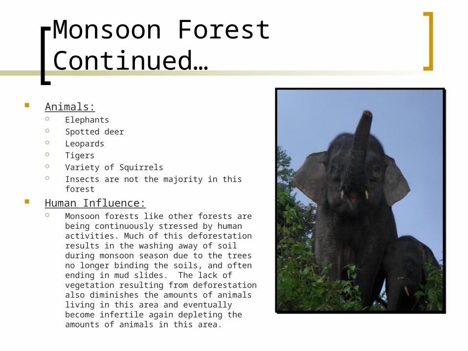
Monsoon Forest Continued…
Animals: Elephants Spotted deer Leopards Tigers Variety of Squirrels Insects are not the majority in this forest
Human Influence: Monsoon forests like other forests are being
continuously stressed by human activities. Much of this deforestation results in the washing away of soil during monsoon season due to the trees no longer binding the soils, and often ending in mud slides. The lack of vegetation resulting from deforestation also diminishes the amounts of animals living in this area and eventually become infertile again depleting the amounts of animals in this area.
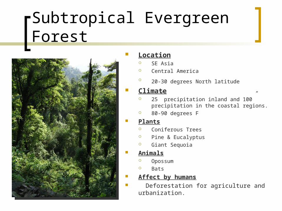
Subtropical Evergreen Forest Location
SE Asia Central America
20-30 degrees North latitude Climate
25” precipitation inland and 100” precipitation in the coastal regions.
80-90 degrees F Plants
Coniferous Trees Pine & Eucalyptus Giant Sequoia
Animals Opossum Bats
Affect by humans Deforestation for agriculture and urbanization.

Midlatitude Deciduous Forest
Location Eastern portion of North America Europe Asia (esp. in Japan, East China, SW
Russia) S.Chile and Coastal Areas of
Paraguay Primarily btwn. 0-50 degress N lat.
Climate Moderate Annual temp. 50 degrees F Annual Rainfall 30-60” rain 4-6 Mo. Summer
Experience all four seasons

Deciduous Forest Biome 5 different zones
1. Tree Stratum zone1. Oak maple walnut, etc
2. 60-100’ high
2. Small tree and sapling Zone1. Young short trees
3. Shrub Zone1. Rhododendrons and mt. laurel
4. Herb Zone
5. Ground Zone1. Lichens and mosses
Plants: Tall trees such as oak, walnut and maple Wildflowers such as oxlip and bluebells
Impact by Humans Deforestation due to agricultural and urbanization growth Hunting and poaching of the animal life

Needleleaf forest ~ Boreal
Geographic Location Sub-arctic: North America, Europe, and
Siberia. Mountain ranges and high plateaus.
Span from East-West lat. 45*N to 75*N.
Climate Very cold long winters w/continuous
snow cover. Short cool summers provide most of the
precipitation However total precipitation generally low.
Greatest annual temperature range of all climates.

Needleleaf Forest ~Boreal
Vegetation Few species mostly evergreen
conifers N.A., Europe, and west Siberia-
spruce and fir North/central and eastern Siberia
dominated by larch.
Animals deer, wolf, bear, moose.
Human influence Logging, clearing for settlement
and grazing, fire prevention.

Needleleaf Forest ~ Coastal
Location Pacific Northwest from
northern California to Alaska.
Heavy precipitation from orographic lifting, causing densest conifer growth.
Vegetation Cedar, spruce, Douglas fir
and giant redwoods, the world’s largest trees.

Sclerophyll Forest
Location Mainly on west coasts between
30* and 45* N/S. Baja California, Mediterranean,
Chile, South Africa, and Australia.
Climate Annual precipitation
varies widely per location
Winter – Most rainfall/moderate Summer – time of drought/ hot

Sclerophyll Forest
Vegetation Sclerophylls shrubs Trees with small leathery leaves Thick bark that are evergreen such as oak, pine and olive.
Animals Rodents, jackals, coyotes, goats.
Human influence Many Sclerophyll Forests have been destroyed completely
or reduced to woodlands.
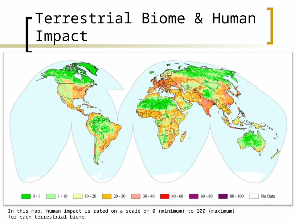
Terrestrial Biome & Human Impact
In this map, human impact is rated on a scale of 0 (minimum) to 100 (maximum) for each terrestrial biome.

Works Cited
"Forest Biomes." World Biomes. 22 Jan 2002. 17 Nov 2008 <http://www.worldbiomes.com/biomes_forest.htm>.
"Map of the Human Footprint." Earth Observatory. 03 Mar 2003. NASA. 16 Nov 2008 <http://earthobservatory.nasa.gov/IOTD/view.php?id=3254>.
"Rainforest Animals." The Animal Spot. 2008. The Animal Network. 17 Nov 2008 <http://www.rainforestanimals.net/copyrightpolicy.html>.
Strahler, Alan, and Arhtur Strahler. Introducing Physical geography. 4th ed. Hoboken, NJ: John Wiley & Sons, Inc., 2006. ISBN 0-471-67950-X.
"The Forest Biome." University of California Museum of Paleontology. Berkely. 17 Nov 2008 <http://www.ucmp.berkeley.edu/exhibits/biomes/forests.php>.