forest service appropriate assessment procedure - … · the forest service appropriate assessment...
TRANSCRIPT
Forest Service AAP Information Note
0
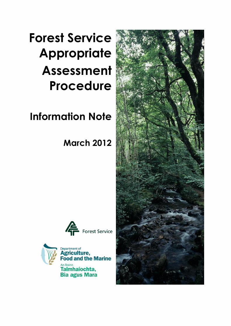
Forest Service
Appropriate
Assessment
Procedure
Information Note
March 2012

Forest Service AAP Information Note
1
Table of Contents
Forest Service Appropriate Assessment Procedure 1
1. General overview 1
2. Legislative background 1
3. The Forest Service Appropriate Assessment Procedure 1
4. Screening 2
5. Appropriate assessment 5
6. Imperative reasons of overriding public interest 6
7. Conclusion of the AAP 7
8. Post-consent 7
9. Public inspection 7
10. References 7
Appendix A: Forest Service Guidance Note: Natura Impact Statements 8
Appendix B: Appropriate Assessment Procedure (AAP) requirements regarding
Hen Harrier SPAs and afforestation (See Note below) 13
Appendix C: Appropriate Assessment Procedure (AAP) requirements regarding
Hen Harrier SPAs, felling and other disturbance operations 17
Appendix D: Appropriate Assessment Procedure (AAP) requirements regarding
Freshwater Pearl Mussel and forestry operations (See Note below) 25
Explanatory Note
The Forest Service AAP Information Note & associated Appendices A-C were originally issued in March 2012 with Forest Service Circular 02 / 2012. Appendix D was subsequently issued in August 2012 with Forest Service Circular 08 / 2012. This version consolidates the above into a single document, for ease of reference.
Please note the following: Procedures set out under Appendix B relate to agreed afforestation limits for individual Hen Harrier SPAs for the 2011/12 planting season. Currently, there are no agreed afforestation limits for Hen Harrier SPAs. The setting of any future limits will take place within the context of a Threat Response Plan, the development of which is been led by the National Parks & Wildlife Service (NPWS).
Forest Service, 06 March 2013

Forest Service AAP Information Note
1
Forest Service Appropriate Assessment Procedure
1. General overview
Natura sites, comprising SACs and SPAs, represent a key component of the protection of rare and endangered habitats and species, both in Ireland and at a European level. Under European and national legislation, the Forest Service is required to apply an appropriate assessment procedure to applications for consent, grant approval and licensing for various forestry activities, to evaluate the project within the context of any potentially relevant SAC or SPA. This procedure involves an initial screening, and if required, an actual appropriate assessment.
Initial screening is carried out to determine if there is a possibility of the project, individually or in combination with other plans or projects, having a significant effect on an SAC or SPA. Screening takes places as part of the normal evaluation of the application by the Forest Service, typically based on the submitted application form and maps. Screening will often conclude that there is no possibility of an impact arising, and approval may issue.
In cases where the screening identifies that there is a possibility of the project having an effect on a Natura site, the applicant is required to submit a Natura Impact Statement (NIS). The NIS examines the nature of the possible impact and sets out proposed mitigation measures. On receipt of this document, the Forest Service undertakes an appropriate assessment, before arriving at a decision to regarding consent, grant approval or licensing.
This information note sets out the Forest Service Appropriate Assessment Procedure (AAP). Appendices give guidance on compiling an NIS, and describe specific requirements under the AAP regarding afforestation and disturbance operations within SPAs designated for Hen Harrier. Other appendices may be added in the future, setting out specific requirements relating to other species and habitats.
2. Legislative background
The overall aim of the European Habitats Directive (Council Directive 92/43/EEC) is to maintain or restore the favourable conservation status of habitats and species which are threatened throughout Europe and deemed highly sensitive to change. These habitats and species are listed in the Habitats Directive and the Birds Directive (Directive 2009/147/EC). Special Areas of Conservation (SACs) and Special Protection Areas (SPAs) – collectively known as the Natura 2000 network – are designated to afford protection to the most vulnerable of these habitats and species.
One of the key protective measures under this European legislation is the requirement under Article 6(3) and 6(4) of the Habitats Directive to apply an appropriate assessment procedure, to consider any possible impact on the conservation objectives of a Natura 2000 site that might arise from a plan or project, before a decision is taken whether or not to allow that plan or project to proceed. The application of appropriate assessment in Ireland is governed by the European Communities (Birds and Natural Habitats) Regulations 2011 (S.I. No. 477 of 2011) (referred to below as the Birds & Habitats Regulations 2011) and the Planning and Development (Amendment) Act 2010, as amended by the Environment (Miscellaneous Provisions) Act 2011 (see Irish Statute Book, http://www.irishstatutebook.ie/).
Note, this Information Note is intended as a summary of the above legislation as it relates to forestry activities regulated by the Forest Service. Readers are advised to consult the original legal text, as appropriate.
3. The Forest Service Appropriate Assessment Procedure
As the public authority responsible for assessing applications for consent, grant approval and licences relating to various forestry activities, the Forest Service of the Department of Agriculture, Food and the Marine is required to apply an appropriate assessment procedure in accordance with the Birds & Habitats Regulations 2011. This procedure comprises an initial screening and where required, the appropriate assessment itself.
Forest Service AAP Information Note
2
This information note sets out the Forest Service Appropriate Assessment Procedure (AAP), to inform landowners, forest owners, forestry consultants, contractors and companies, and the wider forest industry. The AAP applies to all applications for consent, grant approval and licences received by the Forest Service across all relevant activities, from initial afforestation to road construction to clearfelling and reforestation.
Note, for brevity, the term ‘consent’ to used throughout this document to describe consent for afforestation and road construction under the European Communities (Forest Consent and Assessment) Regulations 2010, grant approval issued under any Forest Service grant scheme, and licences issued in relation to aerial fertilisation and under the Forestry Act 1946.
4. Screening
Screening is the initial step of the AAP, undertaken primarily to identify whether or not a project must undergo an appropriate assessment. Screening is required in relation to all applications within, partially within, or outside of a Natura site. In practice, many applications describe projects for which there is no possibility of a significant effect, either due to the nature of the project and / or its physical remoteness and non-connectivity with any Natura site. However, there are a range of situations where the possibility of a significant effect may realistically exist, e.g.
applications for afforestation within the 1 km National Parks & Wildlife Service referral zone surrounding a Natura site;
applications for road construction on a site within 3 km upstream of, and hydrologically connected to, a Natura site; and
applications for felling licences within a Hen Harrier SPA and associated sections of ‘Red Areas’ that extend beyond the SPA boundary.
In these and other similar situations, the Forest Service applies a detailed screening process to identify whether or not the possibility of a significant effect actually exists.
On receipt of an application, the Forest Service undertakes screening to evaluate: whether or not the project is directly connected to or necessary for the management of a Natura site(s); and if not, whether or not there is a possibility that the project, alone or in combination with other plans or projects, will have a significant effect on a Natura site(s). Examples of such effects include:
a reduction in the area of an Annex I habitat or the habitat area of an Annex II species within a Natura site;
damage to the physical quality of the environment in a Natura site, e.g. eutrophication of water, soil compaction;
serious or ongoing disturbance to those species or habitats for which the Natura site has been designated, e.g. increased noise, human activity;
direct or indirect damage to the size, characteristics or reproductive ability of populations in a Natura site;
interference with mitigation measures put in place for other plans or projects; or
cumulative or “in combination” effects, when combined with other plans and projects.
During the screening process, the Forest Service:
reviews the description of the project and local site conditions;
identifies any relevant Natura site and reviews the respective qualifying interests and conservation objectives;
assesses whether or not there is a possibility of the project, individually or in combination with other forestry and non-forestry plans and projects, having a significant effect on the Natura site.

Forest Service AAP Information Note
3
The above is carried out based on information contained in the application, desk assessment and field inspections, using Forest Service information systems. It also considers any responses received from the various referral bodies consulted (NPWS, Inland Fisheries, An Taisce, etc.), public submissions, and any other information it deems relevant (e.g. published data and data available from other public authorities, including local authorities). In undertaking the screening, the Forest Service also factors in (as relevant) adherence to:
environmental guidelines and species guidelines for otter and Kerry slug;
the Freshwater Pearl Mussel Requirements and procedures regarding Hen Harrier SPAs (see Appendices B and C);
additional protective measures set out in the application itself; and
any additional conditions it may attach to any subsequent consent for the project.
NOTE: Specific requirements regarding the screening of projects involving afforestation and disturbance operations within Hen Harrier SPAs are set out in Appendix B and C, respectively.
Note: Screening takes places as part of the normal evaluation of the application by the Forest Service, and in most cases, will be concluded without any additional information being sought from the applicant.
However, it is in the applicant’s own interest to ensure that applications are complete and accurate. Furthermore, the applicant should take account of the qualifying interests and conservation objectives of any potentially relevant Natura sites (available on the National Parks & Wildlife Service website www.npws.ie), and provide relevant supplementary information, including enhanced protective measures, in their initial application. In cases where an appropriate assessment might otherwise be required, this may provide sufficient information to allow the Forest Service to reach a final decision regarding consent at the screening stage.
At the end of screening, the Forest Service reaches one of four possible conclusions, as set out in Figure 1 below.

Forest Service AAP Information Note
4
Figure 1 Screening Conclusions 1-4, and associated implications.
Screening Conclusion 1: The project is necessary for the management of the Natura site.
An appropriate assessment is not required, and consent may issue (with any necessary conditions attached).
Conclusion 1 only refers to specific measures put in place to address the ecological requirements of Annex habitats and species (and their habitats) present on a Natura site. The relationship must be direct and not merely a beneficial by-product of the project. For example, the felling and replanting of a conifer plantation with native species might prove beneficial to a Natura site. However, if the proposed felling is driven by the crop reaching financial maturity, the ecological benefits of replanting with native species are a by-product of the project, and the project may need to proceed to an appropriate assessment. Alternatively, if the plantation is to be felled at thicket stage and not replanted in order to restore a raised bog SAC, then the relationship is direct and is not a by-product. As such, the AAP may conclude at screening.
Screening Conclusion 2: There is no possibility that the project, individually or in combination with other plans or projects, will have a significant effect on a Natura site.
An appropriate assessment is not required, and consent may issue (with any necessary conditions attached).
Note, however, that no changes can be made to the project, as this would invalidate the findings of the screening.
Screening Conclusion 3: The possibility exists that the project, individually or in combination with other plans or projects, will have a significant effect on a Natura site, or where whether or not the possibility exists is uncertain, or where the screening process itself has become overcomplicated.
The project must proceed to an appropriate assessment – see Section 5 below.
Screening Conclusion 4: Any mitigation measure(s) that has been or may be proposed will not be sufficient to prevent a significant effect.
The project is refused consent, nullifying the requirement for an appropriate assessment.
For example, in the case of an afforestation project within a bog SAC, drainage may be an unavoidable necessity in order to establish trees, but would effect the habitat itself. Therefore, Conclusion 4 applies.
SCREENING UNDERTAKEN, RESULTING IN ONE OF FOUR CONCLUSIONS

Forest Service AAP Information Note
5
5. Appropriate assessment
If, at the end of screening, the Forest Service deems that there is a possibility of a significant effect on a Natura site (i.e. Conclusion 3), the project must undergo an appropriate assessment. The procedure involved is set out below. (Note, under Section 42(19) of the Birds & Habitats Regulations 2011, the Minister for Arts, Heritage & the Gaeltacht may require the Forest Service to conduct an appropriate assessment of any project.)
The Forest Service will notify the applicant in writing of the screening conclusion and the requirement for a Natura Impact Statement (NIS) (see below). This letter will list the particular Natura site(s) in question. It may also provide direction regarding issues on which the NIS should focus, and may specify particular information or data to be included in the NIS which the Forest Service considers necessary to enable it to undertake the appropriate assessment. The letter will also set a date for submission of the NIS. Unless otherwise agreed, if the applicant fails to furnish the NIS within the specified period, the application will be deemed to be withdrawn.
Forest Service will also notify the referral bodies and any person who made submissions or observations in relation to the application, of the above outcome of the screening.
Note, under the Section 17(1)(b) of the Environment (Miscellaneous Provisions) Act 2011, where an appropriate assessment is deemed to be required in relation to a proposed thinning, felling, replanting or forest road construction, such development will also require planning permission from the relevant local authority. In cases involving applications for grant aid, the planning permission must be submitted to the Forest Service before a final decision can be taken in relation to consent / approval.
Natural Impact Statement
The NIS is a document reporting on a scientific examination of the proposed forestry project in the context of any relevant Natura site. The purpose of this examination is to identify and characterise any possible impact (including in-combination effects) on the qualifying interest(s) of the Natura site(s), and to identify and detail any proposed mitigation measures designed to avoid the risk of impact. Appendix A contains a guidance note on developing an NIS.
The Forest Service commences the appropriate assessment after the NIS has been received. The appropriate assessment is undertaken principally to evaluate if the project, individually or in combination with any other plan or project, will have a significant effect on a Natura site, the nature of that impact, and the effectiveness (or otherwise) of any proposed mitigation measure(s) designed to avoid the risk of the impact. (Note, mitigation measures must not include measures designed to compensate for an adverse impact.)
When undertaking the appropriate assessment, the Forest Service will consider the following:
the NIS and any required supplementary information submitted (if information provided is inadequate for the purpose of completing the appropriate assessment, further information may be sought from the applicant);
any other plans or projects that may, in combination with the project, adversely affect the integrity of a Natura site;
any information or advice obtained by the Forest Service;
any written submissions or observations made to the Forest Service in relation to the application; and
any other relevant information.

Forest Service AAP Information Note
6
At the end of the appropriate assessment, the Forest Service reaches one of three possible conclusions, as set out in Figure 2 below.
Figure 2 Appropriate Assessment Conclusions 1-3, and associated implications.
6. Imperative reasons of overriding public interest
Normally, the AAP ends with a conclusion reached either at the screening or the appropriate assessment stage, and within the context of the Habitats Directive and the Birds & Habitats Regulations 2011, a final decision regarding consent may follow. However the Birds & Habitats Regulations 2011 provide a mechanism whereby a project may potentially be allowed to proceed due to so-called ‘imperative reasons of overriding public interest’, even if that project will adversely affect a Natura site.
In summary, where an applicant considers that imperative reasons of overriding public interest apply, s/he must include relevant details in the NIS, namely:
all of the various alternative solutions that have been considered, and the reasons why they are not feasible;
the imperative reasons of overriding public interest that are being relied upon to support the contended position that the project should proceed, even if adverse impacts may arise; and
the compensatory measures that are being proposed, to ensure that the overall coherence of the Natura 2000 network is protected.
Appropriate Assessment Conclusion 1: The project, both alone and in combination with other plans or projects, will not have a significant effect on the Natura 2000 site.
Therefore, the project may proceed, and (within the context of the Habitats Directive) consent may issue.
Conclusion 1 can be reached where proposed mitigation measures are deemed adequate to prevent impact, and where these (or other measures) are attached as a condition of consent.
Appropriate Assessment Conclusion 2: The project will have an adverse effect on the integrity of the Natura site, even if any proposed mitigation measures are implemented.
The project may not proceed.
Appropriate Assessment Conclusion 3: There is insufficient information or evidence to enable the Forest Service to ascertain that the project will not adversely affect the integrity of the site, and an adverse impact must be assumed.
The project may not proceed.
APPROPRIATE ASSESSMENT UNDERTAKEN, RESULTING IN ONE OF THE FOLLOWING
CONCLUSIONS

Forest Service AAP Information Note
7
If the Forest Service accepts that imperative reasons of overriding public interest apply, that no alternative solutions exist, and that the proposed compensatory measures regarding the coherence of the Natura network are sufficient, and forms an opinion that the project should proceed despite the adverse impact envisaged, it can compile a statement of case for consideration by the Minister of Arts, Heritage & the Gaeltacht. As set out in Regulation 43 of the Birds & Habitats Regulations 2011, this statement of case is then considered by that Minister in consultation with other Ministers and with the European Commission, and consent for the project may or may not follow.
Note, it is envisaged that this mechanism will not generally apply within the context of forestry activity, primarily due to limitations regarding the type of imperative reasons of overriding public interest that may be considered (e.g. human health, public safety), and the unlikelihood of a situation arising whereby no alternative solutions (including the option not to proceed with the project) exist.
7. Conclusion of the AAP
Overall, the AAP must have ‘run its course’ fully, typically concluding at either screening or appropriate assessment, before any final decision is taken regarding the application. The Forest Service can only give consent if it determines that the project will not adversely affect the integrity of a Natura site, or if it determines that specific conditions attached to the consent will ensure that same outcome. Furthermore, the Forest Service cannot grant any consent for a project with conditions attached purporting to:
permit the deferral of the collection of information required for a screening or for an appropriate assessment, or the completion of a screening or an appropriate assessment until after the consent has been given,
accept an incomplete Natura Impact Statement, or
permit or facilitate the avoidance of compliance with the conditions set out in Article 6(4) of the Habitats Directive.
Note, any decision arising from the AAP is subject to the normal Forest Service Appeals Process.
8. Post-consent
Under 44(2) of the Birds & Habitats Regulations 2011, the Forest Service can at any time vary the conditions attached to any consent, or revoke consent, if it considers that the conditions attached have been breached or if the continuation of such consent would be liable to destroy, or significantly alter, damage or interfere with the qualifying interests of a Natura site. In such situations, the Forest Service will communicate in writing its determination to the persons concerned.
9. Public inspection
The Forest Service will make available for public inspection any decision it makes under the AAP in relation to a project, and reasons for that decision. However, the following will be excluded: information identified by the applicant as being of a commercially sensitive nature; and information that could pose a risk to the conservation of protected species or habitats.
10. References Department of the Environment, Heritage and Local Government, 2009. Appropriate Assessment of plans and projects in
Ireland. Guidance for Planning Authorities. Department of the Environment, Heritage and Local Government, Dublin.
European Commission, 2002. Assessment of plans and projects significantly affecting Natura 2000 sites: Methodological guidance on the provisions of Article 6(3) and (4) of the Habitats Directive 92/43/EEC. Office for Official Publications of the European Communities, Luxembourg.

Forest Service AAP Information Note
8
Appendix A
Forest Service Guidance Note: Natura Impact Statements

[Type text]
9
Forest Service Guidance Note
Natura Impact Statements
1. Introduction
As required under the European Habitats Directive (Council Directive 92/43/EEC) and the European Communities (Birds and Natural Habitats) Regulations 2011 (S.I. No. 477 of 2011), the Forest Service is required to undertake a screening, and where necessary, an appropriate assessment, in relation to applications for consent, grant approval and licensing for various forestry activities, in order to evaluate the project within the context of any potential impact on a Natura site.
As outlined in the Forest Service Appropriate Assessment Procedure (AAP) Information Note, on receipt of an application, the Forest Service initially undertakes screening to determine if there is a possibility of the project, individually or in combination with other plans or projects, having a significant effect on a Natura site (SAC or SPA). Screening takes places as part of the normal evaluation of the application by the Forest Service, typically based on the submitted application form and maps.
Screening may conclude that this possibility exists (i.e. Screening Conclusion 3). If so, the project must undergo an appropriate assessment. In such cases, the applicant is required to submit a Natura Impact Statement (NIS). On receipt of this document, the Forest Service then undertakes the appropriate assessment of the project, based on the NIS and other sources of information, and proceeds towards a final decision regarding consent, grant approval or licensing.
This guidance note describes the NIS and sets out the contents of a typical NIS. This note is intended as guidance only, and readers are advised to consult the original legislation, as appropriate.
2. What is a Natura Impact Statement?
The NIS reports on a scientific examination of the proposed forestry project in the context of any relevant Natura site(s) and associated qualifying interests and conservation objectives. The purpose of this scientific examination is to identify and characterise any possible impact the project may have (individually or in combination with other plans and projects) on the qualifying interests of the Natura site(s), and to identify and detail any proposed mitigation measures to avoid, reduce or offset the risk of these impacts.
The precautionary principle should be applied throughout the preparation of the NIS, i.e. the examination should demonstrate objectively, with supporting evidence, whether or not a significant effect will arise. If it cannot be demonstrated that no significant effect will arise, a significant effect must be assumed, and this must be reflected in the NIS.
The purpose of the NIS is to provide adequate information to enable the Forest Service to undertake and complete its appropriate assessment of the project, based on best scientific evidence and method. Therefore, the NIS must be produced in a scientifically competent, professional and objective manner.
3. How will I know an NIS is required?
Under 42(3) of the Birds & Habitats Regulations 2011, the Forest Service will notify the applicant in writing of the need to furnish an NIS, using the standard ‘Further Information Required’ letter routinely sent in relation to forestry applications. The letter will also set a deadline for submission of the NIS. Unless otherwise agreed, if the applicant does not furnish the NIS within the specified period, the application will be deemed to be withdrawn.
4. What is the likely content of an NIS, who submits it, and who pays?
Section 7 of this guidance note sets out the headings to be addressed in a typical NIS for a forestry project. Where two or more Natura sites are deemed relevant, each site should be dealt with separately throughout the NIS. Please note the following:

[Type text]
10
The contents of an NIS are likely to vary greatly, reflecting the variety and combination of issues that can arise regarding the project type, the Natura site and the project’s spatial relationship to it, the qualifying interests involved, etc. While Section 7 sets out typical headings, other sections may need to be added, as required. Also, in certain situations, the NIS may need to adhere to some other structure or methodology, and this will be specified by the Forest Service in its ‘Further Information Required’ letter specifying the NIS.
Further direction regarding the contents of the NIS will be contained in the Forest Service ‘Further Information Required’ letter. This letter will set out the reason for the determination that an appropriate assessment is required, and the particular Natura site or sites in question. The letter may also provide direction regarding issues to be addressed, and may specify particular information or data to be included, which the Forest Service considers necessary to enable it to carry out the appropriate assessment. Copies of letters from referral bodies (NPWS, Inland Fisheries Ireland, etc.) that contain further direction will also be provided.
Regardless of any direction that may be given, either in this guidance note or in the ‘Further Information Required’ letter from the Forest Service, it is the responsibility of the applicant to ensure that the scientific examination and subsequent NIS address the issues necessary to enable the Forest Service to complete its appropriate assessment. If the information provided is inadequate for the purpose of completing the appropriate assessment, further information may be sought from the applicant. Also note that, in relation to an NIS, it is an offence under Regulation 62 of the Birds & Habitats Regulations 2011 to supply false information or to withhold or fail to divulge information or data likely to be relevant to the appropriate assessment.
It is the responsibility of the proponent of the project to undertake the scientific examination and to prepare the NIS for submission to the Forest Service. As the proponent of the project, the cost of this process is borne by the applicant.
5. Who prepares the NIS?
Professional input is required to undertake the necessary scientific examination of the project and to prepare the NIS. Generally, where applicable, the Registered Forester associated with the original application will oversee the process. However, other relevant expertise must also be engaged, as required.
As habitat and species evaluation is central to the process, it is envisaged that, in most cases, a person or persons with the requisite ecological expertise and experience will be required to undertake the necessary ecological surveys, research and analysis. This input must be supplemented by additional expertise and experience (e.g. geology, hydrology, engineering, planning), as required.
6. What level of ecological input is needed?
As stated above, a certain level of ecological expertise within the appropriate field (botany, ornithology, etc.) will usually be required to undertake the necessary scientific examination of the project (surveys, research and analysis) and to prepare the NIS. Generally, an ecological survey is needed to assess whether or not a species or habitat is present, and to what extent. The type of survey applicable will vary greatly, from a general habitat walkover survey to a more detailed field survey. The following are some examples of various permutations that may arise. (Note, these examples are given for illustrative purposes only, and ecological expertise will inform the type of survey required in relation to any particular project.)
Ex situ: Project located outside a Natura site. General habitat walkover survey undertaken to assess whether or not the project area contains a particular habitat(s) utilised by a species listed as a qualifying interest of the Natura site. For example, part or all of the project area may contain a particular habitat used for resting and grazing by a wintering flock of a particular bird species listed as a qualifying interest of an SPA.
Ex situ: Project located outside of a Natura site. Site assessment undertaken to evaluate whether or not the project area has a functional connection with the Natura site. For example, drainage associated with the project may affect an adjoining designated

[Type text]
11
bog habitat. Such assessments often require some level of hydrological expertise.
In situ: Project located within a Natura site. Ecological survey (ranging from a habitat walkover survey to a detailed field survey) undertaken to determine whether or not a particular habitat or species listed as a qualifying interest is present, likely to be present, or absent within the project area. For example, if a project lies within an SAC with a terrestrial qualifying interest such as wet heath, a habitat survey will be necessary to identify whether or not that habitat occurs within the project area. Similarly, if a project is within an SAC with a terrestrial qualifying interest such as Desmoulin's whorl snail (Vertigo moulinsiana), a species survey or a species habitat survey will be required to determine if the species occurs or has the potential to occur within the project area. Also, any other effects (e.g. on water quality or the hydrology of the site) must be assessed.
Typically, a detailed field survey is required if the project is located within a Natura site and where the qualifying interests include terrestrial habitats and species. In general, a detailed field survey is not necessary in cases where all of the qualifying interests are aquatic in nature. In such cases, the focus of the scientific examination and subsequent NIS should be on minimising or eliminating any potential impacts (e.g. acidification, sedimentation, nutrient enrichment, shading) on the aquatic habitat or species. Some aquatic species, e.g. Freshwater Pearl Mussel, are extremely vulnerable to changes in water chemistry and siltation.
Regarding terrestrial qualifying interests of a Natura site, the nature of these qualifying interests will determine the type of survey(s) required. Given the range of Annex habitats and species, it is not possible to outline the survey method for each. Some Annex II terrestrial species require specialist expertise or may not be present or easily observed during the ecological survey. In such cases, the ecological survey may focus on identifying suitable habitat for the species. If the habitat is present, it may be assumed that the species is present, and appropriate mitigation should be proposed.
Note, relevant data from recent or ongoing surveys undertaken by various bodies may be available, thereby possibly reducing the need for direct survey work during the preparation of the NIS.
7. NIS headings
This section sets out the headings to be addressed in a typical NIS for a forestry project, together with explanatory notes (italicised text). Also see Section 4 above.
Forest Service file reference number (CNxxxx, FLxxxx,
etc.)
Applicant’s name & address
Project description (afforestation, roading, thinning,
clearfelling / replanting, aerial fertilisation, etc.)
Project location (Townland, DED, County)
Project size (area, length, etc.)
State the name & site code of the relevant Natura site
(as identified by the Forest Service) & list the qualifying
interests & conservation objectives for the site.
The Forest Service letter specifying the NIS will list the
relevant Natura site(s). The qualifying interests &
conservation objectives for SACs & SPAs are available
on the National Parks & Wildlife Service website
(http://www.npws.ie/protectedsites/).
Set out any additional direction provided by the Forest
Service regarding issues to be addressed by the NIS.
This may include information contained in letters
received from referral bodies such as NPWS and Inland
Fisheries Ireland in relation to the project.
Describe & summarise the results of any ecological
survey undertaken to assess the presence or otherwise
of any particular species or habitat on the site of the
proposed project.
Include in the NIS appendices full details of the survey
aims & scope, methodology, timing & results, together
with an appropriately-scaled survey map.
For each qualifying interest of the Natura site, list
elements of the project that may create an impact, &
describe the nature & likely significance of that impact.
Consider direct & indirect impacts, both during the
initial implementation stage (e.g. afforestation, road
construction, felling / replanting) & over the long term
(e.g. the entire forest cycle, including future thinning,
clearfelling & replanting, must be considered in relation
to an afforestation proposal).
Potential impacts include sedimentation, nutrient
enrichment, acidification, disturbance, hydrological
effects, shading, habitat degradation & loss, etc.
Describe potential impacts on the qualifying interests of
the Natura site arising from the implementation of the
project in combination with other forestry & non-forestry
plans & projects within a relevant area. Detail the nature
& likely significance of these cumulative impacts.
Consider both short- & long-term impacts.
The „relevant area‟ is that area where activities may
affect the qualifying interests, & will depend on the
nature of the qualifying interests. For example, in the
case of aquatic habitats & species, the relevant area is
defined by the relevant waterbody(-ies).
[Type text]
12
Non-forestry plans & projects include windfarms,
housing development, quarries, water treatment plants,
etc.
Detail any mitigation measures proposed for
incorporation into the project, to avoid the risk of the
potential impacts described. Include specifications,
diagrams & maps, as appropriate.
Mitigation measures are measures aimed at avoiding
the risk of a significant effect arising from the project
before, during or after its completion or
implementation. Mitigation measures include specific
measures not covered in the Forest Service
environmental guidelines. Mitigation measures must not
include measures designed to compensate for an
adverse impact.
Summarise the main findings of this scientific
examination of the project within the context of the
relevant Natura site(s).
The precautionary principle should be applied, i.e. the
examination should demonstrate objectively, with
supporting evidence, whether or not a significant effect
will arise. If it cannot be demonstrated that no
significant effect will arise, a significant effect must be
assumed, and this must be reflected.
Contributing experts
State the name, contact details & relevant professional
qualifications / affiliations of contributing experts
involved in the compilation of this NIS, & the scope of
their involvement.
Declaration
“I/We declare that this NIS accurately reports on the
scientific examination of the project within the context
of any relevant Natura site(s), and the findings of that
scientific examination.”
Applicant (Signature / date)
Contributing experts(s) (Signature / date)
Note, under Regulation 62 of the Birds & Habitats
Regulations 2011, it is an offence to supply false
information or to withhold or fail to divulge information
or data likely to be relevant to the decision of the Forest
Service.
List references for any guidance documents & survey
methodologies used during the compilation of the NIS,
together with any other sources of information used
(e.g. results from previous studies).
See Section 8 („Where can I go for further
information?‟).
Appendices
Include any relevant maps, photographs, survey results,
etc. integral to this NIS. Ensure clear cross-referencing
between the main body of the NIS & the relevant
appendix. Note, all maps used must of an appropriate
scale & follow relevant conventions set out in the Forest
Service Forestry Schemes Mapping Standards.
8. Where can I go for further information?
The following documents provide further information relevant to the compilation of an NIS:
European Commission. 2001. Assessment of plans and projects significantly affecting Natura 2000 sites: Methodological guidance on the provisions of Article 6(3) and (4) of the Habitats Directive 92/43/EEC. Office for Official Publications of the European Communities, Luxembourg.
Smith, G.F., O’Donoghue, P., O’Hora, K., Delaney, E. 2011. Best Practice Guidance for Habitat Survey and Mapping. The Heritage Council, Kilkenny.
Fossitt, J.A. 2000. A Guide to Habitats in Ireland. The Heritage Council, Kilkenny.
National Roads Authority. Undated. Ecological Surveying Techniques for Protected Flora and Fauna during the Planning of National Road Schemes. The National Roads Authority, St. Martin’s House, Waterloo Road, Dublin.

Forest Service AAP Information Note
13
Appendix B
Appropriate Assessment Procedure (AAP) requirements regarding Hen Harrier SPAs and afforestation (*) (* Note, procedure related to 2011/12 planting season only – see Note on Table of Contents page.)
1. Introduction
As required under the European Habitats Directive (Council Directive 92/43/EEC) and the European Communities (Birds and Natural Habitats) Regulations 2011 (S.I. No. 477 of 2011), the Forest Service is required to undertake a screening, and where necessary, an appropriate assessment, in relation to applications for consent, grant approval and licensing for various forestry activities, in order to evaluate the project within the context of any potential impact on a Natura site.
Specific procedures apply in relation to applications for consent (with or without grant aid) for afforestation within SPAs designated for Hen Harrier, and associated National Parks & Wildlife Service (NPWS) referral zones. These procedures, agreed with NPWS, relate primarily to the habitat type of the proposed afforestation area, and the cumulative impact of the proposed afforestation and other developments, principally recent afforestation and wind farms.
Note, these procedures only relate to habitat change associated with afforestation (including in-combination impacts). Additional procedures set out in Appendix C may also apply in relation to certain disturbance operations associated with afforestation. Furthermore, applicants should note that additional complexity may arise during screening, due to other factors, qualifying interests and Natura sites, which may in themselves generate a requirement for an appropriate assessment.
2. Habitat type
To avoid a reduction in suitable foraging habitat for the Hen Harrier, only applications for the afforestation of enclosed / improved land of grass or grass / rush, as agreed by both the Forest Service and NPWS, may be considered for approval, subject to set limits for 2011 (up to the end of the Spring 2012 planting season) (see Table 1). These lands are generally described as enclosed and improved for agriculture. The predominant vegetation types are pasture grasses and herbaceous plants, with rushes on wetter soils. Lands which will not be considered for approval for afforestation within Hen Harrier SPAs include:
unenclosed / unimproved land, including heather moorland;
areas predominately of heath and bog vegetation, whether enclosed or unenclosed;
enclosed / improved land that is significantly reverting to natural vegetation; and
unenclosed / unimproved land reclaimed since January 2007.
Furthermore, 20% of the project area must comprise areas for biodiversity enhancement (ABEs) specifically targeted to improve the Hen Harrier habitat. Such areas must remain unplanted and can comprise heath and bog (whether enclosed or unenclosed), but must be an integral part of the plantation site. If deemed necessary, a condition may be attached to any approval issued, stipulating the inclusion of a larger percentage of ABE for this specific purpose. In such cases, the standard net area formula set out in Chapter 7 of the Forestry Schemes Manual (2011), adjusted to reflect the 20% ABE requirement, will apply, i.e.
Grant / Premium Payment Area = Actual Area Planted x 100/80

Forest Service AAP Information Note
14
3. Cumulative impact
Specified limits of afforestation for 2011 (up to the end of the Spring 2012 planting season) are set for each SPA – see Table 1. These limits, agreed with the NPWS, take into account existing forest cover and the potential habitat displacement arising from both existing wind farms and wind farms with planning permission which have not yet been built.
The levels agreed for 2011 aim to ensure that each SPA contains a minimum of 55% suitable foraging habitat (i.e. heath, bog and pre-thicket forests, both 1st and 2nd rotation). Young 1st rotation forests are widely used by breeding Hen Harriers for up to 12 years after planting. Second rotation forests can be utilised for 3-8 years after replanting.
Based on various studies and observations, the 55% figure is deemed by NPWS as the minimum level of suitable foraging habitat required to sustain a breeding population of Hen Harrier.
Table 1 Maximum level of afforestation for each Hen Harrier SPA for 2011 (up to the end of the Spring 2012 planting season).
SPA
Total area (ha)
(Feb11)
Potential habitat displacement *
Afforestation Max.
allowable level of affor.
for 2011 (up to end of Spring 2012 planting
season) (ha)
Technical approvals for affor. issued, as of 29 Feb.
2012 (ha)
Existing windfarms
(ha)
Approved windfarms
(ha)
Planted 01Jan07
to 30Oct10)
(ha)
Approved & not
planted (ha)
Applications submitted
up to June11 (not approved)
(ha)
Slieve Aughty Mountains (004168)
59,545 644 229 278 59 56 123 58.71
Slieve Beaghs (004167)
3,468 0 0 10 6 5 37 8.01
Slieve Blooms (004160)
21,793 0 0 78 2 8 - -
Boggeragh (004162)
5,005 55 0 38 0 76 86 54.45
Slieve Felim to Silvermines (004165)
20,933 58 449 143 3 64 7 Maximum
level reached
Stacks to Mullaghreirks Mts., West Limerick Hills & Mount Eagle (004161)
See additional requirement below.
56,762 1,167 2,052 352 217 209 45 Maximum
level reached
Total 167,506 1,924 2,730 899 287 418 298 121.17
* Wind farm data as of 22Oct11, based on best available information from Local Authorities. On average, the area of habitat potentially displaced by each wind farm is calculated by multiplying the number turbines by 9.57 ha, based on a 250 m buffer.

Forest Service AAP Information Note
15
Additional requirement regarding the Stack’s to Mullaghreirks Mountains, West Limerick Hills & Mount Eagle SPA
Within the Stack’s to Mullaghreirks Mountains, West Limerick Hills & Mount Eagle SPA, the Forest Service will consider an afforestation application for approval only if there is at least 55% suitable foraging habitat containing heath, bog and pre-thicket forests (both 1st and 2nd rotation) within a 2 km radius.
This radius is based on the intensity of Hen Harrier foraging activities, which is much greater within 2 km of a nest than beyond.
This is a precautionary requirement based on the uncertainty regarding the decline in Hen Harrier numbers within this SPA, and the possible interaction between wind farm development and further afforestation, which may be preventing the establishment and maintaining of territories in some parts of the SPA.
4. Afforestation and Hen Harrier SPAs: Possible scenarios and likely outcomes of the AAP
The Forest Service undertakes detailed screening of all applications for afforestation within Hen Harrier SPAs and associated NPWS referral zones. Table 2 provides an overview of possible scenarios and likely outcomes that may arise. NOTE: These are in addition to other possible scenarios and likely outcomes that may arise relating to afforestation disturbance operations (see Appendix C) and in relation to other factors, qualifying interests and Natura sites.

Forest Service AAP Information Note
16
Table 2 Afforestation and Hen Harrier SPAs: Possible scenarios and likely outcomes of the AAP.
Pro
po
sed
sit
e w
ith
in H
en
Har
rie
r SP
A o
r N
PW
S re
ferr
al z
on
e
De
taile
d s
cre
en
ing
un
de
rtak
en b
y Fo
rest
Ser
vice
POSSIBLE SCENARIO LIKELY OUTCOME (ASSUMING NO ADDITIONAL COMPLEXITY)
If enclosed / improved land of grass or grass / rush;
and
The maximum 2011 afforestation level set for the SPA (see Table 1) has not yet been reached;
and
In the case of the Stack’s to Mullaghreirks Mts., West Limerick Hills & Mt. Eagle SPA, the 2 km radius requirement is satisfied.
Possibility of a significant effect may be ruled out at the screening stage, i.e. Screening Conclusion 2. Therefore, an appropriate assessment may not be required, & consent may issue.
If unenclosed land and / or area predominately of heath and / or bog vegetation.
During screening, the possibility of a significant effect is identified. Therefore, either:
Screening Conclusion 3 reached & an appropriate assessment is required. Natura Impact Statement (NIS) subsequently sought by the Forest Service & submitted by the applicant. Consent may or may not issue, depending on the subsequent outcome of the appropriate assessment.
OR
Screening Conclusion 4 reached, based on the premise that any mitigation measure that has been or may be proposed will not be sufficient to prevent a significant effect. Application refused.
If the maximum 2011 afforestation level set for the SPA has already been reached.
If, in the case of the Stack’s to Mullaghreirks Mts., West Limerick Hills & Mt. Eagle SPA, the 2 km radius requirement is not satisfied.
If the application includes enclosed / improved land with significant areas reverting back to natural vegetation, or where other related (e.g. cumulative) issues exist, or where other borderline situations arise.
During screening, the possibility of a significant effect is identified. Therefore, Screening Conclusion 3 reached & an appropriate assessment is required. NIS subsequently sought by the Forest Service & submitted by the applicant.
Consent may or may not issue, depending on the subsequent outcome of the appropriate assessment.
5. Review
The requirements set out in this appendix have been agreed with NPWS for 2011 (up to the end of the Spring 2012 planting season). They may form the template for subsequent agreements between the Forest Service and NPWS for future periods, based on population studies within each Hen Harrier SPA and the extent and potential impact of afforestation and wind farm development.

Forest Service AAP Information Note
17
Appendix C
Appropriate Assessment Procedure (AAP) requirements regarding Hen Harrier SPAs, felling and other disturbance operations
1. Introduction
As required under the European Habitats Directive (Council Directive 92/43/EEC) and the European Communities (Birds and Natural Habitats) Regulations 2011 (S.I. No. 477 of 2011), the Forest Service is required to undertake a screening, and where necessary, an appropriate assessment, in relation to applications for consent, grant approval and licensing for various forestry activities, in order to evaluate the project within the context of any potential impact on a Natura site.
Specific procedures apply in relation to applications for consent / grant approval / licences involving certain forestry operations which have the potential to disturb Hen Harrier breeding activity within and surrounding SPAs designated for the species. These procedures, agreed with National Parks & Wildlife Service (NPWS), focus on disturbance operations within so-called ‘Red Areas’ during the Hen Harrier breeding season, 1st April to 15th August, inclusive.
Red areas are 1.2 km radius areas centred on known Hen Harrier nesting areas. The 1.2 km radius is based on half the maximum separation distance of annual nest locations within territories observed in the Slieve Aughty Mountains within the 2005-2010 period, plus an additional 500 m buffer. Depending on the location of their centre point, Red Areas may encapsulate land outside the boundary of the SPA. The remainder of the SPA is referred to as ‘Green Areas’. New Red Areas may be generated in the future, as new Hen Harrier nesting sites are identified.
A disturbance operation is a forestry operation which has the potential, through excessive noise, vibration, mechanical movement, etc., to disturb the breeding activity of Hen Harriers. Disturbance operations include:
timber felling (thinning, clearfell); timber extraction to roadside; timber loading at roadside; mechanical cultivation for both afforestation and reforestation; forest road construction (and associated developments); the driving of fencing posts; and any other operation(s) the Forest Service may deem as creating disturbance.
2. Scenarios
Table 1 sets out the various scenarios that apply under these procedures to felling licence applications and associated disturbance operations. Also described are the typical results of the Forest Service Appropriate Assessment Procedure (AAP) and the overall likely outcome. Please note the following:
Scenarios A, B and C also apply to all other applications involving a disturbance operation(s) (e.g. applications
for consent (with or without grant aid) for afforestation and forest road construction under S.I. 558 (2010),
applications for aerial fertilisation licences), and corresponding conditions will be attached accordingly. In
relation to afforestation within Hen Harrier SPAs, also note specific procedures set out in Appendix B of this
document.
Applicants should seek clarification from the Forest Service, should any other situation arise which does not
appear to be covered by one of the three scenarios presented below.
Scenarios A and B represent the default mechanisms, and applicants will be informed whether or not the
project area lies within a Green Area or a Red Area within the conditions attached to any consent / approval
/ licence issued. However, where an applicant intends to undertake a disturbance operation(s) within the
breeding season, s/he must contact the Forest Service or NPWS before preparing the application, to

Forest Service AAP Information Note
18
establish if the project area is within or partially within a Red Area, and if surveying is required, as set out
below.
Table 1 relates to disturbance operations only. Applicants should note that additional complexity may arise
during screening, due to other factors, qualifying interests and Natura sites, which may in themselves
generate a requirement for an appropriate assessment.
Through its licensing system, the Forest Service will not permit aerial fertilisation during the breeding season
anywhere within the SPA and sections of Red Areas overlapping into surrounding land, due to the
unavoidable noise disturbance over a wide area generated by low-flying aircraft. This restriction also applies
to the relevant breeding seasons for all other SPAs designated for breeding bird species, including Merlin.
The requirements for aerial fertilisation licencing are set out in the European Communities (Aerial
Fertilisation) (Forestry) Regulations 2006 (S.I. No. 592 of 2006) and the European Communities (Aerial
Fertilisation) (Forestry) (Amendment) Regulations 2007 (S.I. No. 790 of 2007). Under Section 13(1) of S.I. 592
(2006), aerial fertilisation may only take place between 1st April and 31st August. The above exclusion
regarding the breeding season considerably restricts this window. However, Section 13(2) may apply,
whereby an aerial fertilisation licence for a period outside of 1st April to 31st August may be granted, if
deemed warranted by exceptional circumstances.

Forest Service AAP Information Note
19
Table 1 Felling licence applications within Hen Harrier SPAs: Scenarios, typical results of the AAP, and overall outcomes likely.
SCENARIO TYPICAL RESULT OF THE AAP OVERALL OUTCOME LIKELY
Scenario A
Project area wholly within a Green Area of a Hen Harrier SPA.
Applicant submits a felling licence application.
Forest Service undertakes screening.
Generally, within a Green Area, a disturbance operation(s) will not disrupt Hen Harrier breeding activity.
Therefore, screening (and the AAP) typically concludes with Screening Conclusion 2 (no possibility of effect).
Licence issued with a normal lifespan. Applicant informed that the project area lies within a Green Area, and that any disturbance operation(s) associated with the felling licence can proceed during the Hen Harrier breeding season (1st April to 15th August, inclusive). However, the Forest Service will notify the applicant in the future if any new Red Area (generated by a newly recorded nesting site) overlaps the project area. From the date of receipt of this notification, no disturbance operation(s) associated with the felling licence are to take place within the breeding season (1st April to 15th August, inclusive). To do so will lead to the immediate cancellation of the felling licence (where trees remain standing) and may represent an offence under the Birds & Habitats Regulations 2011.
If notification of a new Red Area is given during the breeding season itself, any ongoing disturbance operation(s) associated with the felling licence is to cease immediately on receipt of the notification, unless otherwise agreed with the Forest Service, and can only recommence after the breeding season has closed.
Scenario B
Project area within or partially within(*) a Red Area (both inside and outside the boundary of the SPA).
Applicant submits a felling licence application.
Forest Service undertakes screening.
Generally, within a Red Area, a disturbance operation(s) will not disrupt Hen Harrier breeding activity if limited to the period outside the breeding season.
Therefore, screening (and the AAP) typically concludes with Screening Conclusion 2 (no possibility of effect), based on adherence to specific conditions attached to the licence – see across.
Licence issued with a normal lifespan, with specific conditions attached, i.e.
Project area lies within a Red Area. Therefore, no disturbance operation(s) associated with the felling licence is to take place during the Hen Harrier breeding season (1st April to 15th August, inclusive). To do so will lead to the immediate cancellation of the felling licence (where trees remain standing) and may represent an offence under the Birds & Habitats Regulations 2011.
Where it is envisaged that timber felling and associated disturbance operations under the licence will run into the breeding season, all disturbance operations are to cease on the 31st March and a new licence application (including survey report) submitted, following Scenario C.
(* For large scale thinnings, the applicant should contact the Forest Service or NPWS before preparing the application, to establish if the thinning area is partially within a Red Area. If so, two separate applications can be submitted, one for the thinning area outside the Red Area (i.e. Scenario A), and one for the thinning area inside the Red Area (i.e. Scenario B). The boundary between the two applications must be positioned outside the Red Area, following defined features on the ground, i.e. subcompartment boundary, rideline, forest road.)

Forest Service AAP Information Note
20
SCENARIO TYPICAL RESULTS OF THE AAP OVERALL OUTCOME LIKELY
Scenario C
Applicant intends to undertake timber felling and other felling licence related disturbance operation(s) during the breeding season (1st April to 15th August, inclusive).
AND
Project area within or partially within a Red Area (both inside and outside the boundary of the SPA) (**).
Applicant submits a felling licence application, together with a survey report setting out the results of the required habitat or breeding survey, together with (if applicable) details of mitigating site factors and / or proposed protective measures. Surveying and reporting to follow prescribed methodologies – see below.
Forest Service undertakes screening, taking into consideration the survey results (including site mitigation factors and proposed protective measures, if applicable). Screening (and the AAP) subsequently concludes with either:
Screening Conclusion 2 (no possibility of effect), based on the survey results and adherence to specific licensing conditions – see across.
OR
Screening Conclusion 4, based on the premise that any mitigating site factor and / or protective measure that has been or may be proposed will not be sufficient to prevent a significant effect on breeding activity.
If Screening Conclusion 2 is reached, the felling licence is issued with a normal lifespan, with specific conditions attached, i.e.
Project area located within or partially within a Red Area. The described disturbance operation(s) is permitted during the current breeding season (1st April to 15th August, inclusive), subject to adherence to the site mitigating factors and proposed protective measures set out in the survey report (and other conditions, as necessary).
No disturbance operation(s) associated with the felling licence is to take place during future Hen Harrier breeding seasons. Doing so may represent an offence under the Birds & Habitats Regulations 2011.
If Screening Conclusion 4 is reached, the felling licence will not be issued and the applicant must submit a new licence application. Scenario B will apply.
(** Applicants intending to undertake disturbance operations during the breeding season must contact the Forest Service or NPWS before preparing the application, to establish if the project area is within or partially within a Red Area.)

Forest Service AAP Information Note
21
3. Survey methodology and reporting
As set out above, where the project area lies within or partially within a Red Area, and if the applicant intends to undertake a disturbance operation(s) during the breeding season, s/he is required to undertake surveying and to compile a report for submission with the application to the Forest Service. The surveying in question will comprise a potential breeding habitat survey, and possibly, a breeding survey. Both surveys and their corresponding reports must follow a prescribed methodology and structure, as set out below.
Note, if required, the breeding survey must be carried out during the breeding season and within the same year as the proposed disturbance operation(s). Due to the required methodology, the breeding survey will not be completed until the second half of May. Therefore, in the case of felling licences, if breeding activity (confirmed or possible) is not occurring or where the proposed mitigating site factors and / or protective measures are deemed adequate (see below), the earliest that the licence can be issued and operations can commence is early June.
3.1 Potential breeding habitat survey
The potential breeding habitat survey is aimed at identifying whether or not there is suitable breeding habitat within an area that includes the operational area (i.e. where the disturbance operation(s) will take place) and a specified hinterland.
3.1.1 Methodology and likely results
A specific methodology applies for the potential breeding habitat survey, as set out below.
The survey must be carried out by a suitably qualified or experienced ornithologist.
The survey must be carried out within the 6-month period before the commencement of the breeding season during which the disturbance operations are intended to take place.
It may be possible to carry out the survey using appropriate and current aerial photography accompanied by on-the-ground verification.
The surveyor must inform NPWS at a local level that s/he is carrying out the habitat survey, prior to the survey itself. This interaction may yield relevant habitat information from NPWS.
‘Suitable breeding habitat’ includes both first and subsequent rotation forests up to 10 years of age, gaps 50 m2 or greater in the canopy of forests older than 10 years, areas of poor tree growth, and ridelines with patches of heather, gorse, bramble or scrub. Outside the forest, it includes heather moorland and open unplanted ground that is not intensively farmed, and areas of scrub, gorse or bramble within improved farmland.
As described above, the potential breeding habitat survey is aimed at identifying whether or not there is suitable breeding habitat within an area that includes the operational area itself and a surrounding hinterland. This hinterland is specified as follows.
o In the case of clearfelling, extraction, timber loading at roadside and mechanical cultivation for both afforestation and reforestation, this hinterland is to comprise an area 500 m from the edge of the operational area outwards.
o In the case of thinning, forest road construction (and associated developments) and the driving of fencing posts, this hinterland is to comprise breeding habitats that lie adjacent to the operational area, including those that continue uninterrupted up to a distance of 500 m from the edge of the operational area.
Where breeding habitat is found to be present, the surveyor should also note the location of vantage points for the subsequent breeding survey.
Forest Service AAP Information Note
22
One of three results (‘Habitat Results’) will arise from the potential breeding habitat survey:
Habitat Result 1 No potential breeding habitat is present in the survey area.
Habitat Result 2
Potential breeding habitat is present in the survey area. However, mitigating site factors and / or proposed protective measures have been identified by the ornithologist as being sufficient to offset the potential for disturbance during the current breeding season.
For example, topography or closed canopy may adequately screen the potential breeding habitat from the proposed disturbance operation(s).
(Note, the Forest Service may deem the mitigating site factors and / or proposed protective measures as being inadequate, leading to Screening Conclusion 3 and a subsequent appropriate assessment. In such cases, the required Natura Impact Statement will comprise a breeding survey (see below). Under Section 17(1)(b) of the Environment (Miscellaneous Provisions) Act 2011, planning permission for the project may also be necessary. In effect, a de facto Habitat Result 3 will apply, but within the context of an appropriate assessment.)
Habitat Result 3 Potential breeding habitat is present in the survey area, and no mitigating site factors and / or proposed protective measures are identified to offset the potential for disturbance. If Habitat Result 3 applies, a breeding survey is required – see below.
3.1.2 Reporting requirement
If Habitat Results 1 and 2 apply, a potential breeding habitat survey report is to be prepared and submitted to the Forest Service with the application. This report must include the following:
A suitable and appropriately-scaled map showing the proposed operational area and the extent of the area surveyed.
A statement describing the disturbance operation(s) involved, and confirming that the area surveyed includes the operational area and the required hinterland, and that the required survey methodology was applied.
The name of the ornithologist.
The date(s) of the survey.
A statement summarising the result of the survey, i.e. Habitat Results 1 or 2, as set out above. (Note, if Habitat Result 3 applies, do not compile a report. Instead, proceed directly to a breeding survey.)
If Habitat Result 2 applies, a detailed description of the relevant mitigating site factors and / or proposed protective measure(s).
3.2 Breeding survey
As set out above, a breeding survey is required where the potential breeding habitat survey has identified that potential breeding habitat is present in the survey area, and where no mitigating site factors and / or proposed protective measures are identified to offset the potential for disturbance (i.e. Habitat Result 3). The breeding survey itself is aimed at identifying whether or not breeding activity (confirmed or possible) is occurring within the operational area and the associated hinterland, and if so, the location of the nesting site(s).

Forest Service AAP Information Note
23
3.2.1 Methodology and likely results
A specific methodology applies for the breeding survey, as set out below.
The survey must be carried out by a suitably qualified or experienced ornithologist.
The breeding survey must be undertaken during the breeding season and within the same year as the proposed disturbance operation(s).
The ornithologist undertaking the survey must inform the NPWS at a local level that s/he is carrying out a breeding survey, prior to the survey. This interaction may yield information from NPWS relevant to the survey.
The survey is to be undertaken from vantage points. It is the responsibility of the ornithologist to choose the location and number of vantage points, so as to fully cover the area to be surveyed (i.e. the operational area and the required hinterland).
The surveyor must be able to identify the approximate location of the nesting site by remote observation. Nests should not be visited, as this requires a specific licence from NPWS.
Three visits are to be made to each vantage point (one in the second half of April, one in the first half of May, one in the second half of May), with at least one week between each consecutive visit.
For each survey visit, each vantage point watch is to be of 3 hours duration in good weather conditions.
Table 2 lists definitions to be used as the basis for assessing if confirmed or possible breeding activity is occurring.
Table 2 Definitions of confirmed and possible Hen Harrier breeding activity.
Confirmed breeding activity
Food pass
Adult carrying prey
Recently fledged young
Agitated behaviour or calls given by adults
Direct evidence of a nest (eggs or chicks seen, chicks heard, used nest or eggshells found)
Courtship or display behaviour involving both a male & female noted on two visits separated by at least a week
A pair seen visiting a probable nesting site on two visits separated by at least a week
Possible breeding activity
Courtship or display behaviour involving both a male & female noted on only one visit, or only one of the adults is ever seen (e.g. displaying male seen twice but no female seen)
A pair seen visiting a probable nesting site on only one visit
Pair or female seen in possible nesting habitat between mid-May & the end of June

Forest Service AAP Information Note
24
One of three results (‘Breeding Results’) will arise from the breeding survey:
Breeding Result 1 Breeding activity (confirmed or possible) is not occurring within the survey area.
Breeding Result 2
Breeding activity (confirmed or possible) is occurring within the survey area. However, mitigating site factors and / or proposed protective measures have been identified by the ornithologist and agreed by NPWS as being sufficient to offset the potential for disturbance and to allow the disturbance operation(s) to proceed during the current breeding season.
Breeding Result 3
Breeding activity (confirmed or possible) is occurring within the survey area, and no mitigating site factors and / or proposed protective measures have been identified or agreed with NPWS.
Note, where Breeding Result 3 applies, it is most likely that Screening Conclusion 4 will apply and the relevant consent / approval / licence will not issue.
3.2.2 Reporting requirement
If Breeding Results 1, 2 or 3 apply, a breeding survey report is to be prepared and submitted to the Forest Service with the application. This report must include the following:
A suitable and appropriately-scaled map showing the proposed operational area, the extent of the area surveyed, and vantage points used (VP1, VP2, etc.).
A statement describing the disturbance operation(s) involved and confirming that the area surveyed includes the operational area and the required hinterland, and that the required survey methodology was applied.
The name of the ornithologist.
The dates of the survey and the weather conditions.
A statement summarising the result of the breeding survey, i.e. Breeding Result 1, 2 or 3 (as set out above).
If Breeding Result 2 applies, a detailed description of the relevant mitigating site factors and / or proposed protective measures. This description must be countersigned and dated by NPWS, confirming its agreement that these will be sufficient to offset the potential for disturbance and to allow the disturbance operation(s) to proceed during the current breeding season. Note, where NPWS do not agree, Breeding Result 3 applies.

Forest Service AAP Information Note
25
Appendix D
Appropriate Assessment Procedure (AAP) requirements regarding Freshwater Pearl Mussel and forestry operations (*) (* Issued 21 August 2012 with Forest Service Circular 08 / 2012.)
1. Introduction
As set out under the EU Habitats Directive and the European Communities (Birds & Natural Habitats) Regulations 2011 (S.I. No. 477 of 2011), the Forest Service is required to evaluate proposals for forestry activities requiring its consent, within the context of any potential impact on a Natura site (SAC, SPA). This process involves screening, and where necessary, an appropriate assessment, as set out in the Forest Service Appropriate Assessment Procedure Information Note (March12).
This appendix sets out the application of the Forest Service Appropriate Assessment Procedure (AAP) in relation to SACs designated for Freshwater Pearl Mussel (FPM). The current FPM Requirements, as set out in the Forest Service document entitled Forestry and Freshwater Pearl Mussel Requirements: Site Assessment and Mitigation Measures, form an important component of the process.
2. FPM Requirements
The current FPM Requirements apply to all potentially impacting forest operations within the catchments of FPM populations in rivers designated as SACs for the species (as listed in Appendix 1 of the FPM Requirements document), with particular emphasis on the area within a 6 km hydrological distance of an identified FPM population.
Section 3.1 of the FPM Requirements document, specifically Table 4, sets out situations where the FPM Requirements apply. In these situations, a completed Form A and Form B (see Appendix 2 of the FPM Requirements document) must be submitted with the application.
Form A ‘FPM Site Assessment – Site Description’ identifies the sensitivities on the site. Once the site sensitivities and risks associated with the proposed operation have been established, the appropriate mitigation measures can be selected and presented using Form B ‘FPM Site Assessment – Mitigation Measures’. Suitable mitigation measures are set out in Section 3.3 of the FPM Requirements document.
Note the following change to the existing FPM Requirements:
Table 4 of Section 3.1 now also applies to thinning (1st, 2nd and subsequent) and aerial fertilisation. Where Table 4 indicates that the FPM Requirements apply, a completed Form A and Form B must be submitted with any application associated with these operations.
See below for the revised version of the FPM Requirements Table 4.

Forest Service AAP Information Note
26
FPM Requirements, Table 4 (REVISED): Application of the FPM Requirements in relation to Afforestation*, Thinning, Clearfelling/Reforestation, Forest Road Works* and Aerial Fertilisation. (*As per S.I.558 of 2010.)
Distance from the nearest downstream FPM population (see Note 1)
Soil (see Note 2) Relevant Requirements / Guidelines that apply
Within 6 km of FPM
Site adjoins population
Erodable FPM Requirements
Peaty FPM Requirements
Mineral FPM Requirements
Site contains or adjoins an aquatic zone
Erodable FPM Requirements
Peaty FPM Requirements
Mineral FPM Requirements
Site does not contain or adjoin an aquatic zone
Erodable FPM Requirements
Peaty FPM Requirements
Mineral Forest Service Guidelines **
Greater than 6 km from FPM Erodable Forest Service Guidelines **
Peaty Forest Service Guidelines **
** Standard Forest Service Guidelines apply, except in the following situations where the FPM Requirements apply:
>10% of FPM catchment (Note 3); Afforestation >50 ha (Note 4); Clearfelling >25 ha (Note 4).
Notes: 1. Distance is measured along the shortest hydrological distance from the nearest point of the site of
application to the nearest known FPM population downstream. 2. Soil types are as defined in the FPM Requirements document (e.g. Table 3 (page 11), Glossary). 3. Regarding cumulative effect, if the application increases the total cumulative area of an operation in a 3-
year period to more than 10% of the FPM catchment, then the FPM Requirements apply. 4. Area of Individual Operation refers to the area of an individual site (e.g. felling coupe, afforestation site).
3. Interaction with the Forest Service AAP
The FPM Requirements provide the basis for the application of the Forest Service AAP in relation to FPM. In effect, the Forest Service undertakes screening in situations where the FPM Requirements apply, as indicated in Table 4 of the FPM Requirements document, amended (as above) to include thinning and aerial fertilisation. In such cases, the submitted Form A and Form B form part of the information used by the Forest Service in its screening. Depending on the screening conclusion, an appropriate assessment (and the associated Natura Impact Statement) may or may not be required.
4. Review
The above procedure will be kept under review. Further FPM procedures may be issued, focusing on form revision and the development of specific measures for high priority FPM catchments.
End