foss presentation
DESCRIPTION
use of free and open source software and SRTM data for selection of sampling location in Regional Geochemical Sampling and exploration Programs. Extraction of drainage using ILWIS. Correction of distortion in scanned images. Generation of Geomorpholoical attributes like slope, basin area and flow direction.TRANSCRIPT
Use ofOpen Source
GIS & other softwarein
Project NGCM
Sanjay SinghGeologist (Jr.)
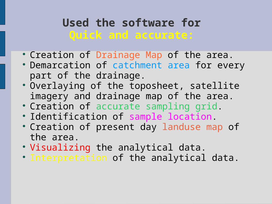
Used the software forQuick and accurate:
Creation of Drainage Map of the area. Demarcation of catchment area for every part
of the drainage. Overlaying of the toposheet, satellite imagery
and drainage map of the area. Creation of accurate sampling grid. Identification of sample location. Creation of present day landuse map of the
area. Visualizing the analytical data. Interpretation of the analytical data.
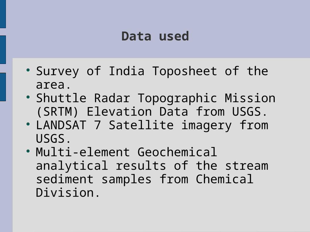
Data used
Survey of India Toposheet of the area.
Shuttle Radar Topographic Mission (SRTM) Elevation Data from USGS.
LANDSAT 7 Satellite imagery from USGS.
Multi-element Geochemical analytical results of the stream sediment samples from Chemical Division.
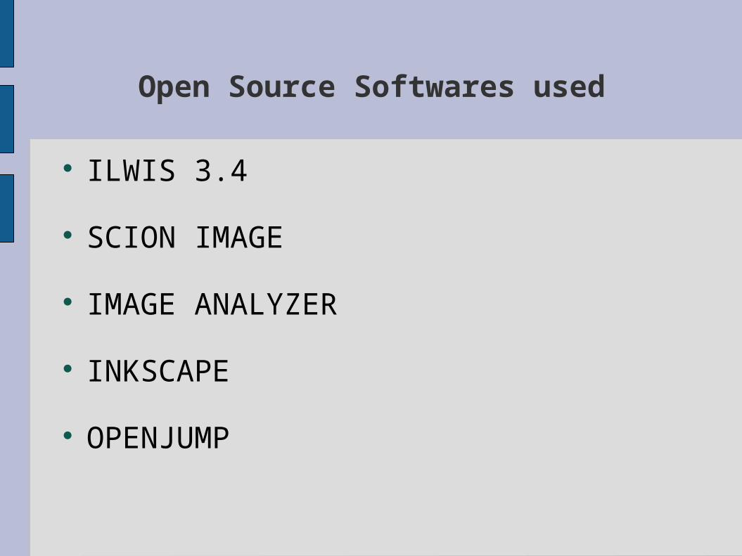
Open Source Softwares used
ILWIS 3.4
SCION IMAGE
IMAGE ANALYZER
INKSCAPE
OPENJUMP

Creation of Georeference for toposheet
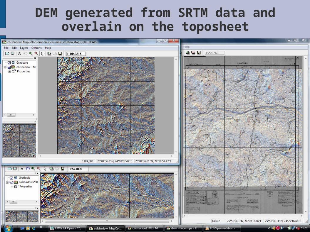
DEM generated from SRTM data and overlain on the toposheet
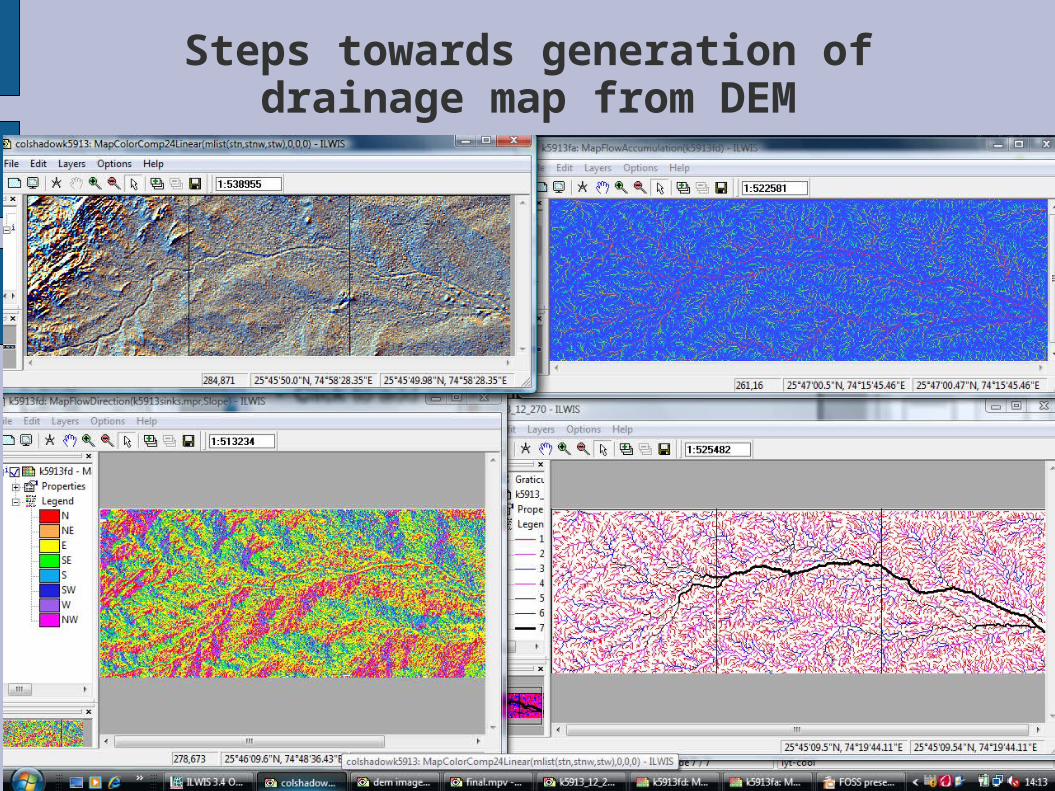
Steps towards generation of drainage map from DEM
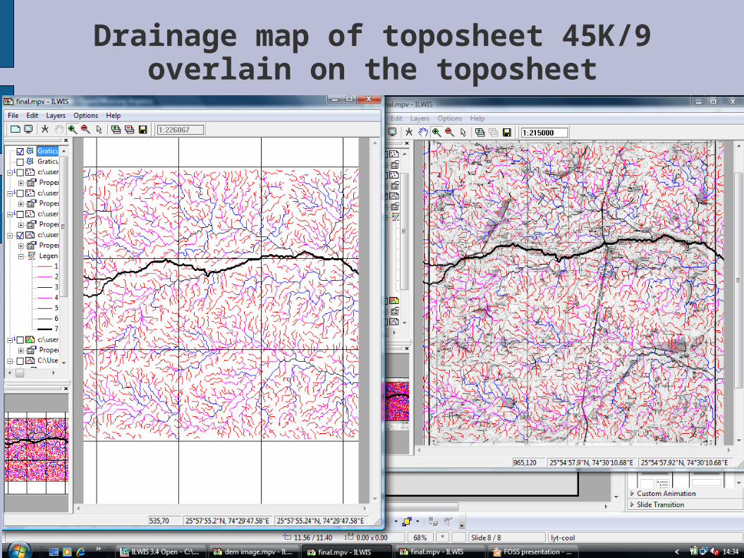
Drainage map of toposheet 45K/9 overlain on the toposheet
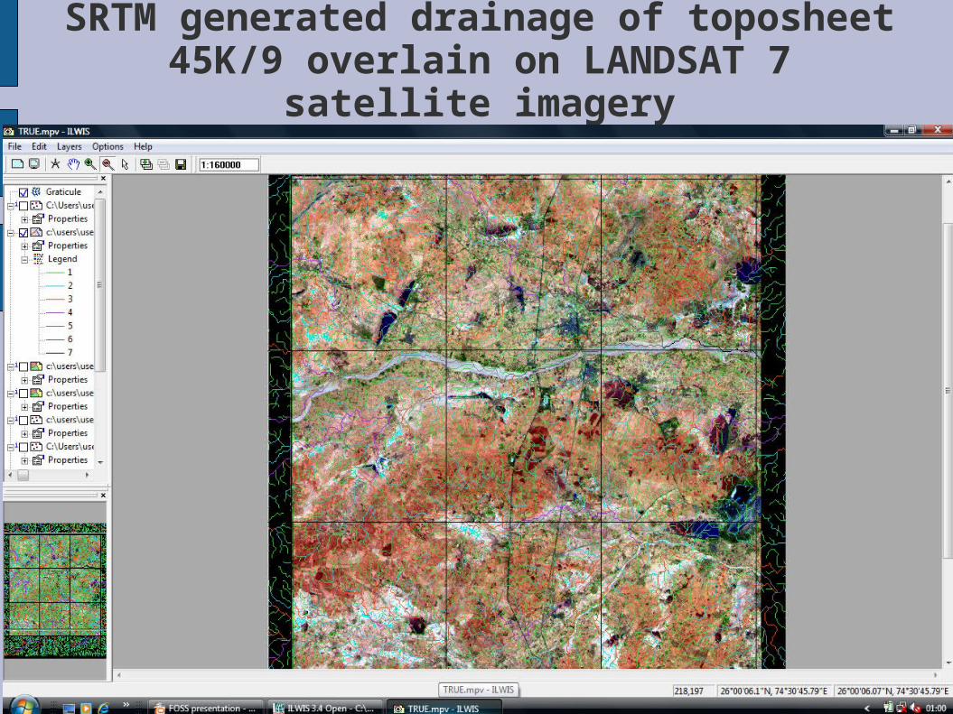
SRTM generated drainage of toposheet 45K/9 overlain on LANDSAT 7 satellite imagery

Catchment area for each segment of the drainage extracted from SRTM DEM
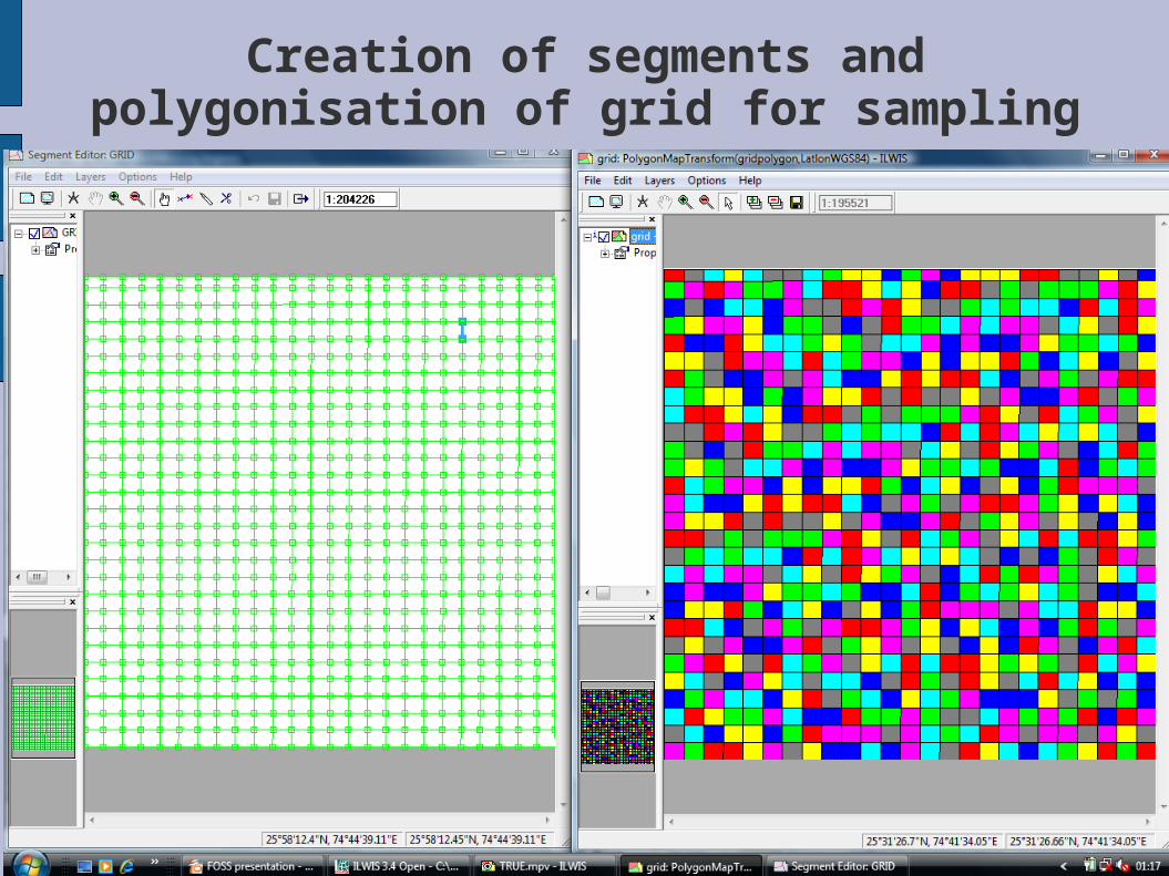
Creation of segments and polygonisation of grid for sampling
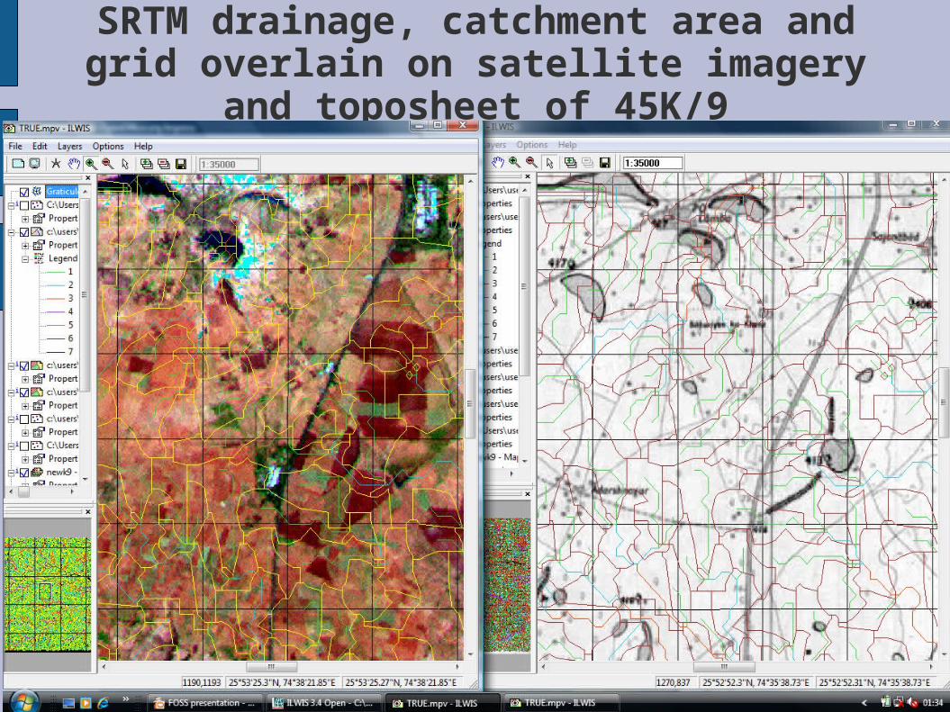
SRTM drainage, catchment area and grid overlain on satellite imagery and toposheet
of 45K/9
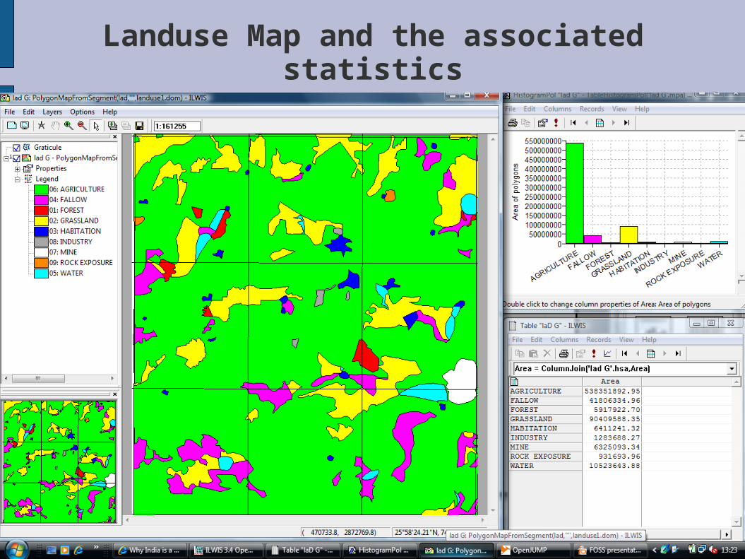
Landuse Map and the associated statistics