friends of a dales high way
TRANSCRIPT

Celebrating our 10th anniversary at St. Leonard's Church, Chapel-le-Dale!
Friends of A Dales High Way
eNewsletter No 6 Summer 2019
Friends of A Dales High Way
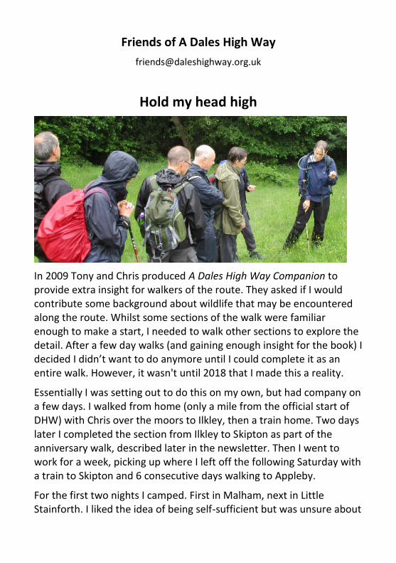
Hold my head high
In 2009 Tony and Chris produced A Dales High Way Companion to provide extra insight for walkers of the route. They asked if I would contribute some background about wildlife that may be encountered along the route. Whilst some sections of the walk were familiar enough to make a start, I needed to walk other sections to explore the detail. After a few day walks (and gaining enough insight for the book) I decided I didn’t want to do anymore until I could complete it as an entire walk. However, it wasn't until 2018 that I made this a reality.
Essentially I was setting out to do this on my own, but had company on a few days. I walked from home (only a mile from the official start of DHW) with Chris over the moors to Ilkley, then a train home. Two days later I completed the section from Ilkley to Skipton as part of the anniversary walk, described later in the newsletter. Then I went to work for a week, picking up where I left off the following Saturday with a train to Skipton and 6 consecutive days walking to Appleby.
For the first two nights I camped. First in Malham, next in Little Stainforth. I liked the idea of being self-sufficient but was unsure about

my ability to carry the gear. However the hostel in Malham was full and I didn’t want to pay the price of B&B on my own, so I took the plunge, reassured by the arrangement that I was able to leave my camping stuff in Stainforth for Chris to collect the following day (I’m not sure such a bespoke service will be available to everyone!). Yes, it was a heavy load, but worth it.
I had a leisurely departure from Malham, spending the morning watching the young peregrines on the Cove in hope they would fledge while I waited for my companions for the day, Tony and Chris, to arrive by bus. The young birds didn’t take their first flight, but I was pleased my schedule gave me time to enjoy them. On arrival in Settle we had a well-timed drink while they waited for their train home, and I dodged a thunderous downpour. It was a shorts and t-shirt week on the whole, the only other weather I encountered was the tail end of storm Hector on my final morning.
I loved being able to look behind me and see where I had come from, and it was great combining very familiar paths with areas I have not explored before. The variety of terrain means there is always something new to look at, but Skylarks created my soundtrack through most of the week and Small Heath butterflies fluttered along the length of the route. I walked with others for sections of the route (tell-tale route guide in map holder makes for an easy introduction), shared other experiences with passers-by (like watching a Short-eared Owl on the slopes of Whernside) and had quiet moments on my own (elevenses with a stoat looking on near Dent). It took less than two hours on the train back to Shipley, a brief and enjoyable recap of my solo adventure.
Whatever motivates you to take to the hills, I hope you enjoy your walking as much I did. I couldn’t have had a better week. And now I can hold my head high amongst the Friends of ADHW committee at last!
- Julia Pearson (Chair of the Friends)

Saltaire "best place to live"
SALTAIRE, the start of A Dales High Way, was named as one of the top 10 best places to live in the north of England by the Sunday Times.
The Sunday Times' list, published in April, puts York as the best place to live in the north, with Saltaire at number nine.
Helen Davies, The Sunday Times Home editor, said: "Finding our very own best place to live now feels more important than ever, for our wellbeing and wealth, happiness and health.
"This year we were looking for community spirit along with convenience and culture. There is so much going on around the country, and so many great places that the choice was a hard one."
Cllr Vick Jenkins, a ward councillor for Shipley, said: "This is really welcome news for Saltaire and Shipley. Saltaire is a fantastic place to live with its World Heritage status, good transport links and local businesses.
"For me though the best thing about Saltaire is the active community doing amazing things voluntarily, to name a few we have Veg on the Edge, Saltaire Stories heritage work, the Village Society and their great Xmas events, not forgetting the Arts Trail and Saltaire Festival. The people make the place."

A Dales High Way - the hard way
A new women's record has been set for running A Dales High Way by Catherine Bradley-Richardson, who covered the 90-mile long distance trail in just 35 hours!
Catherine, who works for the Yorkshire Dales National Park Authority, set off on Sunday morning, September 2nd 2018. She had pacer support from three runners for the first half, up to Ribblehead, but finished the run on her own, late Monday afternoon.
Her actual running time was 27 hours 19 minutes, with some refreshment and rest stops along the way, where she had road support at various locations.
Catherine had originally intended to join three runners who tackled the trail in 2016, including a colleague at the National Park. "I was unable to do it with Matt Neale due to injury 2 years ago...so let’s see what happens!" she said before the start.
In November 2016 three men, Matt Kneale, Mark Collinson and Dave Dixon completed the run in just 26 hours.
Catherine said "It is such a fabulous and varied route. It really does show off the Yorkshire Dales superbly! Although the weather was poor from Sedbergh onwards it was still very enjoyable! I was glad to have previously reccied the Howgills section as it was thick fog and driving rain in Monday morning."
Wow. Well done Catherine!

A Dales High Way - the slow way.
Most people think of a long distance trail as a multi-day walk, a week or longer spent on a coastal path or trekking from coast to coast making steady progress as they go. But being away from home and walking every day doesn’t suit everyone.
To celebrate the 10th anniversary of the creation of the route we, the Friends of A Dales High Way, decided to walk all 90 miles, from Saltaire to Appleby-in-Westmorland, as a series of day walks using public transport.
We wanted to show that the trail can be walked in stages without a car. We used the Leeds-Settle-Carlisle line for most of our train travel with additional bus journeys on days 3, 4, 7 and 8. On days 8 and 9 we used a local taxi firm who took us by minibus to and from Kirkby Stephen station. Mainly we walked on Saturdays although it was only essential for days 7 and 8 when we used the Western Dales bus. Here’s how we did it.
Day 1. Saltaire to Ilkley. 7.5 miles / 12.1km
Crossing Rombalds Moor
We left Saltaire at 10.30 am, walking through the village to join the towpath along the Leeds Liverpool canal for a short way before climbing through Trench Wood to Shipley Glen. We headed onto Baildon Moor, then crossed Bingley Moor, Burley Moor and Ilkley Moor before descending steeply to the
spa town of Ilkley from where buses and trains to Shipley, Skipton or Leeds are regular.
Day 2. Ilkley to Skipton. 11.5 miles / 18.5 km
The group met at Ilkley railway station, again at 10.30 am and climbed quickly back up to rejoin the trail on Ilkley Moor, continuing a long ridge walk onto Addingham High Moor before dropping steeply to the northern edge of the town of Addingham. We then crossed Skipton Moor along the line of the Roman Road before dropping steeply into Skipton. Walkers returning to Ilkley caught the bus while others took the train. This section could be shortened by finishing in Addingham, a village well served by buses.
Day 3. Skipton to Hetton 6.8 miles /10.9 km
We met at Skipton railway station at 11.00 am and climbed up to Tarn Moor and into the Yorkshire Dales National Park. A steady climb over Skyrakes led to the modest summit of Sharp Haw, with great panoramic views. We crossed Flasby Fell to the tiny farming hamlet of Flasby, before an easy beckside ramble to Hetton - Calender Girls country. At Hetton we caught the bus back to Skipton railway station. This was a deliberately short section so we could use the bus between Skipton and Hetton and avoid going into Malham village which has fewer transport links.
Day 4. Hetton to Settle 12.0 miles /19.3 km
We met outside Skipton railway station, to catch the 9.40 a.m. bus to Hetton. The walk started in Hetton, heading up Moor Lane and around the end of Winterburn Reservoir, before a long steady moorland climb to the heights of Weets Top. Then we were into limestone country, dropping to Goredale Bridge and on to the top of magnificent Malham Cove. We followed the Dry Valley to Langscar Gate, continuing to climb up to Nappa Gate and Kirkby Fell. The trail descended to Stockdale Lane, then alongside the stunning crags of Attermire Scar and Warrendale Knotts, before the final steep descent to Settle where we caught the train on the Leeds-Settle-Carlisle line.
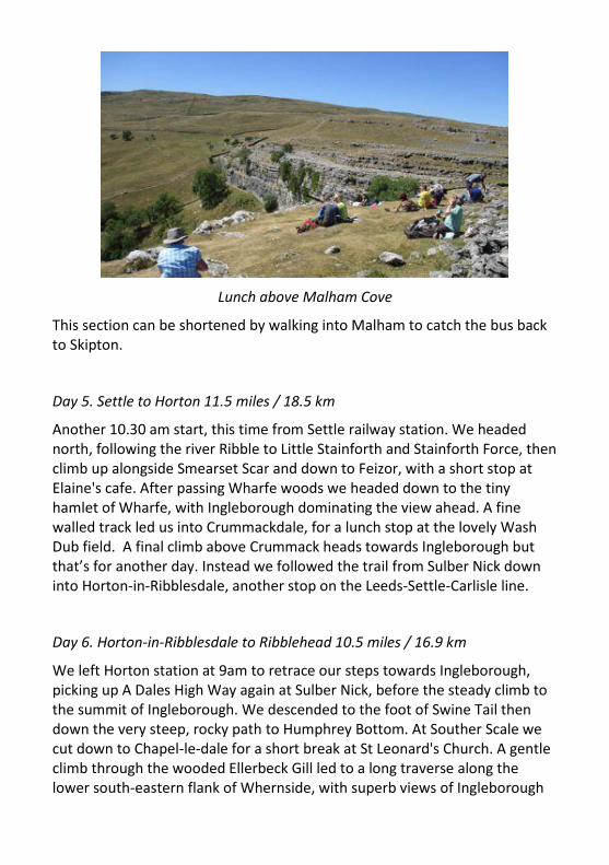
Lunch above Malham Cove
This section can be shortened by walking into Malham to catch the bus back to Skipton.
Day 5. Settle to Horton 11.5 miles / 18.5 km
Another 10.30 am start, this time from Settle railway station. We headed north, following the river Ribble to Little Stainforth and Stainforth Force, then climb up alongside Smearset Scar and down to Feizor, with a short stop at Elaine's cafe. After passing Wharfe woods we headed down to the tiny hamlet of Wharfe, with Ingleborough dominating the view ahead. A fine walled track led us into Crummackdale, for a lunch stop at the lovely Wash Dub field. A final climb above Crummack heads towards Ingleborough but that’s for another day. Instead we followed the trail from Sulber Nick down into Horton-in-Ribblesdale, another stop on the Leeds-Settle-Carlisle line.
Day 6. Horton-in-Ribblesdale to Ribblehead 10.5 miles / 16.9 km
We left Horton station at 9am to retrace our steps towards Ingleborough, picking up A Dales High Way again at Sulber Nick, before the steady climb to the summit of Ingleborough. We descended to the foot of Swine Tail then down the very steep, rocky path to Humphrey Bottom. At Souther Scale we cut down to Chapel-le-dale for a short break at St Leonard's Church. A gentle climb through the wooded Ellerbeck Gill led to a long traverse along the lower south-eastern flank of Whernside, with superb views of Ingleborough

and Ribblehead Viaduct. Finally we left the trail by the viaduct for the Station Inn and Ribblehead station.
Day 7. Ribblehead to Sedbergh 12.8 miles/20.6 km
This was a fine long day’s walk in two halves. Leaving Ribblehead station at 9.06 am we retraced our steps alongside Ribblehead viaduct to rejoin the trail, climbing around the north-eastern flank of Whernside to Boot of the Wold, with spectacular views over Dentdale. A steep descent led us down to join the Dales Way alongside the river Dee into the lovely village of Dent - and lunch (there was an option to break the walk here).
Heading down into Dentdale
Then there was another stiff climb over Frostrow Fell, with stunning views of the Howgill Fells ahead. A steady descent brought us into the attractive market town of Sedbergh to finish at the Dalesman Inn where we caught the Western Dales bus back to Dent station, a journey only possible on a Saturday.

Day 8 Sedbergh to Newbiggin-on-Lune 11.0 mile/ 17.7 km
We caught the train to Dent station, arriving at 09.15 am then waited for the 09.35 Western Dales bus to Sedbergh.
The Howgill Fells await
Leaving Sedbergh, we climbed up onto the Howgill Fells via Settlebeck Gill, along the ridge to climb again onto Calders, and finally up to the summit at the Calf. The six-mile ridge route continues north above Bowderdale, crossing Hazelgill Knott and West Fell, with superb views north across the Orton Fells. Finally we descended to Bowderdale and along a quiet lane to Newbiggin-on-Lune where we waited for our taxi to Kirkby Stephen station at Brownber Hall. We had booked an 8-seater taxi in advance and were delighted that it took less than 10 minutes and cost only £2 per person.
Day 9 Newbiggin-on-Lune to Appleby 12.7 miles / 20.4 km
We were met at 10.53 outside Kirkby Stephen railway station by the taxi which took us to Newbiggin-on-Lune.
From Newbiggin-on-Lune we crossed wild Ravenstonedale Moor to the secluded splendour of Sunbiggin Tarn, before climbing beside Great Kinmond across the spectacular limestone scars of the Orton Fells. We dropped into

the Eden Valley at Great Asby, before enjoying a beckside ramble alongside Hoff Beck via Rutter Force and Hoff to finish at the delightful former county town of Appleby-in-Westmorland where again we caught the train back on the Leeds-Settle-Carlisle line.
We did it! Friends of A Dales High Way at the end of the trail.
You can see the details of the trains and buses we used by following this link:
www.daleshighway.co.uk/friends/2018_anniversary_walk.htm
These were correct for summer 2018 but should not be relied upon if you are planning your own walk. Please check up to date information at:
www.settle-carlisle.co.uk/ for info about the Leeds-Settle-Carlisle line
www.nationalrail.co.uk/ for train times
www.dalesbus.org/ for bus information
http://primataxis.co.uk/ This is the taxi firm we used
www.daleshighway.co.uk for everything you need to know about A Dales High Way.
- Chris Grogan
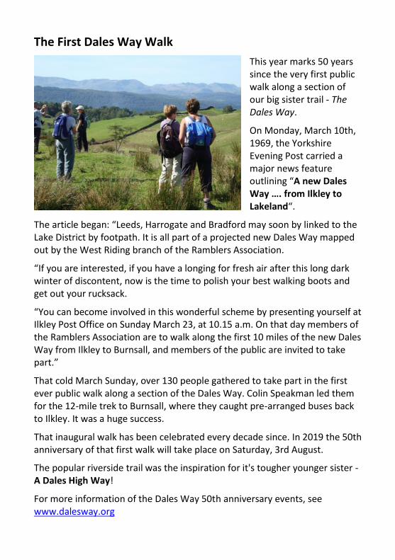
The First Dales Way Walk
This year marks 50 years since the very first public walk along a section of our big sister trail - The Dales Way.
On Monday, March 10th, 1969, the Yorkshire Evening Post carried a major news feature outlining “A new Dales Way …. from Ilkley to Lakeland“.
The article began: “Leeds, Harrogate and Bradford may soon by linked to the Lake District by footpath. It is all part of a projected new Dales Way mapped out by the West Riding branch of the Ramblers Association.
“If you are interested, if you have a longing for fresh air after this long dark winter of discontent, now is the time to polish your best walking boots and get out your rucksack.
“You can become involved in this wonderful scheme by presenting yourself at Ilkley Post Office on Sunday March 23, at 10.15 a.m. On that day members of the Ramblers Association are to walk along the first 10 miles of the new Dales Way from Ilkley to Burnsall, and members of the public are invited to take part.”
That cold March Sunday, over 130 people gathered to take part in the first ever public walk along a section of the Dales Way. Colin Speakman led them for the 12-mile trek to Burnsall, where they caught pre-arranged buses back to Ilkley. It was a huge success.
That inaugural walk has been celebrated every decade since. In 2019 the 50th anniversary of that first walk will take place on Saturday, 3rd August.
The popular riverside trail was the inspiration for it's tougher younger sister - A Dales High Way!
For more information of the Dales Way 50th anniversary events, see www.dalesway.org

Top Ten Dales High Way Snacks
They say that an army marches on its stomach. Well, the same is true for long distance walkers. In a straw poll conducted during the recent Ride2Stride Walking Festival Bridget Izod discovered the following favourite top ten snacks.
1) Baby Bel cheeses
2) Peanut butter sandwiches with
apple slices
3) Flapjacks
4) Carrot sticks
5) Falafels
6) Fruity oatcakes
7) Chilled apple juice and water
8) Fruit leathers
9) Spanish tortilla slices
10) Hard boiled eggs
Just squeezed out in 11th place was a can of Carlsberg lager.

For regular news about A Dales High Way go to our website:
daleshighway.org.uk