from multidisciplinary data to integrated information for ... school - the netherlands/arjen...
TRANSCRIPT

From multidisciplinary data tointegrated information for coastal areas
Inspired by NatureCoast

Process Field data
• GPS drifters• Topography: wheel & quad• Algae analysis dune lake vs lagoon (Arnaud)• Drone photogrammetry• CTD

Integrating data and more!Examples from NatureCoast
• Interdisciplinary hypotheses
• Multidisciplinary field campaign
• Data management
• Interdisciplinary research
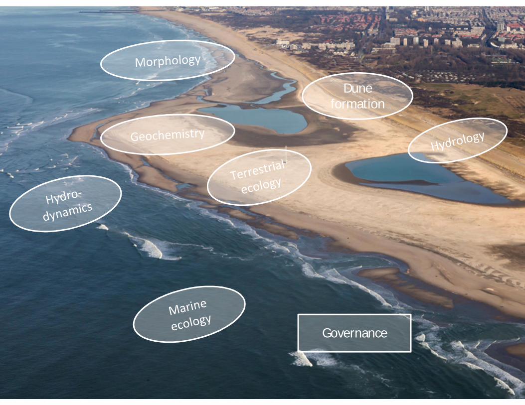
Duneformation
Governance

Interdisciplinary work sessionsExploring interdisciplinary hypotheses at IMARES Yerseke (feb 2014) andtuning of monitoring
Interdisciplinary themes:• Remote sensing (Corjan)• Sediment composition (Bas Hui)• Hydrology / moisture (Sebastian)
Coastal zones:• Dry beach + dunes (Marinka)• Inter-tidal area (Max)• Middle shoreface (Saulo)

Interdisciplinary hypothesesMiddle shoreface
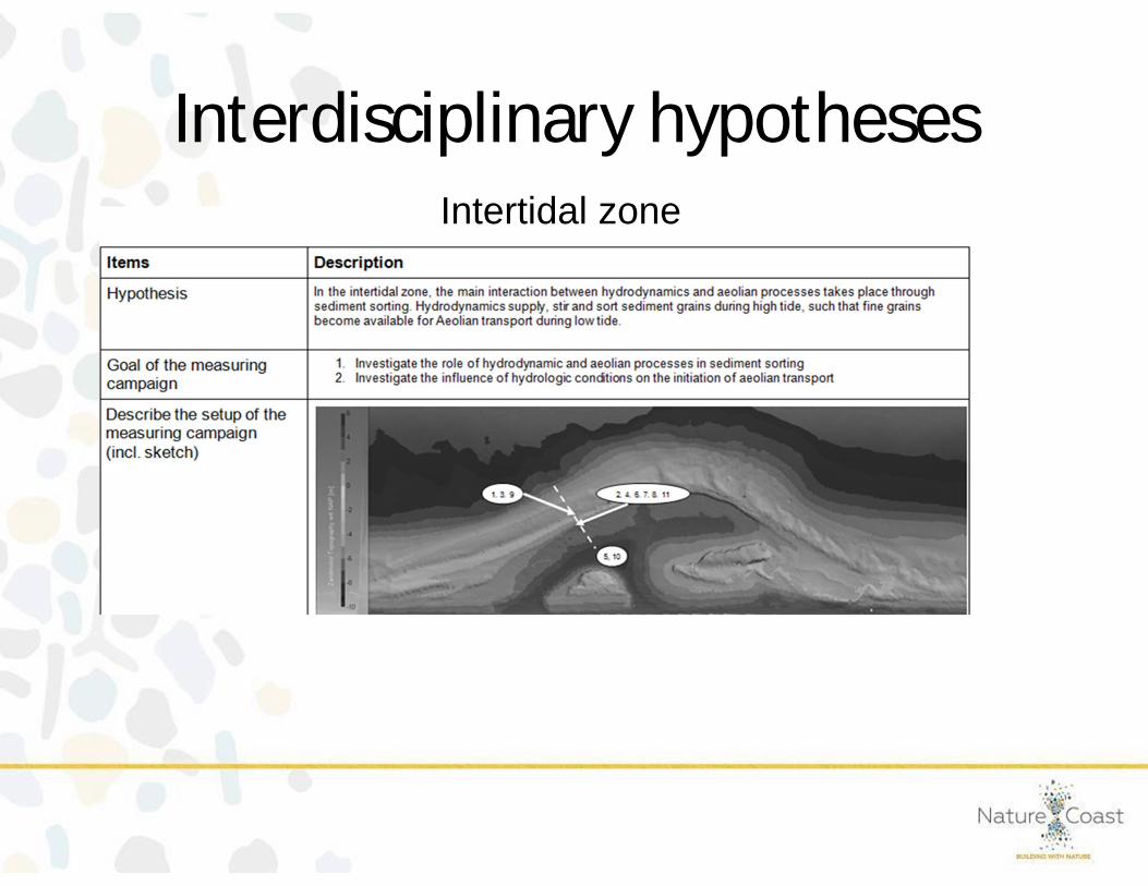
Interdisciplinary hypothesesIntertidal zone
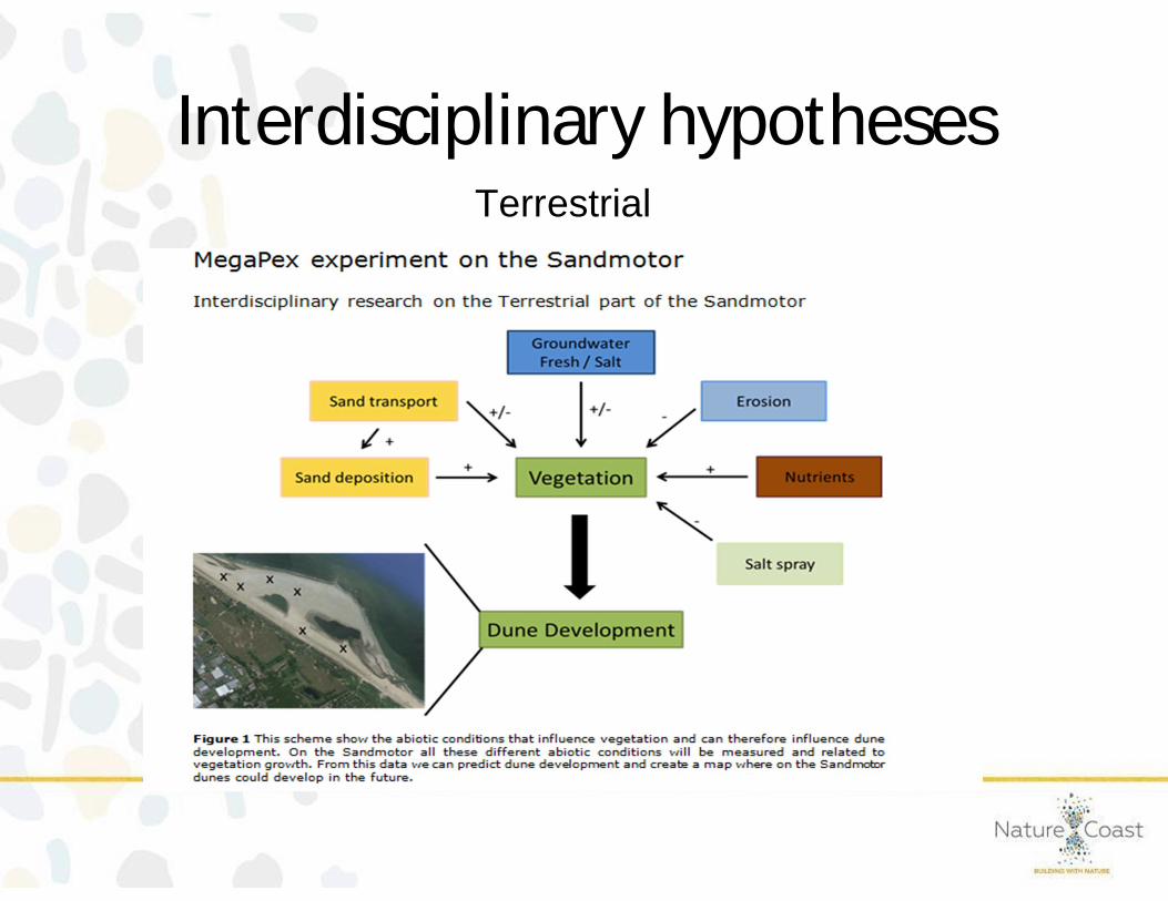
Interdisciplinary hypothesesTerrestrial

MEGAPEX2014MEGA Perturbation EXperiment
•Multidisciplinary ExperimentCoastal safety, dune formation, marine & terrestrialecology, hydrology, geochemistry, and more...
•On, near, inside or above the Sand Engine
•September - October 2014
Sierd de Vries, Martijn Henriquez, Tim Price & Matthieu de Schipper

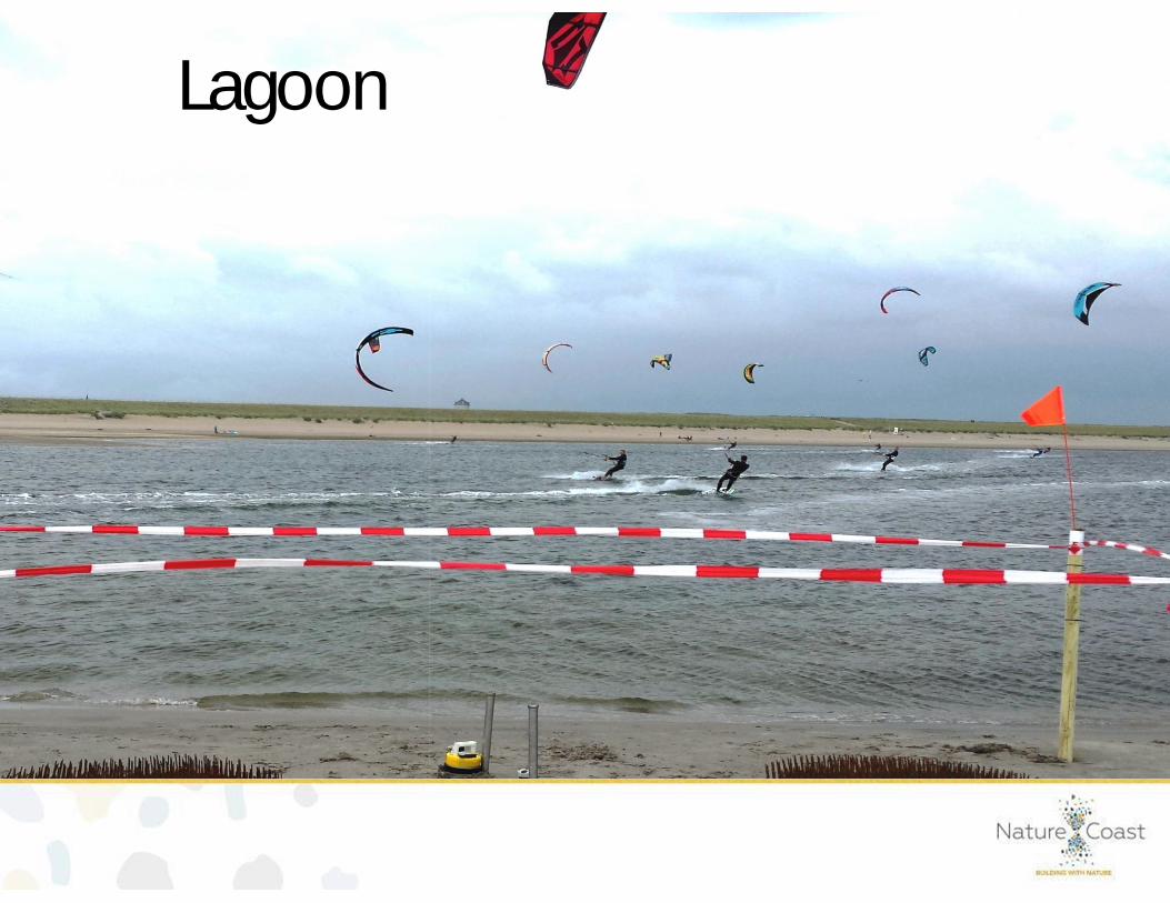
Lagoon

Lagoon
How biota (i.e. worms) affect the morphology?
How much water is exchanging between the lagoon and the sea?

Artificial tube building worm field
Lagoon

Waterlevel, Salinity & Temperature
Lagoon
Tidal range < 0.5 m !
Wat
erle
vel[
m]
Tem
pera
ture
[deg
]
STO
RM

Offshore

OffshoreIt the transport on the lower shoreface onshore or offshore?
What is the influence of the Rhine fresh water plume?

Offshore

Offshore
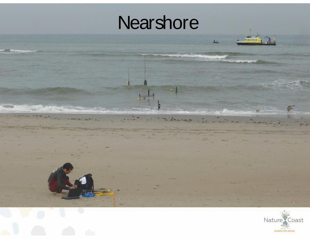
Nearshore

Nearshore
Are large circulations or eddies present at the Sand Engine?
How do seafloor ripples change under different conditions?

Nearshore
?
Flow around the tip

Nearshore
?
Flow around the tipAre there large scale eddies?

NearshoreFlow around the tipAre there large scale eddies?
NearshoreRipple behavior

Intertidal zone

Intertidal zone
How is the groundwater affected by the tide?
How much does the beach profile change in a single tidal period?
How many macro invertebrate can be found in the intertidal?

Measurements of cross-shorehydrodynamics andsand suspensionin the intertidal zone
During the storm:waveheight in theintertidal zone up to1.8m,infragravitywaveheight up to60cm!!
STO
RM
Intertidal zone

Detailed measurements ofturbulence and sediment suspensionbeneath breaking wavesand above ripples
Intertidal zone

Intertidal variability in groundwater levelsand surface moisture content•measured using groundwater wells,•manual conductivity probes and• laserscans
Intertidal zoneMorphology
Surface moisture content

Macro invertebrate sampling
Intertidal zone

Beach & Dunes

Beach & Dunes
Which part of the beach is the Aeolian sand eroded from?
How important is surface moisture?
Can we estimate this transport with the Argus camera images?

Beach & DunesSediment transport measurements across the beach

Beach & DunesErosion rates in a tidal cycle
Aeolian erosion!

12345
1
2
3
4
5
num
bero
fgra
ins
pers
econ
d wind
sandtransport
Argus video imageryin situ transport data
Beach & DunesConnection camera images and in situ measurements of transport

Dune vegetation - Aeolian dynamics

Dune vegetation - Aeolian dynamics
What is the effect of species on sand deposition and transport?
What is the effect of density on sand deposition and transport?

MethodsErosion pinsSand trapsPhotogrammetry

Beach & DunesMapping the beach & dunesWith:•Drone•Small planeand•Kite

Moreover
•Numerous other experiments (Sorry, if I passed over yours!)
•Intensified camera tower observations with Argus (with RobHolman)
•Raw Radar data recordings
•Extra Rijkswaterstaat measurements : Wave bouy, 2 ADCPs, 13hADCP cruise

Science Integration - MegaPEXUnique collaboration
Multi-disciplinary data set
>40 researchers
48 Days and 1 big storm!

Collaboration

Collaboration

A lot of (media) attention
BrochureExcursionsWeb blogsNewspapersRadio broadcastsTV documentaryNature coast MegaPEX movie

Outlook
Continue the long term monitoring
And data processing!
Sierd de Vries, Martijn Henriquez, Tim Price & Matthieu de Schipper

Data portal

Big data1. Behavioral data2. Process data
End-user ambitions thatrequire generic knowledge
usable for design
Interdisciplinaryknowledge
development
Interdisciplinary research

Design: building blocks of Sandy Solutions

Design for what, for whom?
• Grain size
• Height, slope
• Shape, orientation
• Chemistry of sediment
• Volume, frequency
• Ground water salinity
Ø Dune development
Ø Safety
Ø Recreation, Nature
Ø Innovation

Ecosystem services not targeted
• Fresh water provision
• Nursery for flatfish (and other animals?)
• Many different forms of recreation
• Inspiration for art
• Excursions to quintessentially Dutch location
The Sand Motor is (also) a cultural landscape
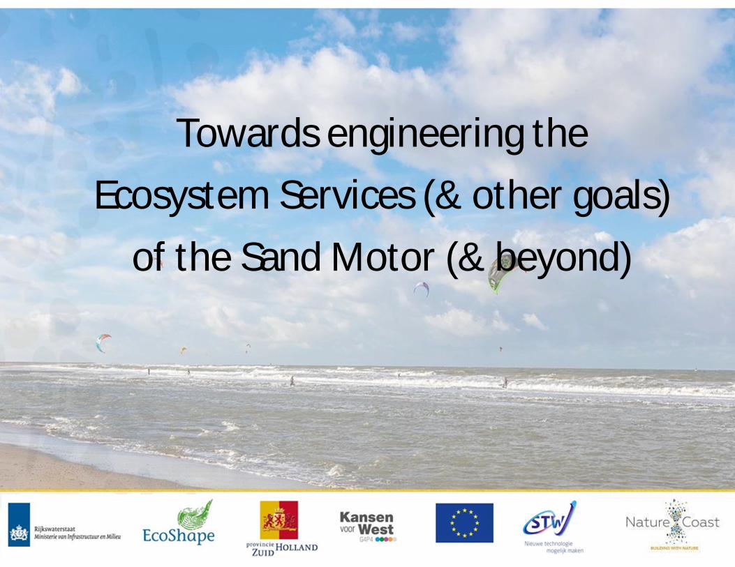
Towards engineering theEcosystem Services (& other goals)
of the Sand Motor (& beyond)

Integrated tools for ESS quantificationTowards engineering the ecosystem services of a mega-nourishment
Suitable sunbathing area60 < beach width < 200
Are
a(h
a)
• Coastal protection• Recreation:
* kite surfing,* strolling,* sunbathing
• Habitat provisionby dynamic ecotope mapping

Integrated morphodynamic modelfor the dry beach and subaerial
• Intertidal area is resolvedby Delft3D and AeoLiSmodel
• Deposition of dune lakeand lagoon is nowincorporated in themorphological simulation.
Arjen Luijendijk, Bas Hoonhout, Rufus Velhorst and Sierd de Vries,Coastal Dynamics, 2017

Room for improvement
• Bridge governance & other NC researchØ Socio-economic research should be strongly embedded
• Emphasis on design (implications) earlier onØKey chapter for each PhD researcherØActively involve end-users, sessions organized by them
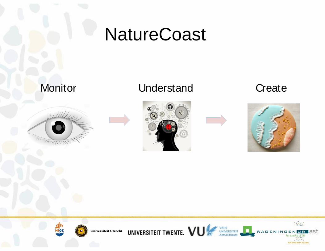
NatureCoast
Monitor Understand Create