ganesh prasad bhatta (m.sc., land administration) chief survey officer, survey department february...
TRANSCRIPT

Ganesh Prasad Bhatta(M.Sc. , Land Administration)
Chief Survey Officer, Survey Department
February 8, 2013, Friday
Spatially enabled e-governance: in the Nepalese Context
13th CAN ICT ConferenceOrganized by: Computer Association of Nepal and Internet Society Nepal

2
g]kfn ;/sf/e"ld;'wf/ tyf Joj:yf d+qfno
gfkL ljefu
Government of NepalMinistry of Land Reform and Management
Survey Department
Presentation OutlineObjective of the Presentation
Setting the SceneBrief Introduction to relevant terminologies Benefits of SEGKey Elements of SEG
Present Situation Initiatives to build infrastructure for SEG Issues and ChallengesConclusion
3
g]kfn ;/sf/e"ld;'wf/ tyf Joj:yf d+qfno
gfkL ljefu
Government of NepalMinistry of Land Reform and Management
Survey Department
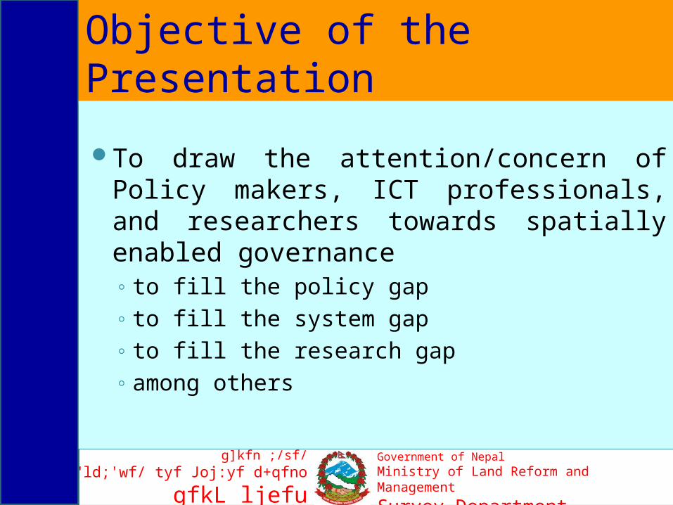
Objective of the Presentation
To draw the attention/concern of Policy makers, ICT professionals, and researchers towards spatially enabled governance◦ to fill the policy gap◦ to fill the system gap◦ to fill the research gap◦ among others

4
g]kfn ;/sf/e"ld;'wf/ tyf Joj:yf d+qfno
gfkL ljefu
Government of NepalMinistry of Land Reform and Management
Survey Department
Setting the Scene 'Death of Distance' 'There is no more there, everywhere is here'
-Internet- (Cairncross, 1997)↓
Exploitation of the opportunity offered by internet -Electronic Self Service
- E-government -↓
Incorporating Location Based Information to the information system
Location based Services - Spatial enablement-

5
g]kfn ;/sf/e"ld;'wf/ tyf Joj:yf d+qfno
gfkL ljefu
Government of NepalMinistry of Land Reform and Management
Survey Department
IntroductionE-government
◦ Online service delivery, using internet or other digital means
◦ Combines various ICTs (Geo-ICTs) to connect government agencies and institutions, promotes reorganization of governments internal and external information flows, activities and functions in order to shift service delivery over the internet
◦ Draws together the public sector, civil society and international actors, as well as improves consultation with, and participation by, all spheres of society to achieve a more participatory process of governance & decision-making
(Navarra and Cornford, 2007).
6
g]kfn ;/sf/e"ld;'wf/ tyf Joj:yf d+qfno
gfkL ljefu
Government of NepalMinistry of Land Reform and Management
Survey Department
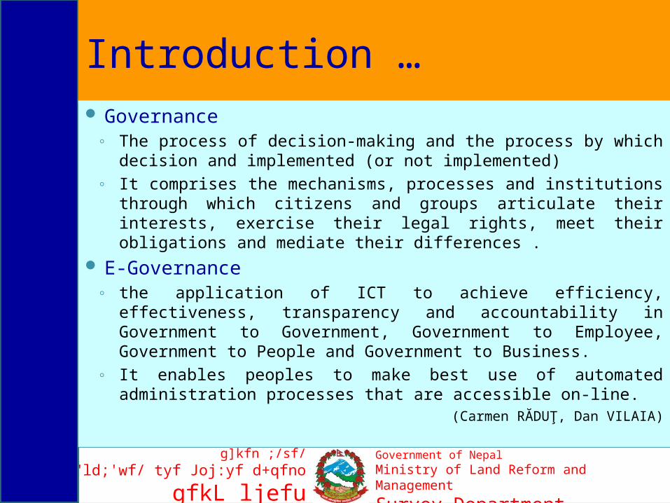
Introduction … Governance
◦ The process of decision-making and the process by which decision and implemented (or not implemented)
◦ It comprises the mechanisms, processes and institutions through which citizens and groups articulate their interests, exercise their legal rights, meet their obligations and mediate their differences .
E-Governance ◦ the application of ICT to achieve efficiency, effectiveness,
transparency and accountability in Government to Government, Government to Employee, Government to People and Government to Business.
◦ It enables peoples to make best use of automated administration processes that are accessible on-line.
(Carmen RĂDUŢ, Dan VILAIA)

7
g]kfn ;/sf/e"ld;'wf/ tyf Joj:yf d+qfno
gfkL ljefu
Government of NepalMinistry of Land Reform and Management
Survey Department
Introduction …
Citizens- customer, - voter,- taxpayer, - applicant, - citoyen, - subject, - stakeholder, - civil servant
G2G
G2G G2B
G2G
Local Government
Business Entities
National Government
G1 Gn
G1 Gm
Fig courtesy: (Do, 2010)
E-Government Concept
8
g]kfn ;/sf/e"ld;'wf/ tyf Joj:yf d+qfno
gfkL ljefu
Government of NepalMinistry of Land Reform and Management
Survey Department
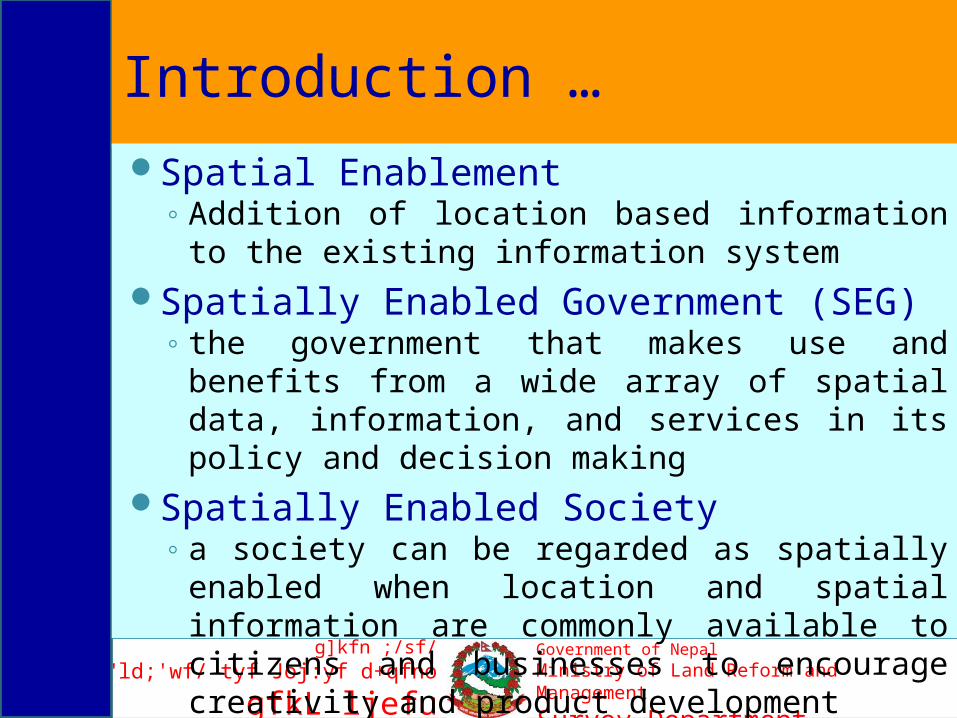
Introduction …Spatial Enablement
◦ Addition of location based information to the existing information system
Spatially Enabled Government (SEG) ◦ the government that makes use and benefits
from a wide array of spatial data, information, and services in its policy and decision making
Spatially Enabled Society◦ a society can be regarded as spatially enabled
when location and spatial information are commonly available to citizens and businesses to encourage creativity and product development
9
g]kfn ;/sf/e"ld;'wf/ tyf Joj:yf d+qfno
gfkL ljefu
Government of NepalMinistry of Land Reform and Management
Survey Department
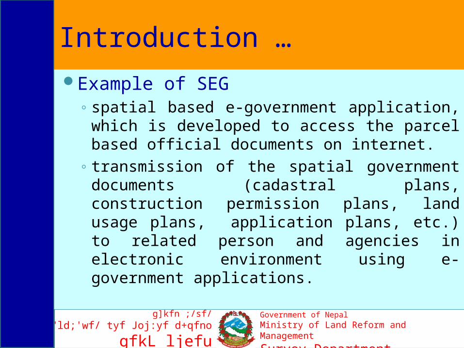
Introduction … Example of SEG
◦ spatial based e-government application, which is developed to access the parcel based official documents on internet.
◦ transmission of the spatial government documents (cadastral plans, construction permission plans, land usage plans, application plans, etc.) to related person and agencies in electronic environment using e-government applications.

10
g]kfn ;/sf/e"ld;'wf/ tyf Joj:yf d+qfno
gfkL ljefu
Government of NepalMinistry of Land Reform and Management
Survey Department
Benefits of SEGEnsures good governanceHelps to make the decision and policy
making effective Helps to make justifiable distribution of
resources and national benefits

11
g]kfn ;/sf/e"ld;'wf/ tyf Joj:yf d+qfno
gfkL ljefu
Government of NepalMinistry of Land Reform and Management
Survey Department
Key Elements of SEGLegal Framework
Spatial Data InfrastructureCommon Data Integration ConceptPositioning InfrastructureLand Information System
Data and Information Concept

12
g]kfn ;/sf/e"ld;'wf/ tyf Joj:yf d+qfno
gfkL ljefu
Government of NepalMinistry of Land Reform and Management
Survey Department
Nepalese Context for Spatially Enabled e-Governance

13
g]kfn ;/sf/e"ld;'wf/ tyf Joj:yf d+qfno
gfkL ljefu
Government of NepalMinistry of Land Reform and Management
Survey Department
Present SituationThe numbers of e-government applications using
non-spatial data have been continuously increasing, while quite a few applications using spatial data have been conducted by the related government agencies.
ICT Policy and Electronic Transaction Act have been enacted but the issues related with spatial and property data are not adequately addressed

14
g]kfn ;/sf/e"ld;'wf/ tyf Joj:yf d+qfno
gfkL ljefu
Government of NepalMinistry of Land Reform and Management
Survey Department
Business vs ICT Market
Strategy
ICT Policy
Processes
Systems
Business
ICT Market
link
link
fitfit
fit
Operational Alignment
Strategic Alignment
fit
(Barnasconi, 2006)
Does this alignment prevail for Geo-ICT based Business and market in Nepal?
15
g]kfn ;/sf/e"ld;'wf/ tyf Joj:yf d+qfno
gfkL ljefu
Government of NepalMinistry of Land Reform and Management
Survey Department
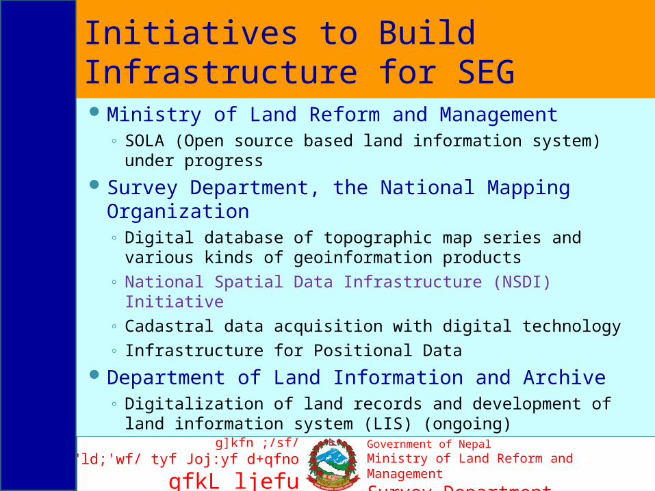
Initiatives to Build Infrastructure for SEGMinistry of Land Reform and Management
◦ SOLA (Open source based land information system) under progress
Survey Department, the National Mapping Organization◦ Digital database of topographic map series and various
kinds of geoinformation products◦ National Spatial Data Infrastructure (NSDI) Initiative◦ Cadastral data acquisition with digital technology◦ Infrastructure for Positional Data
Department of Land Information and Archive◦ Digitalization of land records and development of land
information system (LIS) (ongoing)

16
g]kfn ;/sf/e"ld;'wf/ tyf Joj:yf d+qfno
gfkL ljefu
Government of NepalMinistry of Land Reform and Management
Survey Department
Initiatives to Build Infrastructure for Spatially Enabled Governance …NSDI initiative
◦ National Geographic Information Infrastructure Project (NGIIP) under Survey Department
◦ An initiative to ensure e-democracy in geographic information
◦ An initiative to
discourage duplication of efforts and resources to produce similar kind of geoinformation products
◦ An initiative to ensure interoperability, consistency and sharability of the geo-data

17
g]kfn ;/sf/e"ld;'wf/ tyf Joj:yf d+qfno
gfkL ljefu
Government of NepalMinistry of Land Reform and Management
Survey Department
Challenges and Issues ICT Policy and Electronic Transaction Act- Geo-ICT
issues, especially related to land administration to be addressed adequately
NSDI integration - is vital for e-governanceAwareness - should be enhanced Inland Capacity for system development - to be
developedOrganizational Capacity for sustainability of the system
◦ Infrastructure ◦ Human resources ◦ Investment
Coordination - to be improvedProfessional Development - to be emphasized
18
g]kfn ;/sf/e"ld;'wf/ tyf Joj:yf d+qfno
gfkL ljefu
Government of NepalMinistry of Land Reform and Management
Survey Department
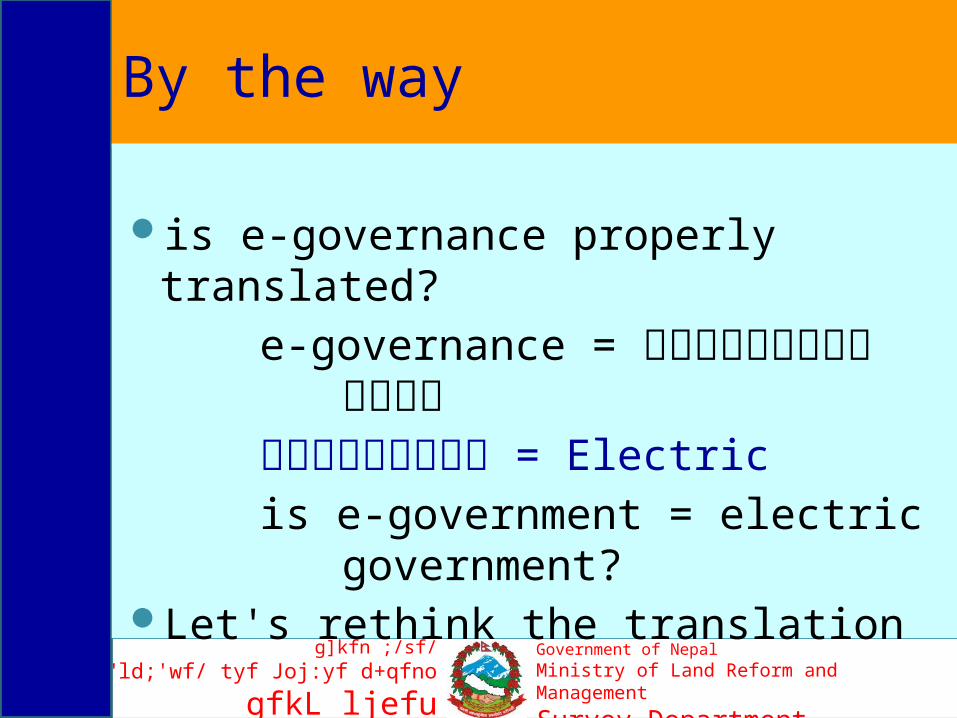
By the way
is e-governance properly translated?
e-governance = वि�द्यु�ती�य शासनवि�द्यु�ती�य = Electricis e-government = electric
government? Let's rethink the translation

19
g]kfn ;/sf/e"ld;'wf/ tyf Joj:yf d+qfno
gfkL ljefu
Government of NepalMinistry of Land Reform and Management
Survey Department
ConclusionSpatial enablement of the information makes the
policy and decision making more effective and spatially better distributed
Due concern of the policy makers, ICT professionals and researchers is needed in order to work more on this domain
Let's work together! Then, we will be successful in promoting e-Democracy in Nepal, ultimately to build 'e-Nepal' since 'together we can'
20
g]kfn ;/sf/e"ld;'wf/ tyf Joj:yf d+qfno
gfkL ljefu
Government of NepalMinistry of Land Reform and Management
Survey Department
Thank Youfor your kind attention!