gbt long range transit plan 9/23/15
TRANSCRIPT

SEPTEMBER 23 & 24, 2015
GREATER BRIDGEPORT TRANSITLONG RANGE MASTER PLAN

Project Overview1

GOALS FOR THE EVENING:1 – Progress Update2 – Show the use of input3 – Solicit feedback on the proposals4 – Identify next steps
WELCOME
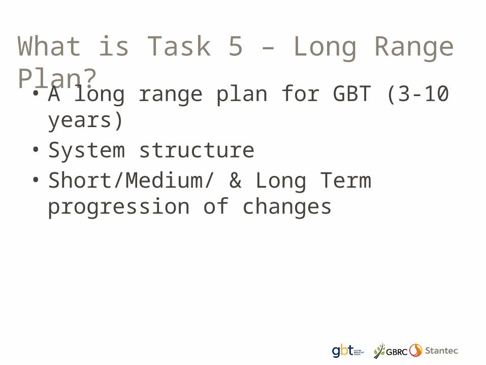
What is Task 5 – Long Range Plan?• A long range plan for GBT (3-10
years)• System structure • Short/Medium/ & Long Term
progression of changes

What are we trying to do?• Increase service in high bus ridership areas• Respond to community requests for more or
different bus services• Delineate improvements necessary to
implement Bus Rapid Transit and regional services (Stamford-New Haven)
• Address infrastructure and operational modifications necessary to implement new bus services
• Consider changes in land use in city and region that impact bus transit

Key Themes
• Provide more service, everywhere• Provide higher levels of service• Build a system for the future• Create a system with better
connections and access

Input into the route options
2

Public survey Routes listed as used most often (156 responses)
25%
11%8%9%10%
8%
Percent
Coastal LinkRoute 1Route 6Route 8Route 9Route 10

What the public wanted• New areas such as
Kings Highway, Capital Ave, Bridgeport University
• Extensions of existing routes to make connections
• Regional connections ranked high
• NOTE: many asked for routings that already exist with a transfer

SYSTEM DESIGN CHARETTE
March 2015 - AttendeesGBT, GBRC, City of Bridgeport,Town of Stratford, Connecticut DOT

DESIGN CHARETTEGroup 1 key desire lines for high level transit service
Blue = BRTOrange = high frequencyRed = regional

DESIGN CHARETTEGroup 2 key desire lines for high level transit service
Blue = High Frequency serviceRed = key connectors

Review of NRZ Plans
• South End • Black Rock • East Side• Mill Hill • Reservoir Avenue

NRZ Plans: Common ThemesMOBILITY Pedestrian Access –
Improvements to Sidewalks, Signage (walkable)
Bicycle Access - Improved Amenities for Cyclists
STREETSCAPE Improved
Streetscapes - Friendly
Transit Amenities – Additional Bus Stops, Signage and Shelters
Transit Oriented Development
TRANSIT/ROADS Make Transit more
accessible and convenient
Directional Changes on roads (East End/East Side/South End)
Barnum Train Station FUNDING
Work to Find the Funding/Resources
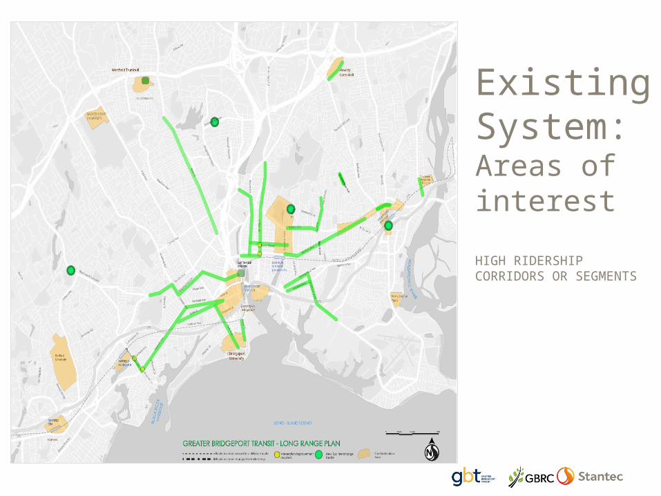
Existing System: Areas of interestHIGH RIDERSHIP CORRIDORS OR SEGMENTS

Existing System: Areas of challengeLOW RIDERSHIPSPOT RIDERSHIPPROBLEMATIC ROADSNO SERVICE EXISTS TODAY
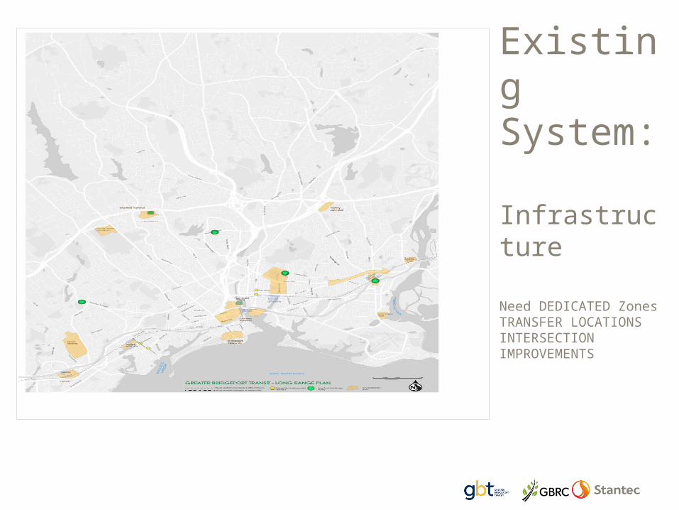
Existing System: InfrastructureNeed DEDICATED Zones TRANSFER LOCATIONSINTERSECTION IMPROVEMENTS
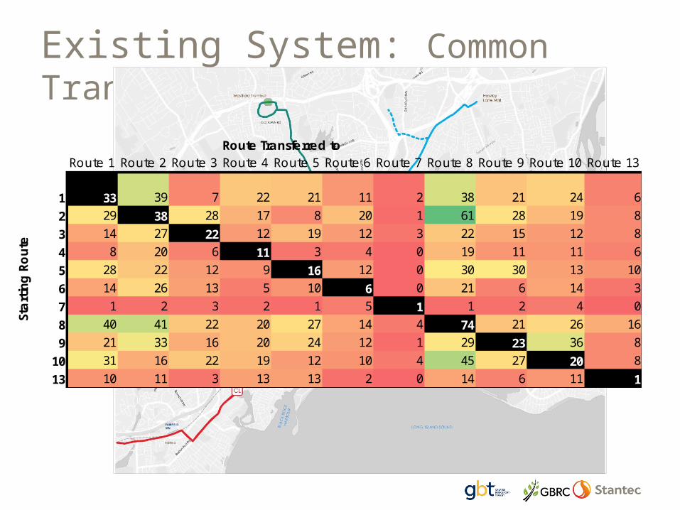
Existing System: Common Transfers
Route Transferred toRoute 1 Route 2 Route 3 Route 4 Route 5 Route 6 Route 7 Route 8 Route 9 Route 10 Route 13
1 33 39 7 22 21 11 2 38 21 24 62 29 38 28 17 8 20 1 61 28 19 83 14 27 22 12 19 12 3 22 15 12 84 8 20 6 11 3 4 0 19 11 11 65 28 22 12 9 16 12 0 30 30 13 106 14 26 13 5 10 6 0 21 6 14 37 1 2 3 2 1 5 1 1 2 4 08 40 41 22 20 27 14 4 74 21 26 169 21 33 16 20 24 12 1 29 23 36 8
10 31 16 22 19 12 10 4 45 27 20 813 10 11 3 13 13 2 0 14 6 11 1
Star
ting
Rout
e

System Considerations3

Coverage vs Frequency• Coverage is
about providing access to transit
• Ridership is focused on the economics of service
• Every system has a unique balance


Regional serviceLocal service
Radial Network with some cross town links
Local serviceCommunity service
BRTHigh Frequency
Regional service
Radial Network with cross town links and layers of
service
All services the same Layered services

PROPOSED ROUTES
Groupings, infrastructure and issues
4
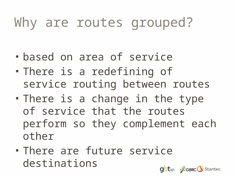
Why are routes grouped?
• based on area of service• There is a redefining of service
routing between routes• There is a change in the type of
service that the routes perform so they complement each other
• There are future service destinations

PACKAGE 1 – The Coastal Link

Coastal Link – AM Inbound to Downtown

Route 1 – Inbound to Downtown

Route 10 – Inbound to Downtown

CURRENT SYSTEMROUTE 1, COASTAL LINE, ROUTE 10

PROPOSED SYSTEMROUTE 1, COASTAL LINK, ROUTE 10

PACKAGE 2 – Bridgeport to Westfield Trumbull

ROUTE 3AM INBOUND TO DOWNTOWN

ROUTE 4AM INBOUND TO DOWNTOWN

ROUTE 8AM INBOUND TO DOWNTOWN
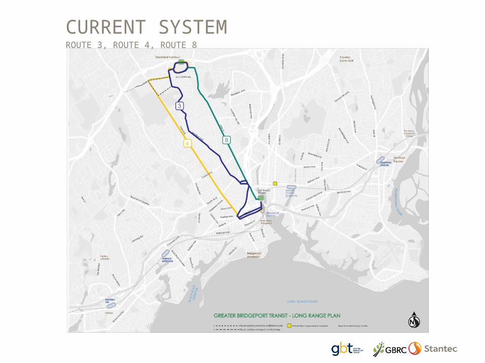
CURRENT SYSTEMROUTE 3, ROUTE 4, ROUTE 8
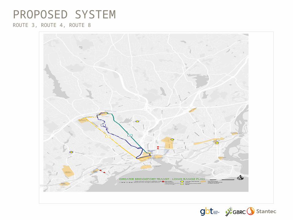
PROPOSED SYSTEMROUTE 3, ROUTE 4, ROUTE 8

PACKAGE 3 – Fairfield to Bridgeport
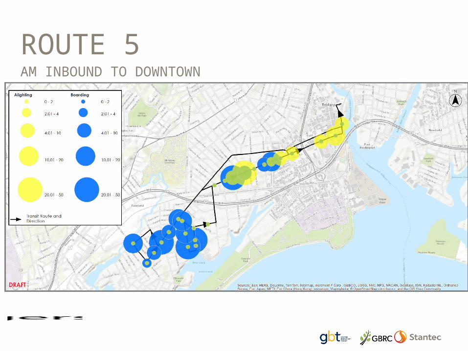
ROUTE 5AM INBOUND TO DOWNTOWN

ROUTE 7PM OUTBOUND FROM DOWNTOWN

CURRENT SYSTEMROUTE 5, ROUTE 7

PROPOSED SYSTEMROUTE 5, ROUTE 7

PACKAGE 4 – North from Downtown

ROUTE 6 AM INBOUND TO
DOWNTOWN

ROUTE 9 AM INBOUND TO
DOWNTOWN

CURRENT SYSTEMROUTE 6, ROUTE 9

PROPOSED SYSTEMROUTE 6, ROUTE 9, ROUTE 11 (NEW), ROUTE 24 (NEW)

PACKAGE 5 – Mill Hill/Lake Success

ROUTE 13AM INBOUND TO
DOWNTOWN

ROUTE 15AM INBOUND TO
DOWNTOWN

ROUTE 17AM INBOUND TO DOWNTOWN

CURRENT SYSTEMROUTE 1, ROUTE 13, ROUTE 15, ROUTE 17

PROPOSED SYSTEMCoastal Link, ROUTE 5, ROUTE 13, ROUTE 15, ROUTE 17, ROUTE 18

Seaview Avenue Route 18

PACKAGE 6 Crosstown Services

CURRENT SYSTEMROUTE 1, ROUTE 10, COASTAL LINK, ROUTE 17

PROPOSED SYSTEMCOASTAL LINK, ROUTE 10, ROUTE 17, ROUTE 24 (NEW), ROUTE 27 (NEW)

PACKAGE 7 – Stratford

ROUTE 23AM INBOUND TO
DOWNTOWN
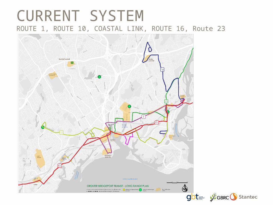
CURRENT SYSTEMROUTE 1, ROUTE 10, COASTAL LINK, ROUTE 16, Route 23

PROPOSED SYSTEMCOASTAL LINK, ROUTE 10, ROUTE 16, ROUTE 23, ROUTE 25
PACKAGE 8 – Trumbull & Monroe

ROUTE 1410-2pm INBOUND
TO WESTFIELD

ROUTE 19AM INBOUND TO
DOWNTOWN

ROUTE 20AM INBOUND TO
WESTFIELD

CURRENT SYSTEMROUTE 14, ROUTE 19, ROUTE 20
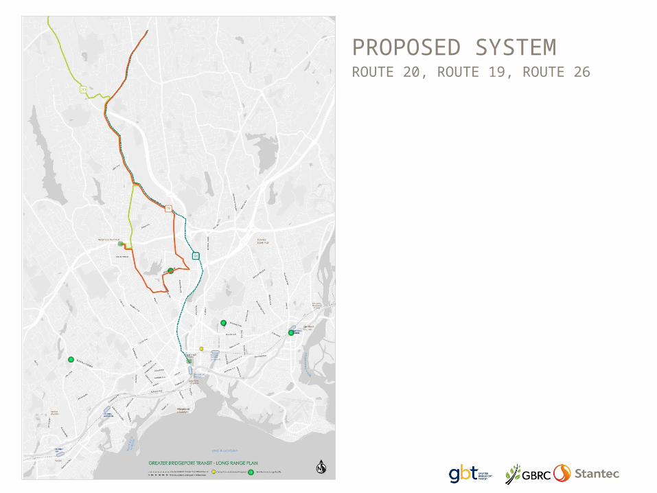
PROPOSED SYSTEMROUTE 20, ROUTE 19, ROUTE 26

PACKAGE 9 – Route 22X

ROUTE 22X

SUMMARYThe Frequent Transit Network & layers of service
5

What we accomplish• Highlight key corridors for growth• Simplify routes• Link majority of key places with
higher frequency service• Minimize disruptions through
consolidation of services and new routings
• New infrastructure• More connections

Bus Rapid Transit - Layer
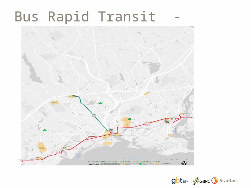
Bus Rapid Transit - Routes

Frequent Routes Layer

Frequent Routes

Standard Route Layerstandard routescommunity routes

Standard Routes

SUMMARY – Layers of service
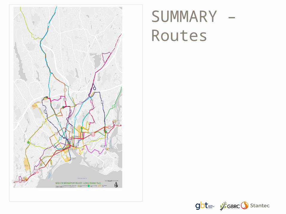
SUMMARY – Routes

Summary of Net Changes

Next Steps
• Finalize Proposals• Short Term – minor changes/hours• Medium term – FTN, major changes,
infrastructure• Long Term – BRT, regional
connections

Questions?