general overview of gauteng - wildlifecampuscultural guiding gauteng course general overview of...
TRANSCRIPT
Cultural Guiding Gauteng Course
General Overview of Gauteng
© &
1
Module # 1 – Component # 1
General overview of
Gauteng Introduction
GENERAL OVERVIEW OF GAUTENG
“A bright desolate, dreary space of open veld, over which the bleak winds of the
winter-time had a passage unhindered and unchecked by the presence of any human habitation save a few farmhouses.” This is how HengryLongland
described the Witwatersrand before gold was discovered in 1886.
Since then, the Province has grown into the most densely populated and urbanized in the country, although comprising of only 1.4% of land area.
Gauteng, the ‘Jacaranda City’ (Pretoria), the ‘City of Gold’,
(Johannesburg/Egoli/Jozi) and the ‘Township life and vibe’ have been the inspiration for many a song, good and bad, humorous and sad.
Geographically it was previously part of the old Transvaal province and known as
the Pretoria-Witwatersrand-Vereeniging (shortened as PWV). In December 1994, it was renamed to Gauteng.
The name Gauteng is the Sesotho word meaning ‘Place of Gold’. This is the historical Sesotho name for Johannesburg and its surrounding areas that refers
to the flourishing gold industry in the province. The Sesotho word ‘gauta’ is derived from the Afrikaans word goud (‘gold’). The suffix, ‘-ng’ means ‘place of
…’.
Cultural Guiding Gauteng Course
General Overview of Gauteng
© &
2
Gauteng is surrounded by four other provinces, Limpopo, North West, Free State
and Mpumalanga. Gauteng is the only landlocked province of South Africa without a foreign border.
The discovery of gold (1886) was not the only contributor to the economy of this
region. Vast coal and iron deposits were also discovered, boosting the mining and industrial sectors. The Premier mine at Cullinan also produced the largest diamond (3106 carats) in the world, adding to the many claims to fame of the
province.
The ‘spirit of gold’ refers to the struggle for liberation, justice and equality for all South Africans. It is symbolic of the pain and suffering of people being shaped
and formed through the fire, emerging stronger and more determined. Their story is told at many places in Gauteng, such as Soweto, Alexandra,
Constitutional Hill, the Apartheids Museum and Freedom Park. The latter is unique in that it celebrates all South Africans struggle for freedom, including the Anglo-Zulu War, the War of Independence, the Great South African War and the
two World Wars.
Gauteng also bears evidence of human origins at the ‘Cradle of Humankind’, a World Heritage Site and home to the renowned Mrs.Ples (Australopithecus
Africanus).
Cultural Guiding Gauteng Course
General Overview of Gauteng
© &
3
Cultural Guiding Gauteng Course
General Overview of Gauteng
© &
4
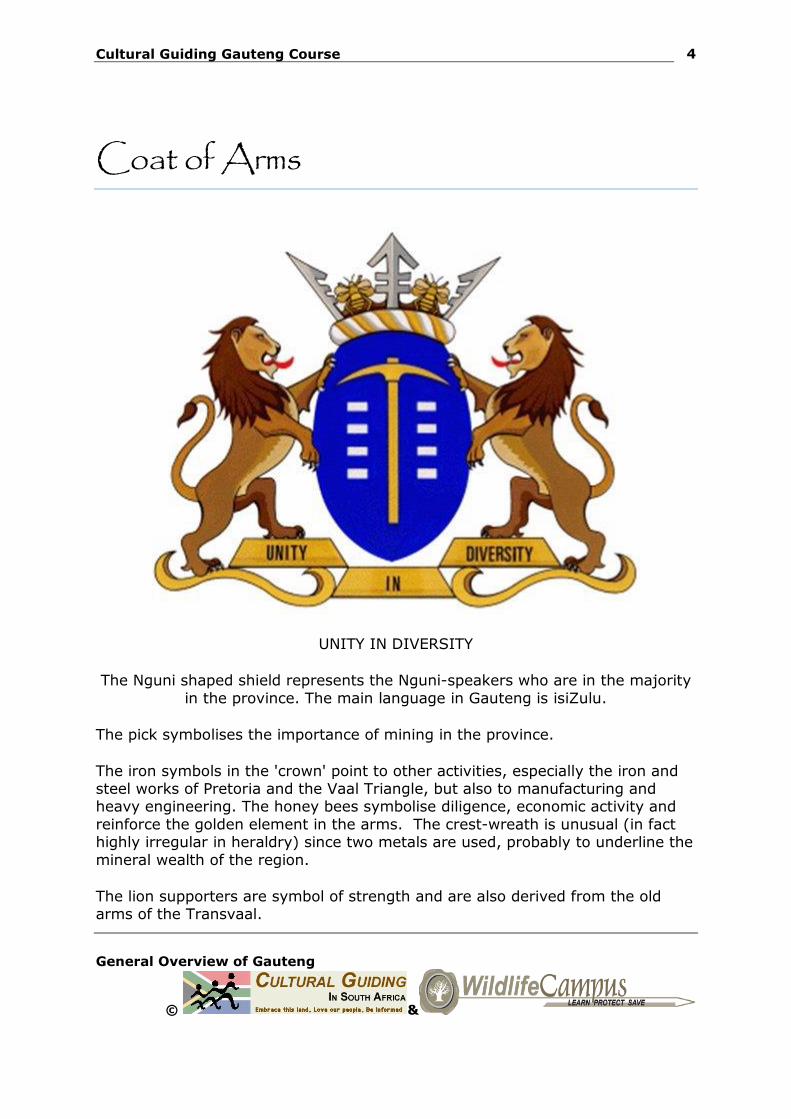
Coat of Arms
UNITY IN DIVERSITY
The Nguni shaped shield represents the Nguni-speakers who are in the majority
in the province. The main language in Gauteng is isiZulu.
The pick symbolises the importance of mining in the province.
The iron symbols in the 'crown' point to other activities, especially the iron and steel works of Pretoria and the Vaal Triangle, but also to manufacturing and heavy engineering. The honey bees symbolise diligence, economic activity and
reinforce the golden element in the arms. The crest-wreath is unusual (in fact highly irregular in heraldry) since two metals are used, probably to underline the
mineral wealth of the region.
The lion supporters are symbol of strength and are also derived from the old arms of the Transvaal.
Cultural Guiding Gauteng Course
General Overview of Gauteng
© &
5
The motto is shown on three gold bars, symbol for the gold mining and
prosperity.
Cultural Guiding Gauteng Course
General Overview of Gauteng
© &
6
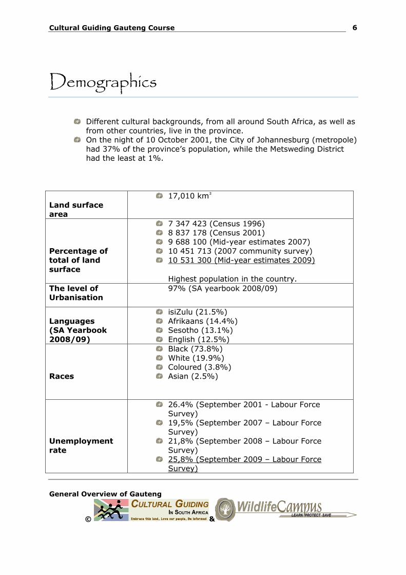
Demographics
Different cultural backgrounds, from all around South Africa, as well as
from other countries, live in the province. On the night of 10 October 2001, the City of Johannesburg (metropole)
had 37% of the province’s population, while the Metsweding District had the least at 1%.
Land surface area
17,010 km²
Percentage of total of land
surface
7 347 423 (Census 1996) 8 837 178 (Census 2001) 9 688 100 (Mid-year estimates 2007)
10 451 713 (2007 community survey) 10 531 300 (Mid-year estimates 2009)
Highest population in the country.
The level of Urbanisation
97% (SA yearbook 2008/09)
Languages (SA Yearbook
2008/09)
isiZulu (21.5%)
Afrikaans (14.4%) Sesotho (13.1%)
English (12.5%)
Races
Black (73.8%)
White (19.9%) Coloured (3.8%) Asian (2.5%)
Unemployment
rate
26.4% (September 2001 - Labour Force Survey)
19,5% (September 2007 – Labour Force
Survey) 21,8% (September 2008 – Labour Force
Survey) 25,8% (September 2009 – Labour Force
Survey)
Cultural Guiding Gauteng Course
General Overview of Gauteng
© &
7
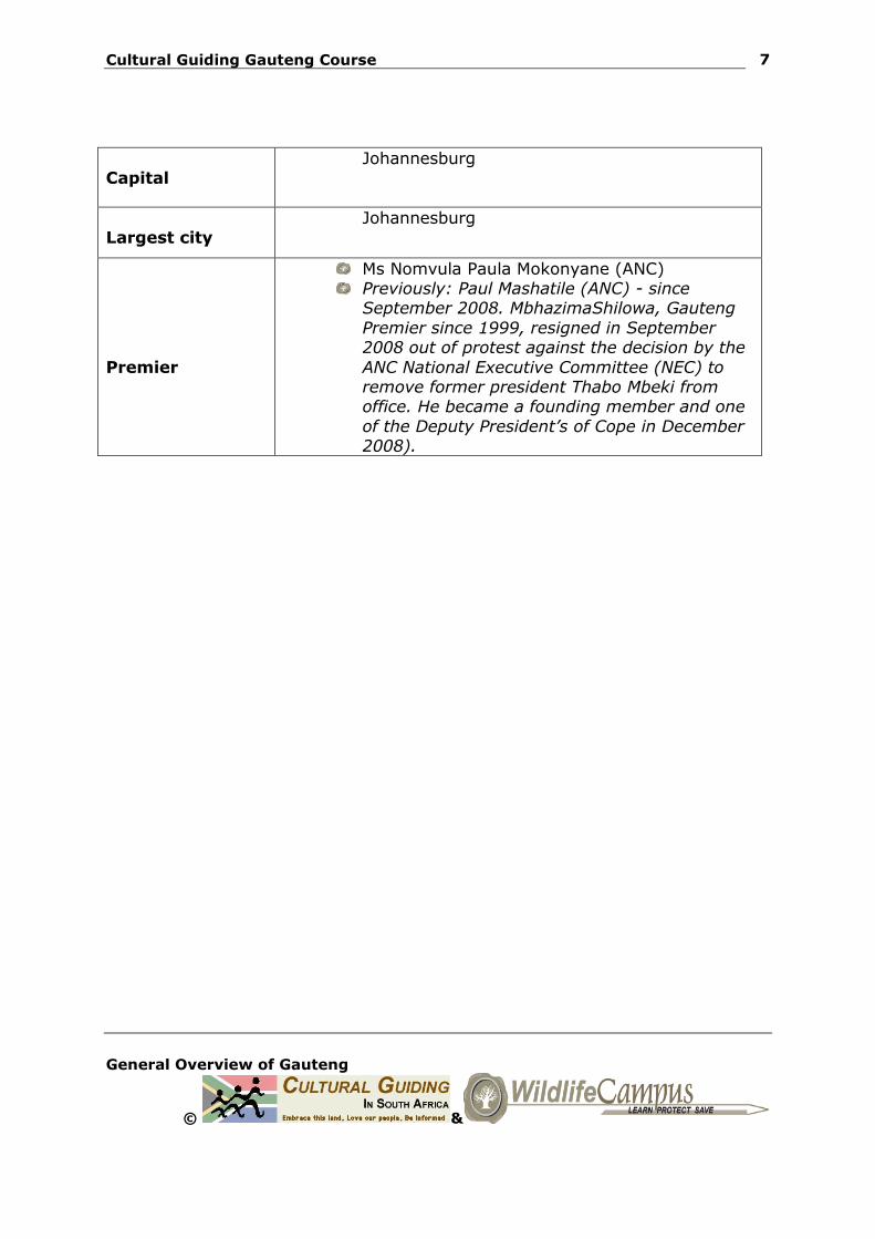
Capital
Johannesburg
Largest city
Johannesburg
Premier
Ms Nomvula Paula Mokonyane (ANC) Previously: Paul Mashatile (ANC) - since
September 2008. MbhazimaShilowa, Gauteng
Premier since 1999, resigned in September 2008 out of protest against the decision by the
ANC National Executive Committee (NEC) to remove former president Thabo Mbeki from office. He became a founding member and one
of the Deputy President’s of Cope in December 2008).
Cultural Guiding Gauteng Course
General Overview of Gauteng
© &
8
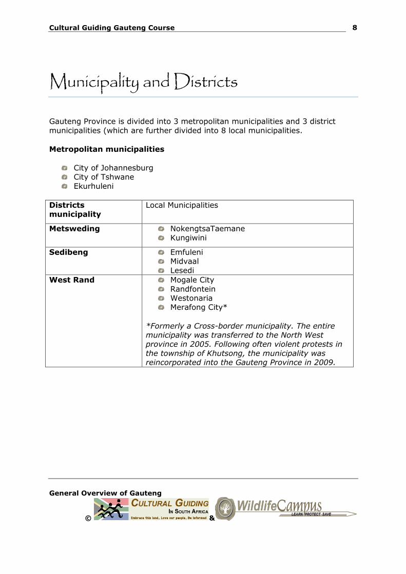
Municipality and Districts
Gauteng Province is divided into 3 metropolitan municipalities and 3 district
municipalities (which are further divided into 8 local municipalities.
Metropolitan municipalities
City of Johannesburg City of Tshwane
Ekurhuleni
Districts municipality
Local Municipalities
Metsweding NokengtsaTaemane
Kungiwini
Sedibeng Emfuleni Midvaal
Lesedi
West Rand Mogale City
Randfontein Westonaria Merafong City*
*Formerly a Cross-border municipality. The entire municipality was transferred to the North West province in 2005. Following often violent protests in
the township of Khutsong, the municipality was reincorporated into the Gauteng Province in 2009.
Cultural Guiding Gauteng Course
General Overview of Gauteng
© &
9
Geology
The most important geological event that took place in the province was the
formation of the Witwatersrand Supergroup.
Experts believe that about 3 billion years ago an inland shallow ‘sea’ or lake was formed due to a depression of the granite crust of the earth.
High mountains surrounded the shallow shores of this sea. It is believed that the gold was first deposited with very ancient volcanic
rocks (now called greenstones) and granites that formed these mountains.
The mountains were eroded away over a very long period of time. Fast-flowing rivers ran from the mountains and carried vast volumes of
sand, mud and pebbles in the sea. It also deposited minute gold particles, together with uranium minerals
and pyrite grains.
The small heavy gold particles and other minerals were concentrated within the pebble beds.
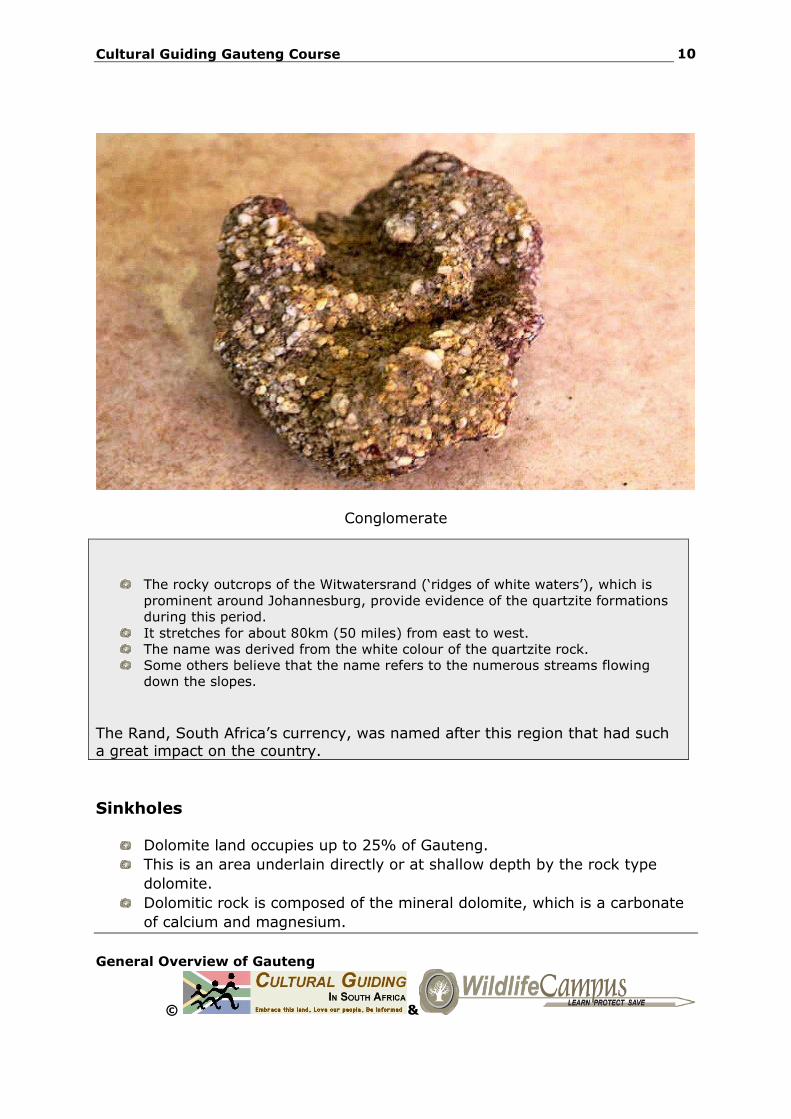
Whenever the rocks were reworked, the gold became more and more concentrated in specific layers, called conglomerates.
These consisted of white quartz pebbles or black chert and a fine sand
matrix with about 10 – 20 grams of gold per ton, resulting in the largest and richest gold deposits on earth.
Cultural Guiding Gauteng Course
General Overview of Gauteng
© &
10
Conglomerate
The rocky outcrops of the Witwatersrand (‘ridges of white waters’), which is
prominent around Johannesburg, provide evidence of the quartzite formations
during this period.
It stretches for about 80km (50 miles) from east to west.
The name was derived from the white colour of the quartzite rock.
Some others believe that the name refers to the numerous streams flowing
down the slopes.
The Rand, South Africa’s currency, was named after this region that had such a great impact on the country.
Sinkholes
Dolomite land occupies up to 25% of Gauteng.
This is an area underlain directly or at shallow depth by the rock type
dolomite.
Dolomitic rock is composed of the mineral dolomite, which is a carbonate
of calcium and magnesium.
Cultural Guiding Gauteng Course
General Overview of Gauteng
© &
11
Rainwater and ground water gradually dissolve the rock over time as it
seeps through cracks in the rock.
In an excess of 1000 sinkholes have occurred on the West Rand, 800
south of Pretoria, Centurion and Attridgeville and 150 on the East Rand.
Mountains
The Magagliesberg
The only mountain range in Gauteng.
This gives rise to cave systems and voids in the rock.
Soils covering the rock can collapse into these caves or spaces resulting in
catastrophic ground movement on the surface such as sinkholes.
Cultural Guiding Gauteng Course
General Overview of Gauteng
© &
12
Main Rivers
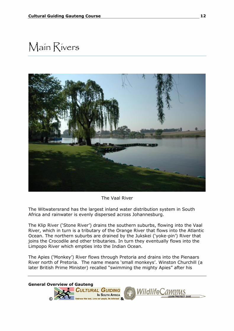
The Vaal River
The Witwatersrand has the largest inland water distribution system in South Africa and rainwater is evenly dispersed across Johannesburg.
The Klip River (‘Stone River’) drains the southern suburbs, flowing into the Vaal River, which in turn is a tributary of the Orange River that flows into the Atlantic
Ocean. The northern suburbs are drained by the Jukskei (‘yoke-pin’) River that joins the Crocodile and other tributaries. In turn they eventually flows into the
Limpopo River which empties into the Indian Ocean.
The Apies (‘Monkey’) River flows through Pretoria and drains into the Pienaars River north of Pretoria. The name means ‘small monkeys’. Winston Churchill (a
later British Prime Minister) recalled “swimming the mighty Apies” after his
Cultural Guiding Gauteng Course
General Overview of Gauteng
© &
13
escape from the StaatsmodelSkool (‘State model School’) School during the
Anglo-Boer War (1899-1902).
The SesmylSpruit (‘Six Mile Stream’) is crossed when traveling south on the R21 from Oliver Tambo International (ORTIA). Other rivers in the province are the
Blesbokspruit, Suikerbosrand, Natalspurit, Rietspruit, Wonderfonteinspruit and the Hennops.
Major Dams
Bon Accord
Bronkhorstspruit Rietvlei Roodeplaat
Roodepoort Vaal Barrage
Vaal
The Vaal-; Rietvlei- and Roodeplaat Dams supply water to the province.
Naturally, Gauteng’s water resource would come from surface runoff and ground water, however due to the high demand for water, Gauteng imports raw water
from outside the province (for example the main supply to the province is from the Vaal river which receives input from the Lesotho Highlands Project). Some of this imported resource is returned to the water system by means of industrial
and domestic discharges.
Cultural Guiding Gauteng Course
General Overview of Gauteng
© &
14
Nature and conservation
Gauteng is mainly open grassland known as the “highveld”.
Plant life consists of a few small indigenous trees and shrubs. Protea species grow south of Johannesburg.
Many trees have been introduced to the region. o Johannesburg alone has some 6 million trees and is regarded as the
world’s largest man-made forest.
o Some of them exotic and have become invasive. o Among these are the wattle (Australian acacias) and bluegum
(Eucalyptus) trees that was introduced to provide support pillars in the mining tunnels.
o Others, for example the Jacaranda trees, were planted for
decoration.
Some common trees and plants in Gauteng
Mountain cabbage Karee
Sweet – and common hookthorn White stinkwood Candelabra
Wild Olive Aloes (Aloe marlothii)
Plumbago
Some common birds in Gauteng
Hadeda Ibis Go-away bird Cape – and House Sparrow
Black-masked weaver Long-tailed widowbird (commonly known as ‘flap’)
Black-eyed Bulbul Laughing – and Cape Turtle Dove Egyptian Goose
Indian Myna Cape Wagtail
Helmeted Guineafowl Crowned Plover African Hoopoe
Cultural Guiding Gauteng Course
General Overview of Gauteng
© &
15
Crested Barbet
Although Gauteng province is dominated by the urban areas of Johannesburg
and Pretoria, it has some beautiful nature reserves. Although the province is highly urbanised and industrialised, it contains wetlands of international
importance, such as Blesbokspruit near Springs.
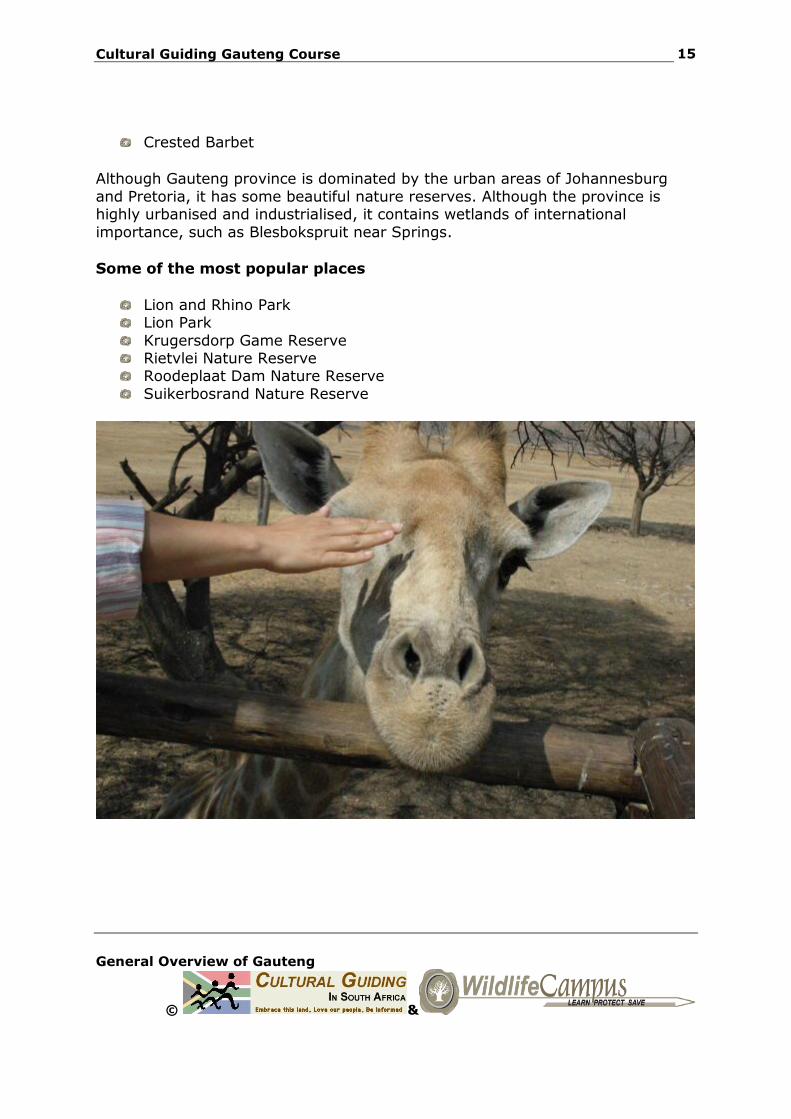
Some of the most popular places
Lion and Rhino Park Lion Park
Krugersdorp Game Reserve Rietvlei Nature Reserve Roodeplaat Dam Nature Reserve
Suikerbosrand Nature Reserve
Cultural Guiding Gauteng Course
General Overview of Gauteng
© &
16
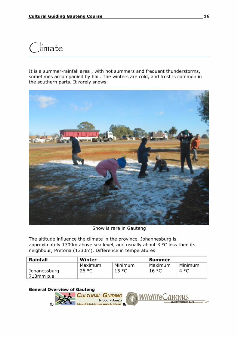
Climate
It is a summer-rainfall area , with hot summers and frequent thunderstorms,
sometimes accompanied by hail. The winters are cold, and frost is common in the southern parts. It rarely snows.
Snow is rare in Gauteng
The altitude influence the climate in the province. Johannesburg is
approximately 1700m above sea level, and usually about 3 °C less then its
neighbour, Pretoria (1330m). Difference in temperatures
Rainfall Winter Summer
Maximum Minimum Maximum Minimum
Johanessburg
713mm p.a.
26 °C 15 °C 16 °C 4 °C
Cultural Guiding Gauteng Course
General Overview of Gauteng
© &
17
Pretoria 674 mm p.a
29 °C 18 °C 19 °C 5 °C
Cultural Guiding Gauteng Course
General Overview of Gauteng
© &
18
Economy
GDPR at current prices (2004): R462 044 million
% of total GDP: 33,3%
Gauteng is the financial and economic powerhouse of South Africa.
Gauteng is considered the economic hub of South Africa and contributes heavily in the financial, manufacturing, transport, technology and telecommunications
sectors, amongst others. It also plays host to a large number of overseas companies requiring a commercial base in and gateway to Africa.
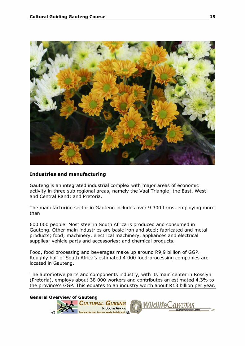
Agriculture
Agricultural activities makes up a small share of the economy in the province
and mainly evolves around providing the cities and towns with daily fresh produce, including dairy products, vegetables, fruit, meat, eggs and flowers. The districts of Heidelberg, Cullinan and Bronkhorstspruit fall within the so-called
“Maize Triangle”. They mainly produce ground-nuts, sunflowers, cotton and sorghum.
Cultural Guiding Gauteng Course
General Overview of Gauteng
© &
19
Industries and manufacturing
Gauteng is an integrated industrial complex with major areas of economic
activity in three sub regional areas, namely the Vaal Triangle; the East, West and Central Rand; and Pretoria.
The manufacturing sector in Gauteng includes over 9 300 firms, employing more
than
600 000 people. Most steel in South Africa is produced and consumed in Gauteng. Other main industries are basic iron and steel; fabricated and metal
products; food; machinery, electrical machinery, appliances and electrical supplies; vehicle parts and accessories; and chemical products.
Food, food processing and beverages make up around R9,9 billion of GGP.
Roughly half of South Africa’s estimated 4 000 food-processing companies are located in Gauteng.
The automotive parts and components industry, with its main center in Rosslyn (Pretoria), employs about 38 000 workers and contributes an estimated 4,3% to
the province’s GGP. This equates to an industry worth about R13 billion per year.
Cultural Guiding Gauteng Course
General Overview of Gauteng
© &
20
Finances
The province is the financial-services capital of Africa. More than 70 foreign banks have their head offices here, as well as most South African banks, stockbrokers and insurance giants. The JSE, the largest securities exchange in
Africa, is also hosted in Johannesburg.
Tourism
Most overseas visitors enter South Africa via OR Tambo International Airport. One in every two foreign tourist in South Africa visits Gauteng, making the
province the country’s highest earner of tourism income.
The opening and closing games of the FIFA World Cup will take place at Soccer City and the province will also host a number of other group matches.

Cultural Guiding Gauteng Course
General Overview of Gauteng
© &
21
Sports and Recreation
Soccer (football) This is the most popular sport in Gauteng. Several
teams from Gauteng plays in the Premier Soccer League: Teams include Kaizer Chiefs, Orlando
Pirates and MamelodiSundowns.
Rugby It is a very popular sport as well. Two teams participate in the Southern Hemisphere’s Super 14,
The lions (previously the cats) and the Bulls (based in Pretoria). The latter was the first South African team to win the competition in 2007. They were
victorious for a second time in 2009, and also won the Currie Cup
Cricket Many local and international matches are hosted in
the province, mainly at Supersport Park (Centurion) and the Wanderers (Johannesburg).
Sports Stadium
Soccer City (near Soweto)
94 700 seats
Ellis Park
(Johannesburg) 61 000 seats
Loftus (Pretoria) 50 000 seats
Cultural Guiding Gauteng Course
General Overview of Gauteng
© &
22
Infrastructure
The urban areas are rapidly growing and it is predicted that by 2015, the
population will be some 14.6 million people, making it one of the largest cities in
the world. AIDS may however have a negative impact on the population
numbers.
The traffic congestion on the roads are one of the major problems in this densely populated province. The Gautrain Rapid Rail Link, a high-speed rail between
Pretoria, Sandton, Johannesburg and OR Tambo International Airport, is an attempt to address this problem. It is expected to be fully functional by 2011.
Cultural Guiding Gauteng Course
General Overview of Gauteng
© &
23
Education
Gauteng is a centre of learning in South Africa, and it has many universities and
other schools of higher learning.
University of South Africa: Also known as UNISA and incorporating the Technikon South Africa and the distance learning unit of Vista University
University of Pretoria. Tshwane University of Technology (Formed after Technikon Pretoria,
Technikon Northern Gauteng, and Technikon North-West merged).
University of the Witwatersrand University of Johannesburg (Formed after Rand Afrikaans University, some
Johannesburg campuses of Vista University and Technikon Witwatersrand merged)
Vaal University of Technology: Previously known as Vaal Triangle
Technikon
Gauteng Department of Education has embarked on a project to provide fully functional ICT laboratories to all public schools in Gauteng. The name of this
project is Gauteng OnLine.
Cultural Guiding Gauteng Course
General Overview of Gauteng
© &
24
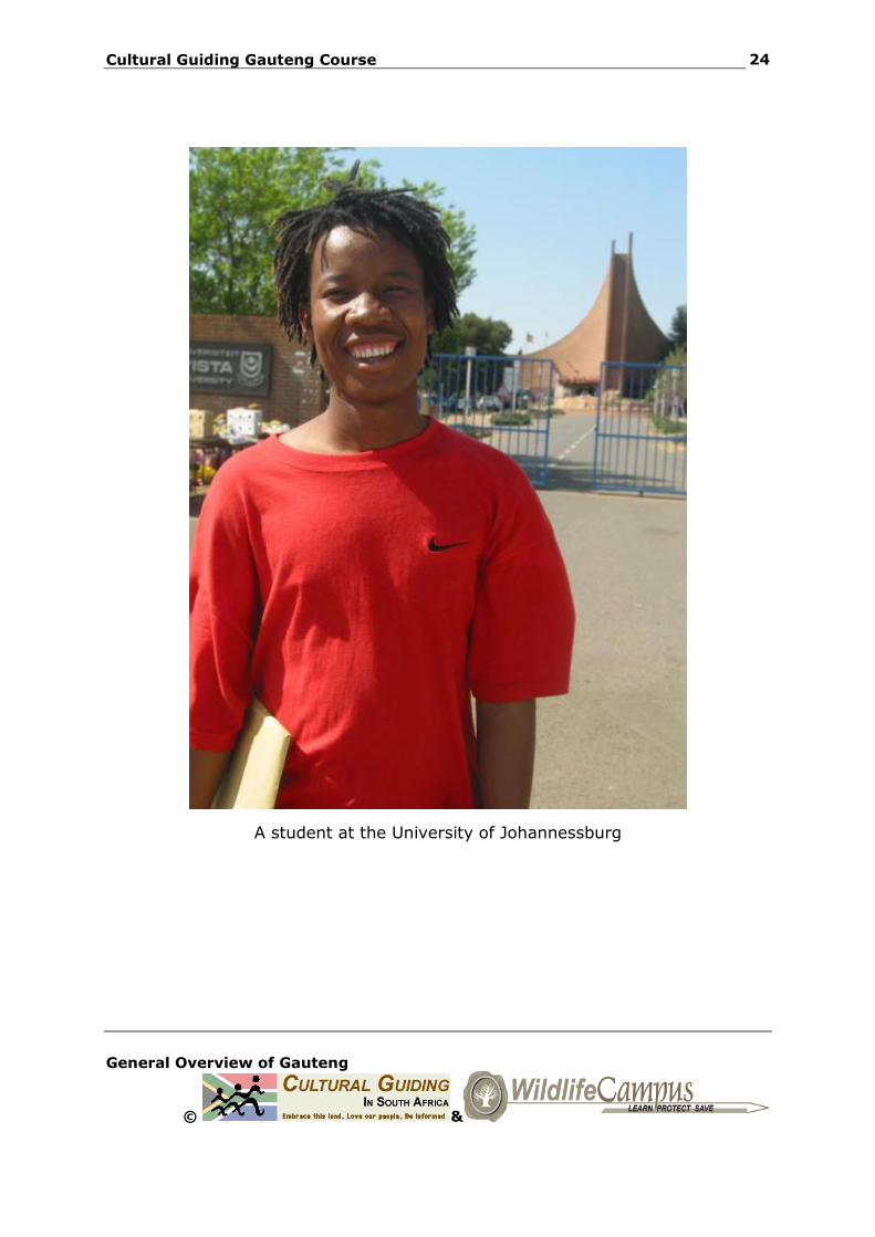
A student at the University of Johannessburg
Cultural Guiding Gauteng Course
General Overview of Gauteng
© &
25
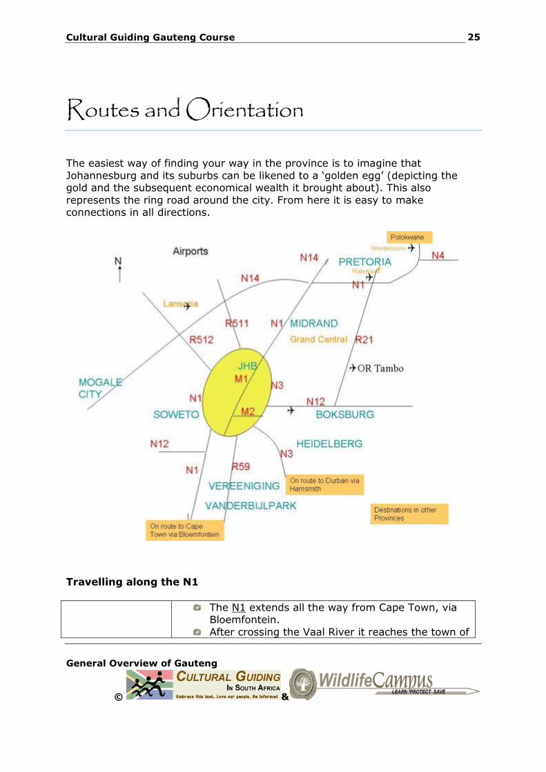
Routes and Orientation
The easiest way of finding your way in the province is to imagine that
Johannesburg and its suburbs can be likened to a ‘golden egg’ (depicting the gold and the subsequent economical wealth it brought about). This also
represents the ring road around the city. From here it is easy to make connections in all directions.
Travelling along the N1
The N1 extends all the way from Cape Town, via Bloemfontein.
After crossing the Vaal River it reaches the town of
Cultural Guiding Gauteng Course
General Overview of Gauteng
© &
26
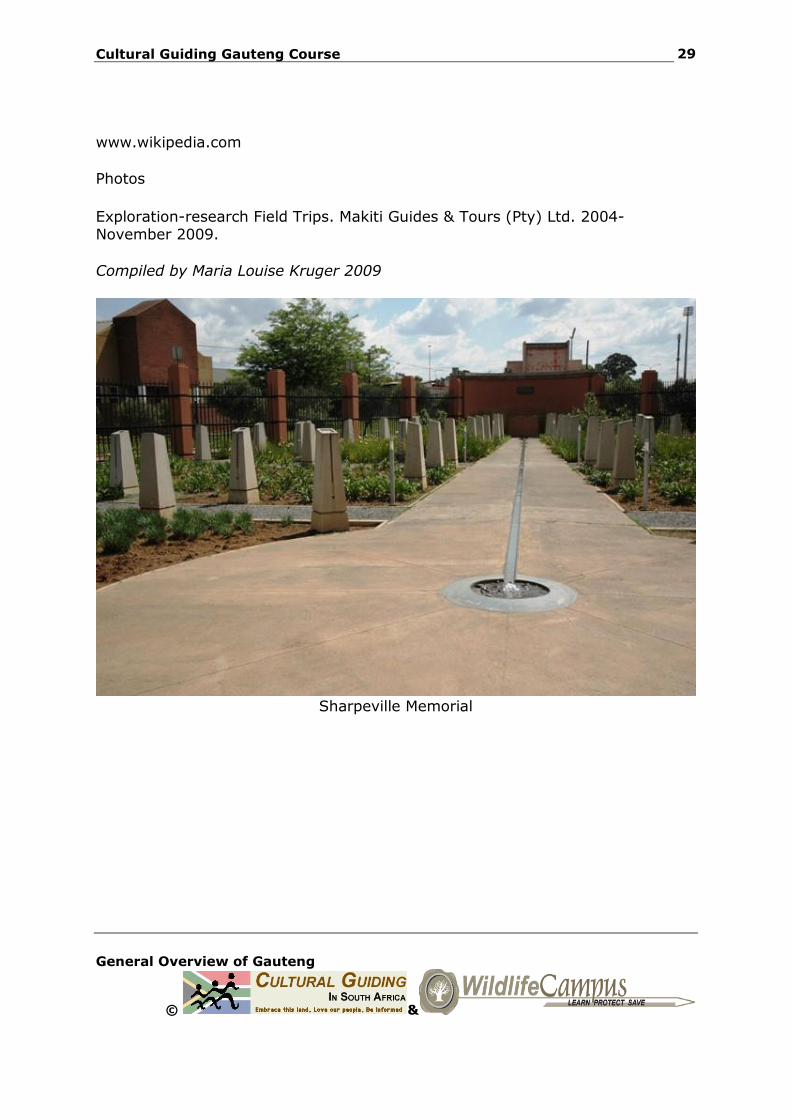
Vanderbijlpark. It passes in close proximity of Sebokeng, scene of
the Sharpeville uprising and later through the
Grasmere Toll Plaza.
N12 South of Johannesburg the N1 links with the N12 (Moroka bypass) coming from Potchefstroom, and
soon after, it becomes what is known as the ‘Western bypass’.
The latter also use to be known as the ‘Cement highway’ due to the fact that is was built with concrete. This section passes Soweto, Roodepoort,
Northcliff, Randburg and Bryanston.
M1
N3
At the Buccleuch Interchange the N1 connects with the M1 (De Villiers Graaff Motorway) and the
N3. The N1 now swerves northwards now becomes known as the ‘Ben Schoeman Highway’.
It is jam packed every working day, and an early start is no guarantee for arriving on time. Always allow at least two hours travel time between
Johannesburg and Pretoria in the morning and late afternoon, or use an alternative route (which is
not always a better solution since everyone else has the same idea!)
Midrand is halfway between Johannesburg and
Pretoria.
N14 Soon after the Olifantsfontein off ramp, the N1 interchange with the N14 (continuing to Pretoria
CBD and to the west to Mogale City/Krugersdorp).
R21 For a while the N1 follows an easterly route, passing Centurion and Irene. It then inter
connects with the R21 (the so called ‘Airport Road’ or AlbertinaSisuluroad) to OR Tambo International
and Pretoria CBD. The N1 now slowly starts its
Cultural Guiding Gauteng Course
General Overview of Gauteng
© &
27
course in a northwards direction again.
N4 The intersection with the N4 supplies yet another option to reach downtown Pretoria. The westward
bound section of the N4 towards Witbank is the main access route from Pretoria to the Lowveld and Kruger National Park.
After passing the most northern suburbs of Pretoria, the N1 becomes known as ‘the Great
North’ road. The N4 or so-called ‘Platinum Highway
Cultural Guiding Gauteng Course
General Overview of Gauteng
© &
28
Resources and further reading
Mccarthy, T &Rubidge, B. The Story of Earth and life. A southern African
perspective on a 4.6-billion-year old journey. Struik Publishers. 2005.
Norman, N & Whitfield, G. Geological Journeys.Struik Publishers. 2006.
Mid-year population estimates 2008 (Stats SA)
South African Yearbook 2006-07
South African Yearbook 2007-08
South African Yearbook 2008-09
Van Dyk, P. Explore Gauteng.Izimpilo C&S Publishers. 2004.
Maps
AA Maps – Road Atlas of South Africa. 2006 (5th edition).
Joburg. City of Johnnesburg.
The Larger Touring Atlas of South Africa (Sunbird) . Dick Wilkins. 2001.
Articles and Brochures
Appropriate development of infrastructure on dolomite: Guidelines for consultants. Department of Public Works. August 2003.
www.dwaf.gov.za
www.gauteng.com
www.roodeplaat-reserve.co.za
www.statssa.gov.za
www.tshwane.gov.za
Cultural Guiding Gauteng Course
General Overview of Gauteng
© &
29
www.wikipedia.com
Photos
Exploration-research Field Trips. Makiti Guides & Tours (Pty) Ltd. 2004-November 2009.
Compiled by Maria Louise Kruger 2009
Sharpeville Memorial