geo326g/386g: what is gis? - university of texas at austin
TRANSCRIPT
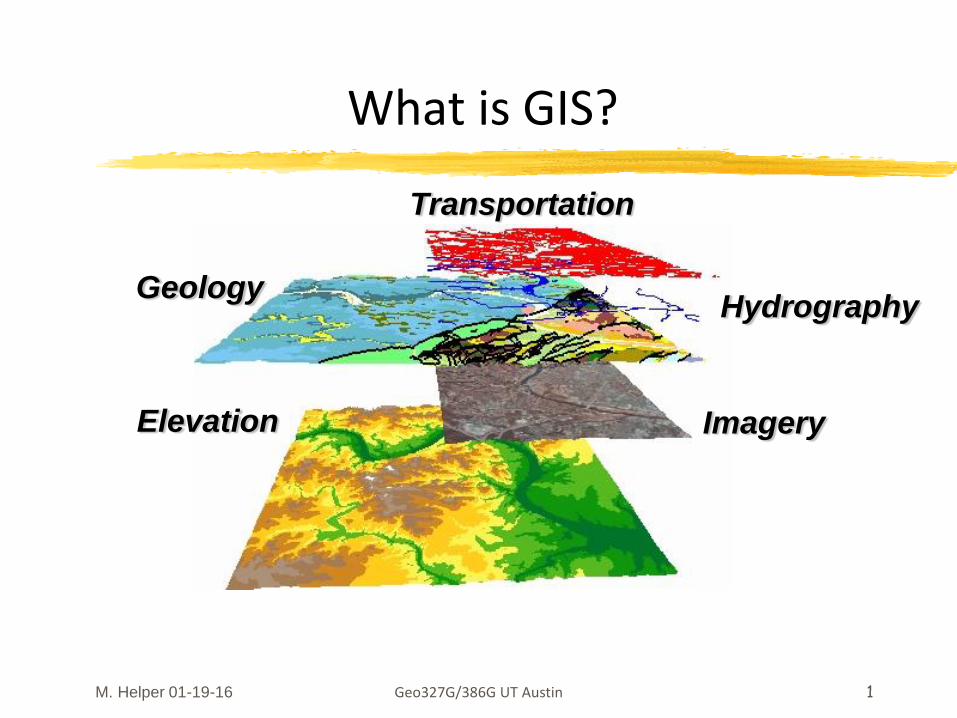
M. Helper 01-19-16 Geo327G/386G UT Austin 1
What is GIS?
Transportation
HydrographyGeology
ImageryElevation
Geo327G/386G UT Austin 2
Key Questions and Issues
What is GIS?
What are the applications of GIS?
How is the real world represented in GIS?
What analyses can GIS performed?
M. Helper 01-14-14
M. Helper 01-19-16
Geo327G/386G UT Austin 3
GIS = Geographic Information System(s)
Computerized management & analysis of geographic information
Group of tools (and people) for collection, management, storage, analysis, display and distribution of spatial data & information
Computer-based tool for mapping and analyzing things that exist and events that happen
Others, e.g. Bolstad
M. Helper 01-14-14
M. Helper 01-19-16
Geo327G/386G UT Austin 4
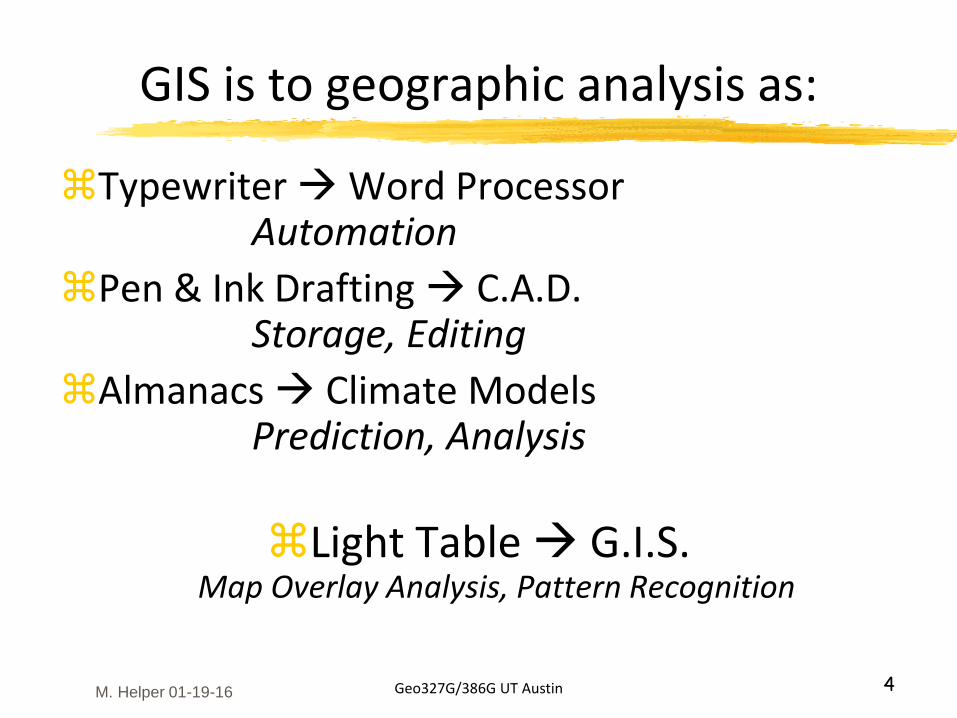
GIS is to geographic analysis as:
Typewriter Word ProcessorAutomation
Pen & Ink Drafting C.A.D.Storage, Editing
Almanacs Climate ModelsPrediction, Analysis
Light Table G.I.S.Map Overlay Analysis, Pattern Recognition
M. Helper 01-19-16
Geo327G/386G UT Austin 5
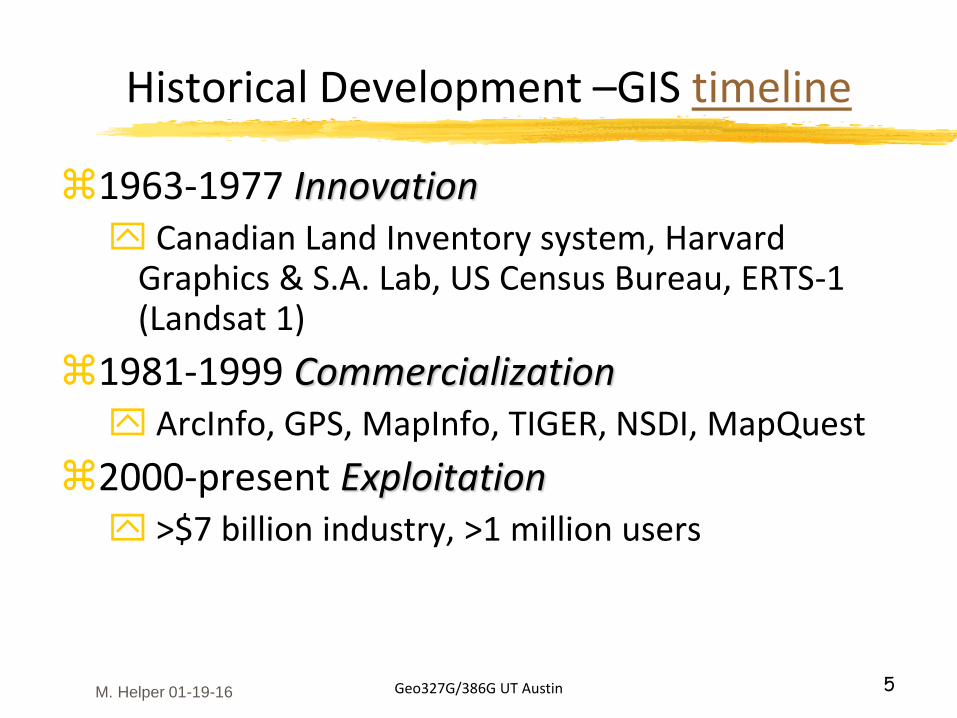
Historical Development –GIS timeline
1963-1977 Innovation Canadian Land Inventory system, Harvard
Graphics & S.A. Lab, US Census Bureau, ERTS-1 (Landsat 1)
1981-1999 Commercialization ArcInfo, GPS, MapInfo, TIGER, NSDI, MapQuest
2000-present Exploitation >$7 billion industry, >1 million users
M. Helper 01-19-16
Geo327G/386G UT Austin 6
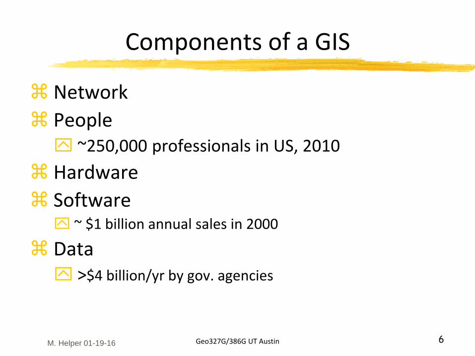
Components of a GIS
Network
People ~250,000 professionals in US, 2010
Hardware
Software ~ $1 billion annual sales in 2000
Data >$4 billion/yr by gov. agencies
M. Helper 01-19-16
Geo327G/386G UT Austin 7
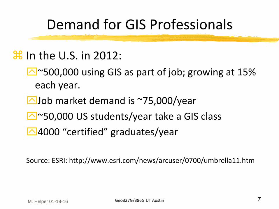
Demand for GIS Professionals
In the U.S. in 2012:
~500,000 using GIS as part of job; growing at 15% each year.
Job market demand is ~75,000/year
~50,000 US students/year take a GIS class
4000 “certified” graduates/year
Source: ESRI: http://www.esri.com/news/arcuser/0700/umbrella11.htm
M. Helper 01-19-16
Geo327G/386G UT Austin 8
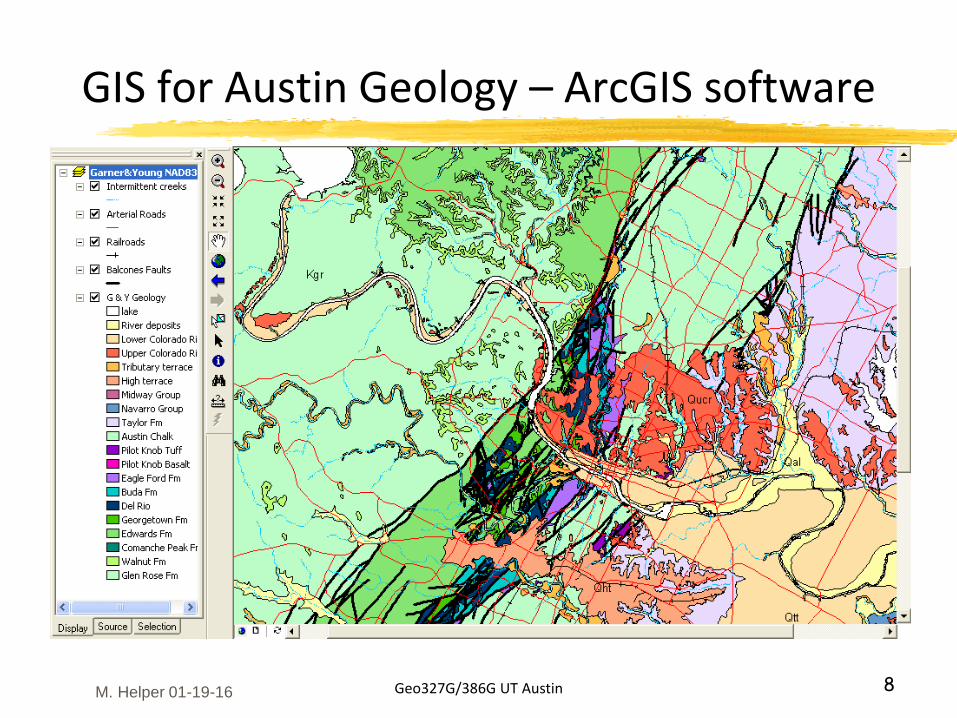
GIS for Austin Geology – ArcGIS software
M. Helper 01-19-16
Geo327G/386G UT Austin 9
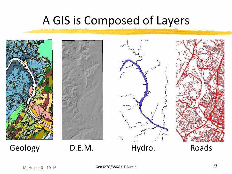
A GIS is Composed of Layers
Geology D.E.M. Hydro. Roads
M. Helper 01-19-16
Geo327G/386G UT Austin 10
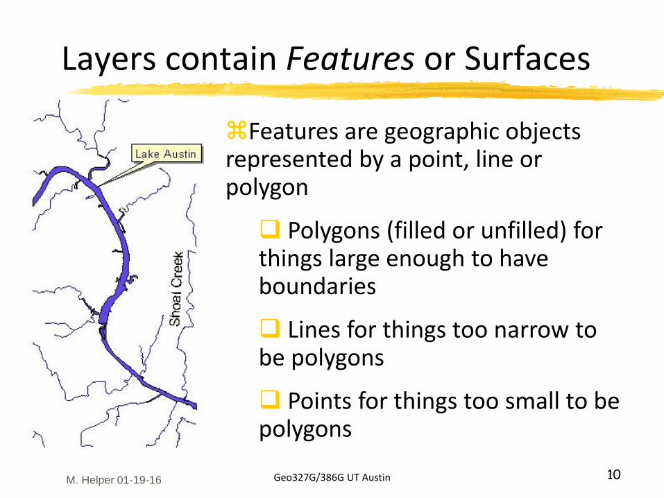
Layers contain Features or Surfaces
Features are geographic objects represented by a point, line or polygon
Polygons (filled or unfilled) for things large enough to have boundaries
Lines for things too narrow to be polygons
Points for things too small to be polygons
M. Helper 01-19-16
Geo327G/386G UT Austin 11
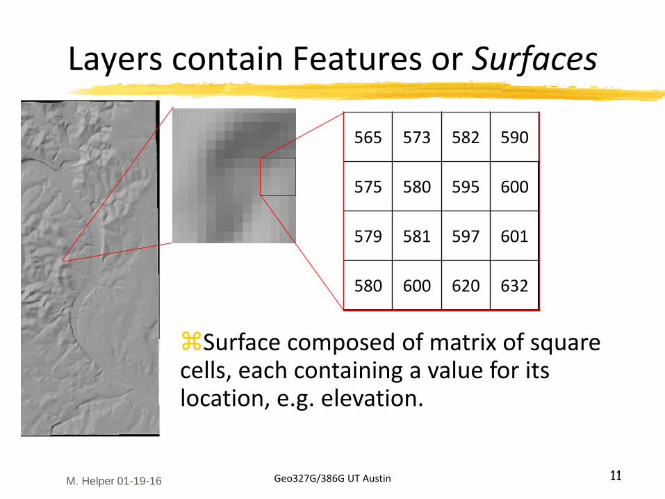
Layers contain Features or Surfaces
565 573 582 590
575 580 595 600
579 581 597 601
580 600 620 632
Surface composed of matrix of square cells, each containing a value for its location, e.g. elevation.
M. Helper 01-19-16
Geo327G/386G UT Austin 12
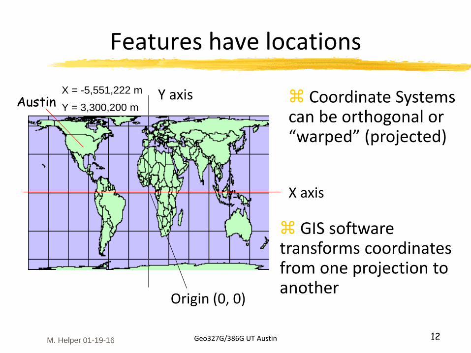
Features have locations
Origin (0, 0)
X axis
Y axisAustinX = -5,551,222 m
Y = 3,300,200 m Coordinate Systems can be orthogonal or “warped” (projected)
GIS software transforms coordinates from one projection to another
M. Helper 01-19-16
Geo327G/386G UT Austin 13
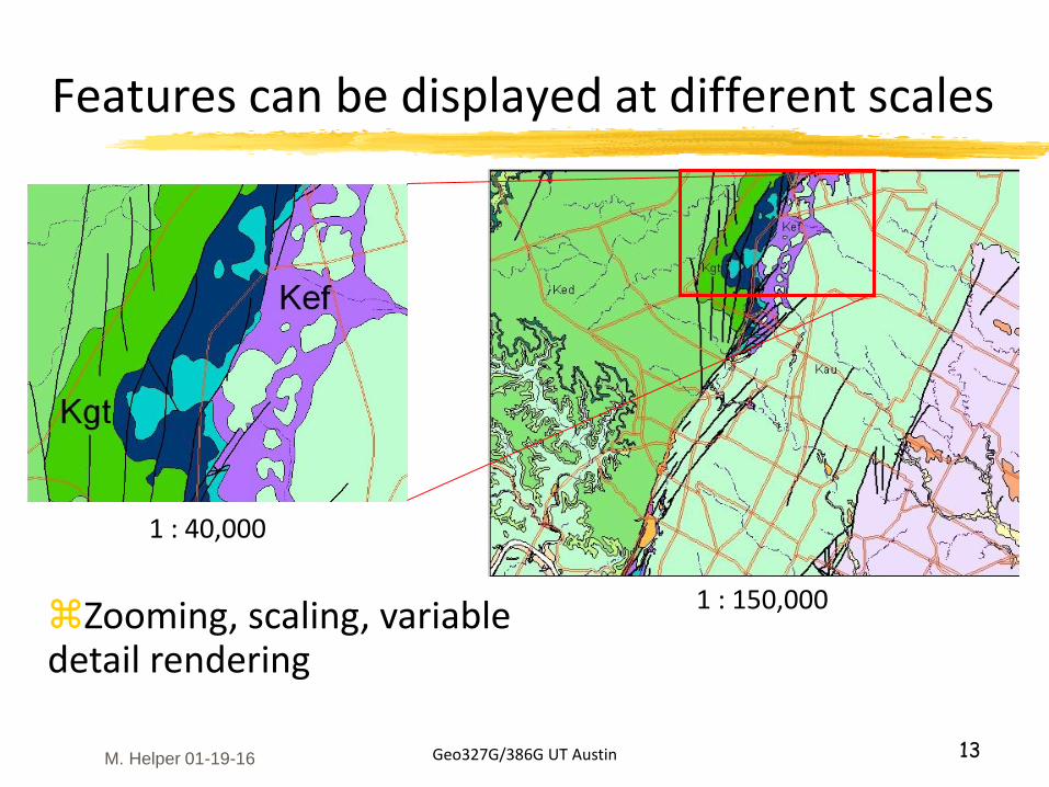
Features can be displayed at different scales
1 : 150,000
1 : 40,000
Zooming, scaling, variable detail rendering
M. Helper 01-19-16
Geo327G/386G UT Austin 14
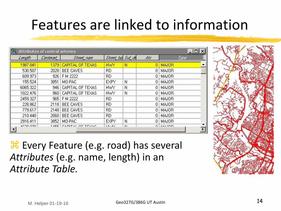
Features are linked to information
Every Feature (e.g. road) has several Attributes (e.g. name, length) in an Attribute Table.
M. Helper 01-19-16
Geo327G/386G UT Austin 15
Spatial relationships can be queried
What crosses what?
Proximity – What is within a certain distance of what?
Containment - What’s inside of what?
Which features share common attributes?
Many others
M. Helper 01-19-16
Geo327G/386G UT Austin 16
Applications
What is where?Query and info. retrieval – e.g. MapQuest, Google Maps
What geographic patterns exist?E.g. Geostatistics; e.g. prediction of ore grades from limited data
Where have temporal changes occurred?E.g. LULC change, water table levels, morphologic studies
Where do certain conditions apply?E.g. suitability analyses – “where is the best place for…”
“What if” forward modeling; what are spatial implications for certain actions?E.g. strip mining reclamation
M. Helper 01-19-16
Geo327G/386G UT Austin 17
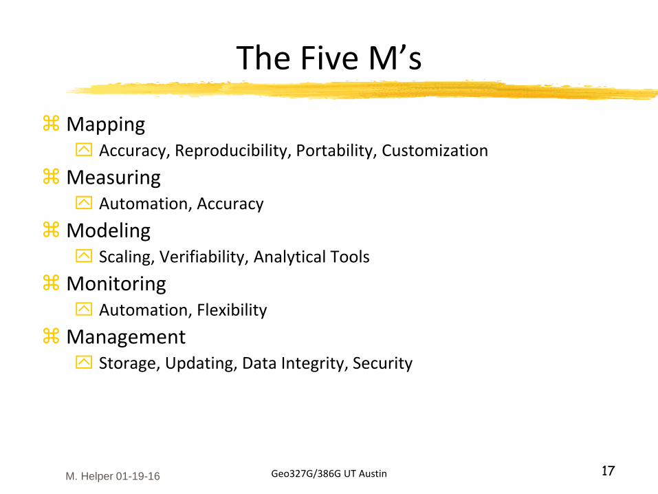
The Five M’s
Mapping Accuracy, Reproducibility, Portability, Customization
Measuring Automation, Accuracy
Modeling Scaling, Verifiability, Analytical Tools
Monitoring Automation, Flexibility
Management Storage, Updating, Data Integrity, Security
M. Helper 01-19-16
Geo327G/386G UT Austin 18
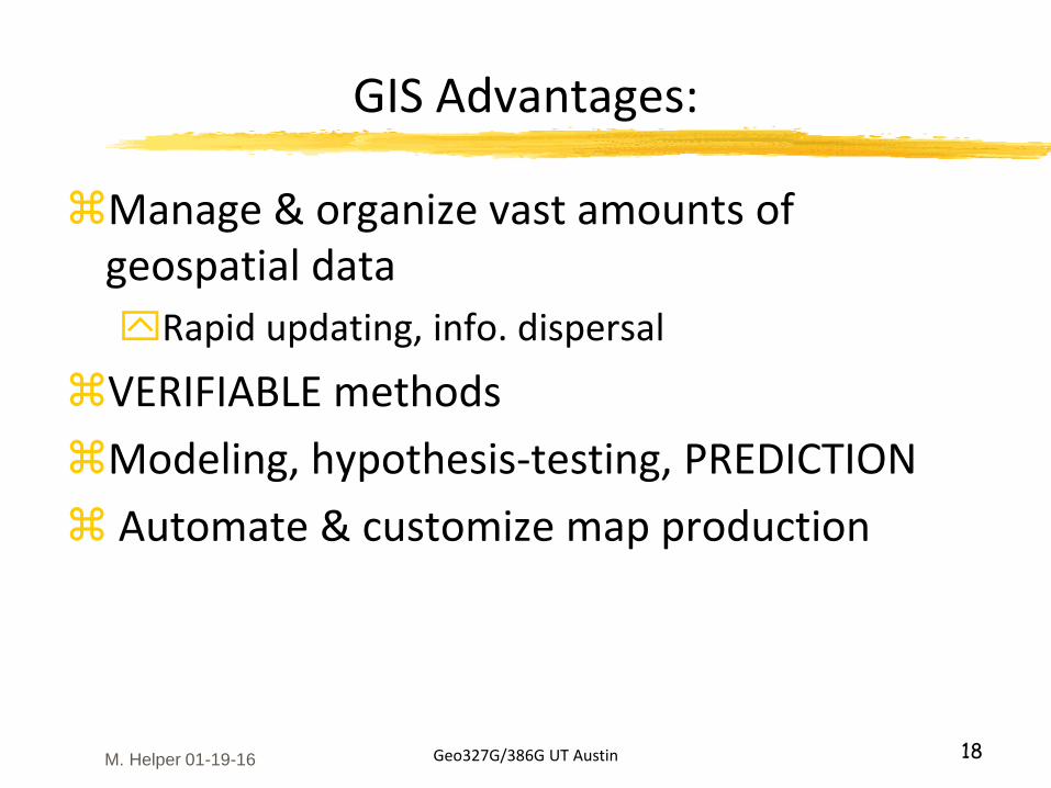
GIS Advantages:
Manage & organize vast amounts of geospatial data
Rapid updating, info. dispersal
VERIFIABLE methods
Modeling, hypothesis-testing, PREDICTION
Automate & customize map production
M. Helper 01-19-16
Geo327G/386G UT Austin 19
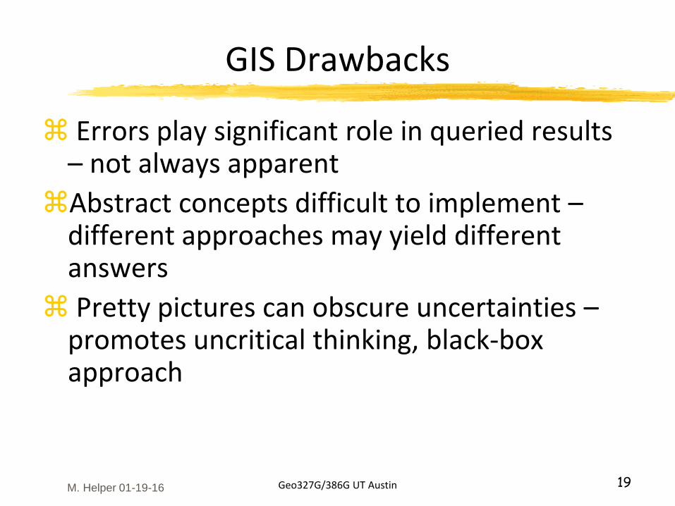
GIS Drawbacks
Errors play significant role in queried results – not always apparent
Abstract concepts difficult to implement –different approaches may yield different answers
Pretty pictures can obscure uncertainties –promotes uncritical thinking, black-box approach
M. Helper 01-19-16
Geo327G/386G UT Austin 21
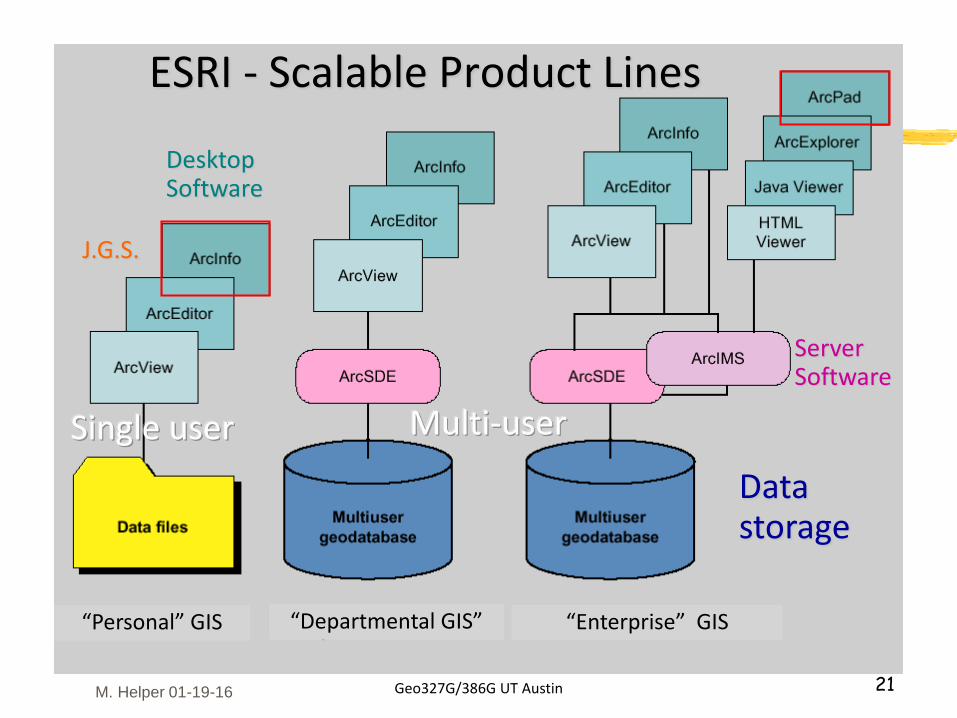
“Personal” GIS “Departmental GIS” “Enterprise” GIS
J.G.S.
Multi-userSingle user
ESRI - Scalable Product Lines
ServerSoftware
DesktopSoftware
Data storage
M. Helper 01-19-16
Geo327G/386G UT Austin 22
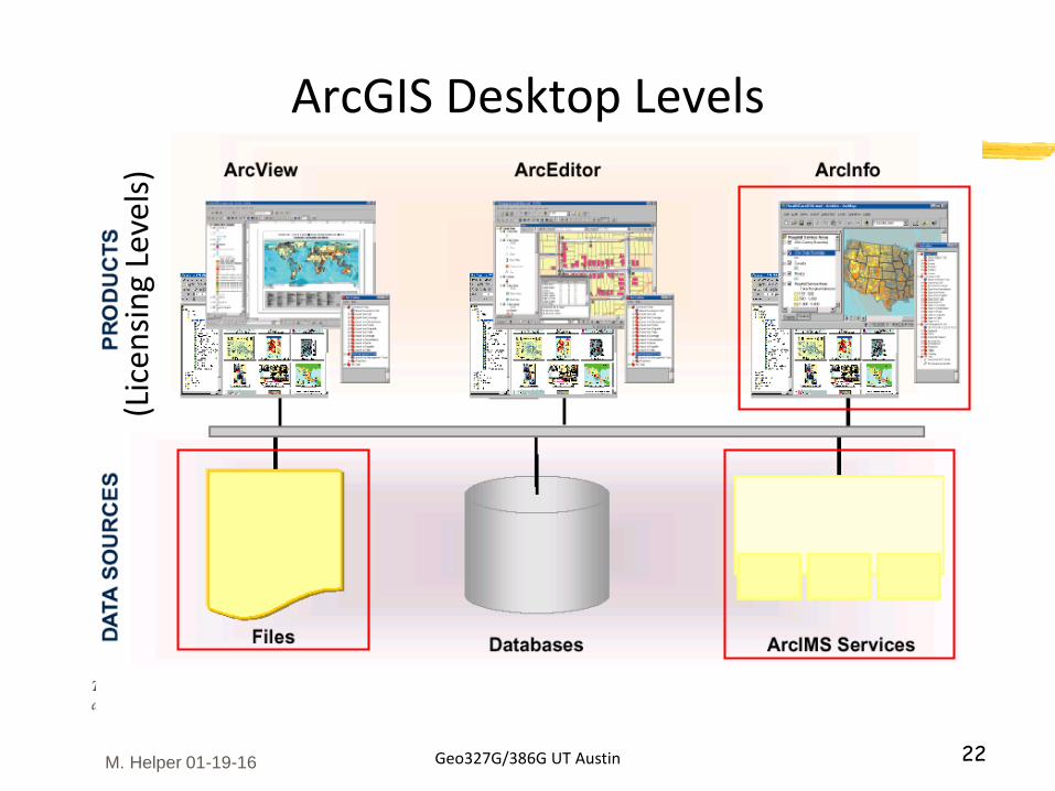
ArcGIS Desktop Levels(L
icen
sin
g Le
vels
)
M. Helper 01-19-16
Geo327G/386G UT Austin 23
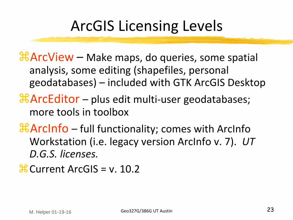
ArcGIS Licensing Levels
ArcView – Make maps, do queries, some spatial analysis, some editing (shapefiles, personal geodatabases) – included with GTK ArcGIS Desktop
ArcEditor – plus edit multi-user geodatabases; more tools in toolbox
ArcInfo – full functionality; comes with ArcInfo Workstation (i.e. legacy version ArcInfo v. 7). UT D.G.S. licenses.
Current ArcGIS = v. 10.2
M. Helper 01-19-16
Geo327G/386G UT Austin 24
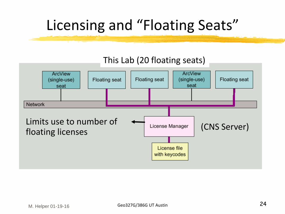
Licensing and “Floating Seats”
(CNS Server)
This Lab (20 floating seats)
Limits use to number of floating licenses
M. Helper 01-19-16
Geo327G/386G UT Austin 25
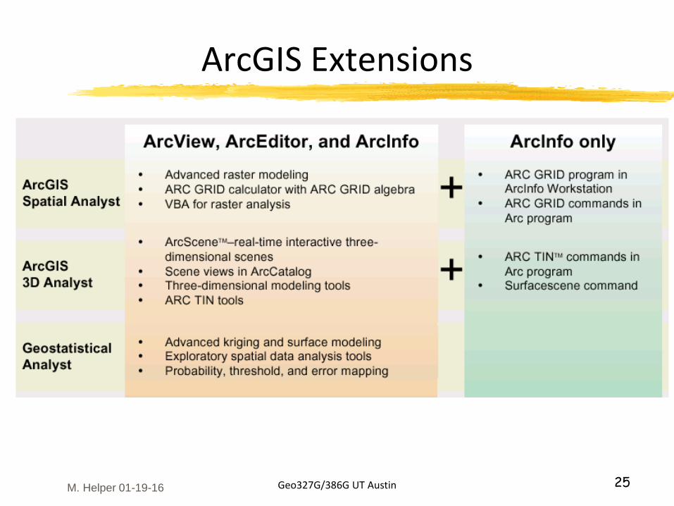
ArcGIS Extensions
M. Helper 01-19-16
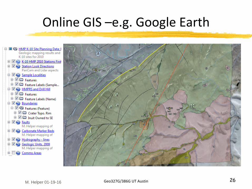
Online GIS –e.g. Google Earth
Geo327G/386G UT Austin 26M. Helper 01-19-16
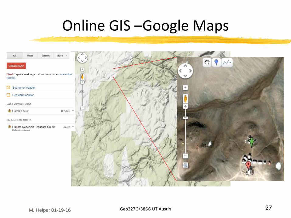
Online GIS –Google Maps
Geo327G/386G UT Austin 27M. Helper 01-19-16