geodatabase - an introductionmaps.uky.edu/esri-uc/esri_uc_2k12/files/202.pdf · technical workshops...
TRANSCRIPT
Technical Workshops |
Esri International User Conference San Diego, California
Geodatabase – An Introduction David Crawford and Colin Zwicker
July 23-27, 2012
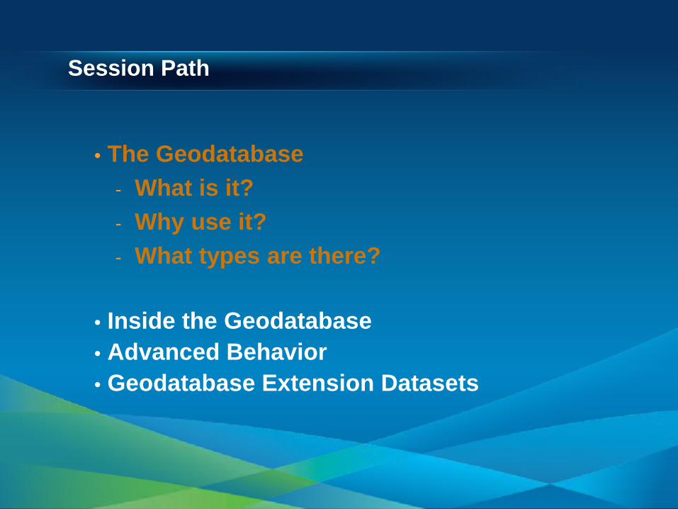
Session Path
• The Geodatabase - What is it? - Why use it? - What types are there?
• Inside the Geodatabase • Advanced Behavior • Geodatabase Extension Datasets
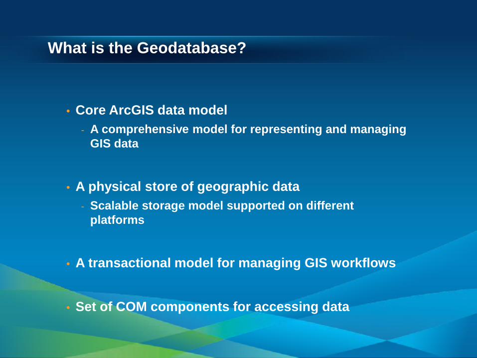
What is the Geodatabase?
• Core ArcGIS data model - A comprehensive model for representing and managing
GIS data
• A physical store of geographic data
- Scalable storage model supported on different platforms
• A transactional model for managing GIS workflows
• Set of COM components for accessing data
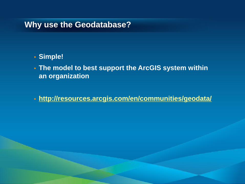
Why use the Geodatabase?
• Simple! • The model to best support the ArcGIS system within
an organization
• http://resources.arcgis.com/en/communities/geodata/
• Campus Viewer • Showing business logic
Why use the Geodatabase?

Session Path
• The Geodatabase - What is it? - Why use it? - What types are there?
• Inside the Geodatabase • Advanced Behavior • Geodatabase Extension Datasets
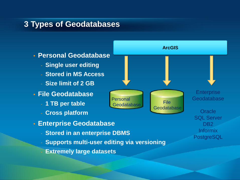
3 Types of Geodatabases
• Personal Geodatabase - Single user editing - Stored in MS Access - Size limit of 2 GB
• File Geodatabase - 1 TB per table - Cross platform
• Enterprise Geodatabase - Stored in an enterprise DBMS - Supports multi-user editing via versioning - Extremely large datasets
Personal Geodatabase
Enterprise Geodatabase
Oracle
SQL Server DB2
Informix PostgreSQL
ArcGIS
File Geodatabase
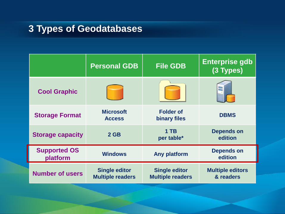
3 Types of Geodatabases
Personal GDB File GDB Enterprise gdb (3 Types)
Cool Graphic
Storage Format Microsoft Access
Folder of binary files DBMS
Storage capacity 2 GB 1 TB per table*
Depends on edition
Supported OS platform Windows Any platform Depends on
edition
Number of users Single editor Multiple readers
Single editor Multiple readers
Multiple editors & readers
* By default; option to have 256 TB per table
3 Types of Geodatabases
Personal GDB File GDB Enterprise gdb (3 Types)
Cool Graphic
Storage Format Microsoft Access
Folder of binary files DBMS
Storage capacity 2 GB 1 TB per table*
Depends on edition
Supported OS platform Windows Any platform Depends on
edition
Number of users Single editor Multiple readers
Single editor Multiple readers
Multiple editors & readers
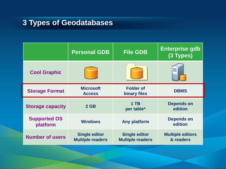
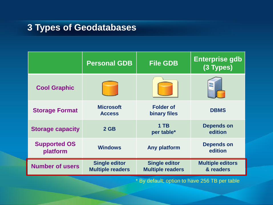
* By default; option to have 256 TB per table
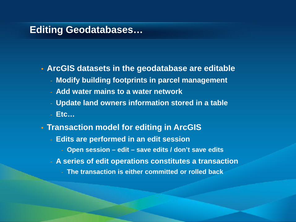
Editing Geodatabases…
• ArcGIS datasets in the geodatabase are editable - Modify building footprints in parcel management - Add water mains to a water network - Update land owners information stored in a table - Etc…
• Transaction model for editing in ArcGIS - Edits are performed in an edit session
- Open session – edit – save edits / don’t save edits
- A series of edit operations constitutes a transaction - The transaction is either committed or rolled back
Editing Geodatabases…
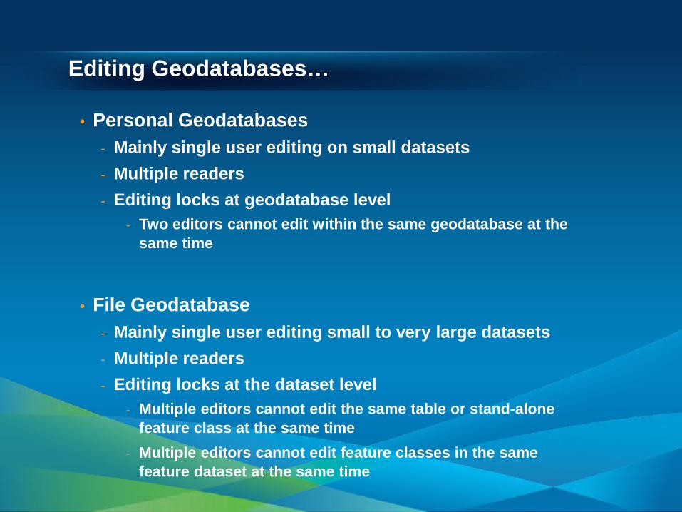
• Personal Geodatabases - Mainly single user editing on small datasets - Multiple readers - Editing locks at geodatabase level
- Two editors cannot edit within the same geodatabase at the same time
• File Geodatabase
- Mainly single user editing small to very large datasets - Multiple readers - Editing locks at the dataset level
- Multiple editors cannot edit the same table or stand-alone feature class at the same time
- Multiple editors cannot edit feature classes in the same feature dataset at the same time
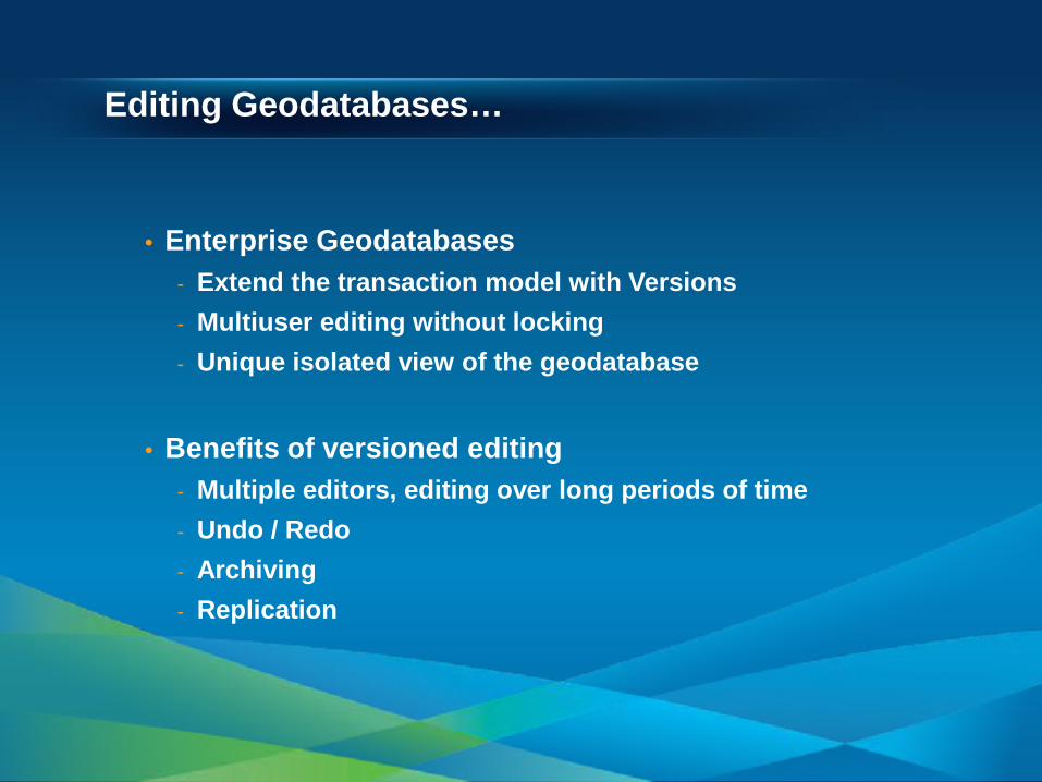
Editing Geodatabases…
• Enterprise Geodatabases - Extend the transaction model with Versions - Multiuser editing without locking - Unique isolated view of the geodatabase
• Benefits of versioned editing - Multiple editors, editing over long periods of time - Undo / Redo - Archiving - Replication
• Using ArcCatalog • Creating a Geodatabase • Loading existing data (shapefile)
Creating a Geodatabase
Session Path
• The Geodatabase • Inside the Geodatabase
- Object Classes, Feature Classes, Rasters - Feature Datasets - Validation Rules - Domains, Subtypes, Relationship Classes - Annotation, Dimensions - Exploring a Geodatabase DEMO
• Advanced Behavior • Geodatabase Extension Datasets
Inside the Geodatabase
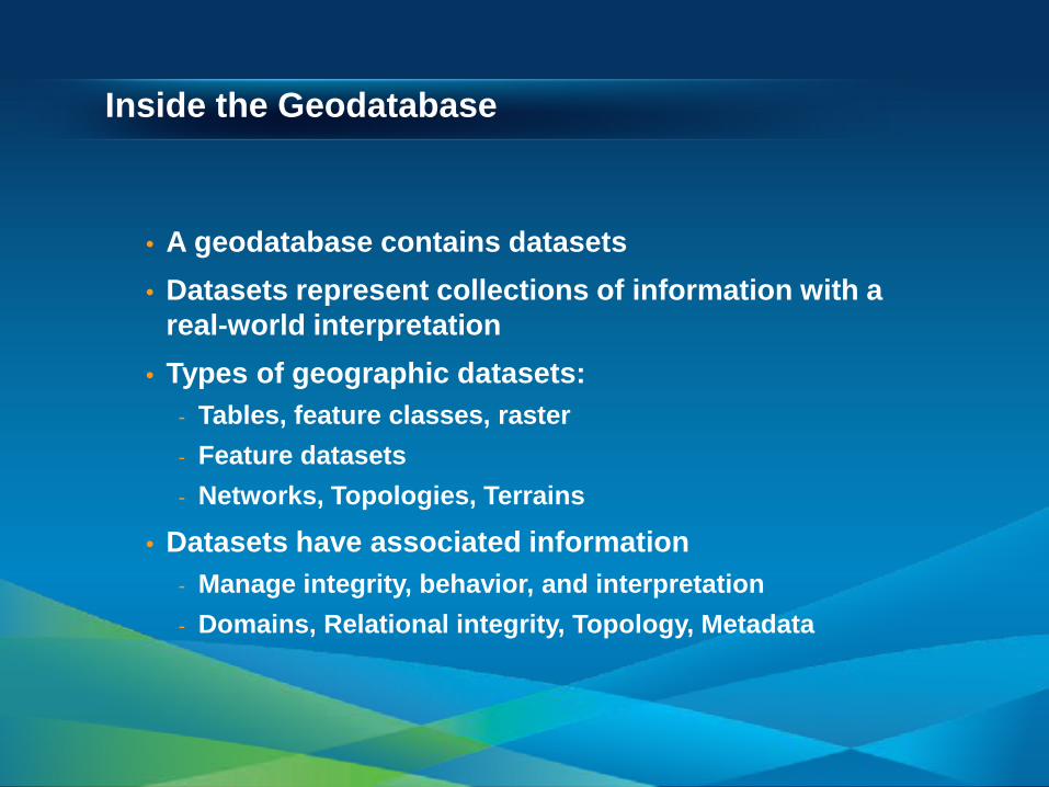
• A geodatabase contains datasets • Datasets represent collections of information with a
real-world interpretation • Types of geographic datasets:
- Tables, feature classes, raster - Feature datasets - Networks, Topologies, Terrains
• Datasets have associated information - Manage integrity, behavior, and interpretation - Domains, Relational integrity, Topology, Metadata
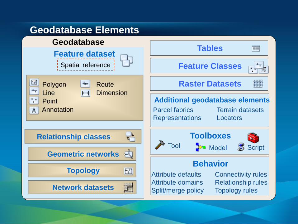
Geodatabase Elements
Additional geodatabase elements Parcel fabrics Terrain datasets Representations Locators
Feature Classes
Behavior Attribute defaults Connectivity rules Attribute domains Relationship rules Split/merge policy Topology rules
Feature dataset Spatial reference
Relationship classes
Topology
Geometric networks
Polygon Route Line Dimension Point Annotation
Raster Datasets
Toolboxes Tool Model Script
Network datasets
Tables Geodatabase
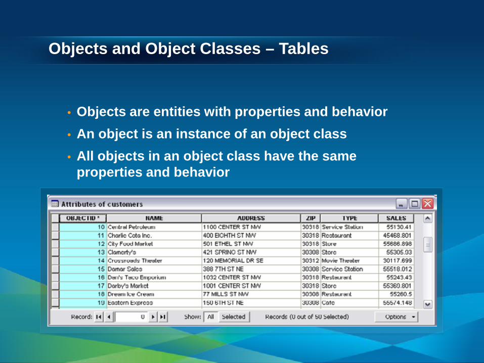
Objects and Object Classes – Tables
• Objects are entities with properties and behavior • An object is an instance of an object class • All objects in an object class have the same
properties and behavior
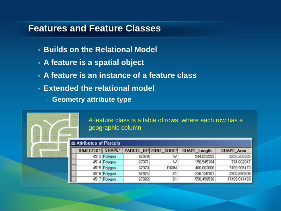
Features and Feature Classes
• Builds on the Relational Model • A feature is a spatial object • A feature is an instance of a feature class • Extended the relational model
- Geometry attribute type
A feature class is a table of rows, where each row has a geographic column
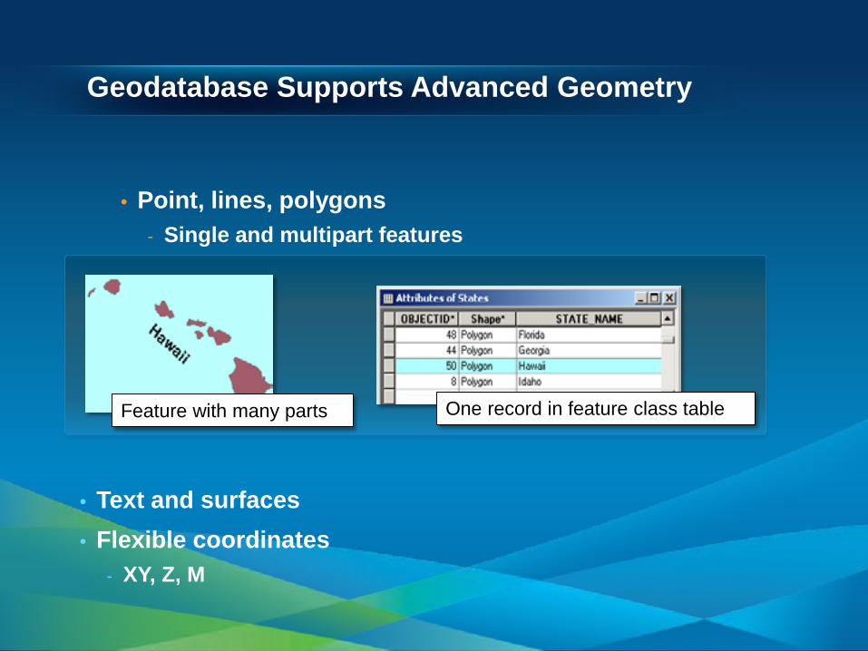
Geodatabase Supports Advanced Geometry
• Point, lines, polygons - Single and multipart features
• Text and surfaces • Flexible coordinates
- XY, Z, M
One record in feature class table Feature with many parts
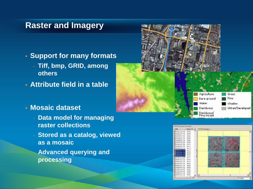
Raster and Imagery
• Support for many formats - Tiff, bmp, GRID, among
others
• Attribute field in a table
• Mosaic dataset - Data model for managing
raster collections - Stored as a catalog, viewed
as a mosaic - Advanced querying and
processing
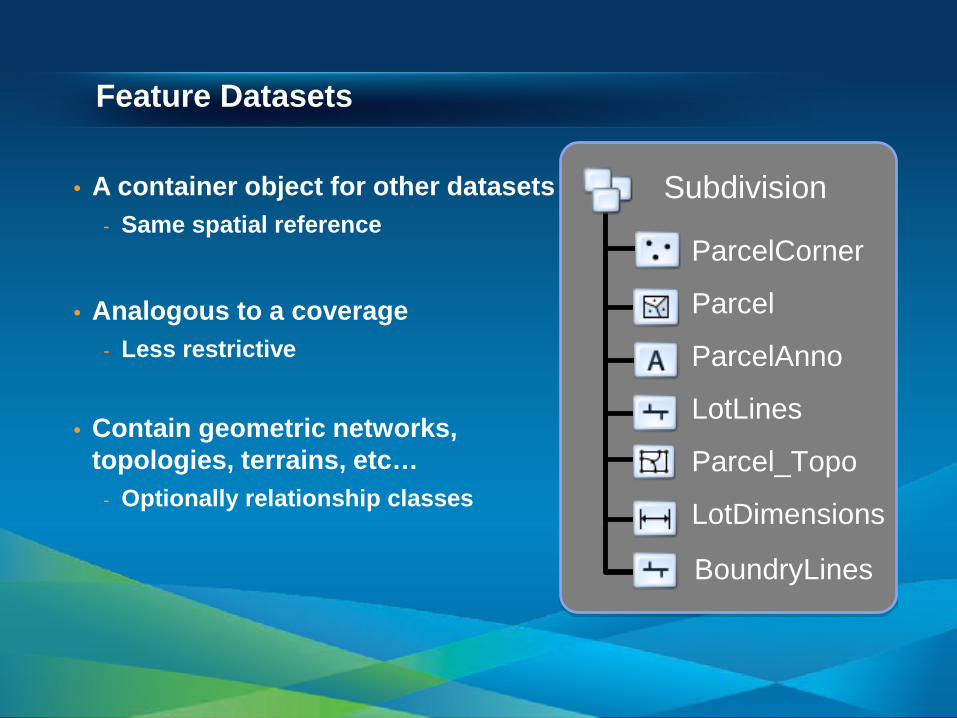
Feature Datasets
• A container object for other datasets - Same spatial reference
• Analogous to a coverage
- Less restrictive
• Contain geometric networks, topologies, terrains, etc…
- Optionally relationship classes
ParcelCorner
Parcel
ParcelAnno
LotLines
Parcel_Topo
LotDimensions
Subdivision
BoundryLines
Validation Rules
• Attribute, connectivity, and relationship rules - Stored on objects as part of the geodatabase
• Predefined, parameter driven - Attribute range rule - Attribute set rule - Connectivity rule
• Perform custom validation by writing code
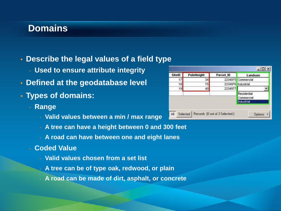
Domains
• Describe the legal values of a field type - Used to ensure attribute integrity
• Defined at the geodatabase level • Types of domains:
- Range - Valid values between a min / max range - A tree can have a height between 0 and 300 feet - A road can have between one and eight lanes
- Coded Value - Valid values chosen from a set list - A tree can be of type oak, redwood, or plain - A road can be made of dirt, asphalt, or concrete
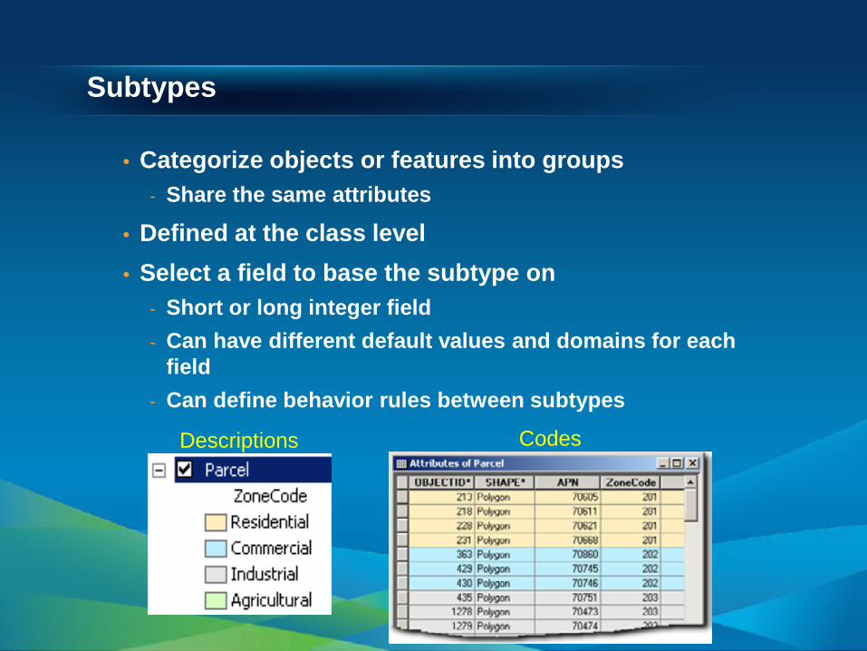
Subtypes
• Categorize objects or features into groups - Share the same attributes
• Defined at the class level • Select a field to base the subtype on
- Short or long integer field - Can have different default values and domains for each
field - Can define behavior rules between subtypes
Codes Descriptions
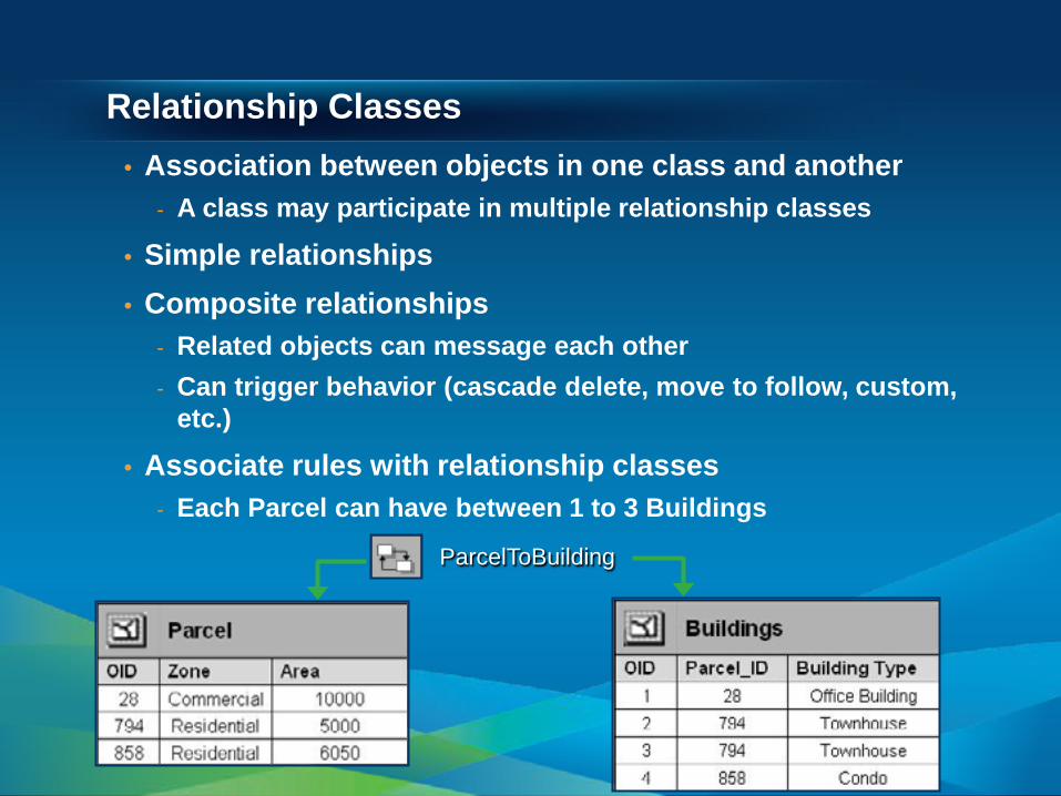
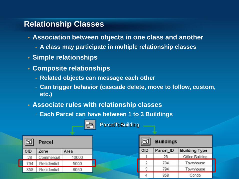
Relationship Classes • Association between objects in one class and another
- A class may participate in multiple relationship classes
• Simple relationships • Composite relationships
- Related objects can message each other - Can trigger behavior (cascade delete, move to follow, custom,
etc.)
• Associate rules with relationship classes - Each Parcel can have between 1 to 3 Buildings
ParcelToBuilding
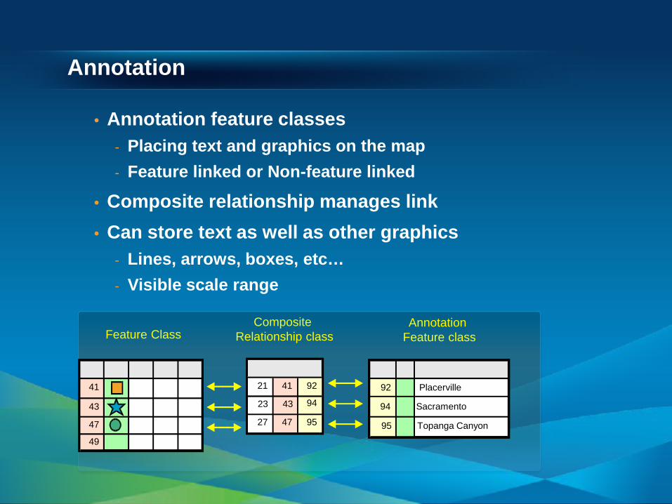
Annotation
• Annotation feature classes - Placing text and graphics on the map - Feature linked or Non-feature linked
• Composite relationship manages link • Can store text as well as other graphics
- Lines, arrows, boxes, etc… - Visible scale range
Feature Class Annotation
Feature class Composite
Relationship class
94 Sacramento
95 Topanga Canyon
92 Placerville 41
43
47
49
92
94
95
41
43
47
21
23
27
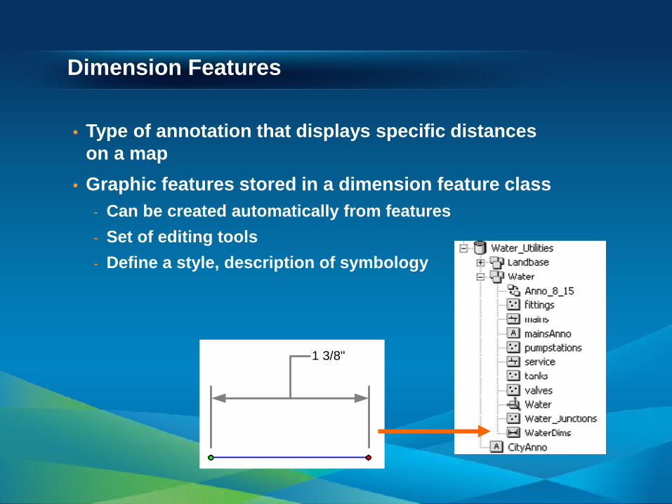
Dimension Features
• Type of annotation that displays specific distances on a map
• Graphic features stored in a dimension feature class - Can be created automatically from features - Set of editing tools - Define a style, description of symbology
1 3/8"
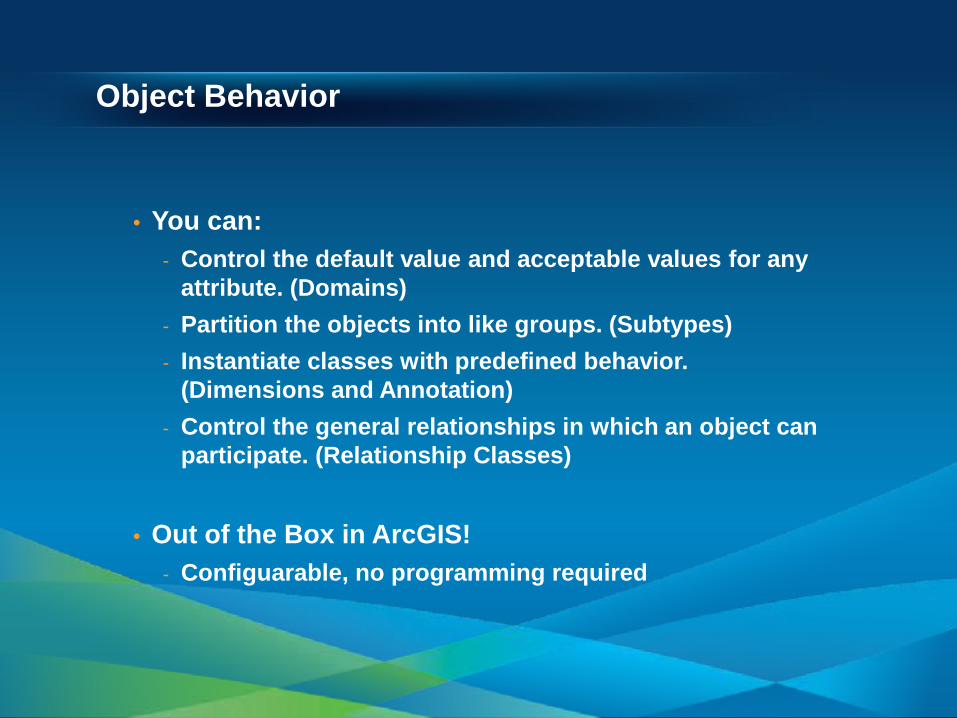
Object Behavior
• You can: - Control the default value and acceptable values for any
attribute. (Domains) - Partition the objects into like groups. (Subtypes) - Instantiate classes with predefined behavior.
(Dimensions and Annotation) - Control the general relationships in which an object can
participate. (Relationship Classes)
• Out of the Box in ArcGIS! - Configuarable, no programming required
• Tables / Feature Classes • Subtypes • Domains • Relationship Classes
Exploring a Geodatabase
Session Path
• The Geodatabase • Inside the Geodatabase • Advanced Behavior
- Attachments - Geometric Networks - Network Datasets - Geodatabase Topology - Advanced Behavior DEMO
• Geodatabase Extension Datasets
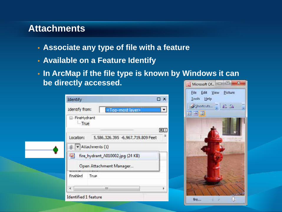
Attachments
• Associate any type of file with a feature • Available on a Feature Identify • In ArcMap if the file type is known by Windows it can
be directly accessed.
Geometric Networks
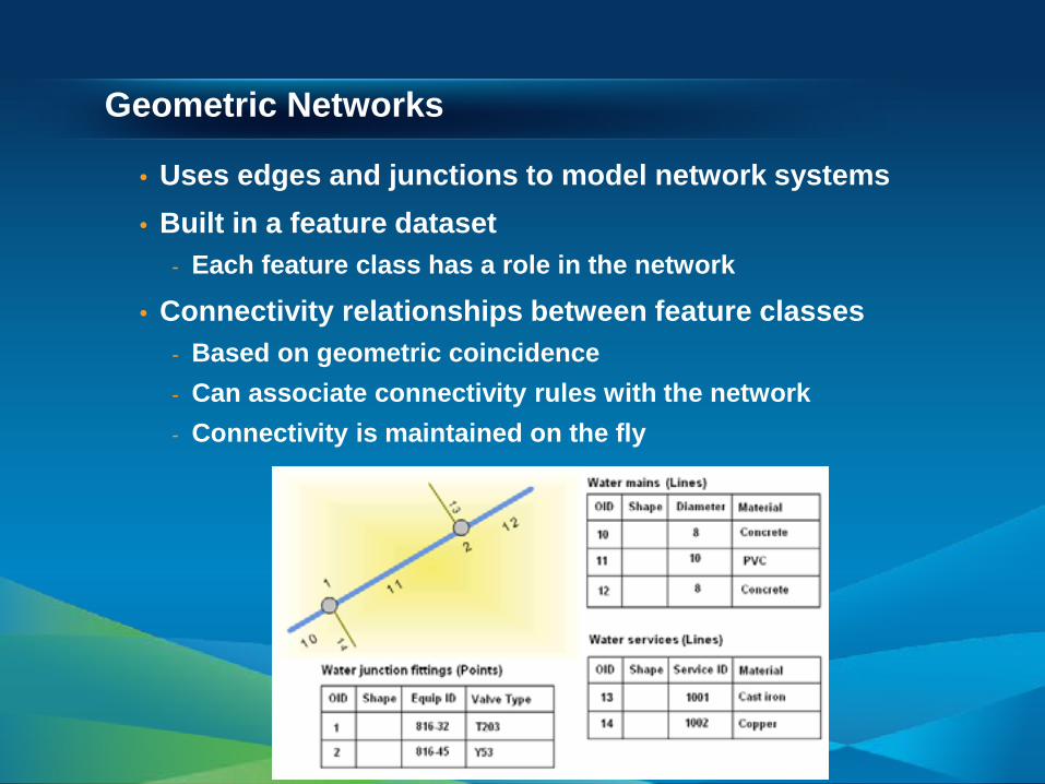
• Uses edges and junctions to model network systems • Built in a feature dataset
- Each feature class has a role in the network
• Connectivity relationships between feature classes - Based on geometric coincidence - Can associate connectivity rules with the network - Connectivity is maintained on the fly
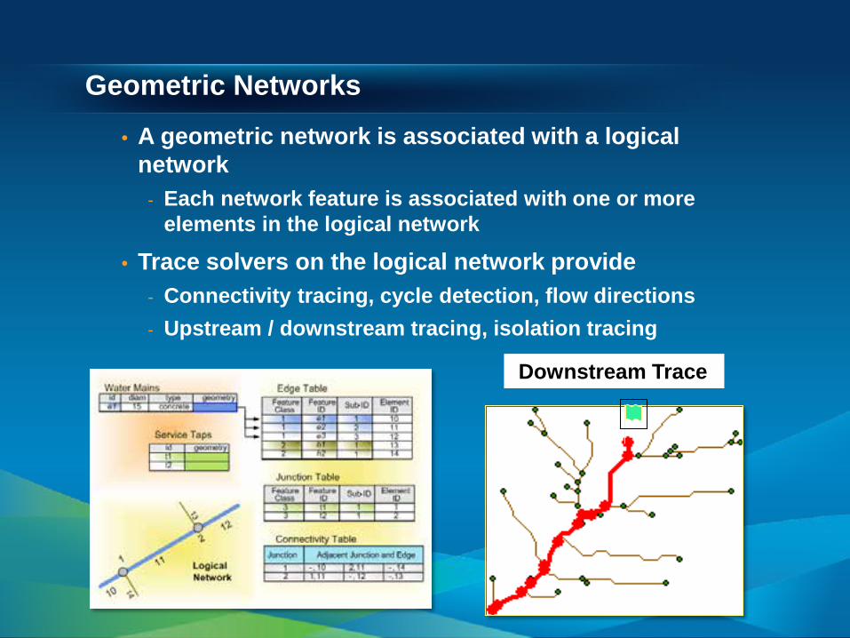
Geometric Networks • A geometric network is associated with a logical
network - Each network feature is associated with one or more
elements in the logical network
• Trace solvers on the logical network provide - Connectivity tracing, cycle detection, flow directions - Upstream / downstream tracing, isolation tracing
Downstream Trace
Network Datasets
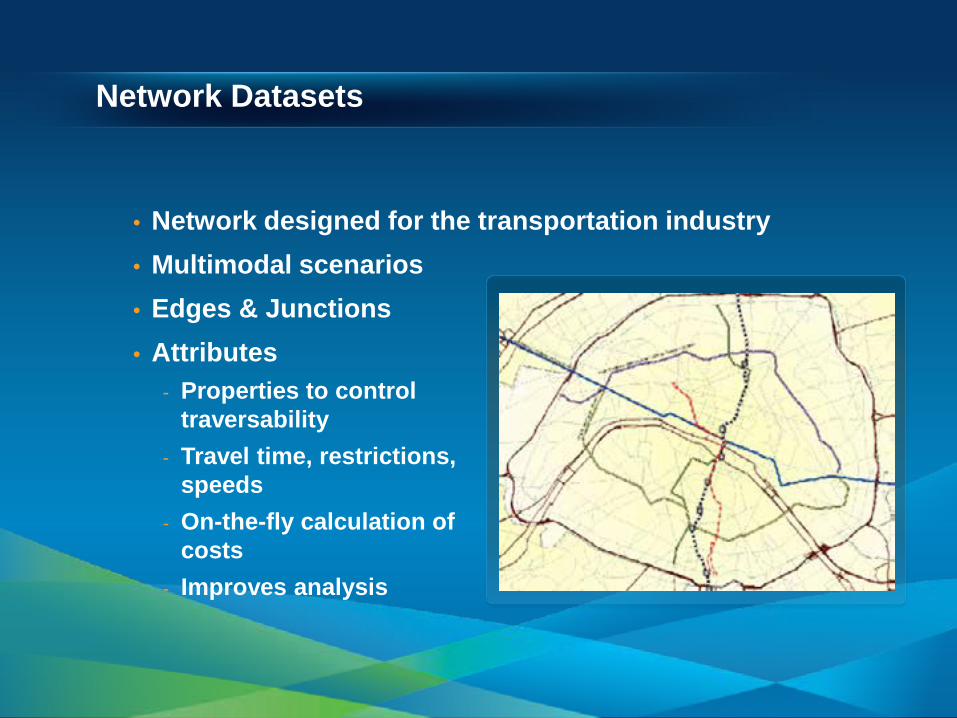
• Network designed for the transportation industry • Multimodal scenarios • Edges & Junctions • Attributes
- Properties to control traversability
- Travel time, restrictions, speeds
- On-the-fly calculation of costs
- Improves analysis
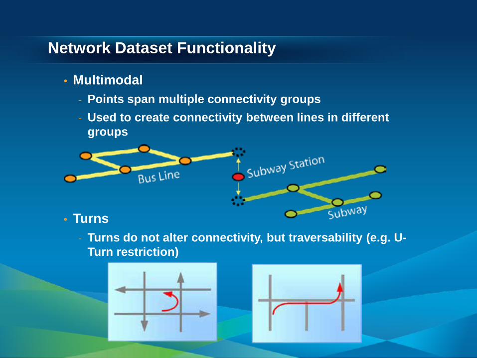
Network Dataset Functionality
• Multimodal - Points span multiple connectivity groups - Used to create connectivity between lines in different
groups
• Turns - Turns do not alter connectivity, but traversability (e.g. U-
Turn restriction)
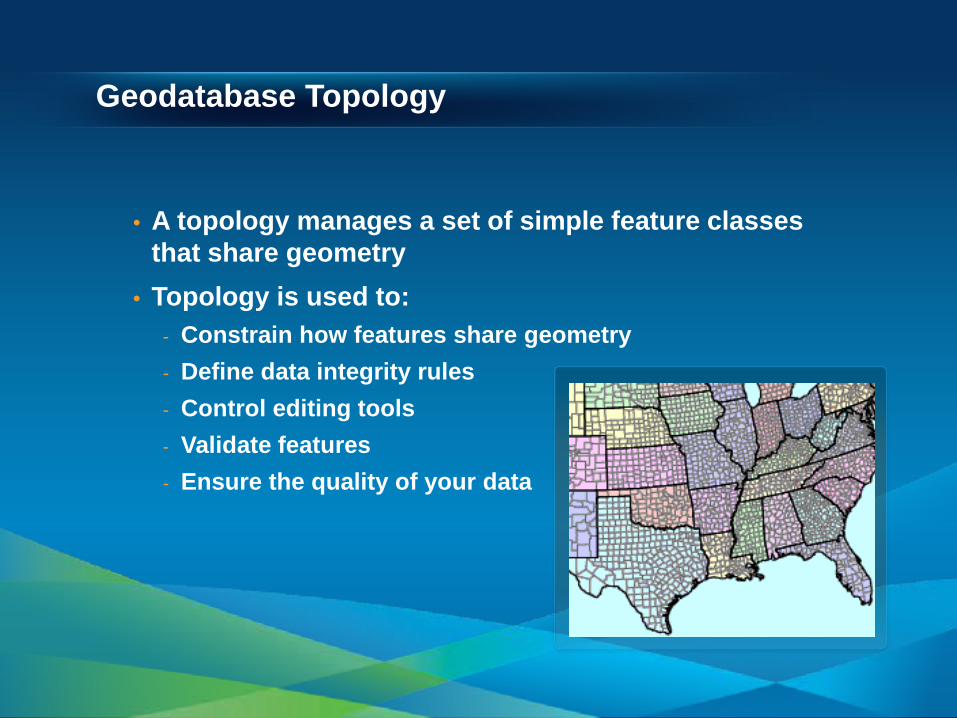
Geodatabase Topology
• A topology manages a set of simple feature classes that share geometry
• Topology is used to: - Constrain how features share geometry - Define data integrity rules - Control editing tools - Validate features - Ensure the quality of your data
Topological Integrity
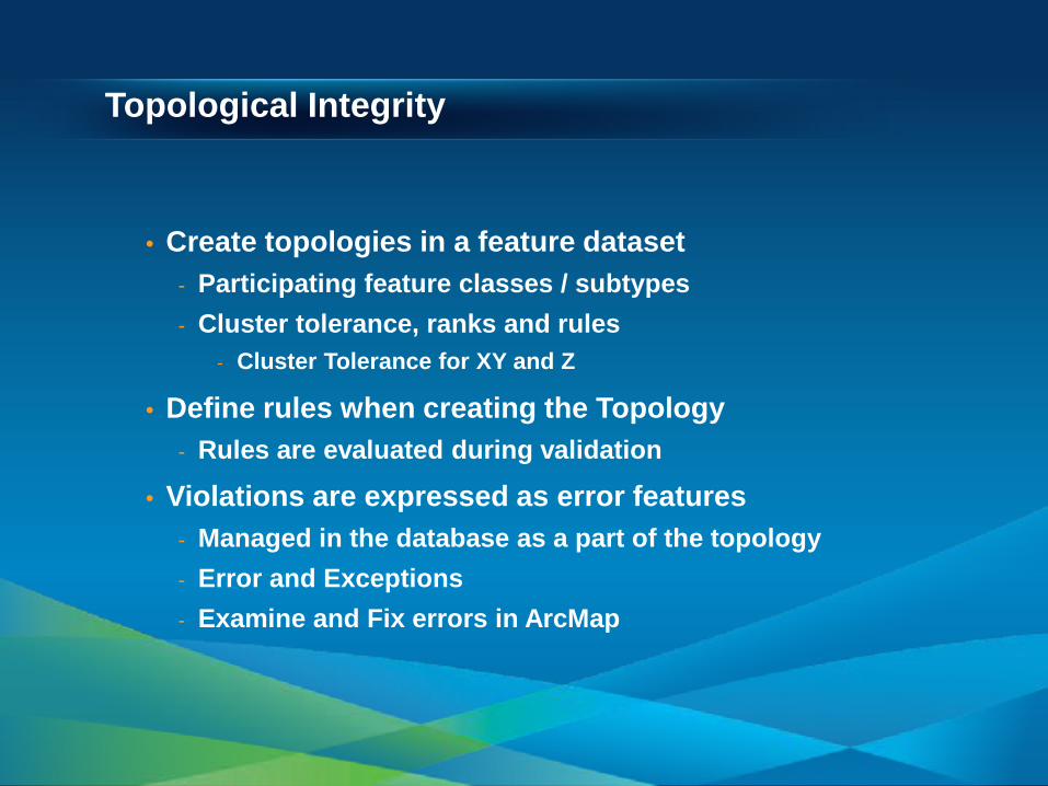
• Create topologies in a feature dataset - Participating feature classes / subtypes - Cluster tolerance, ranks and rules
- Cluster Tolerance for XY and Z
• Define rules when creating the Topology - Rules are evaluated during validation
• Violations are expressed as error features - Managed in the database as a part of the topology - Error and Exceptions - Examine and Fix errors in ArcMap
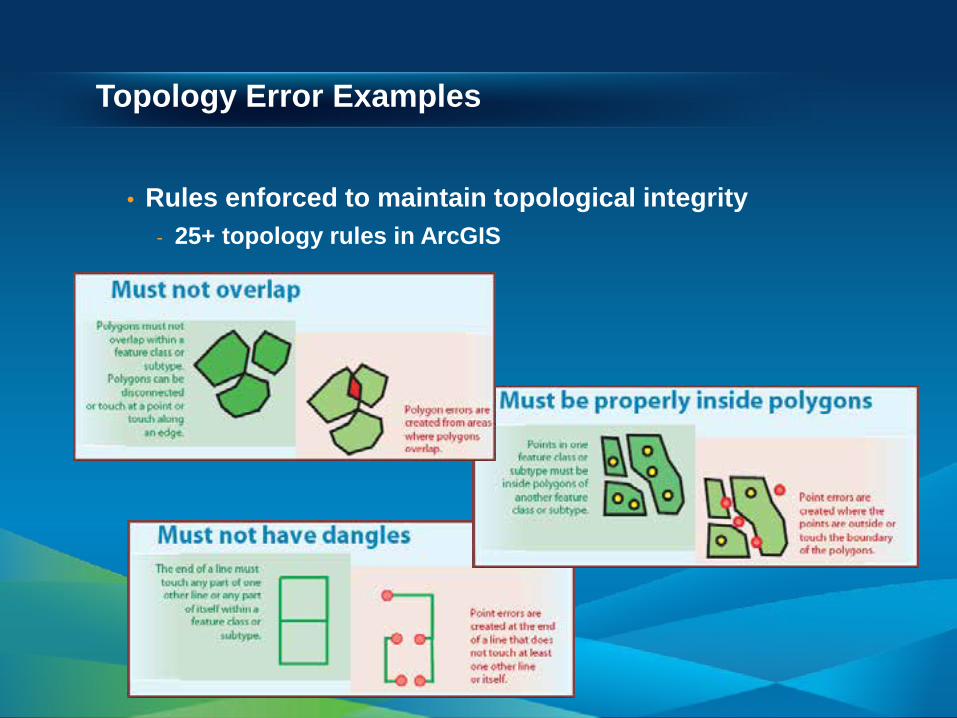
Topology Error Examples
• Rules enforced to maintain topological integrity - 25+ topology rules in ArcGIS
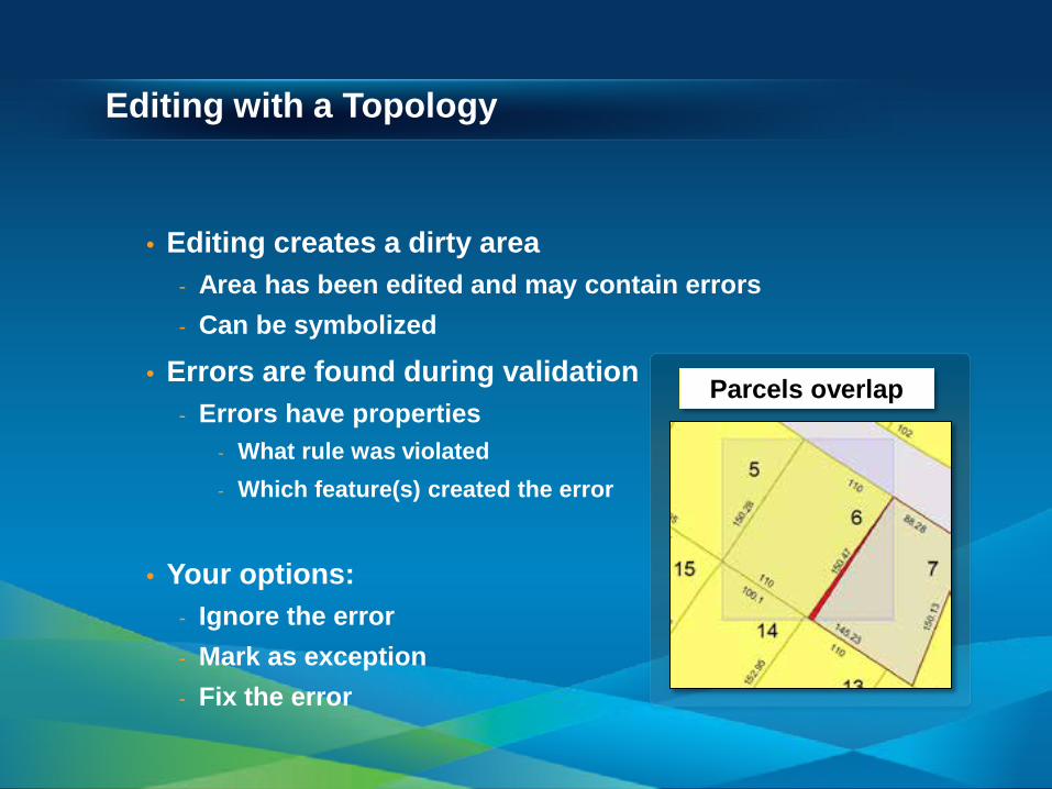
Editing with a Topology
• Editing creates a dirty area - Area has been edited and may contain errors - Can be symbolized
• Errors are found during validation - Errors have properties
- What rule was violated - Which feature(s) created the error
• Your options: - Ignore the error - Mark as exception - Fix the error
Parcels overlap

• Topology • Geometric Network • Attachments
Exploring a Geodatabase
Session Path
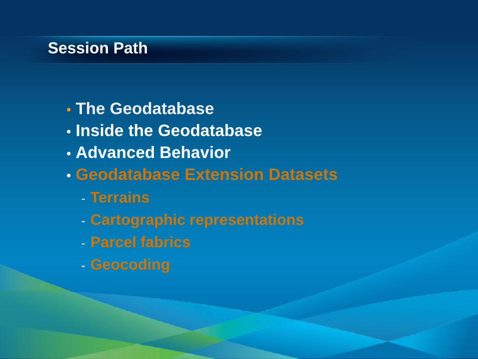
• The Geodatabase • Inside the Geodatabase • Advanced Behavior • Geodatabase Extension Datasets
- Terrains - Cartographic representations - Parcel fabrics - Geocoding
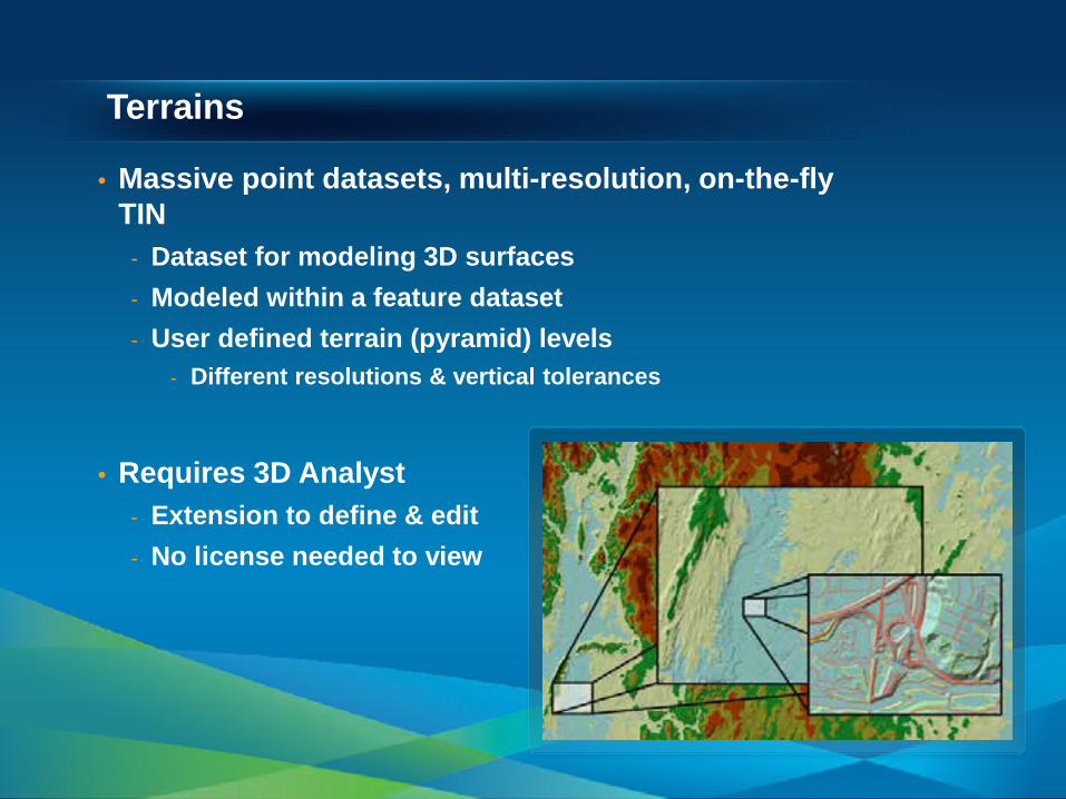
Terrains
• Massive point datasets, multi-resolution, on-the-fly TIN
- Dataset for modeling 3D surfaces - Modeled within a feature dataset - User defined terrain (pyramid) levels
- Different resolutions & vertical tolerances
• Requires 3D Analyst
- Extension to define & edit - No license needed to view
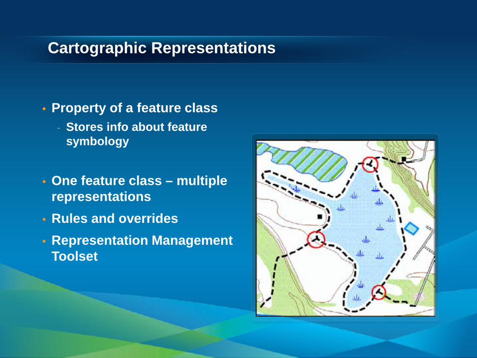
Cartographic Representations
• Property of a feature class - Stores info about feature
symbology
• One feature class – multiple representations
• Rules and overrides • Representation Management
Toolset
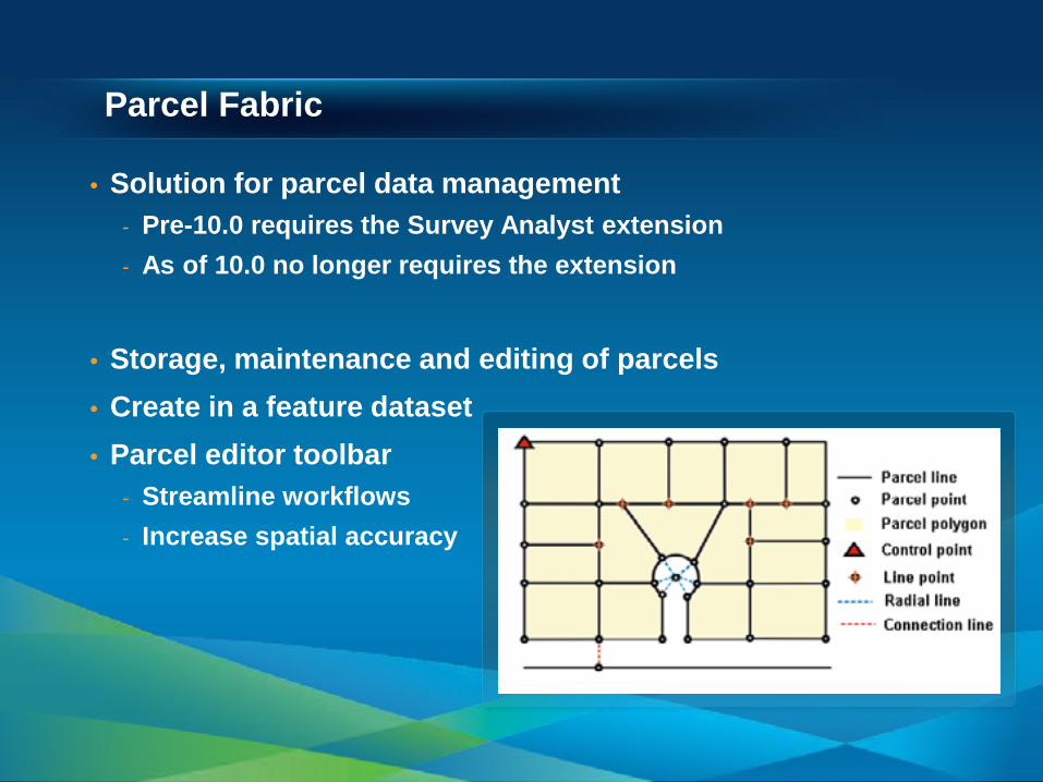
Parcel Fabric
• Solution for parcel data management - Pre-10.0 requires the Survey Analyst extension - As of 10.0 no longer requires the extension
• Storage, maintenance and editing of parcels • Create in a feature dataset • Parcel editor toolbar
- Streamline workflows - Increase spatial accuracy

Geocoding
• Address matching and location services - Use a locations description to find a location
- Coordinates, street name, place name - Points of Interest, addresses
• Address locators - Rules for interpreting addresses
- Parsing and matching address elements
- Standard street components - Reference map data
Summary
• The Geodatabase - Data model, Storage, Transaction model, COM
components
• Inside the Geodatabase - Datasets, Validation rules, data behavior and integrity
• Advanced Behavior - Geometric Networks, Network Datasets, and Topology
• Geodatabase Extension Datasets - Terrains, Representations, Parcel fabrics, Geocoding
Other Geodatabase Resources
• Geodatabase Island in the Showcase Area Meet the specialists!
• Geodatabase Resource Center • Inside the Geodatabase Blog • ArcGIS.com
• Check out the Demo Theatre schedules at the
Islands in the Showcase Area
Thanks for listening!
• Fill out surveys – Esri.com/ucsessionsurveys Offering ID: 601 • Questions?
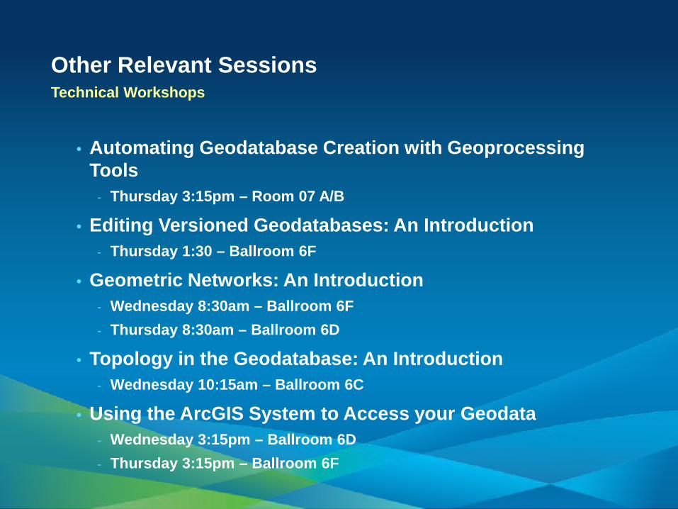
Other Relevant Sessions Technical Workshops
• Automating Geodatabase Creation with Geoprocessing Tools
- Thursday 3:15pm – Room 07 A/B
• Editing Versioned Geodatabases: An Introduction - Thursday 1:30 – Ballroom 6F
• Geometric Networks: An Introduction - Wednesday 8:30am – Ballroom 6F - Thursday 8:30am – Ballroom 6D
• Topology in the Geodatabase: An Introduction - Wednesday 10:15am – Ballroom 6C
• Using the ArcGIS System to Access your Geodata - Wednesday 3:15pm – Ballroom 6D - Thursday 3:15pm – Ballroom 6F