geog 4210/5210 cartography spring 2007 week 1. books/software cartography : thematic map design, by...
TRANSCRIPT

GEOG 4210/5210 Cartography
Spring 2007
Week 1

Books/Software
• Cartography : Thematic Map Design, by Borden D. Dent
• Computer programs: Excel and ArcGIS
• Class Folder: g:/4210/• Your personal folder: G:/YourName/4210/• Now, write your name and folder name on
one sheet of paper and turn in to me.
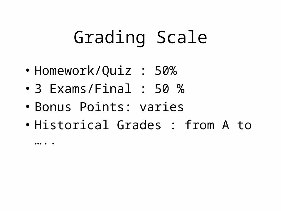
Grading Scale
• Homework/Quiz : 50%
• 3 Exams/Final : 50 %
• Bonus Points: varies
• Historical Grades : from A to …..

Mapmaking and Cartography
• Mapping – process of designing, compiling and producing maps.
• Cartography – broader than mapmaking. Requiring the study of the philosophical and theoretical bases of the rules for mapmaking, including the study of map communication

GIS and Cartography
• Geographical information system is a computer-based system that processes geographical information.
• Still, GIS, to most people, is just a mapmaking tool for displaying maps, not consisting of the fundamental principles of cartography.
• More issues can be found in Chapter 6.

Kinds of Maps 1. General-reference maps
• Topo map from USGS• City maps• AAA map• Mapquest.com

Thematic map• Maps showing spatial distribution
of one or more variables.• Flow map• Population density (in google, type
in “population density maps)• (http://
www.ncovr.heinz.cmu.edu/docs/Special_Project/Atlas/Image_Pages/Images/percen41.gif)
• Crop production• Rainfall• Temperature…

Cartogram

Practice 1
• Find One general reference One Thematic map from internet.
• Save them (right-click on the images), or simply PrintScreen and pass onto Word doc.

• Base Map (geographic) – provide locational information to which the thematic overlay can be related.
• Thematic Overlay – simplicity and clarity are important design features.
Components of the Thematic Map

Map Scale• Large Map Scale Small• Small Mapped earth area Large• More Information detail Less• Less generalized Symbolization More generalized
• What is large-scaled map? 1:10,000 or 1:1,000,000

Scale

Map Communication• Is map communication dead?• Visualization includes both an analysis/visual thinking
component and a communication/presentation component and suggest that communication is a subcomponent of visualization – MacEachren
• Difference between communication and visualization is communication deals with an “optimal map” and visualization doesn’t have an optimum map and convey an unknown message – Hearnshaw and Unwin
• Actually it is the difference bet/w deterministic and probabalistic thinking or linear and parallel processes. However, both visualization and communication emphasize the “Map User”
• Finding patterns and relationships among mapped data, not simply for the communication of ideas to others.

Transform unmapped data to maps – cartographic abstraction
• Selection – geo space to be mapped, scale, projection, aspect, data variables. May involve working closely with the map author or client.
• Classification – group similar objects to reduce the complexity and help organize the mapped information.
• Simplification – such as smoothing lines• Symbolization – Replicate: cars, trees,
houses; Abstract: circles, triangles, squares..• Replicative – for tangible objects, such as tress, coastal
lines, railroads, houses..• Base map symbols are replicative, thematic-overlay
symbols are either replicative or abstract.• Distortion occur while scale is very small.
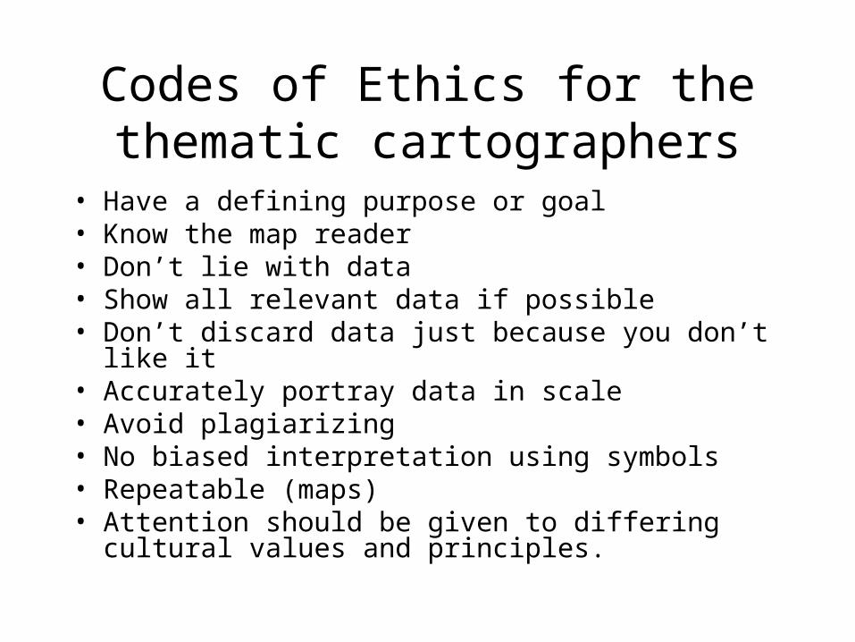
Codes of Ethics for the thematic cartographers
• Have a defining purpose or goal• Know the map reader• Don’t lie with data• Show all relevant data if possible• Don’t discard data just because you don’t like it• Accurately portray data in scale• Avoid plagiarizing• No biased interpretation using symbols• Repeatable (maps)• Attention should be given to differing cultural values and
principles.