geographic issues of the 21st century s 1 2 - … · physical geographic regions that are...
TRANSCRIPT

Geographic Issues of the 21st Century Geographic Literacy
2SENIOR
CLUSTER
1
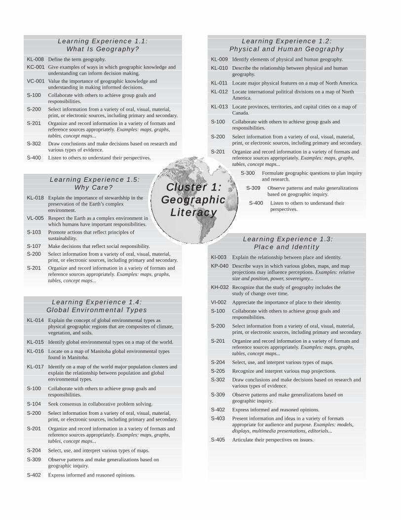
Learning Experience 1.4:Global Environmental Types
KL-014 Explain the concept of global environmental types asphysical geographic regions that are composites of climate,vegetation, and soils.
KL-015 Identify global environmental types on a map of the world.
KL-016 Locate on a map of Manitoba global environmental typesfound in Manitoba.
KL-017 Identify on a map of the world major population clusters andexplain the relationship between population and globalenvironmental types.
S-100 Collaborate with others to achieve group goals andresponsibilities.
S-104 Seek consensus in collaborative problem solving.
S-200 Select information from a variety of oral, visual, material,print, or electronic sources, including primary and secondary.
S-201 Organize and record information in a variety of formats andreference sources appropriately. Examples: maps, graphs,tables, concept maps...
S-204 Select, use, and interpret various types of maps.
S-309 Observe patterns and make generalizations based ongeographic inquiry.
S-402 Express informed and reasoned opinions.
Learning Experience 1.3:Place and Identity
KI-003 Explain the relationship between place and identity.
KP-040 Describe ways in which various globes, maps, and mapprojections may influence perceptions. Examples: relativesize and position, power, sovereignty...
KH-032 Recognize that the study of geography includes the study of change over time.
VI-002 Appreciate the importance of place to their identity.
S-100 Collaborate with others to achieve group goals andresponsibilities.
S-200 Select information from a variety of oral, visual, material,print, or electronic sources, including primary and secondary.
S-201 Organize and record information in a variety of formats andreference sources appropriately. Examples: maps, graphs,tables, concept maps...
S-204 Select, use, and interpret various types of maps.
S-205 Recognize and interpret various map projections.
S-302 Draw conclusions and make decisions based on research andvarious types of evidence.
S-309 Observe patterns and make generalizations based ongeographic inquiry.
S-402 Express informed and reasoned opinions.
S-403 Present information and ideas in a variety of formatsappropriate for audience and purpose. Examples: models,displays, multimedia presentations, editorials...
S-405 Articulate their perspectives on issues.
Learning Experience 1.1:What Is Geography?
KL-008 Define the term geography.KC-001 Give examples of ways in which geographic knowledge and
understanding can inform decision making.VC-001 Value the importance of geographic knowledge and
understanding in making informed decisions.S-100 Collaborate with others to achieve group goals and
responsibilities.S-200 Select information from a variety of oral, visual, material,
print, or electronic sources, including primary and secondary.S-201 Organize and record information in a variety of formats and
reference sources appropriately. Examples: maps, graphs,tables, concept maps...
S-302 Draw conclusions and make decisions based on research andvarious types of evidence.
S-400 Listen to others to understand their perspectives.
Learning Experience 1.2:Physical and Human Geography
KL-009 Identify elements of physical and human geography.
KL-010 Describe the relationship between physical and humangeography.
KL-011 Locate major physical features on a map of North America.
KL-012 Locate international political divisions on a map of NorthAmerica.
KL-013 Locate provinces, territories, and capital cities on a map ofCanada.
S-100 Collaborate with others to achieve group goals andresponsibilities.
S-200 Select information from a variety of oral, visual, material,print, or electronic sources, including primary and secondary.
S-201 Organize and record information in a variety of formats andreference sources appropriately. Examples: maps, graphs,tables, concept maps...
S-300 Formulate geographic questions to plan inquiryand research.
S-309 Observe patterns and make generalizationsbased on geographic inquiry.
S-400 Listen to others to understand theirperspectives.
Learning Experience 1.5:Why Care?
KL-018 Explain the importance of stewardship in thepreservation of the Earth’s complexenvironment.
VL-005 Respect the Earth as a complex environment inwhich humans have important responsibilities.
S-103 Promote actions that reflect principles ofsustainability.
S-107 Make decisions that reflect social responsibility.S-200 Select information from a variety of oral, visual, material,
print, or electronic sources, including primary and secondary.S-201 Organize and record information in a variety of formats and
reference sources appropriately. Examples: maps, graphs,tables, concept maps...
Cluster 1:Geographic
Literacy
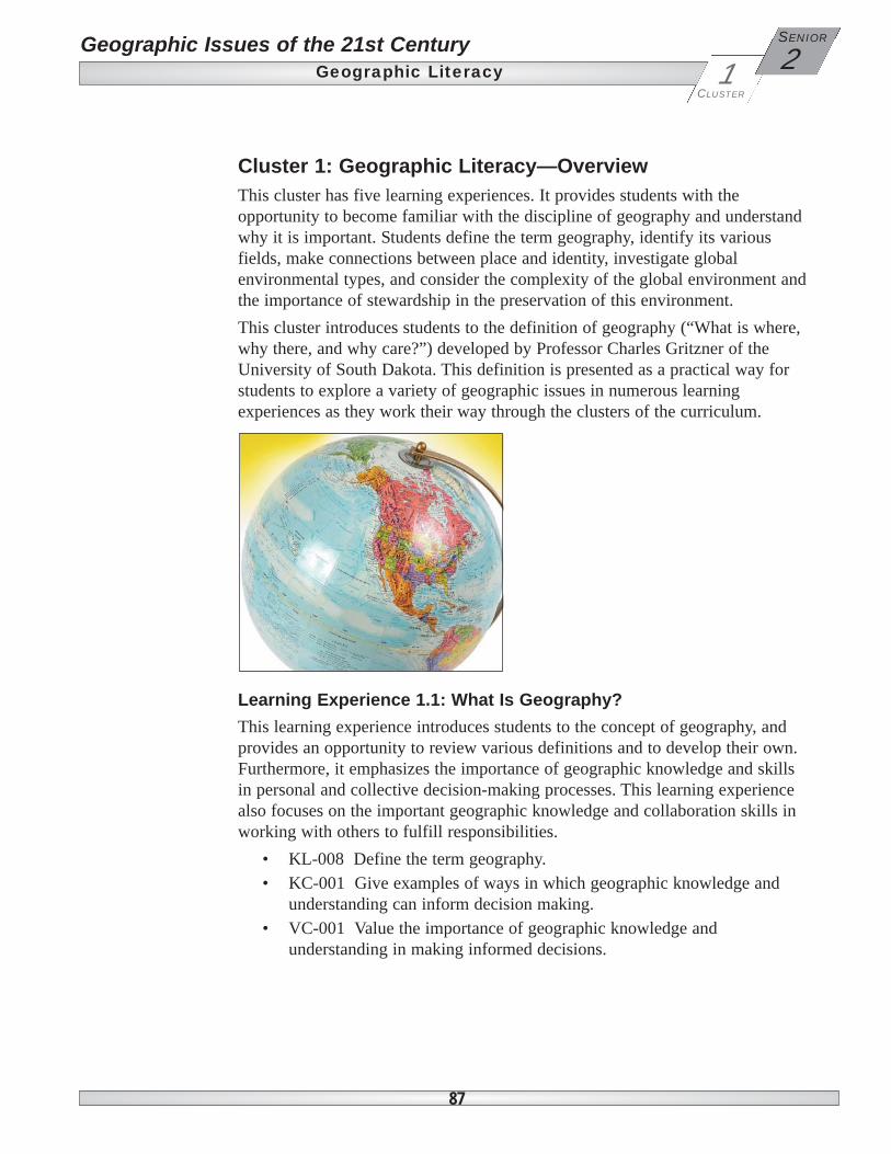
Cluster 1: Geographic Literacy—OverviewThis cluster has five learning experiences. It provides students with theopportunity to become familiar with the discipline of geography and understandwhy it is important. Students define the term geography, identify its variousfields, make connections between place and identity, investigate globalenvironmental types, and consider the complexity of the global environment andthe importance of stewardship in the preservation of this environment.This cluster introduces students to the definition of geography (“What is where,why there, and why care?”) developed by Professor Charles Gritzner of theUniversity of South Dakota. This definition is presented as a practical way forstudents to explore a variety of geographic issues in numerous learningexperiences as they work their way through the clusters of the curriculum.
Learning Experience 1.1: What Is Geography?This learning experience introduces students to the concept of geography, andprovides an opportunity to review various definitions and to develop their own.Furthermore, it emphasizes the importance of geographic knowledge and skillsin personal and collective decision-making processes. This learning experiencealso focuses on the important geographic knowledge and collaboration skills inworking with others to fulfill responsibilities.
• KL-008 Define the term geography.• KC-001 Give examples of ways in which geographic knowledge and
understanding can inform decision making.• VC-001 Value the importance of geographic knowledge and
understanding in making informed decisions.
87
Geographic Issues of the 21st Century Geographic Literacy 2
SENIOR
CLUSTER
1

Learning Experience 1.2: Physical and Human GeographyThe second learning experience extends the definition of geography to includeits two major fields: physical geography and human geography. It providesopportunities for students to identify elements of each. The learning experiencethen proceeds to introduce students to the critical geographic concept of thedynamic interrelationships between the physical and human aspects of theworld. This learning experience also gives students an opportunity toconsolidate and extend their map knowledge of both human and physicalelements of Canada and North America.
• KL-009 Identify elements of physical and human geography.• KL-010 Describe the relationship between physical and human
geography.• KL-011 Locate major physical features on a map of North America.• KL-012 Locate international political divisions on a map of North
America.• KL-013 Locate provinces, territories, and capital cities on a map of
Canada.
Learning Experience 1.3: Place and Identity In this learning experience, students explore issues of perception relating togeography. Students make connections between the concepts of place andidentity, and reflect upon the importance of place to their personal identity.Students also acquire an understanding that maps and map projections can bepowerful symbols that may influence perceptions of position and power. In thislearning experience, students also recognize that the study of geography,whether it be physical or human, includes the study of change over time.
• KI-003 Explain the relationship between place and identity.• KI-003 Explain the relationship between place and identity.• KH-032 Recognize that the study of geography includes the study of
change over time.• KP-040 Describe ways in which various globes, maps, and map
projections may influence perceptions. Examples: relative size andposition, power, sovereignty...
• VI-002 Appreciate the importance of place to their identity.
88
2SENIOR Geographic Issues of the 21st Century
Geographic LiteracyCLUSTER
1
Learning Experience 1.4: Global Environmental TypesThis learning experience introduces students to the concept of globalenvironmental types as a way of classifying a combination of physical factorsthat collectively influence human activities. Students identify the majorenvironmental types on a world map and, in particular, those found in Manitobaon an appropriate map. Students also identify and analyze relationships betweenglobal environmental types and major world population clusters.
• KL-014 Explain the concept of global environmental types as physicalgeographic regions that are composites of climate, vegetation, and soils.
• KL-015 Identify global environmental types on a map of the world.• KL-016 Locate on a map of Manitoba global environmental types found
in Manitoba.• KL-017 Identify on a map of the world major population clusters and
explain the relationship between population and global environmentaltypes.
Learning Experience 1.5: Why Care?In this learning experience, students consider the complexity of the globalenvironment and the importance of stewardship in its preservation. Theemphasis is on the “why care” component of the definition of geography.Students will be encouraged to consider how their individual actions affect theenvironment and to take a pro-active approach regarding their personalresponsibility for the well-being of the planet.
• KL-018 Explain the importance of stewardship in the preservation of theEarth’s complex environment.
• VL-005 Respect the Earth as a complex environment in which humanshave important responsibilities.
89
Geographic Issues of the 21st Century Geographic Literacy 2
SENIOR
CLUSTER
1

Skills Outcomes for Cluster 1: Geographic LiteracySkills for Active Democratic Citizenship
S-100 Collaborate with others to achieve group goals and responsibilities.S-103 Promote actions that reflect principles of sustainability.S-104 Seek consensus in collaborative problem solving.S-107 Make decisions that reflect social responsibility.
Skills for Managing Information and IdeasS-200 Select information from a variety of oral, visual, material, print, or
electronic sources including primary and secondary.S-201 Organize and record information in a variety of formats and reference
sources appropriately. Examples: maps, graphs, tables, concept maps...
S-202 Select and use appropriate tools and technologies to accomplish tasks.Examples: Geographic Information Systems (GIS) and GlobalPositioning Systems (GPS)...
S-204 Select, use, and interpret various types of maps.S-205 Recognize and interpret various map projections.
Critical and Creative Thinking SkillsS-300 Formulate geographic questions to plan inquiry and research.S-302 Draw conclusions and make decisions based on research and various
types of evidence.S-305 Compare diverse perspectives and interpretations in the media and
other information sources.S-309 Observe patterns and make generalizations based on geographic
inquiry.
Communication SkillsS-400 Listen to others to understand their perspectives.S-401 Use language that is respectful of human diversity.S-402 Express informed and reasoned opinions.S-403 Present information and ideas in a variety of formats appropriate for
audience and purpose. Examples: models, displays, multimediapresentations, editorials...
S-405 Articulate their perspectives on issues.
90
2SENIOR Geographic Issues of the 21st Century
Geographic LiteracyCLUSTER
1
Geographic Issues of the 21st CenturyGeographic Literacy
2SENIOR
CLUSTER
1
91
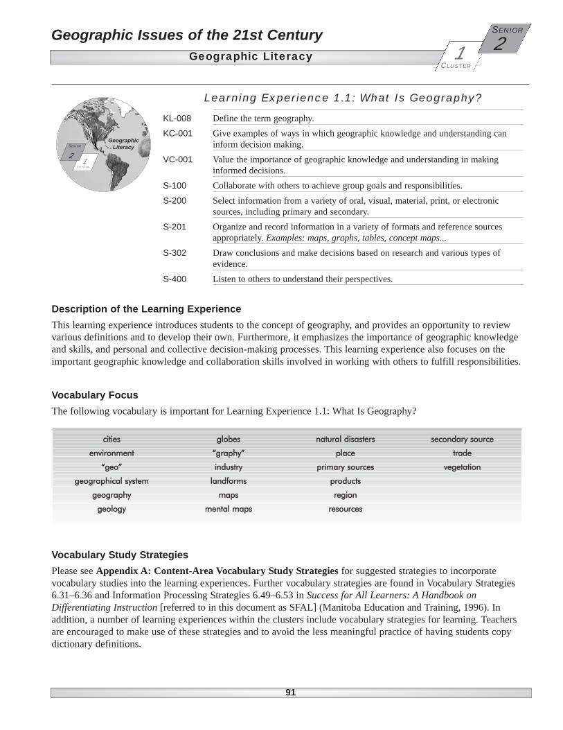
Description of the Learning ExperienceThis learning experience introduces students to the concept of geography, and provides an opportunity to reviewvarious definitions and to develop their own. Furthermore, it emphasizes the importance of geographic knowledgeand skills, and personal and collective decision-making processes. This learning experience also focuses on theimportant geographic knowledge and collaboration skills involved in working with others to fulfill responsibilities.
Vocabulary FocusThe following vocabulary is important for Learning Experience 1.1: What Is Geography?
Vocabulary Study Strategies Please see Appendix A: Content-Area Vocabulary Study Strategies for suggested strategies to incorporatevocabulary studies into the learning experiences. Further vocabulary strategies are found in Vocabulary Strategies6.31–6.36 and Information Processing Strategies 6.49–6.53 in Success for All Learners: A Handbook onDifferentiating Instruction [referred to in this document as SFAL] (Manitoba Education and Training, 1996). Inaddition, a number of learning experiences within the clusters include vocabulary strategies for learning. Teachersare encouraged to make use of these strategies and to avoid the less meaningful practice of having students copydictionary definitions.
cities
environment
“geo”
geographical system
geography
geology
globes
“graphy”
industry
landforms
maps
mental maps
natural disasters
place
primary sources
products
region
resources
secondary source
trade
vegetation
Learning Experience 1.1: What Is Geography?
KL-008 Define the term geography.KC-001 Give examples of ways in which geographic knowledge and understanding can
inform decision making.VC-001 Value the importance of geographic knowledge and understanding in making
informed decisions.S-100 Collaborate with others to achieve group goals and responsibilities.S-200 Select information from a variety of oral, visual, material, print, or electronic
sources, including primary and secondary.S-201 Organize and record information in a variety of formats and reference sources
appropriately. Examples: maps, graphs, tables, concept maps...S-302 Draw conclusions and make decisions based on research and various types of
evidence.S-400 Listen to others to understand their perspectives.
CLUSTER
2SENIOR
1
GeographicLiteracy
Geographic Issues of the 21st CenturyGeographic Literacy
LE 1.1: What Is Geography?CLUSTER
2SENIOR
1
92
Targeted Learning Outcomes Suggested Teaching/Learning StrategiesActivating Strategies Students will...
KL-008 Define the term geography.KC-001 Give examples of ways in whichgeographic knowledge and understandingcan inform decision making.S-100 Collaborate with others to achievegroup goals and responsibilities.
Strategy 1: Using Geographic Knowledge • In small groups, students brainstorm examples of how they use geographic
knowledge to make everyday decisions. Examples: finding the way to school oranother location, deciding how to dress for the weather, describing physicalfeatures, understanding and locating a natural disaster…
• Groups report examples to the class.• Record examples on the board or flip chart and discuss with students the various
ways that geographic knowledge is used in their daily lives. • Students record examples in course notebooks.
KL-008 Define the term geography.KC-001 Give examples of ways in whichgeographic knowledge and understandingcan inform decision making.S-100 Collaborate with others to achievegroup goals and responsibilities.
Strategy 2: Geographic Terminology• Students work in small groups and brainstorm a list of words they associate with
geography. Examples: maps, locations, landforms, regions…• Groups report to class, create a master list, and check for repetition.• Students use terms to create a Word Splash for display on a bulletin board in the
classroom. • Students make connections among three or four of the terms to predict how these
terms relate to geography. • Students share the connections they made, in small groups or with the whole class.
KL-008 Define the term geography.KC-001 Give examples of ways in whichgeographic knowledge and understandingcan inform decision making.S-100 Collaborate with others to achievegroup goals and responsibilities.S-200 Select information from a varietyof oral, visual, material, print, or electronicsources, including primary andsecondary.
Strategy 3: Defining Geography• Using the Listen-Think-Pair-Share strategy, students identify words with the prefix
“geo,” and words with the suffix “graphy.” • Students record findings in the appropriate spaces on the Word Families Form
organizer. (See BLM 1-2.)• Using the two root words, students create a definition for geography on the
organizer and complete the remaining boxes. • Students refer to dictionaries, geography textbooks, or the Internet to record various
definitions of geography.• Students compare these definitions to the one they created in the organizer. • Students begin a personal glossary of prefixes, root words, and suffixes.
93
Geographic Issues of the 21st Century Geographic Literacy
LE 1.1: What Is Geography?
2SENIOR
CLUSTER
1
Teacher Tips and ResourcesSuggested Assessment Strategies
Activating Strategies
• Monitor discussion and assess notes for the student’sunderstanding of the term geography and relevance of examplesprovided.
• Assess examples recorded in notes for the student’s knowledge ofways in which geographic knowledge informs decision making.
• Observe and monitor the student’s skill in collaborating withingroups during the brainstorming activity. (See BLM G-1.)
• Students may not be familiar with the concept ofgeography. Before active brainstorming can begin,students may need a few examples of how they usegeographic knowledge and skills in their daily lives.
• BLM G-1: Group Performance: Assessment Scale • TN 1: Geography: More Than a Subject in School • TN 2: The Nature of Geography • For further information on the discipline of
geography, read the Introduction and Appendix A in“Canadian National Standards for Geography,”published by Canadian Geographic and available onthe Canadian Council for Geographic Educationwebsite at <www.ccge.org> (Follow the link Pro-Development).
• Monitor discussion and assess the Word Splash for the student’sknowledge of geographic terminology.
• Monitor discussion and assess connections made for the student’sknowledge of ways in which geographic knowledge can informdecision making.
• Observe and monitor the student’s skill in collaborating withothers to achieve the group’s goals. (See BLMs G-1, G-2.)
• BLM 1-1: Word Splash • BLM G-1: Group Performance: Assessment Scale • BLM G-2: Group Performance: Self-Assessment
Scale • SFAL 6.28: Word Splash• Paper and markers• Keep a record of the master list for the Activating
Strategy in LE 1.2, Strategy 1.
• Assess responses on the Word Families Form and the student’spersonal glossaries for her or his knowledge of the termgeography, and the relevance of examples provided.
• Observe and assess the student’s skill in collaborating with othersto achieve group goals and responsibilities. (See BLM G-1.)
• Assess the student’s skill in selecting information from a varietyof sources. (See BLM G-9.)
• BLM 1-2: Word Families Form • BLM G-1: Group Performance: Assessment Scale • BLM G-9: Selecting Information: Checklist • SFAL 6.13: Listen-Think-Pair-Share• Dictionaries and online dictionaries (See
<www.dictionary.com>.)
Note: SFAL refers to the teacher support documentSuccess for All Learners: A Handbook onDifferentiating Instruction (Manitoba Education andTraining, 1996).
Where to Find the Blackline Masters (BLMs)Cluster-Specific BLMs are found in Appendix B. They are coded, for example, BLM 3-2,where the “3” refers to Cluster 3 and the “2” refers to the sequential number. General BLMs are found in Appendix C. They are coded, for example, BLM G-6, where theG refers to “General” and the “6” refers to the sequential number. They are used in multiplestrategies. Teacher Notes are found in Appendix D. They are coded TN, and are numberedsequentially (e.g., TN 3 or TN 40).
Antiti Four-Part Word Story
BLM 5–3
Date: Group Members: _________________________________________________
______________________________________________________________
______________________________________________________________
Definition(s): ____________________
____________________
__________
____________________
__________
____________________
__________
____________________
__________
Examples of Places: _________
______
____________________
__________
____________________
__________
____________________
__________
____________________
__________
Drawing of diagram Related words:______
_____________
____________________
__________
____________________
__________
____________________
__________
____________________
__________
Word
__________________

Geographic Issues of the 21st CenturyGeographic Literacy
LE 1.1: What Is Geography?CLUSTER
2SENIOR
1
Activating Strategies
94
Targeted Learning Outcomes Suggested Teaching/Learning StrategiesActivating Strategies Students will...
KL-008 Define the term geography.KC-001 Give examples of ways in whichgeographic knowledge and understandingcan inform decision making.VC-001 Value the importance ofgeographic knowledge and understandingin making informed decisions.
Strategy 4: Expanding the Meaning of Geography • Using the KWL or KWHL strategy, students record what they already know about
the discipline of geography in the “Know” column, its various branches, practicaldaily uses, careers related to geography, and the importance of geographicknowledge in decision making.
• Students discuss what they have recorded in the “Know” column, then proceed tolist things they would like to know in the “Want/Need to Know” column.
• Finally, students discuss strategies that may help them answer questions they havedeveloped (“How to Find Out” column).
• Students complete the “Learned” column in the KWL or KWHL organizer later asquestions are answered in other learning activities.
Acquiring Strategies
KL-008 Define the term geography.KC-001 Give examples of ways in whichgeographic knowledge and understandingcan inform decision making.VC-001 Value the importance ofgeographic knowledge and understandingin making informed decisions.S-200 Select information from a variety oforal, visual, material, print, or electronicsources, including primary and secondary.S-201 Organize and record information ina variety of formats and reference sourcesappropriately. Examples: maps, graphs,tables, concept maps...
Strategy 1: Help Wanted: Geographers• Working with a partner, students use the Internet and/or career sections of weekend
newspapers to search for job/career advertisements related to geography.• Students research job descriptions and required qualifications (i.e., specific
geographic knowledge and skills) to expand their understanding of the importanceof geography.
• Students create a list, on a flip chart or on the board, of various job descriptions andrequired geographic qualifications and skills.
• Students record required qualifications and skills on the Attribute Wheel organizer.(See BLM G-18.)
KL-008 Define the term geography.VC-001 Value the importance ofgeographic knowledge and understandingin making informed decisions.S-100 Collaborate with others to achievegroup goals and responsibilities.S-302 Draw conclusions and makedecisions based on research and varioustypes of evidence.
Strategy 2: What Is Where, Why There, and Why Care?• Individual students or pairs read the article “What Is Where, Why There, and Why
Care?” by Charles Gritzner. (See TN 3.)• Working with a partner and with guidance from the teacher, students use the
Information Mapping model to note the main ideas and supporting details of thearticle.
• As a class, students discuss the importance of each of the components of Gritzner’sdefinition.
Students will...
95
Geographic Issues of the 21st Century Geographic Literacy
LE 1.1: What Is Geography?
2SENIOR
CLUSTER
1
Teacher Tips and Resources
Activating Strategies
Suggested Assessment Strategies
Activating Strategies
• Assess the KWL or KWHL organizer for the student’s knowledgeof the term geography.
• Monitor discussions and assess the KWL or KWHL organizer forthe student’s knowledge of examples of ways in whichgeographic knowledge can inform decision making.
• Monitor discussions and assess the KWL or KWHL organizer forevidence that the student values the importance of geographicknowledge.
• BLM G-19: KWHL (What do I know? What do Iwant/need to know? How will I find out? What haveI learned?)
• SFAL 6.94: KWL Organizer• Ask students to keep the KWL or KWHL Organizer
in their notes for further additions at the end of thelearning activity and for possible use in ApplyingStrategy 3.
Acquiring Strategies
• Assess the job descriptions list and Attribute Wheel for thestudent’s understanding of the term geography and examples ofways in which geographic knowledge can inform decisionmaking.
• Monitor pairs’ work and assess the list of job descriptions forevidence that the student appreciates the importance ofgeographic knowledge.
• Assess the student’s skill in selecting information from a varietyof sources. (See BLM G-9.)
• Assess the Attribute Wheel for the student’s skill in organizingand recording information.
• Access to weekend editions of local and nationalnewspapers
• Geography on the Job website at <www.ccge.org>(Follow links “resources” to “Geography on theJob.”)
• BLM G-9: Selecting Information: Checklist • BLM G-18: Attribute Wheel
• Assess the student’s understanding of the term geography and theimportance of geographic knowledge.
• Monitor the student’s contributions to the Information Mappingexercise to determine understanding of the article.
• Observe and assess the student’s collaboration skills. (See BLMsG-1, G-2.)
• You should be familiar with Gritzner’s article priorto teaching this lesson.
• Depending on student reading skills, you may needto provide an overview of the article beforeassigning the reading.
• BLM G-1: Group Performance: Assessment Scale• BLM G-2: Group Performance: Self-Assessment
Scale• SFAL 6.49, 6.50: Information Mapping model• TN 3: “What Is Where, Why There, and Why
Care?” by Charles Gritzner
Geographic Issues of the 21st CenturyGeographic Literacy
LE 1.1: What Is Geography?CLUSTER
2SENIOR
1
Targeted Learning Outcomes Suggested Teaching/Learning StrategiesAcquiring Strategies
96
Students will...
KC-001 Give examples of ways in whichgeographic knowledge and understandingcan inform decision making.VC-001 Value the importance ofgeographic knowledge and understandingin making informed decisions.S-302 Draw conclusions and makedecisions based on research and varioustypes of evidence.S-400 Listen to others to understandtheir perspectives.
Strategy 3: Using Geographic Knowledge• As a class, students discuss how to prepare for and conduct interviews, and how to
select potential interview candidates. (See TN 14.)• Working with a partner, students develop a list of questions (open-ended,
closed-ended, follow-up) relating to how individuals use geographic knowledge in jobs or activities in the community.
• Students conduct interviews with adults in the school/community and recordappropriate information.
• Students discuss criteria for making oral and/or written reports (using or revisingparts of BLMs G-3 and G-4) in preparation for reporting interview findings to theclass.
• Students share responses and compile information on the board or flip chart. • Students use interview results to answer the question “Why is geographic
knowledge important?”• Students record shared information in course notebooks.
Applying Strategies
KL-008 Define the term geography.S-100 Collaborate with others to achievegroup goals and responsibilities.S-201 Organize and record informationin a variety of formats and referencesources appropriately. Examples: maps,graphs, tables, concept maps...
Strategy 1: Definition of Geography Applied• Individually or in pairs, students identify a specific geographic feature or
phenomenon. Example: their school or a new store…• Students use relevant information about the selected feature to answer the questions
in Gritzner’s definition of geography by completing BLM G-20 or by creating aposter with this information in a similar format.
• Students share examples with the rest of the class.• Students record information from peers in course notebooks.
KC-001 Give examples of ways in whichgeographic knowledge and understandingcan inform decision making.VC-001 Value the importance ofgeographic knowledge and understandingin making informed decisions.S-100 Collaborate with others to achievegroup goals and responsibilities.S-200 Select information from a varietyof oral, visual, material, print, or electronicsources, including primary andsecondary.
Strategy 2: Using Geographic Knowledge: Issue-Based Analysis• From media sources or class discussion, students identify a local or regional issue
with geographic implications. Examples: land use or transportation issue,environmental or ecological concern…
• Working individually or with a partner, students analyze the issue using the Issue-Based Analysis form. (See SFAL 6.70, 6.115.)
• In small groups, students discuss and produce a brief report on the geographicknowledge and skills they used in making decisions to address the issue.
• Students record shared information in course notebooks.
Students will...

97
Geographic Issues of the 21st Century Geographic Literacy
LE 1.1: What Is Geography?
2SENIOR
CLUSTER
1
Teacher Tips and ResourcesSuggested Assessment Strategies
Acquiring Strategies
Applying Strategies
• Monitor discussion and assess reports and notes for the student’sunderstanding of examples of ways in which geographicknowledge can inform decision making. (See BLMs G-3, G-4.)
• Monitor interview questions and assess reports for evidence thestudent appreciates the importance of geographic knowledge.
• Assess the student’s skills in drawing conclusions and makingdecisions based on information from interviews.
• Observe and assess the student’s active listening skills. (SeeBLMs G-5, G-6.)
• You may need to provide examples of everyday usesof geographic knowledge and skills to help studentsgenerate interview questions. Examples: driversfinding their way, managers knowing the location ofclients, farmers understanding soil and weatherconditions, emergency services workers knowingtheir community…
• BLM 1-3: Sample Interview Form • BLM G-3: Oral Presentation: Observation Checklist • BLM G-4: Oral Presentation: Self-Assessment
Checklist • BLM G-5: Listening Skills: Observation Checklist • BLM G-6: Listening Skills: Self-Assessment• TN 11: Asking Geographic Questions• TN 12: Asking Questions• TN 14: Conducting an Interview
• Assess the organizer/poster and notes for the student’sunderstanding of the definition of geography and appropriatenessof examples.
• Observe the student’s collaboration skills if working withpartners. (See BLM G-1.)
• Assess the organizer and notes for the student’s skills inorganizing and recording information.
• BLM G-1: Group Performance: Assessment Scale• BLM G-20: Geography Questions Organizer • Poster paper, markers
• Assess the report and notes for the student’s understanding ofways in which geographic knowledge can inform his or her ownand others’ decision making.
• Monitor discussions and assess the report for evidence of thestudent’s appreciation of the importance of geographicknowledge.
• Observe and monitor group work for the student’s skills incollaborating with others. (See BLMs G-1, G-2.)
• Assess access to and use of a variety of media and the student’sselection of appropriate issue-based news items for her or his skillin selecting information. (See BLM G-9.)
• Newspapers, magazines, Internet, and TV or radionews reports
• BLM G-1: Group Performance: Assessment Scale • BLM G-2: Group Performance: Self-Assessment
Scale • BLM G-9: Selecting Information: Checklist • SFAL 6.70, 6.115: Issue-Based Article Analysis
Geographic Issues of the 21st CenturyGeographic Literacy
LE 1.1: What Is Geography?CLUSTER
2SENIOR
1
98
Targeted Learning Outcomes Suggested Teaching/Learning StrategiesApplying Strategies Students will...
KL-008 Define the term geography.S-100 Collaborate with others to achievegroup goals and responsibilities.S-201 Organize and record informationin a variety of formats and referencesources appropriately. Examples: maps,graphs, tables, concept maps...
Strategy 3: What Have You Learned about Geography?• Students retrieve the KWL or KWHL organizer they started in the Activating
Strategies segment of this learning experience; then, working in small groups,students review information already completed in the “Know” and “Want to Know”columns of their organizers.
• After a brief discussion on what questions they have answered in this learningexperience activity, students complete the last column (Learned) in the KWL orKWHL organizer.
• Individually, students express their concept of the meaning of the term geography inthe Concept Overview organizer. (See SFAL 6.112.)
Teacher Reflections
99
Geographic Issues of the 21st Century Geographic Literacy
LE 1.1: What Is Geography?
2SENIOR
CLUSTER
1
Teacher Tips and ResourcesSuggested Assessment Strategies
Applying Strategies
• Assess responses on the KWL/KWHL and Concept Overvieworganizers for the student’s understanding and knowledge of theterm geography.
• Observe the student’s participation in group discussions as theyreview their learning to determine her or his skill in collaboration.(See BLMs G-1, G-2.)
• Assess KWL/KWHL and Concept Overview organizers for thestudent’s skill in organizing and recording information.
• Remind students to retrieve their partly completedKWL or KWHL organizers from the ActivatingStrategies segment of the learning experience.
• BLM G-1: Group Performance: Assessment Scale • BLM G-2: Group Performance: Self-Assessment
Scale• BLM G-19: KWHL• SFAL 6.94: KWL Organizer• SFAL 6.112: Concept Overview
Teacher Reflections
100
2SENIOR Geographic Issues of the 21st Century
Geographic LiteracyCLUSTER
1
Learning Experience: 1.2 Physical and Human Geography
KL-009 Identify elements of physical and human geography.KL-010 Describe the relationship between physical and human geography.KL-011 Locate major physical features on a map of North America.KL-012 Locate international political divisions on a map of North America.KL-013 Locate provinces, territories, and capital cities on a map of Canada.S-100 Collaborate with others to achieve group goals and responsibilities.S-200 Select information from a variety of oral, visual, material, print, or electronic
sources, including primary and secondary.S-201 Organize and record information in a variety of formats and reference sources
appropriately. Examples: maps, graphs, tables, concept maps...S-300 Formulate geographic questions to plan inquiry and research.S-309 Observe patterns and make generalizations based on geographic inquiry.S-400 Listen to others to understand their perspectives.
CLUSTER
2SENIOR
1
GeographicLiteracy
Geographic Issues of the 21st CenturyGeographic Literacy
2SENIOR
CLUSTER
1
101
Description of Learning Experience The second learning experience extends the definition of geography to include its two major fields: physicalgeography and human geography. It provides opportunities for students to identify elements of each, and proceedsto introduce students to the critical geographic concept of the dynamic interrelationships between the physical andhuman aspects of the world. This learning experience also gives students an opportunity to consolidate and extendtheir map knowledge of both human and physical elements of Canada and North America.
Vocabulary Focus The following vocabulary is important for Learning Experience 1.2: Physical and Human Geography.
Vocabulary Study Strategies Please see Appendix A: Content-Area Vocabulary Study Strategies for suggested strategies to incorporatevocabulary studies into the learning experiences. Further vocabulary strategies are found in Vocabulary Strategies6.31–6.36 and Information Processing Strategies 6.49–6.53 in Success for All Learners: A Handbook onDifferentiating Instruction [referred to in this document as SFAL] (Manitoba Education and Training, 1996). Inaddition, a number of learning experiences within the clusters include vocabulary strategies for learning. Teachersare encouraged to make use of these strategies and to avoid the less meaningful practice of having students copyout dictionary definitions.
aerial photograph
agriculture
borders
boundaries
climate
continental
earthquakes
fauna
flora
general purpose maps
geographic information systems
glaciation
global positioning systems
human geography
ice age
igneous
line scale
map basics
map scale
marine
metamorphic
minerals
mountains
physical geography
plains
plateaus
political divisions
provinces
ratio scale
remote sensing
rock cycle
rock types
rocks
satellite image
sedimentary
shield
states
territories
thematic
topographic map
transect
transition zones
verbal scale
water cycle
Geographic Issues of the 21st CenturyGeographic Literacy
LE 1.2: Physical and Human GeographyCLUSTER
2SENIOR
1
102
Targeted Learning Outcomes Suggested Teaching/Learning StrategiesActivating Strategies Students will...
KL-009 Identify elements of physical andhuman geography.S-100 Collaborate with others to achievegroup goals and responsibilities.S-400 Listen to others to understandtheir perspectives.
Strategy 1: Fields of Geography• With partners or in small groups, students brainstorm words related to geography. • With their partner/group, students sort terms into categories of “physical” and
“human.” • Students record information on the Sort and Predict Frame. (See SFAL 6.100.)• Groups share predictions with the rest of the class to check for agreement and make
necessary corrections.
KL-009 Identify elements of physical andhuman geography.KL-010 Describe the relationshipbetween physical and human geography.S-100 Collaborate with others to achievegroup goals and responsibilities.S-300 Formulate geographic questionsto plan inquiry and research.S-400 Listen to others to understandtheir perspectives.
Strategy 2: Asking Geographic Questions• Working with a partner, students develop geographic questions. Answers to these
questions will reflect the impact of the physical environment on human activities.Example: Why do we wear heavy coats in the winter?
• Students then develop answers to their questions or to other students’ questions todemonstrate a possible relationship between physical and human geography.Example: We wear heavy coats because the mid-latitude continental winter seasonis cold.
• Student partners quiz class members to test for knowledge of the relationshipbetween physical and human geography.
• As a class, students discuss the relationship between physical and humangeography.
KL-013 Locate provinces, territories, andcapital cities on a map of Canada.S-201 Organize and record informationin a variety of formats and referencesources appropriately. Examples: maps,graphs, tables, concept maps...
Strategy 3: Mental Map of Canada• Working individually and from memory (i.e., without the benefit of an atlas or wall
map), students use a blank sheet of paper to draw a freehand map of Canada. • Students focus on the outline shape of Canada’s boundaries, the provincial
boundaries, and the capital cities of the provinces and territories.• Students share freehand maps with classmates and compare them with an atlas or
wall map of Canada. • On the back of their map sheets, students make a list of goals they will need to
work on to improve their knowledge of Canada.

103
Geographic Issues of the 21st Century Geographic Literacy
LE 1.2: Physical and Human Geography
2SENIOR
CLUSTER
1
Teacher Tips and ResourcesSuggested Assessment Strategies
Activating Strategies
• Assess the Sort and Predict Frame for the student’s understandingof physical and human geography.
• Have the student self-assess his or her collaborative skills usingBLM G-2.
• Assess the student’s skill in listening to others to understand theirperspectives. (See BLMs G-5, G-6.)
• If the Word Splash activity was selected in LE 1(Activating Strategy 1), students start with that listand add any new terms that come to mind.
• Students may find it necessary to add a third Sortand Predict category, “geographic tools,” to includeterms that may be on their list such as maps, globes,atlases, and GIS software.
• BLM G-2: Group Performance: Self-AssessmentScale
• BLM G-5: Listening Skills: Observation Checklist • BLM G-6: Listening Skills: Self-Assessment • SFAL 6.100: Sort and Predict Frame• TN 4: Physical Geography • TN 5: Human Geography
• Assess questions for the student’s understanding of human andphysical elements and the relationship between them.
• Observe and assess the student’s skill in collaborating with others toachieve group goals and responsibilities. (See BLM G-1.)
• Assess the student’s skill in formulating geographic questions. • Monitor the student’s listening skills during reports to class and in
class discussion. (See BLMs G-5, G-6.)
• Students may need a number of examples ofquestions to initiate their thinking about the extentto which the physical environment affects humanactivities. TN 11 (Asking Geographic Questions)may be useful. Examples: Why is mining a majoreconomic activity in Thompson? Why do prairiefarmers grow wheat crops instead of bananas andoranges? What is the major locational factor for thecity of Winnipeg?
• Although the impact of physical factors on humanactivities may be the dominant form of therelationship between physical and human geography,human activities can also affect the surroundingphysical environment. Examples: human-inducedclimate change, increased slope erosion due tocutting of forests…
• BLM G-1: Group Performance: Assessment Scale • BLM G-5: Listening Skills: Observation Checklist • BLM G-6: Listening Skills: Self-Assessment • TN 11: Asking Geographic Questions
• Assess the freehand map of Canada for the student’s priorknowledge of locating provinces, territories, and capital cities.
• Assess the map of Canada for the student’s skill in organizinginformation appropriately.
• This learning activity is based on an exercisedeveloped by Dr. J. Lewis Robinson at theUniversity of British Columbia to assess first-yeargeography students’ knowledge of Canada. (See“The Varied ‘Mental Maps’ Our Students Have,”Canadian Geographic, April/May 1981, Volume101, Number 2.)
• Blank sheets of paper and pencils• Wall map of Canada, atlases • Depending on students’ knowledge of Canada, they
may wish to include on their freehand maps majorphysical features such as lakes, rivers, and mountains.
Geographic Issues of the 21st CenturyGeographic Literacy
LE 1.2: Physical and Human GeographyCLUSTER
2SENIOR
1
Targeted Learning Outcomes Suggested Teaching/Learning StrategiesAcquiring Strategies
104
Students will... Activating Strategies
KL-009 Identify elements of physical andhuman geography.KL-011 Locate major physical featureson a map of North America.S-100 Collaborate with others to achievegroup goals and responsibilities.S-400 Listen to others to understandtheir perspectives.
Strategy 4: North American Travel Experience • Working in small groups, students identify memorable places they have visited in
North America. • Students describe both the physical and human features of places visited. • Students report to class and create a master list, on the board or flip chart, of places
visited and their respective physical and human characteristics. • Students identify locations listed on a wall map of North America and discuss
possible relationships between physical and human geography for each.• Individually, students label places on an outline map of North America.
Acquiring Strategies
KL-010 Describe the relationshipbetween physical and human geography.KL-011 Locate major physical featureson a map of North America.KL-013 Locate provinces, territories, andcapital cities on a map of Canada.S-200 Select information from a varietyof oral, visual, material, print, or electronicsources, including primary andsecondary.S-309 Observe patterns and makegeneralizations based on geographicinquiry.
Strategy 1: Map of Canada• Using print and electronic resources, students locate and label major physical
features on a map of Canada. Examples: major landforms, rivers, and bodies ofwater…
• On the same map, students locate and label capital cities of provinces and territoriesof Canada.
• Students analyze and describe any relationships between Canada’s physical featuresand location of capital cities. Examples: Near what kind of features are most capitalcities located? In what type of landform region? Why?
• Students share responses with peers.• Students record findings in their course notebooks.
Students will...
Teacher Reflections
105
Geographic Issues of the 21st Century Geographic Literacy
LE 1.2: Physical and Human Geography
2SENIOR
CLUSTER
1
Teacher Tips and ResourcesSuggested Assessment Strategies
Acquiring Strategies Activating Strategies
• Monitor group discussions and assess the master list for thestudent’s knowledge of elements of physical and humangeography.
• Assess the map for the student’s knowledge of locations of majorphysical features in North America.
• Assess work in small groups for the student’s skill incollaborating with others. (See BLM G-1.)
• Monitor the student’s active listening skills in group discussionsand reports to class. (See BLMs G-5, G-6.)
• Teachers may need to define the extent of NorthAmerica as described in most geography textbooks(including Central America and the Caribbean).
• Students with limited travel experience may need tobe reminded that, from a geographic perspective,any location (however familiar it may seem to us) isas interesting as any other seemingly “exotic”location.
• Wall Map of North America• BLM G-1: Group Performance: Assessment Scale • BLM G-5: Listening Skills: Observation Checklist• BLM G-6: Listening Skills: Self-Assessment• BLM G-35: Map of North America
Acquiring Strategies
• Assess the report and notes for the student’s knowledge of therelationship between physical and human geography.
• Assess the map for the student’s knowledge of locations of majorphysical features, provinces, territories, and capital cities.
• Observe and monitor the student’s skill in selecting informationfrom atlases/wall maps.
• Monitor reports and assess notes for the student’s skill inobserving physical and human patterns and makinggeneralizations.
• You may need to provide some examples of physicalfeatures and specify the major rivers, lakes, andlandforms that students are required to label onmaps.
• BLM G-34: Map of Canada• TN 8: Geographic Information Systems (GIS)• Access to print and online atlases, wall maps for
reference (See <www.atlas.gc.ca>,<www.canadiangeographic.ca/atlas>.)
• The mapping activities may be conducted usingoutline handout maps or GIS computer software.
• The Manitoba Education, Citizenship and Youthwebsite includes an activity to construct a GIS mapof Canada: “Locating Provinces, Territories andCapital Cities on a Map of Canada.” (See<www.edu.gov.mb.ca> and follow the links:Kindergarten to S4/Curriculum/Social Studies/GISResources.)
Teacher Reflections
Geographic Issues of the 21st CenturyGeographic Literacy
LE 1.2: Physical and Human GeographyCLUSTER
2SENIOR
1
106
Targeted Learning Outcomes Suggested Teaching/Learning StrategiesApplying Strategies Students will... Acquiring Strategies
KL-009 Identify elements of physical andhuman geography.KL-010 Describe the relationshipbetween physical and human geography.KL-011 Locate major physical featureson a map of North America.KL-012 Locate international politicaldivisions on a map of North America.S-200 Select information from a varietyof oral, visual, material, print, or electronicsources, including primary andsecondary.S-309 Observe patterns and makegeneralizations based on geographicinquiry.
Strategy 2: Mapping Physical Features of North America• Using print and electronic resources, students locate and label the major physical
features on an outline map of North America.• Students also label the major political divisions on the map of North America.• Students analyze maps and identify countries that are dominated by one or two
major physical features and those that have a variety of physical features.Examples: mountains, plains…
• In small groups, students discuss the possible implications of physical features onthe type and variety of human activities.
• Individually, students write an Exit Slip to describe the implications of physicalfeatures on the type and variety of human activities.
KL-009 Identify elements of physical andhuman geography.KL-010 Describe the relationshipbetween physical and human geography.S-200 Select information from a varietyof oral, visual, material, print, or electronicsources, including primary andsecondary.S-302 Draw conclusions and makedecisions based on research and varioustypes of evidence.
Strategy 3: Relationship between Physical and Human Geography • Working with a partner, students select a human (cultural) feature located either
locally or anywhere in North America. Examples: site of an industry, transportationroute, location of golf course, site of a settlement…
• Students discuss physical and human factors that may have determined the locationof their selected feature. Examples: golf course located on river flats notappropriate for housing due to risk of flooding, near urban centre to attract manygolfing enthusiasts…
• Students share examples with the class.• Students record in their course notebooks examples of the relationship between
physical and human factors of selected features.
KL-009 Identify elements of physical andhuman geography.KL-010 Describe the relationshipbetween physical and human geography.S-201 Organize and record informationin a variety of formats and referencesources appropriately. Examples: maps,graphs, tables, concept maps...S-309 Observe patterns and makegeneralizations based on geographicinquiry.
Strategy 1: Reviewing the Definition of Geography• Students work individually to review their knowledge of geography and the
relationship of the two major fields: physical and human.• Students record their knowledge on a Concept Relationship Frame. (See SFAL 6.53,
6.104.)
Applying Strategies Students will...
107
Geographic Issues of the 21st Century Geographic Literacy
LE 1.2: Physical and Human Geography
2SENIOR
CLUSTER
1
Teacher Tips and ResourcesSuggested Assessment Strategies
Applying Strategies Acquiring Strategies
• Assess the map, analysis, and Exit Slip for the student’sknowledge of elements of physical and human geography andpossible relationships between the two fields of geography.
• Assess the map for the student’s knowledge of locations of majorphysical features and political divisions of North America.
• Monitor the student’s skill in selecting information fromappropriate electronic and print atlas resources.
• Assess the student’s skill in observing patterns and makinggeneralizations about physical and human features of NorthAmerica.
• BLM G-35: Map of North America • Print and electronic atlas resources (See
<www.atlas.gc.ca>.)• SFAL 6.60: Exit Slips• The mapping activities may be conducted with GIS
computer software.• TN 8: Geographic Information Systems (GIS)
• Monitor the discussion and assess notes for the student’sunderstanding of the elements of and relationships betweenphysical and human geography.
• Assess the student’s skill in selecting her or his own examples ofphysical and human geography (primary sources).
• Assess the student’s skill in drawing conclusions and makingdecisions based on various types of evidence.
• Some students may need further examples of humanfeatures they can select. (Examples: specific localfeatures [building, sports field], large features[cities, farmland], or linear features [roads orpathways]…) The main objective is for students tounderstand there are always reasons (physical,human, or both) that explain why human-madefeatures are located where they are.
• TN 4: Physical Geography• TN 5: Human Geography
• Assess the Concept Relationship Frame for the student’sknowledge of the elements of, and relationship between, physicaland human geography.
• Assess the student’s skill in organizing and recording informationand observing patterns on the Concept Relationship Frame.
• You may need to model the use of the ConceptRelationship Frame.
• This strategy can be related to the Sort and Predictactivity in the Activating Strategy earlier in thislearning experience.
• SFAL 6.53, 6.104: Concept Relationship Frame
Applying Strategies
Geographic Issues of the 21st CenturyGeographic Literacy
LE 1.2: Physical and Human GeographyCLUSTER
2SENIOR
1
108
Targeted Learning Outcomes Suggested Teaching/Learning StrategiesApplying Strategies Students will...
KL-009 Identify elements of physical andhuman geography.KL-010 Describe the relationshipbetween physical and human geography.S-200 Select information from a varietyof oral, visual, material, print, or electronicsources, including primary andsecondary.S-201 Organize and record informationin a variety of formats and referencesources appropriately. Examples: maps,graphs, tables, concept maps...
Strategy 2: Scenes of North America• Students collect a variety of pictures depicting physical features and human
(cultural) activities in North America.• Students attach pictures in appropriate locations on a large wall map (or large
outline map they have created). • Students justify their choice of location for each picture. Example: identify specific
clues from the picture that help determine its location in North America…• Students record their rationale for choices in their course notebooks.
KL-009 Identify elements of physical andhuman geography.KL-010 Describe the relationshipbetween physical and human geography.S-200 Select information from a varietyof oral, visual, material, print, or electronicsources, including primary andsecondary.S-201 Organize and record informationin a variety of formats and referencesources appropriately. Examples: maps,graphs, tables, concept maps...
Strategy 3: Home to School Transect• Students note both physical and human features along their route from home to
school.• Students create a transect of their route and label the physical and human features
along the transect. • Students share the transect with the class, pointing out major features along the
route, and explaining possible relationships between physical and human elements.
Teacher Reflections
109
Geographic Issues of the 21st Century Geographic Literacy
LE 1.2: Physical and Human Geography
2SENIOR
CLUSTER
1
Teacher Tips and ResourcesSuggested Assessment Strategies
Applying Strategies
• Assess the location of pictures and accompanying explanationsfor the student’s understanding of the relationship betweenphysical and human geography of North America.
• Assess the student’s skill in selecting appropriate pictures from avariety of sources.
• Assess the student’s skill in organizing and placing pictures inappropriate locations on the map of North America.
• Students may wish to create a large outline map ofNorth America by projecting an overheadtransparency map or a GIS-produced map on a largesheet of poster paper and tracing the outline.
• Access to supply of magazines that can be cut up forpictures (Examples: Canadian Geographic, NationalGeographic, Maclean’s…)
• Brochures from travel agencies, pictures fromcalendars
• Overhead/LCD projector• BLM G-35: Map of North America
• Assess transect and explanations for the student’s understandingof physical and human elements and their relationship.
• Observe the student’s skill in selecting information from primarysources for inquiry.
• Assess the transect for the student’s skill in organizing andrecording information.
• TN 4: Physical Geography• TN 5: Human Geography • TN 19: Creating a Transect • A local street map and/or topographic map may be
helpful for students to identify routes from home toschool.
• Sheets of drawing paper or poster paper
Teacher Reflections
110
2SENIOR Geographic Issues of the 21st Century
Geographic LiteracyCLUSTER
1
Learning Experience 1.3: Place and Identity
KI-003 Explain the relationship between place and identity.KP-040 Describe ways in which various globes, maps, and map projections may influence
perceptions. Examples: relative size and position, power, sovereignty...KH-032 Recognize that the study of geography includes the study of change over time.VI-002 Appreciate the importance of place to their identity.S-100 Collaborate with others to achieve group goals and responsibilities.S-200 Select information from a variety of oral, visual, material, print, or electronic
sources, including primary and secondary.S-201 Organize and record information in a variety of formats and reference sources
appropriately. Examples: maps, graphs, tables, concept maps...S-204 Select, use, and interpret various types of maps.S-205 Recognize and interpret various map projections.S-302 Draw conclusions and make decisions based on research and various types of
evidence.S-309 Observe patterns and make generalizations based on geographic inquiry.S-402 Express informed and reasoned opinions.S-403 Present information and ideas in a variety of formats appropriate for audience and
purpose. Examples: models, displays, multimedia presentations, editorials...S-405 Articulate their perspectives on issues.
CLUSTER
2SENIOR
1
GeographicLiteracy

Geographic Issues of the 21st CenturyGeographic Literacy
2SENIOR
CLUSTER
1
111
Description of the Learning ExperienceIn this learning experience, students explore issues of perception relating to geography. Students make connectionsbetween the concepts of place and identity, and reflect upon the importance of place to their personal identity.Students also acquire an understanding that maps and map projections can be powerful symbols that mayinfluence perceptions of position and power. In this learning experience, students also recognize that the study ofgeography, whether it be physical or human, includes the study of change over time.
Vocabulary FocusThe following vocabulary is important for Learning Experience 1.3: Place and Identity.
Vocabulary Study Strategies Please see Appendix A: Content-Area Vocabulary Study Strategies for suggested strategies to incorporatevocabulary studies into the learning experiences. Further vocabulary strategies are found in Vocabulary Strategies6.31–6.36 and Information Processing Strategies 6.49–6.53 in Success for All Learners: A Handbook onDifferentiating Instruction [referred to in this document as SFAL] (Manitoba Education and Training, 1996). Inaddition, a number of learning experiences within the clusters include vocabulary strategies for learning. Teachersare encouraged to make use of these strategies and to avoid the less meaningful practice of having students copyout dictionary definitions.
absolute location
change over time
compass
compass bearing
compass rose
direction
earth grid
equator
equatorial
gazetteer
geographic coordinates
Greenwich Mean Time
identity
International Date Line
large scale
latitude
location
longitude
map distortion
Mercator
meridians
parallels
perceptions
Peterson
place
place attachment
polar
power
prime meridian
projections
relative location
Robinson
sense of place
small scale
sovereignty
stereoscope
sub-ttropics
temperate
time zones
tropics
values
Geographic Issues of the 21st CenturyGeographic Literacy
LE 1.3: Place and IdentityCLUSTER
2SENIOR
1
112
Targeted Learning Outcomes Suggested Teaching/Learning StrategiesActivating Strategies Students will...
KI-003 Explain the relationship betweenplace and identity.VI-002 Appreciate the importance ofplace to their identity.S-405 Articulate their perspectives onissues.
Strategy 1: Perceptions of Place and Identity• In a class discussion, students brainstorm the idea of “place attachment.” They
discuss how they have come to know and feel comfortable with the place wherethey were born or have lived for a length of time.
• Students identify both physical and human aspects of this place, and the things thatare familiar to them or the things that they miss when they are away from thisfamiliar environment. Examples: street, neighbourhood, or farm…
• Students who have recently moved explain this experience. They may speak ofmissing their old place, and the challenges of getting to know a new place,becoming “attached” to it, and feeling comfortable in their new surroundings.
• Students complete the organizer in BLM 1-4 to express their perceptions of placeand identity.
KP-040 Describe ways in which variousglobes, maps, and map projections mayinfluence perceptions. Examples: relativesize and position, power, sovereignty...S-204 Select, use, and interpret varioustypes of maps.S-205 Recognize and interpret variousmap projections.S-302 Draw conclusions and makedecisions based on research and varioustypes of evidence.
Strategy 2: Map Projections and Perceptions• Students examine a Mercator projection wall map of the world (or in an atlas) to
observe relative size of countries and continents in various parts of the world.• Students view the following pairs of countries and/or continents to see which
appears to be larger, and record their findings:i) Greenland and South Americaii) China and Canadaiii) Scandinavia and Indiaiv) North America and Africa
• Students then view the same pairs, using a globe, to see how their perceptions ofrelative sizes might change (students could also use a gazetteer to determine actualareas of the countries/continents for comparison and contrast), and record findings.
• Students discuss possible reasons for these changing perceptions from the map tothe globe.
• Students record findings in their course notebooks.
KH-032 Recognize that the study ofgeography includes the study of changeover time.S-100 Collaborate with others to achievegroup goals and responsibilities.S-309 Observe patterns and makegeneralizations based on geographicinquiry.
Strategy 3: Time and Change in Your Community • In small groups, students brainstorm any recent changes that have taken place near
their school, in their neighbourhood, or in their community. Examples: a newbuilding, road construction or paving, clearing of trees, removal of old farmbuildings, development in an open space, erosion of a riverbank…
• Students report examples to the class and develop a list on the board or flip chart.• Students record examples of changes and note possible reasons for these changes in
their course notebooks.
113
Geographic Issues of the 21st Century Geographic Literacy
LE 1.3: Place and Identity
2SENIOR
CLUSTER
1
Teacher Tips and ResourcesSuggested Assessment Strategies
Activating Strategies
• Monitor discussions and assess the organizer for the student’sunderstanding of the relationship between place and identity.
• Monitor examples provided and assess the organizer for evidenceof the student’s appreciation of the importance of place to his orher identity.
• Assess the student’s discussions and the organizer for her or hisskill in articulating perspectives about place and identity. (See BLM G-10.)
• You may wish to introduce the concept of “placeattachment” with a discussion of being homesick.
• Photographs of familiar places can be used to evokefeelings of place and identity.
• You might remind students that the sense of placeand identity might also apply to their schoolexperiences, and that feelings of apprehension aboutgoing to a new school result from leaving a familiarplace and trying to become comfortable in the newsurroundings.
• Classrooms with new Canadians provideopportunities for new citizens to identify aspects oftheir former home and places they miss.
• BLM 1-4: Sense of Place and Identity • BLM G-10: Articulating Perspectives: Observation
Checklist• TN 10: Place and Identity• TN 33: Articulating Perspectives on Issues
• Monitor student’s observations and assess findings to assess thestudent’s understanding of ways in which globes and various mapprojections influence perceptions of relative size.
• Assess the student’s skill in selecting, using, and interpretingappropriate maps.
• Monitor discussions and assess notes for the student’s skill indrawing conclusions based on observations of map projections.
• A classroom display including a globe and maps ofvarying projections might provide visualencouragement for students to view and analyzecharacteristics and differing perceptions of globesand maps.
• Travel and tourism maps often highlight and distortspecific areas to draw the interest of the traveller tothat region.
• Access to atlases, wall maps, globes• TN 6: Map Projections • TN 7: Map Types and Properties
• Monitor brainstorming and assess the report and notes for thestudent’s understanding that the study of geography includes thestudy of change over time.
• Observe and monitor the student’s collaborative skills in groupwork. (See BLMs G-1, G-2.)
• Monitor brainstorming and assess examples listed for thestudent’s skill in observing patterns and making generalizationsabout changes in his or her community.
• Historical photos of local features could be posted inthe classroom to further emphasize change over time.
• Students may have “before and after” photographs ofa changing feature at their home or neighbourhood toshare with the class.
• BLM G-1: Group Performance: Assessment Scale • BLM G-2: Group Performance: Self-Assessment
Scale
Geographic Issues of the 21st CenturyGeographic Literacy
LE 1.3: Place and IdentityCLUSTER
2SENIOR
1
Targeted Learning Outcomes Suggested Teaching/Learning StrategiesAcquiring Strategies
114
Students will...
KI-003 Explain the relationship betweenplace and identity.VI-002 Appreciate the importance ofplace to their identity.S-100 Collaborate with others to achievegroup goals and responsibilities.S-405 Articulate their perspectives onissues.
Strategy 1: Perceptions of Place and Identity in Manitoba• In small groups, students examine tourism materials of their community or region.
Examples: brochures, maps, websites…• Students identify and list specific features, events, and characteristics that are
unique to the identity of the community (place) in question. Examples: geographiclocation or feature, seasonal event such as a local fair, cultural characteristics,roadside monument, major economic activities…
• Groups report their findings to the class and discuss how communities emphasizethese relationships between place and identity to promote tourism.
• Students write an Exit Slip to explain what they have learned about the relationshipbetween place and identity and the importance of place to their personal identity.
KP-040 Describe ways in which variousglobes, maps, and map projections mayinfluence perceptions. Examples: relativesize and position, power, sovereignty...S-200 Select information from a varietyof oral, visual, material, print, or electronicsources, including primary andsecondary. S-201 Organize and record informationin a variety of formats and referencesources appropriately. Examples: maps,graphs, tables, concept maps...S-205 Recognize and interpret variousmap projections.
Strategy 2: Characteristics and Perceptions of Map Projections• Working with a partner or in small groups, students view world maps in different
projections.• Using a variety of information sources, students research three well-known
projections used for world maps: Mercator, Peters, and Robinson. • Students identify key characteristics of each projection and record findings.
Should include information for each, such as:– When and why it was developed– Characteristics of lines of latitude and longitude– Characteristics of area, shape, direction, and distances– Visual perception (perceived versus actual size of countries) and distortion– Major uses– Advantages and disadvantages
• Students report to class to share findings and discuss how projections may influenceperceptions.
KH-032 Recognize that the study ofgeography includes the study of changeover time.S-100 Collaborate with others to achievegroup goals and responsibilities.S-200 Select information from a varietyof oral, visual, material, print, or electronicsources, including primary andsecondary. S-201 Organize and record informationin a variety of formats and referencesources appropriately. Examples: maps,graphs, tables, concept maps...S-309 Observe patterns and makegeneralizations based on geographicinquiry.
Strategy 3: Physical and Human Changes over Time• Working in small groups, students use a variety of sources to study geographical
changes, both physical and human, in their community over time. • Students identify specific features and describe the changes over time. The feature
should be identified as a human feature or a physical feature.• Students create sketch maps and/or drawings to reflect changes identified. • Groups present findings to class.• Classmates make notes on changes listed and classify them as physical or human in
their course notebooks.

115
Geographic Issues of the 21st Century Geographic Literacy
LE 1.3: Place and Identity
2SENIOR
CLUSTER
1
Teacher Tips and ResourcesSuggested Assessment Strategies
Acquiring Strategies
• Monitor the report and assess the Exit Slip for the student’sunderstanding of the relationship between place and identity.
• Monitor the report and assess the Exit Slip for evidence of thestudent’s appreciation of the importance of place to her or hisidentity.
• Monitor the student’s collaborative skills. (See BLM G-1.) • Assess the report and Exit Slip for the student’s skill in
articulating perspectives. (See BLM G-10.)
• Some picture books for children could be used tostudy the importance of place and identity for thosegrowing up in the prairies Examples: If You’re Notfrom the Prairie by David Bouchard, illustrated byHenry Ripplinger; and The Prairie Alphabet by JoBannatyne-Cugnet, illustrated by Yvette Moore…
• Tourism materials of community or region• Access to the Internet (See
<www.bigthings.ca/bigmb.html> with links toindividual communities.)
• BLM G-1: Group Performance: Assessment Scale • BLM G-10: Articulating Perspectives: Observation
Checklist• SFAL 6.60, 6.61: Exit Slips• TN 33: Articulating Perspectives on Issues
• Assess the organizer for the student’s understanding ofcharacteristics and perceptions of map projections.
• Observe and monitor the student’s skill in selecting and usingappropriate maps for gathering information.
• Assess the organizer for the student’s skill in organizing andrecording information.
• Monitor the report and assess the organizer for students’ skill inrecognizing and interpreting various types of map projections.
• Wall maps, atlases (introductory sections in someatlases provide information on globes, maps, andprojections), encyclopedias
• The Internet (suggested sites: <atlas.gc.ca> andfollow the links: Learning Resources/Map Making/Map Projections; <www.colorado.edu/geography>,and follow the links: Geographers Craft/Lecture andDiscussion Notes/Map Projections)
• TN 6: Map Projections • TN 7: Map Types and Properties• Video: Many Ways to See the World. (Available at
<www.petersmap.com> and follow the links: How toOrder the Peters Map/Video Many Ways to See theWorld.)
• Assess the organizer, sketch map/drawing, and notes for thestudent’s knowledge of geographic change over time.
• Monitor and assess group work for the student’s skill incollaborating with others to achieve group goals andresponsibilities. (See BLMs G-1, G-2.)
• Assess the student’s skill in selecting appropriate examples ofchanging features in her or his community.
• Assess the organizer, sketch, and notes for the student’s skills inorganizing and recording information.
• Monitor and assess the student’s skill in observing patterns andmaking generalizations about changes over time.
• This activity could be combined with a local fieldstudy to identify physical and human changessubsequent to the last photo or map coverage of thestudy region.
• Current and historical aerial and ground photographsof the study region
• Various editions of topographic and street maps ofthe study region
• Community and regional history books• Local citizens for interviews• BLM G-1: Group Performance: Assessment Scale • BLM G-2: Group Performance: Self-Assessment
Scale • TN 14: Conducting an Interview • TN 30: Field Studies in Geography
Geographic Issues of the 21st CenturyGeographic Literacy
LE 1.3: Place and IdentityCLUSTER
2SENIOR
1
Targeted Learning Outcomes Suggested Teaching/Learning StrategiesAcquiring Strategies
116
Students will... Applying Strategies
KI-003 Explain the relationship betweenplace and identity.VI-002 Appreciate the importance ofplace to their identity.S-309 Observe patterns and makegeneralizations based on geographicinquiry.
Strategy 1: Designing Team Names and Logos—Place and Identity• Working with a partner, students create a team name and logo, and design a mascot
for a sport in their own town, a nearby town, or any North American city. • Students select a town or city they are familiar with and consider the features and
characteristics that are part of its identity. (Examples: landform, major industry,historical event, cultural feature, common bird, animal, or plant…) (See BLM 1-5for further examples.)
• Students record details of their team name, logo, and supporting information in anorganizer. (See BLM 1-6.)
• Students post their team logo on a bulletin board and tell the class of their teamname and mascot.
• Students provide a rationale for their choices and explain how they reflect place andidentity.
KP-040 Describe ways in which variousglobes, maps, and map projections mayinfluence perceptions. Examples: relativesize and position, power, sovereignty...S-200 Select information from a varietyof oral, visual, material, print, or electronicsources, including primary and secondary S-204 Select, use, and interpret varioustypes of maps.S-403 Present information and ideas in avariety of formats appropriate foraudience and purpose. Examples:models, displays, multimediapresentations, editorials...
Strategy 2: Map Collection • Working in small groups, students collect as many different kinds of maps as
possible from various sources. Examples: from newspapers, magazines, cartoons,travel advertisements, tourism offices, local/provincial road and travel maps,history books, the Internet…
• Students analyze maps to check for accuracy, scale, and conventional map basics.Examples: title, legend, coordinates, scale, symbols…
• Students write a brief statement for each map to indicate what perception it isattempting to portray to the reader.
• Students create a bulletin board or wall display of their maps and lead class througha Gallery Walk.
• Classmates list maps presented and describe perceptions portrayed by each in theircourse notebooks.
KH-032 Recognize that the study ofgeography includes the study of changeover time.S-100 Collaborate with others to achievegroup goals and responsibilities.S-302 Draw conclusions and makedecisions based on research and varioustypes of evidence.S-402 Express informed and reasonedopinions.
Strategy 3: Then and Now in Photographs• Working in collaborative groups, students collect old photographs of any five
features (human or physical) in or near their community. Examples: houses, streetscenes, riverbank, woodland, commercial buildings, park…
• Students identify the feature and location in the photographs, and determine the dateof the photograph if possible.
• Students then photograph the same features to show their current appearance.• Students analyze changes that have taken place and write a paragraph to discuss
their findings.• Students display the photos and their written analyses in a “Then and Now” poster
or on the bulletin board.
117
Geographic Issues of the 21st Century Geographic Literacy
LE 1.3: Place and Identity
2SENIOR
CLUSTER
1
Teacher Tips and ResourcesSuggested Assessment Strategies
Acquiring Strategies Applying Strategies
• Assess the organizer for the student’s knowledge in explaining therelationship between place and identity.
• Monitor work in pairs and assess the organizer for evidence of thestudent’s appreciation of the importance of place to identity.
• Assess the student’s skill in observing patterns and makinggeneralizations about place and identity as reflected in his or herprojects.
• Students may refer to actual team names and logosfor ideas, but they should create their own for thislearning experience.
• BLM 1-5: Team Names and Logos: A Reflection ofPlace
• BLM 1-6: Creating a Team Name and Logo • Art materials as required
• Assess maps and notes about perceptions communicated for thestudent’s understanding of ways in which various maps andprojections may influence perceptions.
• Monitor and assess the student’s skill in selecting appropriatemaps from a variety of sources.
• Assess assortment of maps collected and analysis of each for thestudent’s skill in selecting and interpreting various types of maps.
• Assess the student’s skill in presenting maps and analyses in anappropriate format for audience and purpose.
• Remind students that information from AcquiringStrategy 2 in this learning experience may behelpful for this strategy.
• Access to cutting and mounting materials, such asnewspapers, magazines, travel literature, road/streetmaps
• Access to the Internet for each group • BLM G-3: Oral Presentation: Observation Checklist• BLM G-4: Oral Presentation: Self-Assessment
Checklist may be adapted for this learningexperience.
• BLM G-8: Assessment Guide for Visuals may beadapted for this learning experience.
• SFAL 6.80: Gallery Walk• TN 6: Map Projections• TN 7: Map Types and Properties
• Assess photographs and the display for the student’s knowledgeand understanding of changes over time.
• Observe and assess the student’s collaborative skills. (See BLM G-1.)
• Assess the student’s skill in interpreting changes and drawingconclusions based on evidence.
• Assess written analyses for the student’s skill in expressinginformed and reasoned opinions.
• Photographs in albums and in community/regionalhistory books may be used. (Seek permission to usehistorical photographs and handle them with care.These could be copied for use in the project andoriginals returned to owners.)
• Students may have access to family photographsthat might be appropriate.
• Cameras for photographing current geographicalfeatures
• BLM G-1: Group Performance: Assessment Scale • BLM G-7: Checklist for Creating Visuals
118
2SENIOR Geographic Issues of the 21st Century
Geographic LiteracyCLUSTER
1
Learning Experience 1.4: Global Environmental Types
KL-014 Explain the concept of global environmental types as physical geographic regionsthat are composites of climate, vegetation, and soils.
KL-015 Identify global environmental types on a map of the world.KL-016 Locate on a map of Manitoba global environmental types found in Manitoba.KL-017 Identify on a map of the world major population clusters and explain the
relationship between population and global environmental types.S-100 Collaborate with others to achieve group goals and responsibilities.S-104 Seek consensus in collaborative problem solving.S-200 Select information from a variety of oral, visual, material, print, or electronic
sources, including primary and secondary.S-201 Organize and record information in a variety of formats and reference sources
appropriately. Examples: maps, graphs, tables, concept maps...S-204 Select, use, and interpret various types of maps.S-309 Observe patterns and make generalizations based on geographic inquiry.S-402 Express informed and reasoned opinions.
CLUSTER
2SENIOR
1
GeographicLiteracy
Geographic Issues of the 21st CenturyGeographic Literacy
2SENIOR
CLUSTER
1
119
Description of Learning ExperienceThis learning experience introduces students to the concept of global environmental types as a way of classifying a combination of physical factors that collectively influence human activities. Students identify the majorenvironmental types on a world map and locate those found in Manitoba on an appropriate map. Students alsoidentify and analyze relationships between global environmental types and major world population clusters.
Vocabulary FocusThe following vocabulary is important for Learning Experience 1.4: Global Environmental Types.
Vocabulary Study Strategies Please see Appendix A: Content-Area Vocabulary Study Strategies for suggested strategies to incorporatevocabulary studies into the learning experiences. Further vocabulary strategies are found in Vocabulary Strategies6.31–6.36 and Information Processing Strategies 6.49–6.53 in Success for All Learners: A Handbook onDifferentiating Instruction [referred to in this document as SFAL] (Manitoba Education and Training, 1996). Inaddition, a number of learning experiences within the clusters include vocabulary strategies for learning. Teachersare encouraged to make use of these strategies and to avoid the less meaningful practice of having students copyout dictionary definitions.
alpine
aquatic
arid
biome
boreal
desert
ecozones
forest
grasslands
Mediterranean
monsoon
natural vegetation
organic
organisms
population density
population clusters
prairie
rain forest
savanna
semi-aarid
soil profile
soils
steppe
taiga
terrestrial
tundra
Geographic Issues of the 21st CenturyGeographic Literacy
LE 1.4: Global Environmental TypesCLUSTER
2SENIOR
1
120
Targeted Learning Outcomes Suggested Teaching/Learning StrategiesActivating Strategies Students will...
KL-014 Explain the concept of globalenvironmental types as physicalgeographic regions that are compositesof climate, vegetation, and soils.S-309 Observe patterns and makegeneralizations based on geographicinquiry.
Strategy 1: Defining Global Environmental Types (Biomes) • As a class, students discuss general differences in vegetation, climate, and soils
from place to place within Manitoba, Canada, and the world. • Students list on the board or flip chart as many environmental types (biomes) as
they can think of.• Based on the discussion and examples, students complete the Concept Overview
sheet, paying particular attention to the development of a definition of globalenvironmental types (biomes). (See SFAL 6.65–69; 6.112.)
• Students share work and consult a dictionary to confirm or revise their definitions.
KL-015 Identify global environmentaltypes on a map of the world.KL-016 Locate on a map of Manitobaglobal environmental types found inManitoba.S-104 Seek consensus in collaborativeproblem solving.S-309 Observe patterns and makegeneralizations based on geographicinquiry.
Strategy 2: Locations of Environmental Types (Biomes) around the World • Working with a partner, students collect pictures of different biomes of Manitoba
and around the world.• Students identify the biome and its possible location in Manitoba or the world.• Students attach pictures in appropriate places on a wall map of Manitoba or the
world.• Partners report to class giving a brief description of the biomes as seen in pictures
and their rationale for placement.
KL-015 Identify global environmentaltypes on a map of the world.KL-016 Locate on a map of Manitobaglobal environmental types found inManitoba.KL-017 Identify on a map of the worldmajor population clusters and explain therelationship between population andglobal environmental types.S-309 Observe patterns and makegeneralizations based on geographicinquiry.
Strategy 3: Relationship between Global Environmental Types andPopulation • As a class, students discuss the ability of various global environmental types
(biomes) to support human populations.• Students use knowledge of their home province to identify global environmental
types in Manitoba that support the largest and smallest populations and discusspossible reasons.
• Students predict which global environmental types (biomes) around the worldwould likely have major population groups and which ones would not, and create amatching list on the board or flip chart.
• Students check predictions by comparing global environmental types with majorpopulation centres around the world.
• Students complete an Exit Slip to record any observed patterns betweenenvironmental types and populated regions.
121
Geographic Issues of the 21st Century Geographic Literacy
LE 1.4: Global Environmental Types
2SENIOR
CLUSTER
1
Teacher Tips and ResourcesSuggested Assessment Strategies
Activating Strategies
• Assess the Concept Frame for the student’s understanding ofglobal environmental types and examples.
• Monitor discussion of examples and assess the Concept Overviewfor the student’s skill in observing patterns and makinggeneralizations based on geographic inquiry.
• Most published sources use the term “biomes” forGlobal Environmental Types. (See TN 9 forexplanations.)
• Although students may not be familiar with some ofthe terminology of biomes, they may be able toidentify a number of them once several examplesare provided. Examples: grasslands, tundra, borealforest, desert…
• SFAL 6.65-69; 6.112: Concept Overview Frame • TN 9: Global Environmental Types (Biomes)
provides background information for the teacher,and suggests a method of biome classification to usein this learning experience.
• Assess picture selections and placement on the map for thestudent’s knowledge of global environmental types in the world.
• Observe types and placement of appropriate pictures for thestudent’s knowledge of environmental types in Manitoba.
• Monitor the student’s collaboration skills. (See BLM G-1.)• Assess selection and placement of pictures for the student’s skill
in observing patterns and making generalizations.
• TN 9: Global Environmental Types (Biomes) maybe shared with students to remind them of thedifferent types of biomes around the world.
• Access to magazines, tourist brochures, and theInternet to collect pictures of global environmentaltypes (biomes)
• Wall map of Manitoba and the world to mountpictures
• BLM G-1: Group Performance: Assessment Scale
• Monitor predictions and assess the Exit Slip for the student’sknowledge and understanding of global and Manitobaenvironmental types and their respective locations.
• Monitor predictions and assess the Exit Slip for the student’sknowledge of major population clusters around the world andtheir relationships to global environmental types.
• Monitor predictions and assess the Exit Slip for the student’s skillin observing patterns and making generalizations.
• This learning experience could be completed inconjunction with the previous experience (Strategy 2:Locations of Global Environmental Types [Biomes]around the World).
• Atlases, world population map• SFAL 6.60-6.61: Exit Slips • TN 9: Global Environmental Types (Biomes) may
assist students in making their predictions
Geographic Issues of the 21st CenturyGeographic Literacy
LE 1.4: Global Environmental TypesCLUSTER
2SENIOR
1
Targeted Learning Outcomes Suggested Teaching/Learning StrategiesAcquiring Strategies
122
Students will...
KL-014 Explain the concept of globalenvironmental types as physicalgeographic regions that are compositesof climate, vegetation, and soils.KL-015 Identify global environmentaltypes on a map of the world.S-200 Select information from a varietyof oral, visual, material, print, or electronicsources, including primary andsecondary.S-201 Organize and record informationin a variety of formats and referencesources appropriately. Examples: maps,graphs, tables, concept maps...
Strategy 1: Characteristics of Global Environmental Types • Working in pairs, students use a variety of sources to research various global
environmental types (each pair may be assigned a different type to promoteinterdependent learning).
• Students identify specific categories of information about each environmental type,and individually record their findings in an organizer. Organizer headings couldinclude: Type, Location, Landforms, Vegetation, Climate, and Human Settlementand Activities.
• Students include an appropriate title for the organizer, and reference the sourcesthey use for information.
• Pairs share findings with the class.• Class members record information about global environmental types presented in
their organizer.
KL-016 Locate on a map of Manitobaglobal environmental types found inManitoba.KL-017 Identify on a map of the worldmajor population clusters and explain therelationship between population andglobal environmental types.S-200 Select information from a varietyof oral, visual, material, print, or electronicsources, including primary andsecondary. S-201 Organize and record informationin a variety of formats and referencesources appropriately. Examples: maps,graphs, tables, concept maps...
Strategy 2: Global Environmental Types (Biomes) of Manitoba• Working individually, students research a variety of sources for information about
environmental types in Manitoba.• Students locate and label environmental types found in Manitoba on a map of the
province. • Students locate and label all the cities (legal designation) in Manitoba as reference
points.• Students identify the most- and least-populated environmental types in Manitoba.• Students share findings with class and write a journal entry about the possible
reasons for the relationship between environmental types and population inManitoba.

123
Geographic Issues of the 21st Century Geographic Literacy
LE 1.4: Global Environmental Types
2SENIOR
CLUSTER
1
Teacher Tips and ResourcesSuggested Assessment Strategies
Acquiring Strategies
• Assess the organizer for the student’s knowledge of characteristicsof global environmental types and locations.
• Monitor the student’s research for skills in selecting informationfrom a variety of sources.
• Assess the organizer for the student’s skill in organizing andreferencing information.
• Global environmental types (biomes) can beclassified in a number of different ways. Review TN 9: Global Environmental Types (Biomes) forsuggested simplified classification system for thislearning experience.
• If students are using a textbook that includes asection on global environmental types, you maywish to use those classifications.
• TN 9: Global Environmental Types (Biomes) maybe used as a handout if other sources of informationare limited or access to the Internet is not available.
• Access to the Internet (Check<www.ucmp.berkeley.edu/glossary/gloss5/biome/index.html> for a site that uses the classificationssuggested in TN 9.)
• Assess the student’s map of Manitoba for knowledge of locationsof environmental types found in the province.
• Assess the map and journal for the student’s understanding of therelationship between environmental types and population inManitoba.
• Monitor and assess the student’s skill in selecting informationfrom a variety of sources.
• Assess the map and journal entries for the student’s skill inorganizing and recording information.
• BLM G-30: Map of Manitoba • TN 22: Journal Writing in Geography• Access to the Internet for population of Manitoba
cities, legal designation (Check the followingprovincial site for conducting searches:<www.communityprofiles.mb.ca> and follow the linkto Municipal Community Profiles.)
• This learning experience could be completed as anextension to the previous Acquiring Strategy assimilar sources of information apply.
• In some sources, biomes are subdivided into smallerunits called ecozones for more specific study ofenvironmental types in smaller regions. (See TN 9for explanation.)
• Information and maps on Canadian ecozones can befound on the following sites: – <www.ccea.org> and follow the links: Canada’s
Ecosystems/Terrestrial Ecozones of Canada– <atlas.gc.ca> and follow the links: Explore Our
Maps/Environment/Terrestrial Ecozones Map • The ArcCanada 3.0 Data Sets that accompany GIS
software available from Manitoba Education,Citizenship and Youth include data and shape fileson ecozones in Canada.
• Reference to a Canadian ecozones map may assiststudents in creating their map of Manitobaenvironmental types.
Geographic Issues of the 21st CenturyGeographic Literacy
LE 1.4: Global Environmental TypesCLUSTER
2SENIOR
1
124
Targeted Learning Outcomes Suggested Teaching/Learning StrategiesApplying Strategies Students will... Acquiring Strategies
KL-015 Identify global environmentaltypes on a map of the world.KL-017 Identify on a map of the worldmajor population clusters and explain therelationship between population andglobal environmental types.S-200 Select information from a varietyof oral, visual, material, print, or electronicsources, including primary andsecondary.S-204 Select, use, and interpret varioustypes of maps.
Strategy 3: World Global Environmental Types and Population Clusters• Students use an atlas and/or websites to find the major world population clusters
and mark these on an outline map of the world. • Students use an atlas and/or websites to find the location of the various
environmental types around the world and show these, with the use of colour codes,on the same map or as overlays.
• Students complete an Exit Slip noting any correlations between environmental typesand population, and speculate on possible reasons.
KL-008 Define the term geography.KL-014 Explain the concept of globalenvironmental types as physicalgeographic regions that are compositesof climate, vegetation, and soils.S-309 Observe patterns and makegeneralizations based on geographicinquiry.S-402 Express informed and reasonedopinions.
Strategy 1: Analyzing a Biome Using the Definition of Geography • Working individually, students select a global environmental type and review the
information gathered in previous strategies for this learning experience.• Students record information in Part A of BLM 1-7. • As a class, students reflect on the Gritzner definition of geography (what is where,
why there, why care?), and discuss how this definition might relate to theirknowledge of global environmental types and why it might be important.
• Working individually again, students summarize the main points of the classdiscussion in Part B of BLM 1-7.
KL-014 Explain the concept of globalenvironmental types as physicalgeographic regions that are compositesof climate, vegetation, and soils.S-100 Collaborate with others to achievegroup goals and responsibilities.S-201 Organize and record informationin a variety of formats and referencesources appropriately. Examples: maps,graphs, tables, concept maps...
Strategy 2: Biomes in a Box (Creating a Diorama) • Working in small groups, students select a global environmental type (or have one
assigned by teacher), and review relevant information from previous learning in thislearning experience.
• Students create a diorama (using a large shoe box or slightly larger box and artmaterials) to illustrate the selected biome.
• Students identify the selected biome in a prominent title near the top of the box.• Students paint the inside bottom and sides of the box appropriately to represent
typical landscape and vegetation of that region, and add pictures or cut-out shapesto represent animals, plants, and a typical human dwelling found in thatenvironmental type.
• The Characteristics of Global Environmental Types organizer and map (developedin the Acquiring activities above) is displayed alongside the diorama.
• Groups present projects to the class explaining features they have included.
Applying StrategiesStudents will...

125
Geographic Issues of the 21st Century Geographic Literacy
LE 1.4: Global Environmental Types
2SENIOR
CLUSTER
1
Teacher Tips and ResourcesSuggested Assessment Strategies
Applying Strategies Acquiring Strategies
• Assess the map for the student’s knowledge of location ofenvironmental types and population clusters.
• Review the Exit Slip to assess the student’s understanding of therelationships between environmental types and populationclusters.
• Monitor the student’s research for skills in selecting informationfrom a variety of map, atlas, and Internet resources.
• Assess the student’s skill in selecting, using, and interpretingvarious types of maps.
• Websites listed in Acquiring Strategy 1 in thislearning experience may be of use for this learningactivity.
• Atlases, wall maps of the world• BLM G-33: Map of the World • SFAL 6.60 – 6.61: Exit Slips• TN 7: Map Types and Properties• TN 8: Geographic Information Systems (GIS)• This learning activity could be conducted using
ArcView GIS software and ArcCanada data availablefrom Manitoba Education, Citizenship and Youth.
• Assess the organizer for the student’s knowledge of the definitionof geography and the concept of global environmental types.
• Assess the student’s skill in observing patterns and makinggeneralizations about geographic relationships.
• Monitor the student’s contributions to class discussion and assessher or his skills in expressing informed and reasoned opinions.
• Students may need some modelling on how tocomplete BLM 1-10: Analyzing a Biome Using theDefinition of Geography.
• BLM 1-7: Analyzing a Biome Using the Definitionof Geography
• TN 3: What Is Where, Why There, and Why Care?
• Assess components and related information in the diorama for thestudent’s knowledge of environmental type selected.
• Observe the student’s collaboration in group activities. (See BLM G-1.)
• Assess the student’s skill in organizing and recording informationin model format. (See BLM G-8.)
• Students may have the option of creating a poster toillustrate their environmental type.
• Ask students in advance to bring materials.Examples: box, paints...
• Arrange use of art materials as required. • Students may wish to refer to images on websites
(listed in previous strategies) for additionalinformation about the characteristics of the selectedenvironmental type or to print and paste into theproject.
• BLM G-1: Group Performance: Assessment Scale • BLM G-7: Checklist for Creating Visuals• BLM G-8: Assessment Guide for Visuals
Applying Strategies
Geographic Issues of the 21st CenturyGeographic Literacy
LE 1.4: Global Environmental TypesCLUSTER
2SENIOR
1
126
Targeted Learning Outcomes Suggested Teaching/Learning StrategiesApplying Strategies Students will...
KL-014 Explain the concept of globalenvironmental types as physicalgeographic regions that are compositesof climate, vegetation, and soils.KL-015 Identify global environmentaltypes on a map of the world.KL-016 Locate on a map of Manitobaglobal environmental types found inManitoba.KL-017 Identify on a map of the worldmajor population clusters and explain therelationship between population andglobal environmental types.S-201 Organize and record informationin a variety of formats and referencesources appropriately. Examples: maps,graphs, tables, concept maps...
Strategy 3: Reviewing Global Environmental Types• Working with a partner, students create a Sort and Predict Frame to review the
major global environmental types.• Depending on which biome classification is used, students may need to redesign the
Sort and Predict Frame to accommodate the number of categories in theirclassification. (See SFAL 6.100.)
• Student partners develop a random list of terms (in the left column of the frame)that represent characteristics, locations, and descriptors for the major globalenvironmental types.
• Student pairs exchange Sort and Predict sheets with another pair and complete theactivity as a review.
Teacher Reflections
127
Geographic Issues of the 21st Century Geographic Literacy
LE 1.4: Global Environmental Types
2SENIOR
CLUSTER
1
Teacher Tips and ResourcesSuggested Assessment Strategies
Applying Strategies
• Assess the Sort and Predict Frame for the student’s knowledge ofglobal and Manitoba environment types and their locations.
• Assess the Sort and Predict Frame for the student’s knowledge ofworld population clusters and their relation to globalenvironmental types.
• Assess the Sort and Predict Frame for the student’s skill inorganizing and recording information.
• You may wish to photocopy the best Sort andPredict Frame to hand to the entire class as analternative to the student exchange.
• SFAL 6.63-64; 6.100: Sort and Predict Frame(redesigned by students to include more categories ifnecessary)
Teacher Reflections
128
2SENIOR Geographic Issues of the 21st Century
Geographic LiteracyCLUSTER
1
Learning Experience 1.5: Why Care?
KL-018 Explain the importance of stewardship in the preservation of the Earth’s complexenvironment.
VL-005 Respect the Earth as a complex environment in which humans have importantresponsibilities.
S-103 Promote actions that reflect principles of sustainability.S-107 Make decisions that reflect social responsibility.S-200 Select information from a variety of oral, visual, material, print, or electronic
sources, including primary and secondary.S-201 Organize and record information in a variety of formats and reference sources
appropriately. Examples: maps, graphs, tables, concept maps...
CLUSTER
2SENIOR
1
GeographicLiteracy
Geographic Issues of the 21st CenturyGeographic Literacy
2SENIOR
CLUSTER
1
129
Description of Learning ExperienceIn this learning experience, students consider the complexity of the global environment and the importance ofstewardship in its preservation. The emphasis is on the “why care?” component of the definition of geography.Students will be encouraged to consider how their individual actions affect the environment and to take aproactive approach regarding their personal responsibility for the well-being of the planet.
Vocabulary FocusThe following vocabulary is important for Learning Experience 1.5: Why Care?
Vocabulary Study Strategies Please see Appendix A: Content-Area Vocabulary Study Strategies for suggested strategies to incorporatevocabulary studies into the learning experiences. Further vocabulary strategies are found in Vocabulary Strategies6.31–6.36 and Information Processing Strategies 6.49–6.53 in Success for All Learners: A Handbook onDifferentiating Instruction [referred to in this document as SFAL] (Manitoba Education and Training, 1996). Inaddition, a number of learning experiences within the clusters include vocabulary strategies for learning. Teachersare encouraged to make use of these strategies and to avoid the less meaningful practice of having students copyout dictionary definitions.
biodegradable
complex
composting
consumerism
environment
environmental groups
environmentally friendly
herbicides
landfill
organic production
organic waste
pesticides
pollution
preservation
recycle
renewable resources
social responsibility
stewardship
sustainability
Geographic Issues of the 21st CenturyGeographic Literacy
LE 1.5: Why Care?CLUSTER
2SENIOR
1
130
Targeted Learning Outcomes Suggested Teaching/Learning StrategiesActivating Strategies Students will...
KL-018 Explain the importance ofstewardship in the preservation of theEarth’s complex environment.VL-005 Respect the Earth as a complexenvironment in which humans haveimportant responsibilities.S-201 Organize and record informationin a variety of formats and referencesources appropriately. Examples: maps,graphs, tables, concept maps...
Strategy 1: Environmental Mind Maps• Using the Mind Map strategy, students individually brainstorm current issues and
concerns relating to the Earth’s complex environment, both local and global, andrecord them in Mind Map format.
• Students discuss Mind Maps with a partner and add further ideas and connections.• Students share Mind Maps with the class, discuss any possible misconceptions that
may arise, and create a master list of issues and concerns raised on the board or flipchart.
• Students classify environmental issues into categories. Examples: soil, water, air,wildlife…
KL-018 Explain the importance ofstewardship in the preservation of theEarth’s complex environment.VL-005 Respect the Earth as a complexenvironment in which humans haveimportant responsibilities.S-103 Promote actions that reflectprinciples of sustainability.
Strategy 2: Saving the Environment• Students begin with an introductory class discussion on the importance of
stewardship in the preservation of the Earth’s environment.• Students use the Focused Free-write strategy to write about a number of
environmental issues and what actions they, as individuals, can take to demonstratestewardship.
• Students share writing with class and develop a collective list of actions on theboard or flip chart.
• Class members list in their course notebooks actions suggested.
KL-018 Explain the importance ofstewardship in the preservation of theEarth’s complex environment.VL-005 Respect the Earth as a complexenvironment in which humans haveimportant responsibilities.S-200 Select information from a varietyof oral, visual, material, print, or electronicsources, including primary andsecondary.
Strategy 3: Environmental Headlines and Images• Working with a partner or in small groups, students search newspapers, magazines,
and other media for headlines and images that reflect environmental issues and theimportance of stewardship.
• Students browse headlines and images, identify the nature of issues represented, andnote any associated messages promoting stewardship.
• Groups post headlines and images on a wall or bulletin board and discuss findingsand interpretations with members of the class.
• Individual students write an Exit Slip indicating new things they have learned aboutenvironmental issues and identifying any related questions they may have.
131
Geographic Issues of the 21st Century Geographic Literacy
LE 1.5: Why Care?
2SENIOR
CLUSTER
1
Teacher Tips and ResourcesSuggested Assessment Strategies
Activating Strategies
• Assess the Mind Map for the student’s knowledge andunderstanding of current environmental issues.
• Monitor contributions to class discussions and assess the MindMap for evidence of the student’s respect for the Earth as acomplex environment in which humans have importantresponsibilities.
• Assess the Mind Map for the student’s skills in organizing andrecording information appropriately.
• Students may need examples to help them identifylocal or regional environmental concerns. Examples: agricultural concerns such as chemicaland pesticide use or soil erosion, and industrialconcerns such as air pollution and disposal ofhazardous wastes…
• SFAL 6.24: Mind Maps• SFAL 6.100: Sort and Predict Frame (This resource
may be useful for classifying environmental issues.)
• Monitor contributions to class and assess Free-write compositionsand notes for the student’s understanding of the importance ofstewardship.
• Assess the Focused Free-write composition and notes fordemonstration of respect for the environment and stewardship.
• Monitor contributions to class discussion and assess the FocusedFree-write and notes for the student’s skill in promoting actionsthat reflect principles of stewardship and sustainability.
• SFAL 6.30: Focused Free-write
• Assess headlines and images collected and the Exit Slip for thestudent’s knowledge of the importance of stewardship in thepreservation of the Earth’s complex environment.
• Assess the Exit Slip for individual expressions of respect for theEarth and importance of stewardship.
• Monitor and assess the student’s skill in selecting informationfrom a variety of sources. (See BLM G-9.)
• A collection of recent and current newspapers andnews magazines for clipping articles
• Access to the Internet, printers• BLM G-9: Selecting Information: Checklist• SFAL 6.6: Exit Slips • Newspaper/magazine articles collected may be
appropriate for a more detailed study in thesubsequent Acquiring Strategies.
Geographic Issues of the 21st CenturyGeographic Literacy
LE 1.5: Why Care?CLUSTER
2SENIOR
1
Targeted Learning Outcomes Suggested Teaching/Learning StrategiesAcquiring Strategies
132
Students will...
KL-018 Explain the importance ofstewardship in the preservation of theEarth’s complex environment.VL-005 Respect the Earth as a complexenvironment in which humans haveimportant responsibilities.S-200 Select information from a varietyof oral, visual, material, print, or electronicsources, including primary andsecondary.S-201 Organize and record informationin a variety of formats and referencesources appropriately. Examples: maps,graphs, tables, concept maps...
Strategy 1: Viewing Environmental Issues• Students view a video that describes an environmental problem and suggest actions
to resolve it.• Students record important information and key points from the video on prepared
forms provided. (See BLMs G-27 or G-28.) • Students share and discuss what they have learned about environmental issues and
possible solutions.
KL-018 Explain the importance ofstewardship in the preservation of theEarth’s complex environment.VL-005 Respect the Earth as a complexenvironment in which humans haveimportant responsibilities.S-200 Select information from a varietyof oral, visual, material, print, or electronicsources, including primary andsecondary.
Strategy 2: Analyzing Current Environmental Issues• Working with a partner, students search paper and electronic sources for news
stories about environmental issues and concerns on a local, national, or global scale. • Students read and analyze articles and determine whether they are fact-based or
issue-based.• Students complete the article analysis sheets. (See SFAL 6.114, 6.115.)• Partners share articles and analyses, including personal viewpoints, with classmates.• Classmates make notes listing all the issues presented in their course notebooks.
KL-018 Explain the importance ofstewardship in the preservation of theEarth’s complex environment.VL-005 Respect the Earth as a complexenvironment in which humans haveimportant responsibilities.S-200 Select information from a varietyof oral, visual, material, print, or electronicsources, including primary andsecondary. S-103 Promote actions that reflectprinciples of sustainability.
Strategy 3: Stewardship and Sustainability in Your Community• In a class discussion, students identify specific examples of local or school
initiatives and programs that reflect responsibility towards the environment andstewardship in its preservation. Examples: recycling programs, organic production,energy efficient heating systems, chemical-free lawns, healthy transportation…
• Students select an initiative or program for detailed study and analysis.• In small groups, students research and acquire information about the initiative or
program.• Students report findings in the form of a poster or electronic presentation for the
class. • Students complete a Concept Frame for the term “stewardship.” (See SFAL 6.111.)
Students provide a definition and outline the principles of environmentalstewardship and sustainability.

133
Geographic Issues of the 21st Century Geographic Literacy
LE 1.5: Why Care?
2SENIOR
CLUSTER
1
Teacher Tips and ResourcesSuggested Assessment Strategies
Acquiring Strategies
• Assess organizers for the student’s understanding of thecomplexity of the environment and the importance ofstewardship.
• Monitor discussions and assess organizers for evidence of thestudent’s respect for the Earth as a complex environment.
• Assess organizers for the student’s skills in selecting, organizing,and recording important information from the video.
• Consult the Manitoba Education InstructionalResources Unit catalogue, CBC News in Review, andThe Nature of Things for appropriate videos.Examples: The Red #2988, Boreal Forest #8448…
• BLM G-27: Acquiring Information from an Audio-visual (You may wish to revise this organizer for specific videos.)
• BLM G-28: B-D-A Viewing Worksheet
• Assess article analysis sheets and notes for the student’sknowledge and understanding of the importance of stewardship.
• Monitor sharing and assess article analysis sheets for evidence ofthe student’s respect for the environment and stewardship.
• Observe the variety of sources the student selected and used, andthe relevance of news articles selected. (See BLM G-9.)
• Access to a variety of recent and current newspapersand magazines for clipping
• Access to the Internet (You may wish to prepare alist of Internet sites or useful key words forsearches.)
• Students may use articles they selected in theActivating Strategy 3: “Environmental Headlinesand Images.”
• BLM G-9: Selecting Information Checklist • SFAL 6.114-115: Fact-Based and Issue-Based
Article Analysis forms
• Assess the presentation and Concept Frame for the student’sunderstanding of the importance of stewardship. (See BLM G-7.)
• Monitor discussions and assess the presentation and ConceptFrame for evidence of the student’s respect towards theenvironment and promoting stewardship actions.
• Observe and assess the student’s skill in using a variety of sourcesfor research, including primary and secondary. (See BLM G-9.)
• Assess the report and Concept Frame for the student’s skill inpromoting actions that reflect principles of environmentalstewardship and sustainability.
• Students may need suggestions on local sources ofinformation. Examples: city hall or municipal office,local government offices, Manitoba Hydro, projectadministrators and employees, fleet owners, farmorganizations…
• Access to computers with presentation softwareExamples: PowerPoint, Freelance, Astound…
• Poster paper and art supplies • BLM G-7: Checklist for Creating Visuals• BLM G-9: Selecting Information: Checklist• SFAL 6.111: Concept Frame• TN 16: Creating an Electronic Presentation• TN 18: Creating a Poster • TN 24: The Inquiry Process (Conducting Research)• For more information about sustainable
development and, particularly, the United NationsDecade of Education for Sustainable Development,go to <www.unesco.org> and follow the links:Education/United Nations Decade of Education forSustainable Development.

Geographic Issues of the 21st CenturyGeographic Literacy
LE 1.5: Why Care?CLUSTER
2SENIOR
1
134
Targeted Learning Outcomes Suggested Teaching/Learning StrategiesApplying Strategies Students will...
KL-018 Explain the importance ofstewardship in the preservation of theEarth’s complex environment.VL-005 Respect the Earth as a complexenvironment in which humans haveimportant responsibilities.S-103 Promote actions that reflectprinciples of sustainability.S-107 Make decisions that reflect socialresponsibility.
Strategy 1: Individual Environmental Responsibility• Making use of knowledge gained in this learning experience, students develop a list
of activities and actions for individuals to show their interest in and commitment tostewardship and preservation of the environment.
• Working in small groups, students use this knowledge to develop a convincingbrochure or TV advertisement encouraging young people to become better stewardsof the environment.
• Students post brochures for a Gallery Walk and/or present TV advertisements to theclass.
• Class members list suggested actions in their course notebooks.
KL-018 Explain the importance ofstewardship in the preservation of theEarth’s complex environment.VL-005 Respect the Earth as a complexenvironment in which humans haveimportant responsibilities.S-103 Promote actions that reflectprinciples of sustainability.
Strategy 2: Speaking Out• Working individually, students identify a local, regional, or national company or
organization that is facing a decision either to improve its stewardship of theenvironment, resulting in reduced profit margins in the short term, or to continue itsquestionable environmental practices without loss of profits.
• Students write a letter to the president of the company (or to the editor of a localpaper) and explain why the company’s decision should favour environmentalstewardship over short-term profits.
• Students share arguments with the class.• Class members record in their course notebooks the arguments presented.
KL-018 Explain the importance ofstewardship in the preservation of theEarth’s complex environment.VL-005 Respect the Earth as a complexenvironment in which humans haveimportant responsibilities.S-103 Promote actions that reflectprinciples of sustainability.S-107 Make decisions that reflect socialresponsibility.
Strategy 3: Importance of Environmental Stewardship—Taking Action• Working with a partner, students identify a specific environmental issue that calls
for specific individual or collective action to show stewardship.• Students identify what might happen to the environment as a result of taking action,
or what might happen if they do not take action to resolve the issue. • Students use the Decision Tree strategy to record variables.• Students discuss the importance of making decisions to preserve the environment
and promote stewardship.

135
Geographic Issues of the 21st Century Geographic Literacy
LE 1.5: Why Care?
2SENIOR
CLUSTER
1
Teacher Tips and ResourcesSuggested Assessment Strategies
Applying Strategies
• Assess the brochure/advertisement and notes for the student’sunderstanding of the importance of stewardship in thepreservation of the Earth’s environment.
• Assess the brochure/advertisement and notes for evidence of thestudent’s respect for the Earth as a complex environment.
• Assess inherent messages in the brochure/advertisement for thestudent’s skill in promoting actions that reflect stewardship andsustainability.
• Assess the brochure/advertisement for the student’s skill inmaking decisions that reflect social responsibility.
• Poster paper and art supplies• SFAL 6.80: Gallery Walk• TN 15: Creating a Brochure• TN 20: Creating a TV Commercial • TN 25: Persuasive Writing
• Assess the letter and notes for the student’s understanding of theimportance of environmental stewardship and responsiblecorporate actions.
• Assess the letter and arguments presented for evidence of thestudent’s respect for the Earth as a complex environment.
• Assess the letter and arguments presented for the student’s skill inpromoting actions that reflect principles of environmentalstewardship and sustainability.
• Students may need suggestions about localcompanies or organizations for this learningexperience; alternatively, students could select acompany in another part of North America or createan imaginary scenario.
• Students may need to discuss and set criteria forletters, including content and format.
• TN 25: Persuasive Writing • TN 26: Writing an Editorial
• Monitor the discussion and assess the Decision Tree for thestudent’s knowledge and understanding of sustainability andstewardship issues.
• Monitor the discussion and assess the Decision Tree for evidenceof the student’s respect for the Earth as a complex environment.
• Assess the Decision Tree for the student’s skill in promotingactions and decisions that reflect social responsibility and inmaking decisions that reflect social responsibility.
• Often students feel that their individual decisionsregarding the environment are of little consequence.However, this activity demonstrates the importanceof individual decisions and the difference they canmake to create a better, more sustainableenvironment.
• BLM G-25: Decision Tree
