geographic products and data - wvgistc: homewvgis.wvu.edu/conference/2011/census geographic... ·...
TRANSCRIPT

Geographic Products and Data
Improvements in Spatial Accuracy and Accessing Data

How it Began• TIGER was internally developed to support the
1990 Decennial Census operations
• Used data sources such as USGS base maps
• Emphasis on relative location
•2
Shifts in Technology
• The late 1990’s / early 2000’s saw a major shift in technology – Widespread technology access to the individual– More mainstream use of GPS and imagery– Partners had own GIS systems
• Prompted Census to evaluate current technology – Impact of transforming relative data to positionally
accurate data
•3
2010 Census Planning
• Late 1990’s / Early 2000’s• Goal: more accurate geocoding
– Decision to use GPS for housing units– Required improvement of spatial accuracy of TIGER– Requirement was the correct allocation of housing
units to their respective census blocks within the correct jurisdiction
•4

MAF/TIGER Enhancement Program (MTEP)– 5 Objectives
1. Correct locations of features used for orientation (in TIGER) and locations of housing units (in the MAF); implement automated change detection methods (MTAIP)
2. Develop/deploy a new MAF/TIGER processing environment based on COTS and GIS tools
3. Expand and encourage geographic partnership programs
4. Launch the CAUS for rural areas to ensure a complete and accurate MAF/TIGER nationwide
5. Quality control to guide corrective actions needed to foster a fully effective national geocoding system
•5
MAF/TIGER Accuracy Improvement (MTAIP)
• 2002 – 2008
• Emphasis on positional accuracy
• Processed at county level
• Total of 3,233 files processed
•6

Implementing MTAIP• Obtained GIS files from local partners
– Generally county, state, tribal or regional planning officials
• Files were evaluated for completeness and spatial accuracy– Evaluated against TIGER and imagery for
completeness– Spatial accuracy tested
• Also obtained the National Hydrography Dataset (NHD) from USGS– High resolution 1:24,000 used in most places
•7

Implementing MTAIP
• If local sources did not meet spatial accuracy and no other source was available– Spatial Enhancement of local file to imagery
• If local sources were not available– Extracted features from imagery
• Limitation is that no attribute information is collected
– Contractor drove every road in the county collecting a GPS trail
• Attributes collected
•8

Testing Spatial Accuracy• Tested the accuracy of intersections
– Ideally tested 110 intersections per area using independently collected GPS points
– Intersections had to meet requirements such as right angle (+/- 90 degrees)
• Requirement of 7.6 meter 95% Circular Error– 95% of the time the location of the local file
intersection within 7.6 meters of the GPS point• 7.6 meters was selected to ensure that the
housing unit would fall in the correct census block
•9

Scotland Co., NC – Before MATIP
•10

Scotland Co., NC – After MTAIP
•11

Scotland Co., NC – Before MTAIP
•12

Scotland Co., NC – After MTAIP
•13

Migration to Oracle
• Starting in 2007 we changed from home grown system to Oracle Spatial
• MAF and TIGER integration• Uphold commitment to COTS• Seamless National Database
•14
Hiccups/Lessons Learned
• 1159 counties processed through MTAIP in new Oracle Database– Process rules caused Zingers/ZigZags
• National Inconsistency– Used local sources
• Created for their own needs & goals– Hydrography– Landmarks
•15

Orange Co., FL Hiccups - 2008
•16

Orange Co., FL - 2009
•17

Address Canvassing
• April – July 2009• 140,000 enumerators sent to verify
Census addresses & locations• Used handhelds with GPS• Emphasis on verifying addresses• Had the capability to correct road features
that were inaccurate or missing
•18

Address Canvassing
• Spatial updates varied from enumerator to enumerator– Anywhere from meticulous updates to no
updates• All updates were digital and transmitted as
completed allowing for faster processing • For the first time map updates were in
TIGER within weeks of being collected
•19
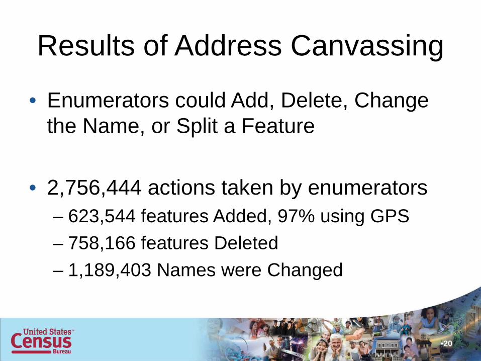
Results of Address Canvassing
• Enumerators could Add, Delete, Change the Name, or Split a Feature
• 2,756,444 actions taken by enumerators– 623,544 features Added, 97% using GPS– 758,166 features Deleted– 1,189,403 Names were Changed
•20
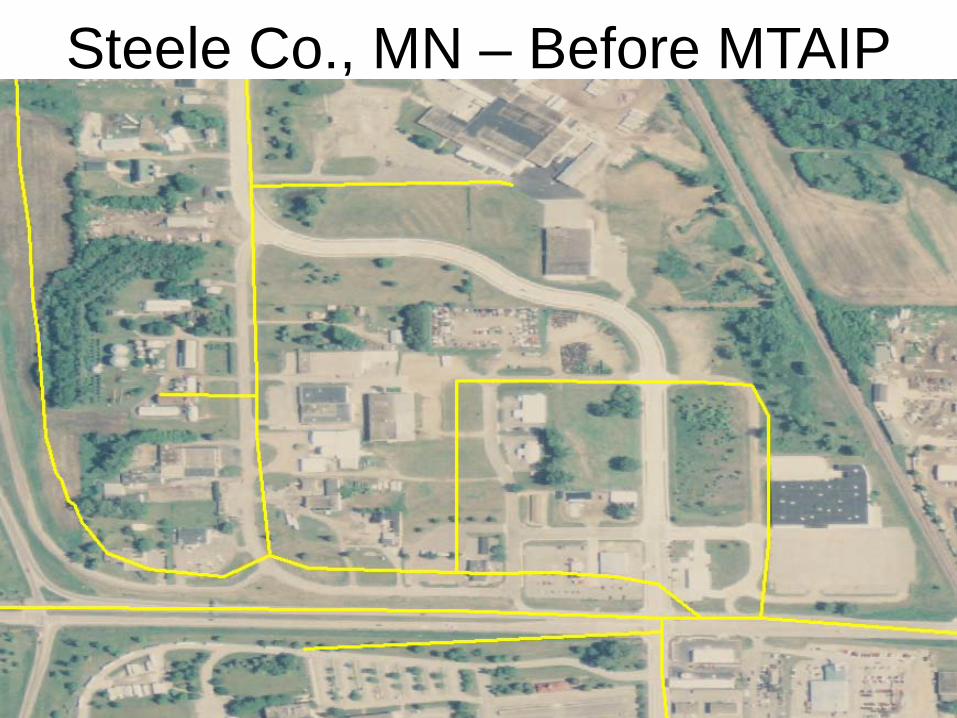
Steele Co., MN – Before MTAIP
•21

Steele Co., MN – After MTAIP
•22

Steele Co., MN – After AdCan
•23
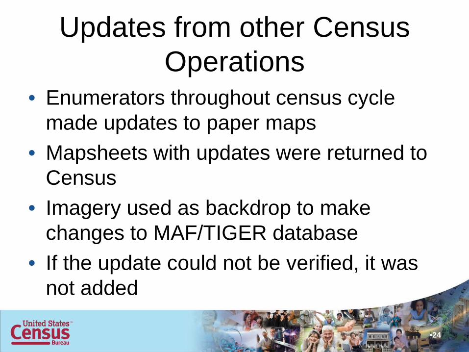
Updates from other Census Operations
• Enumerators throughout census cycle made updates to paper maps
• Mapsheets with updates were returned to Census
• Imagery used as backdrop to make changes to MAF/TIGER database
• If the update could not be verified, it was not added
•24
•Updates from other Census Operations
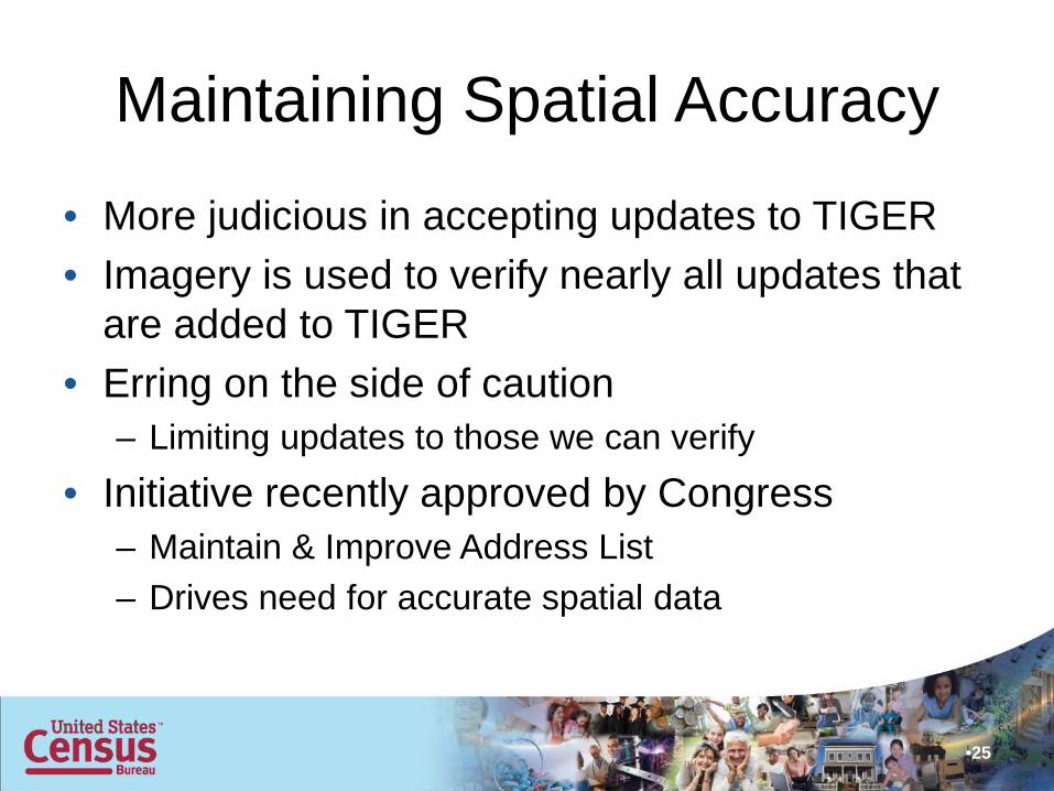
Maintaining Spatial Accuracy
• More judicious in accepting updates to TIGER• Imagery is used to verify nearly all updates that
are added to TIGER• Erring on the side of caution
– Limiting updates to those we can verify• Initiative recently approved by Congress
– Maintain & Improve Address List– Drives need for accurate spatial data
•25

2010 Census Geographic Products
• TIGER/Line Shapefiles• Cartographic Boundary Files• Reference Maps• Thematic Maps• Relationship Files• Geographic Reference• Tallies
•26

TIGER/Line Shapefiles• 2010 Census-based geography
– State and County Level (released)– National level (released)– ZCTAs (released)– Island Areas in summer 2011– Urban/Rural in mid-late 2012– 113th Congressional Districts in Jan. 2013– New CBSAs in mid 2013
• Releases timed with 2010 Census population data availability
•27

New TIGER/Line Shapefiles Features
• Individual Road, Rail, and Linear Water shapefiles– National Primary Roads– State Primary and Secondary Roads– County all Roads– National Rail – County Linear Water
• National Congressional Districts
•28
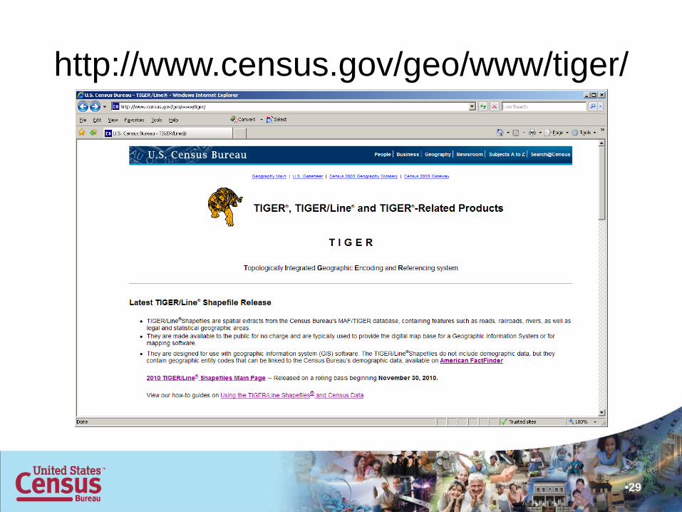
http://www.census.gov/geo/www/tiger/
•29
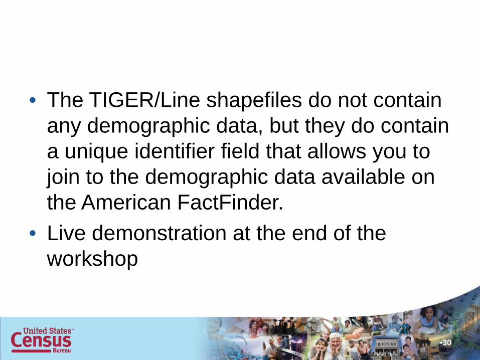
• The TIGER/Line shapefiles do not contain any demographic data, but they do contain a unique identifier field that allows you to join to the demographic data available on the American FactFinder.
• Live demonstration at the end of the workshop
•30
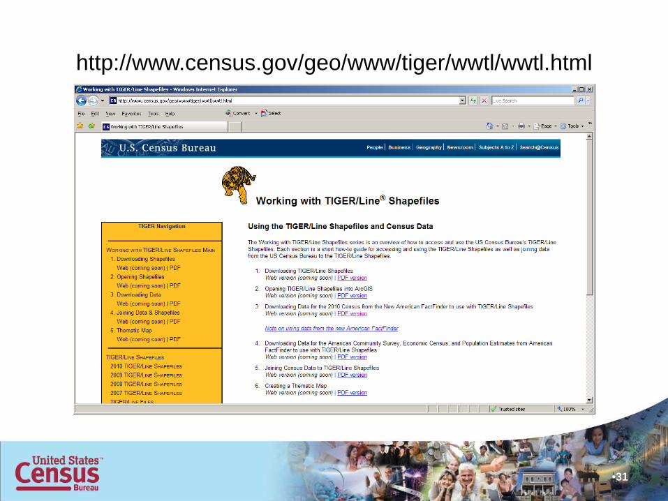
http://www.census.gov/geo/www/tiger/wwtl/wwtl.html
•31

TIGER/Line (T/L) Shapefile Vintages
• The demographic data source you are using determines the vintage of T/L you should use.– 2010 Decennial Census Data – use 2010 T/L
Shapefiles (2010 geography)– 2005-2009 American Community Survey (ACS) Data
– use 2009 T/L Shapefiles– 2009 Population Estimates Data – use 2009 T/L
Shapefiles• Easier next year!
– The 2006-2010 ACS data will use 2010 vintage geography
•32
American FactFinder (AFF)• Tool for downloading demographic data• Currently there are two systems but beginning in
the Fall everything will be moved to the new system– New AFF
• 2010 Decennial Census• http://factfinder2.census.gov/
– Legacy AFF• ACS • Population Estimates• Previous Decennial Censuses• http://factfinder.census.gov/
•33
Cartographic Boundary Files• Designed for small scale thematic mapping• Generalized files in shapefile format• Target scale range 1:500,000 to 1:5,000,000• Files are significantly smaller than the
TIGER/Line Shapefiles• Boundary Files are clipped to shoreline• Should not be used for area calculations,
geocoding, etc.• 2000 and 1990 geography available
– 2010 coming soon
•34

Cartographic Boundaries vs. TIGER/Line Shapefiles
•35

Reference Maps• County Block Maps (released)• Census Tract Outline Maps (released)• American Indian/Alaska Native Areas maps – Nov. 2011• County Wall Map – Nov. 2011• 113th Congressional District maps - Feb. 2013• Metropolitan and Micropolitan Statistical Areas – Jul.
2013
•36

Reference Map – Block Maps
•37
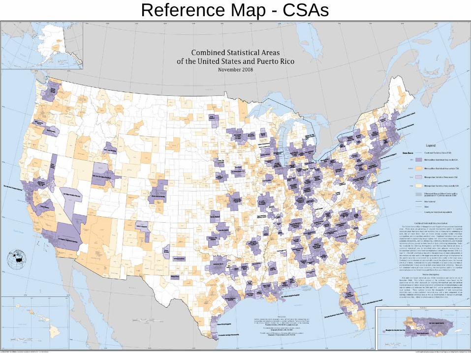
Reference Map - CSAs
•38

Thematic Maps
• Centers of Population (released)• Population Change, 2000-2010, by county
(released)• Loss and Gain of Seats in Congress by State
(released)• Population Density Map – (released)• Population Distribution (“Nighttime”) Map – Dec.
2011
•39

Thematic Map – Center of Population
•40

Thematic Map – Apportionment
•41

Relationship Files
• 2000 Tabulation Block to 2010 Collection Block (released)
• 2000 Tabulation Block to 2010 Tabulation Block (released)
• 2010 Collection Block to 2010 Tabulation Block (released)
• 2000 Census Tract to 2010 Census Tract (released)
•42

Geographic Reference• Gazetteer Files (released)
– Counties - Congressional districts– County subdivisions - Census tracts– Places - School Districts– State legislative districts
• Geographic Change Notes (released)• Geographic Terms and Concepts (released)• Block Assignment Files (released)
•43
Tallies
• Tallies of geographic entities by state (released)– Census tracts– Blocks
• 2000• 2010• Percent Change
•44

http://www.census.gov/geo/www/2010census/
•45
Exploring New Technology• Web Mapping Applications
– On-Line Census Geography Atlas– Download Maps & Shapefiles through map– Thematic Mapping
• Geo-Referenced PDF Maps– Incorporates layers that can be turned on and off– Dynamic Linking to other maps– Can be used as a background in a GIS– Meets needs in between paper map and full GIS
• TIGER/Line in additional formats– KML
•46
