geolo
TRANSCRIPT

NAME FAIZ MUHAMMAD
NADEEM HASSAN
ASSIGNMENT SOUTH AMERICA
SUBJECT GEOGRAPHY
SCHOOL OF ECONOMICS
QUAID E AZAM UNIVERSITY ISLAMBAD
0011

ContentsIntroduction
Climate
Energy issues
Internal and external threats
Economy
Minerals
Industries
Largest cities
0012

0013

Introduction
South America occupies the southern portion of the American landmass. The continent is generally delimited on the northwest by the Darién watershed along the Colombia–Panama border. Some sources[citation needed] instead suggest the Panama Canal. Geopolitically and geographically[4] all of Panama – including the segment east of the Panama Canal in the isthmus – is typically included in North America alone[5][6][7] and among the countries of Central America.[8][9] Almost all of mainland South America sits on the South American Plate. South America's triangular shape gives it the shortest coastline, for its size, of any of the continents.
Traditionally, South America also includes some nearby islands. Aruba, Bonaire, Curaçao, Trinidad, Tobago, and the federal dependencies of Venezuela sit on the northerly South American continental shelf and are often considered part of the continent. Geo-politically, the island states and overseas territories of the Caribbean are generally grouped as a part or subregion of North America, since they are more distant on the Caribbean Plate, even though San Andreas and Providencia are politically part of Colombia and Aves Island is controlled by Venezuela.[7][10][11] Other islands that are included with South America are the Galápagos islands that belong to Ecuador and Easter Island (in Oceania but belongs to Chile), Robinson Crusoe Island, Chiloé are also Chilean islands, while Tierra del Fuego is split between that country and Argentina. In the Atlantic, Brazil owns Fernando de Noronha, Trindade and Martim Vaz, and the Saint Peter and Saint Paul Archipelago, while the Falkland Islands are governed by the United Kingdom, whose sovereignty over the islands is disputed by Argentina. South Georgia and the South Sandwich Islands may be associated with either South America or Antarctica.[citation needed]
South America is home to the world's highest waterfall, Angel Falls in Venezuela; the largest river (by volume), the Amazon River; the longest mountain range, the Andes (whose highest mountain is Aconcagua at 6,962 m [22,841 ft]); the driest place on earth, the Atacama Desert;[12]
[13][14] the largest rainforest, the Amazon Rainforest; the highest capital city, La Paz, Bolivia; the highest commercially navigable lake in the world, Lake Titicaca; and, excluding research stations in Antarctica, the world's southernmost permanently inhabited community, Puerto Toro, Chile.
The Andes are the world's longest continental mountain range.
0014
South America's major mineral resources are gold, silver, copper, iron ore, tin, and petroleum. These resources found in South America have brought high income to its countries especially in times of war or of rapid economic growth by industrialized countries elsewhere. However, the concentration in producing one major export commodity often has hindered the development of diversified economies. The fluctuation in the price of commodities in the international markets has led historically to major highs and lows in the economies of South American states, often causing extreme political instability. This is leading to efforts to diversify production to drive away from staying as economies dedicated to one major export.
South America is one of the most biodiverse continents on earth. South America is home to many interesting and unique species of animals including the llama, anaconda, piranha, jaguar, vicuña, and tapir. The Amazon rainforests possess high biodiversity, containing a major proportion of the Earth's species.
Brazil is the largest country in South America, encompassing around half of the continent's land area and population. The remaining countries and territories are divided among three regions: The Andean States, the Guianas and the Southern Cone.
CLIMATE
South America Climate is predominantly wet and hot. However the large size of the continent makes the climate of South America varied with each region having its own characteristic weather conditions.
The other factors influencing the climate of South America are the geographical location, ocean currents and winds.
South America Climate differs from one region to another. The Amazon river basin has the typical hot wet climate suitable for the growth of rain forests. The temperature in the Amazon basin 70 to 90 degrees F. The Andes Mountains, on the other hand, remain cold throughout the year. The temperatures of the mountains is always very low.
The desert region is of Chile is the driest part of South America. The westerly winds carrying moisture shed their moisture on the western parts of the Andes, thus the eastern portions of the mountains receive very little rainfall. The cold Peru Current is responsible for the dry coastal parts of Peru as well as northern Chile. The cold current is unable to hold much moisture.
0015

The highest temperatures of South America have been recorded in Gran Chaco in Argentina, with temperatures going up to 110 degrees F. The wettest place is Quibdo in Columbia. It receives an annual rainfall of 350 inches(890 centimeters).
The four parts of South America which experience heavy rainfall are the Amazon River Basin, coastal parts of French Guiana, Guyana and Suriname, the southwestern parts of Chile and Columbia and Ecuador coasts.
A unique feature of South America Climate is the El Nino. Every two to seven years the cold dry Peru Current weakens and warm waters from the south rush along the coast in a southward direction. The El Nion affects the Climate of South America and causes heavy rainfall in the dry parts of South America.
IISD Publications Centre
ENERGY IN SOUTH AMERICA: The role of Brazil
» Adilson de Oliveira, IISD, 2010. Paper, 21 pages, copyright: IISD
South America has vast energy resources, both renewable and non-renewable. A net energy exporter, the region will play an important role in achieving global energy security over the next decades. Despite this, at present, the countries in the region are not able to guarantee adequate energy security for their domestic markets.
0016

This report explores Brazil’s role in the quest for energy security in South America. So far, the regional energy trade has been organized around bilateral agreements to export countries’ energy surpluses to their neighbours when necessary. The infrastructure needed to support these trade agreements was put in place in the 1990s, but there have been few advances in regional regulation systems and the pricing mechanisms needed to support the energy trade. The risk of cuts in the energy flows imported from neighbouring countries emerged in the new political and energy context of the 2000s. The perception that energy security is a matter to be dealt with in the domestic context has gained favour among governments in the region, despite the fact that the economic cost of this approach is high. Brazil, due to its central geographical position, the size of its energy market and the availability of both renewable and non-renewable domestic energy resources, has a decisive role to play in the promotion of regional energy flows in order to provide regional energy security.
Key points:
The risk of opportunistic behaviour in the regional energy trade increases the transaction costs of energy projects. Lower-cost solutions for energy supplies are ignored because of the perceived danger of supply cuts, and higher-cost solutions that eliminate such risks are adopted instead. Low-cost energy resources remain unexploited and infrastructure to facilitate the regional energy trade is lying idle.
The liberalization of the South American energy markets opened an important window of opportunity for economic efficiency gains largely associated with the convergence between energy and fuel markets in the energy systems of the region. Energy integration is a necessary mechanism for exploring these opportunities, as large natural gas reserves are located in the region’s economies with lower levels of industrialization and urbanization.
The regional diversities in hydrology and consumer behaviour offer good opportunities to explore the economic benefits of the cooperative use of power plants. The cost of electricity is reduced, the environment suffers lower impacts and the risk of power shortages diminishes. Unfortunately, however, energy integration faces political forces that do not recognize these economic benefits.
Due to its abundance of fossil fuels and its leadership in renewable energy, Brazil is well placed to smooth the transition to a low-carbon economy. Its central geographical position and market size would allow it to extend these attributes to the rest of South America through regional energy integration.
0017

South America’s position in the global process of energy transition will be largely determined by its capacity to secure the region’s energy supplies and to offer safe energy supplies to energy-importing countries outside South America. Access to consumer markets in these countries will create a favourable economic environment for attracting investments to the region, thus adding value to its vast energy resources, whether renewable or non-renewable.
Key recommendations:
In Brazil, in an attempt to contain the escalation in energy costs brought about by the search for energy security, the government has offered subsidies and is studying a proposal to renew hydropower plant concessions at prices much lower than their opportunity costs. These approaches will cause distortions in energy prices without solving the structural problem of energy supply security, and should therefore be abandoned.
Energy integration offers the opportunity for all the countries in the region to improve their energy security and their access to the Brazilian market for energy resources that would otherwise remain idle, as well as the opportunity to participate in the articulation of a productive chain for the energy system of the twenty-first century that is being established in Brazil.
The diversity of the energy situations and regulation regimes in the countries of the region requires integration to take place in stages. Access to neighbouring countries’ reserves in situations of energy supply insecurity should be the initial stage of the process. A treaty that provides the legal basis for contracts for the use of the Multilateral Energy Security Reserve (RMSE) can remove the risks associated with energy imports in these situations.
The RMSE treaty should lay down the economic and technical conditions that will allow free access to the required infrastructure and reserves needed to overcome energy supply insecurity in any country in the region whenever necessary. Economic access to the energy resources of the RMSE (energy price) and the necessary transport logistics (tariffs for the use of networks) should be based on the long-term supply costs of the various domestic markets. Brazil’s active participation in the formulation of the RMSE treaty is essential for the achievement of South American energy security and successful energy integration. Its central geographical position, its market size, its oil resources and its leadership in the renewable energy field make it the best candidate to manage the coordination of the competitive, secure integration of the South American energy market.
Energy integration faces significant obstacles, the greatest of which is the lack of a legal basis for private investment in the energy industry. The European Energy Charter sought to solve this problem by
0018

providing conditions and protection for private investments. This charter has not been accepted in South America, mostly because the dispute settlement system would be based outside the region. Since it is essential to have an institutional mechanism to settle regional disputes, the RMSE treaty needs to address this question.
security
External threats
Colombia does not face any known foreign threats. The only neighbor that might pose a potential military challenge over as-yet unresolved territorial disputes relating to the maritime boundary, where there may be oilfields, would be Venezuela. The two countries have not allowed the occasional security incidents involving Colombian guerrillas and paramilitaries along their long common border to escalate into a serious issue since both nations concluded a bilateral free-trade agreement in 1991.
The already strong cross-border trade links between Colombia and Venezuela were solidified in July 2004 with an agreement to build a US$200 million natural gas pipeline between the two countries. As a friendly gesture on that occasion, President Álvaro Uribe cancelled the planned purchase of French made AMX-30 tanks from Spain and their deployment on the border with Venezuela.
Internal threatsMain articles: Colombian Armed Conflict and Crime in Colombia
Despite endemic violence stemming from left-wing guerrilla activity, paramilitary groups, and drug traffickers, constitutional order and institutional stability have prevailed. Nevertheless, the country’s political and social foundations have been undermined by the violence and corruption associated with the enormous wealth created by the drug cartels. Most Colombian government institutions have a
Reputation for inefficient, corrupt, and bureaucratic management, with the notable exceptions of the Central Bank, Ministry of Finance, and some other agencies responsible for economic policy formulation.
Common crime is rampant and often carried out with impunity. Officially registered homicides in Colombia reached a historic record of 28,837 in 2002, but declined by 20 percent in 2003 to 23,013. The high homicide rate is also fueled by high unemployment, growing poverty, the ready availability of guns, and the growth of drug trafficking and organized crime. Criminal bands specializing in kidnapping, extortion, and robbery target businesses and civilians. Kidnapping exceeded a record 3,700 reported cases in 2000, but subsequently declined to 2,986 cases in 2002 as a result of improved law enforcement; the figure projected for 2003 was between 2,500 and 2,700. Guerrilla and paramilitary groups are responsible for about 68 percent of kidnappings and organized crime, about 32 percent.
Activities by foreign terrorist or drug-trafficking groups in Colombia have been minimal, consisting mostly of criminal activities involving Maicao-based Hezbollah members or international crime groups,
0019

such as the Russian Mafia, which was last reported to have supplied the Revolutionary Armed Forces of Colombia (Fuerzas Armadas Revolucionarias de Colombia—FARC) with sophisticated weapons in 2000. In 1998 an Islamic terrorist was deported for engaging in illegal transactions with the FARC.
Guerrillas
Two major guerrilla organizations, the Revolutionary Armed Forces of Colombia (Fuerzas Armadas Revolucionarias de Colombia—FARC) and the National Liberation Army (Ejército de Liberación Nacional—ELN), plus a smaller Popular Liberation Army (Ejército Popular de Liberación or EPL) group continue to be active. In 1996–98 the FARC and ELN extended their presence in the national territory and scored some strategic gains against the poorly led armed forces by besieging and easily overrunning isolated military garrisons. The Pastrana government responded in November 1998 by granting the FARC a 51,000-square-kilometer demilitarized zone (DMZ) in southeast Colombia as a concession in exchange for beginning peace talks. However, the FARC used the DMZ as a haven to increase illicit drug crops, transport military equipment and provisions, and negotiate kidnappings and extortions. After peace negotiations collapsed in early 2002, security forces retook the DMZ on February 20.
Until 2002, the armed conflict was fought primarily in the countryside. Since then, the FARC, having honed its remote-control bombing techniques with the aid of Europe-based terrorist groups, has expanded its operations to include occasional indiscriminate terrorist bombings and other attacks in Bogotá. Numerous bombings have been attributed to the FARC. One such bombing was the El Nogal club bombing in 2003. FARC itself denied that any of its members were involved in this attack.[1][2]
With the support of the United States, the administration of President Uribe has sought to professionalize the armed forces and to engage them more fully in the counterinsurgency war; as a result, the armed groups have suffered a series of setbacks. The president’s plan includes the formation of platoons of “peasant soldiers,” or locally recruited men, to provide guard duty around previously unguarded municipalities in support of the police and regular troops. By August 2004, more than 8,000 peasant soldiers had been recruited and trained, and plans called for increasing that number to 15,000 across the country by 2006.
In 2003 the FARC had an estimated force of as many as 18,000 active members plus a 5,000-member urban militia; the ELN had an estimated 3,500 members plus an urban militia; and the EPL had an estimated 500 members. In August 2003, under increasing pressure by the armed forces, the FARC and the ELN announced an alliance. This partnership had already been a reality in certain parts of the country where ELN and FARC units fought side by side, and has been broadened to include the whole country.
The alliance has not made any significant difference yet, but in the long term the two groups pose a much greater threat jointly than they do separately, as the military power of the FARC and the political strength of the ELN complement each other. At January 2009, estimates point that the policy of the Uribe Administration of demovilization promises and intense pressure from the Army has left half of the
00110
recruits the FARC had at the start of the decade. Calculations point 7,000 members, and each day more guerrilla fighters demovilize and leave FARC.
The Uribe government has rejected the guerrilla demands for prisoner exchanges and demilitarized zones as a precondition for peace talks. By 2004 stepped-up government actions against the guerrillas with the help of significant U.S. military aid had kept the guerrillas mostly withdrawn into the countryside, while government efforts to improve the economy and reduce cocaine production were showing results. Although it is generally believed that the left-wing guerrillas have little chance of taking power in Colombia, they continue to engage in terrorist activities.
Analysts believe that it would take years for the armed forces to make any significant progress in reducing the territory held by the armed groups, since the Uribe administration progress in this topic has progressed far beyond expectations, where at this point, FARC forces are in retreat plan to the jungles and are constantly attacked by the Colombian army.
Right-Wing Illegal Paramilitary Forces
Main article: Paramilitarism in Colombia
The largest paramilitary organization, the United Self-Defense Forces of Colombia (Autodefensas Unidas de Colombia—AUC), had an estimated 10,600 members. It operated as a loose confederation of disparate paramilitary groups, the largest of which was the Peasant Self-Defense Forces of Córdoba and Urabá (Autodefensas Campesinas de Córdoba y Urabá—ACCU). Other important paramilitary organizations that existed vefore the 2004 peace talks included the Cacique Nutibara Bloc (Bloque Cacique Nutibara—BCN), the Central Bolivar Bloc (Bloque Central Bolívar—BCB), and the Middle Magdalena Bloc (Bloque del Magdalena Medio—BMM). These groups are were involved in battling the guerrillas and terrorizing their supporters or sympathizers among the civilian population.
ECONOMYDuring the last two decades, South American countries have experienced significant economic
growth, which can be seen in many of these countries with the construction of new skyscrapers like the Gran Costanera tower in Chile, and also transportations systems like the Bogota Metro. However, because of histories of high inflation in nearly all South American countries, interest rates remain high and investment remains low. Interest rates are usually twice that of the United States. For example, interest-rates are about 22% in Venezuela and 23% in Suriname. The exception is Chile, which has been implementing free market economic policies since establishing military dictatorship in 1973 and has been increasing its social spending since the return of democratic rule in the early 1990s. This has led to economic stability and interest rates in the low single digits.
00111

South America relies heavily on the exporting of goods and natural resources. On an exchange rate basis Brazil (the seventh largest economy in the world and the largest in South America) leads the way in total amount of exports at $201.9 billion dollars followed by Argentina at 68.01 billion and Chile with 64.28 billion.[42]
The economic gap between the rich and poor in most South American nations is considered to be larger than in most other continents.[citation needed] In Venezuela, Paraguay, Bolivia and many other South
American countries, the richest 20% may own over 60% of the nation's wealth, while the poorest 20% may own less than 5%.[citation needed] This wide gap can be seen in many large South American cities where makeshift shacks and slums lie adjacent to skyscrapers and upper-class luxury apartments.
Agricultural products vary from items like a variety of fruits and vegetables, diary items, meat, livestock, fish and more. Raising beef for export is an important export commodity for Argentina, Uruguay, Paraguay and Colombia.
Amongst the tropical crops grown for domestic use and for export, coffee is the most important. It is produced mainly in the highlands of Brazil and in central and western Colombia. Cacao is also important and produced in the eastern Brazil and western Colombia regions.
Brazil is the world's second biggest producer of soybeans. Output has doubled over the past decade, as demand, particularly from China, has soared. Brazil produced 75.5 million tonnes of soybeans in 2010-11, 28.6% of the world total. Argentina is another important producer of soybeans, producing 49 milion tonnes during the same period, 18.6% of the world total.
Both Brazil and Argentina also produce corn, but severe drought during 2011 has significantly affected production of both corn and soybeans.
Sugar is produced for export in Peru, Guyana and Suriname. The sugarcane produced in most other parts, however, is mainly for domestic use only.
Peru produces cotton for export, as does eastern Brazil. Uruguay has been exporting wool and hides for many years and is reliant on these products.
In Argentina wool and hides are also produced for export and domestic use along with corn, linseed and weat
Forest situation
An estimated 1.115 million hectares were planted as of 2005. There are 33.2 million hectares (82 million acres) of additional land (native forest) for forestry. Out of this total, 20 million hectares (50 million acres) are high quality land for future development in Argentina. However, this vast amount of land is not easy to put into production due to its land tenure situation (the proliferation of owners holding areas of 5 to 10 hectares), legislation which protects native forests, and lack of infrastructure. If investors wish to expand their land for cultivation, the opportunity costs are substantial.[1]
00112

The growth of planted forests has increased dramatically since 1997 due to new investments (especially from Chile). The implementation of Law 25,008 in January 1999 has also been an important factor for growth in this sector. This law promotes and assists the forestry sector for a period of 10 years. Between 1990 and 2000, foreign and domestic investments surpassed US$ 1.5 billion. The forestry industry depends on both cultivated forests (85 percent) and native forests (15 percent). The major species cultivated in Argentina are pines and eucalyptus. In addition, species such as salix and populus are also cultivated in a smaller scale. Currently, there are no other species that have been introduced for cultivation in Argentina.[1]
The current plantation rate is estimated to be 50,000 hectares per year. It is also estimated that the consumption of wood products from cultivated forests is 5.3 million cubic meters, and sustainable wood supply to the year 2015 will be more than 20 million cubic meters. Argentina, however, is not a major consumer of wood products. For instance, wood is not commonly used in building construction. About 60 to 70 percent of wood product production is used for internal consumption (wood boards, plywood, cellulose pulp, etc) and the rest for exports.[1]
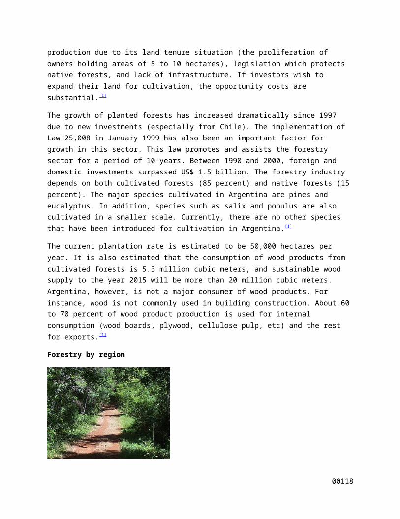
Forestry by region
A path in a jungle in Misiones with its characteristic red soil
Among the most important regions in Argentina for the industry are the provinces of Misiones, Corrientes, Entre Ríos, and Buenos Aires. These four provinces form the country's eastern border with Uruguay and Brazil, and comprise of 80% of the total cultivated area. [1]
Forests are composed of the following species:[1]
50% – Pine (Misiones, Corrientes, Entre Ríos, Patagonia, Central and Northwest areas of the country)
30% – Eucalyptus (Misiones, Corrientes, Entre Ríos, Buenos Aires, La Pampa, Santa Fe, Central and Northwest area of the country)
16% – Willow and aspen (Buenos Aires, Río Negro, Mendoza, Neuquén)
00113

4% – Other broad-leaved trees
The Argentine forestry sector has strengthened considerably in the last 15 years. The reasons behind this growth include:[1]
Great extensions of undeveloped land for the forestry industry at low prices that do not compete with other industries such as agriculture
The Law 25,080 which provides economic incentives and favorable investment environment for the industry (including fiscal stability)
No restrictions for foreign investment
During the 1990s, Argentina was a net importer of forestry products with high value-added (i.e. paper, cardboard, furniture, etc.) and a net exporter of primary and low value added goods (i.e. wood, cellulose pulp). This situation has changed especially after the currency devaluation in 2002 and foreign investment during the 1990s. Now, the country has begun producing a number of high value added products such as fiberboards and finished products such as furniture. Argentina is now in a position to become an important producer of forest products in the future. The industry is focusing on the production of more high value added products, and increasing rates of plantation.[1]
Pulp mill dispute
Main article: Pulp mill dispute between Argentina and Uruguay
There are also other issues that can make some aspects of the industry uncertain. Currently there is a dispute between Uruguay and Argentina over two cellulose plants that are being built on the Uruguayan side of the Río de la Plata, which forms the border between the two countries. This dispute began after Argentine environmentalists alleged that the plants would pollute the river that divides the two countries, and asserted that Uruguay had not provided the necessary information on the environmental impact of the plants. In protest, Argentine environmentalists blocked traffic on the Libertador General San Martín Bridge and General Artigas Bridge, the two main international bridges connecting the two countries. As of now, the Argentine and Uruguay government have not been able to resolve the issue. This impasse could possibly slow down the development and introduction of new technologies for the forestry sector. Such technologies are crucial to increase cultivated land and production. Argentina has the potential to become a major cluster for the worldwide industry, but more investment is necessary.[1]
.[1]
Tax benefits:[1]
o Tax stability for 30 to 50 years for companies with forestry investment projects
o Accelerated amortization of income taxes
o Accelerated return of value-added tax (21 percent)
00114

o Tax breaks on assets, real estate, sales, and gross income from state and municipal governments
o Accelerated depreciation of capital goods
Economic Support[1]
o The Argentine government will finance up to 100 percent for projects with 700 hectares, 50 percent for forests between 701 and 1,000 hectares, 30 percent for extensions between 1,001 and 2,000 hectare, and 15 percent for more than 2,001 hectares Support for projects focused in plantation of traditional species and enrichment of native forests
Production and trade
Argentina’s exports of forestry products began in the 1990s. However, as a producer of primary goods with low value added, the country experienced an overall trade deficit that ran from US$ 500 million to US$ 1 billion from 1992 to 2002. With the sharp devaluation of the peso in 2002, the exports of Argentine forest product were given a shot in the arm. Argentine goods became more attractive and exports began to increase, especially for high-value-added products. Between 2002 and 2004, exports increased from US$ 300 million to about US$ 700 million.[1]
Wood and Furniture
It is estimated that for one hectare of cultivated forest, the industry produces 400 tons of wood. Moreover, the average value of a cubic meter of wood boards from cultivated forests is US$ 70 to US$ 80. In some cases, there are boards that run between US$ 200 to US$ 250 and there is a small niche of specific types of boards with prices up to US$ 400. The area between Misiones, Corrientes, and Entre Ríos is the major producer of wood products, and represents 65 percent of the total production in Argentina.[1]
Cellulose Pulp
Argentina is the third biggest producer of cellulose pulp in Latin America. As of 2005, Argentina produced 1.5 million tons.
Paper Production
Argentina is the fourth largest producer of paper, paperboard and corrugated fiberboard in Latin America. As of the 2004, the sector produced about 1.4 million tons. The production experienced an increase of 11 percent compared to 2003. However, this production only satisfied 67 percent of domestic demand. The paper production in Argentina is primarily for packing (48 percent), printing (25 percent), and newspapers (13 percent).[1]
Atlantic dry forests
00115

The Atlantic dry forests cover an area of 115,100 square kilometers (44,400 sq mi), lying between the Cerrado savannas of central Brazil and the Caatinga dry shrublands of northeastern Brazil. The Atlantic dry forests stretch from northern Minas Gerais state across western Bahia state into central Piauí. The Atlantic dry forests generally lie along the upper São Francisco River of Minas Gerais and Bahia, and in the basin of the Gurguéia River in Piauí. A large enclave of Atlantic dry forest lies on the Chapada Diamantina of east-central Bahia.
The Atlantic dry forests
The Atlantic Forest (Portuguese: Mata Atlântica) is a region of tropical and subtropical moist forest, tropical dry forest, tropical savanna, semi-deciduous forest and mangrove forests which extends along the Atlantic coast of Brazil from Rio Grande do Norte state in the north to Rio Grande do Sul state in the south, and inland as far as Paraguay and the Misiones Province of Argentina. The Atlantic Forest is characterized by a high species diversity and endemism.[1] It was the first environment that the Portuguese conquerors encountered over 500 years ago when it was thought to have had an area of 1 to 1.5 million km2 and stretching an unknown distance inland.[2] Currently, the Atlantic Forest spans over 4000km2 along the coast of Brazil and in a small part of Paraguay and Argentina.[3][4] In Argentina, it is known as Selva Atlántica.
The Atlantic Forest region includes forests of several variations:
Restinga is a forest type that grows on stabilized coastal dunes. Restinga Forests are generally closed canopy short forests with tree density. Open Restinga is an open, savanna-like formation with scattered clumps of small trees and shrubs and an extensive layer of herbs, grasses, and sedges.[3]
Tropical moist forests are forests that receive more than 2000mm of rain a year. This includes Lowland Tropical Moist Forests, Submontane Tropical Moist Forest, and Montane Tropical Moist Forest.[3]
Tabuleiro forests are found over very moist clay soils and Tabuleiro Savannas occur over faster-draining sand soils.[3] These are humid areas that rely on water vapor from the ocean.[4]
Major Landforms Of SOUTH AMERICA AMAZON BASIN In short, the Amazon Basin (Amazonia) is covered by the largest tropical rain forest in the world,
and running through its heart is the Amazon River, and its more than 1,000 tributaries, seven of them more than 1,000 miles in length. Measurable rain falls on an average of 200 days a year, and total rainfall often approaches 100 inches per year.
The overall basin drains over 2,700,000 sq. miles, and covers about one-third of the South
American landmass. Rising high in the Andes, the river's network irrigates almost half of the continent, and in terms of volume of water discharged into an ocean... it's the largest in the world.
00116

ANDES This toothy-edged, massive mountain system extends from the tip of South America all the way
to Panama. It's the source of most major rivers on the continent and is 4,500 miles (7,240 km) in length. It's home to some of the planet's largest volcanoes, and in the far south along the coast of Chile, large ice sheets are commonplace.
The Andes and its many ranges include dozens of peaks that reach over 20,000 ft., with the
highest point being Aconcagua in Argentina, at 22,384 ft. (6,960m). ATACAMA DESERT Sparsely populated and running high into the Andes of Chile, this somewhat small desert (or
plateau) is a cold place and rainfall is very rare. It's approximately 100 miles wide and 625 miles long. The landscape is totally barren and
covered with small borax lakes, lava flow remnants and saline deposits. BRAZILIAN HIGHLANDS This highland region - about 800 miles in length - runs through the Brazilian states of Minas
Gerais, Goias, Bahia and Sao Paulo in southeastern Brazil. The magnificent landscape includes varied mountain ranges, namely the Serra de Mantiquiera, Serra do Paranapiataba, Serra Geral, and Serra do Mar.
South America Mountains, the term conjures up the image of the snow capped peaks of the
Andes standing tall among the topographical features of South America. The Andes Mountains is the most massive mountain ranges of South America with a large number of very high peaks.
South American continent consists of 12 countries. Located at the southernmost corner of the
world, Punta Arenas is a city in South America. Amazon, the largest river in the world is also situated in the South American continent. Your
South America vacation can include a visit to the rainforests of this continent. South American continent is connected to the continent of North America by the narrow cape of Panama and includes few island groups.
Falklands or the Malvinas Islands are few of the prominent islands that are considered part of
the continent of South America. The Andes is the most prominent mountain range of South America. The extension of the Andes
is also greater than any other mountain system of the world. The narrow belt of the three
00117
connected ranges of the Andes stretch from the Caribbean Sea to the Tierra del Fuego island, more than 8000km in length.
The Andes Mountains of South America were formed during the Cretaceous Period due to the
movements of the tectonic plates. The sedimentary layers of the earth's crust make up the folds of the mountains. The living South America Mountains still experience earthquakes and volcanic eruptions. The three parts of the Andes are the northern arc made up of three parallel ranges, Cordillera Occidental, Cordillera Central and Cordillera Oriental; the central part with two ranges enclosing within them Altiplano, a vast plateau; and the southern part, the lower regions. The highest peak of South America is Aconcagua in Argentina with a height of 6,960m.
The rivers on the east of the Andes are fed by the moisture bearing westerly winds and feed the Amazon, the Orinoco and other rivers. Among the lakes in the Andes is Lake Titicaca, in the plateau of the Andes.
The Sierra Nevada de Santa Marta is another mountain range of South America. Forest AMAZON JUNGLE is a moist broadleaf forest that covers most of the Amazon Basin of
South America. This basin encompasses seven million square kilometers (1.7 billion acres), of which five and a half million square kilometers (1.4 billion acres) are covered by the rainforest. This region includes territory belonging to nine nations. The majority of the forest is contained within Brazil, with 60% of the rainforest, followed by Peru with 13%, Colombia with 10%, and with minor amounts in, Venezuela, Ecuador, Bolivia, Guyana, Suriname and French Guiana. States or departments in four nations contain "Amazonas" in their names. The Amazon represents over half of the planet's remaining rainforests, and it comprises the largest and most species-rich tract of tropical rainforest in the world
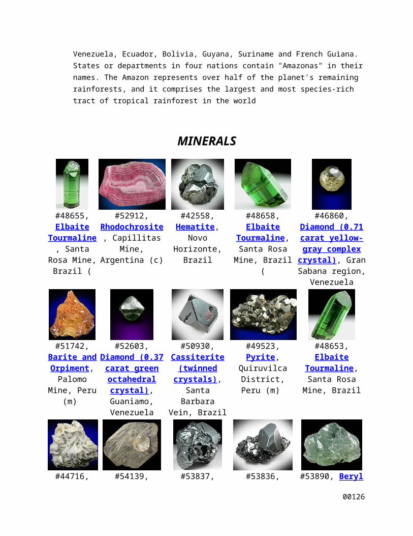
MINERALS
#48655, Elbaite
Tourmaline, Santa Rosa
Mine, Brazil (
#52912, Rhodochrosite, Capillitas Mine,
Argentina (c)
#42558, Hematite, Novo Horizonte, Brazil
#48658, Elbaite Tourmaline, Santa Rosa Mine, Brazil (
#46860, Diamond (0.71 carat yellow-
gray complex crystal), Gran Sabana region,
Venezuela
00118
#51742, Barite and Orpiment,
Palomo Mine, Peru (m)
#52603, Diamond (0.37 carat green
octahedral crystal), Guaniamo,
Venezuela
#50930, Cassiterite (twinned
crystals), Santa Barbara Vein,
Brazil
#49523, Pyrite, Quiruvilca District,
Peru (m)
#48653, Elbaite Tourmaline, Santa Rosa Mine, Brazil
#44716, Barite,
Quiruvilca District, Peru
(m) $18
#54139, Quartz with Rutile inclusions (Rutilated
Quartz), Novo Horizonte, Brazil
(m) $28
#53837, Hematite, Itabira
District, Brazil (m) $60
#53836, Hematite, Itabira District, Brazil (m) $55
#53890, Beryl var. Aquamarine, Brazil
(t) $16
#53931, Sphalerite
and Quartz, Julcani
District, Peru (c) $45
#53904, Quartz var. Rose Quartz Crystals, Lavra da
Ilha, Taquaral, Brazil (t) $32
#54376, Orpiment,
Palomo Mine, Peru (m) $125
#53957, Beryl var. Etched
Aquamarine, Divino das
Laranjeiras, Brazil (m) $225
#54064, Sphalerite, Andradite, Quartz,
El Mochito Mine, Honduras (c) $125
#53969, Stibnite, Tuco
Mine, Peru (m) $30
#53919, Cassiterite, Itinga,
Brazil (t) $38
#54915, Andradite
Garnet with Quartz and Calcite, El
#49913, Kyanite in Quartz, Barra do
Salinas, Brazil (c) $55
#51510, Elbaite Tourmaline, Xia Mine, Sao Jose do
Safira, Brazil (c) $175
00119

Mochito Mine, Honduras (c) $95
#54578, Beryl var.
Morganite, Coronel
Murta, Brazil (m) $175
#54865, Spodumene var. Hiddenite, Brazil
(t) $26
#54872, Beryl var.
Aquamarine, Brazil (t) $16
#54863, Beryl var. Aquamarine, Brazil (t) $35
#55011, Anatase with Gorceixite,
Datas, Brazil (t) $65
#54958, Topaz (flawless gem-grade crystal),
Tres Barras Mine, Teofilo Otoni,
Brazil (m) $165
#54963, Brazilianite with Muscovite, Lavra do Corrego Frio,
Brazil (Type Locality for Brazilianite)
(t) $225
#54890, Rhodochrosite,
Morococha District, Peru
(c) $125
#43860, Beryl var. Emerald in Calcite, La Pita Mine,
Colombia (m) $750
#48153, Quartz (Japan-law twins), Mundo Nuevo Mine,
Peru (lc) $450
#43722, Spodumene, Brazil (c) $1250
00120

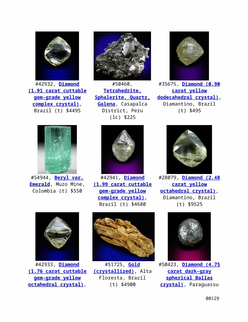
#42932, Diamond (1.91 carat cuttable gem-grade yellow
complex crystal), Brazil (t) $4495
#50460, Tetrahedrite, Sphalerite, Quartz, Galena,
Casapalca District, Peru (lc) $225
#35675, Diamond (0.90 carat yellow dodecahedral crystal),
Diamantino, Brazil (t) $495
#54944, Beryl var. Emerald, Muzo Mine, Colombia
(t) $550
#42941, Diamond (1.99 carat cuttable gem-grade yellow
complex crystal), Brazil (t) $4680
#28079, Diamond (2.48 carat yellow octahedral crystal), Diamantino, Brazil (t) $9525
#42933, Diamond (1.76 carat cuttable gem-grade yellow octahedral crystal), Brazil
(t) $4150
#51725, Gold (crystallized), Alta Floresta, Brazil (t) $4900
#50423, Diamond (4.75 carat dark-gray spherical Ballas crystal), Paraguassu River
District, Brazil (t) $710
00121

#49616, Quartz var. Amethyst with Calcite, Alto
Uruguai, Brazil (lc) $225
#53812, Spodumene var. Hiddenite, Brazil (c) $450
#51491, Bournonite, Sphalerite, Quartz, Pyrite,
Pachapaqui District, Peru (lc)
#53100, Beryl var. Emerald with Pyrite, Chivor Mine,
Colombia (t)
#43860, Beryl var. Emerald in Calcite, La Pita Mine,
Colombia (m)
Industries
Braz NATURAL RESOURCES, AGRICULTURE, INDUSTRIES
Natural Resources: Iron Ore, Manganese, Bauxite, Nickel, Uranium, Gems, Petroleum, Phosphates, Tin, Gold, Platinum, Timber, Hydroelectric Power, Granite, Limestone, Clay,
Sand..
Agriculture: Sugarcane, Corn, Cassava, Soybeans, Oranges, Wheat, Dry Beans, Coffee, Cotton, Tomatoes, Potatoes, Cocoa, Peanuts, Rice, Beef, Cattle, Pork.
Major Industries: Iron & Steel, Chemicals, Petrochemicals, Machinery, Vehicles, Consumer Goods, Cement, Wood Products, Shipbuilding, Metal Products, Fertilizer, Foodstuffs, Textiles,
Clothing, Paper Products, Plastics, Pharmaceuticals.
IMPORTS & EXPORTS
00122
Major Imports: Minerals, Petroleum, Chemicals, Fertilizers, Machinery, Vegetables, Animal Products, Cereals, Electrical Products, Electronics, Vehicles, Metals, Photographic Apparatus,
Surgical Instruments, Scientific Equipment. Major Exports: Processed Foods, Cocoa Beans, Seeds, Juices, Fruit Products, Meat, Animal Products, Vegetables, Metals, Vehicles, Machinery, Animal Feed, Textiles, Footwear, Petroleum
Products.
Balance of Trade: $16,112,000,000 (1989) il
Argentina
Argentina is the second largest country in South America, to the east of Andes Mountain range. It occupies an area of 3,761 million square kilometers. The highest point is in Mendoza province at Cerro Aconcagua 7,010 meters above sea level.
Food industries, motor vehicles, textiles, chemicals and petrochemicals and steel are the major industries in Argentina.
Argentine exports valued USD 70,589 billion in 2009, while imports reached USD 57,413 billion in 2008. Food exports include cereals, oils, flour, beef and fruits.
Bolivia
Bolivia has many industry sectors, with oil and natural gas playing a major part in the economy of the country. Other industry sectors found in the Bolivian economy are mining, smelting, food and beverages, agriculture, tobacco, handicrafts and clothing. The agriculture sector consists of many products which include soybeans, coffee, coca, cotton, corn, sugarcane, rice, potatoes and timber.
Peru
Peru industriesinclude textile industry, mineral industry, food industry, etc. Peru has various kinds of industries. Some of the Peru industries are-
Mineral Industry Iron and Steel Industry Petroleum Industry Fishing Industry Textile Industry Food Industry
The development of modern industries of Perumainly took place after World War II. Before that time Peru industries were absorbed in mineral products, agricultural products, manufacturing textile and leather products. Between the year 1950 and 1980 the contribution of Peru Industries towards domestic production raised from 13.6 % to 24.5 %. Over the last 40
00123

years industrial development comprehended a large number of industries in Peru.
The manufacturing products of Peru Industries include electronic products, engineering products, tobacco products, rubber products, plastic products, etc. Around 70 % of the Peruvian industry is focused on in the metropolitan region of Lima. The main trading collaborators of Peru are the United States, Japan, Germany and Argentina.
Most of the factories of Peru are situated within the greater Lima region. The mining industry of Peru is very large. Minerals like coal, silver, iron ore, gold, etc. are drawn out from Peru's mining industry.
Fish meal, cotton, coffee, minerals and sugar are the chief export items of Peru and motor vehicles, machinery, food, chemicals and metals are the chief import items of Peru.
Chile
Forestry
The Chilean forestry industry grew to comprise 13% of the country’s total exports in 2005, making it one of the largest export sectors for Chile.[22] Radiata Pine and Eucalyptus comprise the vast majority of Chile's forestry exports.[22] Within the forestry sector, the largest contributor to total production is pulp, followed by wood-based panels and lumber.[22] Due to popular and increasing demands for Chile’s forestry products, the government is currently focusing on increasing the already vast acreage of Chile’s Pine and Eucalyptus plantations as well as opening new industrial plants.[22]
Mining
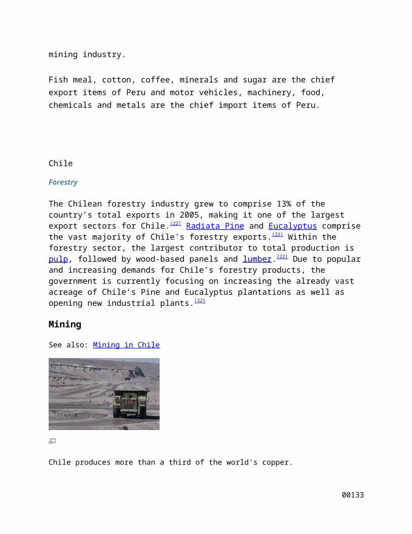
See also: Mining in Chile
Chile produces more than a third of the world's copper.
00124
The mining sector in Chile is one of the pillars of Chilean economy. The Chilean government strongly supports foreign investment in the sector and has modified its mining industry laws and regulations to create a favorable investing environment for foreigners. Thanks to a large amount of copper resources, progressive legislation and a healthy investment environment, Chile has become the copper mining capital of the world, producing over 1/3 of the global copper output.[22]
Major Landforms
of SOUTH AMERICA
AMAZON BASIN
In short, the Amazon Basin (Amazonia) is covered by the largest tropical rain forest in the world, and running through its heart is the Amazon River, and its more than 1,000 tributaries, seven of them more than 1,000 miles in length. Measurable rain falls on an average of 200 days a year, and total rainfall often approaches 100 inches per year.
The overall basin drains over 2,700,000 sq. miles, and covers about one-third of the South American landmass. Rising high in the Andes, the river's network irrigates almost half of the continent, and in terms of volume of water discharged into an ocean... it's the largest in the world.
ANDES
This toothy-edged, massive mountain system extends from the tip of South America all the way to Panama. It's the source of most major rivers on the continent and is 4,500 miles (7,240 km) in length. It's home to some of the planet's largest volcanoes, and in the far south along the coast of Chile, large ice sheets are commonplace.
The Andes and its many ranges include dozens of peaks that reach over 20,000 ft., with the highest point being Aconcagua in Argentina, at 22,384 ft. (6,960m).
00125
ATACAMA DESERT
Sparsely populated and running high into the Andes of Chile, this somewhat small desert (or plateau) is a cold place and rainfall is very rare.
It's approximately 100 miles wide and 625 miles long. The landscape is totally barren and covered with small borax lakes, lava flow remnants and saline deposits.
BRAZILIAN HIGHLANDS
This highland region - about 800 miles in length - runs through the Brazilian states of Minas Gerais, Goias, Bahia and Sao Paulo in southeastern Brazil. The magnificent landscape includes varied mountain ranges, namely the Serra de Mantiquiera, Serra doParanapiataba, Serra Geral, and Serra do Mar.
The estimated highest point is 7,368 ft (2,245m).
Mountains
South America Mountains, the term conjures up the image of the snow capped peaks of the Andes standing tall among the topographical features of South America. The Andes Mountains is the most massive mountain ranges of South America with a large number of very high peaks.
South American continent consists of 12 countries. Located at the southernmost corner of the world, Punta Arenas is a city in South America.
Amazon, the largest river in the world is also situated in the South American continent. Your South America vacation can include a visit to the rainforests of this continent. South American continent is
00126

connected to the continent of North America by the narrow cape of Panama and includes few island groups.
Falklands or the Malvinas Islands are few of the prominent islands that are considered part of the continent of South America.
The Andes is the most prominent mountain range of South America. The extension of the Andes is also greater than any other mountain system of the world. The narrow belt of the three connected ranges of the Andes stretch from the Caribbean Sea to the Tierra del Fuego island, more than 8000km in length.
The Andes Mountains of South America were formed during the Cretaceous Period due to the movements of the tectonic plates. The sedimentary layers of the earth's crust make up the folds of the mountains. The living South America Mountains still experience earthquakes and volcanic eruptions. The three parts of the Andes are the northern arc made up of three parallel ranges, Cordillera Occidental, Cordillera Central and Cordillera Oriental; the central part with two ranges enclosing within them Altiplano, a vast plateau; and the southern part, the lower regions. The highest peak of South America is Aconcagua in Argentina with a height of 6,960m.
The rivers on the east of the Andes are fed by the moisture bearing westerly winds and feed the Amazon, the Orinoco and other rivers. Among the lakes in the Andes is Lake Titicaca, in the plateau of the Andes.
The Sierra Nevada de Santa Marta is another mountain range of South America.
River
he Amazon River is the principal river of South America.
Amazon River, (Portuguese and Spanish: Amazonas), one of the great rivers of the world and the chief river of South America. With a length of about 4,000 miles (6,400 km), it is the second
00127

longest river in the world, exceeded only by the Nile. The Amazon's flow is by far the world's largest.
Tributaries and Basin
Thousands of rivers flow, directly or indirectly, into the Amazon, draining parts of Bolivia, Brazil, Colombia, Ecuador, Guyana, Peru, and Venezuela. The longest tributary is the 2,100-mile (3,380-km) Madeira River; other major tributaries include the Negro, Tapajós and Xingu. Many tributaries have falls and rapids that impede navigation. The Amazon river system is joined to the Orinoco system by the Casiquiare River in Venezuela.
Essequibo,
the largest river in Guyana. Its source is in the Guiana Highlands on the Brazilian border. The river flows 600 miles (965 km) north past Bartica and Parika. Its island-dotted estuary, 20 miles (32 km) wide, runs into the Atlantic northwest of Georgetown. The river has numerous rapids and falls but is navigable for ocean ships for about 50 miles (80 km), up to Bartica. The Essequibo is an important route from the interior.
Casiquiare
River, also Cassiquiare River and Canal Casiquiare, a river linking the Orinoco and Amazon river systems of South America. The Casiquiare branches from the Orinoco in southern Venezuela and flows south westward about 220 miles (350 km) through flat marshy land to the Rio Negro, a principal tributary of the Amazon.
Apurá
River, a river in South America. It is called the Caquetá in Colombia. The length is estimated at 1,700 miles (2,740 km). From its source in the Colombian Andes, the river flows southeastward into Brazil, where it is navigable. It joins the Amazon River through channels that flood seasonally to form lakes.
Japurá
River, a river in South America. It is called the Caquetá in Colombia. The length is estimated at 1,700 miles (2,740 km). From its source in the Colombian Andes, the river flows southeastward into Brazil, where it is navigable. It joins the Amazon River through channels that flood seasonally to form lakes.
00128
Madeira River, a main tributary of the Amazon River. It begins at the junction of the Mamore and Beni rivers and flows generally northeastward through Brazil, reaching the Amazon 90 miles (145 km) east of Manaus.
The Magdalena River
Magdalena River, the main river of Colombia, South America. From southwestern Colombia it flows about 1,000 miles (1,600 km) northward to the Caribbean Sea—past Neiva, Girardot, and the port of Barranquilla.
The Maipo River
Maipo River, a river in central Chile. It flows 155 miles (249 km) westward from the Andes Mountains to the Pacific Ocean.
The Napo River
Napo River, a tributary of the Amazon. It begins in the Andes Mountains of central Ecuador, flows southeastward into Peru, and enters the Amazon 50 miles (80 km) north of Iquitos.
The Orinoco River
Orinoco River, one of the great rivers of South America. It flows through the northern part of the continent, draining parts of Venezuela and Colombia.
The Paraguay River
Paraguay River, a river in central South America. From its source on the Mato Grosso Plateau in southwestern Brazil it flows generally southward through Paraguay to join the Paraná River just north of Corrientes, Argentina.
The Parana River
Paraná River (Spanish, a river in southeastern South America. It is formed by the union of the Grande and Paranaíba rivers in southern Brazil.
00129

Paranaíba River, a river in eastern South America. Its source is in east-central Brazil, and it flows west and southwest for about 500 miles (800 km), uniting with the Grande in southern Brazil to form the Paraná River.
The Pilcomayo River
Pilcomayo River, a river in central South America. It begins in the Andes Mountains of western Bolivia, and flows southeastward 700 miles (1,100 km) to join the Paraguay River at Asunción, Paraguary.
The Purus River
Purus River, a tributary of the Amazon River in central South America. It begins as the Alto (upper) Purús in the Peruvian Andes and flows northeastward for about 1,800 miles (2,900 km).
The Putumayo River
Putumayo River, (in Brazil: Iĉa, a tributary of the Amazon River in east-central South America.
The Rio de La Plata
La Plata, Río de, a body of water forming the major indentation on the Atlantic coast of South America.
The Rio Negro
Rio Negro, a river and important tributary of the Amazon River in South America. It begins at the junction of the Guainía and Casiquiare rivers on the Colombia-Venezuela boundary and forms the boundary between those two countries as it flows southward into Brazil.
The Sao Francisco River
São Francisco River, a major river in eastern Brazil, the longest entirely within the country.
00130

The Tapajos River
Tapajos River, a principal tributary of the Amazon River. The Tapajos is formed by the junction of the Juruena and Teles Pires (Sao Manuel) rivers in nort-central Brazil and flows some 500 miles (800 km) northeastward to the Amazon at Santarem.
The Ucayali River
Ucayali River, a river in eastern and northern Peru, and one of the main headstreams of the Amazon River.
Deserts
The Atacama Desert (Spanish: Desierto de Atacama) is a plateau in South America, covering a 600-mile (1,000 km) strip of land on the Pacific coast, west of the Andes mountains. It is, according to NASA, National Geographic and many other publications, the driest desert in the world.[1][2][3][4] The Atacama occupies 40,600 square miles (105,000 km2)[5] in northern Chile, composed mostly of salt basins (salares), sand, and felsic lava flows towards the Andes.
The Atacama Desert ecoregion, as defined by the World Wide Fund for Nature (WWF), extends from a few kilometers south of the Peru-Chile border to about 30° south latitude.[6] To the north lies the Peruvian Sechura Desert ecoregion, whilst to the south is the Chilean Matorral ecoregion.
The National Geographic Society, by contrast, considers the coastal area of southern Peru to be part of the Atacama Desert.[7][8] It includes in this definition the deserts south of the Ica Region in Peru.
To the east lies the less arid Central Andean dry puna ecoregion. The drier portion of this ecoregion is located south of the Loa River between the parallel Sierra Vicuña Mackenna and Cordillera Domeyko. To the north of the mentioned river lies the Pampa del Tamarugal.
The Patagonian Desert, also known as the Patagonia Desert or the Patagonian Steppe, is the largest desert in Argentina and is the 7th largest desert in the world by area, occupying 673,000 square kilometers (260,000 mi²). It is located primarily in Argentina with small parts in Chile and is bounded by the Andes, to its west, and the Atlantic Ocean to its east, in the region of Patagonia, southern Argentina. To the north the desert grades into the semi-arid Cuyo Region
00131
and the Dry and Humid Pampas. The central parts of the steppe are dominated by shrubby and herbaceous plant species albeit to the west, where precipitation is higher, bushes are replaced by grasses.[1] Topographically the deserts consist of alternating tablelands and massifs dissected by river valleys and canyons. The more western parts of the steppe host lakes of glacial origin and grades into barren mountains or cold temperate forests along valleys.
Inhabited by hunter-gatherers since Pre-Hispanic times the desert faced in the 19th century migration of Mapuches, Chileans, Argentines, Welshs and other European peoples transforming it from a conflictive borderland zone to an integral part of Argentina with cattle, sheep and horse husbandry being the primary land use.
La Guajira Desert is located in the northernmost part of Colombia, 610 km (380 mi) north of Bogota, in the La Guajira Department, covering most of La Guajira Peninsula including Venezuelan territory. The area holds immense coal reserves, exploited in a zone known as El Cerrejon. The area is also home to the indigenous Wayuu people and a variety of desert flora and fauna.
The National Natural Park of Macuira is located in the La Guajira Desert and is a tropical oasis. It has been a national park since 1977. The park covers 25,000 hectares (62,000 acres) in La Guiajira’s only mountain chain, and ranges in altitude from 0 to 450 metres (1,480 ft). It has a warm climate of about 27 °C (81 °F).
Largest cities
This list features the most populated cities in South America, considering the city proper only. See the article on each city for sources.
00132
00133
Ranking Name Country Population
1 São Paulo Brazil 10,886,518
2 Bogotá Colombia 6,840,116
3 Lima Peru 6,321,173
4 Rio de Janeiro Brazil 6,093,472
5 Caracas Venezuela 5,576,000
6 Santiago Chile 5,428,590
7 Maracaibo Venezuela 4,163,670
8 Buenos Aires Argentina 3,776,138
9 Salvador da Bahia Brazil 2,892,625
10 Valencia Venezuela 2,585,202
11 Brasília Brazil 2,455,903
12 Fortaleza Brazil 2,431,415
13 Belo Horizonte Brazil 2,412,937
14 Medellín Colombia 2,214,494
15 Cali Colombia 2,119,908
16 Guayaquil Ecuador 1,985,379
17 Curitiba Brazil 1,797,408
18 Córdoba Argentina 1,613,211
19 Manaus Brazil 1,612,475
20 Barquisimeto Venezuela 1,600,000
21 Recife Brazil 1,533,580
22 Porto Alegre Brazil 1,420,667
23 Belém Brazil 1,408,847
24 Quito Ecuador 1,399,378
25 Rosario Argentina 1,325,090
26 Montevideo Uruguay 1,303,182
27 Maracay Venezuela 1,302,000
28 Goiânia Brazil 1,244,645
29 Guarulhos Brazil 1,236,192

GDP (PPP) per capita
Rank Country2009 GDP per capitaUS dollars (World Bank)
1 Argentina 14,559
2 Chile 14,331
3 Uruguay 13,208
4 Venezuela 12,341
5 Brazil 10,427
6 Colombia 8,870
7 Suriname 8,800
8 Peru 8,600
9 Ecuador 7,300
11 Bolivia 4,600
10 Paraguay 4,100
12 Guyana 3,900
00134

Countries with its population and area
Country orterritory with flag
Area(km²)[35] (per sq mi)
Population(July 2009 est.)
[35]
Population densityper km²
Capital
Argentina2,766,890 km2 (1,068,300
sq mi)40,482,000 14.3/km² (37/sq mi) Buenos Aires
Bolivia1,098,580 km2 (424,160
sq mi)9,863,000
8.4/km² (21.8/sq mi)
La Paz and Sucre [36]
Brazil8,514,877 km2 (3,287,612
sq mi)191,241,714 22.0/km² (57/sq mi) Brasília
Chile [37] 756,950 km2 (292,260
sq mi)16,928,873 22/km² (57/sq mi) Santiago
Colombia1,138,910 km2 (439,740
sq mi)45,928,970
40/km² (103.6/sq mi)
Bogotá
Ecuador 283,560 km2 (109,480
sq mi)14,573,101
53.8/km² (139.3/sq mi)
Quito
Falkland Islands (United Kingdom)[38]
12,173 km2
(4,700 sq mi)3,140[39] 0.26/km²
(0.7/sq mi)Port Stanley
French Guiana (France) 91,000 km2 (35,000
sq mi)221,500[40] 2.7/km² (5.4/sq mi) Cayenne
Guyana 214,999 km2 (83,012
sq mi)772,298 3.5/km² (9.1/sq mi) Georgetown
Paraguay 406,750 km2 (157,050
sq mi)6,831,306
15.6/km² (40.4/sq mi)
Asunción
Peru 1,285,220 km2 (496,230 29,132,013 22/km² (57/sq mi) Lima
00135

Country orterritory with flag
Area(km²)[35] (per sq mi)
Population(July 2009 est.)
[35]
Population densityper km²
Capital
sq mi)
South Georgia andSouth Sandwich Islands (United Kingdom)[41]
3,093 km2 (1,194 sq mi) 20 0/km² (0/sq mi) Grytviken
Suriname 163,270 km2 (63,040
sq mi)472,000 3/km² (7.8/sq mi) Paramaribo
Uruguay 176,220 km2 (68,040
sq mi)3,477,780
19.4/km² (50.2/sq mi)
Montevideo
Venezuela 912,050 km2 (352,140
sq mi)26,814,843 30.2/km² (72/sq mi) Caracas
Total 17,824,513 385,742,554 21.5/km²
00136