geometricalgeodesy thomas h. meyer, ph.d. department of natural resources management &...
TRANSCRIPT
GeometricalGeodesy
Thomas H. Meyer, Ph.D.
Department of Natural Resources Management & Engineering
University of Connecticut

Surveying is…
“Measuring distance, angles, heights, etc., to determine the relative locations of points on the Earth” -- NGS Glossary.
what you do to make a map applied trigonometry
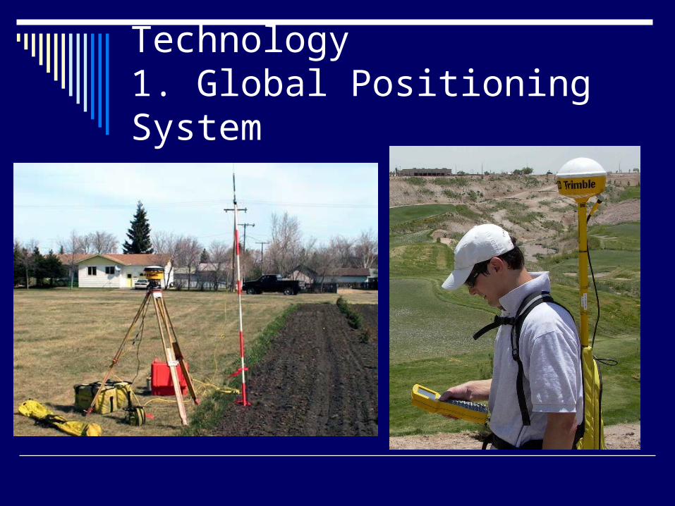
Technology1. Global Positioning System
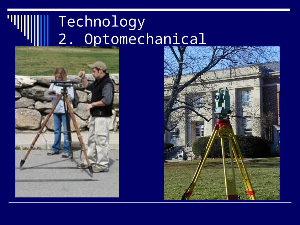
Technology2. Optomechanical

The job is to
collect observations of features to be mapped and thereby determine their coordinates
observations are things, such as angles and distances, a surveyor “observed” using an instrument
maps are drawn using the coordinates of the features
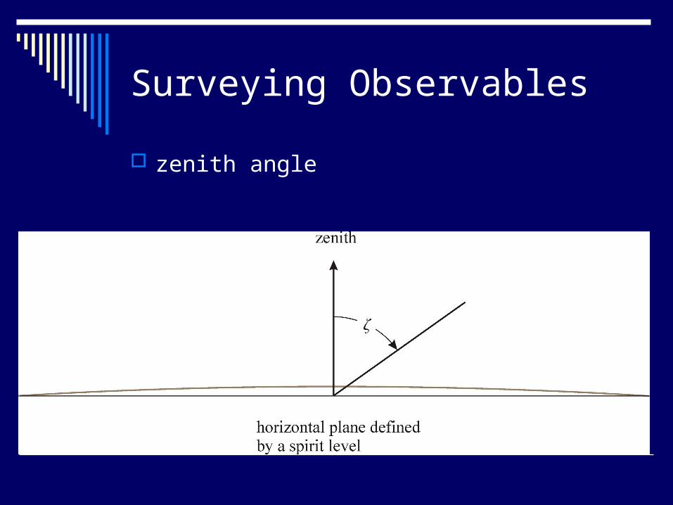
Surveying Observables
zenith angle

Surveying Observables, cont. bearings
angles in the horizontal plane between features of interest
slant distances
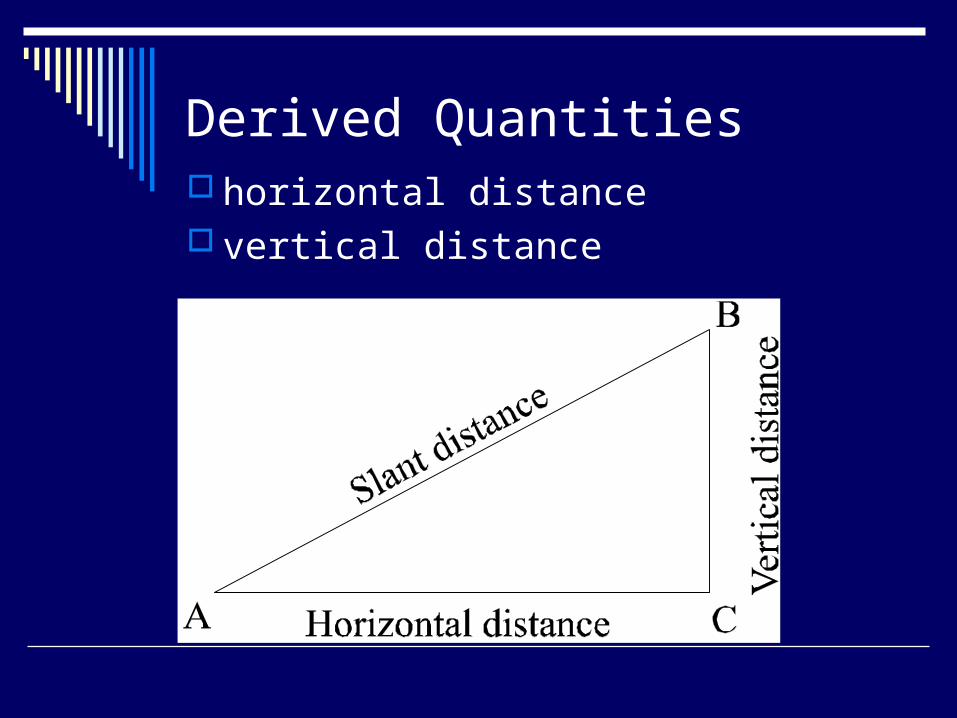
Derived Quantities horizontal distance vertical distance
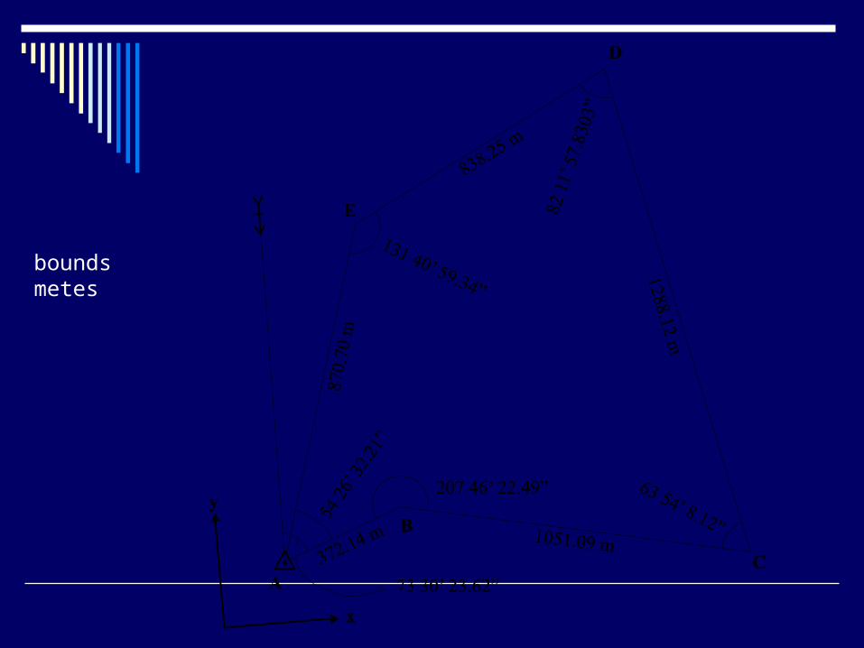
boundsmetes

Suppose…
you have a properly leveled instrument. you site an object in the distance… at a zenith angle of exactly 90 degrees.
Is that object above, below or level to you?

How do you know the Earth is round?
The Flat-Earth Assumption
causes objects to appear lower and farther away than they really are.
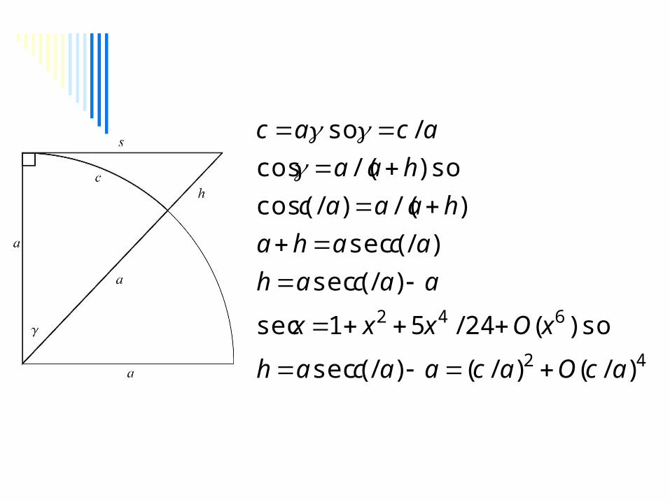
42
642
)/()/()/sec(
so)(24/51sec
)/sec(
)/sec(
)/()/cos(
so)/(cos
/so
acOacaacah
xOxxx
aacah
acaha
haaac
haa
acac
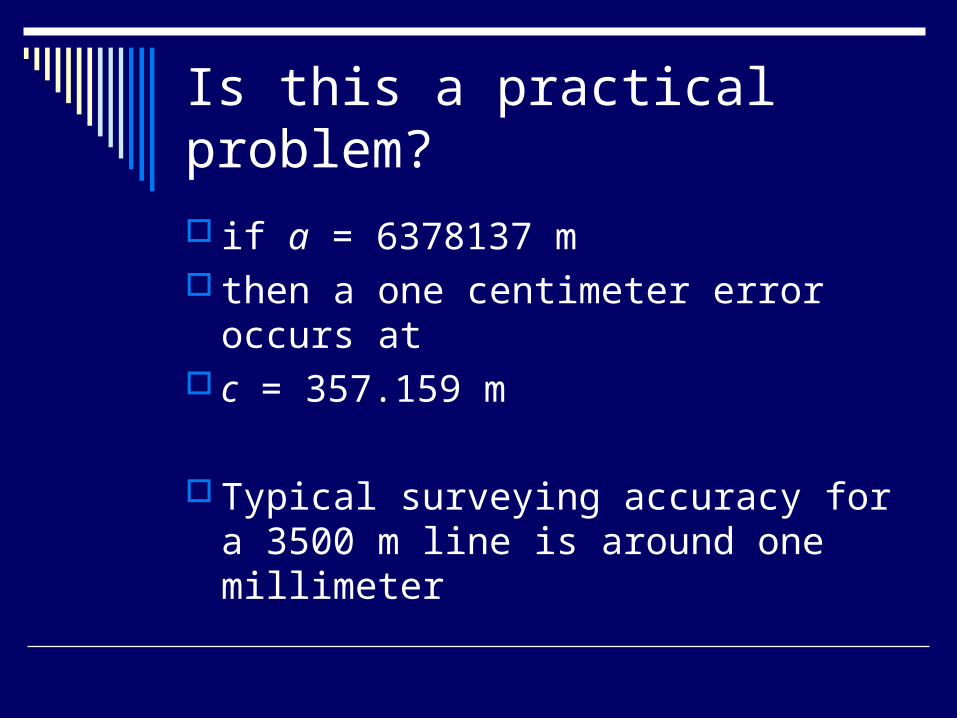
Is this a practical problem?
if a = 6378137 m then a one centimeter error occurs at c = 357.159 m
Typical surveying accuracy for a 3500 m line is around one millimeter

Ok, so far we’ve been using a coordinate system…
it’s Cartesian In what reference frame does that
coordinate system reside within?

Geodesy
“The science concerned with determining the size and shape of the Earth.”
--NGS Glossary

Why study geodesy?


With inches to spare…

going aground in the Panama Canal is bad…

fender benders…

Barge-Bridge Collision

A horizontal geodetic datum..
is a system by which latitude and longitude coordinates are assigned to places of interest
i.e., the foundation of spatial coordinates note bene: height is not included

Surveying on the Sphere
To construct and use geodetic datums we must be able to determine latitude and longitude coordinates from surveying observations.
That requires spherical trigonometry

Spherical Triangles

Our fundamental figure

Geodetic Coordinates
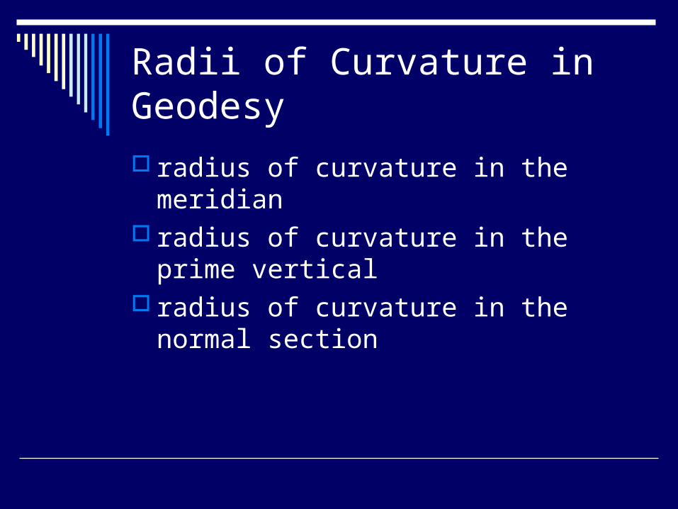
Radii of Curvature in Geodesy
radius of curvature in the meridian radius of curvature in the prime vertical radius of curvature in the normal section

Radius of Curvature in the Meridian
2
1
2/322
2
)(
sin1
)1()(
dd
e
ea

Radius of Curvature in the Prime Vertical
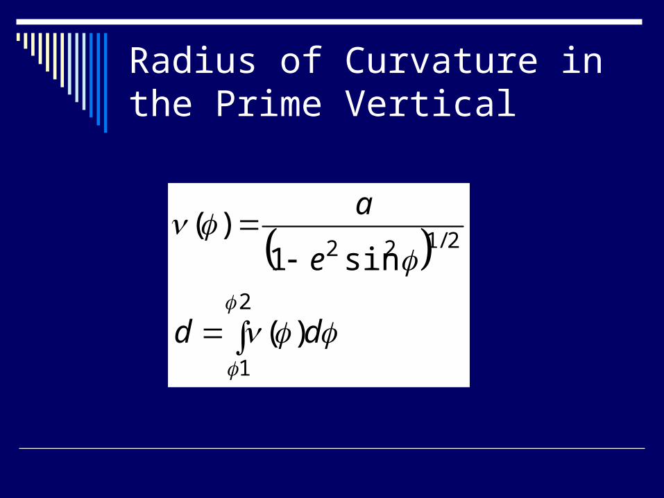
Radius of Curvature in the Prime Vertical
2
1
2/122
)(
sin1)(
dd
e
a

Normal Section
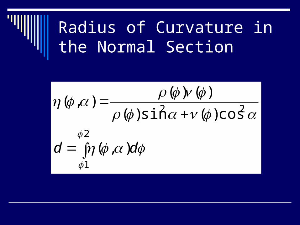
Radius of Curvature in the Normal Section
2
1
22
),(
cos)(sin)(
)()(),(
dd

GeometricalGeodesy
Thomas H. Meyer, Ph.D.
Department of Natural Resources Management & Engineering
University of Connecticut