geospatial one-stop fgdc and gos: working as one to build the nsdi rob dollison geospatial one-stop...
TRANSCRIPT
Geospatial One-Stop Geospatial One-Stop FGDC and GOS:FGDC and GOS:
Working as One to Build the NSDIWorking as One to Build the NSDI
Rob DollisonRob Dollison
Geospatial One-StopGeospatial One-Stop
Program Office Program Office
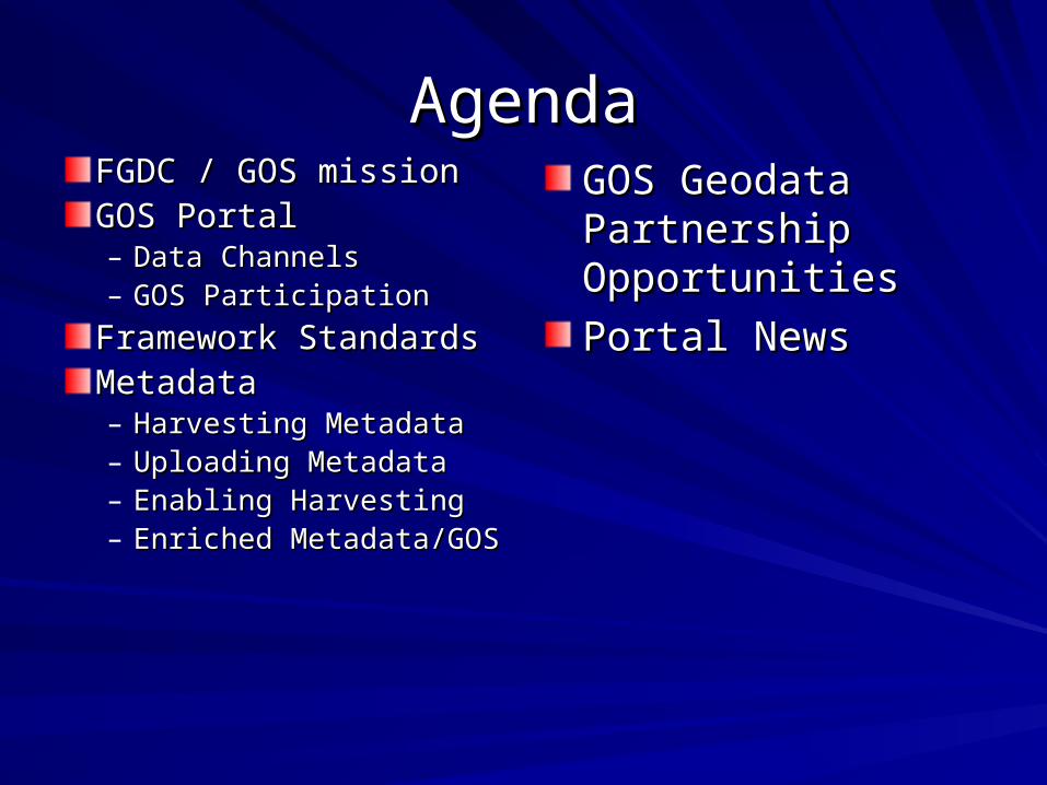
AgendaAgendaFGDC / GOS missionFGDC / GOS missionGOS PortalGOS Portal– Data Channels Data Channels – GOS ParticipationGOS Participation
Framework StandardsFramework StandardsMetadataMetadata– Harvesting MetadataHarvesting Metadata– Uploading MetadataUploading Metadata– Enabling HarvestingEnabling Harvesting– Enriched Enriched
Metadata/GOSMetadata/GOS
GOS Geodata GOS Geodata Partnership Partnership OpportunitiesOpportunities
Portal NewsPortal News
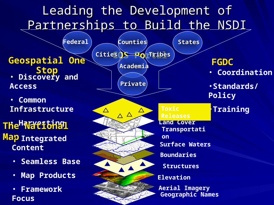
Geographic Names
Geospatial One StopGeospatial One Stop• Discovery and Access
• Common Infrastructure
• Harvesting
GOS Portal
Leading the Development of Partnerships Leading the Development of Partnerships to Build the NSDIto Build the NSDI
Aerial Imagery
Elevation
Structures
Boundaries
Surface Waters
Transportation
Land Cover The National MapThe National Map
• Integrated Content
• Seamless Base
• Map Products
• Framework Focus
FGDCFGDC• Coordination
•Standards/Policy
•Training
CitiesCities
CountiesCounties
TribesTribes
AcademiaAcademia
StatesStates
PrivatePrivate
Federal
Toxic Releases
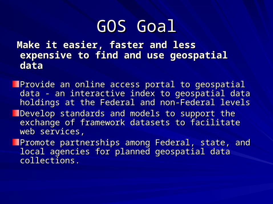
GOS GoalGOS Goal Make it easier, faster and less expensive to Make it easier, faster and less expensive to
find and use geospatial datafind and use geospatial data
Provide an online access portal to geospatial data - Provide an online access portal to geospatial data - an interactive index to geospatial data holdings at an interactive index to geospatial data holdings at the Federal and non-Federal levelsthe Federal and non-Federal levelsDevelop standards and models to support the Develop standards and models to support the exchange of framework datasets to facilitate web exchange of framework datasets to facilitate web services,services,Promote partnerships among Federal, state, and Promote partnerships among Federal, state, and local agencies for planned geospatial data local agencies for planned geospatial data collections.collections.
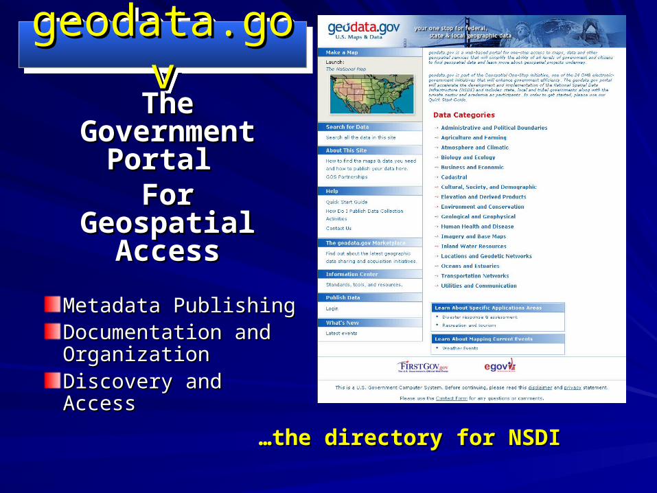
Metadata PublishingMetadata PublishingDocumentation and Documentation and OrganizationOrganizationDiscovery and AccessDiscovery and Access
The The Government Government
Portal Portal For For
Geospatial Geospatial AccessAccess
……the directory for NSDIthe directory for NSDI
geodata.govgeodata.govgeodata.govgeodata.gov
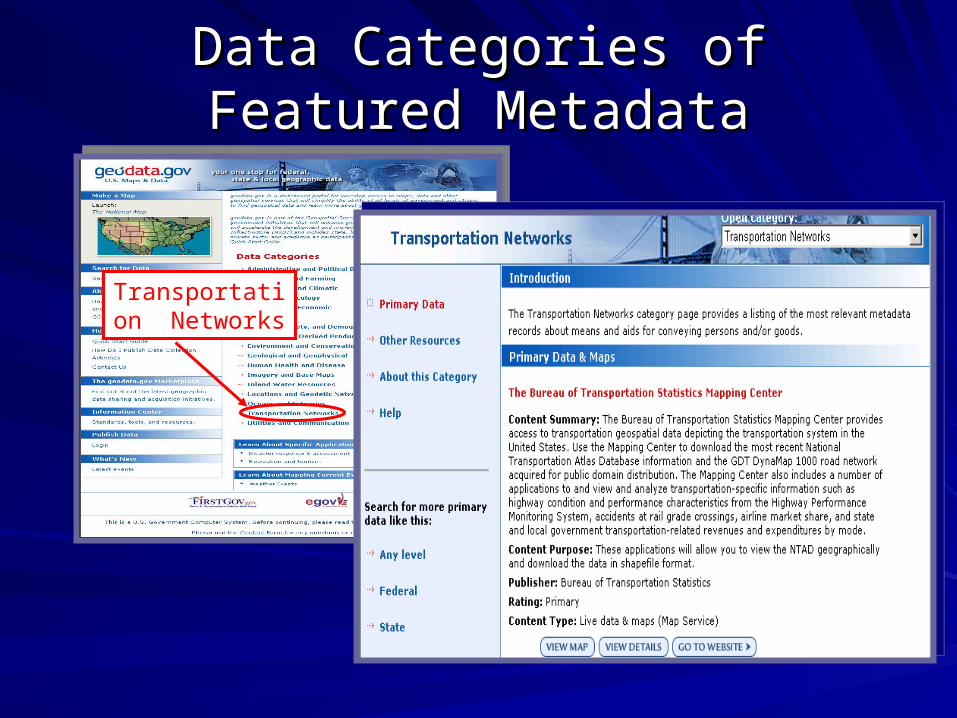
Data Categories of Featured Data Categories of Featured MetadataMetadata
Transportation Networks
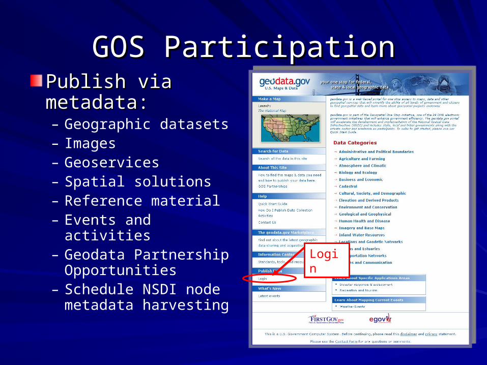
GOS ParticipationGOS ParticipationPublish via Publish via metadata:metadata:– Geographic datasets– Images– Geoservices– Spatial solutions– Reference material– Events and activities– Geodata Partnership
Opportunities– Schedule NSDI node
metadata harvesting
Login
How do I publish?How do I publish?
Before you can publish metadata in Before you can publish metadata in geodata.gov, you need to register as a geodata.gov, you need to register as a publisherpublisher
After your registration is completed, you After your registration is completed, you will have username and password to will have username and password to access the portal as a publisheraccess the portal as a publisher
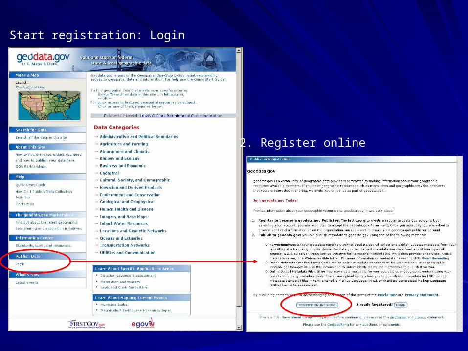
1. Start registration: Login
2. Register online
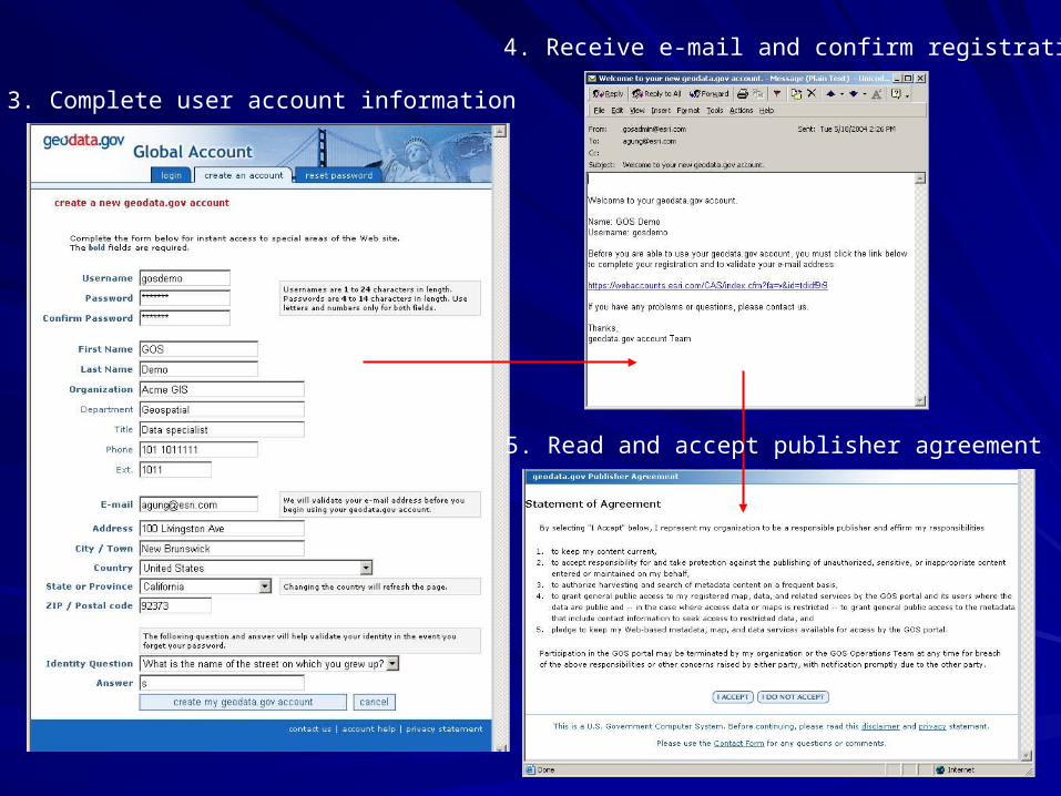
3. Complete user account information
4. Receive e-mail and confirm registration
5. Read and accept publisher agreement
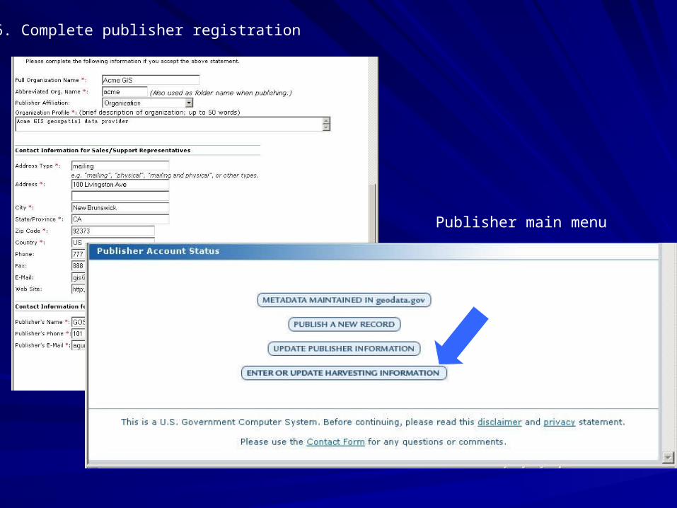
6. Complete publisher registration
Publisher main menu
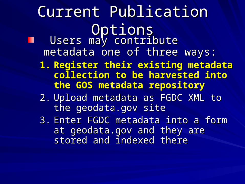
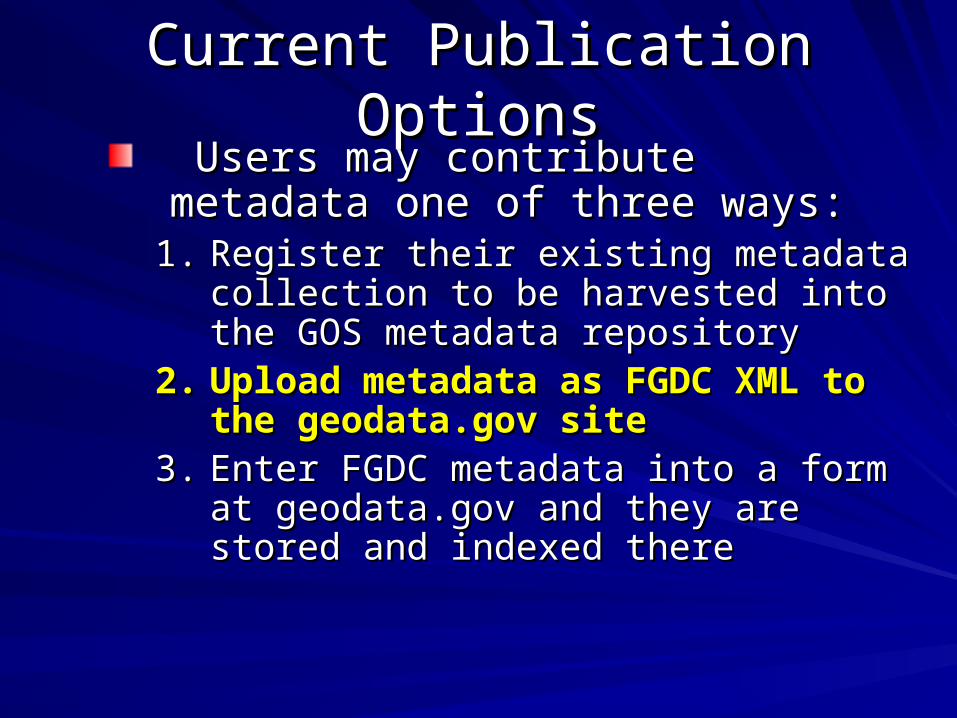
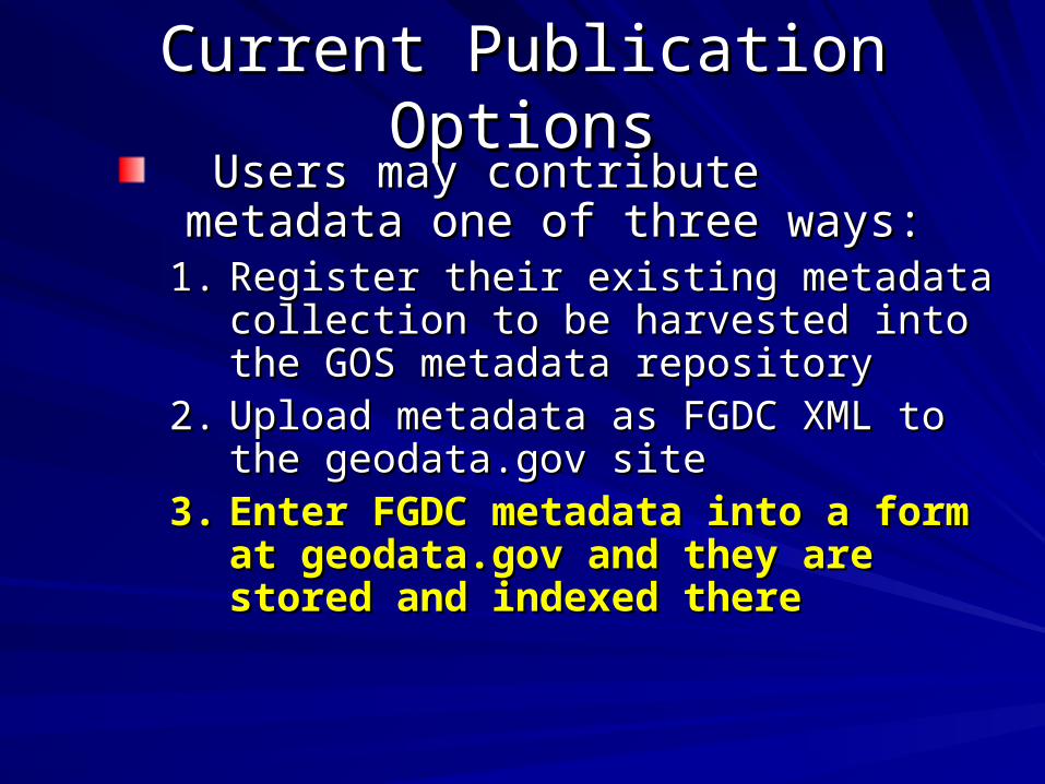
Current Publication OptionsCurrent Publication Options Users may contribute metadata one of Users may contribute metadata one of three ways:three ways:
1.1. Register their existing metadata Register their existing metadata collection to be harvested into the GOS collection to be harvested into the GOS metadata repositorymetadata repository
2.2. Upload metadata as FGDC XML to the Upload metadata as FGDC XML to the geodata.gov sitegeodata.gov site
3.3. Enter FGDC metadata into a form at Enter FGDC metadata into a form at geodata.gov and they are stored and geodata.gov and they are stored and indexed thereindexed there
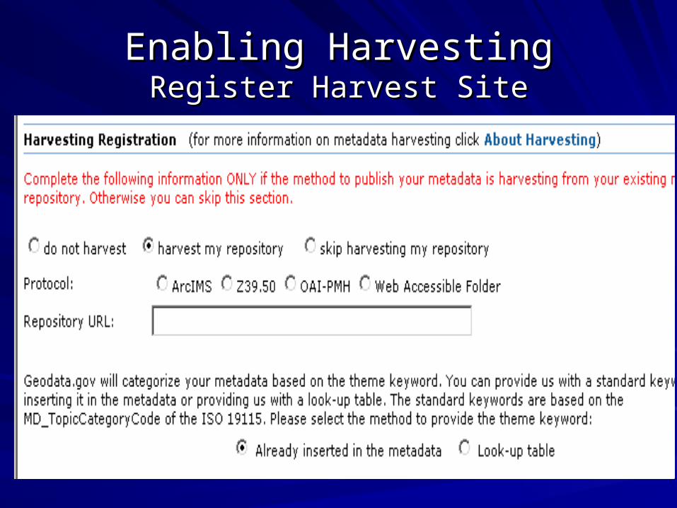
Enabling HarvestingEnabling HarvestingRegister Harvest SiteRegister Harvest Site
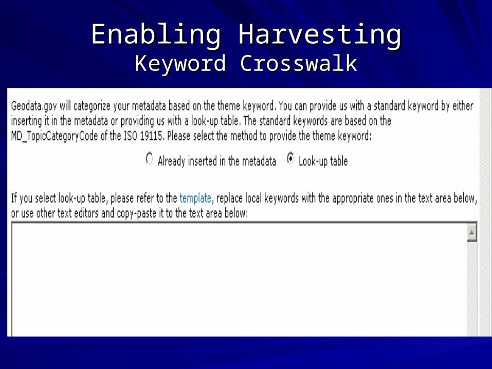
Enabling HarvestingEnabling HarvestingKeyword CrosswalkKeyword Crosswalk
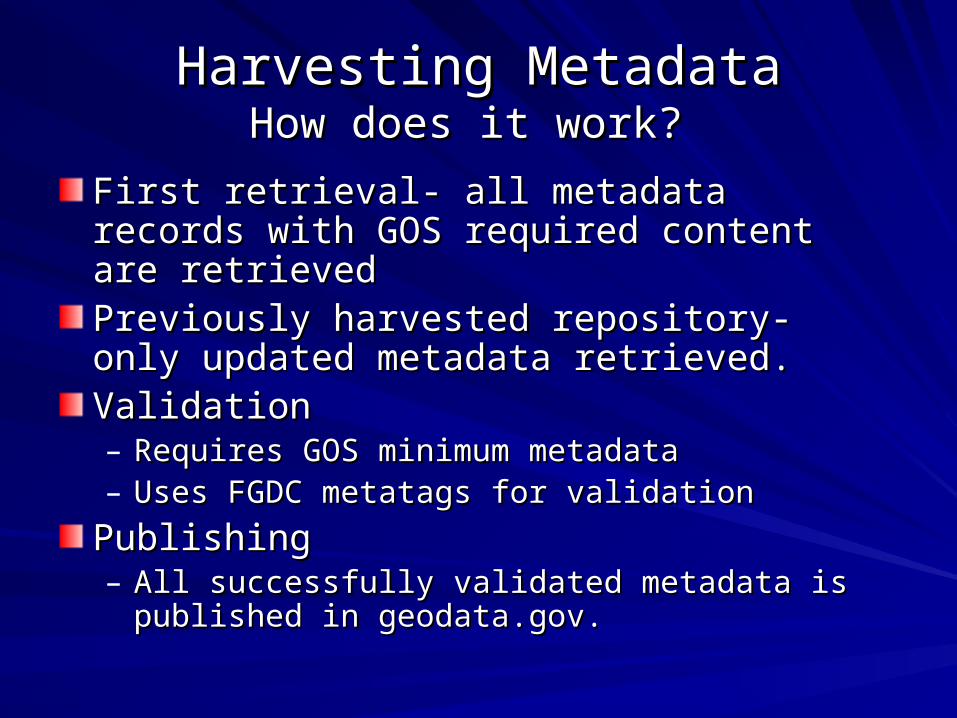
Harvesting MetadataHarvesting MetadataHow does it work? How does it work?
First retrieval- all metadata records with GOS First retrieval- all metadata records with GOS required content are retrievedrequired content are retrievedPreviously harvested repository- only updated Previously harvested repository- only updated metadata retrieved. metadata retrieved. ValidationValidation– Requires GOS minimum metadataRequires GOS minimum metadata– Uses FGDC metatags for validationUses FGDC metatags for validation
PublishingPublishing– All successfully validated metadata is published in All successfully validated metadata is published in
geodata.gov. geodata.gov.
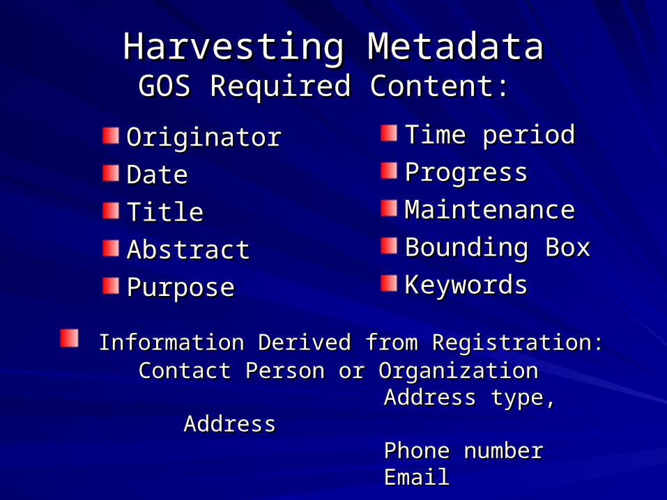
Harvesting MetadataHarvesting MetadataGOS Required Content: GOS Required Content:
OriginatorOriginator
DateDate
TitleTitle
AbstractAbstract
PurposePurpose
Time periodTime period
ProgressProgress
MaintenanceMaintenance
Bounding BoxBounding Box
KeywordsKeywords
Information Derived from Registration: Information Derived from Registration: Contact Person or OrganizationContact Person or Organization Address type, Address type, AddressAddress
Phone numberPhone numberEmailEmail
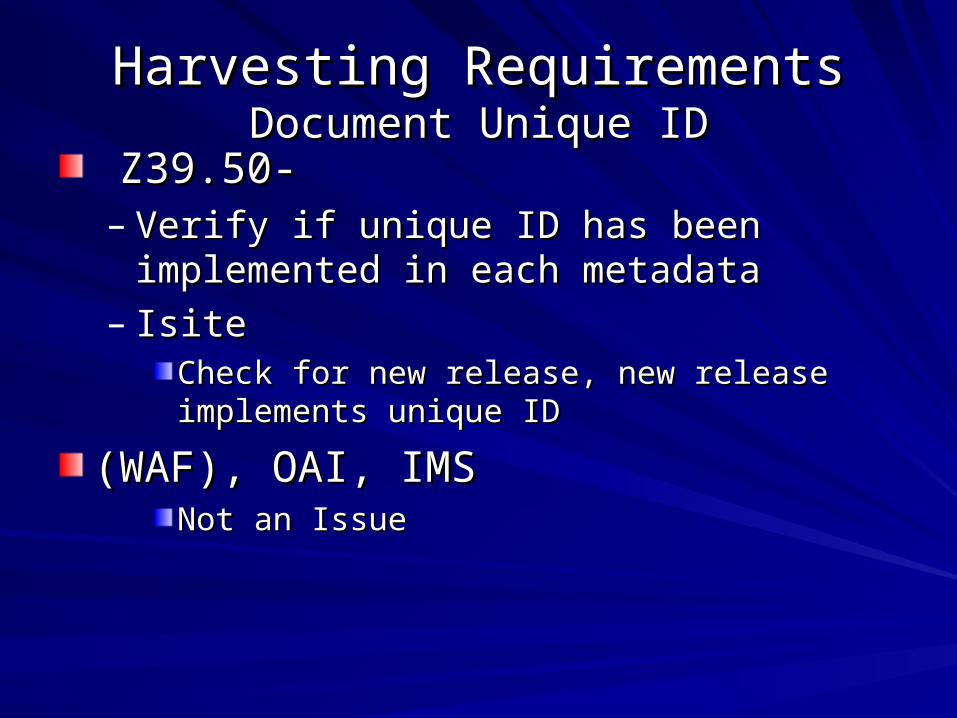
Harvesting RequirementsHarvesting RequirementsDocument Unique IDDocument Unique ID
Z39.50- Z39.50- – Verify if unique ID has been implemented in Verify if unique ID has been implemented in
each metadataeach metadata– IsiteIsite
Check for new release, new release implements Check for new release, new release implements unique IDunique ID
(WAF), OAI, IMS(WAF), OAI, IMSNot an IssueNot an Issue

Harvesting Requirements:Harvesting Requirements: Date/Update DateDate/Update Date
Z39.50Z39.50– Once harvested, subsequent harvests checks Once harvested, subsequent harvests checks
update date for updated metadata.update date for updated metadata.
WAF, OAI, IMSWAF, OAI, IMS– Not an issueNot an issue
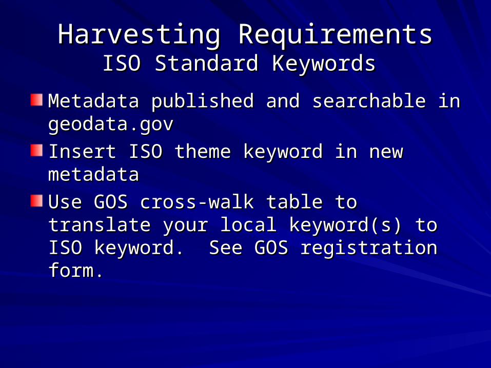
Harvesting RequirementsHarvesting RequirementsISO Standard Keywords ISO Standard Keywords
Metadata published and searchable in Metadata published and searchable in geodata.gov geodata.gov
Insert ISO theme keyword in new metadataInsert ISO theme keyword in new metadata
Use GOS cross-walk table to translate your local Use GOS cross-walk table to translate your local keyword(s) to ISO keyword. See GOS keyword(s) to ISO keyword. See GOS registration form. registration form.
Current Publication OptionsCurrent Publication Options Users may contribute metadata one of Users may contribute metadata one of three ways:three ways:
1.1. Register their existing metadata collection Register their existing metadata collection to be harvested into the GOS metadata to be harvested into the GOS metadata repositoryrepository
2.2. Upload metadata as FGDC XML to the Upload metadata as FGDC XML to the geodata.gov sitegeodata.gov site
3.3. Enter FGDC metadata into a form at Enter FGDC metadata into a form at geodata.gov and they are stored and geodata.gov and they are stored and indexed thereindexed there
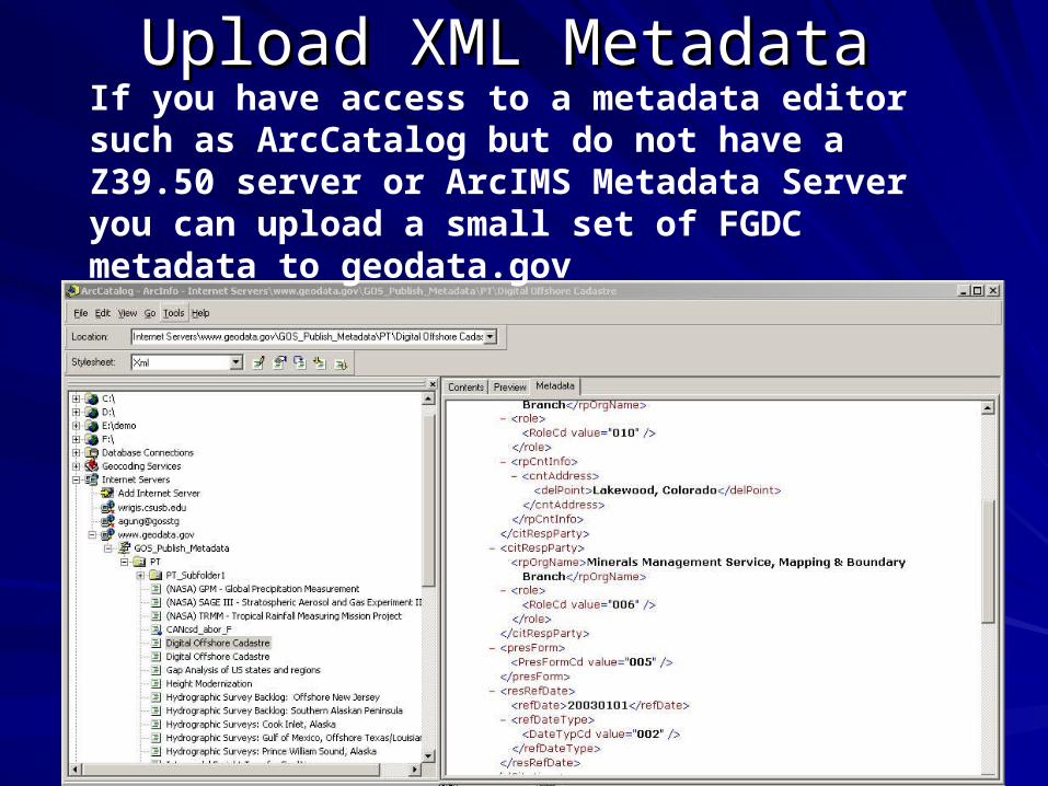
Upload XML Metadata Upload XML Metadata If you have access to a metadata editor such as ArcCatalog but do not have a Z39.50 server or ArcIMS Metadata Server you can upload a small set of FGDC metadata to geodata.gov
Current Publication OptionsCurrent Publication Options Users may contribute metadata one of Users may contribute metadata one of three ways:three ways:
1.1. Register their existing metadata collection Register their existing metadata collection to be harvested into the GOS metadata to be harvested into the GOS metadata repositoryrepository
2.2. Upload metadata as FGDC XML to the Upload metadata as FGDC XML to the geodata.gov sitegeodata.gov site
3.3. Enter FGDC metadata into a form at Enter FGDC metadata into a form at geodata.gov and they are stored and geodata.gov and they are stored and indexed thereindexed there
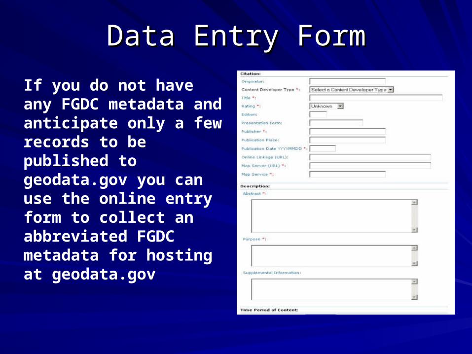
Data Entry FormData Entry Form
If you do not have any FGDC metadata and anticipate only a few records to be published to geodata.gov you can use the online entry form to collect an abbreviated FGDC metadata for hosting at geodata.gov
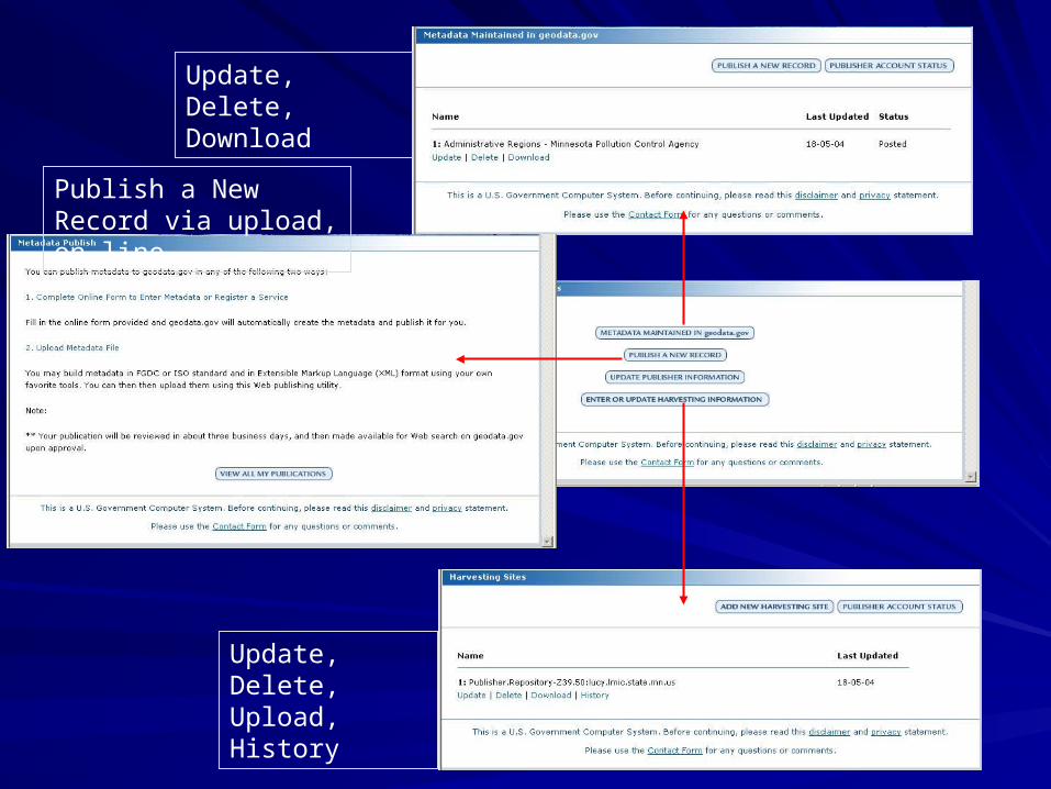
Update, Delete, Download
Publish a New Record via upload, on-line
Update, Delete, Upload, History
Data Partnership Data Partnership Discovery Through One-StopDiscovery Through One-Stop
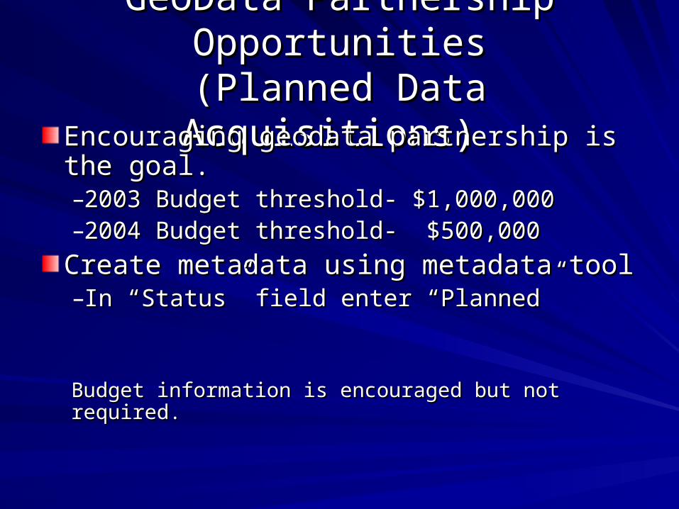
GeoData Partnership OpportunitiesGeoData Partnership Opportunities(Planned Data Acquisitions) (Planned Data Acquisitions)
Encouraging geodata partnership is the Encouraging geodata partnership is the goal.goal.–2003 Budget threshold- $1,000,0002003 Budget threshold- $1,000,000–2004 Budget threshold- $500,0002004 Budget threshold- $500,000
Create metadata using metadata toolCreate metadata using metadata tool–In “Status” field enter “Planned”In “Status” field enter “Planned”
Budget information is encouraged but not required. Budget information is encouraged but not required.
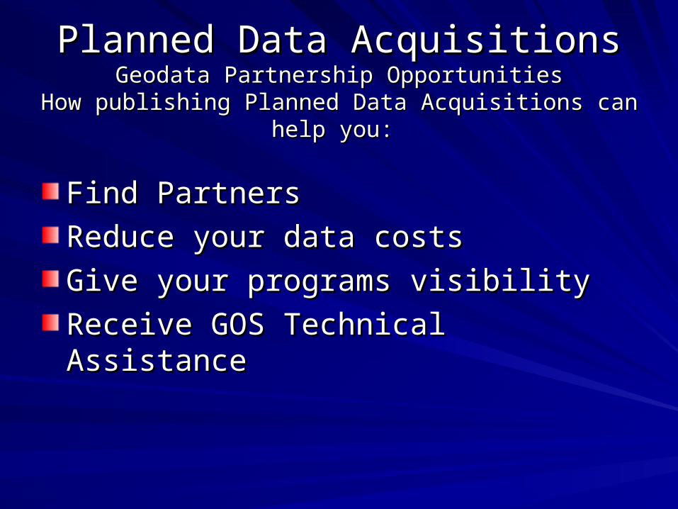
Planned Data AcquisitionsPlanned Data AcquisitionsGeodata Partnership OpportunitiesGeodata Partnership Opportunities
How publishing Planned Data Acquisitions can help you: How publishing Planned Data Acquisitions can help you:
Find Partners Find Partners
Reduce your data costsReduce your data costs
Give your programs visibilityGive your programs visibility
Receive GOS Technical AssistanceReceive GOS Technical Assistance
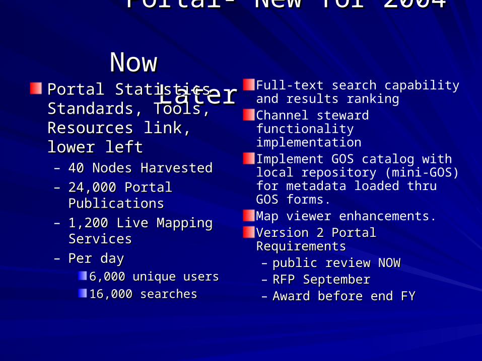
Portal- New for 2004 Portal- New for 2004 Now Later Now Later
Portal Statistics Portal Statistics Standards, Tools, Standards, Tools, Resources link, lower leftResources link, lower left– 40 Nodes Harvested40 Nodes Harvested– 24,000 Portal Publications24,000 Portal Publications– 1,200 Live Mapping 1,200 Live Mapping
ServicesServices– Per dayPer day
6,000 unique users6,000 unique users
16,000 searches16,000 searches
Full-text search capability and results rankingChannel steward functionality implementationImplement GOS catalog with local repository (mini-GOS) for metadata loaded thru GOS forms.Map viewer enhancements.Version 2 Portal RequirementsVersion 2 Portal Requirements– public review NOW public review NOW – RFP SeptemberRFP September– Award before end FY Award before end FY
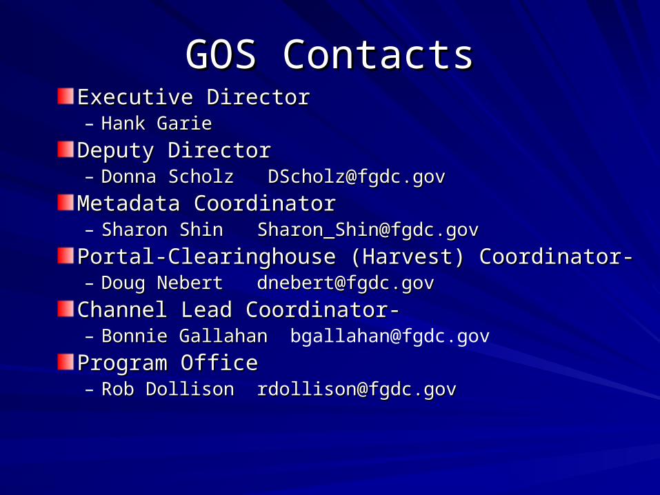
GOS ContactsGOS ContactsExecutive DirectorExecutive Director– Hank GarieHank Garie
Deputy DirectorDeputy Director– Donna Scholz [email protected] Scholz [email protected]
Metadata CoordinatorMetadata Coordinator– Sharon Shin [email protected] Shin [email protected]
Portal-Clearinghouse (Harvest) Coordinator- Portal-Clearinghouse (Harvest) Coordinator- – Doug Nebert [email protected] Nebert [email protected]
Channel Lead Coordinator-Channel Lead Coordinator-– Bonnie Gallahan Bonnie Gallahan [email protected]
Program OfficeProgram Office– Rob Dollison [email protected] Dollison [email protected]