geotoursim in volcanic area geoparks in japan - … geotourism in... · geotoursim in volcanic area...
TRANSCRIPT
2014/1/2
1
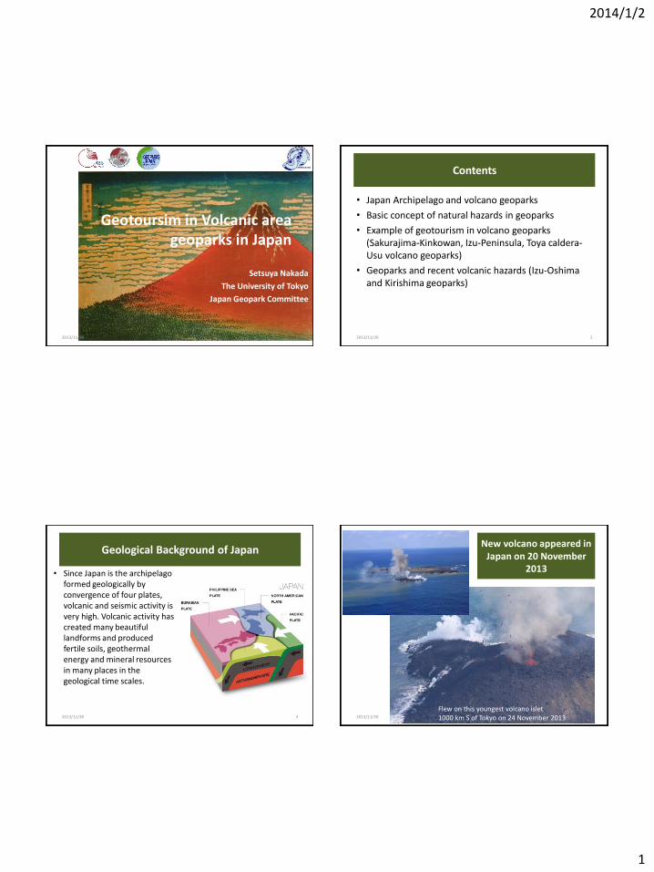
Geotoursim in Volcanic area geoparks in Japan
Setsuya Nakada
The University of Tokyo
Japan Geopark Committee
2013/11/30 1
Contents
• Japan Archipelago and volcano geoparks
• Basic concept of natural hazards in geoparks
• Example of geotourism in volcano geoparks (Sakurajima-Kinkowan, Izu-Peninsula, Toya caldera-Usu volcano geoparks)
• Geoparks and recent volcanic hazards (Izu-Oshima and Kirishima geoparks)
2013/11/30 2
Geological Background of Japan
• Since Japan is the archipelago formed geologically by convergence of four plates, volcanic and seismic activity is very high. Volcanic activity has created many beautiful landforms and produced fertile soils, geothermal energy and mineral resources in many places in the geological time scales.
2013/11/30 3
New volcano appeared in Japan on 20 November
2013
2013/11/30 4
Flew on this youngest volcano islet 1000 km S of Tokyo on 24 November 2013
2014/1/2
2
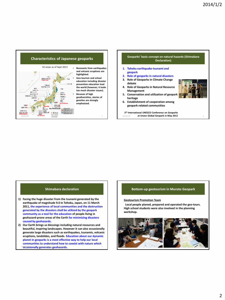
Characteristics of Japanese geoparks
• Remnants from earthquakes and volcanic eruptions are highlighted.
• Geo-tourism and school education including disaster prevention education lead the world (however, it looks too much disaster issues).
• Because of high geodiversities, stories of geosites are strongly emphasized.
活火山 Incl. active volcanoes 5
32 areas as of Sept 2013
Global GP
Domestic GP
2013/11/30
Toya-Usu
Izu-Oshima
Izu Peninsual
Kirishima Sakurajima
Muroto
Geoparks’ basic concept on natural hazards (Shimabara Declaration)
1. Tohoku earthquake-tsunami and geopark
2. Role of geoparks in natural disasters 3. Role of Geoparks in Climate Change
debate 4. Role of Geoparks in Natural Resource
Management 5. Conservation and utilization of geopark
heritage 6. Establishment of cooperation among
geopark-related communities
5th International UNESCO Conference on Geoparks at Unzen Global Geopark in May 2012
6 2013/11/30
Shimabara declaration
1) Facing the huge disaster from the tsunami generated by the earthquake of magnitude 9.0 in Tohoku, Japan, on 11 March 2011, the experience of local communities and the destruction generated by the disasters shall be utilized by the geopark community as a tool for the education of people living in geohazard-prone areas of the Earth for minimizing disasters caused by geohazards.
2) Our Earth brings us blessings including natural resources and beautiful, inspiring landscapes. However it can also occasionally generate large disasters such as earthquakes, tsunamis, volcanic eruptions, landslides, and floods. Education about our dynamic planet in geoparks is a most effective way to help our local communities to understand how to coexist with nature which occasionally generates geohazards.
7 2013/11/30
Bottom-up geotourism in Muroto Geopark
Geotourism Promotion Team
Local people planed, prepared and operated the geo-tours. High school students were also involved in the planning workshop.
2013/11/30 8
2014/1/2
3
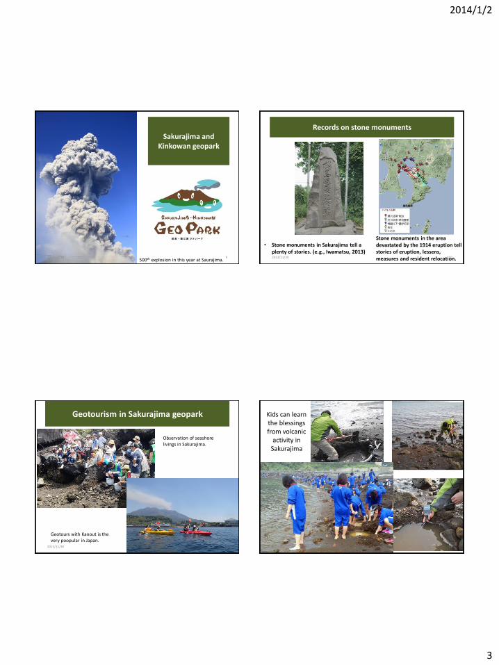
Sakurajima and Kinkowan geopark
500th explosion in this year at Saurajima. 2013/11/30 9
Records on stone monuments
• Stone monuments in Sakurajima tell a plenty of stories. (e.g., Iwamatsu, 2013)
Stone monuments in the area devastated by the 1914 eruption tell stories of eruption, lessens, measures and resident relocation. 2013/11/30 10
Geotourism in Sakurajima geopark
Observation of seashore livings in Sakurajima.
Geotours with Kanout is the very poopular in Japan.
2013/11/30 11
Kids can learn the blessings from volcanic
activity in Sakurajima
2013/11/30 12
2014/1/2
4
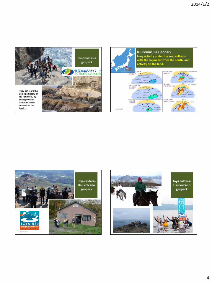
Izu-Peninsula geopark
They can learn the geologic history of Izu Peninsula, by seeing volcanic activities in the sea and on the land. 2013/11/30 13
Izu Peninsula Geopark Long activity under the sea, collision with the Japan arc from the south, and activity on the land.
2013/11/30 14
Toya caldera-Usu volcano
geopark
2013/11/30 15
Toya caldera-Usu volcano
geopark
Map
2013/11/30 16
2014/1/2
5
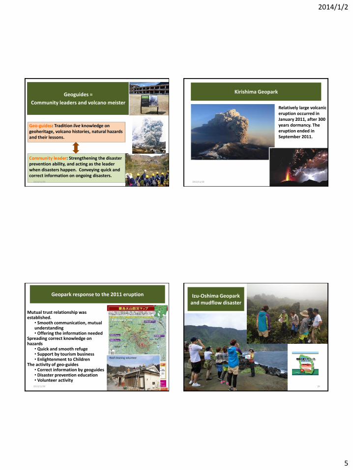
Geo-guides: Tradition live knowledge on geoheritage, volcano histories, natural hazards and their lessons.
Community leader: Strengthening the disaster prevention ability, and acting as the leader when disasters happen. Conveying quick and correct information on ongoing disasters.
17
Geoguides =
Community leaders and volcano meister
2013/11/30 17
Kirishima Geopark
Relatively large volcanic eruption occurred in January 2011, after 300 years dormancy. The eruption ended in September 2011.
2013/11/30 18
Geopark response to the 2011 eruption
Mutual trust relationship was established.
• Smooth communication, mutual understanding • Offering the information needed
Spreading correct knowledge on hazards
• Quick and smooth refuge • Support by tourism business • Enlightenment to Children
The activity of geo-guides • Correct information by geoguides • Disaster prevention education • Volunteer activity
Published in 2009
Roof cleaning volunteer
2013/11/30 19
Izu-Oshima Geopark and mudflow disaster
2013/11/30 20
2014/1/2
6
The extreme climate generated mudflow
disaster at Izu-Oshima on Oct. 16, 2013
One-hour precipitation at Izu-Oshima
mm
At 6 a.m. on October 16, 2013
Typhoon
H
L H
October 15 09 10 11 12 13 14 15 16 17 18 19 20 21 22 23 24 01 02 03 04 05 06 07 08 09
October 16
Mud flows began
Izu-Oshima: basalt volcano which frequently erupt in the historical time. The geology is characterized accumulation of unconsolidated volcanic ash layers with lava flows
Izu-Oshima
2013/11/30 21
• Sliding of loose volcanic ash layers occurred only in steep slopes due to heavy rain.
• Resultant mud flow attached the residence area.
2013/11/30 22
2013/11/30 23
Casualties: 39 (including missing)
Mountain Tsunami! (tradition handed down from old times).
• Japan Geopaks Network collected contributions and donated to the town of Izu-Oshima geopark.
• Geoguides helped the scientists’ Inspection of deposits immediately after the disaster.
• Geoguides voluntarily joined cleaning the deposits.
Geoguides after the mud flow disaster
2013/11/30 24
2014/1/2
7
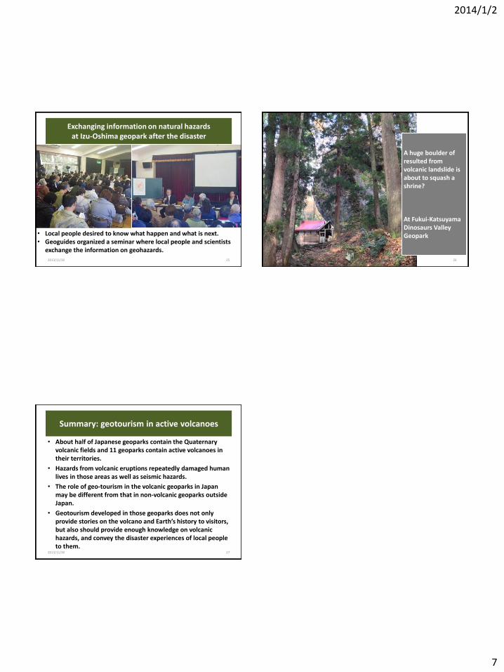
Exchanging information on natural hazards at Izu-Oshima geopark after the disaster
• Local people desired to know what happen and what is next. • Geoguides organized a seminar where local people and scientists
exchange the information on geohazards.
2013/11/30 25 2013/11/30 26
A huge boulder of resulted from volcanic landslide is about to squash a shrine? At Fukui-Katsuyama Dinosaurs Valley Geopark
Summary: geotourism in active volcanoes
• About half of Japanese geoparks contain the Quaternary volcanic fields and 11 geoparks contain active volcanoes in their territories.
• Hazards from volcanic eruptions repeatedly damaged human lives in those areas as well as seismic hazards.
• The role of geo-tourism in the volcanic geoparks in Japan may be different from that in non-volcanic geoparks outside Japan.
• Geotourism developed in those geoparks does not only provide stories on the volcano and Earth’s history to visitors, but also should provide enough knowledge on volcanic hazards, and convey the disaster experiences of local people to them.
2013/11/30 27