gis based integrated planning and monitoring system - mr. koustuv basu
TRANSCRIPT
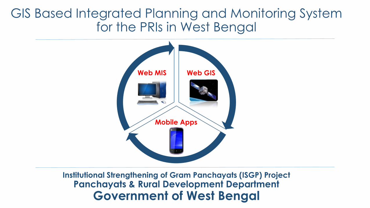
GIS Based Integrated Planning and Monitoring System for the PRIs in West Bengal
Institutional Strengthening of Gram Panchayats (ISGP) Project
Panchayats & Rural Development Department
Government of West Bengal
Web MIS Web GIS
Mobile Apps
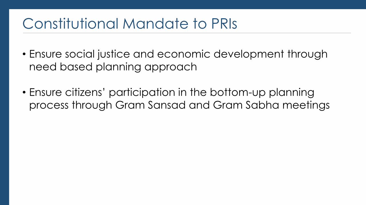
Constitutional Mandate to PRIs
• Ensure social justice and economic development through
need based planning approach
• Ensure citizens’ participation in the bottom-up planning
process through Gram Sansad and Gram Sabha meetings
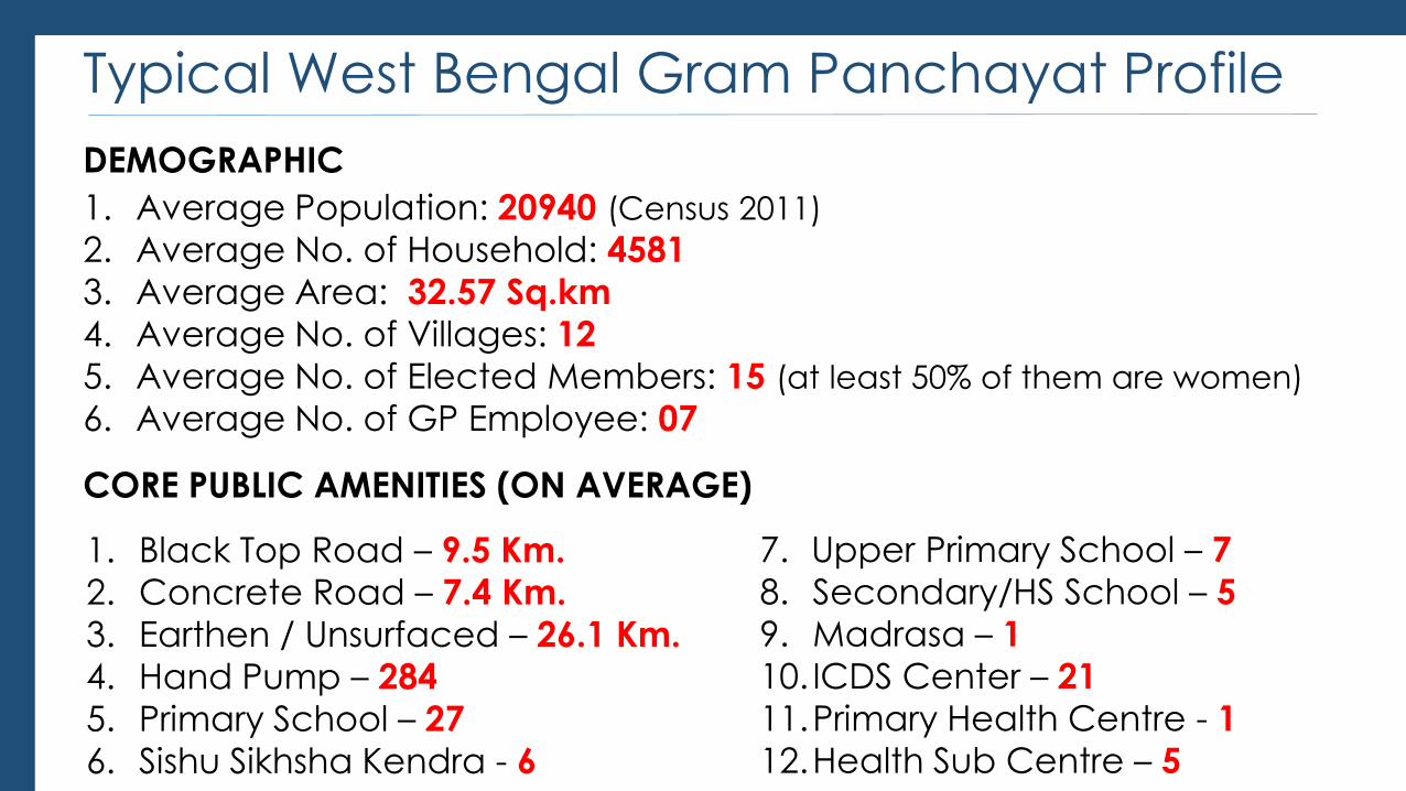
Typical West Bengal Gram Panchayat Profile
1. Average Population: 20940 (Census 2011)
2. Average No. of Household: 4581
3. Average Area: 32.57 Sq.km
4. Average No. of Villages: 12
5. Average No. of Elected Members: 15 (at least 50% of them are women)
6. Average No. of GP Employee: 07
DEMOGRAPHIC
CORE PUBLIC AMENITIES (ON AVERAGE)
1. Black Top Road – 9.5 Km.
2. Concrete Road – 7.4 Km.
3. Earthen / Unsurfaced – 26.1 Km.
4. Hand Pump – 284
5. Primary School – 27
6. Sishu Sikhsha Kendra - 6
7. Upper Primary School – 7
8. Secondary/HS School – 5
9. Madrasa – 1
10. ICDS Center – 21
11.Primary Health Centre - 1
12.Health Sub Centre – 5
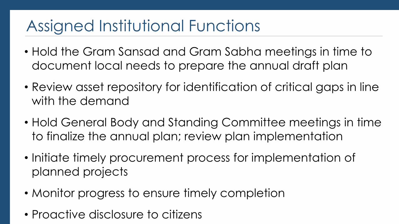
Assigned Institutional Functions
• Hold the Gram Sansad and Gram Sabha meetings in time to
document local needs to prepare the annual draft plan
• Review asset repository for identification of critical gaps in line
with the demand
• Hold General Body and Standing Committee meetings in time
to finalize the annual plan; review plan implementation
• Initiate timely procurement process for implementation of
planned projects
• Monitor progress to ensure timely completion
• Proactive disclosure to citizens
GIS Based Integrated Planning & Monitoring System: Objectives
• To create a one stop solution to aid the PRIs for better
planning and monitoring
• To create a global platform for data sharing amongst all
stakeholders to facilitate decision support
• To strengthen the system of state oversight
• To ensure transparency and public accountability
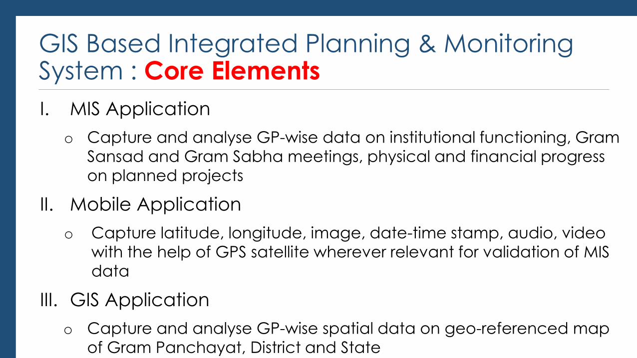
GIS Based Integrated Planning & Monitoring System : Core Elements
I. MIS Application
o Capture and analyse GP-wise data on institutional functioning, Gram
Sansad and Gram Sabha meetings, physical and financial progress
on planned projects
II. Mobile Application
o Capture latitude, longitude, image, date-time stamp, audio, video
with the help of GPS satellite wherever relevant for validation of MIS
data
III. GIS Application
o Capture and analyse GP-wise spatial data on geo-referenced map
of Gram Panchayat, District and State
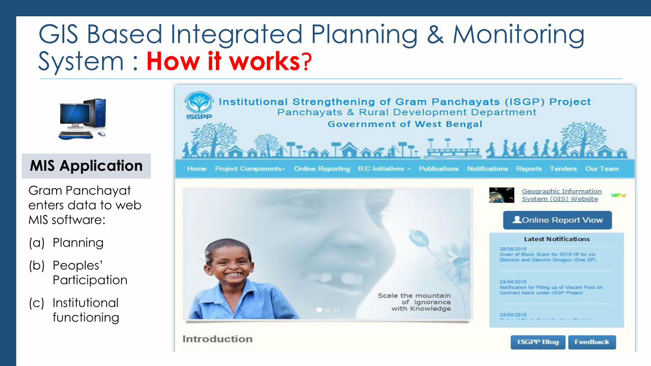
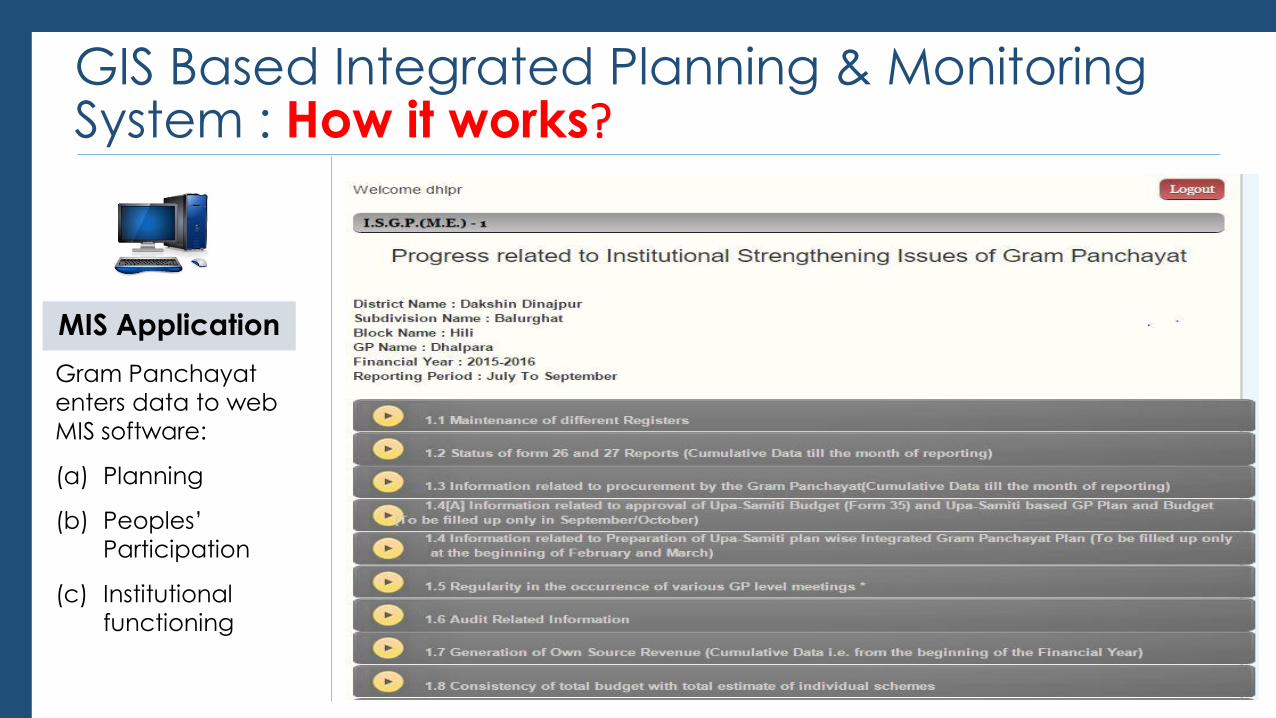
GIS Based Integrated Planning & Monitoring System : How it works?
MIS Application
Gram Panchayat
enters data to web
MIS software:
(a) Planning
(b) Peoples’
Participation
(c) Institutional
functioning
GIS Based Integrated Planning & Monitoring System : How it works?
MIS Application
Gram Panchayat
enters data to web
MIS software:
(a) Planning
(b) Peoples’
Participation
(c) Institutional
functioning
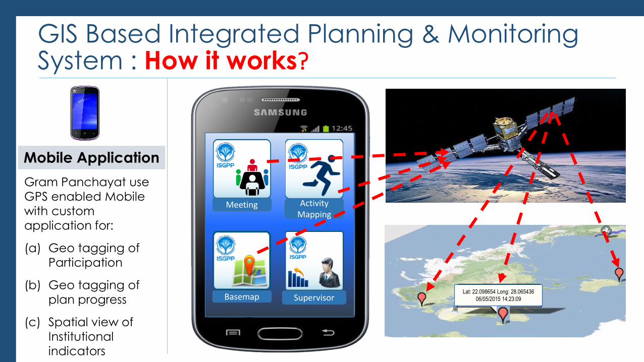
GIS Based Integrated Planning & Monitoring System : How it works?
Mobile Application
Gram Panchayat use
GPS enabled Mobile
with custom
application for:
(a) Geo tagging of
Participation
(b) Geo tagging of
plan progress
(c) Spatial view of
Institutional
indicators
Meeting Activity Mapping
Supervisor Basemap Lat: 22.098654 Long: 28.065436
06/05/2015 14:23:09
GIS Based Integrated Planning & Monitoring System : How it works?
GIS Application
Gram Panchayat use
GIS software for:
(a) Planning with GIS
tools
(b) Real time
monitoring of
planned projects
with image
(c) Comparative
Analysis of
performance
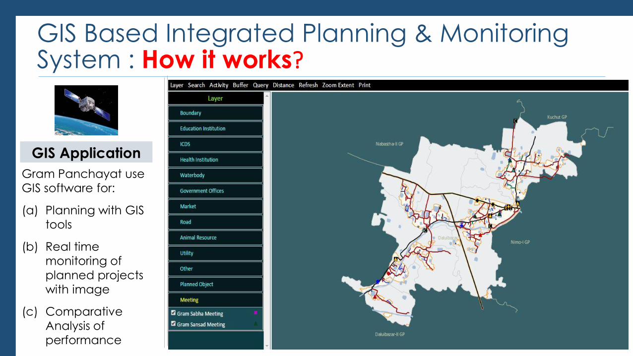
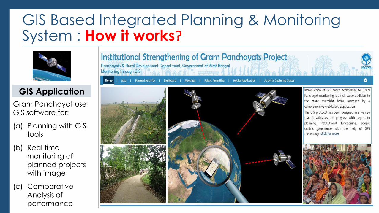
GIS Based Integrated Planning & Monitoring System : How it works?
GIS Application
Gram Panchayat use
GIS software for:
(a) Planning with GIS
tools
(b) Real time
monitoring of
planned projects
with image
(c) Comparative
Analysis of
performance
GIS Based Integrated Planning & Monitoring System : How it works?
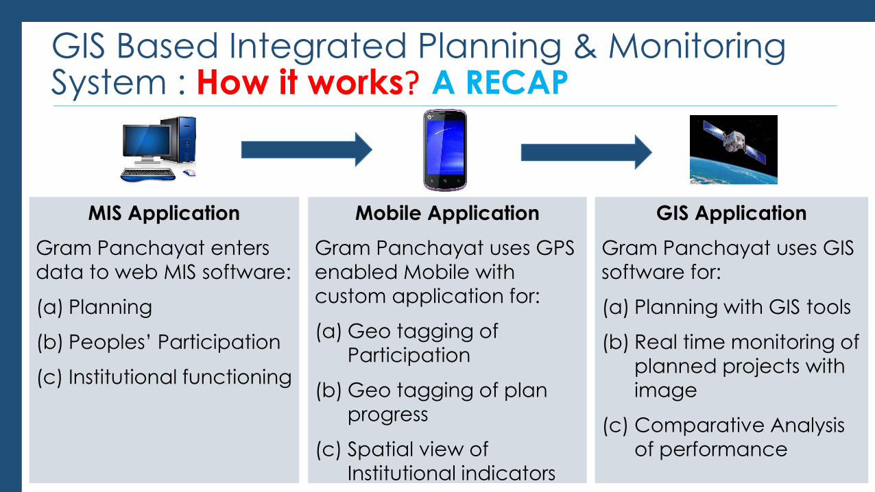
MIS Application
Gram Panchayat enters
data to web MIS software:
(a) Planning
(b) Peoples’ Participation
(c) Institutional functioning
Mobile Application
Gram Panchayat uses GPS
enabled Mobile with
custom application for:
(a) Geo tagging of
Participation
(b) Geo tagging of plan
progress
(c) Spatial view of
Institutional indicators
GIS Application
Gram Panchayat uses GIS
software for:
(a) Planning with GIS tools
(b) Real time monitoring of
planned projects with
image
(c) Comparative Analysis
of performance
A RECAP
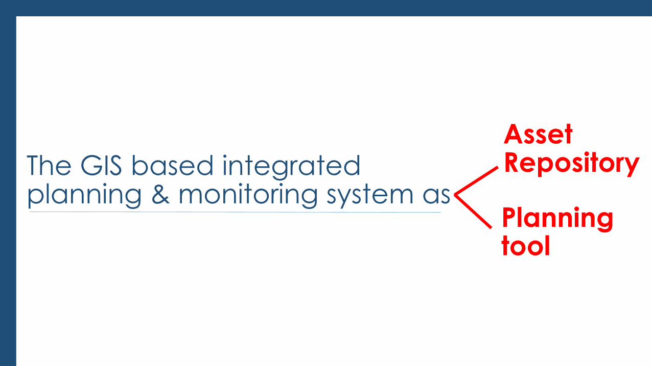
The GIS based integrated planning & monitoring system as
Asset Repository
Planning tool
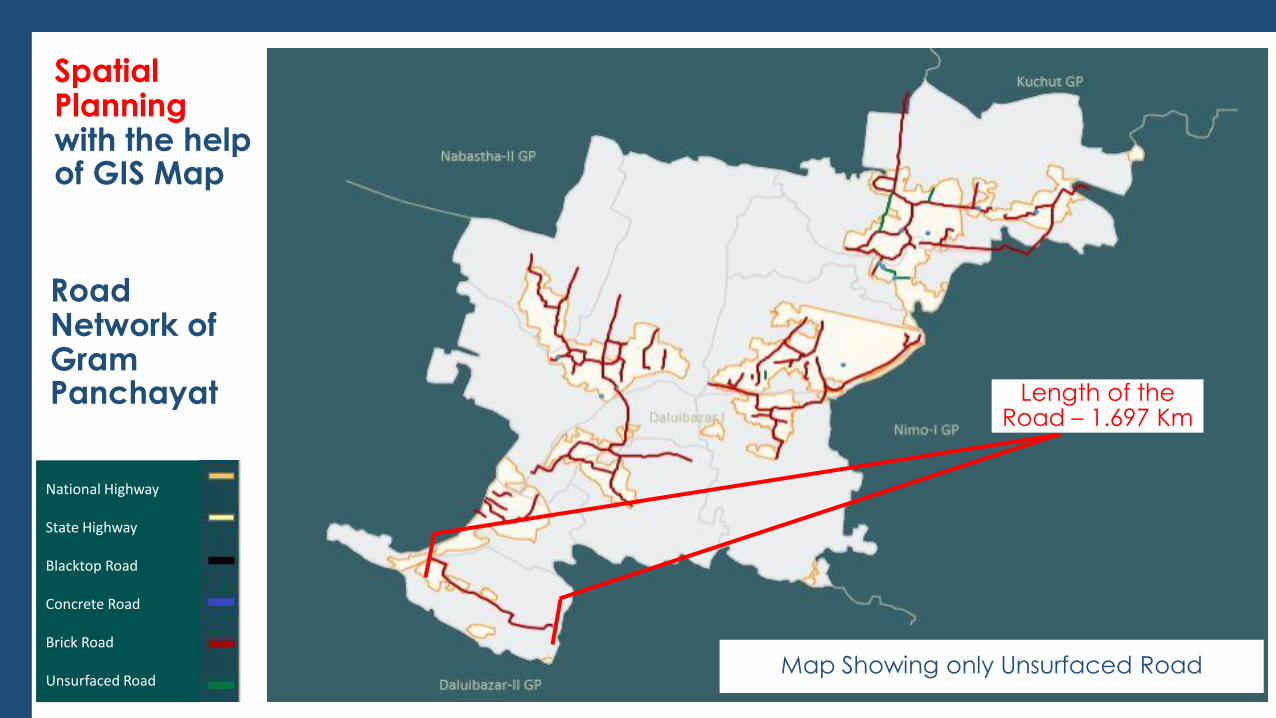
Spatial Planning with the help of GIS Map
Map Showing Surfaced & Unsurfaced Road Map Showing only Unsurfaced Road
Road Network of Gram Panchayat Length of the
Road – 1.697 Km
National Highway
State Highway
Blacktop Road
Concrete Road
Brick Road
Unsurfaced Road
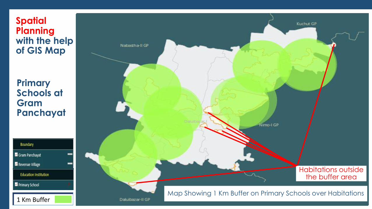
Spatial Planning with the help of GIS Map
Primary Schools at Gram Panchayat
Map Showing Habitations Map Showing Primary Schools over Habitations
P
Map Showing 1 Km Buffer on Primary Schools over Habitations 1 Km Buffer
Habitations outside the buffer area
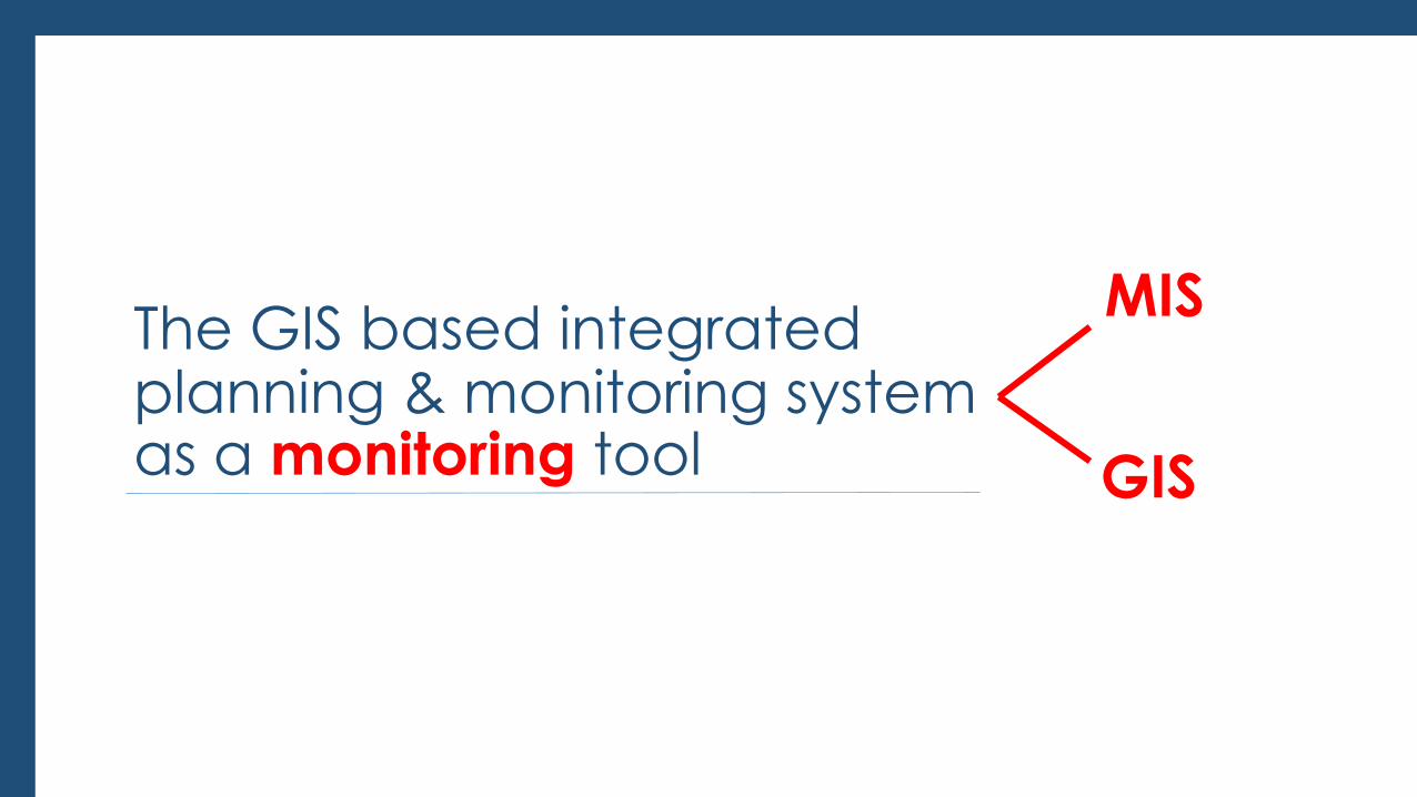
The GIS based integrated planning & monitoring system as a monitoring tool
MIS
GIS
Monitoring with the help of
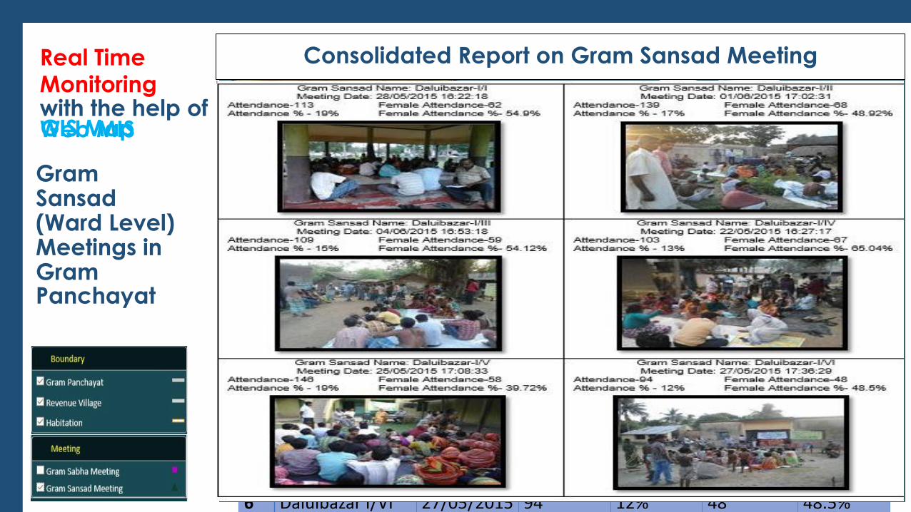
Gram Sansad (Ward Level) Meetings in Gram Panchayat
Web MIS
Sl No.
Name of the GS Date of GS Meeting
Total Attendance
% Attendance
Women Attendance
% Women Attendance
1 Daluibazar I/I 28/05/2015 113 19% 62 54.9%
2 Daluibazar I/II 01/06/2015 139 17% 68 48.92%
3 Daluibazar I/III 04/06/2015 109 15% 59 54.12%
4 Daluibazar I/IV 22/05/2015 103 13% 67 65.04%
5 Daluibazar I/V 25/05/2015 146 19% 58 39.72%
6 Daluibazar I/VI 27/05/2015 94 12% 48 48.5%
REPORT ON ANNUAL GRAM SANSAD MEETING: DALUIBAZAR GRAM PANCHAYAT
GIS Map
Real Time
GS Meeting 23/05/2015 16:24:14
GS Meeting 28/05/2015 17:06:31
Consolidated Report on Gram Sansad Meeting
Monitoring with the help of
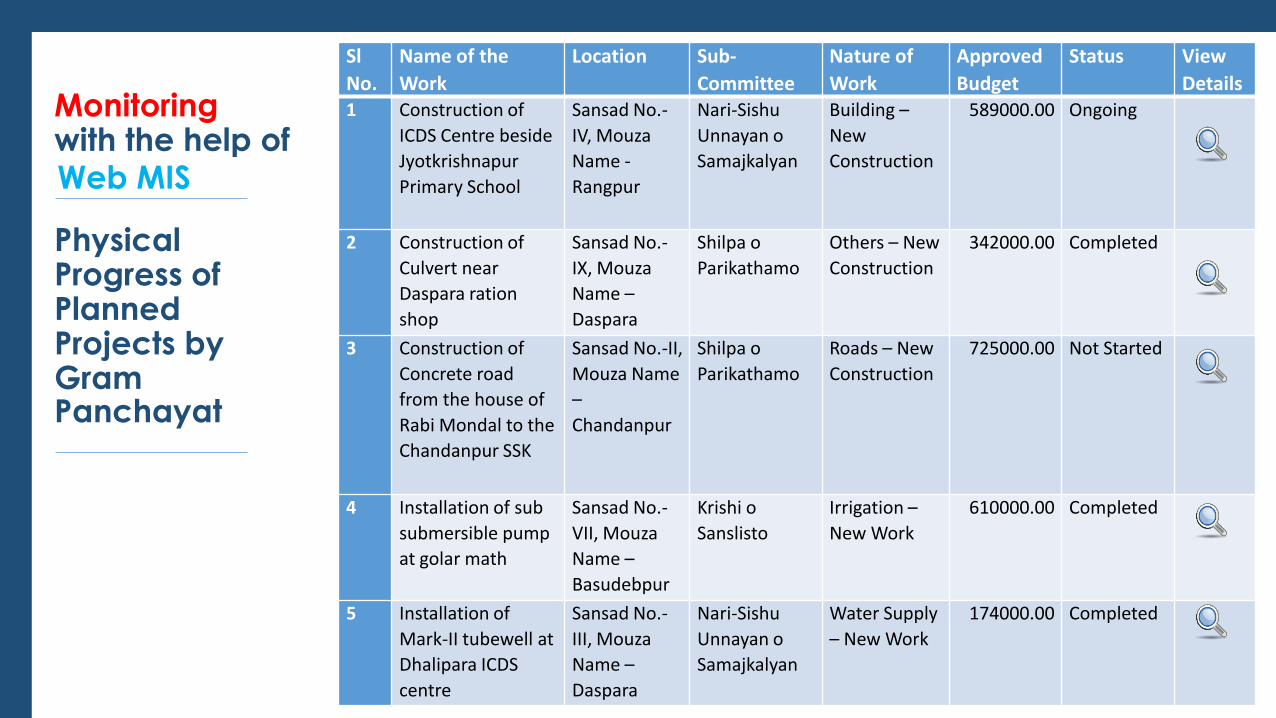
Physical Progress of Planned Projects by Gram Panchayat
Web MIS
Sl
No.
Name of the
Work
Location Sub-
Committee
Nature of
Work
Approved
Budget
Status View
Details 1 Construction of
ICDS Centre beside
Jyotkrishnapur
Primary School
Sansad No.-
IV, Mouza
Name -
Rangpur
Nari-Sishu
Unnayan o
Samajkalyan
Building –
New
Construction
589000.00 Ongoing
2 Construction of
Culvert near
Daspara ration
shop
Sansad No.-
IX, Mouza
Name –
Daspara
Shilpa o
Parikathamo
Others – New
Construction
342000.00 Completed
3 Construction of
Concrete road
from the house of
Rabi Mondal to the
Chandanpur SSK
Sansad No.-II,
Mouza Name
–
Chandanpur
Shilpa o
Parikathamo
Roads – New
Construction
725000.00 Not Started
4 Installation of sub
submersible pump
at golar math
Sansad No.-
VII, Mouza
Name –
Basudebpur
Krishi o
Sanslisto
Irrigation –
New Work
610000.00 Completed
5 Installation of
Mark-II tubewell at
Dhalipara ICDS
centre
Sansad No.-
III, Mouza
Name –
Daspara
Nari-Sishu
Unnayan o
Samajkalyan
Water Supply
– New Work
174000.00 Completed
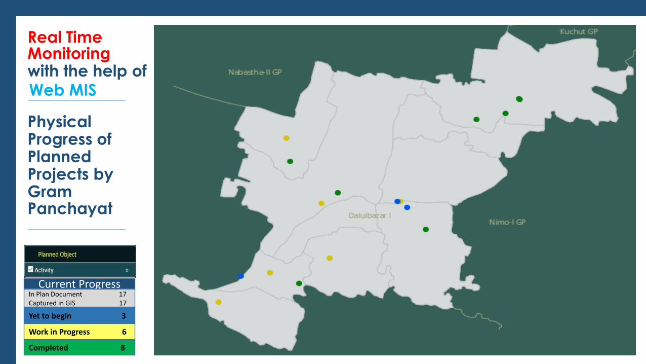
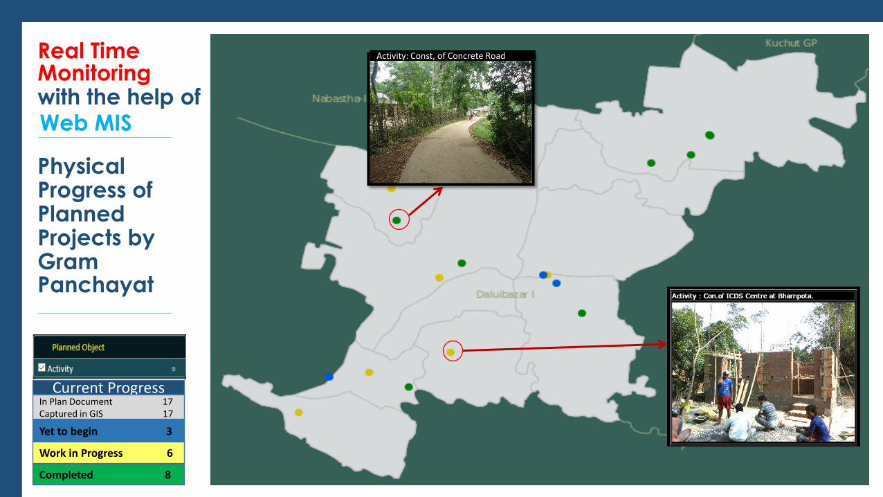
Monitoring with the help of
Physical Progress of Planned Projects by Gram Panchayat
Web MIS
Real Time
Current Progress In Plan Document 17 Captured in GIS 17
Yet to begin 3
Work in Progress 6
Completed 8
Monitoring with the help of
Physical Progress of Planned Projects by Gram Panchayat
Web MIS
Real Time
Current Progress In Plan Document 17 Captured in GIS 17
Yet to begin 3
Work in Progress 6
Completed 8
Activity: Const, of Concrete Road
Monitoring with the help of GIS Map
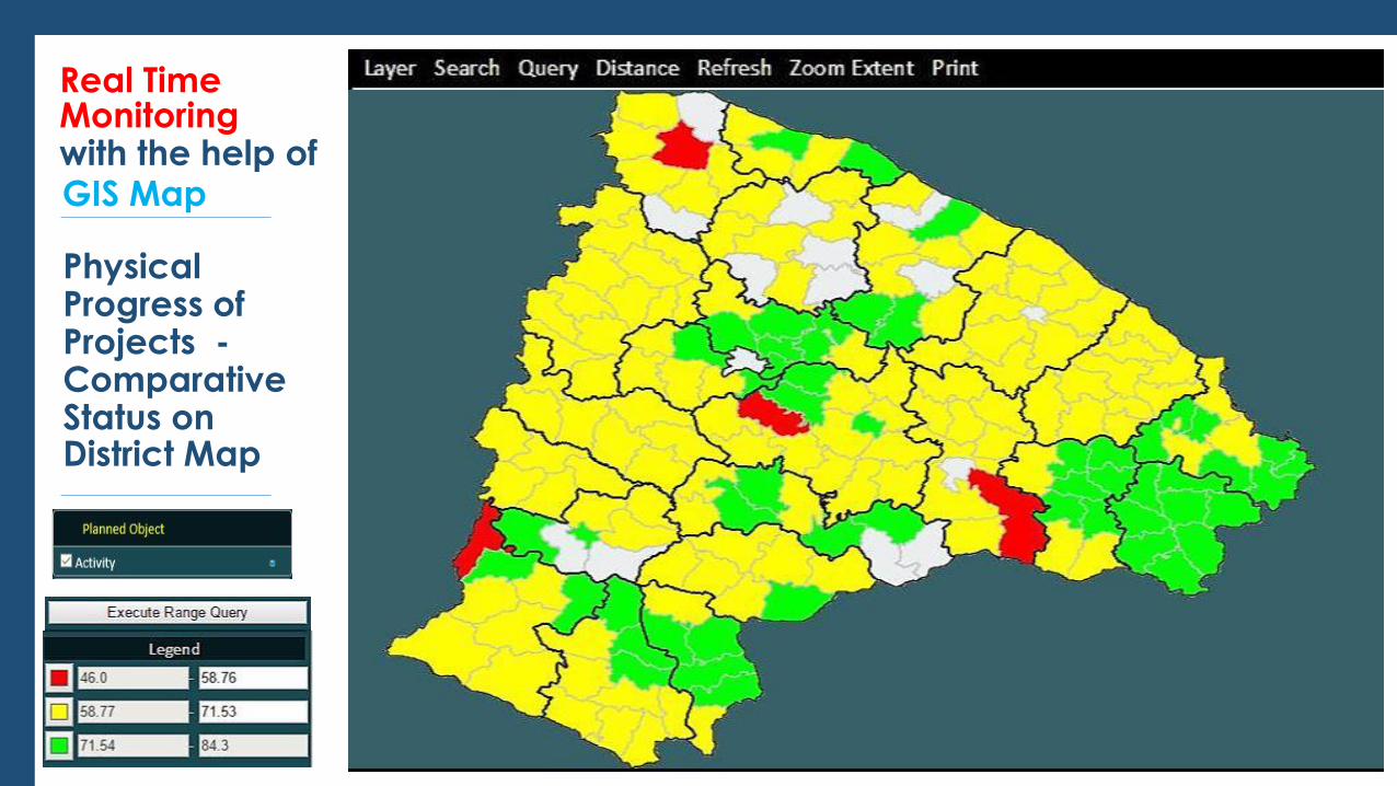
Real Time
Physical Progress of Projects - Comparative Status on District Map
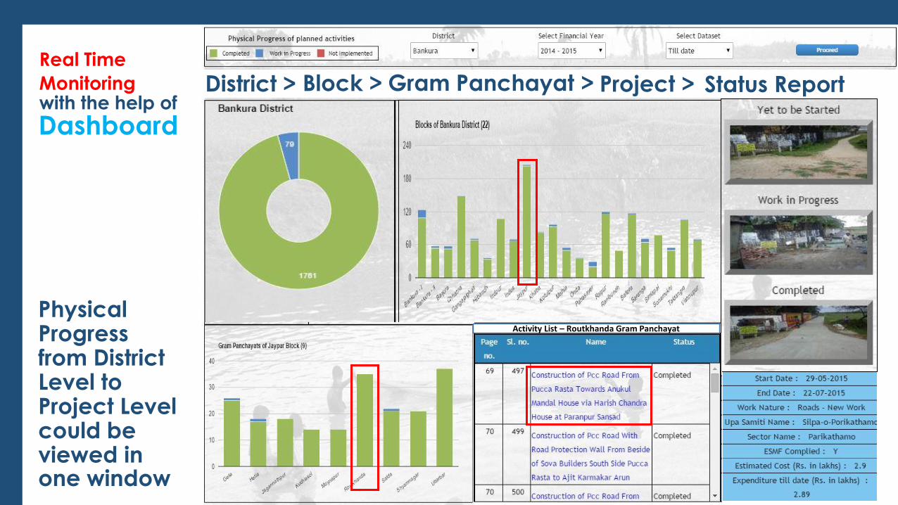
Monitoring with the help of
Real Time
Dashboard
Physical Progress from District Level to Project Level could be viewed in one window
District > Block > Gram Panchayat > Project > Status Report
Activity List – Routkhanda Gram Panchayat
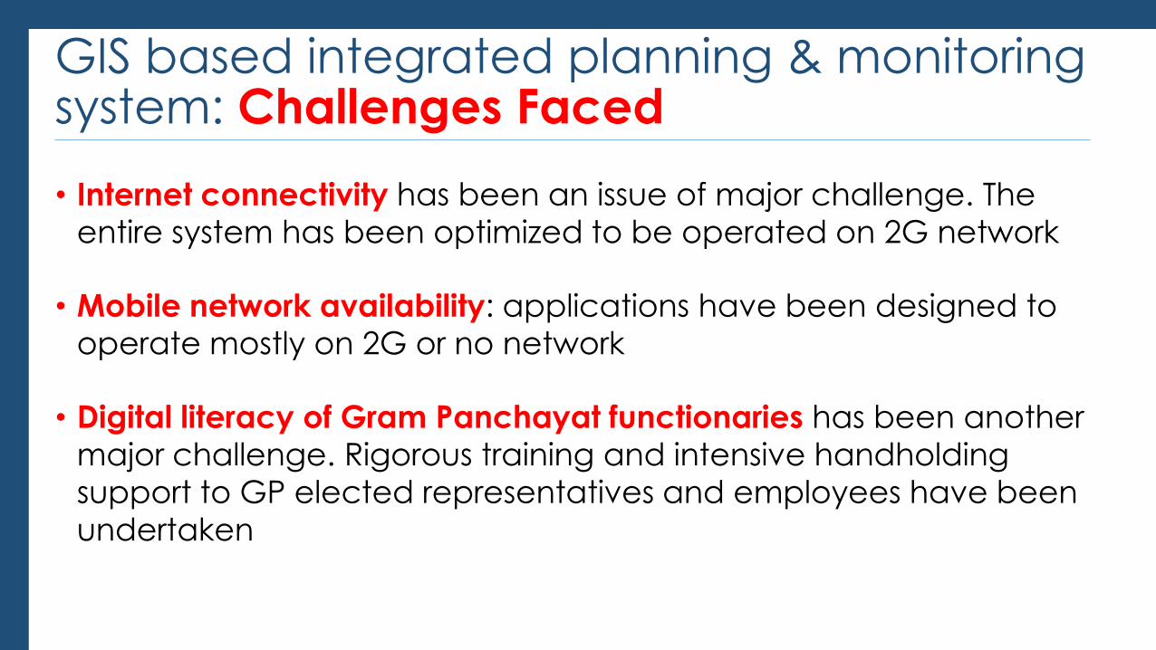
GIS based integrated planning & monitoring system: Challenges Faced
• Internet connectivity has been an issue of major challenge. The entire system has been optimized to be operated on 2G network
• Mobile network availability: applications have been designed to
operate mostly on 2G or no network
• Digital literacy of Gram Panchayat functionaries has been another
major challenge. Rigorous training and intensive handholding
support to GP elected representatives and employees have been
undertaken
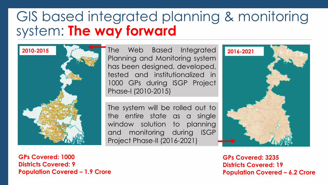
GIS based integrated planning & monitoring system: The way forward
GPs Covered: 1000
Districts Covered: 9
Population Covered – 1.9 Crore
GPs Covered: 3235
Districts Covered: 19
Population Covered – 6.2 Crore
2010-2015 2016-2021 The Web Based Integrated
Planning and Monitoring system
has been designed, developed, tested and institutionalized in
1000 GPs during ISGP Project
Phase-I (2010-2015)
The system will be rolled out to
the entire state as a single window solution to planning
and monitoring during ISGP
Project Phase-II (2016-2021)
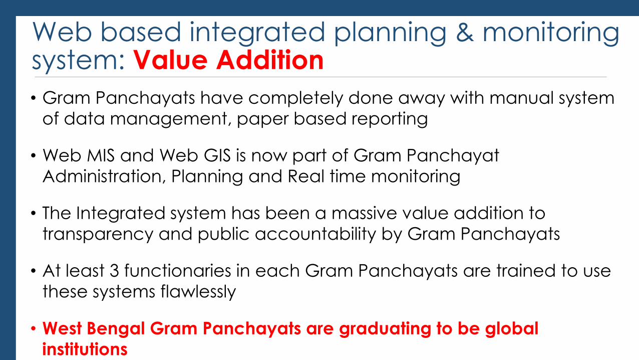
Web based integrated planning & monitoring system: Value Addition
• Gram Panchayats have completely done away with manual system
of data management, paper based reporting
• Web MIS and Web GIS is now part of Gram Panchayat Administration, Planning and Real time monitoring
• The Integrated system has been a massive value addition to transparency and public accountability by Gram Panchayats
• At least 3 functionaries in each Gram Panchayats are trained to use
these systems flawlessly
• West Bengal Gram Panchayats are graduating to be global
institutions
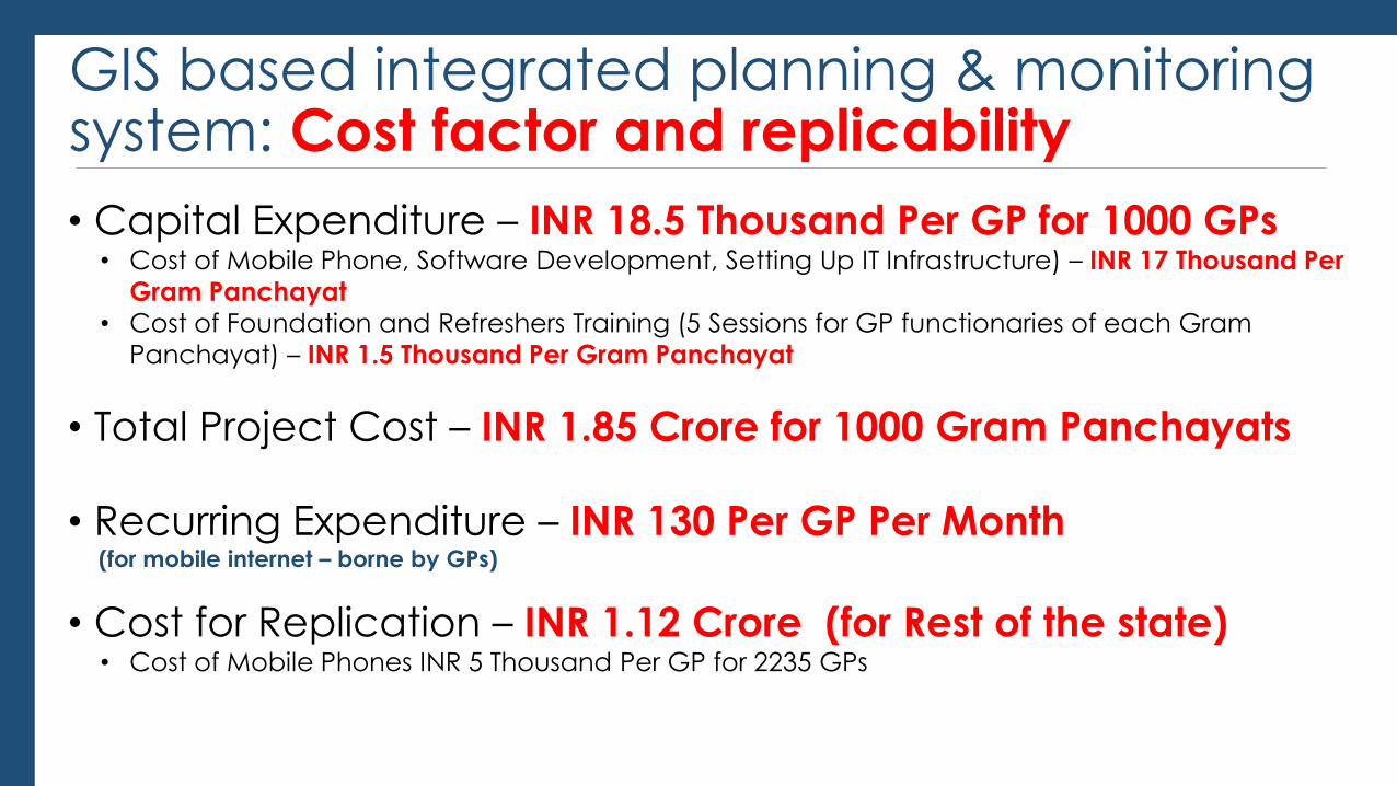
GIS based integrated planning & monitoring system: Cost factor and replicability
• Capital Expenditure – INR 18.5 Thousand Per GP for 1000 GPs • Cost of Mobile Phone, Software Development, Setting Up IT Infrastructure) – INR 17 Thousand Per
Gram Panchayat
• Cost of Foundation and Refreshers Training (5 Sessions for GP functionaries of each Gram
Panchayat) – INR 1.5 Thousand Per Gram Panchayat
• Total Project Cost – INR 1.85 Crore for 1000 Gram Panchayats
• Recurring Expenditure – INR 130 Per GP Per Month (for mobile internet – borne by GPs)
• Cost for Replication – INR 1.12 Crore (for Rest of the state) • Cost of Mobile Phones INR 5 Thousand Per GP for 2235 GPs

The journey has begun..