gis data the 9-1-1 way - nsgic.memberclicks.net · gis data the 9-1-1 way: understanding nena’s...
TRANSCRIPT
GIS Data the 9-1-1 Way:Understanding NENA’s
NG9-1-1 GIS Data Model Standard
Cheryl Benjamin Richard KellyNYS ITS –GIS Program Office 911 Datamaster NSGIC liaison to NENA NENA liaison to NSGIC
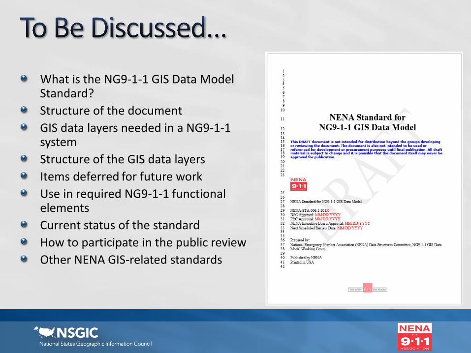
What is the NG9-1-1 GIS Data Model Standard?Structure of the documentGIS data layers needed in a NG9-1-1 systemStructure of the GIS data layersItems deferred for future workUse in required NG9-1-1 functional elementsCurrent status of the standardHow to participate in the public reviewOther NENA GIS-related standards
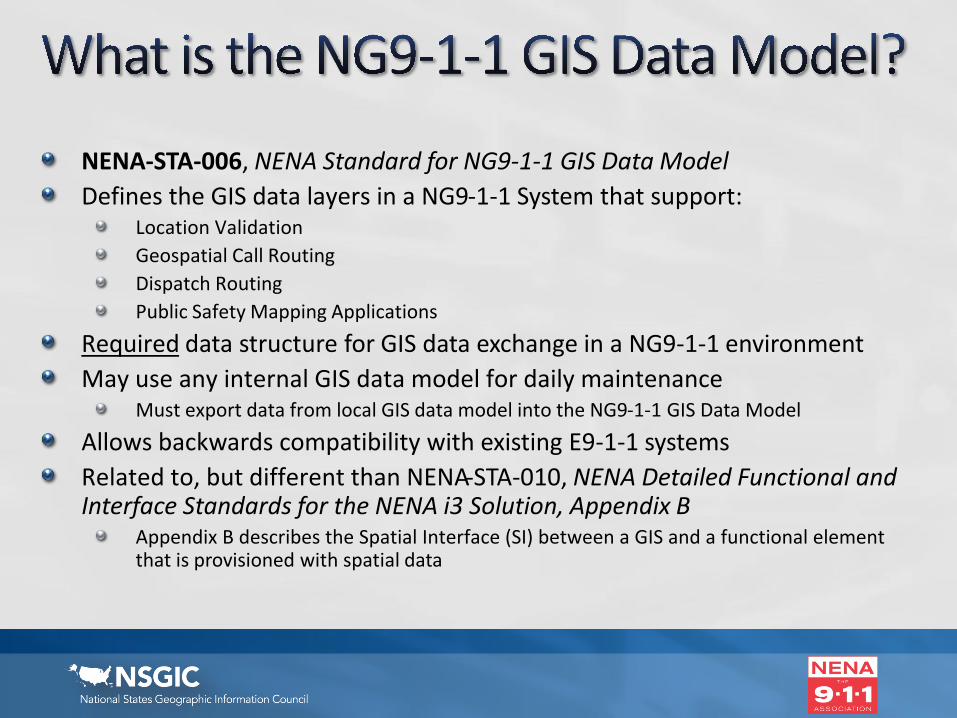
NENA-STA-006, NENA Standard for NG9-1-1 GIS Data ModelDefines the GIS data layers in a NG9-1-1 System that support:
Location ValidationGeospatial Call RoutingDispatch Routing Public Safety Mapping Applications
Required data structure for GIS data exchange in a NG9-1-1 environmentMay use any internal GIS data model for daily maintenance
Must export data from local GIS data model into the NG9-1-1 GIS Data Model
Allows backwards compatibility with existing E9-1-1 systemsRelated to, but different than NENA-STA-010, NENA Detailed Functional and Interface Standards for the NENA i3 Solution, Appendix B
Appendix B describes the Spatial Interface (SI) between a GIS and a functional element that is provisioned with spatial data
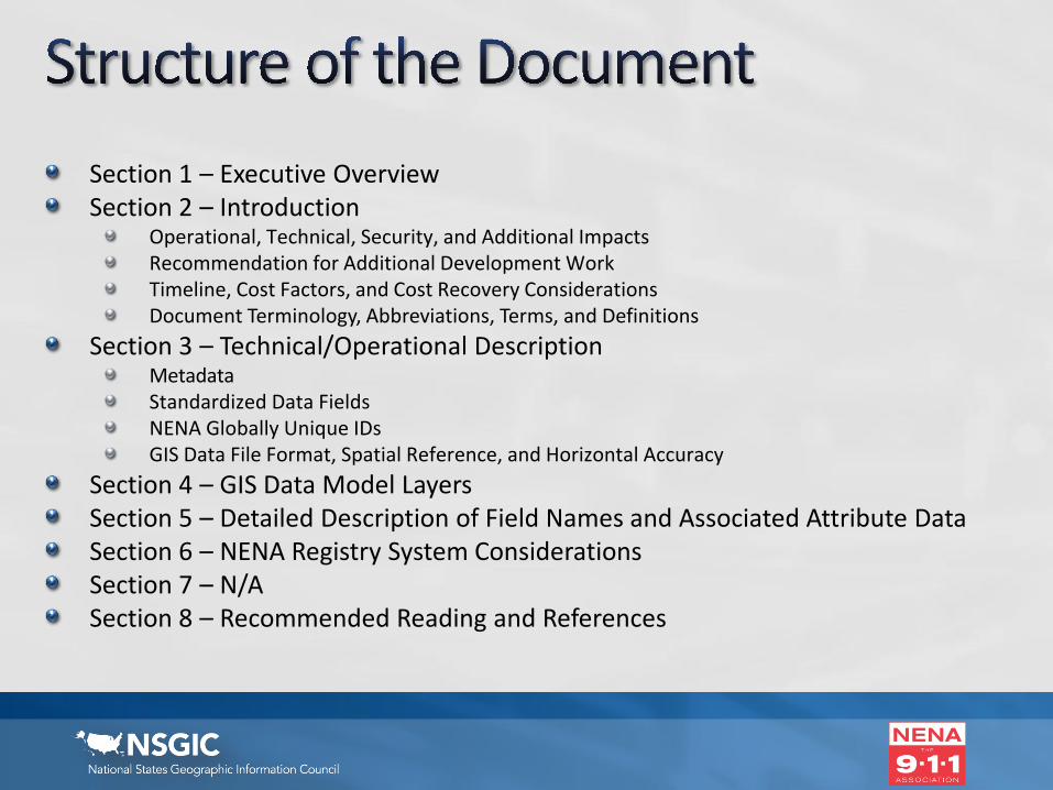
Section 1 – Executive OverviewSection 2 – Introduction
Operational, Technical, Security, and Additional ImpactsRecommendation for Additional Development WorkTimeline, Cost Factors, and Cost Recovery ConsiderationsDocument Terminology, Abbreviations, Terms, and Definitions
Section 3 – Technical/Operational DescriptionMetadataStandardized Data FieldsNENA Globally Unique IDsGIS Data File Format, Spatial Reference, and Horizontal Accuracy
Section 4 – GIS Data Model LayersSection 5 – Detailed Description of Field Names and Associated Attribute DataSection 6 – NENA Registry System ConsiderationsSection 7 – N/ASection 8 – Recommended Reading and References
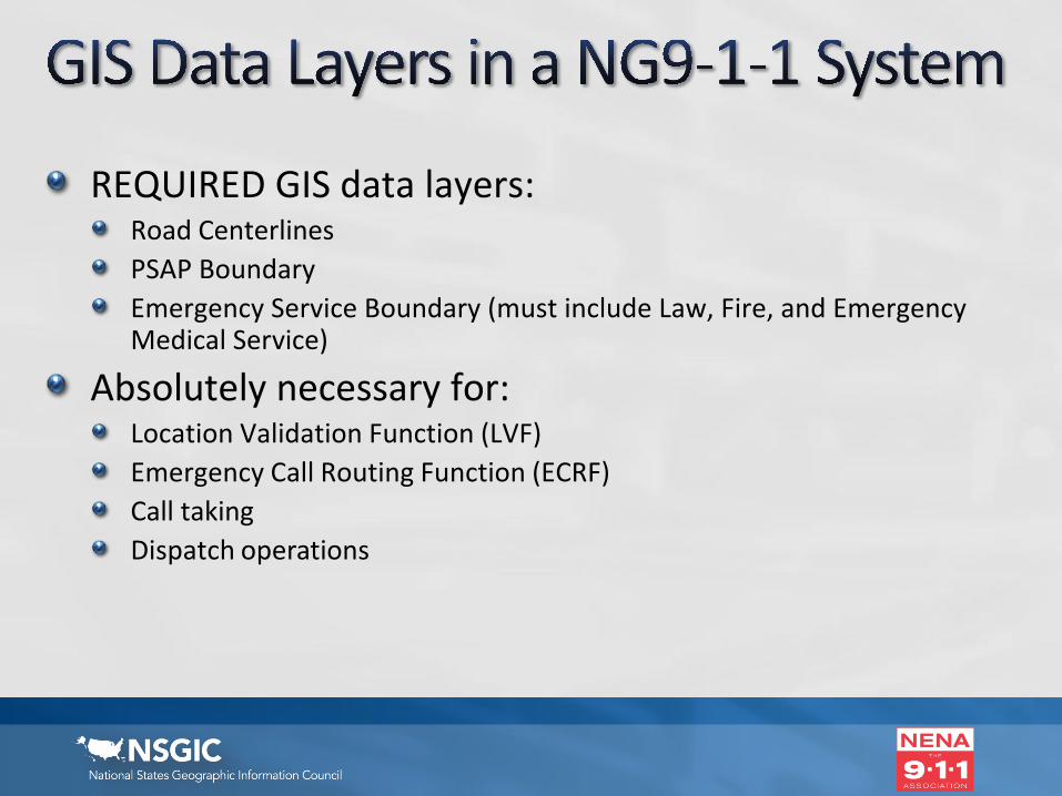
REQUIRED GIS data layers:Road CenterlinesPSAP BoundaryEmergency Service Boundary (must include Law, Fire, and Emergency Medical Service)
Absolutely necessary for:Location Validation Function (LVF)Emergency Call Routing Function (ECRF)Call takingDispatch operations
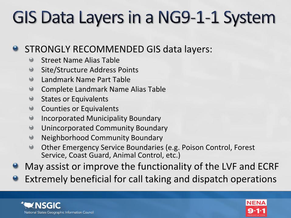
STRONGLY RECOMMENDED GIS data layers:Street Name Alias TableSite/Structure Address PointsLandmark Name Part TableComplete Landmark Name Alias TableStates or EquivalentsCounties or EquivalentsIncorporated Municipality BoundaryUnincorporated Community BoundaryNeighborhood Community Boundary Other Emergency Service Boundaries (e.g. Poison Control, Forest Service, Coast Guard, Animal Control, etc.)
May assist or improve the functionality of the LVF and ECRFExtremely beneficial for call taking and dispatch operations
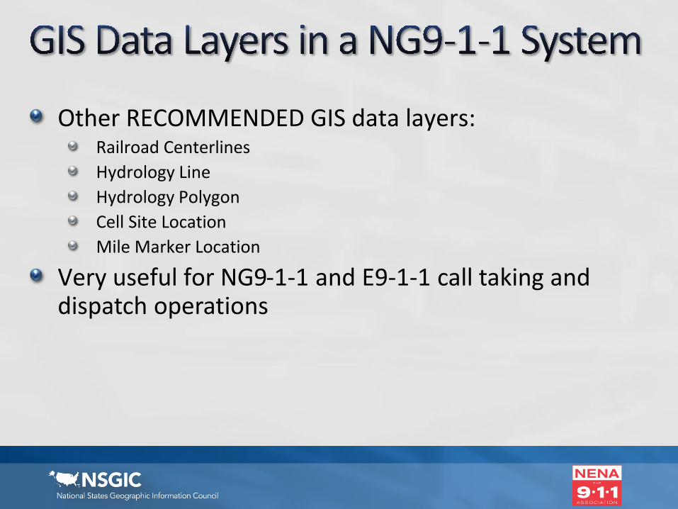
Other RECOMMENDED GIS data layers:Railroad CenterlinesHydrology LineHydrology PolygonCell Site LocationMile Marker Location
Very useful for NG9-1-1 and E9-1-1 call taking and dispatch operations
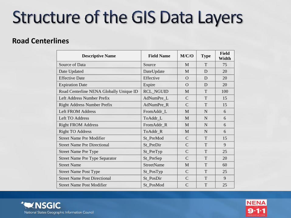
Road Centerlines
Descriptive Name Field Name M/C/O Type Field Width
Source of Data Source M T 75 Date Updated DateUpdate M D 20 Effective Date Effective O D 20 Expiration Date Expire O D 20 Road Centerline NENA Globally Unique ID RCL_NGUID M T 100 Left Address Number Prefix AdNumPre_L C T 15 Right Address Number Prefix AdNumPre_R C T 15 Left FROM Address FromAddr_L M N 6 Left TO Address ToAddr_L M N 6 Right FROM Address FromAddr_R M N 6 Right TO Address ToAddr_R M N 6 Street Name Pre Modifier St_PreMod C T 15 Street Name Pre Directional St_PreDir C T 9 Street Name Pre Type St_PreTyp C T 25 Street Name Pre Type Separator St_PreSep C T 20 Street Name StreetName M T 60 Street Name Post Type St_PosTyp C T 25 Street Name Post Directional St_PosDir C T 9 Street Name Post Modifier St_PosMod C T 25
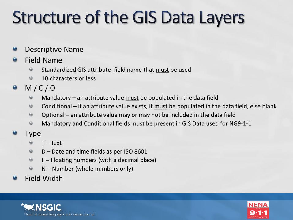
Descriptive NameField Name
Standardized GIS attribute field name that must be used10 characters or less
M / C / OMandatory – an attribute value must be populated in the data field Conditional – if an attribute value exists, it must be populated in the data field, else blankOptional – an attribute value may or may not be included in the data fieldMandatory and Conditional fields must be present in GIS Data used for NG9-1-1
TypeT – Text D – Date and time fields as per ISO 8601F – Floating numbers (with a decimal place)N – Number (whole numbers only)
Field Width

Section 5:Detailed Description of Field Names & Associated Attribute Data
Alphabetical listing of each Field Name with:DescriptionAttribute DomainExample
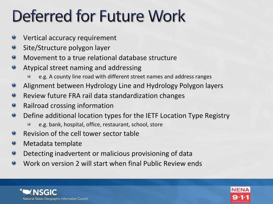
Vertical accuracy requirementSite/Structure polygon layerMovement to a true relational database structureAtypical street naming and addressing
e.g. A county line road with different street names and address ranges
Alignment between Hydrology Line and Hydrology Polygon layersReview future FRA rail data standardization changesRailroad crossing informationDefine additional location types for the IETF Location Type Registry
e.g. bank, hospital, office, restaurant, school, store
Revision of the cell tower sector tableMetadata templateDetecting inadvertent or malicious provisioning of dataWork on version 2 will start when final Public Review ends
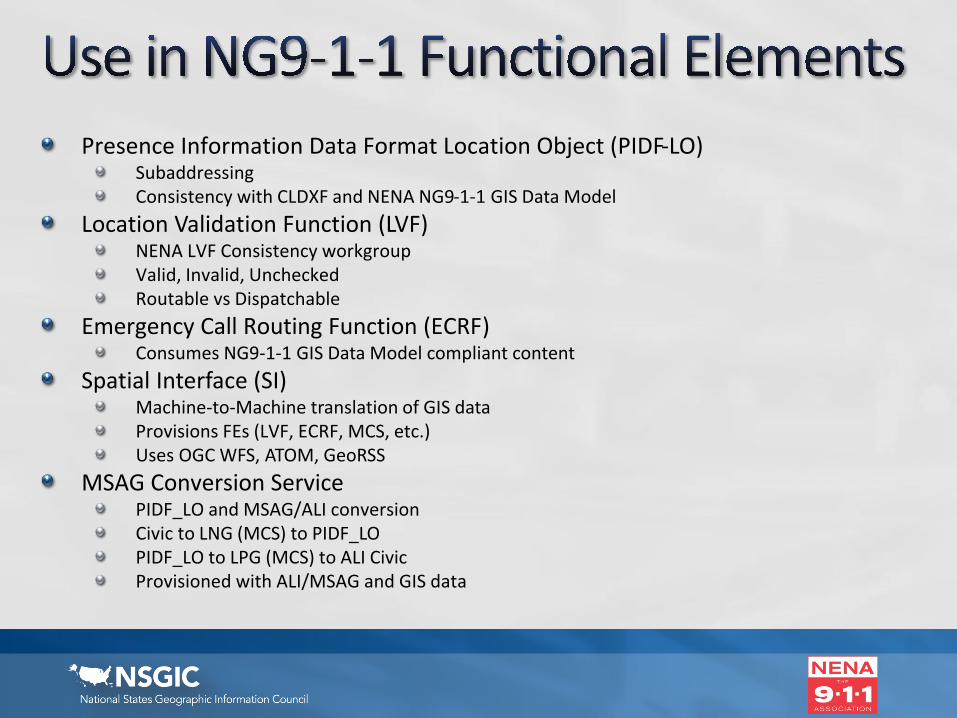
Presence Information Data Format Location Object (PIDF-LO)SubaddressingConsistency with CLDXF and NENA NG9-1-1 GIS Data Model
Location Validation Function (LVF)NENA LVF Consistency workgroupValid, Invalid, UncheckedRoutable vs Dispatchable
Emergency Call Routing Function (ECRF)Consumes NG9-1-1 GIS Data Model compliant content
Spatial Interface (SI)Machine-to-Machine translation of GIS dataProvisions FEs (LVF, ECRF, MCS, etc.) Uses OGC WFS, ATOM, GeoRSS
MSAG Conversion ServicePIDF_LO and MSAG/ALI conversionCivic to LNG (MCS) to PIDF_LOPIDF_LO to LPG (MCS) to ALI CivicProvisioned with ALI/MSAG and GIS data

Standard completed & submitted to NENA leadership Internal NENA Authoring Committee Review (6/7/12 - 6/22/12)
First internal NENA All Committee Review (12/17/14 - 1/30/15)
Second internal NENA All Committee Review (6/14/16 - 7/8/16)
Public review (minimum 45 business days) Released 12/9/2016
Comments due 2/28/2017NENA Workgroup reviews comments & updates documentRevised standard submitted to NENA leadership for additional public review(s) as necessary
Revised standard submitted for publication

Don’t wait…It’s 86 pages long!Use bulk load option (NENA Development Group members)Clearly articulate your concernProvide supporting references, examples, and justificationProposal should include suggested textOffer to be on workgroup calls for a complicated commentConsider noting new items as future development workSubmissions from multiple states/local governments on same issue will have more weight than one comment submitted by NSGICReview other submitted comments (for topics, format)Consider joining the workgroup to help resolve the public comments
https://dev.nena.org/kws/public/document?document_id=9828&wg_abbrev=csds-gis
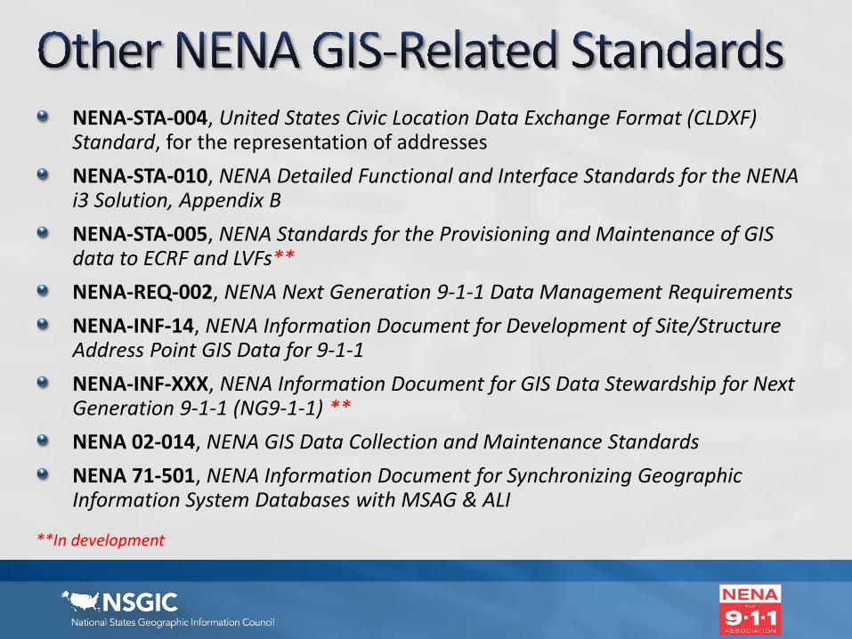
NENA-STA-004, United States Civic Location Data Exchange Format (CLDXF) Standard, for the representation of addressesNENA-STA-010, NENA Detailed Functional and Interface Standards for the NENA i3 Solution, Appendix BNENA-STA-005, NENA Standards for the Provisioning and Maintenance of GIS data to ECRF and LVFs**NENA-REQ-002, NENA Next Generation 9-1-1 Data Management RequirementsNENA-INF-14, NENA Information Document for Development of Site/Structure Address Point GIS Data for 9-1-1NENA-INF-XXX, NENA Information Document for GIS Data Stewardship for Next Generation 9-1-1 (NG9-1-1) **NENA 02-014, NENA GIS Data Collection and Maintenance StandardsNENA 71-501, NENA Information Document for Synchronizing Geographic Information System Databases with MSAG & ALI
**In development