gis solutions for business continuity planning
TRANSCRIPT

GIS Solutions for Business Continuity Planning

ESRI GIS
What Is GIS?
Geographic information system (GIS) technology combines mapping software with database management tools to collect, analyze, organize, report, and share many types of information. Different data sources and data types are linked using the location at which the data is collected or its association to a place or address. A GIS can link to and access information that is shared from the field or read from a departmental database anywhere on the network. In addition, time-critical information collected by real-time sensors and broadcast from notification systems can be combined to improve situational awareness.
GIS provides an intuitive medium through which a consolidated and coordinated common operational picture (COP) can be developed. This visual snapshot can be enriched and extended by spatial analysis and modeling of events as they occur, thereby improving decision making and response execution. Historical results can be modeled for possible impact analysis.
GIS data is normally organized into collections of map layers that contain the important datasets that are relevant to the scenario or event. Business continuity systems often contain street-level data; aerial or satellite imagery; administrative boundaries; and dynamic or real-time layers such as weather, GPS locations, plume tracks, and live video feeds.
Critical infrastructure
Street network
Facilities and sites
Administrative boundaries
Population distribution
Command and control
Land and water features
One in five businesses experiences a major business disruption
each year. For those that do experience a disruption, many do
not resume operations or will fail within 24 months. Disruption
can be caused by power outages, internal flooding, fire, ter-
rorism, crime, transportation issues, or severe weather events.
While a portion of businesses have deployed measures for ensur-
ing business continuance, few have implemented a BCP that
encompasses front- and back-office systems, employee safety,
and supplier and client management.
Why Use GIS to Plan for Contingencies?
GIS technology allows businesses to quickly display, analyze, and determine vulnerabilities, exposures, and weaknesses. Develop-ing mitigation strategies, modeling against potential events, and analyzing consequences can be done quickly and efficiently. GIS enables a business to mitigate risks that disruptions pose in areas such as health and safety liability, loss of productivity from downtime, loss of work to competitors, failures within the supply chain, penalties from regulators, and higher insurance rates.
Regardless of industry or size, all companies have responsibilities from a compliance standpoint.

GIS Solutions for Business Continuity Planning
Business continuity plan (n.)—holistic management process that identifies potential impacts that threaten an organization and provides a framework for building resilience with the capacity for an effective response that safeguards the interests of key stakeholders, reputation, brand, and value-creating activities
—The Business Continuity Institute
GIS can help a business prepare for disruptions to minimize
potential effects.
Keep It Simple
GIS has been recognized as a powerful tool for developing effective BCPs due to the geographic nature of the data and models. GIS helps businesses develop an effective plan by addressing the following:
• Damageassessmentandrepairduringemergencies
• Employee(andfamily)notification
• Evacuation
• Facilitiesmanagement
• Mitigationstrategydevelopment
• Officerelocation
• Supplychainassessment
• Threatassessment
• Vulnerabilityanalysis
• Weathermapping
www.esri.com/businesscontinuity
Stay Connected
GIS integrates many seemingly unconnected data sources. Because a fundamental part of creating a BCP is determin-ing the location of a company’s assets, even the most basic GIS application (determining where things are) adds value to a standard BCP.
Using GIS to show locations of assets lets BCP analysts evaluate them in relation to potential disruptions in ways that are not possible with text or tabular representations of the same data. GIS enables businesses to visualize and maintain overall situational awareness during emergencies and normal operations.
ESRI® ArcGIS® Server integrates with multiple back-end systems such as human resources, customer relationship management, real-time information, and inventory databases.

See Your Company
GIS can provide a visual snapshot that shows where assets and employees are located. Using GIS to model what-if scenarios can capture the infrastructure, business processes, and locations of an organization in a meaningful way. Through GIS-based dashboard-type applications, managers can quickly obtain a high-level overview of a situation and understand what needs to be done to reestablish critical business functions in the event of a disruption.
Multimedia- and event-driven data, including historic playback, can be easily combined to more fully model and understand the potential impact on your organization.
GIS models can be integrated into CAD and 3D analysis to more effectively plan and
build scenario response models.
Relocate Operations
EveryBCPmustaddresstherelocationofpersonnel,operations,and assets. In some industries, specific rules govern what must be included. GIS is well suited to relocation analysis, allowing BCP analysts to factor in locations of the company’s most critical employees from a day-to-day operations perspective and deter-mine a temporary operations site that is accessible and optimal in relation to these employees.
Companies can avoid existing potential threats when relocat-ing their facilities yet remain close to customers and major transportation routes by using relocation models available in ArcGIS.
GIS Solutions for Business Continuity Planning
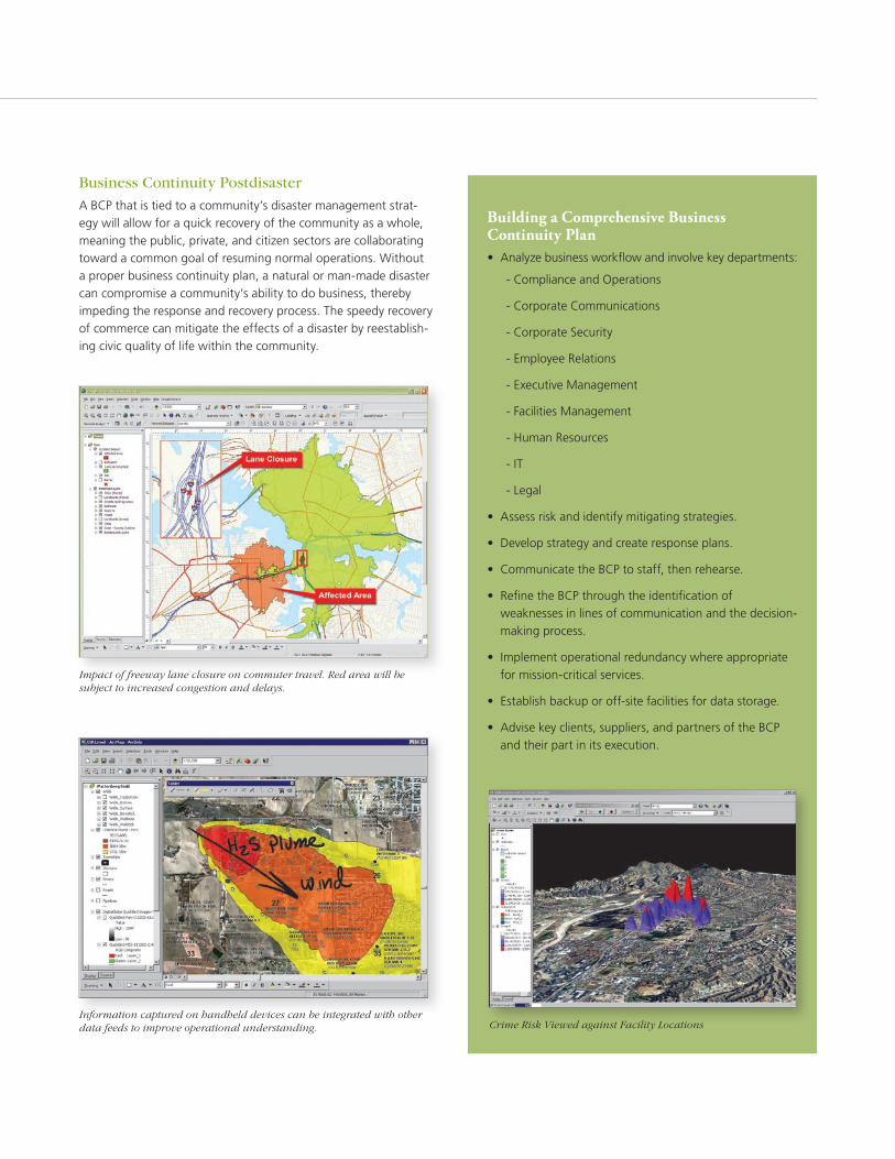
Impact of freeway lane closure on commuter travel. Red area will be subject to increased congestion and delays.
Information captured on handheld devices can be integrated with other data feeds to improve operational understanding.
Business Continuity Postdisaster
A BCP that is tied to a community’s disaster management strat-egy will allow for a quick recovery of the community as a whole, meaning the public, private, and citizen sectors are collaborating towardacommongoalofresumingnormaloperations.Withouta proper business continuity plan, a natural or man-made disaster can compromise a community’s ability to do business, thereby impeding the response and recovery process. The speedy recovery of commerce can mitigate the effects of a disaster by reestablish-ing civic quality of life within the community.
Building a Comprehensive Business Continuity Plan• Analyzebusinessworkflowandinvolvekeydepartments:
- Compliance and Operations
- Corporate Communications
- Corporate Security
-EmployeeRelations
-ExecutiveManagement
-FacilitiesManagement
- Human Resources
- IT
- Legal
• Assess risk and identify mitigating strategies.
• Developstrategyandcreateresponseplans.
• CommunicatetheBCPtostaff,thenrehearse.
• RefinetheBCPthroughtheidentificationofweaknesses in lines of communication and the decision-making process.
• Implementoperationalredundancywhereappropriatefor mission-critical services.
• Establishbackuporoff-sitefacilitiesfordatastorage.
• Advisekeyclients,suppliers,andpartnersoftheBCPand their part in its execution.
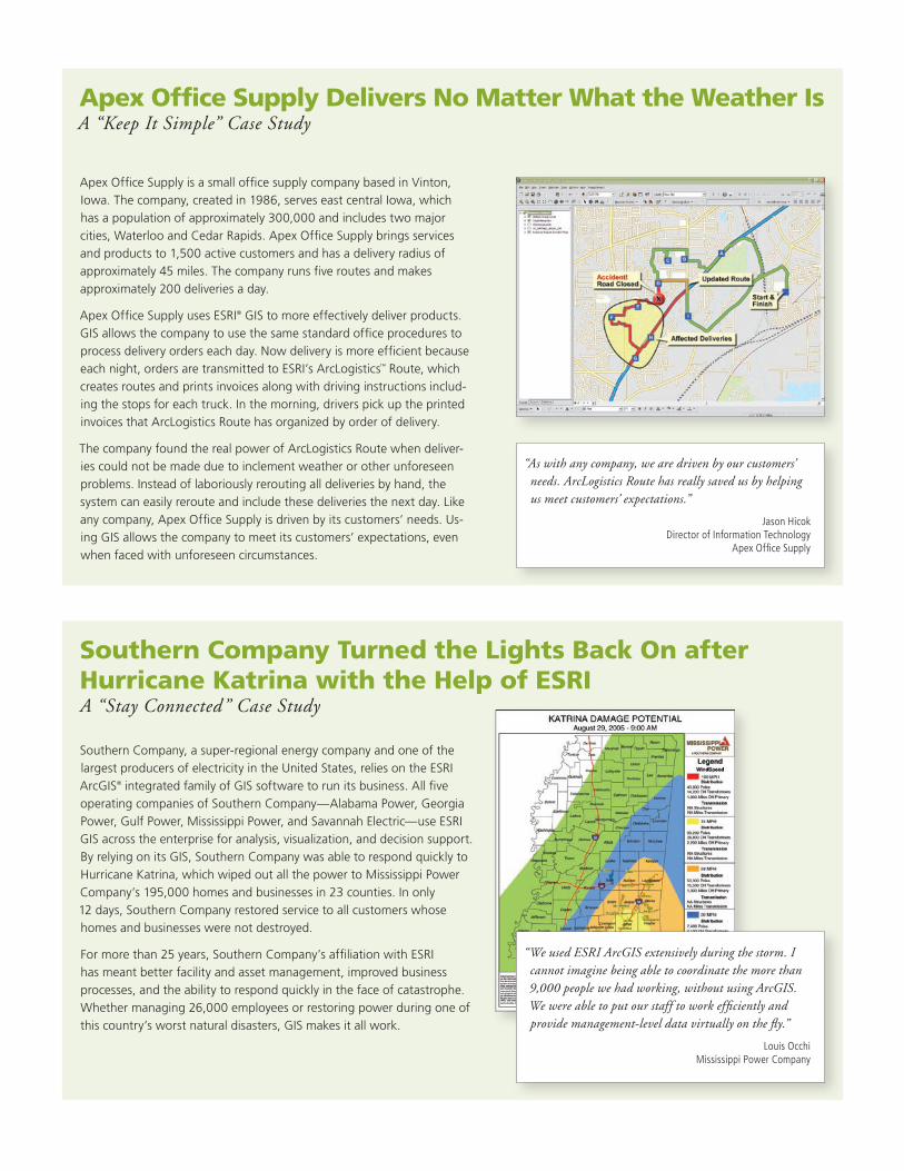
Crime Risk Viewed against Facility Locations
ApexOfficeSupplyisasmallofficesupplycompanybasedinVinton,Iowa. The company, created in 1986, serves east central Iowa, which has a population of approximately 300,000 and includes two major cities,WaterlooandCedarRapids.ApexOfficeSupplybringsservicesand products to 1,500 active customers and has a delivery radius of approximately 45 miles. The company runs five routes and makes approximately 200 deliveries a day.
ApexOfficeSupplyusesESRI® GIS to more effectively deliver products. GIS allows the company to use the same standard office procedures to process delivery orders each day. Now delivery is more efficient because eachnight,ordersaretransmittedtoESRI’sArcLogistics™ Route, which creates routes and prints invoices along with driving instructions includ-ing the stops for each truck. In the morning, drivers pick up the printed invoices that ArcLogistics Route has organized by order of delivery.
The company found the real power of ArcLogistics Route when deliver-ies could not be made due to inclement weather or other unforeseen problems. Instead of laboriously rerouting all deliveries by hand, the system can easily reroute and include these deliveries the next day. Like any company, Apex Office Supply is driven by its customers’ needs. Us-ing GIS allows the company to meet its customers’ expectations, even when faced with unforeseen circumstances.
Apex Office Supply Delivers No Matter What the Weather IsA “Keep It Simple” Case Study
Southern Company, a super-regional energy company and one of the largestproducersofelectricityintheUnitedStates,reliesontheESRIArcGIS® integrated family of GIS software to run its business. All five operating companies of Southern Company—Alabama Power, Georgia Power,GulfPower,MississippiPower,andSavannahElectric—useESRIGIS across the enterprise for analysis, visualization, and decision support. By relying on its GIS, Southern Company was able to respond quickly to HurricaneKatrina,whichwipedoutallthepowertoMississippiPowerCompany’s 195,000 homes and businesses in 23 counties. In only 12 days, Southern Company restored service to all customers whose homes and businesses were not destroyed.
Formorethan25years,SouthernCompany’saffiliationwithESRIhas meant better facility and asset management, improved business processes, and the ability to respond quickly in the face of catastrophe. Whethermanaging26,000employeesorrestoringpowerduringoneofthis country’s worst natural disasters, GIS makes it all work.
Southern Company Turned the Lights Back On after Hurricane Katrina with the Help of ESRIA “Stay Connected” Case Study
“We used ESRI ArcGIS extensively during the storm. I cannot imagine being able to coordinate the more than 9,000 people we had working, without using ArcGIS. We were able to put our staff to work efficiently and provide management-level data virtually on the fly.”
Louis Occhi Mississippi Power Company
“As with any company, we are driven by our customers’ needs. ArcLogistics Route has really saved us by helping us meet customers’ expectations.”
Jason Hicok Director of Information Technology
Apex Office Supply

Identifying evacuation meeting points for employees who work in a specific building is another application of spatial statistics in a BCP. Although businesses typically prefer employees stay inside during an emergency until the situation is fully understood, an evacuation plan should be in place.
The location of the office affects the complexity of this task. It can be simple if the business is located in an office park. How-ever, if the office is located in a densely populated city, such as New York City, logistics are more complex. If the emergency is isolated to a single building, it is easier to manage than if multiple adjacent buildings are affected. In the latter case, the plan must take into account the neighborhood surrounding the affected buildings.
After evacuating the office, employees usually meet at a specific locationanddecidewhatneedstobedonenext.Whereshouldemployees regroup? Factors such as how far from the building employees can travel with relative ease, taking into account those with disabilities and the presence of open spaces that can be used, must be considered. These sorts of questions are all geographic in nature.
The Hot Spot Analysis tool is used to find the location of statisti-cally significant spatial clusters of high- and low-attribute values. This tool shows areas where higher-than-average values tend to be found near each other and where lower-than-average values tend to be found near each other.
Figure 1 shows a simple model illustrating how the ArcGIS Hot/Cold Spot Analysis tools were used for this analysis. This model
geocodes the address of the building in question, then buffers that location by one-quarter mile (assuming all employees can travel that far). It clips a business location dataset that contains the area’s daytime population by business address. Using this dataset, the model runs the Hot/Cold Spot Analysis tools to find statistically significant hot and cold spots for building employees.
The dark blue spots shown in figure 2 represent statistically significant cold spots—areas with few employees that may serve as good meeting places in the event of an emergency. To more clearly see the areas represented by these points, a continuous surface was created using the ArcGIS Spatial Analyst extension (as shown in figure 2). The surface reveals more generalized areas representing cold spots in the data, shown as dark blue spots. These areas are potential sites for meeting points. How-ever, more information, perhaps obtained from orthophotos of the area, would be required before selecting a final location.
Handling EvacuationsA “See Your Company” Case Study
CommercialorganizationsusingESRIGIScanprovidehigh-quality, accurate BCPs that integrate many types of data from multiple sources, incorporate geography, and use new tools developedspecificallyforspatialstatisticalanalysis.ESRIGIS,through the use of spatial techniques, enables BCP analysts to ask different types of questions and obtain better answers than they could previously using tools that relied solely on databases, spreadsheets, and traditional business intelligence packages.
ESRIworkscloselywithContingencyPlanningExchange,Securi-ties Industry Association, and Business Continuity Institute to understand business continuity. And since its technology is consistent with IT industry standards and philosophy, it follows a CIO’s approach to business continuity issues.
Figure 2: Using spatial statistics, GIS models help determine the best location to meet after evacuating a building.
Figure 1: By identifying the daytime population in each building and the evacuation points, a GIS model can calculate how people will become clustered and concentrated when they are evacuated. Hot spots of overcrowding can be identified and better assembly sites found to improve public safety.

The SARS epidemic of 2003 reinforced the importance of plan-ningforlocaldiseaseoutbreaks.Morerecently,governmenthealth authorities have been warning the business community thataninfluenzapandemicwilloccuratsomepointinthenearfuture, as they have in the past (1918, 1957, and 1968).
Businesses are developing specific plans regarding how they will protect their employees, maintain operations during a pandemic, and anticipate changes in consumer behavior. GIS is essential for
• Understandinglocationsofhealthrisks
• Predictinghospitalcapacityshortages
• Locatingvaccine/antiviraldeliverysites
• Identifyingemployeehouseholdsatrisk
A pandemic will impact different business locations at different times. GIS enables informed decision-making regarding how the geographic spread of disease is impacting employees, operations, andcustomers.Executivedashboardscanbebuiltusingreal-time news feeds and notification systems. Using the latest information from public health authorities and other sources, any business can understand the impact of the pandemic on their organization, suppliers, and employees.
Surviving the Next PandemicProtecting Employees, Maintaining Operations, and Serving Customers
Real-time data feeds can be mashed up with mapping and GIS analysis. An earthquake-tracking application provides input to ArcWeb Explorer, which automatically triggers notices and map views for the business continuity manager. Similar systems monitor diseases and community risks.
Event-driven e-mail notification alerts you if the application finds potentially affected company-owned facilities, employees, or other assets.
Using home addresses, geoprocessing tools identify distribution of sick people and compare the distribution to places where people typically gather such as schools, churches, and hospitals.

Enterprise GIS Integrates Business Continuity Operations
Build a Foundation to Support All Your Departments
AnESRIenterpriseGISisanintegrated,cross-departmentalresourcecomposed of interoperable components that support all aspects of the business continuity mission. It provides broad access to geospatial data and analysis through a common standards-compliant application architecture.
ESRIenterpriseGIScustomerscanrealizemajorimprovementstotheway they analyze, plan, and mitigate threats associated with busi-ness interruption and disaster management. These benefits include
• Improvedcollaborationandcommunicationacrosscommand,control, and response teams
• Reduceddataredundancycoupledwithimprovedaccuracyandmanagement integrity of geographic information
• Increasedabilitytoanalyzeandrespondtoeventsastheyunfoldby using a single, common view of the field of operations
• Improvedanalysis,visualization,anddecisionsupport
• Commonoperatingviewstounderstandareasofbusinessriskaswell as business opportunity
Vulnerability Analysis
Human Resources
RegulatoryCompliance
Situation Awareness/Catastrophe Management
Command Infrastructure
Mobile Deployment
Cost Models
Financial Forecasting
Environmental Impact
Threat Assessment

Asacompletegeographicinformationsystem,ESRIArcGISallows you to easily author data, maps, globes, and models on the desktop; serve them to a GIS server; and use them through Web,desktop,andmobileclients.TheArcGISfamilyofproductsincludesArcGISDesktop,ArcGISServer,ArcGISMobile,andArcGIS SM Online.
As a developer, you can access the capabilities of ArcGIS through theESRIDeveloperNetwork(EDNSM), an annual subscription-based program that provides you with the resources you need to build a wide range of custom GIS solutions.
Desktop GIS
Desktop GIS allows you to see your data on a map and analyze it to reveal patterns, relationships, and trends that are not readily apparent in tabular data, improving your decision making. Desktop GIS lets you create and edit data and includes ready-to-use tools that let you build process models, scripts, and completeworkflowstohelpyoubettertestpredictions,examinerelationships in your data, and answer questions such as
• WherearemycustomersandwhereshouldIputnewfacilities?
• Whodoesanemergencyimpact?
• Howwillapoweroutageaffectmyoperations?
• Whatistheimpactofnewurbandevelopment?
Server GIS
Server GIS lets you share and maintain the data that you create with Desktop GIS with a large number of users across the enterprise using focused, easy-to-use applications. Server GIS enables you to push your maps, models, and tools out to engineers, schedulers, and planners in a way that fits into their workflows.Staffincustomercareandoutinthefieldcanqueryaccurate, up-to-date data, increasing their productivity.
ArcGISThe Complete Geographic Information System
ArcGIS
Desktop GISServer GIS
Online GIS
ESRI Data
Mobile GIS
ArcGIS ServerArcGIS Image Server
ArcGISSM Online
CommunityTM DataStreetMapTM
ESRI Data & Maps
ArcGIS MobileArcPad®
ArcGIS DesktopArcGIS EngineArcGIS Explorer
Centrally host GIS applications and data, delivering GIS capabilities to large numbers of users.
Compile, author, analyze, map, and publish geographic information and knowledge.

Online GIS
Online GIS provides ready-to-use content for your GIS. You can access2Dmaps,3Dglobes,andtasksviatheWebtoquickstartyour GIS projects. Online GIS also provides developers with a comprehensiveWebplatformforintegratingGIScontentandcapabilitiesintodesktop,server,mobile,orWebapplications.
Mobile GIS
MobileGISistheexpansionofa GIS from the office into the field.Wirelessconnectivity,geoservices,andWebmappingapplications allow your inspectors and repair personnel to complete database transactions in near real time.Whetherconnectedtoordisconnected from the database, this increases efficiency and provides users who may have little or no GIS experience with access to previously unavailable data.
Take Advantage of a Complete GIS
ArcGIS allows you to easily author data, maps, globes, and models on the desktop; serve them to a GIS server; and use themthroughWeb,desktop,andmobileclients.
Easily Publish Your Geographic Information and Applications
WithArcGISServer,it’seasytopublishyourgeographicinformation and user-focused geospatial applications. You can serve models and applications authored with ArcGIS Desktop as GIS services that can be consumed by browser-based, desktop, and mobile clients. Out-of-the-box capabilities and templates let you get started creating services with no programming. ArcGISServeralsoincludesthenewArcGISExplorerclient,which supports a wide variety of 3D mapping services as well as geoprocessing services for spatial analysis.
Learn more about ArcGIS at www.esri.com/arcgis.
High-resolution street data from ArcGIS Online is available for the United States, Canada, and Europe.
•
Deliver your GIS capabilities to large numbers of users over networks with server-based GIS.
ESRI Data
InadditiontodataprovidedasaWebserviceviaArcGISOnline,ESRIoffersafullspectrumofready-to-usegeospatialdataprod-ucts delivered as packaged media.

102985ACE10M10/07dh
Copyright©2007ESRI.All rights reserved.ESRI, theESRIglobe logo,ArcGIS,ArcInfo,ArcLogistics,ArcMap,ArcPad,ArcScene,ArcWeb,ArcEditor,3DAnalyst,Tapestry,Community,EDN,StreetMap, @esri.com,andwww.esri.comaretrademarks,registeredtrademarks,orservicemarksofESRIintheUnitedStates,theEuropeanCommunity,orcertainotherjurisdictions.Othercompaniesandproductsmentioned herein may be trademarks or registered trademarks of their respective trademark owners.
No. GS-35F-5086H
Printed in USA
ESRI International Offices
ESRI Regional Offices
Olympia 360-754-4727
St. Louis 636-949-6620
Minneapolis 651-454-0600
Boston 978-777-4543
Washington,D.C. 703-506-9515
Charlotte 704-541-9810
San Antonio 210-499-1044
Denver 303-449-7779
California 909-793-2853 ext. 1-1906
1-800-GIS-XPRT (1-800-447-9778)
www.esri.com/businesscontinuity
LocateanESRIvalue-addedreseller near you at
www.esri.com/resellers
Outside the United States, contactyourlocalESRIdistributor. For the number of your distributor, callESRIat909-793-2853, ext.1-1235,orvisitourWebsiteat
www.esri.com/distributors
For More Information
ESRI 380 New York Street Redlands, California 92373-8100 USA
Phone: 909-793-2853Fax: 909-793-5953 E-mail:[email protected]
For more than 35 years, ESRI has
been helping people make better
decisions through management
and analysis of geographic
information. A full-service GIS
company, ESRI offers a framework
for implementing GIS technology
and business logic in any
organization from personal GIS on
the desktop to enterprise-wide GIS
servers (including the Web) and
mobile devices. ESRI GIS solutions
are flexible and can be customized
to meet the needs of our users.
Philadelphia 610-644-3374
Australia www.esriaustralia.com.au
Belgium/Luxembourg www.esribelux.com
Bulgaria www.esribulgaria.com
Canada www.esricanada.com
Chile www.esri-chile.com
China (Beijing) www.esrichina-bj.cn
China (Hong Kong) www.esrichina-hk.com
Finland www.esri-finland.com
France www.esrifrance.fr
Germany/Switzerland www.esri-germany.de www.esri-suisse.ch
Hungary www.esrihu.hu
India www.esriindia.com
Indonesia www.esrisa.com.my
Italy www.esriitalia.it
Japan www.esrij.com
Korea www.esrikr.co.kr
Malaysia www.esrisa.com.my
Netherlands www.esrinl.com
Northeast Africa 202-516-7485
Poland www.esripolska.com.pl
Portugal www.esri-portugal.pt
Romania www.esriro.ro
Singapore www.esrisa.com
Spain www.esri-es.com
Sweden www.esri-sgroup.se
Thailand www.esrith.com
United Kingdom www.esriuk.com
Venezuela www.esriven.com