glasgow strategic drainage plan iain macnab – head of ... · iain macnab – head of...
TRANSCRIPT
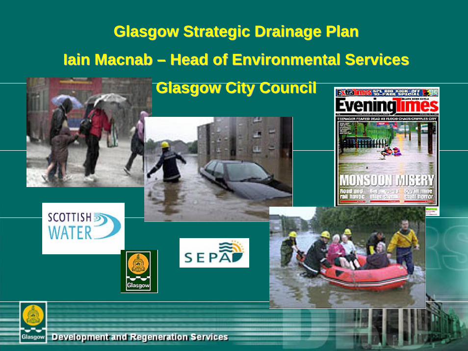
Glasgow Strategic Drainage PlanGlasgow Strategic Drainage Plan
Iain Macnab Iain Macnab –– Head of Environmental ServicesHead of Environmental Services
Glasgow City CouncilGlasgow City Council
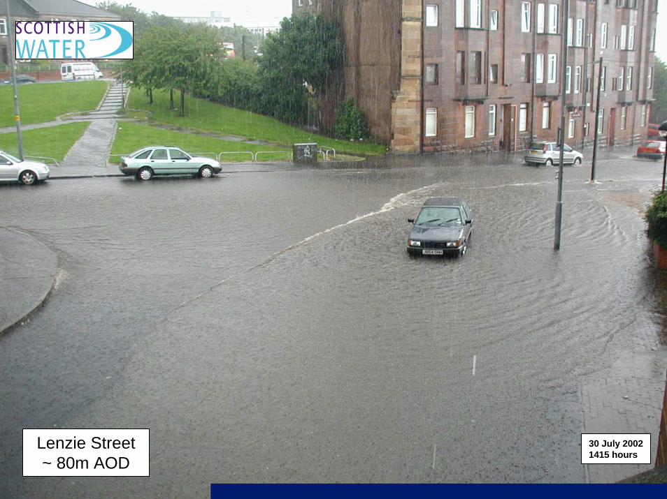
Lenzie Street ~ 80m AOD
30 July 2002 1415 hours
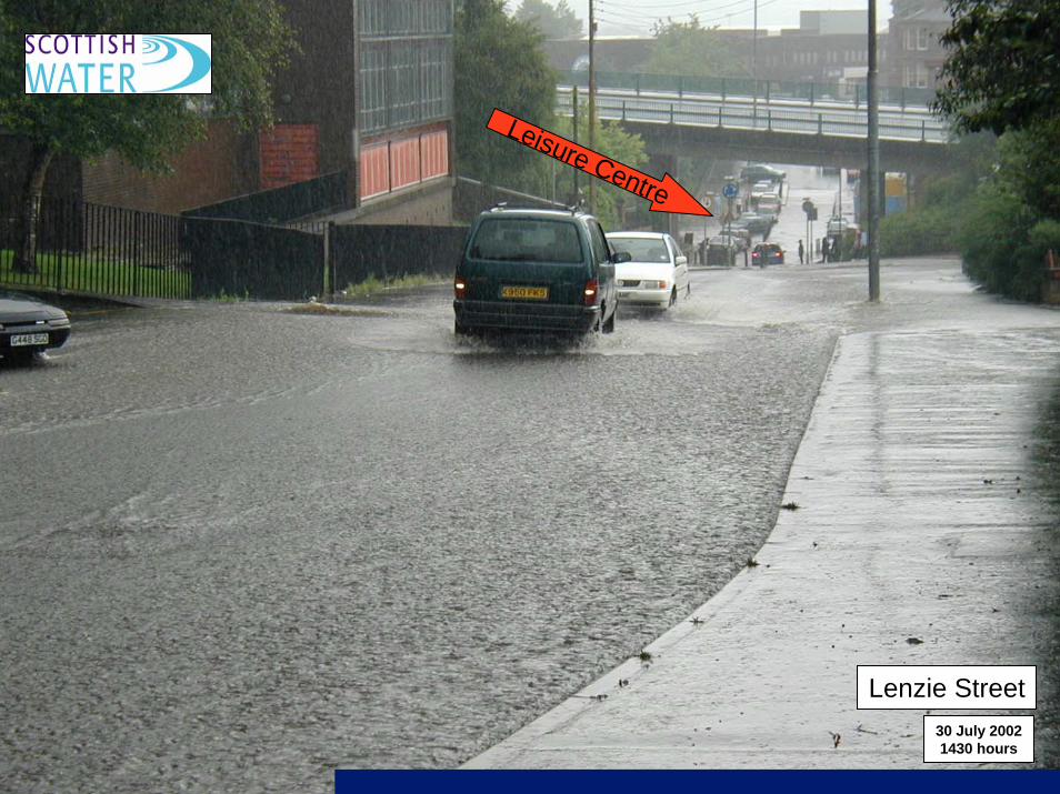
Lenzie Street30 July 2002 1430 hours
Leisure Centre
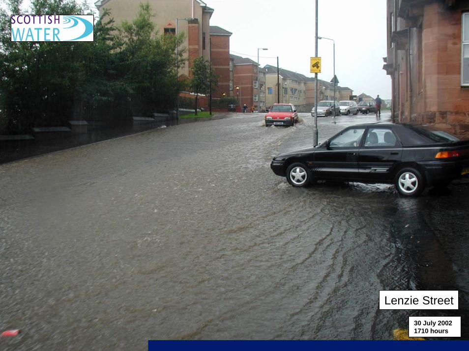
Lenzie Street
30 July 2002 1710 hours
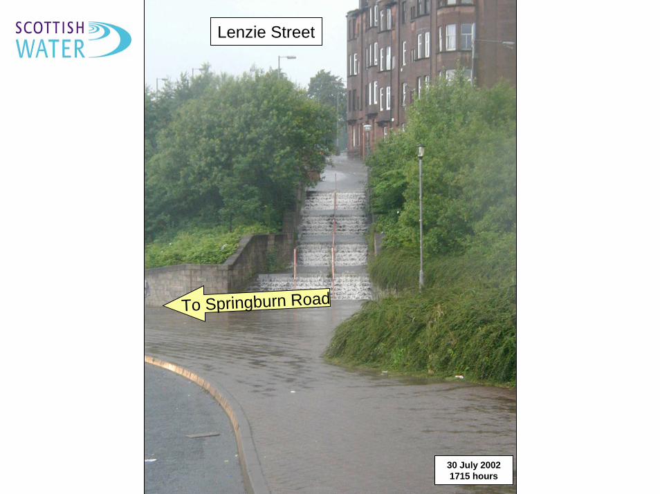
To Springburn Road
30 July 2002 1715 hours
Lenzie Street
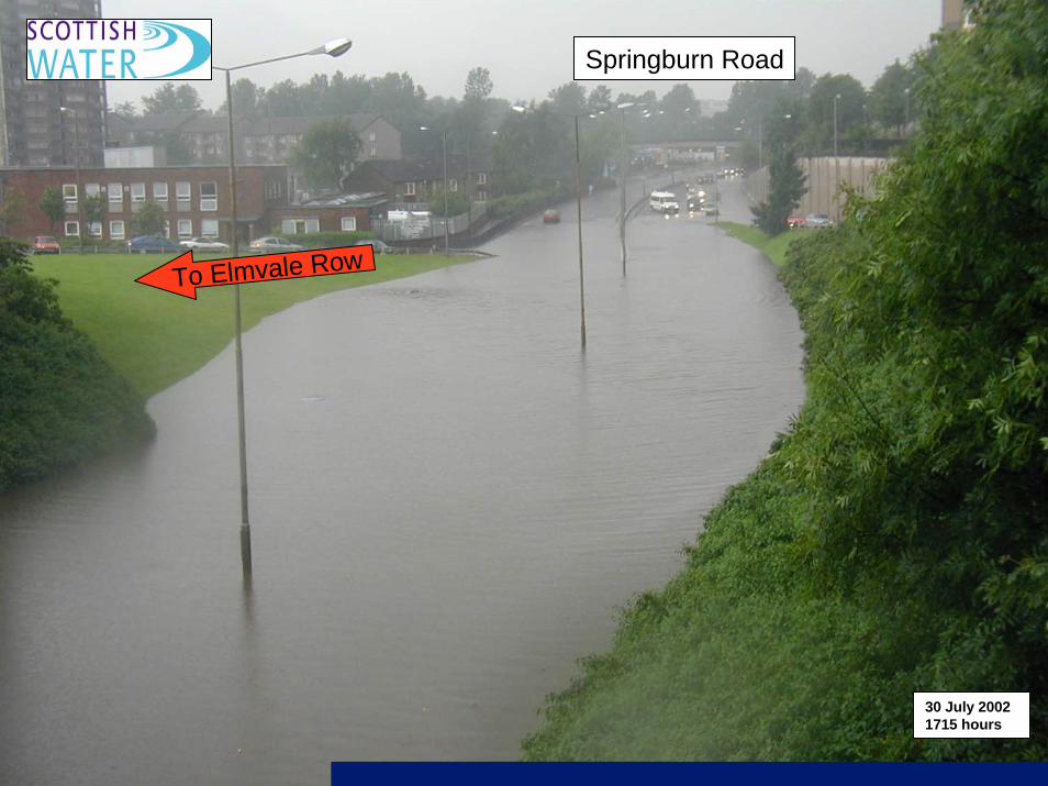
To Elmvale Row
30 July 2002 1715 hours
Springburn Road
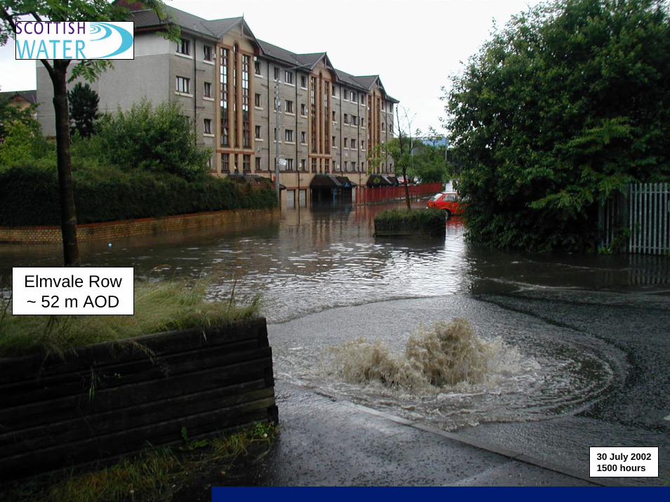
Elmvale Row ~ 52 m AOD
30 July 20021500 hours
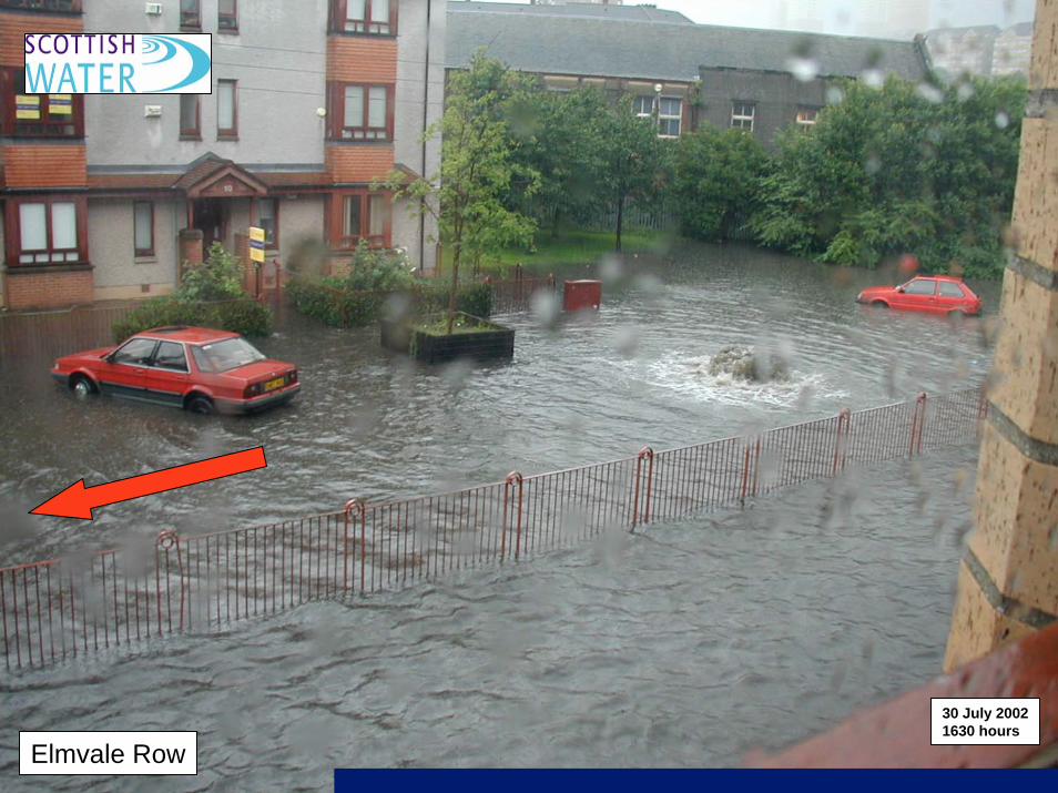
Elmvale Row
30 July 2002 1630 hours
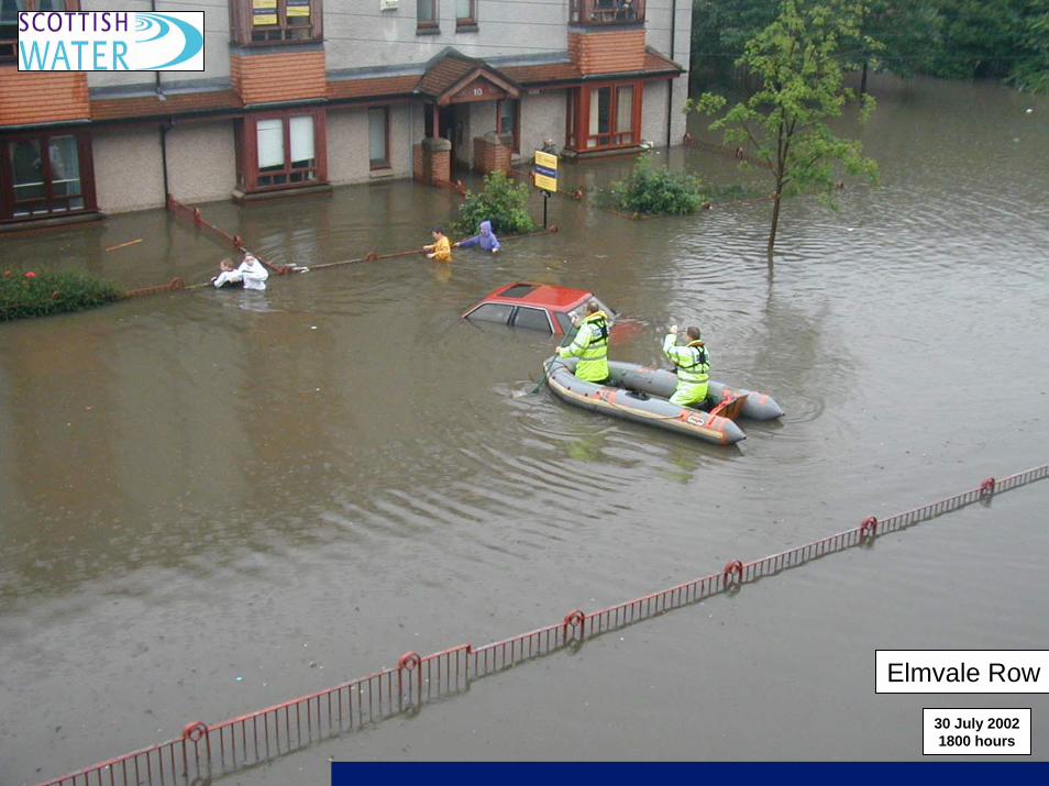
Elmvale Row
30 July 2002 1800 hours
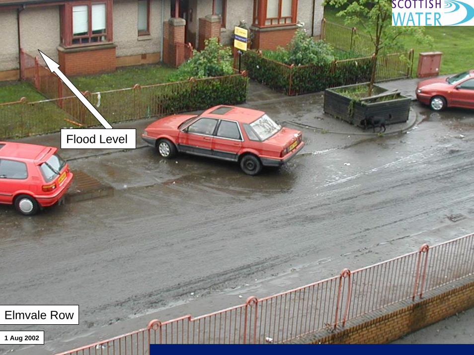
Flood Level
Elmvale Row
1 Aug 2002
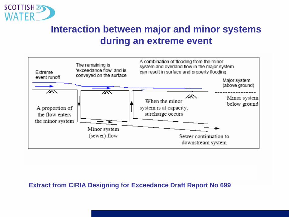
Extract from CIRIA Designing for Exceedance Draft Report No 699
Interaction between major and minor systems during an extreme event
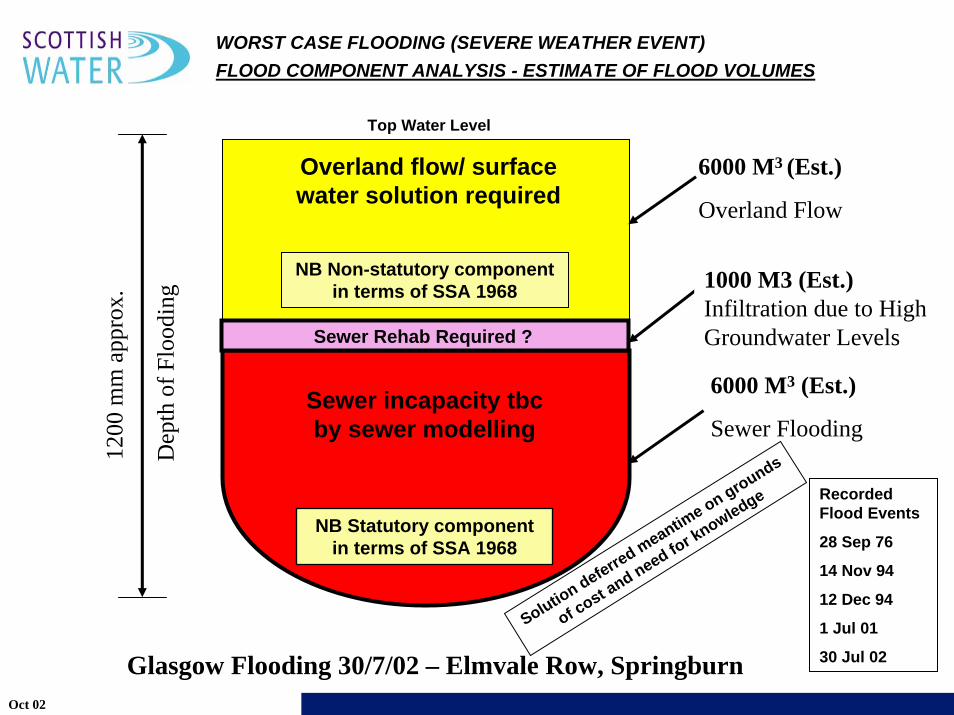
6000 M3 (Est.)
Overland Flow
6000 M3 (Est.)
Sewer Flooding
WORST CASE FLOODING (SEVERE WEATHER EVENT)FLOOD COMPONENT ANALYSIS - ESTIMATE OF FLOOD VOLUMES
1200
mm
app
rox.
Top Water Level
Glasgow Flooding 30/7/02 – Elmvale Row, Springburn
Sewer incapacity tbcby sewer modelling
Overland flow/ surface water solution required
Recorded Flood Events
28 Sep 76
14 Nov 94
12 Dec 94
1 Jul 01
30 Jul 02
NB Statutory component in terms of SSA 1968
NB Non-statutory component in terms of SSA 1968
Dep
th o
f Flo
odin
g 1000 M3 (Est.)Infiltration due to High Groundwater LevelsSewer Rehab Required ?
Oct 02
Solution deferred meantim
e on grounds
of cost and need for knowledge
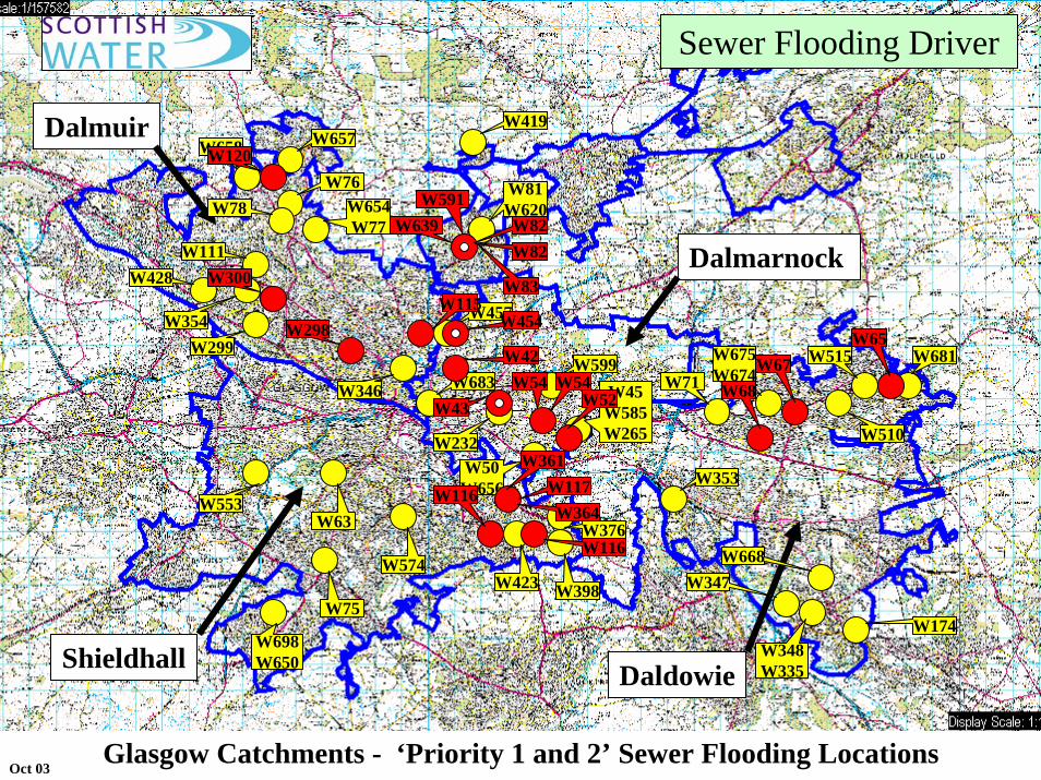
Glasgow Catchments - ‘Priority 1 and 2’ Sewer Flooding Locations
Dalmuir
Shieldhall
Dalmarnock
Daldowie
W457
W683W599
W232W50W656
W45W585W265
W353
W71W675W674
W515 W681
W510
W347W668
W348W335
W174
W657W658
W76W78 W654
W77W111
W428
W354W299
W346
W81W620
W7
W419
W423
W376
W398W574
W698W650
W75
W63W553
W42
W454
W43W54 W54
W52 W68W67
W65
W120
W300
W298W115
W83
W82W82
W591W639
W361W117W364
W116
W116
Sewer Flooding Driver
Oct 03
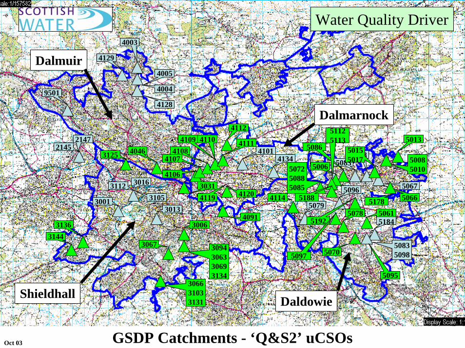
GSDP Catchments - ‘Q&S2’ uCSOs
Dalmuir
Dalmarnock
Shieldhall Daldowie
41344101
41204119
4106
41074108
4109 41104112
4111
4003
4004
4128
4005
4129
9501
41145079
5078
3125
3112 3016
310530013013
3006
3067
21452147
50915184
50835098
5067
50685083 5008
5010
50965066
5095
5086
5192
31443136
306631033131
3094306330693134
4091
3031
4046
5070
5061
50155017
5013
5006507250885085
5097
51125113
51785188
Water Quality Driver
Oct 03
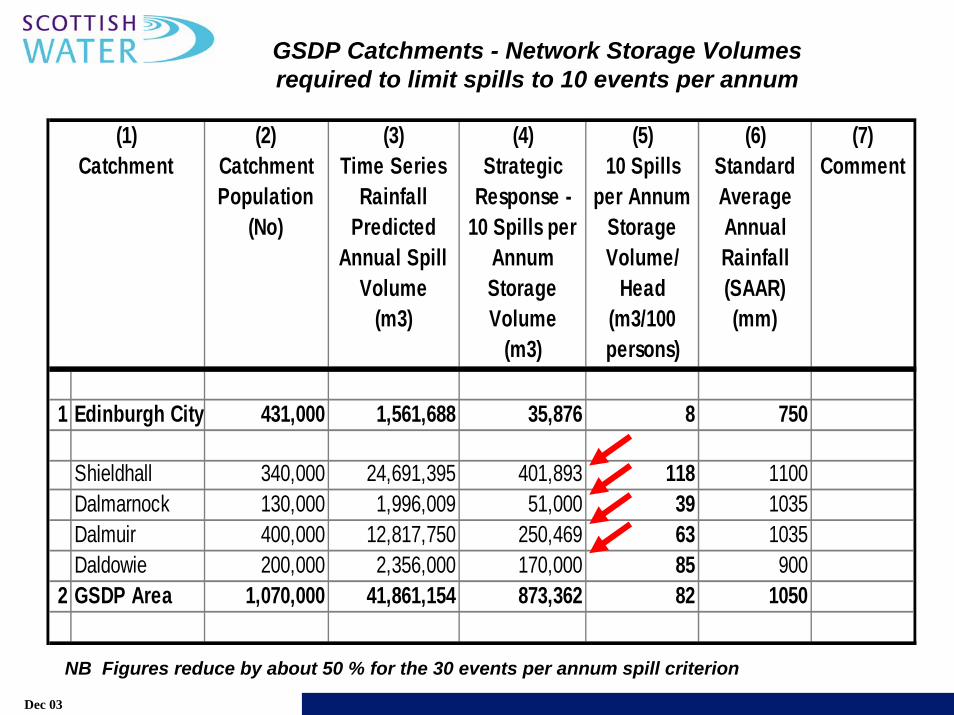
1 Edinburgh City 431,000 1,561,688 35,876 8 750
Shieldhall 340,000 24,691,395 401,893 118 1100Dalmarnock 130,000 1,996,009 51,000 39 1035Dalmuir 400,000 12,817,750 250,469 63 1035Daldowie 200,000 2,356,000 170,000 85 900
2 GSDP Area 1,070,000 41,861,154 873,362 82 1050
(1) Catchment
(7) Comment
(6) Standard Average Annual Rainfall (SAAR) (mm)
(4) Strategic
Response - 10 Spills per
Annum Storage Volume
(m3)
(3) Time Series
Rainfall Predicted
Annual Spill Volume
(m3)
(2) Catchment Population
(No)
(5) 10 Spills
per Annum Storage Volume/
Head (m3/100 persons)
GSDP Catchments - Network Storage Volumes required to limit spills to 10 events per annum
Dec 03
NB Figures reduce by about 50 % for the 30 events per annum spill criterion
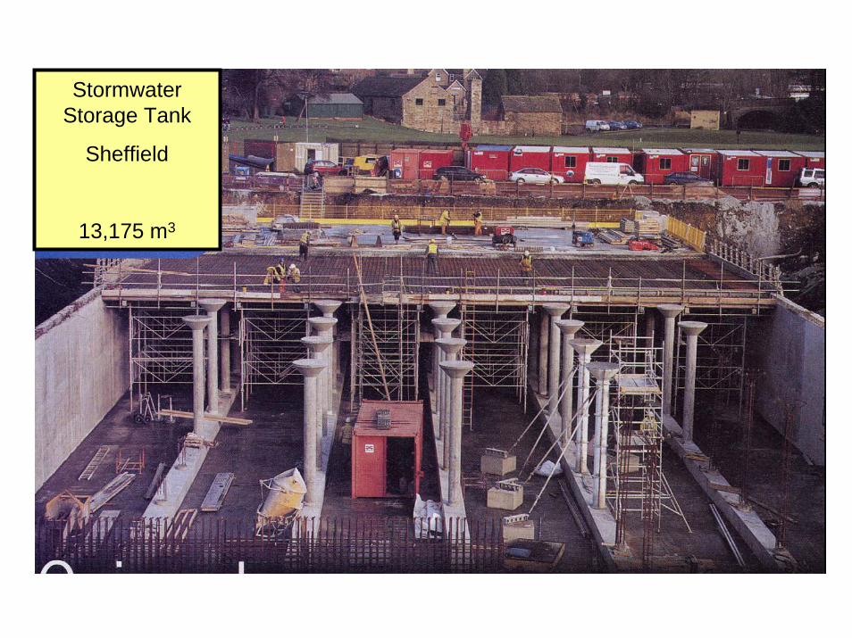
StormwaterStorage Tank
Sheffield
13,175 m3
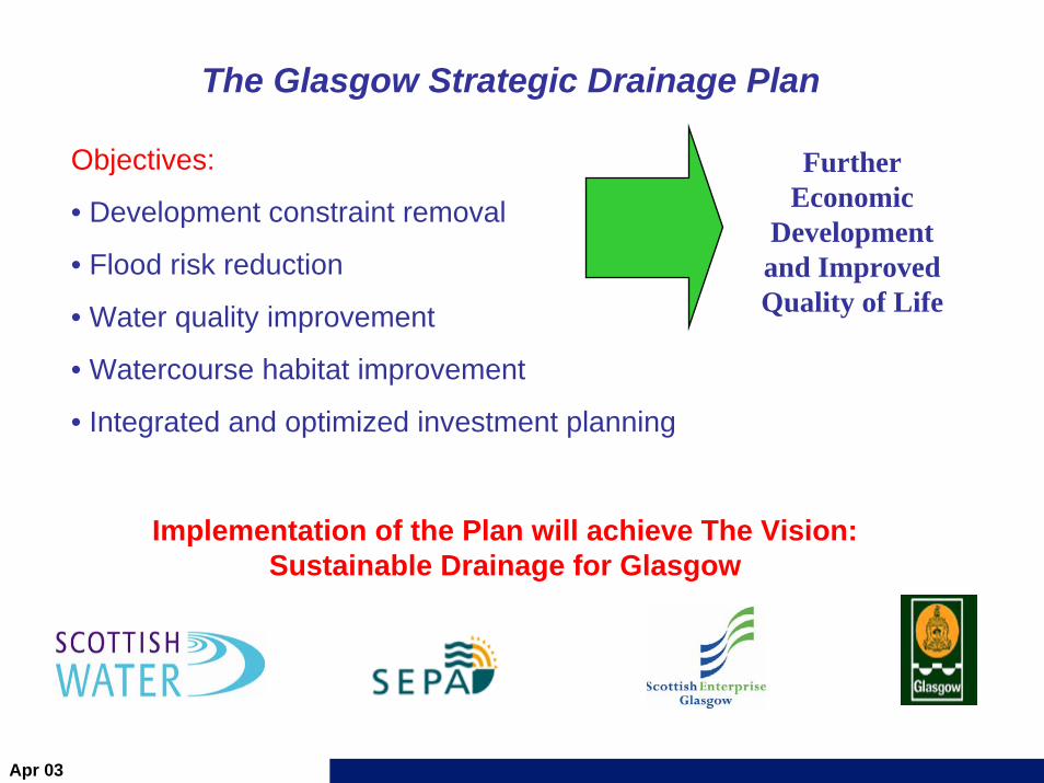
The Glasgow Strategic Drainage Plan
Implementation of the Plan will achieve The Vision: Sustainable Drainage for Glasgow
Further Economic
Development and Improved Quality of Life
Objectives:
• Development constraint removal
• Flood risk reduction
• Water quality improvement
• Watercourse habitat improvement
• Integrated and optimized investment planning
Apr 03
xx
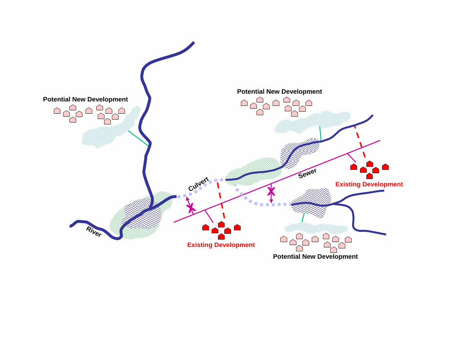
Sewer
Culvert
RiverExisting Development
Existing Development
Potential New Development
Potential New DevelopmentPotential New Development
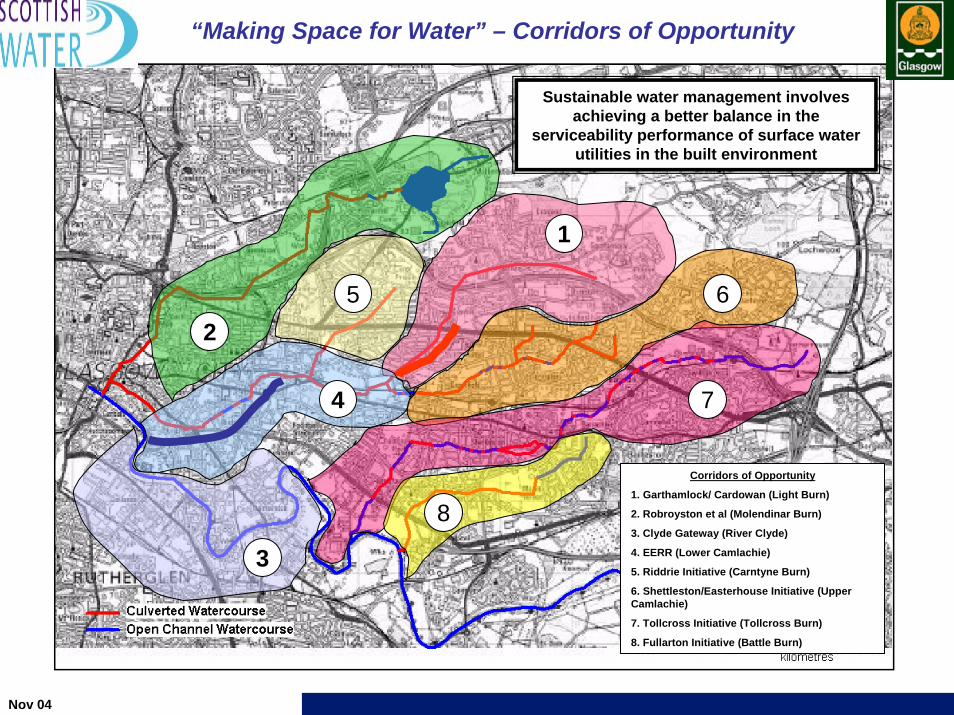
“Making Space for Water” – Corridors of Opportunity
4
1
3
Nov 04
2
Corridors of Opportunity
1. Garthamlock/ Cardowan (Light Burn)
2. Robroyston et al (Molendinar Burn)
3. Clyde Gateway (River Clyde)
4. EERR (Lower Camlachie)
5. Riddrie Initiative (Carntyne Burn)
6. Shettleston/Easterhouse Initiative (Upper Camlachie)
7. Tollcross Initiative (Tollcross Burn)
8. Fullarton Initiative (Battle Burn)
5 6
7
8
Sustainable water management involves achieving a better balance in the
serviceability performance of surface water utilities in the built environment
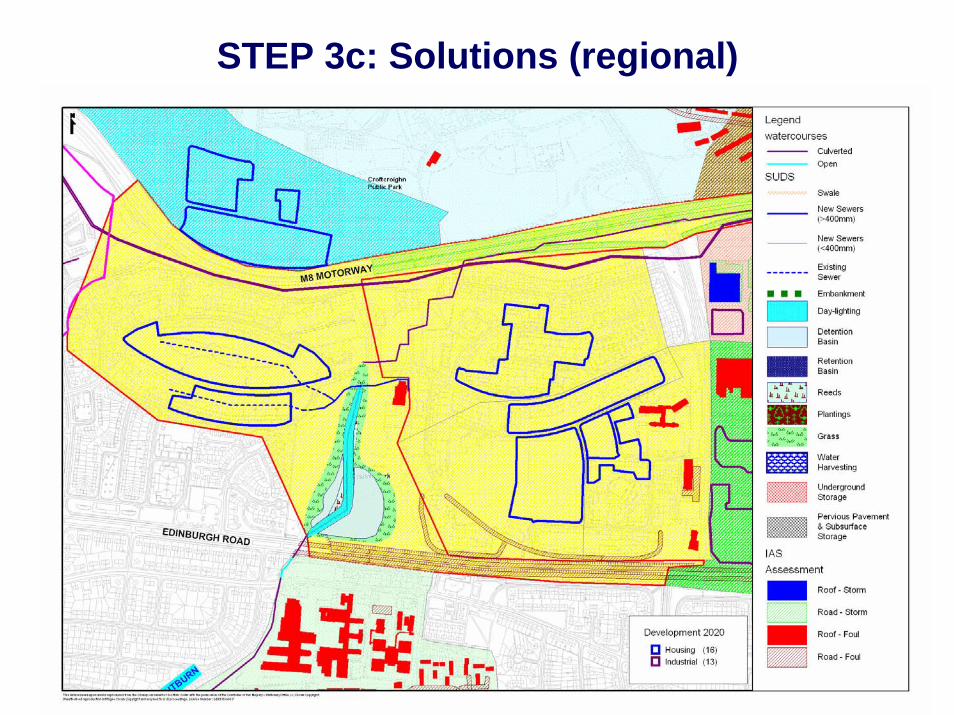
STEP 3c: Solutions (regional)
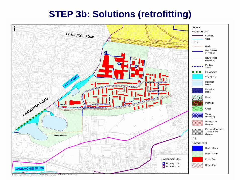
STEP 3b: Solutions (retrofitting)
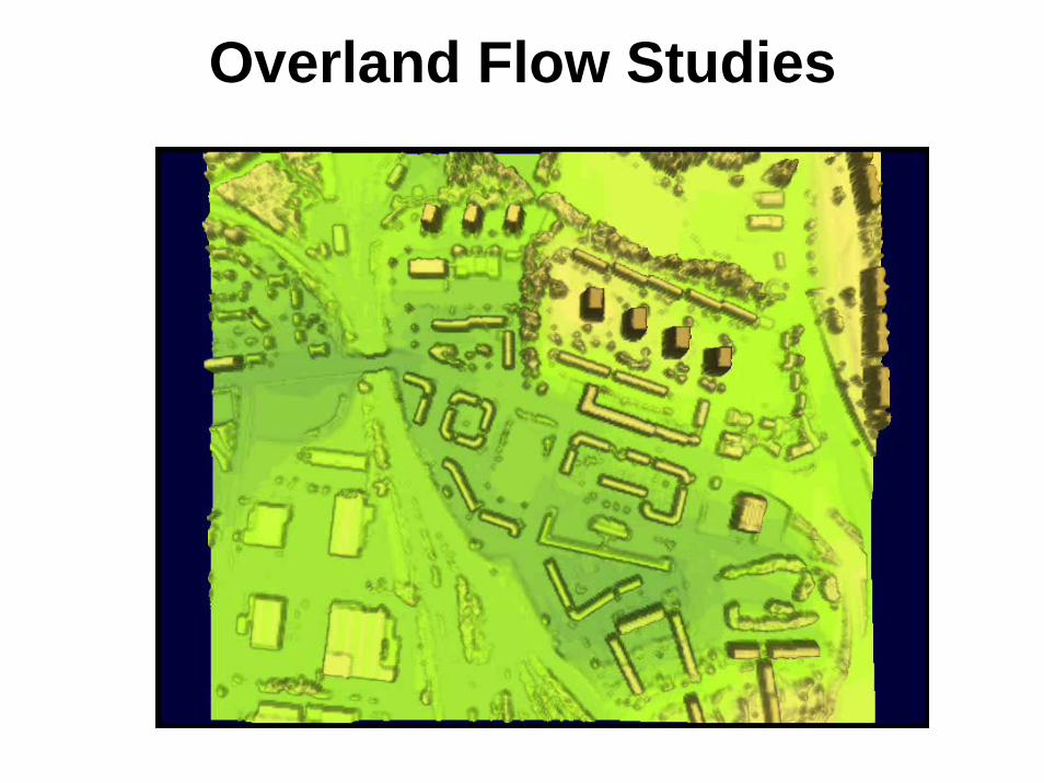
Overland Flow Studies
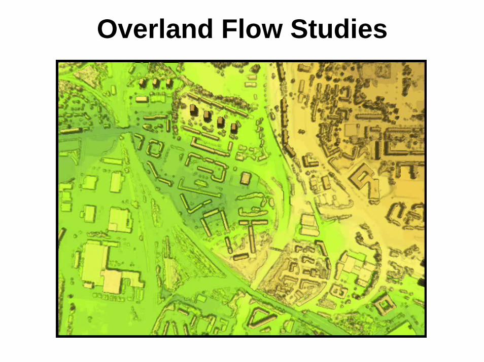
Overland Flow Studies
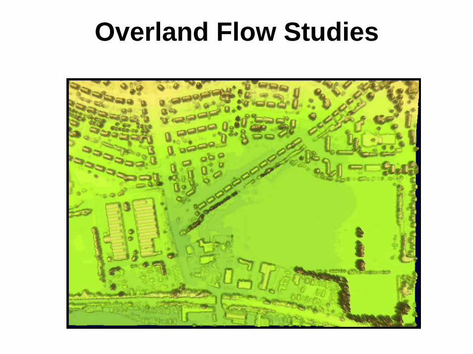
Overland Flow Studies
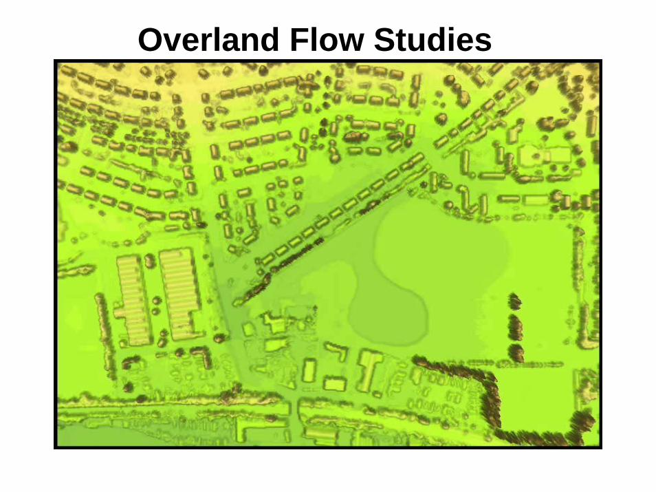
Overland Flow Studies
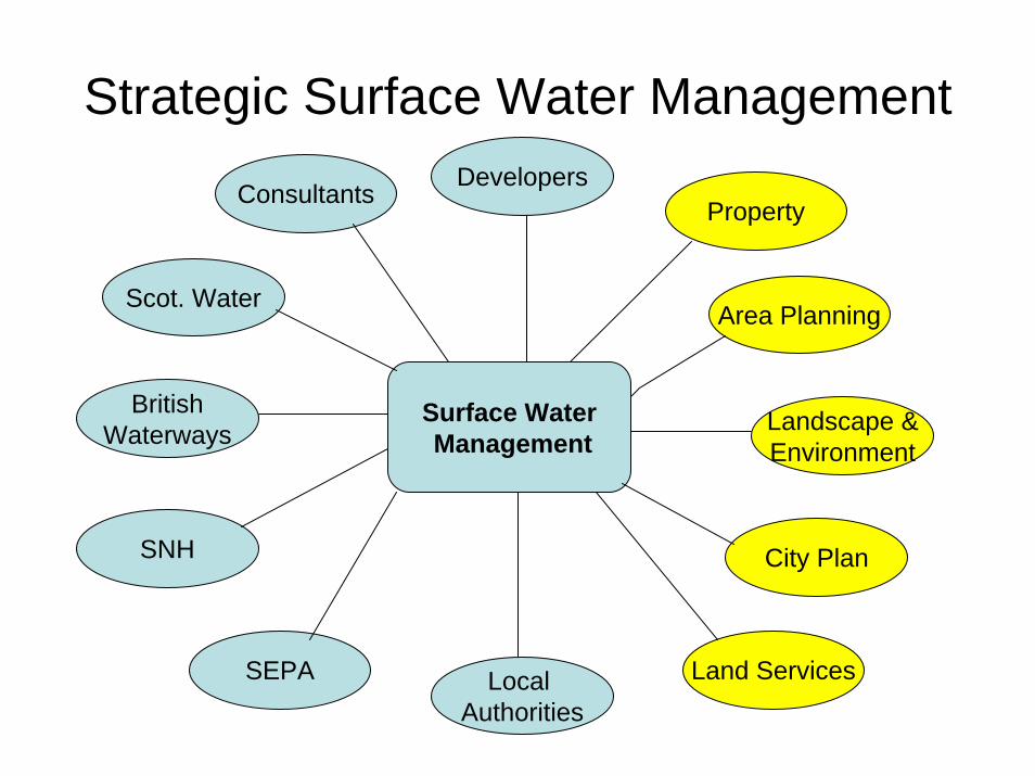
Strategic Surface Water Management
Surface WaterManagement
Scot. Water
SEPA
SNH
BritishWaterways
Local Authorities
Property
Area Planning
Landscape &Environment
City Plan
Land Services
ConsultantsDevelopers
Development and Regeneration ServicesDevelopment and Regeneration Services
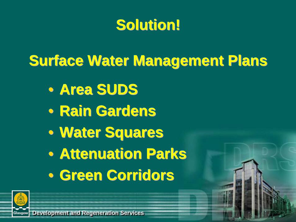
Solution!Solution!
Surface Water Management PlansSurface Water Management Plans
•• Area SUDS Area SUDS •• Rain GardensRain Gardens•• Water SquaresWater Squares•• Attenuation ParksAttenuation Parks•• Green CorridorsGreen Corridors