governments look to gis and web-based maps to solve ... look to gis and web-based maps to solve...
TRANSCRIPT
Governments Look to GIS and Web-based Maps to Solve Budget Headaches and Improve Services
Budgets are now, and have always been, one of the most contentious topics facing our municipal leaders. From the smallest municipalities to the largest national governments, the question of how, when, and where money should be spent is often the annual topic of the longer debates heard within the chambers.
However, when a more cost-effective means of delivering expected services becomes available—with the added bonus of a measurable improvement in level of satisfaction—it should be greeted with enthusiasm. Continuing developments in GIS technology is one such area that can help governments achieve these goals and should be a welcome addition to any budgetary proceedings.
Of course, politicians and constituents alike will want to see the benefits and understand the return on investment (ROI) when considering any expenditure on GIS or anything else construed as “new” technology. For proponents of GIS, there are many current examples to provide this evidence in support of municipal investment in location based information.
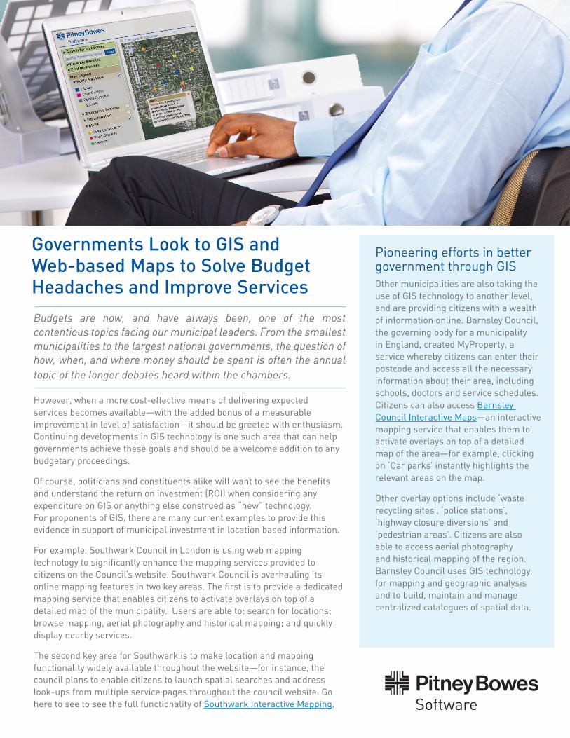
For example, Southwark Council in London is using web mapping technology to significantly enhance the mapping services provided to citizens on the Council’s website. Southwark Council is overhauling its online mapping features in two key areas. The first is to provide a dedicated mapping service that enables citizens to activate overlays on top of a detailed map of the municipality. Users are able to: search for locations; browse mapping, aerial photography and historical mapping; and quickly display nearby services.
The second key area for Southwark is to make location and mapping functionality widely available throughout the website—for instance, the council plans to enable citizens to launch spatial searches and address look-ups from multiple service pages throughout the council website. Go here to see to see the full functionality of Southwark Interactive Mapping.
Pioneering efforts in better government through GISOther municipalities are also taking the use of GIS technology to another level, and are providing citizens with a wealth of information online. Barnsley Council, the governing body for a municipality in England, created MyProperty, a service whereby citizens can enter their postcode and access all the necessary information about their area, including schools, doctors and service schedules. Citizens can also access Barnsley Council Interactive Maps—an interactive mapping service that enables them to activate overlays on top of a detailed map of the area—for example, clicking on ‘Car parks’ instantly highlights the relevant areas on the map.
Other overlay options include ‘waste recycling sites’, ‘police stations’, ‘highway closure diversions’ and ‘pedestrian areas’. Citizens are also able to access aerial photography and historical mapping of the region. Barnsley Council uses GIS technology for mapping and geographic analysis and to build, maintain and manage centralized catalogues of spatial data.
Every connection is a new opportunityTM
EvacuationsMandatory Evacuations
Recommended Evacuations
Warnings
Search for an Address
Recently SelectedFind My Nearest
Map Legend
Traffic Information
Utilities
4
4
Power outagesGas outagesTelephone outages
Road ClosuresEvacuation RoutesDetours
Effective: Saturday, February 9, 2012Warning: Mandatory EvacuationDetails: Storm surge expected 07:00. Flood levels at 22’ expected. All residents are required to evacuate. If you need assistance please call 123.456.7890
Evacuations
XX
XX
XX
HybridAerial
Roads
Citizens are ready to embrace GIS in their government
With the advent of Google Maps and Bing, people across all walks of life have been exposed to the advantages of having a GIS solution in their hand-held devices, laptops or home PCs. This wide-spread exposure has served as a catalyst in increasing the demand for GIS apps.
As consumers continue to be exposed to GIS technology without even realizing what GIS is, they will be expecting their governments to provide them with similar location intelligence tools.
And now, governments can deliver these services economically and effectively. These applications provide a communication platform that allows for more informed citizens and an increase in citizen satisfaction. The efficient publishing of data also helps organizations to comply with freedom of information or other data requests. They can achieve this without having to spend valuable time compiling reports or re-publishing data to provide the most up-to-date information.
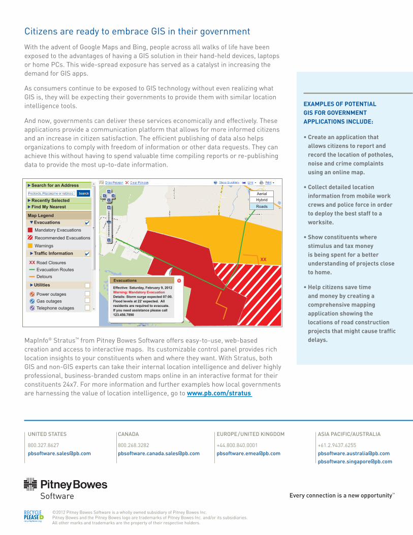
MapInfo® Stratus™ from Pitney Bowes Software offers easy-to-use, web-based creation and access to interactive maps. Its customizable control panel provides rich location insights to your constituents when and where they want. With Stratus, both GIS and non-GIS experts can take their internal location intelligence and deliver highly professional, business-branded custom maps online in an interactive format for their constituents 24x7. For more information and further examples how local governments are harnessing the value of location intelligence, go to www.pb.com/stratus
EXAMPLES OF POTENTIAL GIS FOR GOVERNMENT APPLICATIONS INCLUDE:
• Create an application that allows citizens to report and record the location of potholes, noise and crime complaints using an online map.
• Collect detailed location information from mobile work crews and police force in order to deploy the best staff to a worksite.
• Show constituents where stimulus and tax money is being spent for a better understanding of projects close to home.
• Help citizens save time and money by creating a comprehensive mapping application showing the locations of road construction projects that might cause traffic delays.
©2012 Pitney Bowes Software is a wholly owned subsidiary of Pitney Bowes Inc. Pitney Bowes and the Pitney Bowes logo are trademarks of Pitney Bowes Inc. and/or its subsidiaries. All other marks and trademarks are the property of their respective holders.
UNITED STATES
CANADA
EUROPE/UNITED KINGDOM
ASIA PACIFIC/AUSTRALIA
[email protected]@pb.com