gps & gis
TRANSCRIPT


ADVANCE MINE SURVEYING
TOPICSGIS & GPS
Copyright © 2005 Environmental Systems Research Institute, Inc. All Rights Reserved. GIS and GPS Technology
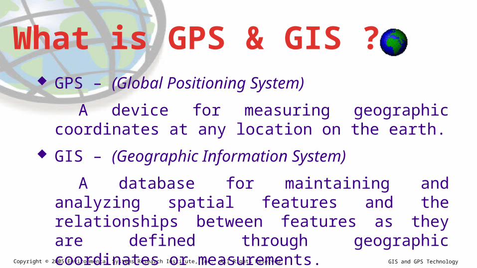
GPS – (Global Positioning System)
A device for measuring geographic coordinates at any location on the earth.
GIS – (Geographic Information System)
A database for maintaining and analyzing spatial features and the relationships between features as they are defined through geographic coordinates or measurements.
What is GPS & GIS ?
Copyright © 2005 Environmental Systems Research Institute, Inc. All Rights Reserved. GIS and GPS Technology

Copyright © 2005 Environmental Systems Research Institute, Inc. All Rights Reserved. GIS and GPS Technology
• GPS stands for Global Positioning System
• GPS is a satellite navigation system designed to provide accurate position, velocity, and time information almost anywhere in the world.
• The present system is known as NAVSTAR - NAVigation Satellite Timing And Ranging.
What is GPS ?

GPS (Global Positioning System) GPS was originally intended
for military applications, but in the 1980s, the government made the system available for civilian use.
GPS works in any weather conditions, anywhere in the world, 24 hours a day.
GPS (Global Positioning System)• Stands for Global Positioning System• GPS is used to get an exact location on the surface of the earth, in three
dimensions. • GPS is a very important data input source, used for surveying, military operations,
engineering, in mining, vehicle tracking, flight navigation, car navigation, ship navigation, unmanned vehicle guidance, agriculture, and of course, mapping
• For mapping, a GPS tells us “where” and allows us to input “what”• GPS is a worldwide radio-navigation system formed from 24 satellites and their
ground stations. • Uses satellites in space as reference points for locations here on earth • Ground stations help satellites determine their exact location in space.

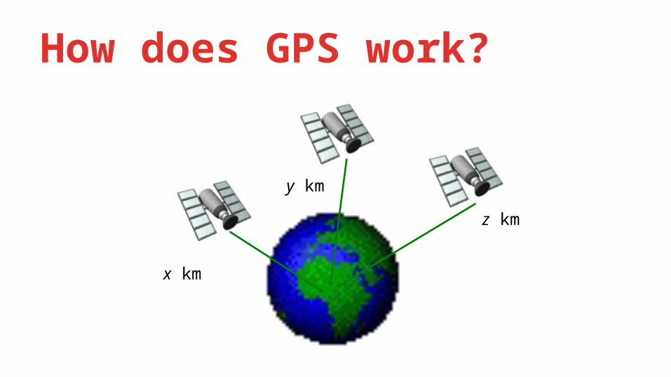
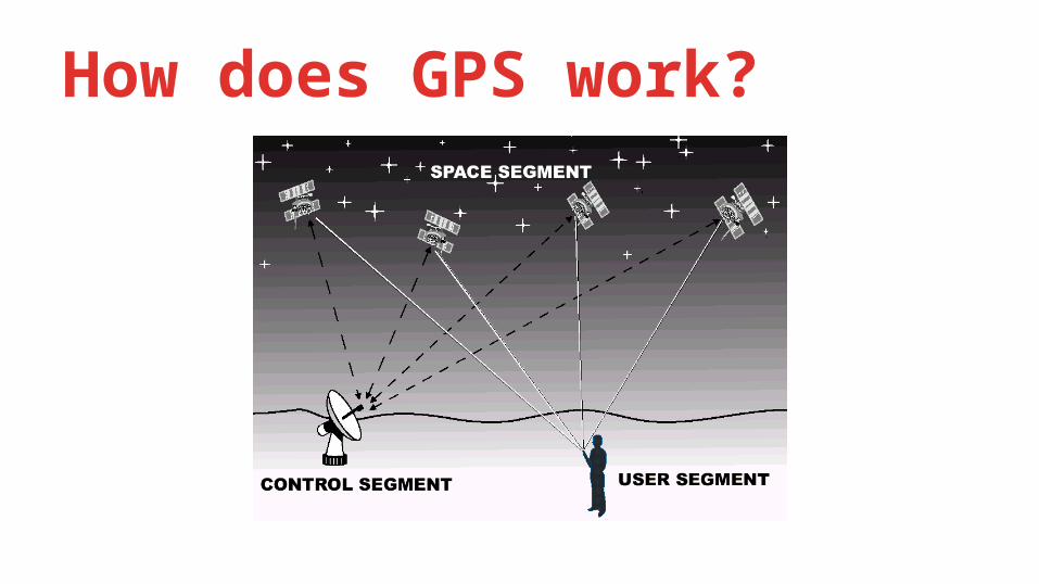
How does GPS work?• GPS derives position relative to satellite “reference points,”
using triangulation.• The GPS unit on the ground figures out its distance to each
of several satellites using the time it takes for a radio signal to travel to the satellite.
• To do this, the exact position of the satellites at a given time, must be known; otherwise they can’t serve as reference points.
How does GPS work?
x km
y km
z km
How does GPS work?

How does GPS work?• We need at least 3 satellites as reference points to “triangulate” our
position.• Based on the principle that where we know our exact distance from a
satellite in space, we know we are somewhere on the surface of an imaginary sphere with radius equal to the distance to the satellite.
• With two satellites we know we are in the plane where the two intersect. With three or more, we can get two possible points, and one of those is usually impossible from a practical standpoint and can be discarded
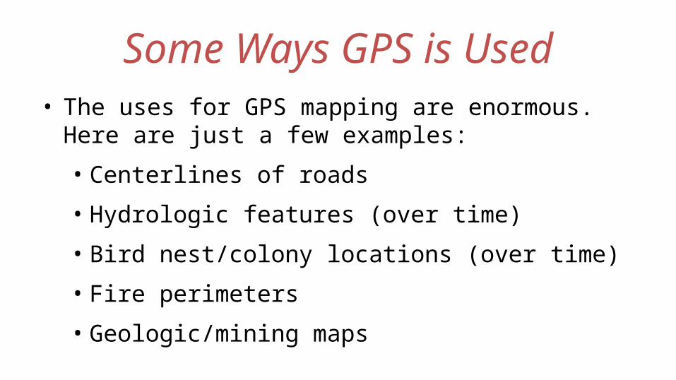
• The uses for GPS mapping are enormous. Here are just a few examples:• Centerlines of roads• Hydrologic features (over time)• Bird nest/colony locations (over time)• Fire perimeters• Geologic/mining maps
Some Ways GPS is Used
GISGeographic Information System

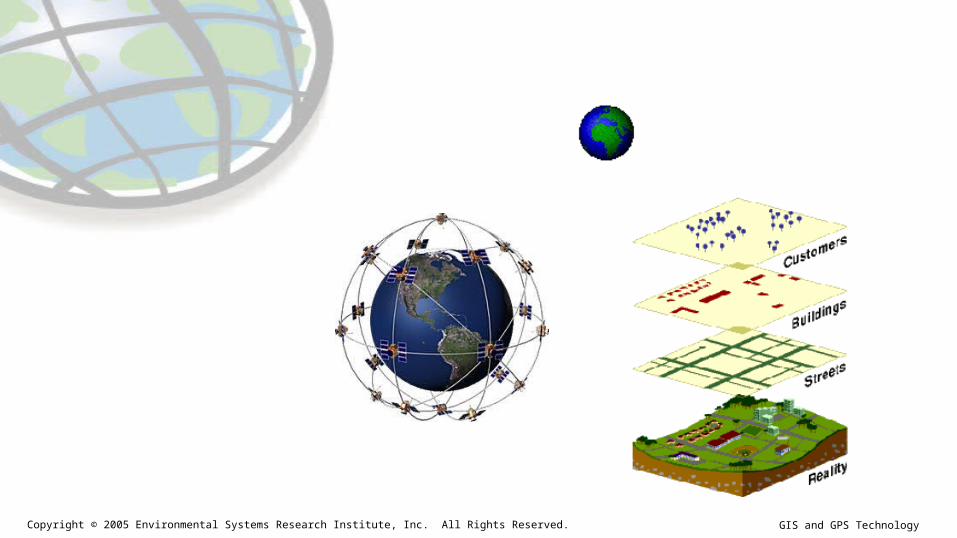
GIS (Geographic Information System)• A Geographic Information System, or GIS, integrates hardware, software,
and data for capturing, managing, analyzing, and displaying all forms of geographically referenced information.
• GIS is a System of computer software, hardware and data, and personnel to help manipulate, analyze and present information that is tied to a spatial location –• spatial location – usually a geographic location• information – visualization of analysis of data • system - linking software, hardware, data• personnel – a thinking explorer who is key to the power of GIS-

What is GPS ?• GIS is a spatial database with a strong visual display
component
• GIS is not primarily a mapping program
• GIS was developed in the early 1980s, but its acceptance and development outside of the environmental sciences has been slow


Emergency Services Environmental Natural Disasters Education Government Medical Industry, Businesses Defense
Some Ways GIS is Used

Thank You