gps project presentation
TRANSCRIPT

IOWA STATE UNIVERSITY
CRIME RATES OF 2012
Joel Heilman & Jonathan Beavers

OUTLINE Objectives Study Area Statistics Equipment Used Methodology Project Planning Uncorrected Data Corrected Data Finished Maps For the Future

OBJECTIVES Collect line (streets) and polygon
(buildings &parking lots) features of central Iowa State campus
Collect point features (the location of crimes & emergency poles) on central campus
Create a map in ArcMap showing the location and number of crimes on central campus
Provide students/faculty with a spatial distribution of crime reports provided by ISU police department
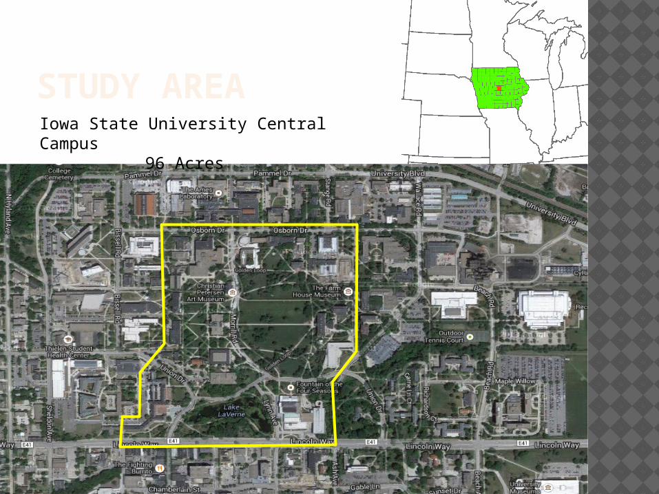
STUDY AREAIowa State University Central Campus
96 Acres

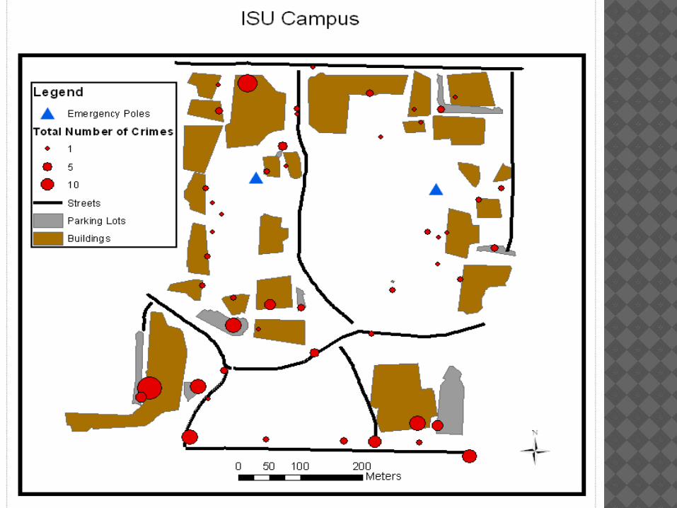
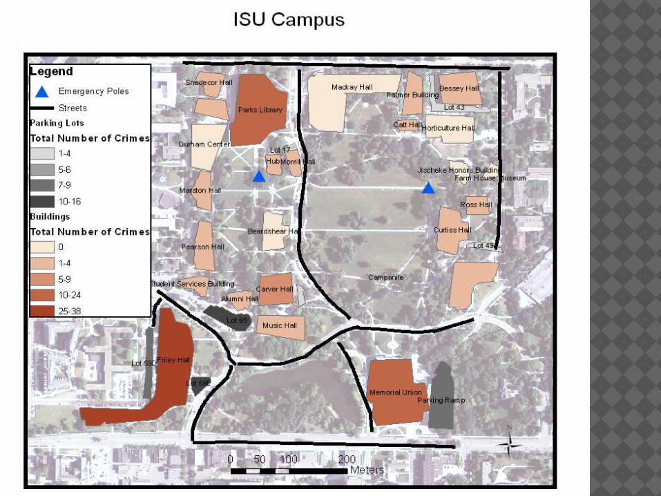
STATISTICS Total of 272 crimes in our mapped area
Least (49) in summer months (Jun-Aug)Most (84) in fall months (Sep-Nov)
Most crimes in 24 hour period: 20th April (VEISHEA weekend)37 crimes (48% of spring crimes) occurred
during the week of VEISHEA 16 Emergency poles on ISU campus
(1,795 acres), 12 Emergency poles on UNI campus (716 acres)

EQUIPMENT USED Trimble JUNO 3B Receiver 2012 Crime Data from ISU Police
Department <http://www.police.iastate.edu/daily-crime-log>
Trimble Pathfinder Office ArcMap

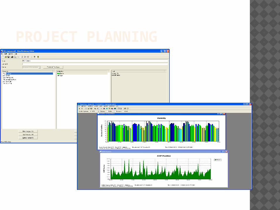
METHODOLOGYProject
Planning
Setup Data
Dictionary
Data Collection
Post ProcessingMake Excel
Document with Crime
Data
Export to ArcMap
Join Features with Crime
Data
Analysis/ Resulting Map
Quick Plan
Data Transfe
r
PROJECT PLANNING

UNCORRECTED DATA

CORRECTED DATA

FOR THE FUTURE Continue mapping ISU campus Map according to specific types of
crimes Compare with buffer zone around
emergency poles Compare with other state universities
(University of Iowa and UNI)