green- duwamish river watershed the green river watershed is the land area where rainwater drains to...
Post on 20-Dec-2015
219 views
TRANSCRIPT
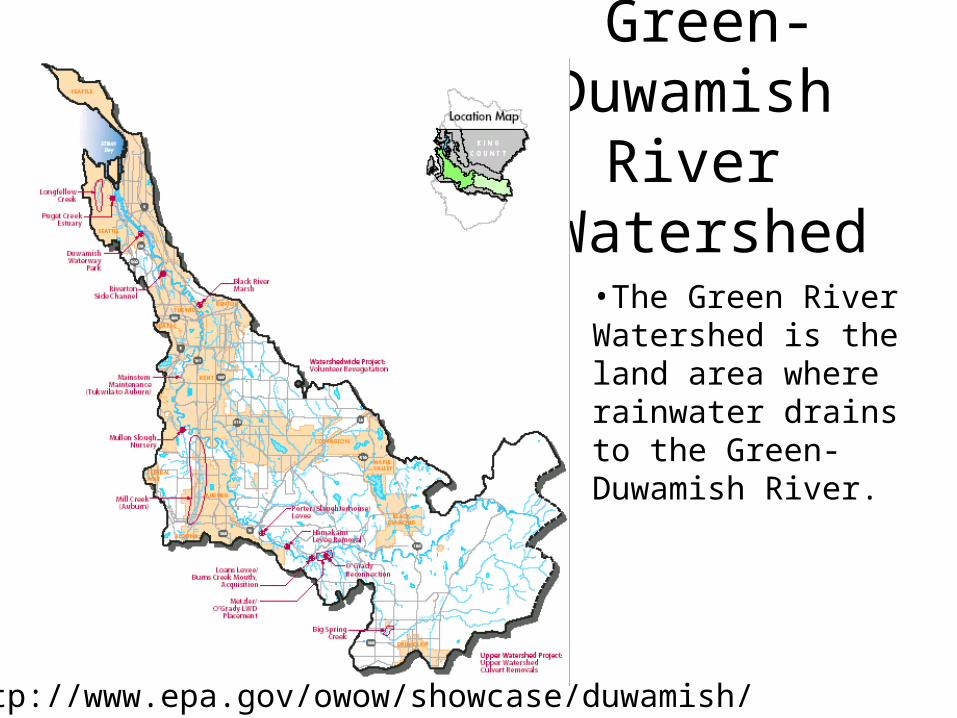
Green-Duwamish
River Watershed•The Green River Watershed is the land area where rainwater drains to the Green-Duwamish River.
http://www.epa.gov/owow/showcase/duwamish/

• The watershed includes Black River, Springbrook Creek, Mill Creek, Soos Creek, Jenkins and Covington Creeks, Newaukum Creek, Crisp Creek, and other tributaries.
http://dnr.metrokc.gov/wlr/watersheds/green.htmhttp://wa.water.usgs.gov/realtime/htmls/green.html
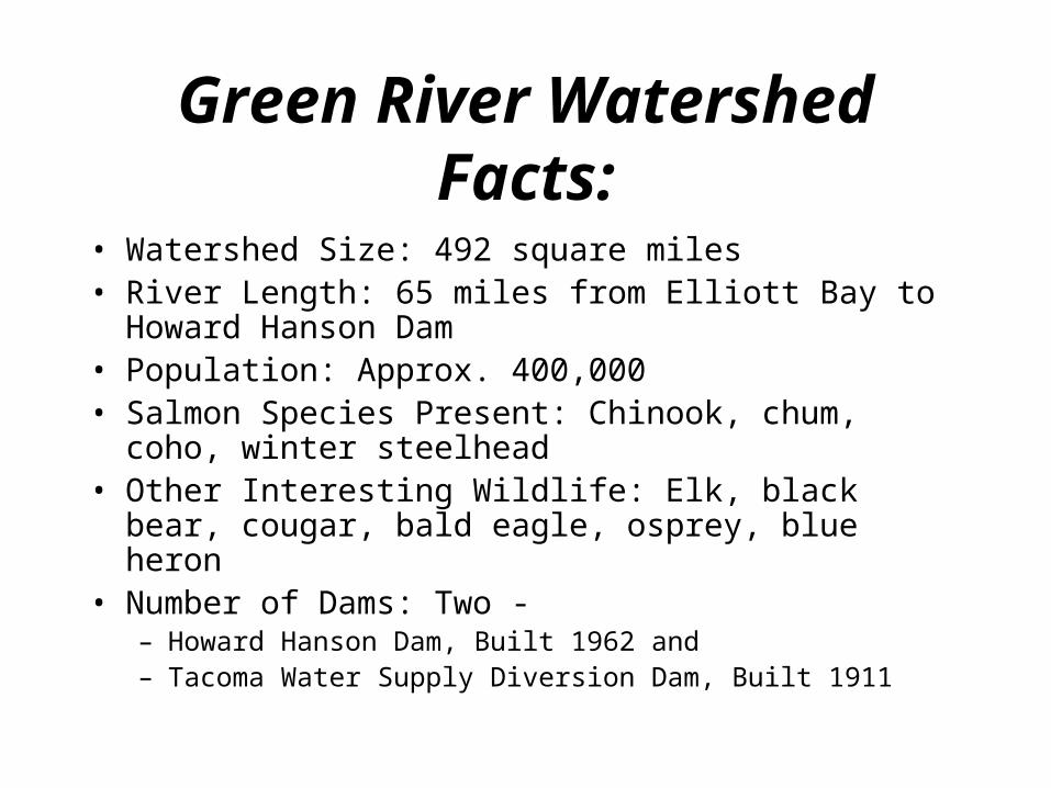
Green River Watershed Facts:
• Watershed Size: 492 square miles • River Length: 65 miles from Elliott Bay to Howard
Hanson Dam • Population: Approx. 400,000 • Salmon Species Present: Chinook, chum, coho, winter
steelhead • Other Interesting Wildlife: Elk, black bear, cougar, bald
eagle, osprey, blue heron • Number of Dams: Two -
– Howard Hanson Dam, Built 1962 and – Tacoma Water Supply Diversion Dam, Built 1911

Watershed words:
• Headwaters: Source of a stream. • Watershed: The land from which rain collects
and runs to a single point. • Groundwater: Water that lies beneath the earth's
surface. • Infiltration: The slow movement of water from
the surface to the groundwater. • Hydrologic: Related to water in all its forms. • Aquifer: An underground water supply flowing
through rock.

Historic OutlookMid-1800s
We have examined the valley of the Duwamish River and find it a fine
country. There is plenty of room for one thousand travelers.
Come at once."
Today it is one of the most altered hydrological ecosystems in
the Puget Sound basin.
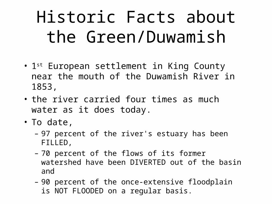
Historic Facts about the Green/Duwamish
• 1st European settlement in King County near the mouth of the Duwamish River in 1853,
• the river carried four times as much water as it does today.
• To date, – 97 percent of the river's estuary has been FILLED,
– 70 percent of the flows of its former watershed have been DIVERTED out of the basin and
– 90 percent of the once-extensive floodplain is NOT FLOODED on a regular basis.

Fill• Upper Green River
Basin lies primarily in the boundaries of the Mt. Baker-Snoqualmie National Forest and has been extensively LOGGED
UW

Fill
• Middle Green River basin has high AGRICULTURAL use -- much of the original forests and riparian zones have been cleared for pasture.

Fill• Lower
Green/Duwamish Basin begins at Fort Dent Park near Tukwila. A major area of DEVELOPMENT
http://www.historylink.org, kiro

Diversion
• 1907 the White River was permanently diverted into the Puyallup River
The Black River was the outlet channel of Lake Washington and the Cedar River.
• 1916 Ship Canal and Locks built – Lake Washington was lowered nine feet, and
the Black River was cut off from the Duwamish.
– Cedar River was redirected to Lake Washington

Black River
• 1916 Lk Washington was lowered 8.8 feet
The Black River ran out of the southern end of Lake Washington. It flowed south through Renton, and then veered west and merged with the Green River to form the Duwamish River. The point where the Black River merged with the Duwamish was in
Tukwila just north of present-day Southcenter Mall, near the site of Fort Dent Park. http://www.historylink.org/essays/output.cfm?file_id=2624

Cedar River
• Until 1912, the Cedar River emptied into the Black River and became part of the Black River, which then emptied into the Duwamish.
• In 1911, the Cedar River flooded Renton. The following year the town dug a 2000-foot-long, 80-foot-wide canal to reroute the course of the Cedar to the north so that it flowed directly into Lake Washington, in the hope of avoiding floods in the future.
• Masonry Dam
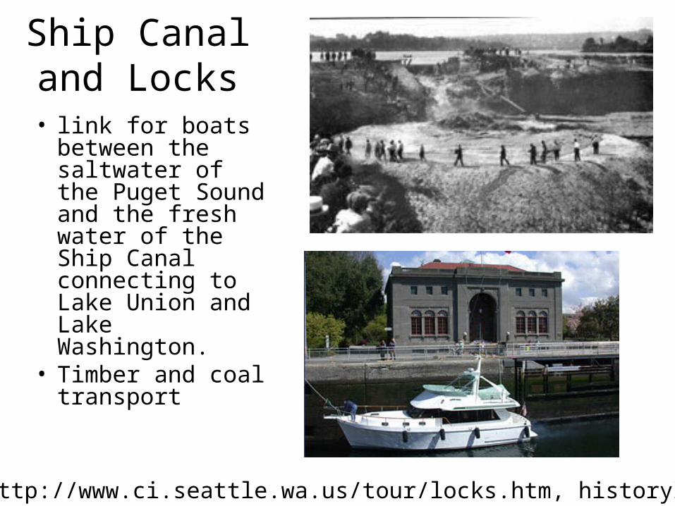
Ship Canal and Locks
• link for boats between the saltwater of the Puget Sound and the fresh water of the Ship Canal connecting to Lake Union and Lake Washington.
• Timber and coal transport
http://www.ci.seattle.wa.us/tour/locks.htm, historylink.org

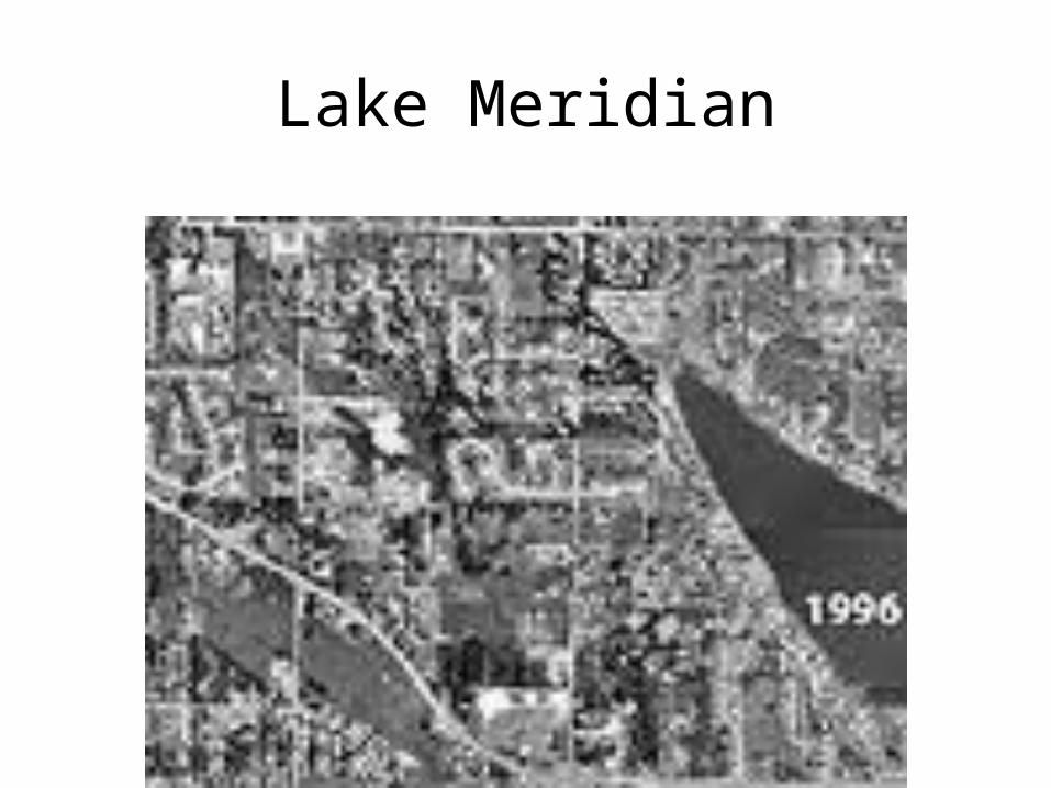
Development
from the 1930's, 1970's and 1990's illustrating growth around Lake Meridian in the Soos Creek
drainage
http://dnr.metrokc.gov/topics/map/aerials/1970LkMeridian.htm
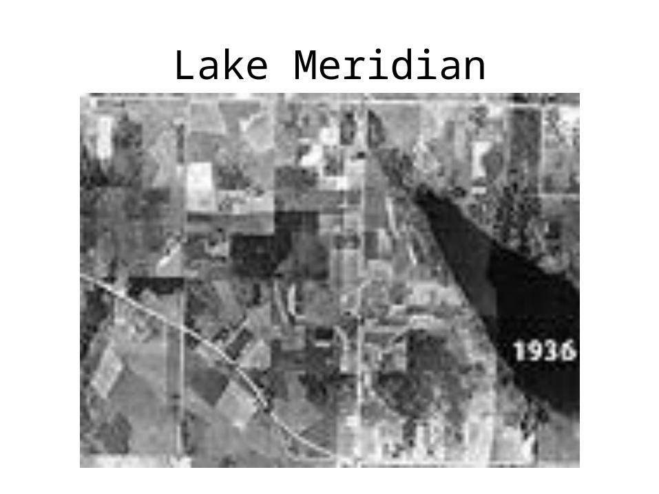
Lake Meridian

Lake Meridian