gwinnett county board of commissioners resolutions for brd ... · gwinnett county board of...
TRANSCRIPT

Gwinnett County Board of Commissioners' Resolutions for BRD, CIC, RZC, RZM, RZR, MIH, MUO, MUR, and/or SUP
Cases and Amendments acted upon in March 2017

CASE NUMBER CIC20 17-00002 GCID 2017-0018
GWINNETT COUNTY
BOARD OF COMMISSIONERS
LAWRENCEVILLE, GEORGIA
RESOLUTION ENTITLED: Change in Conditions of Zoning
ADOPTION DATE: MARCH 28. 20 17
At the regular meeting of the Gwinnett County Board of Commissioners, held in the Justice and Administration Center Auditorium, 75 Langley Drive, Lawrenceville, Georgia.
Name Charlotte J. Nash, Chairman Jace Brooks, District I Lynette Howard, District 2 Tom my Hunter, District 3 John Heard, District 4
Present Yes Yes Yes Yes Yes
Vote Aye Aye Aye Aye Aye
On motion of COMM. BROOKS, which carried a 5-0 vote, the following Resolution to Amend the Official Zoning Map of Gwinnett County is hereby adopted:
A RESOLUTION TO AMEND THE OFFICIAL ZONING MAP
WHEREAS, the Municipai-Gwinnett County Planning Commission has held a duly
advertised public hearing and has filed a formal recommendation with the Gwinnett County
Board of Commissioners upon an Application by ANGEL AMARO to Change the Conditions of
Zoning on a tract of land zoned R-75 and described by the attached legal description, which is
incorporated herein and made a part hereof by reference; and
WHEREAS, notice to the public regarding said Amendment to the Official Zoning Map
has been duly published in THE GWINNETT DAILY POST, the Official News Organ of
Gwinnett County; and
WHEREAS, a public hearing was held by the Gwinnett County Board of
Commissioners on MARCH 28. 2017 and objections were filed.

CASE NUMBER CIC2017-00002 GCID 2017-0018
NOW, THEREFORE, BE IT RESOLVED by the Gwinnett County Board of
Commissioners, that the aforesaid application to amend the Official Zoning Map is hereby
DENIED WITHOUT PREJUDICE.
GWINNETT COUNTY BOARD OF COMMISSIONERS
Charlotte J. Nash,
ATTEST: Date Signed: -1J~ff-J.L__.'i_,_,/._.!....f-'-7 _______ _
~{A_/ IV( . k. \

l&gnlJ),e.ru.lpllim ~ .. · All rhnt trnct l)r puree/ of lnnd l~ing aod bl.'ing in Lnnd Lot 263 of rhc 6rh l)i~tric,:t, f( ____ . __ U\\Iir)llctt.County, Georgia nml being more.pllrli~ularly tlcscribcd as li:>.llows: _
f: -r;~ · t··· ~~J..
if ~.: ~:. ~; ::!' 1:1 ?·-. '('
~~ · \
i~· .. ~~· ~,..
f; ~·· ~: r.., ~i: F. ~:; ~1:· v,
f.:' ~-.~-(.
... I;_
l'o rendtthc 'tru~ point ofbcginulitg commence at n point hcing tha. in~en;cctio]1·of th~ ll~'nll<wly Righl-t>t:-W11y ofCJnH1onw Drive (70' IVW) ami tlm :;ombwc-stcrly·_ · · · Right-of-Wny of Oeorgin HighwAy No. 20 (Vrniable R/W, b~ing 40 teet .from contorlinu nt!Mls poit_,t); th~ncc olong,sni.(1 Right-of· \Voy ufGcorgin Highway No, 20.1\r\d mnnipg· Norlh Jso-ow 01" West a distance of 199.97 fc~t to 11 point: them:ll South 59° 1 0'·38'' We. 'it a di_s'rnnce M 35.47 fcct to ti1e TRUE POT NT OF BEGINNING, froll1 point th\lfl t!$tobllllhcd an4 leaving ~mid Right-of· Wny of Oeot~iu Highwuy No. 20·al\(l n10ning South $9° :LO' 38" \Vest a distunp& of 400. l3 feet too point; thence South 58° 39' 33" \Vest n c.li~lrolcc of 173.31 fc~:'t to-n poin1; thence NL)rth 3'1 ~ 02' 34': West a·dilitnnce of 7Y9.25 feet tiJ &.point on the Lund J.:ot Line cotnmon to Lnnd J..ots 26j and 264: thence
· nlong :mid Lund Lot Line North 58° J7' 35" East n dislunce of I 59;33 f:eet to' a poinl~ · theuc~ leaving stlid.LI\ild Lot Lino ond rwming South 32° 4'7' 5311 nast a dist~nc~ ~'f 200.(14 f~l to~ point; th..:mcc Norlh 59° pa• W' Enst a dlst11noo of390.72 fee~ to a poln.t on· I he smnhwcs{crly Ri~ht·of· Way of tllorcmcntioncd Georgin l-Jjgh\vaY. No. 20 (V~I'iable f{/W, being 7~' t'ron'l cenctrline nt this poiut); tlnmcc along sa itt Rlght.of~ WAy South ~ll" 09'' J !)_I! J~a'lt u dlsmnco of 327.69 feet ton point; lhenc-e olung n curv'c to·the let\ 1\l\. nl'c <llst\\nce 1.1t' 272.07 tct~t (s:1id ctirve having a mdjus of 5390.91. !ect; n .;:h.oro. distnuce of272.04 feet nnd 1\ ch.r;>.rd b~l'ing ofSo\t1J1 no 32' 46" East) to the·truc J10lNI
. OF BEOl.N"NJNG. Sa.lct tmct contniuing 8.553 ucrC:~ .
. ' ..
P!mmi11a p, nnvnlnrmnnt
CIC '17 00 2

CASE NUMBER SUP20 17-0000 I GCID 2017-0019
BOARD OF COMMISSIONERS
GWINNETT COUNTY
LAWRENCEVILLE, GEORGIA
RESOLUTION
READING AND ADOPTION: MARCH 28. 2017
At the regular meeting of the Gwinnett County Board of Commissioners, held in the Justice and Administration Center Auditorium, 75 Langley Drive, Lawrenceville, Georgia.
Charlotte J. Nash, Chairman Jace Brooks, District I Lynette Howard, District 2 Tom my Hunter, District 3 John Heard, District 4
Present Yes Yes Yes Yes Yes
Vote Aye Aye Aye Aye Aye
On motion of COMM. BROOKS, which carried a 5-0 vote, the following resolution w as adopted:
A RESOLUTION TO GRANT A SPECIAL USE PERMIT
WHEREAS, the Municipai-Gwinnett County Planning Commission has held a duly
advertised public hearing and has filed a formal recommendation with the Gwinnett County
Board of Commissioners upon an Application for a Special Use Permit by LAWRENCEVILLE
RENTALS. INC. for the proposed use of TRUCK RENTAL on a tract of land described by the
attached legal description, which is incorporated herein and made a part hereof by reference;
and
WHEREAS, notice to the public regarding said Special Use Permit Application has been
duly published in THE GWINNETT DAILY POST, the Official News Organ of Gwinnett
County; and

CASE NUMBER SUP20 17-0000 I GCID 2017-0019
WHEREAS, a public hearing was held by the Gwinnett County Board of Commissioners
on MARCH 28, 20 17 and objections were not filed .
NOW, THEREFORE, BE IT RESOLVED by the Gwinnett County Board of
Commissioners on this, the 28TH day of MARCH 2017 that the aforesaid application for a
Special Use Permit is hereby APPROVED with the following enumerated conditions:
I. Retail, service-commercial and accessory uses which may include truck rental as a Special Use.
2. Truck rental shall be limited to no more than three trucks. Rental trucks shall be no larger than 16-foot box trucks, and must be parked to the rear of the suite and in marked parking spaces. Rental trucks and tow-behind trailers must be parked to the rear of suite I 19B and an 80-foot by 65-foot designated marked parking area as shown on Exhibit A The designated area shall be bordered and striped with traffic yellow paint. The designated area shall be clearly marked with a four-foot high rail and signage along each of the 65-foot sides to indicate use only by the applicant. The only exception is that no more than two 16-foot box trucks may be parked in front of the office.
3. The rear lot shall be restriped for parking spaces.
4. No tents, canopies, temporary banners, streamers or roping decorated with flags, tinsel, or other similar material shall be displayed, hung, or strung on the site. No decorative balloons or hot-air balloons shall be displayed on the site. Yard and/or bandit signs, sign-walkers and sign-twirlers shall be prohibited.
5. Peddlers and/or parking lot sales shall be prohibited.
6. The property owner shall repaint or repair any graffiti or vandalism that occurs on the property within 72 hours.
7. Abide by all applicable conditions of RZ-00-146
8. The damaged grassed area used for parking has been compacted due to the vehicular traffic. Repair and restore by removing all ruts and holes, rework the surface to a uniform slope and conditioned as originally designed. Add new sod as necessary and completely aerate and fertilize.
9. The existing dumpster location in the designated parking area shown in Exhibit A shall be relocated to a suitable area subject to review and approval by the Director of Planning of Development. The dumpster shall be screened by I 00% brick or stacked stone wall with opaque metal gate enclosure.

CASE NUMBER SUP2017-00001 GCID 2017-0019
I 0. The Special Use Permit shall expire after two years from the time of its enactment. The applicant may apply for renewal at that time.
GWINNETT COUNTY BOARD OF COMMISSIONERS
Date Signed: - -1--f-f-/-l-U-++f(_.__t..J-7 ______ _
ATTEST:
County Clerk/Deputy Coun

Type: DEED Book: 53561
lAND DESOliPnON River Exchange Shopping Center Tract One River Exchange I
Page: 00130
BK 5 3 5 6 I PG 0 I 3 0
EXHIBIT "A"
LEGAL DESCRIPTION
All of that tract or parcel of land lying and being in land Lot 33 of the 7111 land District of Gwinnett County, Georgia, containing 22.97 acres of land, more or Jess, and being more particularly described as follows:
BEGINNING at an iron pin found (W rebar} at the eastern end of the 20.00 foot radius return at the intersection of the southern margin ofthe right-of-way of Georgia Highway 120 (right-of-way va~ies} and the eastern margin of the right-of-way of Riverside Parkway (right-of-way varies); thence along the southern margin of the right-of-way of Georgia Highway 120, 192.56 feet along the arc of a curve to the right having a radius of 5659.58 feet and a chord bearing and distance of North 77 degrees 58 minutes 04 seconds East 192.55 feet to an iron pin found (W' rebar} being the TRUE POINT OF BEGINNING; thence continuing along said right-of-way 505.37 feet along the arc of a curve to the right having a radius of 5659.58 feet and a chord bearing and distance of North 81 degrees 30 minutes 02 seconds East, 505.20 feet to an iron pin found (>S" rebar) on the southern margin of the right-of-way of Georgia Highway 120 and the western margin of the right-of-way of lakes Parkway (right-of-way varies}; thence continuing along the western margin of right-of-way of Lakes Parkway 31.59 feet along the arc of a curve to the right having a radius of 20.00 feet and a chord bearing and distance of South 50 degrees 41 minutes 14 seconds East, 28.41 feet to an iron pin set (W rebar with cap}; thence continuing along the western margin of the right-ofway of lakes Parkway the following courses and distances: South 05 degrees 26 minutes 00 seconds East, 453.27 feet to an iron pin found (W rebar); thence 238.21 feet along the arc of a curve to the right having a radius of 793.51 feet and chord bearing and distance of South 03 degrees 10 minutes 00 seconds West, 237.32 feet to a point; thence South 11 degrees 46 minutes 00 seconds West, 267.14 feet to a point; thence 170.12 feet along the arc of a curve to the right having a radius of 793.51 feet and a chord bearing and distance of South 17 degrees 54 minutes 30 seconds West,169.79feet to a point; South 24 degrees 03 minutes 00 seconds West, 157.46 feet to a point; 164.57 feet along the arc of a curve to the right having a radius of 793.51 feet and a chord bearing and distance of South 29 degrees 59 minutes 30 seconds West, 164.28 feet to a point; thence South 35 degrees 55 minutes 59 seconds West, 195.86 feet to an iron pin found (W' rebar); thence departing said right-of-way North 54 degrees 04 minutes 00 seconds West, 338.48 feet to a point; thence South 35 degrees 56 minutes 00 seconds West, 65.23 feet to a point; thence North 54 degrees 04 minutes 00 seconds West, 235.35 feet to a nail found; thence North 03 degrees 43 minutes 14 seconds West, 102.41 feet to an iron pin found (Yz" rebar); thence North 23 degrees 51 minutes 00 seconds East, 207.24 feet to an iron pin set (W rebar with cap); thence North 68 degrees 21 minutes 00 seconds West, 196.34 feet to a nail found on the eastern margin of the right-of-way of Riverside Parkway; thence along said right-of-way North 31 degrees 25 minutes 00 seconds East, 13.92 feet to a point; thence continuing along said right-of-way 56.07 feet along the arc of a curve to the left having a radius of 1383.00 feet and chord bearing and distance of North 30 degrees 15 minutes 18 seconds East, 56.07 feet to a nail found; thence departing said right-of-way South 65 degrees 47 minutes 00 seconds East, 188.11 feet to an iron pin found (W'rebar); thence North 23 degrees 51 minutes 00 seconds East, 201.50 feet to an iron pin found (W' rebar); thence North 75 degrees 56 minutes 41 seconds West, 185.67 feet to an iron pin set (W' rebar with cap} on the eastern margin of the right-of-way of Riverside Parkway; thence along the eastern margin of said right-of·way the following courses and distances: 126.31 feet along the arc of a curve to the left having a radius of 1383.00 feet and a chord bearing and distance of North 19 degrees 28 minutes 48 seconds East, 126.27 feet to an iron pin found ()~·rebar}; thence South 73 degrees 08 minutes 11 seconds East, 10.00 feet to an Iron pin found (W rebar); thence 282.52 feet along the arc of a curve to the left having a radius of 1393.00 feet and a chord bearing and distance of North 11 degrees 03 minutes 12 seconds East, 282 04 feet to an iron pin found (~n rebar}; thence departing said right-of-way South 87 degrees 35 minutes 00 seconds East, 199.99 feet to an iron pin found (W' rebar); thenc~ Nof!.h 02 degr~~s 2~ 1~1Jlutes 00 seconds East, 254.34 feet to an iron pin found (W' rebar) and the TRUE POINT OF BEGI~NfNG. I I \/1 ·1 ) • ' I
i\11 1\t · , ,'I'll
SUP '17 00 1

CASE NUMBER SUP20 17-00006 GCID 2017-0149
BOARD OF COMMISSIONERS
GWINNETT COUNTY
LAWRENCEVILLE, GEORGIA
RESOLUTION
READING AND ADOPTION: MARCH 28. 20 17
At the regular meeting of the Gwinnett County Board of Commissioners, held in the Justice and Administration Center Auditorium, 75 Langley Drive, Lawrenceville, Georgia.
Charlotte J. Nash, Chairman Jace Brooks, District I Lynette Howard, District 2 Tommy Hunter, District 3 John Heard, District 4
Present Yes Yes Yes Yes Yes
Vote Aye Aye Aye Aye Aye
On motion of COMM. BROOKS, which carried a 5-0 vote, the following resolution was adopted:
A RESOLUTION TO GRANT A SPECIAL USE PERMIT
WHEREAS, the Municipai-Gwinnett County Planning Commission has held a duly
advertised public hearing and has filed a formal recommendation with the Gwinnett County
Board of Commissioners upon an Application for a Special Use Permit by ALEX TSYNMAN for
the proposed use of a CONTRACTOR'S OFFICE. HEAVY/CIVIL CONSTRUCTION/
LOGGING (BUFFER REDUCTION) on a tract of land described by the attached legal
description, which is incorporated herein and made a part hereof by reference; and
WHEREAS, notice to the public regarding said Special Use Permit Application has been
duly published in THE GWINNETT DAILY POST, the Official News Organ of Gwinnett
County; and

CASE NUMBER SUP20 17-00006 GCID 2017-0149
WHEREAS, a public hearing was held by the Gwinnett County Board of Commissioners
on MARCH 28. 20 17 and objections were not filed.
NOW, THEREFORE, BE IT RESOLVED by the Gwinnett County Board of
Commissioners on this, the 28TH day of MARCH 2017 that the aforesaid application for a
Special Use Permit is hereby APPROVED with the following enumerated conditions:
I. To restrict the use of the property as follows:
A To restrict the use of the property to a contractor's office (heavy/civil construction/logging) with gravel parking lots.
B. The property shall not be used as a towing/wrecker service or junk salvage yard. Outdoor activities shall be restricted to areas screened on all sides by a I 00% opaque fence and gate. The fence height, materials and design shall be subject to the review and approval of the Director of Planning and Development.
C. Heavy equipment traffic moving through the property adjacent to the existing office building shall be restricted and not used after 8 a.m. and before 6 p.m. Monday through Friday.
D. The Special Use Permit shall be valid for a two-year period, at which time the use shall cease or an application shall be made for renewal of the Special Use Permit.
2. To abide by the following site development considerations:
A Obtain all necessary development and building permits and bring all structures up to all applicable zoning, development, and building codes within 60 days of zoning approval.
B. Gravel parking and storage areas shall be limited to those in existence before January I, 2017.
C. New ground signage shall be limited to monument-type sign(s), and shall be subject to review and approval by the Director of Planning & Development. The sign shall include a minimum two-foot high brick or stacked stone base, complementing the building's architectural treatment. The masonry base shall extend at least the full width of the sign cabinet, and the sign cabinet shall be fully recessed and surrounded by the same materials. Ground signage shall not exceed ten feet in height.
CASE NUMBER SUP2017-00006 GCID 2017-0149
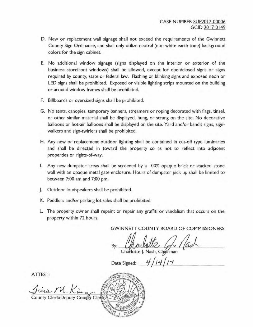
D. New or replacement wall signage shall not exceed the requirements of the Gwinnett County Sign Ordinance, and shall only utilize neutral (non-white earth tone) background colors for the sign cabinet.
E. No additional window signage (signs displayed on the interior or exterior of the business storefront windows) shall be allowed, except for open/closed signs or signs required by county, state or federal law. Flashing or blinking signs and exposed neon or LED signs shall be prohibited. Exposed or visible lighting strips mounted on the building or around window frames shall be prohibited.
F. Billboards or oversized signs shall be prohibited.
G. No tents, canopies, temporary banners, streamers or roping decorated with flags, tinsel, or other similar material shall be displayed, hung, or strung on the site. No decorative balloons or hot-air balloons shall be displayed on the site. Yard and/or bandit signs, signwalkers and sign-twirlers shall be prohibited.
H. Any new or replacement outdoor lighting shall be contained in cut-off type luminaries and shall be directed in toward the property so as not to reflect into adjacent properties or rights-of-way.
I. Any new dumpster areas shall be screened by a I 00% opaque brick or stacked stone wall with an opaque metal gate enclosure. Hours of dumpster pick-up shall be limited to between 7:00 am and 7:00 pm.
J. Outdoor loudspeakers shall be prohibited.
K. Peddlers and/or parking lot sales shall be prohibited.
L. The property owner shall repaint or repair any graffiti or vandalism that occurs on the property within 72 hours.
GWINNETT COUNTY BOARD OF COMMISSIONERS
Date Signed: _ '-/-1-f-1/_,_/_,_'f+/--'-L _._1 ______ _
ATTEST:
County Clerk/Deputy Cou

BK 12 I o 9 PG o o 0 a
EXHIBIT "A"
p, ,_j
4 ,u'l.
All that tract or porcol of land lying and being in Land Lot 201 of the 6th Diotriot of Gwinnott county, Goorgia, being more particularly described as follows:
BBGINN!NG at u point Barked by an iron pin at tho intorsoction common to Land Lots 200, 201, 184 and 1851 run thence north 30 degrees 45 ~1nutes oo seconds woot a distance of 255,00 feet to a point marked by an iron pin oet1 run thence north 59 degrees 27 minutes 25 seconds east a distance of 525.99 teet to a point marked by an iron pin set1 run thence north 30 degrees 32 minutes 35 seconds weet a distonco of 34.78 feet to a point1 run tlmeoe north 53 degrees 23 ninutes 47 seconds east a distance ot 547.59 feet to n pointr run thence north 63 degrees 14 uinutes 17 seconds east a distance of 125.28 feet to o point on the southwesterly riqht~of-way of Seaver Ruin Road (a ~30 foot rightwof•ltay) ; run thenoe along said right-of- way of Beaver RUin Road, south 72 degrees 28 minutes 25 seconds east a distonca or 40.0 foet to a point marked by an iron pin set1 run thence south 69 degrees 39 minutes 10 seconds wast a distance of 152.99 teet to a point marked by an iron pin set1 run thence south 53 degrlies 23 mdnutes 47 seconds went a distance of 440 . 29 feet to a point uarkod by an iron pin sets run thence south 33 degrees 19 ninutes 25 seconds east a distance of 290 .52 feet to a point carked by an iron pin setr run thence south 59 deqrees 27 ninuteo 25 eeoonds west a distance of 647,02 feet to the POl tiT OF BEGINlUtiG hereof, containing 4,025, acres more or lees aooording to a plat of individual survey dated November 12, 1982 by Benchmark Engineering corpo:ration.
RCCCI\
CASE NUMBER SUP20 17-000 I 0 GCID 2017-0153
BOARD OF COMMISSIONERS
GWINNETI COUNTY
LAWRENCEVILLE, GEORGIA
RESOLUTION
READING AND ADOPTION: MARCH 28.2017
At the regular meeting of the Gwinnett County Board of Commissioners, held in the Justice and Administration Center Auditorium, 75 Langley Drive, Lawrenceville, Georgia.
Present Vote Charlotte J. Nash, Chairman Yes Aye Jace Brooks, District I Yes Aye Lynette Howard, District 2 Yes Aye Tommy Hunter, District 3 Yes Aye John Heard, District 4 Yes Aye
On motion of COMM. HOWARD, which carried a 5-0 vote, the following resolution was adopted:
A RESOLUTION TO GRANT A SPECIAL USE PERMIT
WHEREAS, the Municipai-Gwinnett County Planning Commission has held a duly
advertised public hearing and has filed a formal recommendation with the Gwinnett County
Board of Commissioners upon an Application for a Special Use Permit by MICHEL NJEM for
the proposed use of an AUTOMOBILE REPAIR SHOP. LUBRICATION & TIRE STORE on a
tract of land described by the attached legal description, which is incorporated herein and made
a part hereof by reference; and
WHEREAS, notice to the public regarding said Special Use Permit Application has been
duly published in THE GWINNETT DAILY POST, the Official News Organ of Gwinnett
County; and

CASE NUMBER SUP2017-000IO GCID 2017-0153
WHEREAS, a public hearing was held by the Gwinnett County Board of Commissioners
on FEBRUARY 28. 2017 and objections were filed.
NOW, THEREFORE, BE IT RESOLVED by the Gwinnett County Board of
Commissioners on this, the 28TH day of MARCH 20 17 that the aforesaid application for a
Special Use Permit is hereby APPROVED with the following enumerated conditions:
I . To restrict the use of the property as follows:
A. Retail, service commercial, office and accessory uses only which may include an automobile repair shop, lubrication and tire store as special uses consisting of a maximum of six bays.
B. On-site automobile sales or storage of junked vehicles shall be prohibited.
C. Service bay doors shall face to the side and shall not face Jimmy Carter Boulevard.
D. The proposed building must be set back a minimum of forty-five feet from the right
of-way of Jimmy Carter Boulevard.
2. To abide by the following site development considerations:
A. Provide a ten-foot wide landscaped strip adjacent to all internal property lines. The landscape strip adjacent to Jimmy Carter Boulevard, shall be planted with two staggered rows of evergreen shrubs, minimum five gallon container size at planting, to provide an evergreen screen a minimum of three feet in height. The landscape strip adjacent to the northern property line shall be planted with evergreen trees to screen the view of the service bays from traffic on Jimmy Carter Boulevard. The final landscaping plan is subject to review and approval of the Director of Planning and Development.
B. Ground signage shall be limited to one monument-type sign(s), and shall be subject to review and approval by the Director of Planning & Development. The sign shall include a minimum two-foot high brick or stacked stone base, complementing the building's architectural treatment. The masonry base shall extend at least the full width of the sign cabinet, and the sign cabinet shall be fully recessed and surrounded by the same materials. Ground signage shall not exceed six feet in height.
C. Wall signage shall not exceed the requirements of the Gwinnett County Sign Ordinance, and shall only utilize neutral (non-white earth tone) background colors for the sign cabinet.
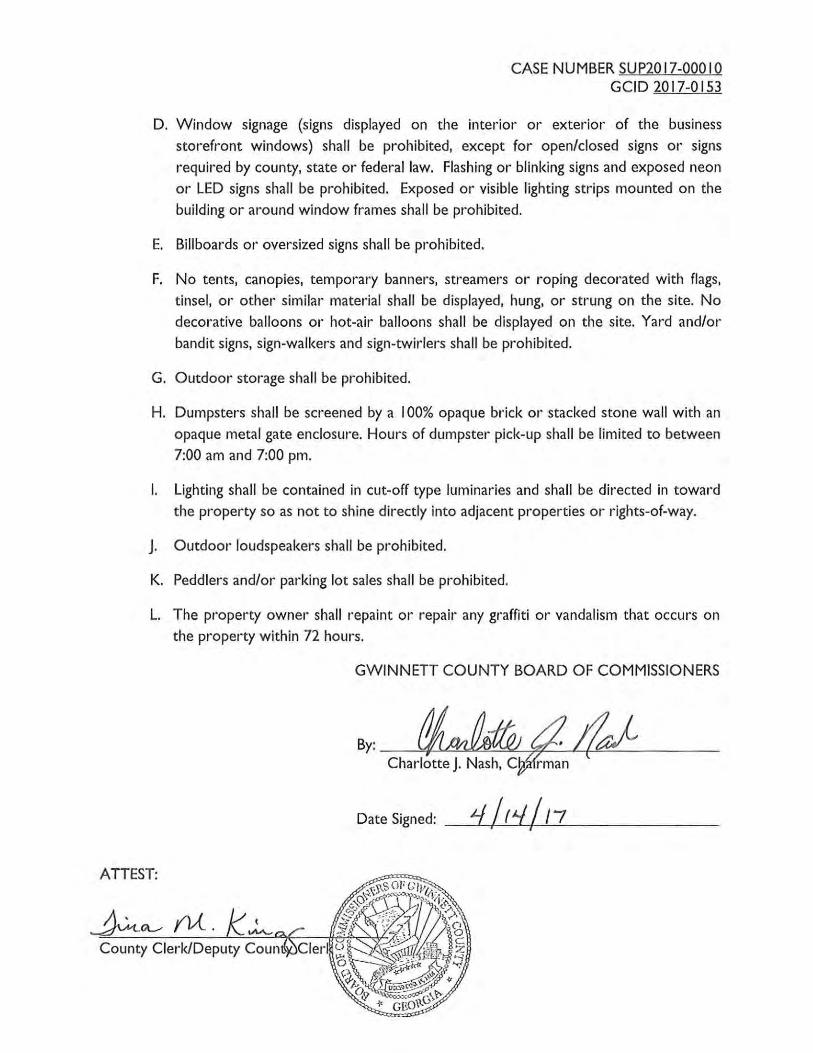
CASE NUMBER SUP2017-000IO GCID 2017-0153
D. Window signage (signs displayed on the interior or exterior of the business storefront windows) shall be prohibited, except for open/closed signs or signs required by county, state or federal law. Flashing or blinking signs and exposed neon or LED signs shall be prohibited. Exposed or visible lighting strips mounted on the building or around window frames shall be prohibited.
E. Billboards or oversized signs shall be prohibited.
F. No tents, canopies, temporary banners, streamers or roping decorated with flags, tinsel, or other similar material shall be displayed, hung, or strung on the site. No decorative balloons or hot-air balloons shall be displayed on the site. Yard and/or bandit signs, sign-walkers and sign-twirlers shall be prohibited.
G. Outdoor storage shall be prohibited.
H. Dumpsters shall be screened by a I 00% opaque brick or stacked stone wall with an opaque metal gate enclosure. Hours of dumpster pick-up shall be limited to between 7:00 am and 7:00 pm.
I. Lighting shall be contained in cut-off type luminaries and shall be directed in toward the property so as not to shine directly into adjacent properties or rights-of-way.
J. Outdoor loudspeakers shall be prohibited.
K. Peddlers and/or parking lot sales shall be prohibited.
L. The property owner shall repaint or repair any graffiti or vandalism that occurs on the property within 72 hours.
GWINNETT COUNTY BOARD OF COMMISSIONERS
Date Signed: __ 1'-f-/...:..t ~_._,../__,1_7,__ _____ _
ATTEST:
County Clerk/Deputy Coun

244114 111511
· BK 2 ~ ~ o ~ PG o 1 s o G71l·ii?<I0580
hll th~t t~act or pn~cel of lnnd lying an~ being in Loud Lot 195 of the Gth Dhtrict of Gwinnett Count, GP.orgia ~s shown and descriuod on a. sut:Vey for Nje10 Investments and Lttwyers Tit).e Insut"ance Corporation, prepared by Construction Engineering 1\e«JOciatcs, MUton Robl!lL L~:010il, Georgia R,L,$ , No . 1'139, dated onoember 29, 1998, Md last tevised October 26, 1!199, which survey is i.nco~~ornted tnco and ~de a p11rt of this description by reftn~uuc, and being mot-e pn~tioul"rly doooribod a11 follows:
TO timl th .. TRUll l'OltiT Ol? UEGXmlnlc, co~tn~onc~ nt ~hA 1nr.t:uaction of the aouthweatorly right·of-way line of Jimror carter Boulevard (a 100 toot right· o!-wayl and the southerly right-of•Wi\)' line of ~lcDonough oriveJ run tbonco o0\1thMAt.t\rly along tho south11esterly rinht·of•way line of JillV!\y C~~~er Boulevard a distance of 154.97 foot ~o a reba~ oet at che TRUB POlliT OF BBGIIINING1 run thence south 1? d!:greeu 07 adnlltes 49 seconds Bast along the westerly :dght•of-wny lu\<1 of J imn1y Cnrtol=' Doulovard a dl.&tnnoe of 27.30 feet to a rebar set; ntn thence Jlorch 71. de!:Jrt!ull 02 Minutes 33 seconds Bast a distance of 4.14 feet. co a rebDr set on the westerly right · of·II8Y line of JillV!Iy Carter Boulevard/ :nm chence South 16 degrees 59 minuceo 30 uucoudij f:bllt 1110119 tho wootcrly :righr.-of·way Hue of Jimmy Career Boulevard a distallc':t: of 110.37 feet to n rebar found; thouce departing the aouthwesterly right•of·way line of Jimmy Carter Doul.svard run 11outh O<l dograaa 0!1 mimorAR .1!i seconds llest n distance of 242.77 feet to at\ ope11 top pipe found; a:w1 thence llorth 21 degrees 31 minutes 00 seconds West ~ distance ot 72.15 feet to ~ rebar round, >:lU\ th<W"A IJnrt:h 60 degree& ;\2 minuti!S 20 aeconds Bast a dhtllnce of 240.40 feet co a rebar. set on the oouthlleSterly right-of·Hay line o£ Jim11y Ca..:t:er Boulevard at the TRUB POXIIT OF IJEGXNliiiiG.
The above described property being the sa111c property deDCdbed in ~hdL certain Warranty Deed fro111 No:roross-85 Park, Inc. to Bill Wat)(ino, dated 1\llguat 16, 1977, recorded llovember 21, 197'1 in Deed 9ook 1374, Page 344, OtUce OJ: the (;lcrk. oC the Sllp~L'iOL Court of Ou~nnctt Coul'lty, Oot>.cgl."'l LESS AND EXCEPT that certain propl.lrtY conveyed by Bill wat)(ins to the Department of Transportation in thnt nepartment of Transportation Right vr Wtay Deed, do.eed Ooptcmb~>: 2~, 19A?, recotdod OctobP.l" 14, l9A7 in Deecl Book 1500, Page 101, aforesaid records.
RECEIVED BY
DEC 0 2 2016
Plsnnmo & Dsvdopment "
•
•
•
•

CASE NUMBER RZC20 17-0000 I GCID 2017-0020
GWINNETT COUNTY
BOARD OF COMMISSIONERS
LAWRENCEVILLE, GEORGIA
RESOLUTION ENTITLED: Amendment to the Official Zoning Map of Gwinnett County
ADOPTION DATE: MARCH 28. 2017
At the regular meeting of the Gwinnett County Board of Commissioners held in the Gwinnett Justice and Administration Center, Auditorium, 75 Langley Drive, Lawrenceville, Georgia.
Name Present Vote Charlotte J. Nash, Chairman Yes Aye Jace Brooks, District I Yes Aye Lynette Howard, District 2 Yes Aye Tommy Hunter, District 3 Yes Aye John Heard, District 4 Yes Aye
On motion of Commissioner COMM. HUNTER, which carried a 5-0 vote, the following Resolution to Amend the Official Zoning Map of Gwinnett County is hereby adopted:
WHEREAS, the Municipai-Gwinnett County Planning Commission has held a duly
advertised public hearing and has filed a formal recommendation with the Gwinnett County
Board of Commissioners upon an Application to Amend the Official Zoning Map from RA-200
to M-1 by RUTH DAMPSON & ANDREW YOUNG for the proposed use as a TRUCK
STORAGE LOT (BUFFER REDUCTION) on a tract of land described by the attached legal
description, which is incorporated herein and made a part hereof by reference; and
WHEREAS, notice to the public regarding said Amendment to the Official Zoning Map
has been duly published in THE GWINNETT DAILY POST, the Official News Organ of
Gwinnett County; and
WHEREAS, a public hearing was held by the Gwinnett County Board of
Commissioners on MARCH 28. 20 17 and objections were filed.

CASE NUMBER RZC2017-0000I GCID 2017-0020
NOW, THEREFORE, BE IT RESOLVED by the Gwinnett County Board of
Commissioners, that the aforesaid application to amend the Official Zoning Map from RA-200
to M-1 is hereby DENIED.
GWINNETT COUNTY BOARD OF COMMISSIONERS
Charlotte J. Nash, Ch
Date Signed: __ qL-1---( .!.-{lf....!.....f---{--'-1-.!7 ___ _ _ _ _ _
ATTEST:
County Clerk/Deputy County
PCI"[i-il· 1.>!" d;: ._.l-..:. l ::r:·: of iht~:r i',. J ll.: --.;h, • .. ~ i J !•.
~~": ·I:: ··iJ. : . \ '"
•) f Hurri.c ~:•t; Sit.-,:<.· r·- ~! :;:·L:' U: :1.:t r: -:·: · c·. t ,·. :L n '? lt. _, :) (I 7 I .'1•.:. r: i:·. ·, ,
RFCE!VED RY -rue '17 oo 1 NOV ~ :· 2D tG
Plmnning & Development

CASE NUMBER SUP20 17-00002 GCID 2017-0021
BOARD OF COMMISSIONERS
GWINNETT COUNTY
LAWRENCEVILLE, GEORGIA
RESOLUTION
READING AND ADOPTION: MARCH 28.2017
At the regular meeting of the Gwinnett County Board of Commissioners, held in the Justice and Administration Center Auditorium, 75 Langley Drive, Lawrenceville, Georgia.
Charlotte J. Nash, Chairman Jace Brooks, District I Lynette Howard, District 2 Tommy Hunter, District 3 John Heard, District 4
Present Yes Yes Yes Yes Yes
Vote Aye Aye Aye Aye Aye
On motion of COMM. HUNTER, which carried a 5-0 vote, the following resolution was adopted:
A RESOLUTION TO GRANT A SPECIAL USE PERMIT
WHEREAS, the Municipai-Gwinnett County Planning Commission has held a duly
advertised public hearing and has filed a formal recommendation with the Gwinnett County
Board of Commissioners upon an Application for a Special Use Permit by RUTH DAMPSON &
ANDREW YOUNG for the proposed use of a TRUCK STORAGE LOT (BUFFER
REDUCTION) on a tract of land described by the attached legal description, which is
incorporated herein and made a part hereof by reference; and
WHEREAS, notice to the public regarding said Special Use Permit Application has been
duly published in THE GWINNETT DAILY POST, the Official News Organ of Gwinnett
County; and

CASE NUMBER SUP20 17-00002 GCID 2017-0021
WHEREAS, a public hearing was held by the Gwinnett County Board of Commissioners
on MARCH 28, 2017 and objections were filed.
NOW, THEREFORE, BE IT RESOLVED by the Gwinnett County Board of
Commissioners on this, the 28TH day of MARCH 2017 that the aforesaid application for a
Special Use Permit is hereby DENIED.
GWINNETT COUNTY BOARD OF COMMISSIONERS
Date Signed: 4-/1 '± /11 ATTEST:
County Clerk/Deputy Cou
!:'!IIi<] . iY r~ i~ .:=. < . ]. ':(' .• y f ilt,r r(, . .; n< -i h ; •,!l.;
RECEIVEf? BY
NOV · · 1 20iG
Planning & Development
i\iV · •·:
... '
1 • • • ,I. - -
,\ ..
I • ·~
.. : '
. : ...
.. '. -~ ~ ·. -
SUP '17 00 2
CASE NUMBER SUP20 17-00005 GCID 2017-0029
BOARD OF COMMISSIONERS
GWINNETT COUNTY
LAWRENCEVILLE, GEORGIA
RESOLUTION
READING AND ADOPTION: MARCH 28, 2017
At the regular meeting of the Gwinnett County Board of Commissioners, held in the Justice and Administration Center Auditorium, 75 Langley Drive, Lawrenceville, Georgia.
Charlotte J. Nash, Chairman Jace Brooks, District I Lynette Howard, District 2 Tommy Hunter, District 3 John Heard, District 4
Present Yes Yes Yes Yes Yes
Vote Aye Aye Aye Aye Aye
On motion of COMM. HOWARD, which carried a 5-0 vote, the following resolution was adopted:
A RESOLUTION TO GRANT A SPECIAL USE PERMIT
WHEREAS, the Municipai-Gwinnett County Planning Commission has held a duly
advertised public hearing and has filed a formal recommendation with the Gwinnett County
Board of Commissioners upon an Application for a Special Use Permit by AZIZ CHARANIA
for the proposed use of a MONTESSORI SCHOOL (BUFFER REDUCTION) on a tract of land
described by the attached legal description, which is incorporated herein and made a part
hereof by reference; and
WHEREAS, notice to the public regarding said Special Use Permit Application has been
duly published in THE GWINNETT DAILY POST, the Official News Organ of Gwinnett
County; and

CASE NUMBER SUP2017-00005 GCID 2017-0029
WHEREAS, a public hearing was held by the Gwinnett County Board of Commissioners
on MARCH 28. 20 17 and objections were filed.
NOW, THEREFORE, BE IT RESOLVED by the Gwinnett County Board of
Commissioners on this, the 28TH day of MARCH 20 17 that the aforesaid application for a
Special Use Permit is hereby DENIED WITHOUT PREJUDICE.
GWINNETT COUNTY BOARD OF COMMISSIONERS
Date Signed: _ _ 4-'---i{l---'1'---t.f-'-+-{-'-17__.__ _____ _ _ _
ATTEST:
LEGAL DESCRIPTION
All that tract or Parcel of land lying and being in Land Lot 86 of the 6th Land District of Gwinnett county, Georgia, containing less or more of 1.41 Acres, bounded on the north by the other lands of J.H. and Commie Lee Simpson; on the east by Oal< Rd (formerly knowri as Five-Forks Snellville Rd); and on the South and west by the lands of Roddy. Said tract of land is more particularly described as follows; Beginning at the point of west side Oak Road which is 434 feet south from the corner of the property of the WD Phillips Estate and run thence in a southerly direction along the west side of Oak Road 327 feet to a corner with lands of Roddy; Thence in a westerly direction along said lands of Roddy 157 feet to a corner, thence in a northerly direction also along lands of Roddy 367 feet to a corner, thence in easterly direction 270 feet to the point of beginning on Oak Rd.
=<ECElVED 8Y
NOV 0 4 7.0"16
Planning & Dovelopment SUP '17 00 5-

CASE NUMBER RZC20 17-00007 GCID 2017-0143
GWINNETT COUNTY
BOARD OF COMMISSIONERS
LAWRENCEVILLE, GEORGIA
RESOLUTION ENTITLED: Amendment to the Official Zoning Map of Gwinnett County
ADOPTION DATE: MARCH 28. 20 17
At the regular meeting of the Gwinnett County Board of Commissioners held in the Gwinnett Justice and Administration Center, Auditorium, 75 Langley Drive, Lawrenceville, Georgia.
Name Charlotte J. Nash, Chairman Jace Brooks, District I Lynette Howard, District 2 Tommy Hunter, District 3 John Heard, District 4
Present Yes Yes Yes
Absent Yes
Vote Aye Aye Aye
Absent Aye
On motion of Commissioner COMM. HOWARD, which carried a 4-0 vote, the following Resolution to Amend the Official Zoning Map of Gwinnett County is hereby adopted:
WHEREAS, the Municipai-Gwinnett County Planning Commission has held a duly
advertised public hearing and has filed a formal recommendation with the Gwinnett County
Board of Commissioners upon an Application to Amend the Official Zoning Map from 0-1 to
C-1 by MAHAFFEY PICKENS TUCKER. LLP for the proposed use as a CONVENIENCE
STORE WITH FUEL PUMPS (BUFFER REDUCTION) on a tract of land described by the
attached legal description, which is incorporated herein and made a part hereof by reference;
and
WHEREAS, notice to the public regarding said Amendment to the Official Zoning Map
has been duly published in THE GWINNETT DAILY POST, the Official News Organ of
Gwinnett County; and

CASE NUMBER. R.ZC2017-00007 GCID 2017-0143
WHEREAS, a public hearing was held by the Gwinnett County Board of
Commissioners on MARCH 28, 20 17 and objections were filed.
NOW, THEREFORE, BE IT RESOLVED by the Gwinnett County Board of
Commissioners, that the aforesaid application to amend the Official Zoning Map from 0-1 to
C-1 is hereby DENIED.
GWINNETT COUNTY BOARD OF COMMISSIONERS
By: ~L#L Charlotte J. Nash, Cl);l rman
Date Signed: _i.f-+-+{___,l'--Lf~{_,_f _.1 _ _____ _
ATTEST:
County Clerk/Deputy Count
Property Description
/\11 that tract or parcel of land lying and being in Land Lot 169, of the 6th Land District, Gwinnct1 County, Georgia containing +/-0. 745 acres and being more pat1icularly described as follows:
BEGINNING at an iron pin found (l/2" RB) located at the intersection of Jimmy Carter Boulevard (I 00' R/W) and Queen Atme Court (50' RJW); thence along the right-of-way of Jimmy Carter Boulevard N zoo 47' 11" W a distance of Z5.92 feet to a point; thence continuing along said right-of-way N zoo 47' 11" W a distance of 123.41 feet to an iron pin found; thence leaving said right-of-way N 68° 15' 55" E a distance of 185.56 feet to an iron pin found; thence S 43° 49' 06" E a distance of 161.56 feet to an iron pin found; thence along the right-of-way of Queen /\nne CourtS 68° 2I' 26" W a distance of248.77 feet to the POINT OF BEGINNING.
RECEIVED BY RZC '17 00 7
DEC 0 2 2016
Pla-nning 8, Delf~!opmp,nt

CASE NUMBER RZM20 17-0000 I GCID 2017-0030
GWINNETT COUNTY
BOARD OF COMMISSIONERS
LAWRENCEVILLE, GEORGIA
RESOLUTION ENTITLED: Amendment to the Official Zoning Map of Gwinnett County
ADOPTION DATE: MARCH 28. 20 17
At the regular meeting of the Gwinnett County Board of Commissioners held in the Gwinnett Justice and Administration Center, Auditorium, 75 Langley Drive, Lawrenceville, Georgia.
Name Present Vote Charlotte J. Nash, Chairman Yes Aye Jace Brooks, District I Absent Absent Lynette Howard, District 2 Yes Aye Tom my Hunter, District 3 Absent Absent John Heard, District 4 Yes Aye
On motion of Commissioner COMM. HEARD, which carried a 3-0 vote, the following Resolution to Amend the Official Zoning Map of Gwinnett County is hereby adopted:
WHEREAS, the Municipai-Gwinnett County Planning Commission has held a duly
advertised public hearing and has filed a formal recommendation with the Gwinnett County
Board of Commissioners upon an Application to Amend the Official Zoning Map from R-1 00 to
R-TH by FIELDSTONE HOMES for the proposed use as TOWNHOMES (BUFFER
REDUCTION) on a tract of land described by the attached legal description, which is
incorporated herein and made a part hereof by reference; and
WHEREAS, notice to the public regarding said Amendment to the Official Zoning Map
has been duly published in THE GWINNETT DAILY POST, the Official News Organ of
Gwinnett County; and
WHEREAS, a public hearing was held by the Gwinnett County Board of
Commissioners on MARCH 28, 2017 and objections were filed.

CASE NUMBER RZM2017-0000I GCID 2017-0030
NOW, THEREFORE, BE IT RESOLVED by the Gwinnett County Board of
Commissioners, that the aforesaid application to amend the Official Zoning Map from R- 1 00 to
R-TH is hereby APPROVED with the following enumerated conditions:
I. To restrict the use of the property as follows:
A Attached townhouse dwellings and accessory uses not to exceed one hundred eighteen (I 18) units. All proposed townhouse units shall be a minimum of 24 feet wide.
B. The minimum heated floor area per dwelling shall be 2,000 square feet.
C . Buildings shall be constructed of brick and/or stacked stone masonry materials on all front elevations with accent building materials permitted to include but not limited to stucco, EIFS, metal, painted cement siding, and wood. The side and rear building elevations shall have an entire elevation of paintable cement siding. Accent trim materials of stucco, EIFS, metal, painted cement siding, and wood are permitted on the rear elevations.
D. All units shall have a double-car garage.
E. Provide a swimming pool and appropriately sized clubhouse equipped with bathrooms and storage rooms only. The clubhouse shall be finished to match the facades of the adjacent townhouses.
F. Provide a playground, and/or community open space with benches and sitting areas adjacent to the swimming pool area located near the entrance to the townhouse community.
2. To satisfy the following site development considerations:
A Provide a 50 foot graded and replanted residential buffer adjacent to the northern Taylor Oaks property lines. The graded and replanted buffer shall include a landscaped berm that is a minimum of eight feet tall at the time of planting and includes two rows of staggered evergreen trees that are six to eight feet tall at the time of installation and are spaced out no further than 12 feet on center within each row. The acceptable evergreen trees to be planted in this buffer are as follows: Cryptomeria, Cypress, Hollies, Southern Magnolia, Wax Myrtles, and Thuga Green Giants.
B. Provide a 30 foot graded and replanted residential buffer adjacent to the western property lines. The graded and replanted buffer shall include a landscaped berm that is minimum of six feet tall at the time of planting and includes two rows of staggered evergreen trees that are six to eight feet tall at the time of installation and are spaced out no further than 12 feet on center within each row. The acceptable evergreen trees to be planted in this buffer are as follows: Cryptomeria, Cypress, Hollies, Southern Magnolia, Wax Myrtles, and Thuga Green Giants, or staff approved plantings.

CASE NUMBER RZM2017-0000I GCID 2017-0030
C. Provide a six foot tall vinyl-coated chain link fence to be installed at the top of the berm located within the 30 foot and 50 foot graded and replanted residential buffers between the two rows of trees. The fence shall be continued along the southern property line adjacent to the C-2 zoned property and stopped where the sanitary sewer easement crosses the property line.
D. Natural vegetation shall remain on the property until the issuance of a development permit.
E. No direct lot access shall be allowed to Buford Drive.
F. The Buford Drive frontage and project entrance shall be landscaped and maintained by the Homeowner's Association, and shall include a landscaped entrance feature, a decorative wrought iron fence with brick columns spaced 30 feet on center and landscaping along the entire frontage. Landscaping, fencing and monument signage plans shall be subject to review and approval of the Director of Planning and Development.
G. All grassed areas shall be sodded.
H. Underground utilities shall be provided throughout the development.
I. The Homeowners Association will provide a mosquito control program for the stormwater control features.
3. To abide by the following requirements, dedications, and improvements:
A Prior to the issuance of a Development Permit, the applicant shall provide a traffic impact study.
B. Prior to the issuance of the first certificate of occupancy, the applicant shall make any improvements recommended by the traffic impact study, provided the improvements are approved by the D.O.T. All design and construction will be subject to D.O.T. review and approval.
GWINNETT COUNTY BOARD OF COMMISSIONERS
By:
ATTEST:
County Clerk/Deputy County Cler
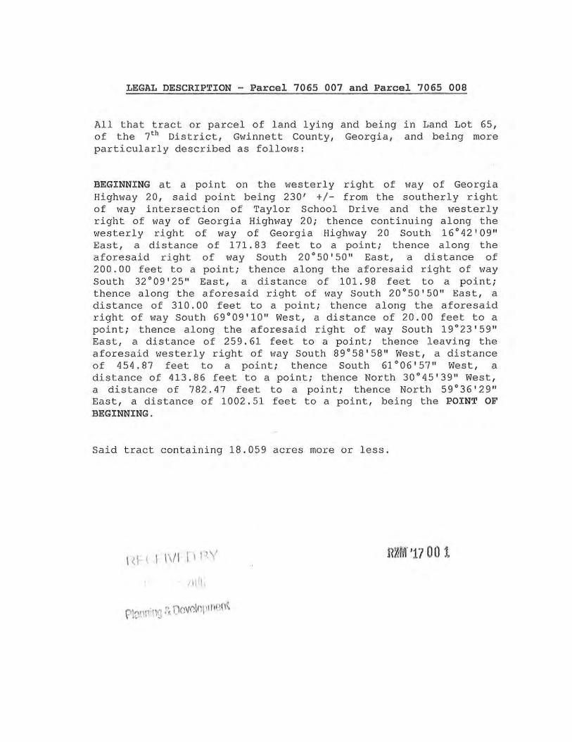
LEGAL DESCRIPTION - Parcel 7065 007 and Parcel 7065 008
All that tract or parcel of land lying and being in Land Lot 65, of the 7th Dis trict, Gvlinnett County, Georgia, and being more particularly described as follows:
BEGINNING at a point on the westerly right of \•Tay of Georgia High1.,ray 20 , said point being 230' +/- from the southerly right of way intersection of Taylor School Drive and the westerly right of way of Georgia Highway 20; thence continuing along the \•Testerly right of way of Georgia Highway 20 South 16°42' 09 11
East, a distance of 171.83 feet to a point; thence along the aforesaid right of way South 20°50'50 11 East, a distance of 200.00 feet to a point; thence along the aforesaid right of way South 32°09'25 11 East, a distance of 101.98 feet to a point; thence a long the aforesaid right of I·Jay South 20°50 '50 11 East, a distance of 310.00 feet to a point; thence along the aforesaid right of \•Jay South 69°09'10 11 West, a distance of 20.00 feet to a point; thence along the aforesaid right of way South 19°23 • 59 11
East, a distance of 259.61 feet to a point; thence leaving the aforesaid \•Jesterly right of way South 89° 58' 58 11 West, a distance of 454.87 feet to a point; thence South 61°06 ' 57 11 West, a distance of 413.86 feet to a point; t hence North 30°45'39 11 West, a distance of 782.47 feet to a point; t hence North 59°36'29 11
East, a distance of 1002. 51 feet to a point, being the POINT OF BEGINNING.
Said tract containing 18.059 acres more or less .
1 ~I ( .I 1\/1 11 P 1 n~M· '17 o o 1.
/I j il,
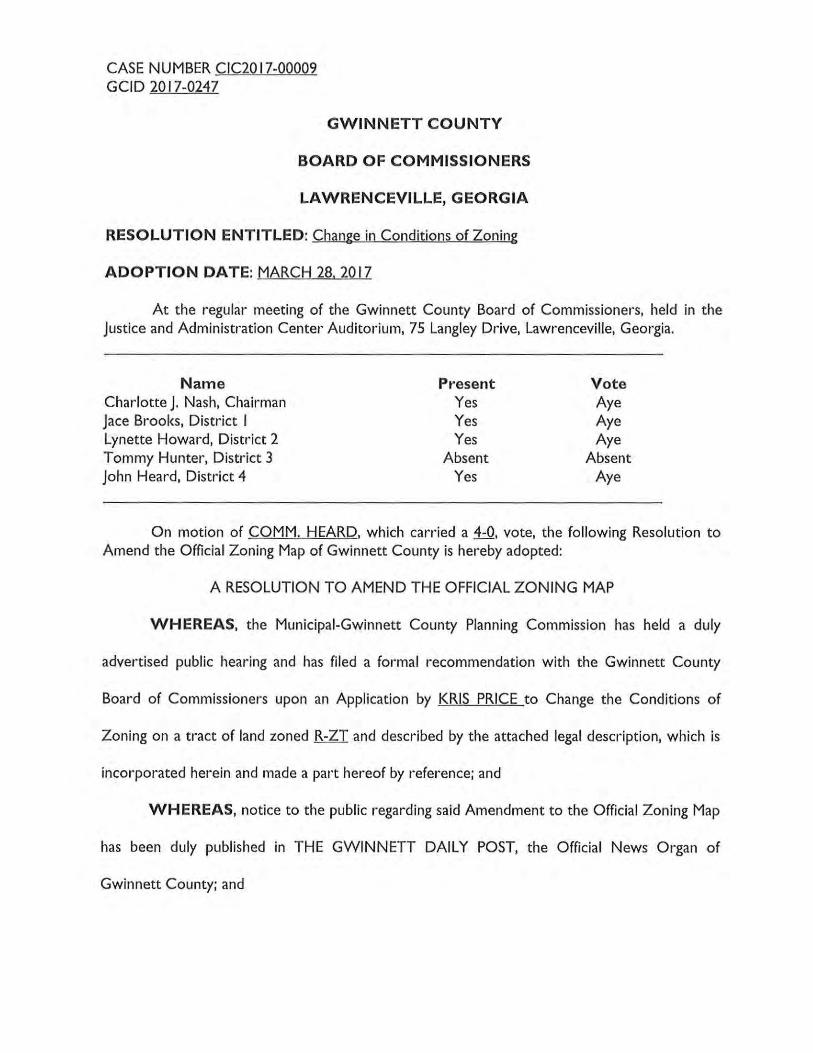
CASE NUMBER CIC20 17-00009 GCID 2017-0247
GWINNETT COUNTY
BOARD OF COMMISSIONERS
LAWRENCEVILLE, GEORGIA
RESOLUTION ENTITLED: Change in Conditions of Zoning
ADOPTION DATE: MARCH 28.2017
At the regular meeting of the Gwinnett County Board of Commissioners, held in the Justice and Administration Center Auditorium, 75 Langley Drive, Lawrenceville, Georgia.
Name Charlotte J. Nash, Chairman Jace Brooks, District I Lynette Howard, District 2 Tommy Hunter, District 3 John Heard, Distr-ict 4
Present Yes Yes Yes
Absent Yes
Vote Aye Aye Aye
Absent Aye
On motion of COMM. HEARD, which carried a 4-0, vote, the following Resolution to Amend the Official Zoning Map of Gwinnett County is hereby adopted:
A RESOLUTION TO AMEND THE OFFICIAL ZONING MAP
WHEREAS, the Municipai-Gwinnett County Planning Commission has held a duly
advertised public hearing and has filed a formal recommendation with the Gwinnett County
Board of Commissioners upon an Application by KRIS PRICE to Change the Conditions of
Zoning on a tract of land zoned R-ZT and described by the attached legal description, which is
incorporated herein and made a part hereof by reference; and
WHEREAS, notice to the public regarding said Amendment to the Official Zoning Map
has been duly published in THE GWINNETT DAILY POST, the Official News Organ of
Gwinnett County; and

CASE NUMBER CIC20 17~00009 GCID 20 17~0247
WHEREAS, a public hearing was held by the Gwinnett County Board of
Commissioners on MARCH 28. 20 17 and objections were not filed.
NOW, THEREFORE, BE IT RESOLVED by the Gwinnett County Board of
Commissioners, that the aforesaid application to amend the Official Zoning Map is hereby
APPROVED subject to the following enumerated conditions:
I. To restrict the use of the property as follows:
A Single-family detached dwellings and accessory uses and structures not to exceed
five (5) units per acre. Lots shall be a minimum of SO-feet in width.
B. The minimum heated floor area per dwelling shall be 1,800 square feet for onestory homes, and 2,000 for two story homes.
C. Dwellings shall be constructed of brick, stacked stone or stucco on the front fac;:ade with the balance of the dwelling being brick, stacked stone, stucco, wood or fiber-cement type siding.
D. All dwellings shall have double car garages and where front entry, driveways shall
be a minimum of 16 feet.
E. Homes shall be part of the homeowners association established by RZM-05-038.
2. To satisfy the following site development considerations:
A Natural vegetation shall remain on the property until the issuance of a development permit.
B. No direct lot access to Lawrenceville Suwanee Road.
C. All grassed areas in front and side yards to be sodded.
D. All utilities shall be placed underground.
E. Provide a I 0-foot landscape strip along the rear property lines.

CASE NUMBER CIC2017-00009 GCID 2017-0247
F. There shall not be street interconnectivity between this development and Ox
Bridge Court, Gables View Place or Kelsey Place.
GWINNETT COUNTY BOARD OF COMMISSIONERS
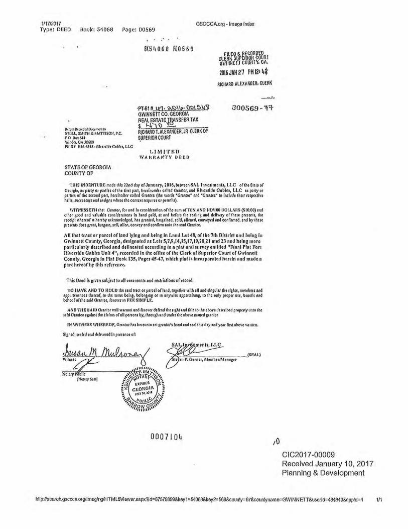
1/1i'/2017 Type: DEED
GSCCCA.or(l- lma90 Index Book: 5t1068 Page: 00569
Rcl<m Rc«<4c4 Poc\'"""tto STI!Ll., SMITII & MAmSOII, P.C. ro Dox6l4 WI Mil, 01\ 30610 fll.llM Rl6-6.).18 • Rlnuldr Ciblu, LLC
ST A Tfi OP OEOROIA COUNTYOP
8K5 ~ 0 6 0 POO 56 9
·PT-6111 U1 · 'M}\ID• {)ol5\_4'i? OWIIINE TT CO. GEORGIA REAL ESTATEJgANSfER TAX $ Y,\{) -R{CHARO T.AlEXAilOER, JR ClERK OF S.VPERIOR COURT
LIMITED WARRANTY 0 EP.D
f'lt:£0 ·& RECORDED t,;LERK SUPERIOR COUR I GY/IIItlE f,T COUtlfY, Gfl.
2016 JAH 21 PH 12•1l~ RICIIARO AL£XIIIWER, CL£RK
TillS INDENTURE m•de this Hnd day of Jnnunry, 2016, b{lwc~n SAL lnv~lmrniJ1 LLC oflho SIUO of Oeor,sb, u p1rty or put Ill or the lint ptrt, hmlnunder ullcd Onntor, and IUI'tnlde Gablu, LLC n pmy or puttts of the second plrt, hmlnnnu cJIIcd Onntce (lhe words •oren tor" llld "0111\tec• 10 Include thllr m pC<tlve hclrt, successo.rs end .. signs where the context rcqurru or Pfm1ll1).
WITNESSETllthat 01'3ntor, for and In consldlr.ltlon of the ~urn ofTCN AND ND/100 DOLLARS (SIO.OO) end othtr good and Yllv•blo consldmtrons In bend p~ld, at Md before the sulcng end dellvuy of thBe prmnts, tho rtc~lpl 11hcreofn hcttby ecknowledgcd, has grantcd, barsalned, sold, ellencd, conveyed end connrmed, end by 1hm prcscniS docs grant, bargarn, srll, aile~. con1·ey end connrm unto thcs•td Orentce.
All that trACt or pnrul of lnnd lying nnd being In Lnml Lot 48, or the 7th Olstrlcl nntl being In Gwlnmll County, Gcorgln, deslgnnled ns Lois 5,7,9114,15117119,20,21 and 23 Rllll being more pnrllcularly de.scrlbed nnd delineAted according ton pint anti survey enlllled "Finn I Pint For: Riverside Gnblu Unit 4", ruorded In the ofnce of the Clerk or Supulor Court of GIYinncll County, Georgia In Pint Dook 135, Pages 45·47, 1Yhlch pint h lncorpornlcd herein and made n pnrl hereof by I his reference.
This Deed is gtl'en subjecllo oll cestntcnls and re.,s tricllons of record.
TO IJAVE AND TO II OLD tho se1d trace or parcel ofhnd, togethu 11hh ell and singular 1ho rl&)lts, mcmb{rs Md appurten1ncu thereof, lo lhe nme b{lng, belongcng or rn enywhe eppertalnrng, to the only proper usc, benefil end b{hoofofthe uld Oranrcc, forcm'" FEr. SIMPLE.
AND TilE SAID Orantor well warrant end forevtr defend the ught end title to the above dmrlbed pr<>Pfrty unto 1M slid Onnree 'galnstrho claims of ell pcnons by, through ond undu the abo1·e named grantor
IN WITNeSS WllllREOF, Orentor has hereunto set cnntofs h1nd ond sc•l th1s d•y end )'Ut Ontabol'c \\llllcn.
Signed, sc•lcd and dchl·tr~d In presence of:
0007104 ,o CIC2017-00009 Received January 10, 2017 Planning & Development
hllp://scarch.gsccca.orgllmaglng/HTML5Viewer.aspx?ld" 67679899&key1" 54008&key2=569&counly=67&counlyname=GWINNETT&userld=484849&eppld=4 1/1

CASE NUMBER SUP20 17-00012 GCID 2017-0248
BOARD OF COMMISSIONERS
GWINNETT COUNTY
LAWRENCEVILLE, GEORGIA
RESOLUTION
READING AND ADOPTION: MARCH 28,2017
At the regular meeting of the Gwinnett County Board of Commissioners, held in the Justice and Administration Center Auditorium, 75 Langley Drive, Lawrenceville, Georgia.
Present Vote Charlotte J. Nash, Chairman Yes Aye Jace Brooks, District I Yes Aye Lynette Howard, District 2 Yes Aye Tommy Hunter, District 3 Absent Absent John Heard, District 4 Yes Aye
On motion of CHAIRMAN NASH, which carried 4-0 vote, the following resolution was adopted:
A RESOLUTION TO GRANT A SPECIAL USE PERMIT
WHEREAS, the Municipal-Gwinnett County Planning Commission has held a duly
advertised public hearing and has filed a formal recommendation with the Gwinnett County
Board of Commissioners upon an Application for a Special Use Permit by PARADISE GROUP.
LLC for the proposed use of an AUTOMOBILE LUBRICATION on a tract of land described by
the attached legal description, which is incorporated herein and made a part hereof by
reference; and
WHEREAS, notice to the public regarding said Special Use Permit Application has been
duly published in THE GWINNETT DAILY POST, the Official News Organ of Gwinnett
County; and
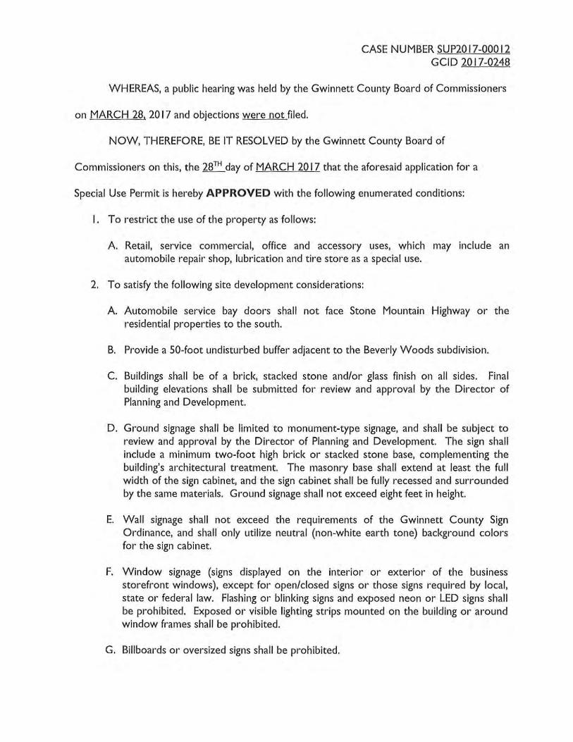
CASE NUMBER SUP20 17-00012 GCID 2017-0248
WHEREAS, a public hearing was held by the Gwinnett County Board of Commissioners
on MARCH 28. 2017 and objections were not filed.
NOW, THEREFORE, BE IT RESOLVED by the Gwinnett County Board of
Commissioners on this, the 28TH day of MARCH 20 17 that the aforesaid application for a
Special Use Permit is hereby APPROVED with the following enumerated conditions:
I . To restrict the use of the property as follows:
A. Retail, service commercial, office and accessory uses, which may include an automobile repair shop, lubrication and tire store as a special use.
2. To satisfy the following site development considerations:
A. Automobile service bay doors shall not face Stone Mountain Highway or the residential properties to the south.
B. Provide a 50-foot undisturbed buffer adjacent to the Beverly Woods subdivision.
C. Buildings shall be of a brick, stacked stone and/or glass finish on all sides. Final building elevations shall be submitted for review and approval by the Director of Planning and Development.
D. Ground signage shall be limited to monument-type signage, and shall be subject to review and approval by the Director of Planning and Development. The sign shall include a minimum two-foot high brick or stacked stone base, complementing the building's architectural treatment. The masonry base shall extend at least the full width of the sign cabinet, and the sign cabinet shall be fully recessed and surrounded by the same materials. Ground signage shall not exceed eight feet in height.
E. Wall signage shall not exceed the requirements of the Gwinnett County Sign Ordinance, and shall only utilize neutral (non-white earth tone) background colors for the sign cabinet.
F. Window signage (signs displayed on the interior or exterior of the business storefront windows), except for open/closed signs or those signs required by local, state or federal law. Flashing or blinking signs and exposed neon or LED signs shall be prohibited. Exposed or visible lighting strips mounted on the building or around window frames shall be prohibited.
G. Billboards or oversized signs shall be prohibited.

CASE NUMBER SUP2017-00012 GCID 2017-0248
H. No tents, canopies, temporary banners, streamers or roping decorated with flags, tinsel, or other similar material shall be displayed, hung, or strung on the site. No decorative balloons or hot-air balloons shall be displayed on the site. Yard and/or bandit signs, sign-walkers and sign-twirlers shall be prohibited.
I. Owner shall repair or repaint any graffiti or vandalism that occurs on the property within 72 hours.
J. No outdoor display or storage of merchandise.
K. Dumpsters shall be screened by a I 00% opaque brick or stacked stone wall with an opaque metal gate enclosure. Hours of dumpster pick-up shall be limited to between 7:00 am and 7:00 pm.
L. Outdoor loudspeakers shall be prohibited.
M. Lighting shall be contained to cut-off type luminaries and shall be directed in toward the property so as not to shine directly into adjacent properties or rights-of-way.
GWINNETT COUNTY BOARD OF COMMISSIONERS
Date Signed: _ '-fl---f-'/ 1'-tf,__,/,____,_t J,___ _____ _ r I
ATTEST:
County Clerk/Deputy County
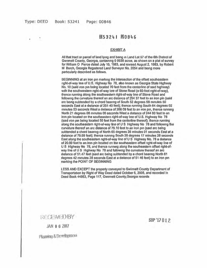
Type: DEED Book: 53241 Page: 00846
BKS 3 2 4 I PG 0 8 4 6
EXHIBIT A
All that tract or parcel of land lymg and bemg m Land Lot 57 of the 6th 01stnct of Gw1nnett County, Georg1a, contamtng 0 9938 acres. as shown on a plat of survey for W1lham 0 Prerce dated July 15, 1963, and rev1sed August 2, 1983, by Robert M Burch, Georgia Registered Land Surveyor No. 2054 and be1ng more partrcularly descrrbed as follows.
BEGINNING at an Iron ptn markrng the intersection of the offset southeastern rrght-of-way 11ne of U.S. Highway No 78, also lmown as Georgia State Highway No. 10 (said 1ron pm being located 70 feet from the centerline of sard highway) w1th the southwestern nght-of-way line of Stone Road (a 60-foot nght-of-way), thence running along the southwestern right-of-way line of Stone Road and follow1n9 the curvature thereof an arc drstance of 254 37 feet to an iron pin (said arc bemg subtended by a chord bearrng of South 52 degrees 58 mrnutes 50 seconds East at a drstance of 251 40 feet); thence running South 64 degrees 02 mmutes 53 seconds West a drstance of 266 09 feel to an rron pm, thence runmng North 21 degrees 08 mrnutes 06 seconds West a drstance of 244 60 feet to an Iron pin located on the southeastern right-of-way hne of U.S. Hrghway No 78 (sard rron p1n being located 50 feet from the centerline thereof); thence 11.1nning along the southeastern right-of-way line of U S Highway No 78 and followmg the curvature thereof an arc distance of 79.10 feet to an iron p1n (sard arc being subtended a chord beanng of North 65 degrees 26 minutes 01 seconds East at a drstance of 79.09 feet); thence runnrng South 28 degrees 17 minutes 28 seconds East along the southeastern nght-of-way line of US Highway No. 78 a distance of 20.00 feet to an Iron pin located on the southeastern offset nght-of-way line of U S Highway No 78, and thence runnrng along the southeastern offset right-ofway line of U S Hrghway No 78 and followmg the curvature thereof an arc distance of 51.47 feet (sard arc being subtended by a chord beanng North 61 degrees 42 mmutes 28 seconds East at a drstance of 51 46 feet) to an Iron pm marking the POINT OF BEGINNING
LESS AND EXCEPT the property conveyed to Gwlnnett County Department of Transportatron by Right of Way Deed dated October 6, 2005, and recorded in Deed Book 44863, Page 117, Gwmnett County,Georgra records
{·~f·r;~: :j\ft~f) BY
JAN 0 G 2017 SUP '17 01. 2
CASE NUMBER RZM20 16-00004 GCID 2016-0828
GWINNETT COUNTY
BOARD OF COMMISSIONERS
LAWRENCEVILLE, GEORGIA
RESOLUTION ENTITLED: Amendment to the Official Zoning Map of Gwinnett County
ADOPTION DATE: MARCH 28. 2017
At the regular meeting of the Gwinnett County Board of Commissioners held in the Gwinnett Justice and Administration Center, Auditorium, 75 Langley Drive, Lawrenceville, Georgia.
Name Charlotte J. Nash, Chairman Jace Brooks, District I Lynette Howard, District 2 Tommy Hunter, District 3 John Heard, District 4
Present Yes Yes Yes
Absent Yes
Vote Aye Aye Aye
Absent Aye
On motion of Commissioner COMM. HEARD, which carried a 4-0 vote, the following Resolution to Amend the Official Zoning Map of Gwinnett County is hereby adopted:
WHEREAS, the Municipai-Gwinnett County Planning Commission has held a duly
advertised public hearing and has filed a formal recommendation with the Gwinnett County
Board of Commissioners upon an Application to Amend the Official Zoning Map from RA-200
to R-TH by SATILLA CAPITAL PARTNERS for the proposed use as a TOWNHOMES on a
tract of land described by the attached legal description, which is incorporated herein and made
a part hereof by reference; and
WHEREAS, notice to the public regarding said Amendment to the Official Zoning Map
has been duly published in THE GWINNETT DAILY POST, the Official News Organ of
Gwinnett County; and
WHEREAS, a public hearing was held by the Gwinnett County Board of
Commissioners on DECEMBER 6, 2016 and objections were filed.

CASE NUMBER RZM20 16-00004 GCID 2016-0828
NOW, THEREFORE, BE IT RESOLVED by the Gwinnett County Board of
Commissioners, that the aforesaid application to amend the Official Zoning Map from RA-200
toR-THis hereby APPROVED AS R-60 with the following enumerated conditions:
I. To restrict the use of the property as follows:
A Single family detached dwellings, accessory uses and structures not to exceed 90 lots.
B. Homes shall be constructed of maintenance-free architectural materials of primarily brick or stacked stone on the front fa<;ade, with minor treatments of fiber-cement shake or siding. The balance shall be the same or of fiber-cement shake or siding with a minimum 3-foot brick or stone water table. The front fa<;ade design shall include at least two of the following elevation features: shutters, covered porches, bay windows, roof eave brackets, cornice, architectural entrance door surround. Architectural elevations shall be submitted for review and approval by the Director of Planning and Development.
C. The minimum heated floor area per dwelling unit shall be 2,200 square feet for one story and 2,400 square feet for two stories.
D. All homes shall have at least a double-car garage.
2. To satisfy the following site development considerations:
A Provide a 40-foot wide undisturbed buffer adjacent to the side and rear property lines abutting all adjacent residentially-zoned properties. No pine trees shall be allowed in any required landscaped area or buffer. Buffers may be enhanced and disturbed for landscaping, planting, grading, and the construction of the fence and utilities.
B. All grassed areas shall be sodded.
C. All utilities shall be placed underground.
D. Natural vegetation shall remain on the property until the issuance of a development permit.
E. Minimum lot width shall be 52 feet with five-foot side setbacks.
F. A recreation area consisting of a minimum of two tennis courts, a swimming pool and a clubhouse shall be provided on the subject property or on property adjacent to the site that is developed and integrated with the subject property development.
CASE NUMBER RZM20 16-00004 GCID 2016-0828
G. There shall be five-foot wide sidewalks and curb ramps constructed along all abutting or internal streets, in accordance with Unified Development Ordinance Section 900-90. Pedestrian and common area connectivity shall be provided throughout the development.
H. There shall be pedestrian connectivity and shared amenities between the subject property and the property adjacent to the site that is developed and integrated with the subject property development.
I. Developer shall create nature trails and open spaces as amenities consistent with the site plan dated March 28, 20 17.
J. Prior to the issuance of a development permit, the applicant shall complete all traffic improvements reflected in the traffic study submitted with this application, subject to the transportation development requirements under the Unified Development Ordinance.
K. Detention pond(s) shall be fenced with a black vinyl-coated chain link fence a minimum of four feet in height, and shall be fully screened from view of adjacent residences with a double-staggered row of evergreens.
L. An opening shall be provided to allow for a potential future road connection between the subject development and a potential future extension of what is currently an unused dead-end street (Morgan Road) linked to Brown Road.
GWINNETT COUNTY BOARD OF COMMISSIONERS
Date Signed: ~11
ATTEST:
County Clerk/Deputy County
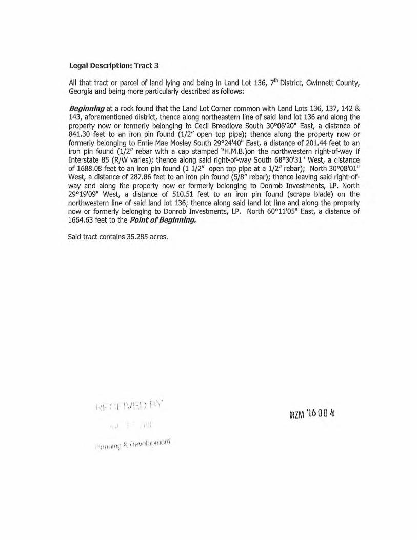
Legal Description: Tract 3
All that tract or parcel of land lying and being in Land Lot 136, 7th District, Gwinnett County, Georgia and being more particularly described as follows:
Beginning at a rock found that the Land Lot Corner common with Land Lots 136, 137, 142 & 143, aforementioned district, thence along northeastern line of said land lot 136 and along the property now or formerly belonging to Cecil Breedlove South 30°06'2011 East, a distance of 841.30 feet to an iron pin found (1/2" open top pipe); thence along the property now or formerly belonging to Ernie Mae Mosley South 29°24'4011 East, a distance of 201.44 feet to an iron pin found (1/2" rebar with a cap stamped "H.M.B.)on the northwestern right-of-way if Interstate 85 (R/W varies); thence along said right-of-way South 68°30'31" West, a distance of 1688.08 feet to an iron pin found (1 1/2" open top pipe at a 1/2" rebar); North 30°08'01" West, a distance of 287.86 feet to an iron pin found (5/8" rebar); thence leaving said right-ofway and along the property now or formerly belonging to Donrob Investments, LP. North 29°19'09" West, a distance of 510.51 feet to an iron pin found (scrape blade) on the northwestern line of said land lot 136; thence along said land lot line and along the property now or formerly belonging to Donrob Investments, LP. North 60°11'05" East, a distance of 1664.63 feet to the Point of Beginning.
Said tract contains 35.285 acres.
1 , 1- r :I I \f l-.1 > \ .. , , RZM '1600 4
I •• , 1 I I t
1 \• ,· ,···\• • ·h l\'l l l(\1 i'l \:liH tll \~ r · ' · ·
CASE NUMBER RZC2017-00005 GCID 2017-0028
GWINNETT COUNTY
BOARD OF COMMISSIONERS
LAWRENCEVILLE, GEORGIA
RESOLUTION ENTITLED: Amendment to the Official Zoning Map of Gwinnett County
ADOPTION DATE: MARCH 28.2017
At the regular meeting of the Gwinnett County Board of Commissioners held in the Gwinnett Justice and Administration Center, Auditorium, 75 Langley Drive, Lawrenceville, Georgia.
Name Present Vote Charlotte J. Nash, Chairman Yes Aye Jace Brooks, District I Yes Aye Lynette Howard, District 2 Yes Aye Tommy Hunter, District 3 Yes Aye John Heard, District 4 Yes Aye
On motion of Commissioner COMM. HOWARD, which carried a 5-0 vote, the following Resolution to Amend the Official Zoning Map of Gwinnett County is hereby adopted:
WHEREAS, the Municipai-Gwinnett County Planning Commission has held a duly
advertised public hearing and has filed a formal recommendation with the Gwinnett County
Board of Commissioners upon an Application to Amend the Official Zoning Map from R-1 00 to
0-1 by AZIZ CHARANIA for the proposed use as a MONTESSORI SCHOOL (BUFFER
REDUCTION) on a tract of land described by the attached legal description, which is
incorporated herein and made a part hereof by reference; and
WHEREAS, notice to the public regarding said Amendment to the Official Zoning Map
has been duly published in THE GWINNETT DAILY POST, the Official News Organ of
Gwinnett County; and
WHEREAS, a public hearing was held by the Gwinnett County Board of
Commissioners on MARCH 28. 20 17 and objections were filed.

CASE NUMBER RZC20 17-00005 GCID 2017-0028
NOW, THEREFORE, BE IT RESOLVED by the Gwinnett County Board of
Commissioners, that the aforesaid application to amend the Official Zoning Map from R-1 00 to
0-1 is hereby DENIED WITHOUT PREJUDICE.
GWINNETT COUNTY BOARD OF COMMISSIONERS
Date Signed: ---'~'-1/,__/'---=3-+(_,_1___,7,__ _____ _
ATTEST:
County Clerk/Deputy Count~

LEGAL DESCRIPTION
All that tract or Parcel of Land lying and being in Land Lot 86 of the 6th Land District of Gwinnett county, Georgia, containing less or more of 1.41 Acres, bounded on the north by the other lands of J.H. and Commie Lee Simpson; on the east by Oak Rd (formerly known as Five-Forks Snellville Rd); and on the South and west by the lands of Roddy. Said tract of land is more particularly described as follows; Beginning at the point of west side Oak Road which is 434 feet south from the corner of the property of the WD Phillips Estate and run thence in a southerly direction along the west side of Oak Road 327 feet to a corner with lands of Roddy; Thence in a westerly direction along said lands of Roddy 157 feet to a corner, thence in a northerly direction also along lands of Roddy 367 feet to a corner, thence in easterly direction 270 feet to the point of beginning on Oak Rd.
~ECE!VED BY
NOV 0 1 2016
P18nning & Development RZC '17 00 5

CASE NUMBER RZR2017-00004 GCID 2017-0243
GWINNETT COUNTY
BOARD OF COMMISSIONERS
LAWRENCEVILLE, GEORGIA
RESOLUTION ENTITLED: Amendment to the Official Zoning Map of Gwinnett County
ADOPTION DATE: MARCH 28. 2017
At the regular meeting of the Gwinnett County Board of Commissioners held in the Gwinnett Justice and Administration Center, Auditorium, 75 Langley Drive, Lawrenceville, Georgia.
Name Charlotte J. Nash, Chairman Jace Brooks, District I Lynette Howard, District 2 Tommy Hunter, District 3 John Heard, District 4
Present Yes Yes Yes
Absent Yes
Vote Aye Aye Aye
Absent Aye
On motion of Commissioner COMM. HOWARD, which carried a 4-0 vote, the following Resolution to Amend the Official Zoning Map of Gwinnett County is hereby adopted:
WHEREAS, the Municipai-Gwinnett County Planning Commission has held a duly
advertised public hearing and has filed a formal recommendation with the Gwinnett County
Board of Commissioners upon an Application to Amend the Official Zoning Map from
R-75. C-2. & 0 -1 to TND by BLUE RIVER DEVELOPMENT. LLC for the proposed use as a
TRADITIONAL NEIGHBORHOOD DEVELOPMENT (BUFFER REDUCTION) on a tract of
land described by the attached legal description, which is incorporated herein and made a part
hereof by reference; and
WHEREAS, notice to the public regarding said Amendment to the Official Zoning Map
has been duly published in THE GWINNETT DAILY POST, the Official News Organ of
Gwinnett County; and
CASE NUMBER RZR2017-00004 GCID 2017-0243
WHEREAS, a public hearing was held by the Gwinnett County Board of
Commissioners on MARCH 28, 20 17 and objections were not filed.
NOW, THEREFORE, BE IT RESOLVED by the Gwinnett County Board of
Commissioners, that the aforesaid application to amend the Official Zoning Map from
R-75. C-2, & 0-1 to TND is hereby APPROVED with the following enumerated conditions:
I . To restrict the use of the property as follows:
A. Single-family detached dwellings and townhomes and accessory structures with the following limitations:
i. No less than 2% of the total number of lots may be categorized as "mid-size lots" per the TN D standards within the Unified Development Ordinance.
ii. No more than 66% of the total number of lots may be categorized as "townhomes" per the TND standards within the Unified Development Ordinance.
B. All single-family detached homes and townhomes shall be constructed with front facades of brick and/or stacked stone; the rear and sides of each home may be the same or concrete siding. All homes, including the townhome end caps, shall have a minimum three-foot brick or stacked stone water table on all sides. Final approval for building materials and elevations shall be subject to the approval of the Director of Planning and Development.
C. The minimum heated floor area per dwelling shall be as follows:
i. T ownhomes: I ,600 square feet
ii. Small Lot dwellings: 2,000 square feet
iii. Mid-size Lot dwellings: 2,200 square feet
D. All dwellings shall have at least a double-car garage.
2. To satisfy the following site development considerations:
A. A mandatory Homeowner's Association shall be established and shall be responsible for maintenance of all common areas/facilities and street frontage landscaping. The Bethesda Road frontage shall be landscaped and maintained by the Homeowner's Association, and shall include decorative masonry entrance features. A decorative fence shall be required
CASE NUMBER RZR20 17-00004 GCID 2017-0243
along the Bethesda Road right-of-way. Landscaping plans, entrance features and fencing shall be subject to the review and approval of the Director of Planning and Development.
B. The subdivision shall be designed to require homes to be constructed with garages adjacent to one another where feasible. Residential driveways for said homes shall meet with a minimum side yard setback with no more than a I 0-foot grass separation between driveways centered on the common property line. A conceptual plan identifying those lots, and which complies with the requirement, shall be submitted for
approval by the Director of Planning and Development prior to issuance of development permit.
C. Provide 20-foot wide natural und isturbed buffers adjacent to all residentially-zoned property. Buffers shall be enhanced where sparsely vegetated, and may be graded and replanted per approval of the Director of Planning and Development.
D. Unless located on the periphery of the subject site, all townhomes shall be accessed by rear alleys, subject to the review and approval of the Director of Planning and Development.
E. Underground utilities shall be provided throughout the development.
F. Natural vegetation shall remain on the property prior to the issuance of a Development Permit.
G. All grassed areas shall be sodded.
H. Lighting for the amenity area shall be contained in cut-off type luminaries and shall be directed in toward the property so as not to shine directly into adjacent residential properties or rights-of-way.
I. On-street parking may be provided as shown on the site plan dated March 6, 20 17.
J. Sidewalks are to be provided as shown on the site plan dated March 6, 20 17.!.

CASE NUMBER RZR2017-00004 GCID 2017-0243
3. To abide by the following requirements, dedications and improvements:
A. Provide left turn lanes at entrances from Bethesda Church Road.
GWINNETT COUNTY BOARD OF COMMISSIONERS
By: ~~, ((J Charlotte J. Nash,~ airman
Date Signed: 4/tt.!j;l ATTEST:

All that tract or parcel of land lying and being Land Lots 128, 129, and 130 of the 6th District, Gwinnett County, Georgia and being more particularly described as follows:
Beginning at a found right of way monument at the intersection of the northwesterly right of way of Bethesda Church Road and the northeasterly right of way of Ramp E of Ronald Reagan Parkway, THENCE along said northeasterly right of way for following courses: N 80°47'14" W a distance of 45.89' to a found right of way monument; THENCE with a curve turning to the left with an arc length of 553.65', with a radius of 1462.39', with a chord bearing of N 68"33'51" W, with a chord length of 550.35' to a point; THENCE N 79°24'36" W a distance of 134.25' to a point; THENCE with a curve turning to the right with an arc length of 398.40', with a radius of 2261.83', with a chord bearing of N 74°21'50" W, with a chord length of 397.89' to a found right otway monument; THENCE N 6r58'06" E a distance of 38.55' to a found right of way monument; THENCE N 70°44'45" W a distance of 48.78' to a found right of way monument; THENCE S 70°16'40" W a distance of 37.62' to a found right of way monument; THENCE with a curve turning to the right with an arc length of 10.63', with a radius of 2261.83', with a chord bearing of N 68°20'23" W, with a chord length of 10.63' to a found right of way monument; THENCE leaving said northeasterly right of way line of Ramp E of Ronald Reagan Parkway N 50°03'12" E a distance of 168.22' to a found 112" rebar; THENCE N 60°42'08" E a distance of 1567 .80' to a found 112" rebar on the westerly right of way line of the aforementioned Bethesda Church Road; THENCE along said right of way for the following courses: S 01 °11'23" E a distance of 68.92' to a point; THENCE with a curve turning to the left with an arc length of 376.49', with a radius of 1912.97', with a chord bearing of S 06°53'43" E, with a chord length of 375.88' to a point; THENCE S 12°53'09" E a distance of 326.05' to a point; THENCE with a curve turning to the right with an arc length of 215.60', with a radius of 283.25', with a chord bearing of S 08°58'54" W, with a chord length of 210.43' to a point; THENCE N 08°14'20" W a distance of 86.11' to a point; THENCE S 6r57'36" W a distance of 80.61' to a point; THENCE S 19°12'20" E a distance of 121.11' to a point; THENCE with a curve turning to the right with an arc length of 78.11', with a radius of 283.25',
\. __ ..., ······· ··osv ),_, ,- lV C . l •. v '-
Rlft17 00 Ls DEC 2 v 2016
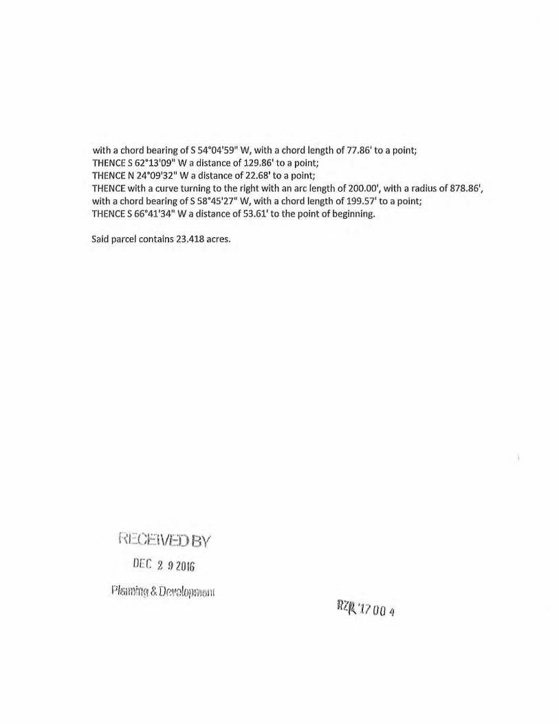
with a chord bearing of S 54.04'59" W, with a chord length of 77.86' to a point; THENCE S 62.13'09" W a distance of 129.86' to a point; THENCE N 24.09'32" W a distance of 22.68' to a point;
THENCE with a curve turning to the right with an arc length of 200.00', with a radius of 878.86', with a chord bearing of S 58.45'27" W, with a chord length of 199.57' to a point; THENCE S 66.41'34" W a distance of 53.61' to the point of beginning.
Said parcel contains 23.418 acres.
h'I::CEi\/E:O BY DEC 2 !} 2016