haestad solutions - kangwonenv1.kangwon.ac.kr/leakage/2009/knowledge/methods/haestad/08... · ©...
TRANSCRIPT

Strategic Modeling and Leveraging GIS for Stormwater Systems
© 2004 Bentley Systems, Incorporated * Haestad Solution Center * Watertown, CT 06795 * (203) 755-1666. All rights reserved.
1
Haestad Solutions
Bentley Systems Incorporated Haestad Solution Center Watertown, CT 06795Toll-free: 1-800-727-6555 Fax: 203-597-1488
www.bentley.com/www.haestad.com
WhoWho waswas Haestad MethodsHaestad Methods??• World Leader in Water Resources Software
• $17 million in Revenue 2004
• 25 Years in Research and Development
• Strong Direct Marketing Focus
• Complete Solutions:Software - 17 products
Training - North America and International
Publications
Services
• Autodesk & ESRI Development
Strategic Modeling and Leveraging GIS for Stormwater Systems
© 2004 Bentley Systems, Incorporated * Haestad Solution Center * Watertown, CT 06795 * (203) 755-1666. All rights reserved.
2
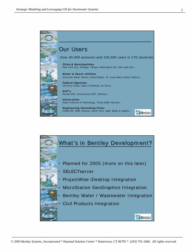
Our UsersOur Users
Cities & MunicipalitiesNew York City, Chicago, Tampa, Washington DC, Salt Lake City…
Water & Sewer UtilitiesAmerican Water Works, United Water, St. Louis Metro Sewer District…
Federal AgenciesUS Army Corps, Dept of Defense, Air Force…
DOT’sFlorida DOT, Connecticut DOT, Caltrans…
UniversitiesAsian Institute of Technology, Texas A&M, Harvard…
Engineering Consulting FirmsCH2M Hill, CDM, Stantec, Earth Tech, JJ&G, Black & Veatch…
Over 40,000 accounts and 130,000 users in 170 countries
WhatWhat’’s in Bentley Development?s in Bentley Development?
• Planned for 2005 (more on this later)
• SELECTserver
• ProjectWise iDesktop Integration
• MicroStation GeoGraphics Integration
• Bentley Water / Wastewater Integration
• Civil Products Integration

Strategic Modeling and Leveraging GIS for Stormwater Systems
© 2004 Bentley Systems, Incorporated * Haestad Solution Center * Watertown, CT 06795 * (203) 755-1666. All rights reserved.
3
In 2005In 2005
• SELECTserver (Q1)
• ProjectWise iDesktop Integration (Q1)
• MicroStation GeoGraphics IntegrationCivilStorm (Q3)
SewerGEMS (Q3)
WaterGEMS / WaterCAD (Q4)
• Bentley Water (Q1)
• Wastewater (Q3) Integration
• Civil Integration (TBD)
ProjectWise ProjectWise iDesktopiDesktop IntegrationIntegration
• Open / Save Project Documents
• Managed Reference Files
• Supports Multiple Datasources

Strategic Modeling and Leveraging GIS for Stormwater Systems
© 2004 Bentley Systems, Incorporated * Haestad Solution Center * Watertown, CT 06795 * (203) 755-1666. All rights reserved.
4
MicroStation GeoGraphics IntegrationMicroStation GeoGraphics Integration
• Not CAD Neutral Anymore
• Most Powerful / Comprehensive Solution
• Utilize XML Feature Modeling (XFM)Benefit from the work of others
Managed Environment
Geo Web Publisher
etc
Bentley Water & Wastewater IntegrationBentley Water & Wastewater Integration
• Leverage the investment in Water / Wastewater
• Provide a complete asset management & modeling solution
• Future integration will be even tighter

Strategic Modeling and Leveraging GIS for Stormwater Systems
© 2004 Bentley Systems, Incorporated * Haestad Solution Center * Watertown, CT 06795 * (203) 755-1666. All rights reserved.
5
Haestad ProductsHaestad Products
Common Product SuffixesCommon Product Suffixes
• GEMS – Geospatial Engineering Modeling SystemArcGIS, AutoCAD, and Stand-Alone Interfaces
(MicroStation GeoGraphics in 2005)
Powerful Geospatial Tools
• CAD – Computer Aided DesignAutoCAD and Stand-Alone Interfaces
Limited Geospatial Tools
• Master – Not an acronymNon-network products
Worksheets, graphs, tables, etc.

Strategic Modeling and Leveraging GIS for Stormwater Systems
© 2004 Bentley Systems, Incorporated * Haestad Solution Center * Watertown, CT 06795 * (203) 755-1666. All rights reserved.
6
Haestad Product Line UpHaestad Product Line Up
• Water DistributionWaterGEMS
WaterCAD
HAMMER
• WastewaterSewerGEMS
SewerCAD
• CAD / GIS Interoperability
GISConnect
• Storm WaterCivilStorm
StormCAD
PondPack
CulvertMaster
FlowMaster
HEC-Pack
Stormwater ApplicationsStormwater Applications
Featuring:
• StormCAD
• FlowMaster
• PondPack
• CulvertMaster
• CivilStorm

Strategic Modeling and Leveraging GIS for Stormwater Systems
© 2004 Bentley Systems, Incorporated * Haestad Solution Center * Watertown, CT 06795 * (203) 755-1666. All rights reserved.
7
StormCADStormCAD
Storm sewer design & analysis with inlet modeling
StormCADStormCAD
Applies to:
• Commercial site design
• Land development
• Roadway drainage design
• Planning, mapping, and inventories for larger areas (e.g., municipality)

Strategic Modeling and Leveraging GIS for Stormwater Systems
© 2004 Bentley Systems, Incorporated * Haestad Solution Center * Watertown, CT 06795 * (203) 755-1666. All rights reserved.
8
StormCADStormCADCapabilities
• Uses rational method hydrology
• Performs Gradually Varied Flow profile analysis
• Incorporates HEC-22 methods for inlet and gutter capacity calcs, including gutter spread and bypass flow calcs
• Performs automated pipe & inlet design
• Includes GIS and database connections
• Computes capital costs
• Generates profile plots and tabular reports
• Includes AutoCAD integration option
• Includes Scenario Management
FlowMasterFlowMaster
Solves basic hydraulic equations for a variety of channel and structure types

Strategic Modeling and Leveraging GIS for Stormwater Systems
© 2004 Bentley Systems, Incorporated * Haestad Solution Center * Watertown, CT 06795 * (203) 755-1666. All rights reserved.
9
FlowMasterFlowMasterCan be applied in most any area of
hydraulic analysis
Available structures
• Open channels
• Pressure Pipes
• Weirs
• Orifices
• Inlets
Capabilities
• Computes normal and critical depths
• Generates rating curves and tables
PondPackPondPack
Hydrologic modeling and detention pond design
Strategic Modeling and Leveraging GIS for Stormwater Systems
© 2004 Bentley Systems, Incorporated * Haestad Solution Center * Watertown, CT 06795 * (203) 755-1666. All rights reserved.
10
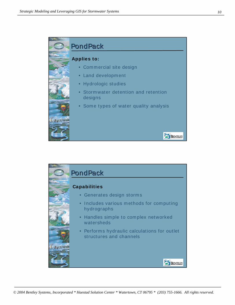
PondPackPondPack
Applies to:
• Commercial site design
• Land development
• Hydrologic studies
• Stormwater detention and retention designs
• Some types of water quality analysis
PondPackPondPack
Capabilities
• Generates design storms
• Includes various methods for computing hydrographs
• Handles simple to complex networked watersheds
• Performs hydraulic calculations for outlet structures and channels

Strategic Modeling and Leveraging GIS for Stormwater Systems
© 2004 Bentley Systems, Incorporated * Haestad Solution Center * Watertown, CT 06795 * (203) 755-1666. All rights reserved.
11
PondPackPondPack
Capabilities (continued from previous)
• Estimates required detention volume
• Routes detention ponds, including ponds in series and interconnected ponds
• Performs water quality calculations such as detention time and pond drain time
• Includes detailed graphing and reporting features
CulvertMasterCulvertMaster
Culvert design and analysis based on HDS-5 methods

Strategic Modeling and Leveraging GIS for Stormwater Systems
© 2004 Bentley Systems, Incorporated * Haestad Solution Center * Watertown, CT 06795 * (203) 755-1666. All rights reserved.
12
CulvertMasterCulvertMaster
Applies to any situation where culvert roadway crossing needs design or evaluation using HDS-5 methods
Capabilities
• Can automatically design culvert size
• Handles multiple barrels
• Handles roadway overtopping/weir flow
• Generates rating curves and rating tables
CivilStormCivilStormDynamic modeling of storm sewers, channels, culverts, overflows, and detention ponds

Strategic Modeling and Leveraging GIS for Stormwater Systems
© 2004 Bentley Systems, Incorporated * Haestad Solution Center * Watertown, CT 06795 * (203) 755-1666. All rights reserved.
13
CivilStormCivilStorm
Applies to:
• More complex commercial site and land development designs, such as those using storm sewer structures for detention
• Designs where culverts or channels must be modeled as connected to the larger drainage system as opposed to modeled individually, for instance if backwater effects are a consideration
• Larger-scale drainage studies where stormwater volume and/or hydrograph timing are important considerations
CivilStormCivilStorm
Capabilities
• Supports a variety of methods for computing runoff hydrographs
• Provides a dynamic solution to the full Saint-Venant equations
• Computes flow profiles for storm sewers, culverts, and open channels
• Models looped systems and diversions
• Attenuates hydrographs due to storage in detention facilities and conveyance structures

Strategic Modeling and Leveraging GIS for Stormwater Systems
© 2004 Bentley Systems, Incorporated * Haestad Solution Center * Watertown, CT 06795 * (203) 755-1666. All rights reserved.
14
CivilStormCivilStorm
Capabilities (continued from previous)
• Performs hydraulic calculations for a variety of structures, including culverts, orifices, and weirs
• Displays HGL profile animation
• Includes AutoCAD integration option
• Includes Scenario and Alternative Management
GISConnectGISConnect
• Run GIS from within AutoCAD

Strategic Modeling and Leveraging GIS for Stormwater Systems
© 2004 Bentley Systems, Incorporated * Haestad Solution Center * Watertown, CT 06795 * (203) 755-1666. All rights reserved.
15
Sanitary Sewer ApplicationsSanitary Sewer Applications
Featuring:
• SewerCAD
• SewerGEMS
SewerCAD SewerCAD sanitary sewer design & analysis with extended period modelingsanitary sewer design & analysis with extended period modeling
• Peak Flow (steady state) or Extended Period Simulation
• Master planning, CMOM compliance, or design
• Connected gravity and pressure systems
• Flexible sanitary loading
• Automated Design
• Infiltration and Inflow Loadings
• Profile Manager
• Integrated with AutoCAD and Land Development Desktop
• Link with GIS or any database

Strategic Modeling and Leveraging GIS for Stormwater Systems
© 2004 Bentley Systems, Incorporated * Haestad Solution Center * Watertown, CT 06795 * (203) 755-1666. All rights reserved.
16
SewerGEMSSewerGEMS
New Features:Complete GIS Integration
One database for model and GIS
Automated Skeletonizer
Automated Load Building
TRex Elevation Extraction
Water Distribution ApplicationsWater Distribution Applications
Featuring:
• WaterCAD
• WaterGEMS
• PumpMaster
• Hammer

Strategic Modeling and Leveraging GIS for Stormwater Systems
© 2004 Bentley Systems, Incorporated * Haestad Solution Center * Watertown, CT 06795 * (203) 755-1666. All rights reserved.
17
WaterCADWaterCADWater distribution modeling & management
• Steady state and extended period hydraulic simulations
• Dynamic water quality analysis
• Automated fire flow analysis
• View results with dynamic graphing, contouring, color-coding, and annotation tools
• Share data across the enterprise with robust GIS and database connections
• Compare and contrast an unlimited number of scenarios within the same model
Scenario Control CenterScenario Control Center™™Data Management
Scenarios AlternativesCurrent Scenario Physical: Original
Demand: TodayActive Topology: Current
Year 2010 Scenario
Physical: OriginalDemand: 2010Active Topology: New 2010
Year 2020 Scenario
Physical: OriginalDemand: 2020Active Topology: New 2020
New Diameter Scenario
Physical: New DesignDemand: Max 2005Active Topology: New 2020

Strategic Modeling and Leveraging GIS for Stormwater Systems
© 2004 Bentley Systems, Incorporated * Haestad Solution Center * Watertown, CT 06795 * (203) 755-1666. All rights reserved.
18
Fire FlowFire FlowAnalysis
• Determine water availability
• Evaluate Response of your system
• Provide adequate fire protection
Logical ControlsLogical ControlsAnalysis
IF {System Demand > 63 l/s} Or {T-1 HGL < 264 m}THEN {PMP-2 Relative Speed Factor = 1.50}ELSE {PMP-2 Relative Speed Factor = 1.00}
• Use logic to set controls
• Actions
• Conditions
SimpleComposite
Element status, setting or attribute valueSystem demandClock time or time to start

Strategic Modeling and Leveraging GIS for Stormwater Systems
© 2004 Bentley Systems, Incorporated * Haestad Solution Center * Watertown, CT 06795 * (203) 755-1666. All rights reserved.
19
PMP-2
Time(hr)
Spee
d
0.69
0.70
0.71
0.72
0.73
0.74
0.75
0.76
0.77
0.78
0.0 4.0 8.0 12.0 16.0 20.0 24.0
VSP & Energy CostVSP & Energy Cost
Variable speed pumping
Analysis
VSPs: Operational and economical optimizationPattern based or Fixed-Head type
Energy CostAccount for storagePump efficiency by; Best Efficiency Point, Constant Efficiency, Multiple Efficiency Points
Pump Speed,
Pump Efficiency,
Cumulative Volume,and more…
Analyze:
Water QualityWater Quality
• Constituent
• Age
• Trace
• Tank Mixing Models
• Vulnerability Assessment and Emergency Planning
Analysis
Contour Legend
Calculated Concentration (mg/l)
20.00
40.00
60.00
80.00
100.00
Strategic Modeling and Leveraging GIS for Stormwater Systems
© 2004 Bentley Systems, Incorporated * Haestad Solution Center * Watertown, CT 06795 * (203) 755-1666. All rights reserved.
20
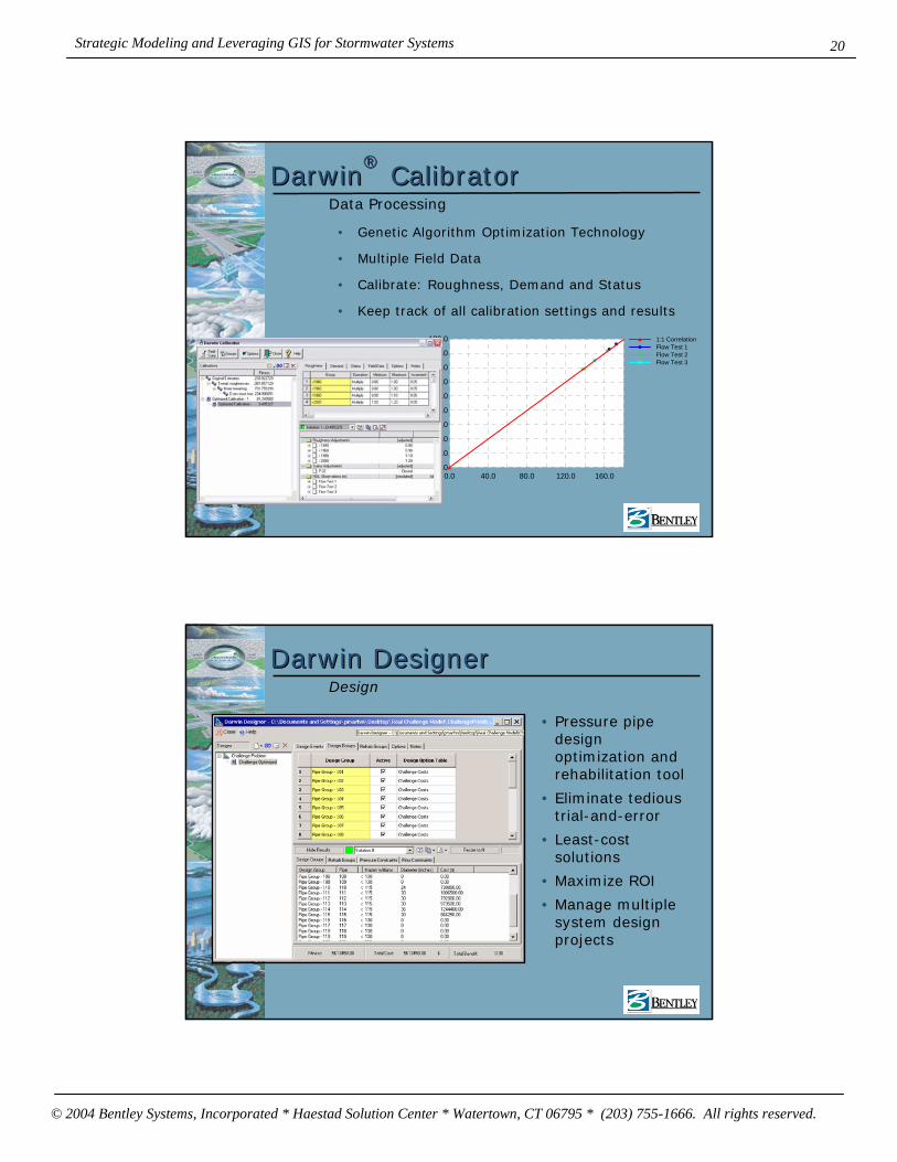
DarwinDarwin®®
CalibratorCalibrator
0.0
20.0
40.0
60.0
80.0
100.0
120.0
140.0
160.0
180.0
0.0 40.0 80.0 120.0 160.0
1:1 CorrelationFlow Test 1Flow Test 2Flow Test 3
• Genetic Algorithm Optimization Technology
• Multiple Field Data
• Calibrate: Roughness, Demand and Status
• Keep track of all calibration settings and results
Data Processing
Darwin DesignerDarwin Designer
• Pressure pipe design optimization and rehabilitation tool
• Eliminate tedious trial-and-error
• Least-cost solutions
• Maximize ROI
• Manage multiple system design projects
Design
Strategic Modeling and Leveraging GIS for Stormwater Systems
© 2004 Bentley Systems, Incorporated * Haestad Solution Center * Watertown, CT 06795 * (203) 755-1666. All rights reserved.
21
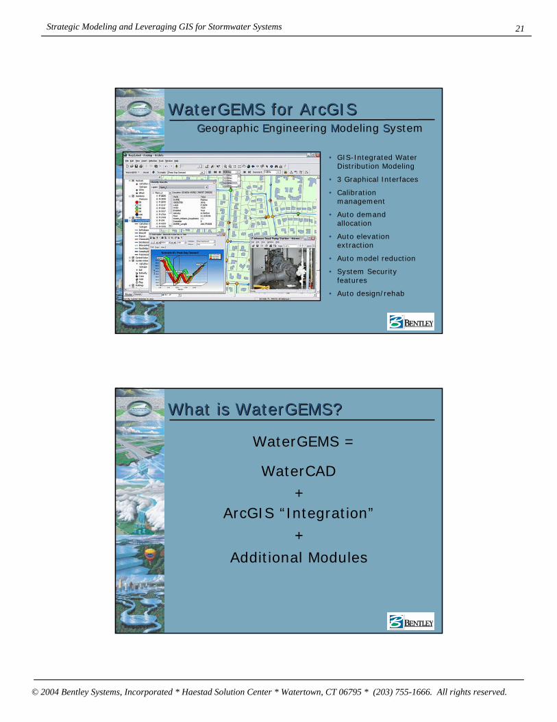
WaterGEMS for WaterGEMS for ArcGISArcGIS
• GIS-Integrated Water Distribution Modeling
• 3 Graphical Interfaces
• Calibration management
• Auto demand allocation
• Auto elevation extraction
• Auto model reduction
• System Security features
• Auto design/rehab
GGeographic EEngineering MModeling SSystem
What is WaterGEMS?What is WaterGEMS?
WaterGEMS =
WaterCAD+
ArcGIS “Integration”
+Additional Modules
Strategic Modeling and Leveraging GIS for Stormwater Systems
© 2004 Bentley Systems, Incorporated * Haestad Solution Center * Watertown, CT 06795 * (203) 755-1666. All rights reserved.
22
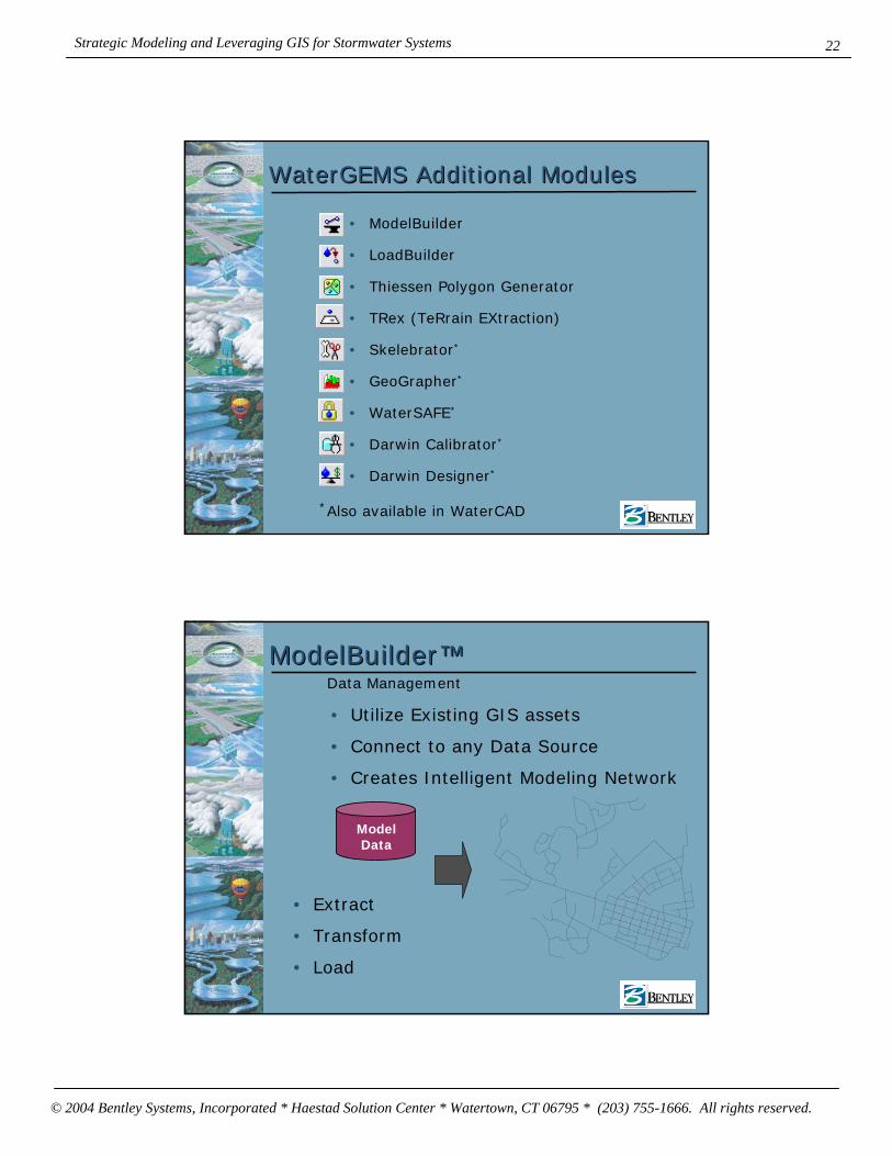
WaterGEMS Additional ModulesWaterGEMS Additional Modules
• ModelBuilder
• LoadBuilder
• Thiessen Polygon Generator
• TRex (TeRrain EXtraction)
• Skelebrator*
• GeoGrapher*
• WaterSAFE*
• Darwin Calibrator*
• Darwin Designer*
*Also available in WaterCAD
ModelBuilderModelBuilder™™
• Extract
• Transform
• Load
Data Management
• Utilize Existing GIS assets
• Connect to any Data Source
• Creates Intelligent Modeling Network
Model Data
Strategic Modeling and Leveraging GIS for Stormwater Systems
© 2004 Bentley Systems, Incorporated * Haestad Solution Center * Watertown, CT 06795 * (203) 755-1666. All rights reserved.
23
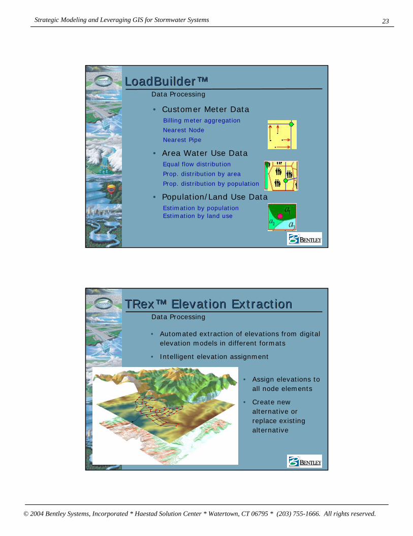
Estimation by population
LoadBuilderLoadBuilder™™Data Processing
• Customer Meter Data
• Area Water Use Data
• Population/Land Use Data
Billing meter aggregation
Estimation by land use
Equal flow distribution
Nearest Node
Nearest Pipe
Prop. distribution by area
Prop. distribution by population
TRexTRex™™ Elevation ExtractionElevation ExtractionData Processing
• Automated extraction of elevations from digital elevation models in different formats
• Intelligent elevation assignment
• Assign elevations to all node elements
• Create new alternative or replace existing alternative

Strategic Modeling and Leveraging GIS for Stormwater Systems
© 2004 Bentley Systems, Incorporated * Haestad Solution Center * Watertown, CT 06795 * (203) 755-1666. All rights reserved.
24
SkelebratorSkelebrator™™Model Reduction
Smart Pipe Removal
Branch Collapsing
Series Pipe Merging
Parallel Pipe Merging
• Preserve Network connectivity
• Demand location
• Hydraulic Equivalence
• Save Optimized Settings
LEGENDPump PMP-1 Tank T-1
Flow
(l/s
)
Time (hr)
GeoGrapherGeoGrapher™™
• Powerful data analysis tool
• Combine different elements and attributes
• Prepare fully customized professional reports
Data Processing

Strategic Modeling and Leveraging GIS for Stormwater Systems
© 2004 Bentley Systems, Incorporated * Haestad Solution Center * Watertown, CT 06795 * (203) 755-1666. All rights reserved.
25
WaterSAFEWaterSAFE
• Advanced water quality module
• Track multiple contamination sources
• Manage and safeguard your system
• Reduce infrastructure vulnerability
Prevention & Preparation
PumpMasterPumpMaster• Worksheet-based
pump selection tool
• Reference multiple catalogs
• Enhance pump selection process
• Compare multiple performance curves

Strategic Modeling and Leveraging GIS for Stormwater Systems
© 2004 Bentley Systems, Incorporated * Haestad Solution Center * Watertown, CT 06795 * (203) 755-1666. All rights reserved.
26
HAMMERHAMMER• Hydraulic
Transient Analysis Software
• Rigorous hydraulic engine
• Prevent system damage
• Develop cost-effective surge control strategies
• Model any surge protection device
Analysis
WaterObjectsWaterObjects• Software
Development Kit (SDK)
• Customize and extend WaterCAD and WaterGEMS
• Write programs using VB, C++, etc.
• Create powerful MS Office™macros
• Develop custom applications
Strategic Modeling and Leveraging GIS for Stormwater Systems
© 2004 Bentley Systems, Incorporated * Haestad Solution Center * Watertown, CT 06795 * (203) 755-1666. All rights reserved.
27
Haestad Solutions
Bentley Systems Incorporated Haestad Solution Center Watertown, CT 06795
Toll-free: 1-800-727-6555 Fax: 203-597-1488
www.bentley.com/www.haestad.com