heritage impact assessment hotel & restaurant 200 john
TRANSCRIPT
Heritage Impact Assessment
144-176 John Street – Hotel & Restaurant
200 John Street & 588 Charlotte Street – Plan of
Subdivision
Town of Niagara-on-the-Lake
October 30, 2017
Leah D. Wallace, MA MCIP RPP
Land Use & Heritage Planning Services
Niagara-on-the-Lake, Ontario

LEAH D. WALLACE, MA MCIP RPP
Land Use & Heritage Planning Services 47B Garrison Village Drive, RR#3, NIAGARA-ON-THE-LAKE, ONTARIO LOS 1J0 Cell/Text: 905-941-1950
Phone: 905-468-0582
Email: [email protected]
Executive Summary October 30, 2017
Leah D. Wallace, Land Use & Heritage Planning Services was retained by Two Sisters Resorts
Corp. in July 2017 to complete a heritage impact assessment for the properties at 144-176
(Randwood) and 200 John Street and 588 Charlotte Street in the Town of Niagara-on-the-Lake.
These properties are subject of development proposals for a hotel and restaurant complex and
plan of subdivision respectively. A heritage impact assessment is required by the Town to
assess the value of the heritage resources on these properties and to recommend conservation
and mitigation for any identified built heritage resources and cultural landscapes.
Four site visits to the subject properties and the surrounding area were conducted in late July
and early August and images were taken on each of these site visits, some of which are
included in this document. Historical research was completed at the Niagara Historical
Museum, the University of Guelph and online. A number of other documents and publications
were also consulted.
The heritage impact assessment includes a description of the proposed developments based on
plans and drawings provided by the applicant; a description of the surrounding land uses; an
analysis of the existing heritage policy context; and a heritage impact analysis.
The heritage impact analysis includes a historical description of the Town and the Rand Estate;
site analysis of the subject properties and adjacent properties of heritage significance, including
any designated under the Ontario Heritage Act; evaluation of heritage impacts of both proposals
on identified built and cultural heritage landscape resources; recommended mitigation and
conservation methods and monitoring procedures; and a conclusion with respect to impacts on
the built heritage resources and the cultural heritage landscape.
This summary is an outline only. For complete information and findings the reader should
examine the full report.
Respectfully submitted
Leah D. Wallace, MA MCIP RPP

October 2017 Leah D. Wallace, MA MCIP RPP Page 1
INTRODUCTION...................................................................................................................................... 3
Subject Lands ......................................................................................................................................................... 3
Surrounding Land Uses and Heritage Properties .................................................................................................... 3
PROPOSAL ................................................................................................................................................ 5
EXISTING HERITAGE POLICY CONTEXT ......................................................................................... 8
The Planning Act .................................................................................................................................................... 8
Provincial Policy Statement (PPS) .......................................................................................................................... 8
Growth Plan for the Greater Golden Horseshoe .................................................................................................. 10
Ontario Heritage Act (OHA) ................................................................................................................................. 10
Standards and Guidelines for Conservation of Historic Places in Canada ............................................................. 11
Niagara Regional Official Plan .............................................................................................................................. 12
Niagara-on-the-Lake Official Plan ........................................................................................................................ 12
1. Low Density Residential .................................................................................................................................. 13
2. General Commercial ....................................................................................................................................... 13
3. Open Space ..................................................................................................................................................... 14
4. Growth Management Policies ........................................................................................................................ 14
5. Heritage Conservation .................................................................................................................................... 15
Niagara-on-the-Lake Zoning By-law No. 4316-09 ................................................................................................. 15
1. 144-176 John Street ....................................................................................................................................... 15
2. 200 John Street and 588 Charlotte Street ...................................................................................................... 16
HERITAGE IMPACT ANALYSIS ......................................................................................................... 17
Description of Proposed Development and Site Alteration .................................................................................. 17
1. 144-176 John Street – The Rand Estate .......................................................................................................... 17
2. 588 Charlotte and 200 John Street. ................................................................................................................ 17
Historical Research and Site Analysis ................................................................................................................... 18
1. History of Old Town ....................................................................................................................................... 18
2. History of the Rand Estate ............................................................................................................................. 21
3. Site Analysis .................................................................................................................................................... 26

October 2017 Leah D. Wallace, MA MCIP RPP Page 2
Identification and Significance and Heritage Attributes of Properties .................................................................. 31
1. 144-176 John Street ....................................................................................................................................... 31
2. 200 John Street ............................................................................................................................................... 36
3. 588 Charlotte Street ....................................................................................................................................... 37
4. Adjacent Properties Designated Under Part IV of the OHA and/or Listed on the Register of Cultural
Heritage Value and Interest .................................................................................................................................... 38
5. Other Features and Structures Related to the Rand Estate ........................................................................... 39
6. The Commons (Fort George Military Reserve) .............................................................................................. 40
Evaluation of Heritage Impacts ............................................................................................................................ 41
1. Impacts of Hotel and Restaurant Proposal ..................................................................................................... 41
2. Impacts of Plan of Subdivision ........................................................................................................................ 44
MITIGATION AND CONSERVATION METHODS .......................................................................... 48
1. 144-176 John Street (Rand Estate) ................................................................................................................. 48
2. 200 John Street and 588 Charlotte Street ...................................................................................................... 49
IMPLEMENTATION AND MONITORING ........................................................................................ 50
CONCLUSION AND CONSERVATION RECOMMENDATIONS .................................................... 51
APPENDICES .......................................................................................................................................... 53
BIBLIOGRAPHY .................................................................................................................................... 54
Books ................................................................................................................................................................... 54
Articles ................................................................................................................................................................ 54
Websites .............................................................................................................................................................. 54

October 2017 Leah D. Wallace, MA MCIP RPP Page 3
Introduction
This Heritage Impact Assessment is in support of a proposed zoning by-law amendment and
site plan application for 144-176 John Street (Randwood) for a hotel and restaurant complex;
and an application for a plan of subdivision for the properties at 200 John Street and 588
Charlotte Street. The assessment provides historical background, identifies significant heritage
resources and cultural heritage landscapes and analyses the impact of the proposed
developments on the protected and identified heritage resources adjacent to the subject
property and its impact on cultural heritage landscape features and resources on each of these
properties. A draft Statement of Significance for the Rand Estate is also provided in preparation
for designation under Part IV of the Ontario Heritage Act (OHA) as required.
Subject Lands
The three properties are located in a predominantly residential area east of King Street with
frontage along both John and Charlotte Streets and consist of the remaining core of the
Randwood Estate at 144-176 John Street; 588 Charlotte Street with a house and outbuildings,
formerly the Randwood stables accessed by a 6.5m (21ft.) unpaved driveway; and 200 John
Street, with a house, pool and outbuildings on an irregularly shaped lot with 18m (60ft.) of
frontage, accessed via a long winding driveway from John Street. A portion of the property at
200 John Street is located outside of the urban area boundary.
Surrounding Land Uses and Heritage Properties
The surrounding land uses are residential and open space. The residential properties consist of
single detached dwellings of varying ages and styles as well as townhouses and condominium
developments. The Randwood Estate at 144-176 John Street has a commercial and open
space designation that permits a hotel, spa, restaurant and conference centre. Immediately to
the north are the Commons and Butler’s Barracks which are federal lands administered by
Parks Canada. These lands, along with Fort George are nationally designated.
There are no designated properties adjacent to the subject properties. The closest property
designated under Part IV of the Ontario Heritage Act, is the Randwood Milkhouse and Stables
at 9 Weatherstone Court, which was once part of the Randwood Estate (By-law 1971-88)
(APPENDIX I).
While it is not designated under Part IV of the OHA, the subject property at 144-176 John Street
is listed on the Town’s Municipal Register of Properties of Cultural Heritage Value and Interest
and is subject to limited demolition control. The adjacent property to the east at 210 John Street
(Brunswick Place) is also listed on the Register.

October 2017 Leah D. Wallace, MA MCIP RPP Page 4
There are several other designated and listed buildings in the surrounding area. However, none
are close to the subject properties nor will they be impacted by any proposed development on
those properties.

October 2017 Leah D. Wallace, MA MCIP RPP Page 5
Proposal
The proposal is to construct a six (6) storey hotel building with a one storey function hall and
restaurant, an outdoor restaurant patio space, a pool, a small one storey maintenance building
and underground parking on the property at 144-176 John Street (Rand Estate). Randwood,
the Sheets (Devonian) House, the brick pavilion, the wooden pergola, and the Coach House are
also part of the hotel development. (Figure 2)
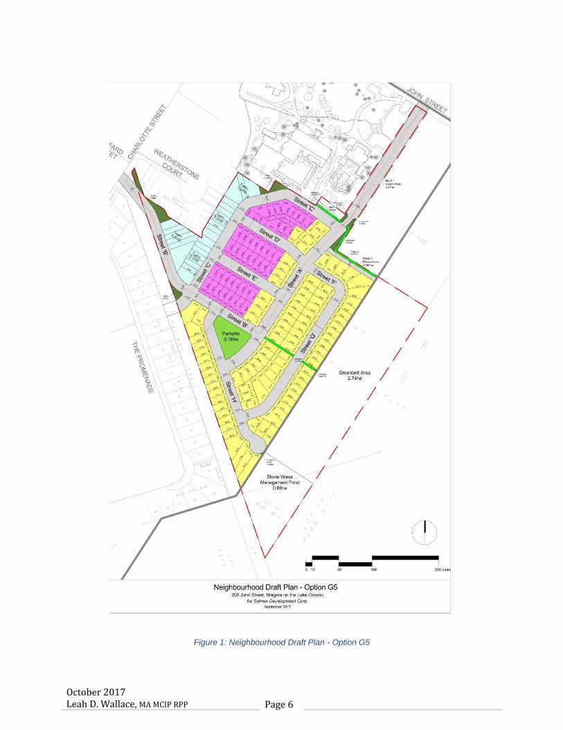
The properties at 200 John and 588 Charlotte Street will become the site of a subdivision
consisting of 25 townhouse units, 44 semi-detached houses and 100 single-detached houses
for a total of 169 units. The portion of the property at 200 John Street which lies outside of the
urban area boundary does not constitute part of the subdivision. Future uses intended for the
area are agricultural and stormwater management. (Figure 1)
October 2017 Leah D. Wallace, MA MCIP RPP Page 6
Figure 1: Neighbourhood Draft Plan - Option G5

October 2017 Leah D. Wallace, MA MCIP RPP Page 7
Figure 2: Randwood Resort: Hotel & Convention Centre Site Plan

October 2017 Leah D. Wallace, MA MCIP RPP Page 8
Existing Heritage Policy Context
The Planning Act
Part 1 of the Planning Act includes a list of matters of provincial interest. Section 2(d) states
that the Minister, the council of a municipality and the Ontario Municipal Board, in carrying out
their responsibilities shall have regard to:
The conservation of features of significant architectural, cultural, historical,
archaeological or scientific interest.
In 2015, an additional clause, Section 2(r), was added. This clause provides for the promotion
of built form that is well-designed, encourages a sense of place, and provides for public spaces
that are of high quality, safe, accessible, attractive and vibrant.
Provincial Policy Statement (PPS)
Section 2.6 of the PPS, Cultural Heritage and Archaeology, contains the following policies for
both built heritage resources and cultural heritage landscapes.
Policy 2.6.1: Significant built heritage resources and significant cultural landscapes shall be
conserved.
Policy 2.6.3: Planning authorities shall not permit development and site alterations on adjacent
lands to protected heritage property unless the proposed development and any site alteration is
evaluated and that evaluation demonstrates that the heritage attributes of the protected property
will be conserved.
Policy 2.6.2: Development and site alteration on lands containing archaeological potential is not
permitted unless any archaeological resources have been conserved.
The PPS provides the following definitions which assist in understanding and applying these
cultural heritage and archaeology policies.
Significant built heritage resource means a building, structure, monument, installation or any
manufactured remnant that contributes to a property’s cultural heritage value or interest as
identified by a community. Built heritage resources are generally located on property that has
been designated under Parts IV or V of the Ontario Heritage Act (OHA), or included on local,
provincial and/or federal registers.

October 2017 Leah D. Wallace, MA MCIP RPP Page 9
Significant cultural landscape means a defined geographical area that may have been modified
by human activity and is identified as having cultural heritage value or interest by a community.
The area may involve features such as structures, spaces, archaeological sites or natural
elements that are valued for their interrelationship, meaning or association. Examples may
include, but are not limited to, heritage conservation districts, villages, parks, gardens,
battlefields, main streets, neighbourhoods, cemeteries, trailways, view sheds, natural areas and
industrial complexes.
Protected heritage property means a property designated under Parts IV, V or VI of the Ontario
Heritage Act.
Adjacent means those lands contiguous to a protected heritage property or as otherwise defined
in the municipal official plan.
Development means creation of a new lot, a change in land use, or the construction of buildings
and structures requiring Planning Act approval.
Site alteration means activities such as grading, excavations and placement of fill.
Heritage attributes means the principal features or elements that contribute to a protected
heritage property’s cultural heritage value or interest. These may include the property’s built
elements as well as natural landforms, vegetation, water features and visual setting including
views or vistas to or from a protected heritage property
Archaeological resources include artifacts and archaeological sites as defined under the Ontario
Heritage Act. Identification and evaluation of these resources are based on archaeological
fieldwork undertaken in accordance with that Act.
There is a designated (protected) property at 9 Weatherstone Court which is close to the subject
properties and which was once part of the Rand Estate, as well as a national historic site (the
Commons and Fort George) to the north. The properties at 144-176 and 210 John Street are
both listed on the Municipal Register of Properties of Cultural Heritage Value and Interest and
are considered to be of significant cultural heritage value both for the individual cultural
resources on these sites and their cultural heritage landscape value. Because of this, a
heritage impact assessment is required in accordance with the policies in the PPS to ensure
that any significant heritage resources and cultural heritage landscapes are conserved. This
requirement is affirmed in the Regional Official Plan policies.

October 2017 Leah D. Wallace, MA MCIP RPP Page 10
Growth Plan for the Greater Golden Horseshoe
The 2017 Growth Plan for the Greater Golden Horseshoe was approved by an Order in Council
in May 2017 and came into effect on July 1, 2017. Heritage conservation policies in the new
Growth Plan have been enhanced to recognize the importance of cultural heritage resources for
their contribution to a sense of identity; their support of a vibrant tourism industry; and their
ability to attract investment based on cultural amenities. The Plan also recognizes that
accommodating development growth can put pressure on these resources and that it is
necessary to plan to protect and maximize the benefits of these resources for their ability to
make communities unique and attractive places to live.
Policy 4.2.7 states that cultural heritage resources will be conserved to foster a sense of place
and encourages municipalities to prepare archaeological management plans and cultural plans
to be considered in their decisions regarding development
Policy 4.2.9(d)iii, A Culture of Conservation, promotes building conservation and adaptive reuse
and recycling of construction materials. The Plan also includes definitions for Built Heritage
Resource, Cultural Heritage Landscape and Cultural Heritage Resources that align with the
definitions in the PPS.
Ontario Heritage Act (OHA)
The OHA provides policies and regulations for the protection of built heritage resources, cultural
landscapes such as heritage conservation districts and archaeological resources through the
process of identifying, listing and designating those resources.
Part IV of the Act deals with:
Designation of individual properties;
Alterations that are likely to affect the heritage attributes of those properties as specified
in designation by-laws;
Requests to demolish those properties; and
Listing designated properties on the Register
Section 27(1.2) of the Act permits Council to include property on the Register that is not
designated under Part IV; but that the municipality believes to be of cultural heritage value or
interest.
Part V of the Act deals with:
Designation of heritage conservation districts;
Preparation of heritage conservation district plans and their contents;
October 2017 Leah D. Wallace, MA MCIP RPP Page 11
Alterations to any part of the property with the exception of the interior of buildings or
structures; and
Requests to demolish buildings or structures on those properties.
Part VI of the Act deals with:
Archaeological sites including activities of work on those sites; and
Licensing of archaeologists.
Regulation 9/06 under the OHA provides criteria for determining cultural heritage value or
interest.
Standards and Guidelines for Conservation of Historic Places in Canada
The Standards and Guidelines for the Conservation of Historic Places in Canada were first
published in 2003 and updated in 2010. These standards and guidelines, while they have no
legislative authority, are a tool to help users decide how best to conserve historic places, their
heritage value and character defining elements. They are used in partnership with statements
of the significance of heritage resources, such as designation by-laws. Anyone carrying out an
intervention that may impact the heritage values and character defining elements of a heritage
resource must be mindful of the impacts on that resource.
The Standards and Guidelines indicate that it is important to know where the heritage value of
the historic place lies, along with its condition, evolution over time, and past and current
importance to its community.
Planning should consider all factors affecting the future of a historic place, including the needs
of the owners and users, community interests, the potential for environmental impacts, available
resources and external constraints. The most effective planning and design approach is an
integrated one that combines heritage conservation with other planning and project goals, and
engages all partners and stakeholders early in the process and throughout. For historic places,
the conservation planning process also needs to be flexible to allow for discoveries and for an
increased understanding along the way, such as information gained from archaeological
investigations or impact assessments.
Any action or process that results in a physical change to the character-defining elements of a
historic place must respect and protect its heritage value. A historic place’s heritage value and
character-defining elements can be identified through formal recognition, such as designation
under the OHA and by nomination to the Canadian Register of Historic Places. In assessing a
proposed alteration to a designated property or any property of cultural heritage value and

October 2017 Leah D. Wallace, MA MCIP RPP Page 12
interest, Standard 11 of the Guidelines will be adhered to. The heritage value and character-
defining elements of the property must be conserved when creating the new hotel on the
property at 144-176 John Street. The hotel building and any other new structures will be
designed to be physically and visually compatible with, subordinate to and distinguishable from
the historic place. Any physical attributes of the properties at 588 Charlotte and 200 John Street
will also be analyzed and assessed for their cultural heritage value and interest and the potential
impact of proposed development on these attributes.
Niagara Regional Official Plan
The Niagara Regional Official Plan, Section 10C, contains objectives and policies for the
protection of built heritage resources and cultural heritage landscapes and requires a heritage
impact assessment where development, site alteration and/or public works projects are
proposed on, or adjacent to, a significant built heritage resource or cultural heritage landscape.
Objectives include:
Supporting the identification and conservation of significant built heritage resources and
significant cultural heritage landscapes;
Recognizing the aesthetic, cultural and economic value of open space and parks;
Recognizing the importance of quality design; and
Conserving significant built heritage resources and cultural heritage landscapes within
the unique community context of every site.
Policy 10.C.2.1.6 encourages local municipalities to establish cultural heritage landscape
policies in their Official Plans and identify significant cultural heritage landscapes for designation
in order to conserve groupings of features with heritage attributes that together form a
significant type of heritage form, distinctive from that of its constituent elements or parts.
Niagara-on-the-Lake Official Plan
The property at 144-176 John Street was the subject of official plan and zoning by-law
amendments in 2011 and is designated General Commercial and Open Space (APPENDIX II &
III). The property at 588 Charlotte Street is designated Low Density Residential. Approximately
half of the property at 200 John Street within the urban area boundary is designated Low
Density Residential. The remainder of the property outside of the urban area boundary is
designated Agricultural and lies within the Greenbelt.

October 2017 Leah D. Wallace, MA MCIP RPP Page 13
1. Low Density Residential
Goals and objectives of the Residential designation include:
To ensure that new development or redevelopment is appropriately located, is
compatible with surrounding land uses, retains to the greatest extent feasible desirable
natural features and uses land in an efficient manner;
To ensure that existing housing and existing residential areas are preserved and
improved;
To encourage infill residential development on vacant or under-utilized parcels of land in
residential areas where such development will be compatible with existing uses and
contribute to the more efficient use of sewers and water and community facilities; and
To encourage the development of well designed and visually distinctive forms.
In the Low Density Residential designation the following uses are permitted:
Low Density Residential uses such as single detached, semi-detached and duplex
dwellings.
Secondary Uses;
Minor open space and community facilities; and
Medium density residential uses subject to the relevant policies of Section 9 of the Plan
and a site specific amendment to the Zoning By-law, provided that the development
does not significantly impact on heritage resources or result in the removal or demolition
of buildings of historic or architectural significance.
General residential policies include:
Encouraging the creation of new residential units in developed neighbourhoods through
infill, conversion of existing buildings, redevelopment and the provision of accessory
apartments within existing developments;
Minimizing the impact on heritage buildings and resources;
Being sensitive to the height, scale and architectural design of buildings in the
surrounding neighbourhood.
2. General Commercial
The General Commercial designation specific to the Rand Estate permits the following land
uses:
Hotel;
Spa;
Arts and Learning Centre;
Conference Centre; and
Restaurant.

October 2017 Leah D. Wallace, MA MCIP RPP Page 14
Other policies include:
Designation of the property at site plan approval stage under Part IV of the OHA
Approval of final design and plans of additions or new buildings by the Municipal
Heritage Committee;
Sufficient landscaping, buffers and setbacks to minimize impact on abutting residential
uses;
No terraces or balconies above the second storey oriented toward abutting properties;
No negative impact on abutting properties;
Adequate building separation from adjacent residential uses;
Preparation of a tree preservation plan with the site plan application; and
Preservation of the boxwood hedge adjacent to the western property line.
3. Open Space
The Open Space designation specific to the Rand Estate permits the following land uses:
Pedestrian and carriage pathways;
Existing buildings and structures;
Stormwater management facilities;
Parking lots;
Walls along John and Charlotte Streets; and
Accessory buildings and structures.
Other policies include:
Orienting parking areas in such a way that there is no impact on abutting residential
properties;
No negative impact on abutting properties; and
Preparation of a tree preservation plan with the site plan application.
4. Growth Management Policies
The Town will ensure that intensification and redevelopment is consistent with the heritage and
character of the Built-up Area. Urban design guidelines for the Built-up Area may be prepared
and used as a tool to achieve compatible built form with intensification and redevelopment.
Intensification and/or redevelopment should be consistent with:
The existing and/or planned built from and heritage of the property and surrounding
neighbourhood;
The existing and/or planned natural heritage areas of the site and within the surrounding
neighbourhood; and
Compatible and integrate with the established character and heritage of the area.
In circumstances where a proposed development supports the Town’s intensification
target but does not support the compatibility policies of the Plan, the compatibility
policies will prevail.
October 2017 Leah D. Wallace, MA MCIP RPP Page 15
5. Heritage Conservation
Section 18 of the Niagara-on-the-Lake Official Plan is devoted to objectives and policies for the
conservation of cultural heritage resources in the Town.
Goal and Objective 18(2) encourages good contemporary building design by using sympathetic
forms while avoiding simply copying historic architecture and restricts building design that is not
compatible with existing structures or unsympathetic alterations to buildings that would detract
from the character of a heritage resource.
General heritage policies include:
encouraging the preservation of buildings and sites having historical and/or architectural
values;
designating and regulating heritage resources under appropriate legislation, including
the Ontario Heritage Act, the Planning Act and the Municipal Act ;
exercising legislative authority to control the alteration or demolition of heritage;
ensuring through by-laws designating individual buildings or districts under the Ontario
Heritage Act that no person shall demolish the whole or any part of the designated
property or property in a designated area, or alter or make additional to a designated
property or property in a designated area, without first receiving a permit issued by
Council;
On the advice of the Municipal Heritage Committee (MHC), regulating and guiding
alterations and additions to heritage resources;
Requesting comments from the MHC for any development within a heritage district,
proposed expansion area or where it is believed that a development may impact
heritage resources.
Requiring an archaeological survey as a result of a planning application. This policy can
also be found in Section 6, General Development Policies.
Niagara-on-the-Lake Zoning By-law No. 4316-09
1. 144-176 John Street
The property at 144-179 John Street (The Rand Estate) is zoned Open Space (OS-56) Holding
(H) Zone and General Commercial (GC-56) Holding (H) Zone (APPENDIX III).
Permitted uses in the Open Space (OS-56) Holding (H) Zone include:
Pedestrian and carriage pathways;
Existing structures;
Stormwater management facilities;
Parking spaces to a maximum of 50 spaces;
Walls along Charlotte and John Streets; and
Accessory landscaping structures or uses.

October 2017 Leah D. Wallace, MA MCIP RPP Page 16
Permitted uses in the General Commercial (GC-56) Holding (H) Zone include:
Hotel with a maximum of 106 rooms;
Conference centre;
Artist studio and learning centre;
Art gallery;
Restaurant;
Outdoor patio; and
Accessory buildings and structures.
2. 200 John Street and 588 Charlotte Street
The properties 588 Charlotte Street and a portion of the property at 200 John Street are zoned
Residential Development (RD) Zone. Only existing uses are permitted. The Zoning By-law
notes that this is a development zone that intends these lands to be developed for residential
purposes at a subsequent date. At that time the appropriate zoning category will be determined
through a zoning by-law.

October 2017 Leah D. Wallace, MA MCIP RPP Page 17
Heritage Impact Analysis
Description of Proposed Development and Site Alteration
1. 144-176 John Street – The Rand Estate
The proposal for 144-176 John Street (The Rand Estate) presents a plan with similar uses to
the one that received planning approval in 2011; but when compared, the earlier plan is less
intrusive. It consists of a new six (6) storey, 22m (72ft.) hotel with a one (1) storey extension
with underground parking, a restaurant and patio and open air gathering spaces to the rear.
The new hotel is located in a central, relatively flat open space at the rear of the property, west
of the building known as Randwood and southeast of the Devonian or Sheets House. A new
one (1) storey maintenance shed is located at the rear of the property west of the hotel building.
The existing buildings and structures on the site, including Randwood, the Sheets (Devonian)
House, the Coach House, the wooden pergola and the brick pavilion will be retained. The
exterior elevations and footprints of these buildings will not be altered with the exception of a
small section of the newer rear addition to Randwood, located on the southwest side of the
building and the stone steps at the front of the building, which will be removed. (Figure 2)
All of the original landscape features, including those designed by the firm of Dunnington-Grubb,
will also be retained as will the existing concrete, brick and stone wall and entrance gates that
surround the property on two (2) sides. All existing parking areas, driveways and heritage lanes
will also be retained and enhanced in some areas. No new buildings or structures are proposed
for the open space area at the front of the property or along the creek which runs through the
estate.
2. 588 Charlotte and 200 John Street.
A plan of subdivision is proposed for the property at 588 Charlotte Street and for the portion of
the property at 200 John Street located inside the urban area boundary. The area outside of the
urban area boundary will be used for agricultural and stormwater management purposes and
does not constitute part of the subdivision.
Figure 3: Hotel & Conference Centre Site Plan

October 2017 Leah D. Wallace, MA MCIP RPP Page 18
The proposed subdivision consists of 100 single dwellings generally located in the southwest
quadrant of the properties; 44 semi-detached homes located in the centre of the development;
and 25 townhouse units located on the east side of the development adjacent to Weatherstone
Court. A .19ha (.47acre) parkette is located to the south and several buffer areas and a
walkway giving access to the open greenbelt area have been provided. Access to the railway
trail has also been provided via Street ‘C’. There are two street entrances to the proposed
subdivision, one via the existing laneway entrance to 200 John Street (Street ‘A”) and one via
the existing driveway entrance to 588 Charlotte Street (Street ‘B’). The wall that encloses the
two properties to the rear along the railway trail and the wall and gates at the entrance to 200
John Street will be retained. However, a new entrance through the existing wall along the
railway trail close to the Charlotte Street entrance to the subdivision will be required. (Figure 1)
Historical Research and Site Analysis
1. History of Old Town 2
a. Early History
The earliest settlers in the Niagara area were the Mound Builders who settled in the Niagara
region around 100 AD. By 1400, Neutrals occupied the area. It is from their word, Onighiara,
describing the waters flowing between Lakes Erie and Ontario, that Niagara is derived. The
Iroquois defeated the Neutrals in the mid 1600’s. Later Mississaugas settled on the Canadian
bank of the Niagara River.
Etienne Brule was probably the first European to visit the area in 1615. Other French explorers
used the Aboriginal portage around Niagara Falls for trade with the west. Beginning with
LaSalle in 1679, the French constructed several buildings on the American side of the river to
serve as links in the lucrative fur trade. One of these was Fort Niagara, at the mouth of the
Niagara River across from Old Town.
b. First Settlement
The Town of Niagara was founded as a direct result of the proximity of Fort Niagara on the east
bank of the Niagara River. With the arrival of many refugees from the American Revolutionary
War, who were housed at Fort Niagara, the situation became desperate and Governor-General
Haldimand proposed to settle the Loyalists on the rich agricultural lands on the west bank.
2 Community and Development Services, Queen-Picton Streets Heritage Conservation District Expansion
Study (Town of Niagara-on-the-Lake, June 2016) p.7-12

October 2017 Leah D. Wallace, MA MCIP RPP Page 19
In 1791, a town plan was devised by Assistant Surveyor General D.W. Smith consisting of a
military grid system of four (4) acre blocks divided into one (1) acre lots. Subsequently, the lots
between Queen Street and the waterfront were reduced to a half acre. The main streets, now
known as Queen, King, Mary, William, Mississsagua and Butler, were laid out to a width of 99
feet with 66 foot wide secondary streets. An area towards the interior was designated as the
town centre; but in practice commerce gravitated towards the waterfront with housing along
Queen Street. The subject properties at 144-176 and 200 John Street and 588 Charlotte Street
are located outside of this military grid.
In 1792, Governor Simcoe chose the Town as the capital of Upper Canada and named it
Newark. The arrival of government officials and military personnel encouraged the
establishment of businesses to supply their needs. The settlers brought with them their vision of
what a proper house should look like and many fine houses were erected during this period
including at least one on the Randwood property. At that point, the original Town plot was
enlarged to a plan of 412 lots including reserves.
Construction of Fort George began in 1796; but for reasons of security the capital was moved to
York in 1797. Newark reverted to the role of county seat and the inhabitants applied to the
legislature for their old name back. Niagara remained the legal name of the Town until Regional
government was established in 1970.
a. War of 1812-1814 and Aftermath
The War of 1812 – 1814 brought a halt to the Town’s growth. American forces occupied the
Town on May 27, 1813 and on December 10, 1813, before retreating across the Niagara River,
put the Town of Niagara to the torch destroying virtually all the buildings and severely damaging
others including that of William Dickson, second owner of the Rand Estate.
The form of Niagara-on-the-Lake as it is today is largely the result of the reorganization which
took place during the reconstruction. Except for those enterprises directly connected with
shipping, businesses tended to concentrate along Queen Street. Returning residents built their
houses mainly between Queen Street and the waterfront and up King Street to the new Court
House, which had been built, for safety’s sake, at the upper end of the street. A four (4) acre
block south of Queen Street owned by D.W. Smith was sold back to the Crown and designated
as a market square. In order to compensate for lands expropriated to build Fort Miississauga, a
new survey was opened up east of King Street in 1826.
b. The Niagara Harbour and Dock Company and the Welland Canal
The evolution of the Town from the end of the War of 1812 -1814 onwards was affected by
periods of boom and recession, with an attendant rise and fall in building construction.
October 2017 Leah D. Wallace, MA MCIP RPP Page 20
Initially there was a period of rapid growth and commercial success, mainly because of
Niagara’s location at the end of Lake Ontario and the head of the portage route around Niagara
Falls. It was also the government headquarters for the Niagara District for most of this period.
Enterprises such as the Niagara Harbour and Dock Company, founded in 1831, provided many
jobs and the increase in population led to new building construction.
In 1829 the first Welland Ship Canal was completed, replacing the overland portage route that
was vital to the economy of Niagara. Despite this setback, the Town embarked on an era of
economic diversification between 1830 and 1850. The Niagara Harbour and Dock Company
built sailing vessels, steamboats, docks and warehouses around the new harbour. Industry
followed, including a tannery and a brewery. Fine commercial buildings were also constructed
along Queen Street at this time.
This period of prosperity ended with the construction of the second Welland Canal in the mid
1840’s and the ultimate failure of the Niagara Harbour and Dock Company. The situation was
compounded when the county seat was relocated from Niagara to St. Catharines, despite the
construction of the third Court House in 1847, designed by the eminent Anglo-Canadian
architect, William Thomas. As a result, the population of the Town declined steadily throughout
the second half of the nineteenth century.
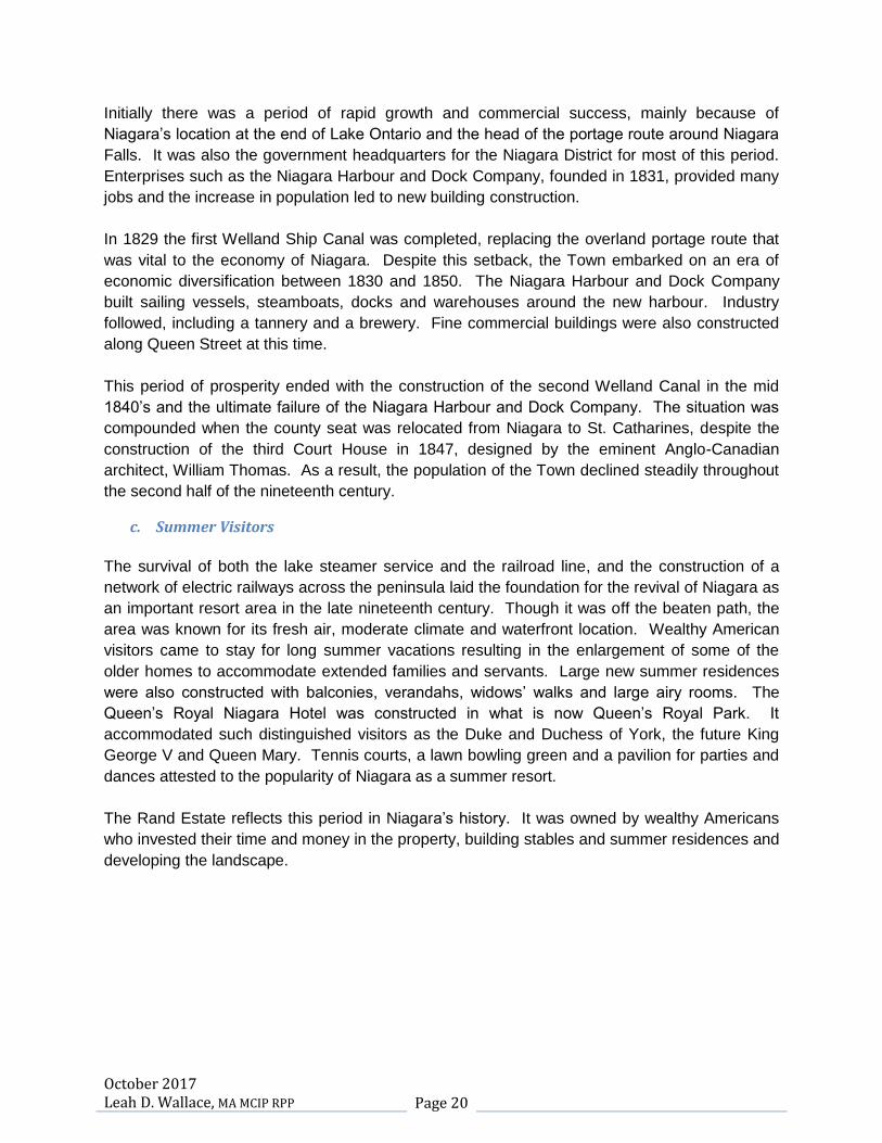
c. Summer Visitors
The survival of both the lake steamer service and the railroad line, and the construction of a
network of electric railways across the peninsula laid the foundation for the revival of Niagara as
an important resort area in the late nineteenth century. Though it was off the beaten path, the
area was known for its fresh air, moderate climate and waterfront location. Wealthy American
visitors came to stay for long summer vacations resulting in the enlargement of some of the
older homes to accommodate extended families and servants. Large new summer residences
were also constructed with balconies, verandahs, widows’ walks and large airy rooms. The
Queen’s Royal Niagara Hotel was constructed in what is now Queen’s Royal Park. It
accommodated such distinguished visitors as the Duke and Duchess of York, the future King
George V and Queen Mary. Tennis courts, a lawn bowling green and a pavilion for parties and
dances attested to the popularity of Niagara as a summer resort.
The Rand Estate reflects this period in Niagara’s history. It was owned by wealthy Americans
who invested their time and money in the property, building stables and summer residences and
developing the landscape.
October 2017 Leah D. Wallace, MA MCIP RPP Page 21
d. The Twentieth Century
Throughout the twentieth century, tender fruit farming and tourism have been the basis of the local economy. In the mid 1970’s, encouraged by the special climate of Niagara, Inniskillin winery began to plant vinefera vines and was producing wine from those grapes by the early 1980’s. The switch to vinefera grapes resulted in a burgeoning wine industry that has seen tremendous growth and has resulted in the creation of a number of estate wineries in Niagara-on-the-Lake, many of which have introduced interesting and challenging modern architectural styles to the residents of the Town.
Cultural institutions such as the Niagara Historical Society Museum, have always been
important for Niagara-on-the-Lake’s development. The founding of the Shaw Festival by Calvin
Rand and Brian Doherty the 1960’s, also saw growth of cultural institutions such as the Niagara
Pumphouse Arts Centre. The festival has since grown to encompass three theatres and
attracts over 300,000 patrons each year.
Tourism grew throughout the second half of the twentieth century and continues to grow in the
twenty-first. The popularity of Queen Street and adjacent side streets as a visitor oriented
shopping and dining area is confirmed by the crowds that flock there throughout the year.
2. History of the Rand Estate 3
The property known the Rand Estate, which once constituted the properties at 144-176 John
Street, 588 Charlotte Street, 200 John Street and the developments on Weatherstone and
Christopher Courts, was part of the 160 acre land grant the Honourable Peter Russell received
from the Crown in 1796. Russell was Simcoe’s successor as Administrator for Upper Canada
and President of the Executive Council.
A plan of Russell’s house drawn by Robert Pilkington of the Royal Engineers shows a two (2)
storey residence about 21m (70ft.) in length with various outbuildings and an orchard. The road
from Fort George runs in front of the house. Joy Ormsby, in her first draft of the Niagara
Institute Background History, speculates that the oldest part of the Randwood basement may be
the remains of Russell’s house or that of its second owner, William Dickson.
Russell sold the 160 acres to William Dickson in 1798, when, in his position as the Administrator
for Upper Canada, he was obliged to relocate because the capital was moved from Niagara to
York (Toronto) for reasons of security.
3 Joy Ormsby, (Niagara Institute Property Background History, First Draft for Board of Directors), May
1989.
October 2017 Leah D. Wallace, MA MCIP RPP Page 22
William Dickson, a native of Dumfries Scotland, arrived in Canada in 1784, at the age of 16 to
work for his cousin Robert Hamilton of Queenston. He settled in Niagara about 1787 and, as a
prominent merchant of the Town, he was there to welcome Lieutenant Governor Simcoe in
1792. He practised law and became a member of the Legislative Council. After the war of
1812-1814 he became increasingly interested in developing his land along the Grand River. He
moved to Galt in 1827; but he and members of his family owned parts of the John Street
property until 1873.
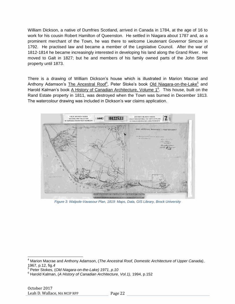
There is a drawing of William Dickson’s house which is illustrated in Marion Macrae and
Anthony Adamson’s The Ancestral Roof4, Peter Stoke’s book Old Niagara-on-the-Lake5 and
Harold Kalman’s book A History of Canadian Architecture, Volume 16. This house, built on the
Rand Estate property in 1811, was destroyed when the Town was burned in December 1813.
The watercolour drawing was included in Dickson’s war claims application.
Figure 3: Walpole-Vavasour Plan, 1819: Maps, Data, GIS Library, Brock University
4 Marion Macrae and Anthony Adamson, (The Ancestral Roof, Domestic Architecture of Upper Canada),
1967, p.12, fig.4 5 Peter Stokes, (Old Niagara-on-the-Lake) 1971, p.10
6 Harold Kalman, (A History of Canadian Architecture, Vol.1), 1994, p.152

October 2017 Leah D. Wallace, MA MCIP RPP Page 23
Figure4: Willson Plan, 1823: Maps, Data, GIS Library, Brock University
Two plans, the Willson Plan of 1823 and the Walpole-Vavasour Plan of 1819, show buildings on
the Dickson property. (Figures 3 & 4) This may indicate that another house and outbuildings
were constructed on the property in the period after the War of 1812-1814. It is not possible to
identify the purpose of these buildings, some of which may be encompassed in existing
buildings on the site, such as Randwood and the Coach House.
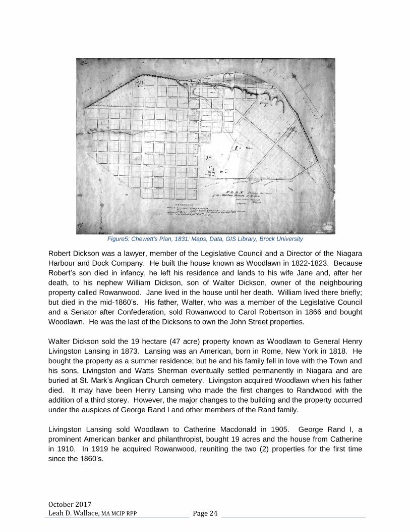
By the 1830’s William Dickson had disposed of most of his farm. In 1827 he gave each of his
two eldest sons, Robert and William, a 10 acre block. William’s block with 161m (528ft) of
frontage on John Street was called Brunswick Place while Robert’s block, with 163m (535ft.) of
frontage was called the Dickson Homestead and later renamed Woodlawn. William moved to
Galt in 1829 and sold Brunswick Place to Captain Melville of the Niagara Harbour and Dock
Company. However, Robert and his younger brother Walter continued to add to their property.
Chewett’s Plan of 1831 shows Captain Melville, Robert Dickson and Walter Dickson as owners
of the frontage across from the Military Reserve along what is now John Street. (Figure 5)
October 2017 Leah D. Wallace, MA MCIP RPP Page 24
Figure5: Chewett's Plan, 1831: Maps, Data, GIS Library, Brock University
Robert Dickson was a lawyer, member of the Legislative Council and a Director of the Niagara
Harbour and Dock Company. He built the house known as Woodlawn in 1822-1823. Because
Robert’s son died in infancy, he left his residence and lands to his wife Jane and, after her
death, to his nephew William Dickson, son of Walter Dickson, owner of the neighbouring
property called Rowanwood. Jane lived in the house until her death. William lived there briefly;
but died in the mid-1860’s. His father, Walter, who was a member of the Legislative Council
and a Senator after Confederation, sold Rowanwood to Carol Robertson in 1866 and bought
Woodlawn. He was the last of the Dicksons to own the John Street properties.
Walter Dickson sold the 19 hectare (47 acre) property known as Woodlawn to General Henry
Livingston Lansing in 1873. Lansing was an American, born in Rome, New York in 1818. He
bought the property as a summer residence; but he and his family fell in love with the Town and
his sons, Livingston and Watts Sherman eventually settled permanently in Niagara and are
buried at St. Mark’s Anglican Church cemetery. Livingston acquired Woodlawn when his father
died. It may have been Henry Lansing who made the first changes to Randwood with the
addition of a third storey. However, the major changes to the building and the property occurred
under the auspices of George Rand I and other members of the Rand family.
Livingston Lansing sold Woodlawn to Catherine Macdonald in 1905. George Rand I, a
prominent American banker and philanthropist, bought 19 acres and the house from Catherine
in 1910. In 1919 he acquired Rowanwood, reuniting the two (2) properties for the first time
since the 1860’s.

October 2017 Leah D. Wallace, MA MCIP RPP Page 25
It was George Rand I and his son, George Rand II, who had the lasting visual impact on the
cultural heritage landscape of the Rand Estate, which included, at that time, the core of the
estate at 144-176 John Street as well as the properties at 200 John Street and 588 Charlotte
Street. He was responsible for the landscaping and major additions to the house, which he
renamed Randwood. At the time of the purchase of Rowanwood in 1919, newspaper stories
indicate that he had ordered a considerable amount of stone for making driveways and had
plans to build cottages, a barn and other structures on Charlotte Street.
George Rand I met an untimely death in a plane crash in 1919. His eldest son, George Rand II,
was Vice-president of Marine Midland Bank and founder of the Rand Capital Corporation. He
inherited the estate and was appointed legal guardian to the other three (3) surviving children,
who were minors. Rand continued to renovate and add to the property. Rowanwood was
demolished. A prominent family of local masons, William, John and James Elliott worked on the
brick, concrete and stone
walls that define the original
extent of the Rand Estate
and are a distinctive feature
of the John and Charlotte
Street streetscape. Mr.
Rand also constructed
stables, a milkhouse and
various other outbuildings
and engaged the prominent
firm of Dunnington-Grubb
landscape architects to develop a landscape plan in the late 1920’s, a portion of which remains
today on both the property at 144-176 John Street and at 200 John Street, including the formal
vista from the entrance gates on John Street terminating in the building known as Randwood.
(Figure 6) Changes to this house included expansion of the library and kitchen and the addition
of a breakfast room and solarium.
In 1922, Evelyn Rand, one of George Rand I’s
children, married Colonel Henry Sheets. As a
wedding gift her brother built a new house on the
property now known as the Sheets or Devonian
House. This charming frame house was
constructed as a summer residence in the
Colonial Revival style and was accessed by a
separate entrance from John Street. (Figure 7)
Calvin Rand, son of George Rand II, along with
Brian Doherty, was instrumental in the creation
of the Shaw Festival. He continued to use the house
during the summer and settled permanently at Randwood with his family from 1961 – 1964.
Figure 6: School of Landscape Architecture Archives, University of Guelph
Figure 7: Sheets (Devonian House)

October 2017 Leah D. Wallace, MA MCIP RPP Page 26
In 1971 he leased Randwood to the Niagara Institute for seminar use in the fall, winter and
spring, returning to the house during the summer. During this period he renovated the guest
house located at 200 John Street and used it as his summer home. The 5.26 hectares (13
acres) containing Randwood and the Sheets House was sold to the Devonian Foundation in
1971, and continued to house the Niagara Institute. The Foundation sold the property to
William and Carol Fox in 1993, who renovated the Sheets (Devonian) House and the Coach
House. Randwood was also doubled in size with the addition of a solarium, music room,
second kitchen and classrooms and offices. The tower was also enclosed. During this period
the property was used by the School of Philosophy with classes being held in the renovated
building. The Foxes then sold to the Petersons who intended to turn the property into a hotel,
spa and arts centre.
From 1960 into the 1980’s portions of the property were severed from the Rand Estate including
200 John Street, the site of the guest house, garage and pool and summer home of Calvin
Rand; 588 Charlotte Street, site of the stables which were renovated as a home by Henry
Sheets Junior; the milkhouse and gatehouses along Charlotte Street, and the developments on
Weatherstone (1970’s) and Christopher Courts (1980’s).
3. Site Analysis
a. 144-176 John Street
This property is the core of the Rand Estate and
contains the largest concentration of significant
heritage resources. As previously indicated, it forms
part of the original 160 acre land grant from the
Crown to Peter Russell in 1796.
The property is enclosed on the north (John Street) and west (Charlotte Street) sides by a high wall which has been neglected and is overgrown with ivy and undergrowth. The wall along the front consists of concrete interspersed at regular intervals with
Figure 8: Randwood Main Entrance Gate, John Street Figure 9: Randwood Wall, John Street
Figure 10: Randwood Wall, Charlotte Street
October 2017 Leah D. Wallace, MA MCIP RPP Page 27
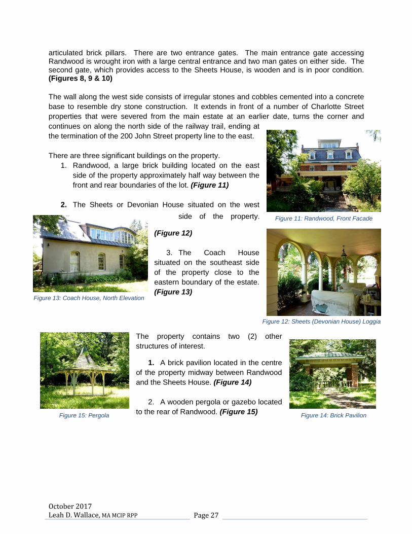
articulated brick pillars. There are two entrance gates. The main entrance gate accessing Randwood is wrought iron with a large central entrance and two man gates on either side. The second gate, which provides access to the Sheets House, is wooden and is in poor condition. (Figures 8, 9 & 10)
The wall along the west side consists of irregular stones and cobbles cemented into a concrete
base to resemble dry stone construction. It extends in front of a number of Charlotte Street
properties that were severed from the main estate at an earlier date, turns the corner and
continues on along the north side of the railway trail, ending at
the termination of the 200 John Street property line to the east.
There are three significant buildings on the property.
1. Randwood, a large brick building located on the east
side of the property approximately half way between the
front and rear boundaries of the lot. (Figure 11)
2. The Sheets or Devonian House situated on the west
side of the property.
(Figure 12)
3. The Coach House
situated on the southeast side
of the property close to the
eastern boundary of the estate.
(Figure 13)
The property contains two (2) other
structures of interest.
1. A brick pavilion located in the centre
of the property midway between Randwood
and the Sheets House. (Figure 14)
2. A wooden pergola or gazebo located
to the rear of Randwood. (Figure 15)
Figure 11: Randwood, Front Facade
Figure 12: Sheets (Devonian House) Loggia
Figure 13: Coach House, North Elevation
Figure 14: Brick Pavilion Figure 15: Pergola

October 2017 Leah D. Wallace, MA MCIP RPP Page 28
The property is also distinguished by a naturalized
picturesque landscape and a formal designed landscape
located mainly in front of Randwood. This formal
landscape consists of a stone walkway, lily pond and
stone walls. A watercourse, One Mile Creek, runs
through the property on the east side. A tributary runs
horizontally behind the Sheets House and in front of
Randwood, where it is incorporated in the formal
landscape and pond design. (Figure 17) A meandering
pathway extends throughout the property giving car
access to the major buildings on the site. Two existing
parking lots are situated near the entrance to Randwood and there are paved parking areas
adjacent to both the Sheets (Devonian)
House and Randwood. (Figure 16)
The north side of John Street consists of a
large, flat open space, punctuated by
walkways, the occasional line of mature
trees, and some widely dispersed buildings.
This area of approximately 115 hectares (285
acres) of land is known as the Commons or
Fort George Military Reserve. It is a national
historic site owned by the Government of
Canada and administered by Parks Canada.
Buildings on the site include Butler’s Barracks, Fort George,
the recently constructed Agora-on-the-Common, and Upper
Canada Lodge and the Shaw Festival Theatre, both of
which lease the land from Parks Canada. (Figure 17)
On the east side of the property, separated by the driveway
and 18m right-of-way
at 200 John Street,
is a large well-
landscaped estate
property at 210 John Street , known as Brunswick Place
with a two storey brick house located in the centre of the
lot, various outbuildings and a tennis court. This
property was once part of the original 160 acre land
grant to Peter Russell and was owned by both William
Dickson Senior and his son William Dickson Junior.
(Figure 18 & 19)
Figure 16: Lily Pond with Sculpture, Dunnington-Grubb
Figure 17: The Commons from John Street
Figure18: Brunswick Place from John Street
Figure 19: Brunswick Place

October 2017 Leah D. Wallace, MA MCIP RPP Page 29
On the west side of Charlotte Street are a number of new homes constructed throughout the
second half of the 20th century. These are one and two storey houses of varying styles and size
set back on spacious lots. A line of mature pine trees screens the homes from the street.
On the east side of Charlotte Street, adjacent to the
Rand Estate is the development know as Christopher
Street, a cul-de-sac located behind a portion of the
Rand Estate stone wall consisting of traditionally
designed two storey homes on larger lots constructed
in the 1980’s. It is screened from the Rand Estate by a
magnificent boxwood hedge of considerable height as
well as mature trees included native White Pine and
large cedars (Figure 20).
b. 200 John Street
The property at 200 John Street is an irregularly
shaped lot accessed by a long gravel driveway
located within an 18m (60ft.) right-of-way.
(Figure 21) It was once part of the Rand Estate
and was severed from the property when Calvin
Rand sold the estate to the Devonian
Foundation in 1971. The majority of the
property is located immediately behind the Rand
Estate and is screened from that property by a
natural
fence of trees and hedges. The property contains
the Rand Estate garage, a remodelled guest
house, the pool with its related pavilion and bath
house and the tea house. (Figure 22)
Figure21: 200 John Street, Entrance
Figure 20: Christopher Street
Figure 22: Pool Pavilion

October 2017 Leah D. Wallace, MA MCIP RPP Page 30
A Lord and Burnham greenhouse located on this
property has since been dismantled and donated to
the School of Restoration Arts at Willowbank. At the
rear of the property is the stone wall which borders
both the estate and the railway trail. The gate
accessing the
railway line and the
gazebo where the
family would wait for
the electric train is
located in this area. (Figures
23 & 24) Because of the
secluded nature of the lot and the location of the buildings on the
site, none of the structures on the property are visible from a
public street or the railway trail.
c. 588 Charlotte Street
The property at 588 Charlotte Street is an
irregularly shaped lot accessed by a long,
narrow gravel driveway from Charlotte
Street. It is part of the Rand Estate severed
from the property when the property at 200
John Street was severed. It contains a one
storey estate stable which once housed
Evelyn Sheets’ horses. It was converted
and adapted for domestic use by the Sheets
family. There is also a small outbuilding of
similar design and a pool which was
constructed at a later date. In front of the house is
a large lawn with a distinctive linear hedge.(Figure
25)
The property is bordered on the east by Weatherstone Court, which was also part of the estate
at one time. The Court is the site of a designated property, the former dairy and milkhouse for
the estate. To the south, the lot is bordered by the stone wall adjacent to the railway trail. As
with 200 John Street, the secluded nature of this property conceals the structures from view
from a public street or the railway trail.
Figure23: Family Gate to Railway
Figure24: Gazebo
Figure25: 588 Charlotte Street, Former Stables
October 2017 Leah D. Wallace, MA MCIP RPP Page 31
Identification and Significance and Heritage Attributes of Properties
1. 144-176 John Street
The property at 144-176 John Street contains three (3) significant built heritage resources and is
a cultural heritage landscape of considerable value. While it is not designated under Part IV of
the OHA, it is listed on the Municipal Register of Properties of Cultural Heritage Value and
Interest and is worthy of designation under the OHA.
The built heritage resources include:
Randwood, a three (3) storey brick building with Second Empire, Itatlianate and Neo-
classical characteristics.
The Sheets (Devonian) House, a frame building dating from 1922 constructed in the
Colonial Revival style.
The Coach House, the earliest building on the site, with Gothic Revival details.
The Victorian wooden gazebo and the modern brick pavilion.
a. Randwood
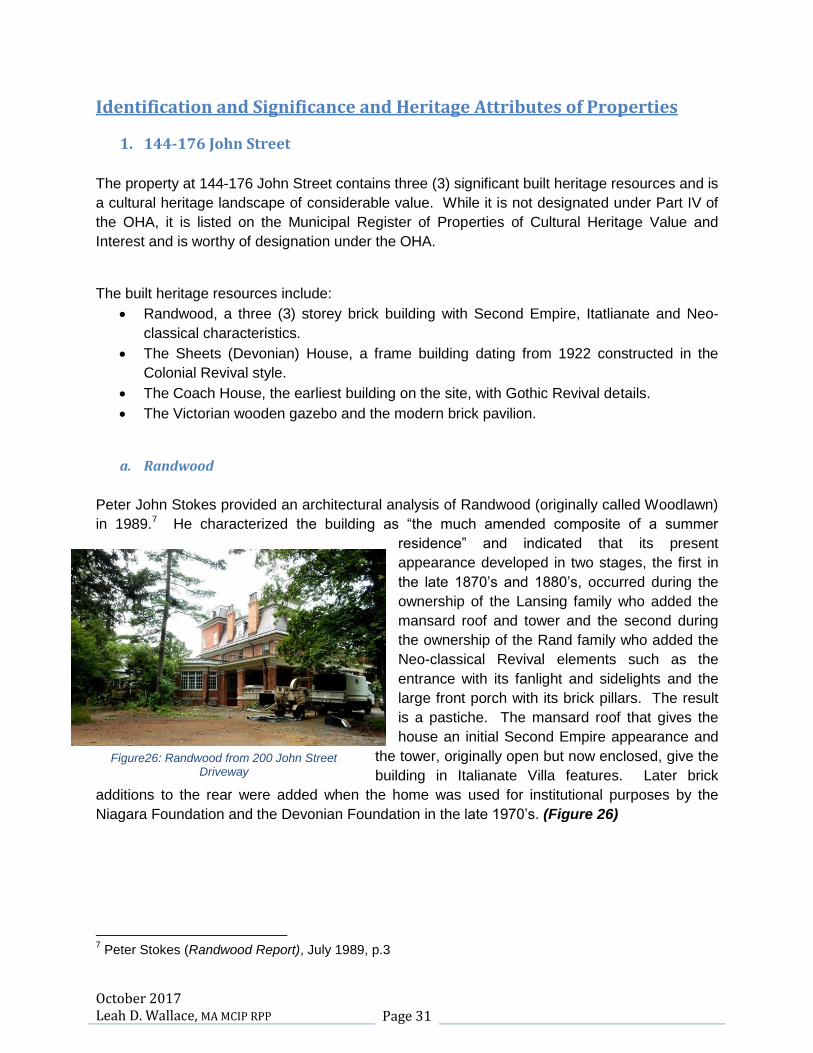
Peter John Stokes provided an architectural analysis of Randwood (originally called Woodlawn)
in 1989.7 He characterized the building as “the much amended composite of a summer
residence” and indicated that its present
appearance developed in two stages, the first in
the late 1870’s and 1880’s, occurred during the
ownership of the Lansing family who added the
mansard roof and tower and the second during
the ownership of the Rand family who added the
Neo-classical Revival elements such as the
entrance with its fanlight and sidelights and the
large front porch with its brick pillars. The result
is a pastiche. The mansard roof that gives the
house an initial Second Empire appearance and
the tower, originally open but now enclosed, give the
building in Italianate Villa features. Later brick
additions to the rear were added when the home was used for institutional purposes by the
Niagara Foundation and the Devonian Foundation in the late 1970’s. (Figure 26)
7 Peter Stokes (Randwood Report), July 1989, p.3
Figure26: Randwood from 200 John Street Driveway

October 2017 Leah D. Wallace, MA MCIP RPP Page 32
In his analysis, Mr. Stokes acknowledged the “composite character” of the building and
indicated that further changes to the structure would be acceptable if the earlier alterations by
the Lansings and Rands were respected and if appropriate restoration and maintenance was
carried out. He also indicated that some of the original features of the Dickson house might still
remain in the basement; but that later improvements by the Niagara Foundation may have
obscured an original below stairs kitchen with bake oven and cooking fireplace.
b. The Sheets (Devonian) House
The Sheets (Devonian) House (Figure 25) was
constructed in 1922 as a summer residence for the
newly married Evelyn Rand and her husband, received
some updates during the tenure of the Fox family and
the Devonian Foundation in the 1990’s, such as the
modern kitchen and upstairs bathrooms. It is Colonial
Revival in style.
This style developed first in the United States and was
a hybrid of New England vernacular building styles that
became popular in the northeast at about the time of
the 1876 American Centennial Exhibition in
Philadelphia. 8
Colonial Revival buildings are distinguished from the historic antecedents by the use of modern
materials, a difference in scale and proportions and a
mixture of old and new elements. There is often a mix
of historical architectural details.
The Sheets House is a charming three (3) bay home
clad in clapboard with a generous front porch with
balcony and classical Chippendale style railings and
paired squared columns. The gable roof is punctuated
by three (3) dormer windows providing light for the attic
rooms. On the west side of the building is a loggia with
arched openings set on simple Tuscan columns, which
houses a unique exterior brick fireplace. A conservatory or
solarium with an attractive original tiled floor is lit by a series
of arched openings that mirror the loggia on the west side of the building creating a balanced
facade. (Figures 27 & 28)
8 John Blumenson, (Ontario Architecture: A Guide to Styles and Building Terms 1784 to the Present),
1990, p.142
Figure27: Sheets (Devonian) House Facade
Figure28: Sheets (Devonian) House, Entrance Hallway

October 2017 Leah D. Wallace, MA MCIP RPP Page 33
The ground floor principle rooms, entrance and staircase are original to the building. These are
of generous size with traditional details such as the classical fireplace mantels and trim.
Wainscoting detail is found in the dining room, along the staircase wall and in the upstairs
hallway. The wallpaper in the dining room depicts picturesque garden scenes punctuated with
depictions of garden features such as temples and pagodas. It is in excellent condition and is
similar in age and style to the wallpaper in one of the downstairs rooms at Willowbank which is
in a much deteriorated condition.
c. The Coach House
The Coach House (Figure 29) is probably the earliest building on the site. It was altered to
accommodate institutional uses. Constructed in the Gothic Revival style, probably in the 1860’s
or 1870’s, when the property was still owned by the
Dicksons, it has a steep gable roof with decorative
bargeboard trim and early windows on the ground
floor north elevation and the first and second floor
east elevation and south elevations.
Alterations include modern stucco cladding, a
metal standing seam roof of traditional design and
large elaborate dormer windows on the north and
south roofs. The entrance is through a door on the
east elevation.
d. Cultural Heritage Landscape
Any analysis of the heritage resources on the Rand
Estate property cannot separate the built heritage
resources from their setting which constitutes a
significant cultural heritage landscape with both
designed and evolving components. The Ontario
Heritage Trust has defined a cultural heritage landscape
as a property or defined geographical area of cultural
heritage significance that has been modified by human
activities and is valued by a community. These activities
or uses may be the key to the cultural value, significance
and meaning of these landscapes.9
9 Ontario Heritage Trust, (Cultural Landscapes, An Introduction) Nov.2012.
Figure30: Planting Plan, School of Landscape Architecture Archives, University of Guelph
Figure29: Coach House
October 2017 Leah D. Wallace, MA MCIP RPP Page 34
A designed landscape is one that is clearly
defined and was created intentionally by man
and may include parklands, landscapes
which are constructed for esthetic reasons
and which are sometimes associated with
monumental buildings and assemblies. 10
An evolved cultural landscape results from an
initial social, economic or administrative
imperative and has developed its present form
by association with, and in response to, its
natural environment. It reflects its process of
evolution and may still be continuing to evolve. 11
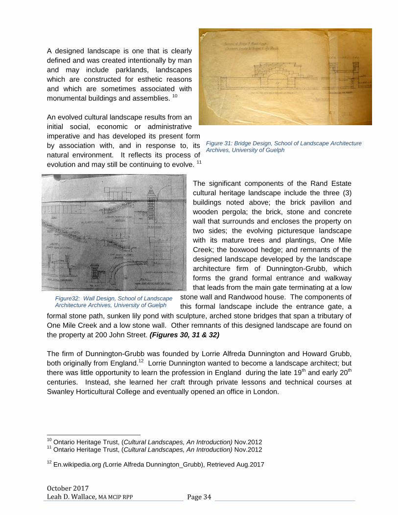
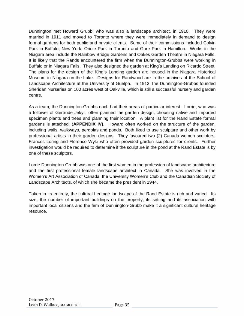
The significant components of the Rand Estate
cultural heritage landscape include the three (3)
buildings noted above; the brick pavilion and
wooden pergola; the brick, stone and concrete
wall that surrounds and encloses the property on
two sides; the evolving picturesque landscape
with its mature trees and plantings, One Mile
Creek; the boxwood hedge; and remnants of the
designed landscape developed by the landscape
architecture firm of Dunnington-Grubb, which
forms the grand formal entrance and walkway
that leads from the main gate terminating at a low
stone wall and Randwood house. The components of
this formal landscape include the entrance gate, a
formal stone path, sunken lily pond with sculpture, arched stone bridges that span a tributary of
One Mile Creek and a low stone wall. Other remnants of this designed landscape are found on
the property at 200 John Street. (Figures 30, 31 & 32)
The firm of Dunnington-Grubb was founded by Lorrie Alfreda Dunnington and Howard Grubb,
both originally from England.12 Lorrie Dunnington wanted to become a landscape architect; but
there was little opportunity to learn the profession in England during the late 19th and early 20th
centuries. Instead, she learned her craft through private lessons and technical courses at
Swanley Horticultural College and eventually opened an office in London.
10
Ontario Heritage Trust, (Cultural Landscapes, An Introduction) Nov.2012 11
Ontario Heritage Trust, (Cultural Landscapes, An Introduction) Nov.2012 12
En.wikipedia.org (Lorrie Alfreda Dunnington_Grubb), Retrieved Aug.2017
Figure32: Wall Design, School of Landscape Architecture Archives, University of Guelph
Figure 31: Bridge Design, School of Landscape Architecture Archives, University of Guelph
October 2017 Leah D. Wallace, MA MCIP RPP Page 35
Dunnington met Howard Grubb, who was also a landscape architect, in 1910. They were
married in 1911 and moved to Toronto where they were immediately in demand to design
formal gardens for both public and private clients. Some of their commissions included Colvin
Park in Buffalo, New York, Oriole Park in Toronto and Gore Park in Hamilton. Works in the
Niagara area include the Rainbow Bridge Gardens and Oakes Garden Theatre in Niagara Falls.
It is likely that the Rands encountered the firm when the Dunnington-Grubbs were working in
Buffalo or in Niagara Falls. They also designed the garden at King’s Landing on Ricardo Street.
The plans for the design of the King’s Landing garden are housed in the Niagara Historical
Museum in Niagara-on-the-Lake. Designs for Randwood are in the archives of the School of
Landscape Architecture at the University of Guelph. In 1913, the Dunnington-Grubbs founded
Sheridan Nurseries on 100 acres west of Oakville, which is still a successful nursery and garden
centre.
As a team, the Dunnington-Grubbs each had their areas of particular interest. Lorrie, who was
a follower of Gertrude Jekyll, often planned the garden design, choosing native and imported
specimen plants and trees and planning their location. A plant list for the Rand Estate formal
gardens is attached. (APPENDIX IV). Howard often worked on the structure of the garden,
including walls, walkways, pergolas and ponds. Both liked to use sculpture and other work by
professional artists in their garden designs. They favoured two (2) Canada women sculptors,
Frances Loring and Florence Wyle who often provided garden sculptures for clients. Further
investigation would be required to determine if the sculpture in the pond at the Rand Estate is by
one of these sculptors.
Lorrie Dunnington-Grubb was one of the first women in the profession of landscape architecture
and the first professional female landscape architect in Canada. She was involved in the
Women’s Art Association of Canada, the University Women’s Club and the Canadian Society of
Landscape Architects, of which she became the president in 1944.
Taken in its entirety, the cultural heritage landscape of the Rand Estate is rich and varied. Its
size, the number of important buildings on the property, its setting and its association with
important local citizens and the firm of Dunnington-Grubb make it a significant cultural heritage
resource.

October 2017 Leah D. Wallace, MA MCIP RPP Page 36
2. 200 John Street
The property at 200 John Street was initially part of the Rand Estate. It was severed in 1971. It
is not a designated property under the OHA nor is it listed on the Register of Properties of
Cultural Heritage Value and Interest. The property
contains the following buildings, features and structures
that may potentially have cultural heritage value.
The guest house
The garage
The pool, tea house and pool pavilion
The gazebo next to the railway trail
The stone wall at the rear
Although the guest house is one of the older buildings
on the site, it has been modernized with the addition of
new windows and doors and, until recently, was used as
a summer residence by Calvin Rand. It is one and half
storeys in height with a gable roof, asphalt shingles and a
stucco exterior. (Figure 33)
The garage is a two (2) storey gable-roofed structure with large doors for vehicle access on the
north elevation. The second floor was probably
accommodation for the chauffeur. The second
floor level is distinguished by a string or belt
course on the exterior which is finished in stucco
in keeping with other outbuildings that were once
part of the Rand Estate property. The windows
on the second floor are 6 over 6 and appear to
be original, as are the doors on the lower level
with their decorative diamond pane divisions.
The deep eave overhang and other features of
the building give it a Craftsman style
appearance. The building is not in particularly good
shape and does not appear to be currently in use. (Figure 34)
Figure 33: 200 John Street Guest House
Figure34: 200 John Street Garage
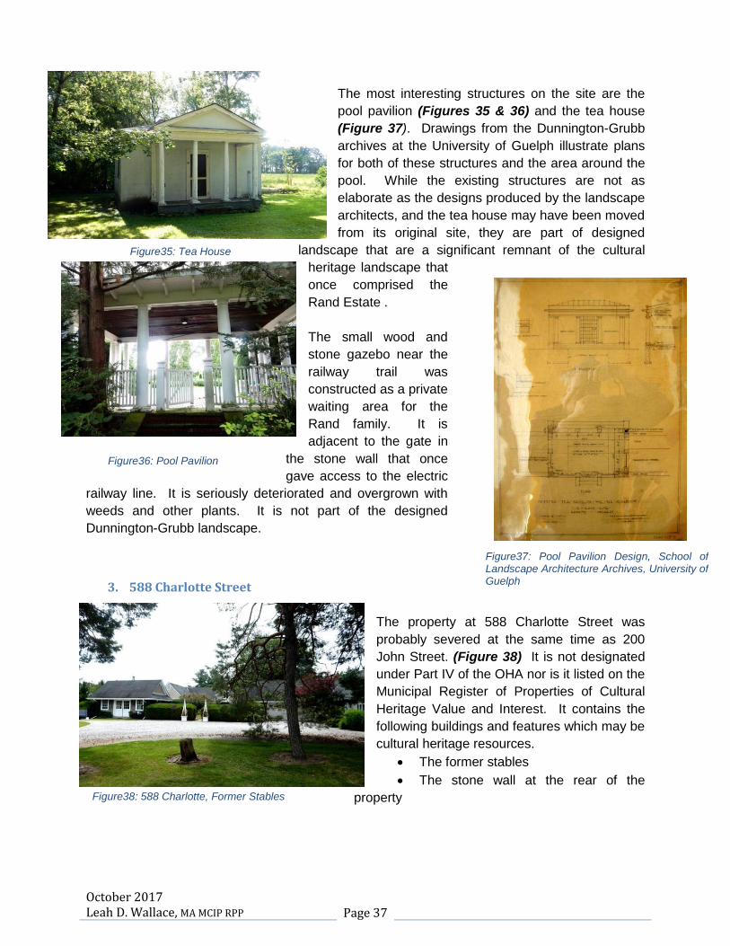
October 2017 Leah D. Wallace, MA MCIP RPP Page 37
The most interesting structures on the site are the
pool pavilion (Figures 35 & 36) and the tea house
(Figure 37). Drawings from the Dunnington-Grubb
archives at the University of Guelph illustrate plans
for both of these structures and the area around the
pool. While the existing structures are not as
elaborate as the designs produced by the landscape
architects, and the tea house may have been moved
from its original site, they are part of designed
landscape that are a significant remnant of the cultural
heritage landscape that
once comprised the
Rand Estate .
The small wood and
stone gazebo near the
railway trail was
constructed as a private
waiting area for the
Rand family. It is
adjacent to the gate in
the stone wall that once
gave access to the electric
railway line. It is seriously deteriorated and overgrown with
weeds and other plants. It is not part of the designed
Dunnington-Grubb landscape.
3. 588 Charlotte Street
The property at 588 Charlotte Street was
probably severed at the same time as 200
John Street. (Figure 38) It is not designated
under Part IV of the OHA nor is it listed on the
Municipal Register of Properties of Cultural
Heritage Value and Interest. It contains the
following buildings and features which may be
cultural heritage resources.
The former stables
The stone wall at the rear of the
property
Figure36: Pool Pavilion
Figure35: Tea House
Figure37: Pool Pavilion Design, School of Landscape Architecture Archives, University of Guelph
Figure38: 588 Charlotte, Former Stables
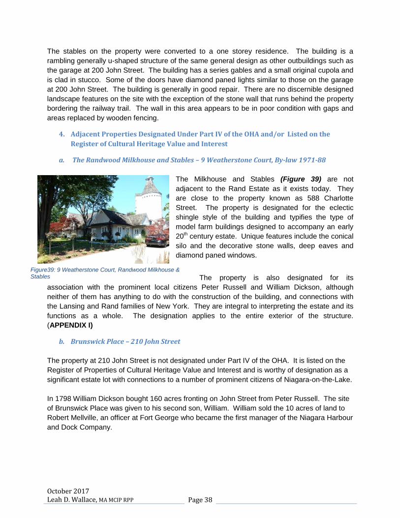
October 2017 Leah D. Wallace, MA MCIP RPP Page 38
The stables on the property were converted to a one storey residence. The building is a
rambling generally u-shaped structure of the same general design as other outbuildings such as
the garage at 200 John Street. The building has a series gables and a small original cupola and
is clad in stucco. Some of the doors have diamond paned lights similar to those on the garage
at 200 John Street. The building is generally in good repair. There are no discernible designed
landscape features on the site with the exception of the stone wall that runs behind the property
bordering the railway trail. The wall in this area appears to be in poor condition with gaps and
areas replaced by wooden fencing.
4. Adjacent Properties Designated Under Part IV of the OHA and/or Listed on the
Register of Cultural Heritage Value and Interest
a. The Randwood Milkhouse and Stables – 9 Weatherstone Court, By-law 1971-88
The Milkhouse and Stables (Figure 39) are not
adjacent to the Rand Estate as it exists today. They
are close to the property known as 588 Charlotte
Street. The property is designated for the eclectic
shingle style of the building and typifies the type of
model farm buildings designed to accompany an early
20th century estate. Unique features include the conical
silo and the decorative stone walls, deep eaves and
diamond paned windows.
The property is also designated for its
association with the prominent local citizens Peter Russell and William Dickson, although
neither of them has anything to do with the construction of the building, and connections with
the Lansing and Rand families of New York. They are integral to interpreting the estate and its
functions as a whole. The designation applies to the entire exterior of the structure.
(APPENDIX I)
b. Brunswick Place – 210 John Street
The property at 210 John Street is not designated under Part IV of the OHA. It is listed on the
Register of Properties of Cultural Heritage Value and Interest and is worthy of designation as a
significant estate lot with connections to a number of prominent citizens of Niagara-on-the-Lake.
In 1798 William Dickson bought 160 acres fronting on John Street from Peter Russell. The site
of Brunswick Place was given to his second son, William. William sold the 10 acres of land to
Robert Mellville, an officer at Fort George who became the first manager of the Niagara Harbour
and Dock Company.
Figure39: 9 Weatherstone Court, Randwood Milkhouse & Stables

October 2017 Leah D. Wallace, MA MCIP RPP Page 39
In 1830, Melville built this three-bay, two story brick house with center hall and called it
Brunswick Place. Other pre-1900 owners included Robert George Dickson, William's grandson,
who renamed the estate Pinehurst because it contained 200 pine trees planted by Melville, and
Buffalo barrister Herbert Bissell. Twentieth-century owners Charles and Harriet Grenier (1902-
22) and Edward H. and Ruth Abbott Letchworth (1928-65) refurbished and extended Melville's
home. From the 1930's through the 1950's, the Rands and the Letchworths made their part of
John Street a centre of the summer scene in Niagara
The red brick house sits behind an elaborate white picket fence and is centred on an extensive
well- landscaped estate lot. It is separated from the Rand Estate by the laneway into the
property at 200 John Street. The building has a hip roof, prominent corner chimneys and Neo-
classical details such as the portico with Tuscan columns and the entrance doorway with its
elliptical fanlight and sidelights. A conservatory on the west side of the building was constructed
at a later date.
There are no other properties adjacent or close to the subject properties that are either
designated or listed on the Municipal Register.
5. Other Features and Structures Related to the Rand Estate
Other features that are no longer part of the
Rand Estate but are significant cultural heritage
resources related to the property before it was
partitioned are the continuation of the stone wall
and the gate house and formal stone entrance
gate, all of which are located on Charlotte
Street. These features are not designated and
are not listed on the Register of Properties of
Cultural Heritage Value and Interest. However,
they help to define and delineate the full extent
and impact of the Rand Estate as it existed in the
first half of the 20th century. They are an
important component of the cultural heritage
landscape of the Rand Estate in its heyday and,
taken as a whole, are important remnants of the
period when wealthy summer visitors to the Town built commodious homes on large estate lots
or converted old ones and stayed for the whole season. (Figures 40, 41& 42)
Figure40: Christopher Street Entrance
Figure41: Cobblestone Wall, Charlotte Street

October 2017 Leah D. Wallace, MA MCIP RPP Page 40
6. The Commons (Fort George Military Reserve)
The Commons is located directly across John Street from the Rand Estate and the laneway
accessing the 200 John Street property.
The approximately 115 hectares (285
acres) that constitute what remains of
the original 444 acres is designated as a
national historic site and is protected and
managed by Parks Canada. It
comprises a number of national historic
sites within it including Fort George,
Navy Hall and Butler’s Barracks, the
Officers’ Quarters and the archaeological
remains of the Indian Council House.13
This land is viewed by many residents as
a public park and maintenance of the site
as open space is passionately supported
by many of the residents of the Town. While it has been considerably reduced in size over the
years it is still an important green space and has been the site of many events and assemblies
such as the Scout Jamboree, military encampments, parades and more recently, concerts.
Views into and out of the commons are part of its significance as a heritage resource and a
cultural heritage landscape. Possible impacts on this resource require evaluation. (Figure 43)
13
Richard D. Merritt, (On Common Ground, The Ongoing Story of the Commons in Niagara-on-the-Lake), Introduction
Figure42: Randwood Entrance from Charlotte Street
Figure 43: Commons from John Street

October 2017 Leah D. Wallace, MA MCIP RPP Page 41
Evaluation of Heritage Impacts
Policy 2.6.3 of the PPS states that planning authorities shall not permit development and site
alterations on adjacent lands to protected heritage property unless the proposed development
and any site alteration is evaluated and that evaluation demonstrates that the heritage attributes
of the protected property will be conserved.
The Planning Act, the Growth Plan, 2017 and the Region of Niagara Official Plan also contain
policies that encourage the conservation of significant and protected heritage properties. The
Region’s Official Plan includes additional policies for requiring heritage impact assessments to
evaluate the impact of new development on cultural heritage resources.
The Standards and Guidelines for the Conservation of Historic Places in Canada states that any
action or process that results in a physical change to the character-defining elements of an
historic place must respect and protect its heritage value.
There are two separate development proposals associated with three subject properties all of
which contain, or are adjacent to, cultural heritage resources of varying significance which could
be impacted. These are:
1. A hotel and restaurant proposal associated with the Rand Estate at 144-176 John Street.
2. An application for a plan of subdivision to be constructed on the properties at 200 John
Street and 588 Charlotte Street.
1. Impacts of Hotel and Restaurant Proposal
a. Rand Estate
The impact of the proposed hotel and restaurant development on the existing buildings on the
Rand Estate property is not as great as the plan that was approved in 2011 which proposed
large additions to both Randwood and the Coach House that had a direct effect on their
appearance and cultural heritage value. The Coach House, particularly, would have been
dwarfed by its later additions and would lose much of its context as a small outbuilding. The
earlier plan also included two (2) new buildings in the centre of the property as well as the hotel
and Coach House additions.
The new hotel building will be located on the open, flat ground at the rear of the property
adjacent to the Coach House to the rear of both the Sheets (Devonian) House and Randwood.

October 2017 Leah D. Wallace, MA MCIP RPP Page 42
Because this is open ground with few mature tree or shrubs, it is the best location for the new
building and will have minimal impact on the mature vegetation on the site. The front façade of
the hotel building will be a full 17.3m (55.77ft) from the southwest corner of Randwood and
almost 50m (164ft.) from the Sheets (Devonian) House. The greatest potential impact will be on
the Coach House, which is a small two storey structure. The distance between the Coach
House and the hotel is 16.4m (54ft) which will help to mitigate impacts. Impacts on this building
are also mitigated because it is adjacent to the one storey function hall of the hotel rather than
the main six (6) storey structure.
The new hotel is a six (6) storey building and is 22m (72ft) in height (Figure 38). This height
has potential to create impacts. However, the hotel will be constructed at the rear of the
property a full 111m (364ft) from John Street and the wall that surrounds the property. It has
been designed to complement rather than copy the existing building styles on the site and is
articulated to reduce its massing. The simple shape will help to ensure that its potential impact
on the site will be minimized and that it will reflect the continuing evolution of the property which
contains buildings that are eclectic in design and reflect a number of building styles from
different periods including Gothic Revival, Italianate, Second Empire and Colonial Revival. The
property has also been impacted and altered over the years by renovations and additions to
Randwood in the 19th and early 20th centuries and the Coach House in the 1990’s; construction
of the Sheets (Devonian) House in 1922; and severance of large portions of the estate in the
1960’s and 1970’s.
The cultural heritage landscape is the most significant cultural heritage resource on the
property. The buildings on the site are a component of this resource and will be maintained and
repaired or restored as required. Any new additional parking for the hotel will be underground
with the exception of a small drop off area. All remnants of the Dunnington-Grubb landscape
plan, including the stone walkway, lily pond, walls, perimeter gates, and stone bridges will be
conserved as will the entrances and the wall surrounding the estate on John and Charlotte
Street. The view into the site from the main gate along the walkway will be enhanced when
repairs are made and maintenance work on the grounds and plantings is carried out.
Many components of the picturesque natural landscape, including healthy mature trees and
shrubs, the boxwood hedge on the western boundary and existing paths and walkways will also
be conserved and will not be impacted by the hotel development. Currently, these landscape
features are in a neglected state and are in need of conservation, repair and rehabilitation. This
will be carried out as part of the development program and will enhance and preserve the
existing cultural heritage resources on the site.

October 2017 Leah D. Wallace, MA MCIP RPP Page 43
b. The Commons (Fort George Military Reserve)
The Commons or Fort George Military
Reserve is located across the road from the
Rand Estate and extends from the corner of
King Street along John to the Niagara River
Parkway. As a national historic site it is a
level one resource and the views and vistas
into and out of the Commons are character-
defining features that have potential to be
impacted by the proposed hotel
development particularly as it relates to the
height of the building. (Figure 44)
As indicated above, the new hotel building will
be located 111m (364 ft.) from John Street and the Rand Estate wall running along John Street
will be retained. A visual survey of the property from the Commons along John Street confirms
that the mature trees, including many coniferous species, which rise to a considerable height,
coupled with retention of the wall, will successfully screen the hotel and that views of the new
building will be fleeting at best, even in the winter when the deciduous trees are bare.
There will be no impacts on the views from the Rand Estate into the Commons and minimal
impacts on views from the Commons into the estate. No built or archaeological cultural heritage
resources will be impacted.
c. 210 John Street (Brunswick Place)
The property at 210 John Street is not
designated. However, it is listed on the
Register of Properties of Cultural Heritage
Value and Interest and is recognized as an
important property worthy of designation
under the OHA. The PPS states that
impacts on significant properties must be
evaluated.(Figure 45)
Figure44: Randwood from Commons
Figure45: Brunswick Place from 200 John Street Driveway

October 2017 Leah D. Wallace, MA MCIP RPP Page 44
Brunswick Place is a large property. The house on the lot is situated at some distance from
John Street and from the boundary of the Rand Estate. It is separated from the Rand Estate by
an 18m (60ft.) right-of-way access to the property at 200 John Street. This right-of-way is
bordered on the east side, adjacent to 210 John Street by dense plantings of mature trees and
shrubs which successfully screen the property from the Rand Estate. When the proposed
subdivision is constructed, this natural buffer will be conserved and will screen Brunswick Place
from the hotel development. The proposed hotel is also 80m (262ft) from the Brunswick Place
property line. Impacts on 210 John Street will be minimal and will be limited to glimpses of the
hotel through the trees. There will be no impacts on the built heritage resources or cultural
heritage landscape of the Brunswick Place.
2. Impacts of Plan of Subdivision
a. 588 Charlotte Street
This property is not designated and is not listed on the Register of Properties of Cultural
Heritage Value and Interest. It was once part of the larger Rand Estate which also included
Weatherstone Court, Christopher Court and 120 John Street. If there were remnants of the
designed Dunnington-Grubb landscape on the lot, they have since disappeared.
A review of the 1934 aerial photograph of the property and surroundings does not show any
formal plantings or garden structures (Figures 46 & 47). The wall at the rear of the property is
still in existence, though it is in a deteriorated state. Some sections are shored up, some have
disappeared and some have been replaced with wooden fencing. The stone fence, which is an
important artifact of the cultural heritage landscape, will be retained along the rear of the
property and repaired as necessary. It will not be impacted by the proposed subdivision and will
be conserved, maintaining the historic appearance and views along the trail. It will continue to
define the boundary and full extent of the Rand Estate before it was partitioned. Visual impact
of the proposed subdivision will also be minimized. Figure46: Aerial Photograph, 1934

October 2017 Leah D. Wallace, MA MCIP RPP Page 45
There is a building on the site, one of the former
stables, which will be removed when the
subdivision is approved. Stylistically the stable
resembles other outbuildings on the former Rand
property such as the milkhouse and stables on
Weatherstone Court. It was adapted for domestic
use by the Sheets family and, based on a
comparison of the 1934 and the 2015 aerial
photograph, the stables appear to have been the
subject of a number of later additions. (Figure 40)
While the building will be demolished, other
examples of the remnant estate outbuildings,
including the gatehouse on Charlotte Street and the
Milkhouse on Weatherstone Court are good examples of the estates outbuildings. These are
visible to the public from the street. The stables have lost much of their context as outbuildings
within the larger Rand Estate. Impacts can be mitigated by careful measurement and
documentation of the structure before demolition. The stone wall which borders the rear of this
property will be retained to define the extent of the original estate.
b. 200 John Street
The property at 200 John Street is not designated
and is not listed on the Register of Properties of
Cultural Heritage Value and Interest. It is accessed
from John Street via a long winding driveway that is
heavily treed and landscaped. The driveway
entrance is situated between two (2) brick pillars in
the existing Rand Estate wall. The pillars are similar
to the other brick pillars along the wall; but appear to
be of newer construction and were probably built
when the driveway access was created in the
1970’s. The proposed subdivision will not impact
this driveway or the appearance of the wall and
entrances on John Street. The driveway and pillars will
be maintained as access to the subdivision which will not be visible from John Street. It may be
necessary to widen this entrance when the subdivision is approved. If this is necessary, the
pillars will be dismantled and reconstructed.
The wall at the rear of the property contains the wrought iron gate that provided the Rand family
with access to the electric railway line. This gate and the pillars, which are seriously
deteriorated, will be retained and repaired as will the wall, screening the subdivision from the
Figure47: 588 Charlotte Street landscape
Figure48: Family Gate, detail

October 2017 Leah D. Wallace, MA MCIP RPP Page 46
trail and defining the full extent of the Rand Estate before it
was severed in the mid 20th century. (Figure 48)
There is a small gazebo just inside the family gate which is
reputed to have provided shelter for the Rand children when
waiting for the train to take them to school. (Figure 49) This
gazebo, with its stone base and wooden supports, is in
extremely poor condition. Any attempt at repair would result in
replacement of most of the wooden components. The best
solution, under these circumstances, is documentation and
removal.
There are four structures on the 200 John
Street property.
The guest house
The garage
The tea house
The pool house
The guest house has been modernized and
no longer retains any of the details that are
noticeable on the garage, the stables and
the milkhouse at Weatherstone Court. As
such, it has lost much of its context and can
be demolished if documented and
photographed.
The garage is in poor condition and is no longer in use. It has lost both its purpose and its
context within the original Rand Estate. It can be measured, documented and demolished.
The 1934 aerial photograph reveals that a number of elements of the formal garden design,
which is an integral part of the cultural heritage landscape, extended south into the 200 John
Street property. These have been lost and, more recently, the Lord and Burnham greenhouse
was removed and taken to the School of Restoration Arts at Willowbank. Any remnants of this
designed landscape that are no longer visible may be discovered and documented when
archaeology is completed on the property.
Two remnants of the Dunnington-Grubb design remain, however. These are the pool and pool
pavilion and the tea house (Figure 50). They are significant artifacts of this landscape that
should be retained. Ideally, they would be left in situ as the Standards and Guidelines
recommend. However, the design of the subdivision does not provide for this and, in any case,
they are in need of conservation and repair. The subdivision design includes a parkette
between Street ‘B’ and Street ‘H’. The portico from the tea house and the pool pavilion should
Figure 49: Gazebo
Figure50: Pool Pavilion
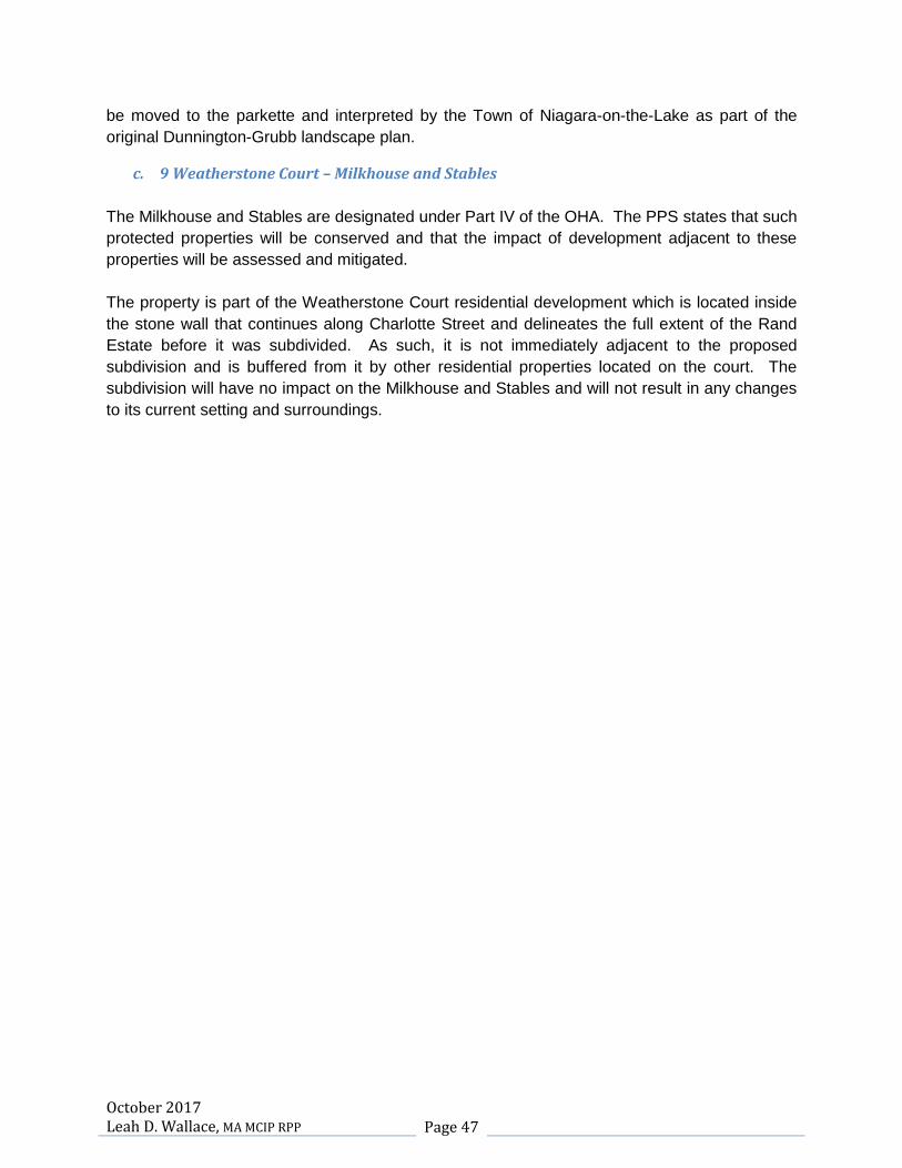
October 2017 Leah D. Wallace, MA MCIP RPP Page 47
be moved to the parkette and interpreted by the Town of Niagara-on-the-Lake as part of the
original Dunnington-Grubb landscape plan.
c. 9 Weatherstone Court – Milkhouse and Stables
The Milkhouse and Stables are designated under Part IV of the OHA. The PPS states that such
protected properties will be conserved and that the impact of development adjacent to these
properties will be assessed and mitigated.
The property is part of the Weatherstone Court residential development which is located inside
the stone wall that continues along Charlotte Street and delineates the full extent of the Rand
Estate before it was subdivided. As such, it is not immediately adjacent to the proposed
subdivision and is buffered from it by other residential properties located on the court. The
subdivision will have no impact on the Milkhouse and Stables and will not result in any changes
to its current setting and surroundings.

October 2017 Leah D. Wallace, MA MCIP RPP Page 48
Mitigation and Conservation Methods
1. 144-176 John Street (Rand Estate)
Following are the mitigation and conservation recommendations for the proposed hotel and
restaurant development application on the Rand Estate.
1. Based on the archaeological report produced by Archaeologix Inc. in 2008, additional
archaeology will be completed and appropriate mitigation carried out in the locations
indicated in that report to the satisfaction of the Ministry of Tourism, Culture and Sport.
2. The wall surrounding the property along John and Charlotte Streets will be maintained
and restored using appropriate conservation methods. All ivy and other undergrowth will
be removed. The original brick pillars will be repointed and missing or damaged bricks
will be replaced using similar brick. All loose stones will be re-cemented and all missing
stones will be replaced.
3. A tree preservation plan will be prepared and all healthy trees including native and
specimen or ornamental trees will be retained to screen the new hotel building and to
ensure that the picturesque and designed landscapes are conserved.
4. The Dunnington-Grubb designed landscape features will be retained, restored and
repaired where necessary. Any existing plantings identified on the Sheridan Nurseries
plant list for this property will be retained and, where possible, re-introduced into the
landscape. (APPENDIX IV)
5. An overall landscape plan will be prepared by a qualified landscape architect.
6. The boxwood hedge will be retained and, if necessary, will be carefully moved a short
distance to ensure its survival when the underground parking is constructed.
7. The exterior of Randwood will be restored, if necessary, and any repairs to the structure
will be completed by qualified restoration specialists. A small portion of the western
addition at the rear of the building will be removed and the courtyard landscaping will be
restored and improved.
8. The wooden pergola and brick pavilion will be retained and repaired, if necessary and
will remain in their current locations.
9. The Sheets (Devonian) House will be retained and the exterior will be restored and
repaired, if necessary.
10. The interior ground floor rooms of the Sheets (Devonian) House and all details such as
fireplaces, trim, staircase, the conservatory tiled floor and the dining room wallpaper
should be retained and repaired as necessary and adapted to hotel uses.
11. The Coach House will be retained and original ground floor windows and doors will be
retained and repaired. A new appropriate use for this building should be found in order
to ensure its continued existence.
12. The Municipal Heritage Committee will be consulted regarding all restoration and repair
of significant built heritage resources on the property.

October 2017 Leah D. Wallace, MA MCIP RPP Page 49
13. The new hotel building will be designed to contrast with the existing buildings on the site.
It should be clear that it is a contemporary addition to the property and that it is indicative
of the constantly evolving nature of the cultural heritage landscape of the Rand Estate.
14. A Statement of Significance should be prepared for the Rand Estate and should inform
the designation by-law for the site. A draft Statement of Significance for 144-176 John
Street is attached. (APPENDIX V)
15. The Rand Estate will be designated under Part IV of the OHA at site plan stage in
accordance with the policy number two (2) in Official Plan Amendment Number 51.
2. 200 John Street and 588 Charlotte Street
Following are the mitigation and conservation recommendations for the proposed
subdivision development application on 120 John Street and 588 Charlotte Street.
1. If these properties are in the zone of archaeological potential, an archaeological survey
will be prepared and any mitigation measures will be completed to the satisfaction of the
Ministry of Tourism, Culture and Sport
2. The stone wall along the railway trail will be retained and repaired and restored where
possible. The family gate and brick pillars will also be retained and restored.
3. If the entrance from John Street to the property at 200 John Street is widened to allow
for vehicular traffic, the two entrance pillars will be carefully dismantled and reassembled
in their new location. Any damage to the wall during this procedure will also be repaired.
4. All buildings that will be demolished during construction of the subdivision will be
documented, photographed and measured.
5. The pool house and tea house portico will be conserved and moved to the parkette in
the subdivision and incorporated, by the Town, into the park design. They will be
reassembled, restored by qualified restoration specialists and appropriately interpreted
as a remnant of the larger designed cultural heritage landscape of the Rand Estate.
6. The remaining features of the Rand Estate such as the wall along the railway trail and
the tea house portico and pool house should be listed on the Register of Properties of
Cultural Heritage Value and Interest to afford them some protection from future
demolition.
7. The MHC should consider recommending to Council that the wall, stone entrance and
gate house on Charlotte Street, which are not the subject of this application should also
be listed on the Register of Properties of Cultural Heritage Value and Interest to afford
them some protection from future demolition.
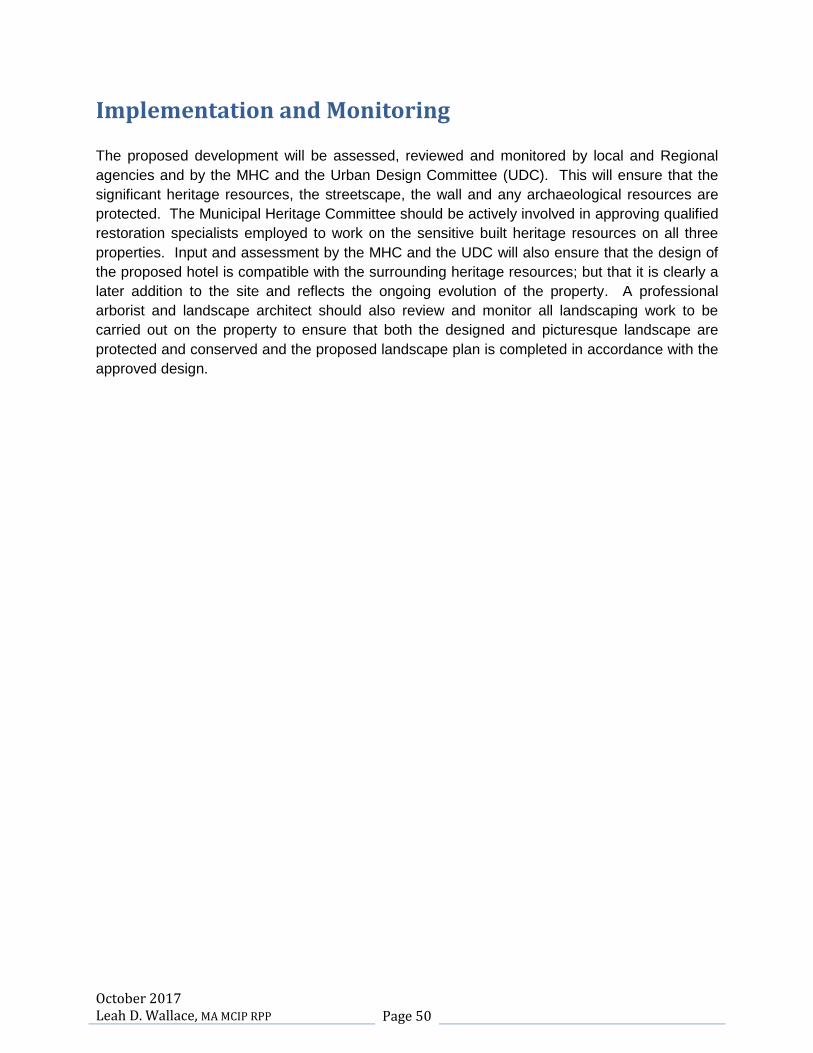
October 2017 Leah D. Wallace, MA MCIP RPP Page 50
Implementation and Monitoring
The proposed development will be assessed, reviewed and monitored by local and Regional
agencies and by the MHC and the Urban Design Committee (UDC). This will ensure that the
significant heritage resources, the streetscape, the wall and any archaeological resources are
protected. The Municipal Heritage Committee should be actively involved in approving qualified
restoration specialists employed to work on the sensitive built heritage resources on all three
properties. Input and assessment by the MHC and the UDC will also ensure that the design of
the proposed hotel is compatible with the surrounding heritage resources; but that it is clearly a
later addition to the site and reflects the ongoing evolution of the property. A professional
arborist and landscape architect should also review and monitor all landscaping work to be
carried out on the property to ensure that both the designed and picturesque landscape are
protected and conserved and the proposed landscape plan is completed in accordance with the
approved design.
October 2017 Leah D. Wallace, MA MCIP RPP Page 51
Conclusion and Conservation Recommendations
The question is not whether there is an impact on the properties at 144-176 John Street, 200
John Street and 588 Charlotte Street, which once constituted a major portion of the Rand
Estate, as a result of the hotel and subdivision development applications, since any and all
changes will have an impact. The question is whether there are any undue adverse impacts
resulting from the proposals.
The Rand Estate is a significant cultural heritage landscape that includes both important built
heritage resources, a naturalized picturesque landscape and a formal landscape designed by
the firm of Dunnington-Grubb, pioneers in the profession of landscape architecture in Canada.
The estate dates back to the founding of the Town and was owned by such significant early
citizens as Peter Russell, Governor Simcoe’s successor; William Dickson, a prominent lawyer
and merchant and member of the Legislative Council; General Lansing, a prominent New York
businessman and Civil War general, George Rand I and George Rand II, also prominent New
York businessmen who made a lasting impact on the estate; and Calvin Rand, who, with Brian
Doherty, founded the Shaw Festival.
The estate is indicative of the large lots and homes built by wealthy summer visitors in the late
19th and early 20th centuries. At one time it was a much more self-sufficient and cohesive entity
with a milkhouse, and stables. However, over the years the estate was subdivided and the
buildings on the site were adapted for other uses. Randwood became a year-round home for a
time and was used for institutional purposes with dormitories and an industrial kitchen. The
Coach House was used for storage and a residence for guests. The property at 200 John
Street was severed and the guest house was modernized and became a home for Calvin Rand.
The lot at 588 Charlotte was also severed and the stables became a home for descendants of
Evelyn Sheets. Significant landscape features were removed and the Lord and Burnham
greenhouse was dismantled and donated to Willowbank. Though it may be restored and rebuilt,
it has lost its context as it relates to the Rand Estate.
The gatehouse and stone entryway became an enclave of private homes. The milkhouse
became a private home and is now part of the small subdivision known as Weatherstone Court.
Christopher Court was also developed as a small subdivision. The hotel/restaurant and the
proposed subdivision mark the continued evolution of the site. Only the wall remains as an
important artifact that continues to delineate and define the full extent of the Rand Estate.
Over the years there have been adverse impacts on the property at 144-176 John Street as a
result of neglect. The remaining core of the Rand Estate has deteriorated over the past few
years. Trees have fallen and been left to decay; the gardens are overgrown; the wall which
defines the estate is covered in ivy, the concrete is cracking and the bricks and cobbles require
repointing, replacement and repair; and buildings such as Randwood and the Sheets (Devonian
House) are in need of repair. A good adaptive reuse, that results in minimal impact will ensure
the survival and conservation of the cultural landscape and built heritage resources.

October 2017 Leah D. Wallace, MA MCIP RPP Page 52
Based on an analysis of the significant heritage attributes of the property at 144-176 and the
impacts of the proposed development have been assessed. Significant built heritage resources
adjacent or close to the proposed development and on the Rand Estate will not be unduly or
adversely impacted. Views from the Commons, a cultural landscape of national significance,
into the development will mitigated by the location of the hotel to the rear of the property and will
be screened by both the existing wall and the mature trees. The proposed hotel is sensitive to
the significant heritage resources on the property and has been located in an area where it will
have the least impact on those resources and on the cultural heritage landscape. All heritage
resources comprising this landscape, including the Dunnington-Grubb design and landscape
features, the built heritage resources and the picturesque natural landscape, which have been
neglected in recent years, will be repaired, restored if necessary, and conserved.
The existing buildings and structures on 200 John Street and 588 Charlotte Street have been
assessed. While they were once part of the estate, they have lost much of their contextual
value. Until now they have not been assessed and have not been identified by the Town as
having significant heritage value. As with 144-176 John Street, there are indications of
deterioration as they relate to the garage, the pool house, the tea house and the wall. Those
features that have been determined in this heritage impact assessment to be of significant
heritage value, such as the tea house and pool pavilion, which are remnants of the Dunnington-
Grubb landscape design, and the stone wall which defines the full extent of the original Rand
Estate, have been recommended for conservation, repair and, where necessary, relocation as
close to their original site as possible.

October 2017 Leah D. Wallace, MA MCIP RPP Page 53
Appendices
Appendix I Designation By-law 1971-88 – 9 Weatherstone Court
Appendix II Official Plan Amendment 51 – Randwood Estate
Appendix III Zoning By-law Amendment 4316T-11 – Randwood Estate
Appendix IV Dunnington-Grubb Plant List
Appendix V Draft Statement of Significance – The Rand Estate
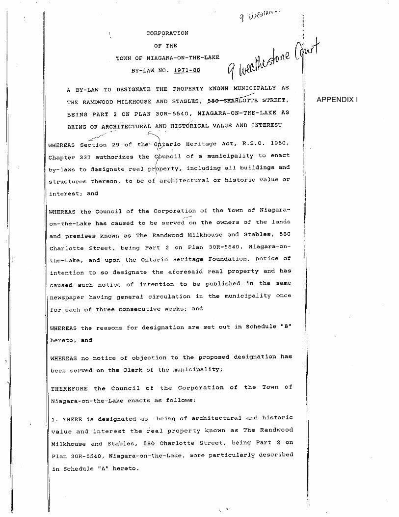
APPENDIX I


APPENDIX II

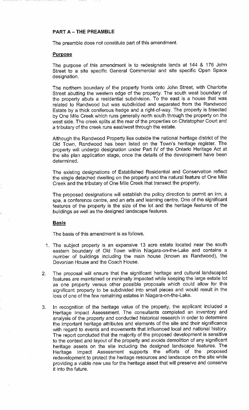

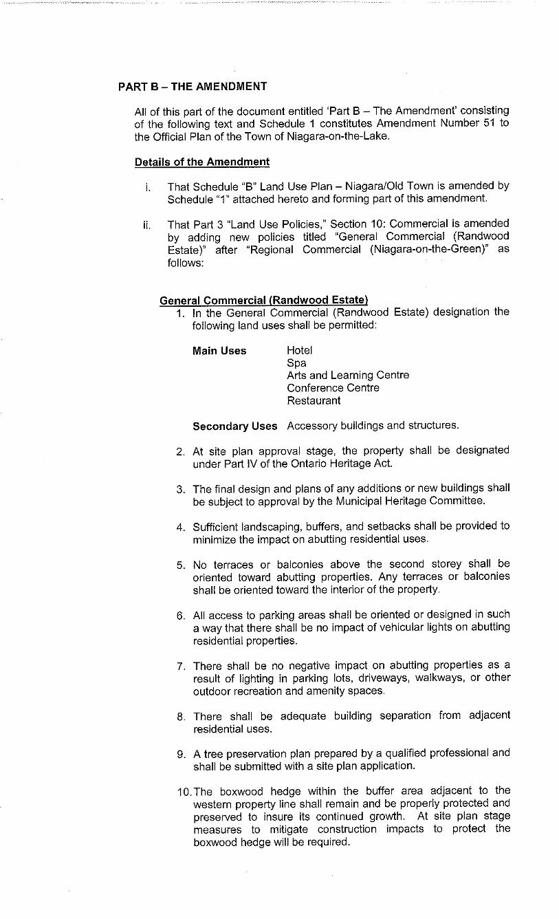
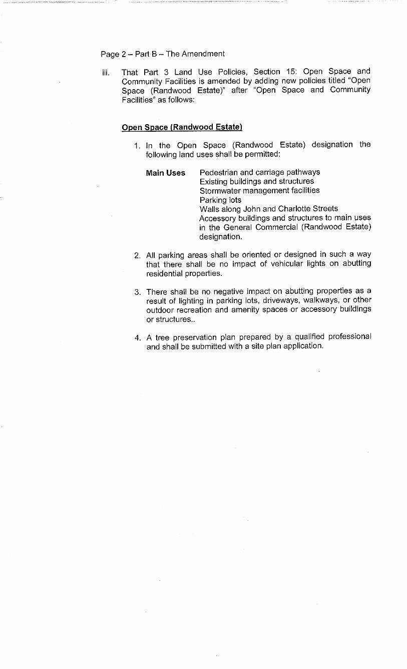

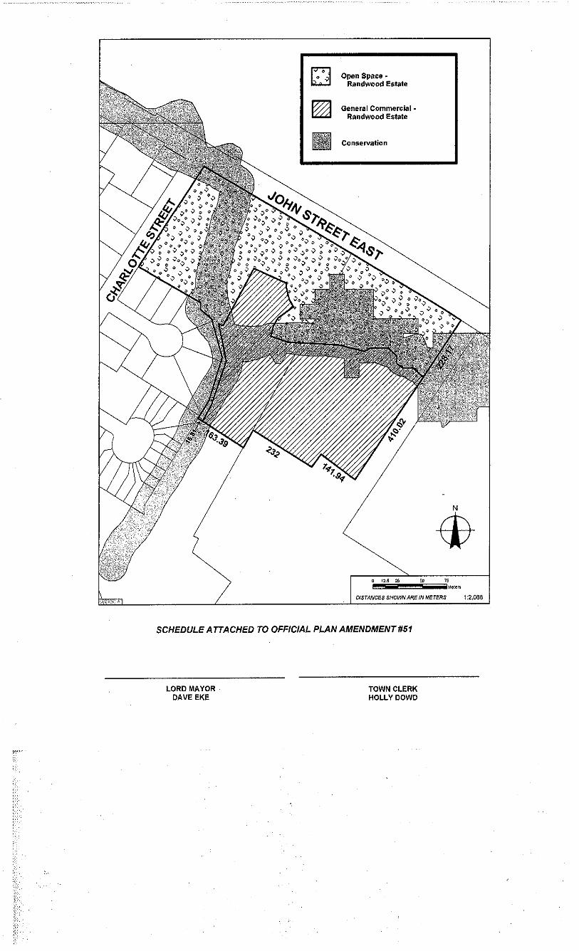
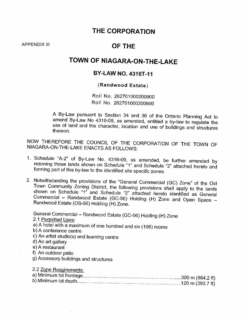
APPENDIX III


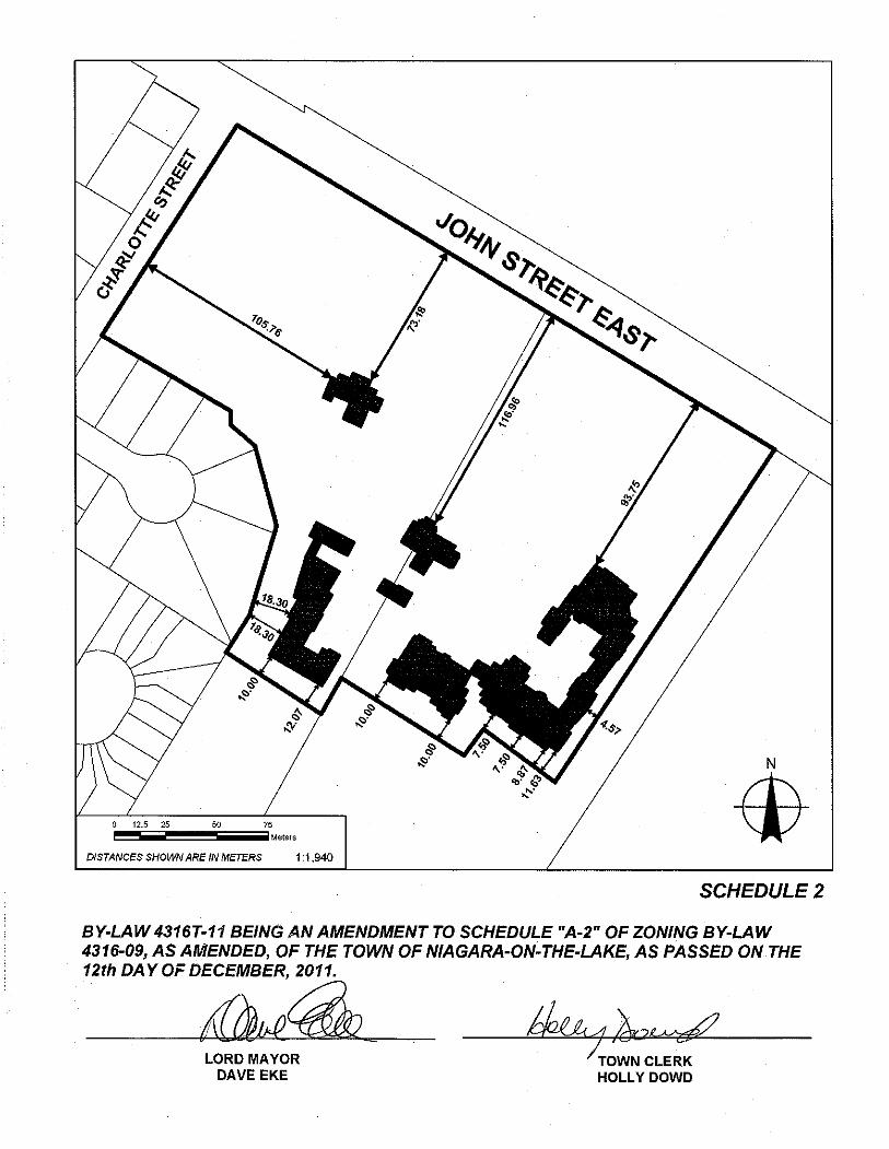
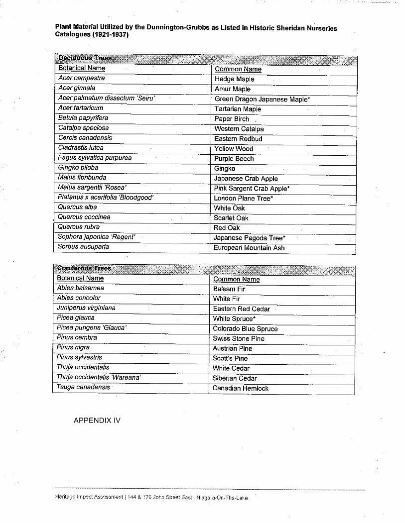
APPENDIX IV


Appendix V – Draft Statement of Significance – The Rand
Estate – 144-176 John Street, Niagara-on-the-Lake
The Rand Estate is a 5 hectare estate lot located on the south side of John Street between
Charlotte Street and the Niagara River Parkway. It is a significant cultural heritage landscape
that includes important built heritage resources, a formal designed landscape and a natural or
picturesque landscape.
The estate dates back to the founding of the Town and was owned by such important early
citizens as Peter Russell, Governor Simcoe’s successor and William Dickson, a lawyer and
merchant and member of the Legislative Council. Later summer residents included General
Lansing, a prominent New York businessman and Civil War general, George Rand I and
George Rand II, New York businessmen and philanthropists who made a lasting impact on the
estate; and Calvin Rand, who, with Brian Doherty, founded the Shaw Festival.
The estate is indicative of the large lots and homes built in Niagara-on-the-Lake by wealthy
summer visitors in the late 19th and early 20th centuries. There are three (3) significant buildings
on the property and two (2) garden structures.
1. Randwood, the original summer home. This brick building may contain portions of the
William Dickson house destroyed in the War of 1812-14. It has a mansard roof and
characteristics of both the Second Empire and Italianate Villa styles. It has been
considerably altered by a number of owners of the years.
2. The Coach House is the oldest of the three (3) buildings and may have been constructed
by descendants of the William Dickson. It is Gothic Revival in style and was altered in
the late 20th century.
3. The Sheets (Devonian) House was constructed in 1922 for Evelyn Rand on the occasion
of her marriage to Henry Sheets. It is Colonial Revival in style and retains many original
interior details, particularly on the main floor.
4. The brick pavilion and the wooden gazebo are significant structures that contribute to the
picturesque cultural heritage landscape.
The property is enclosed on two (2) sides by a concrete and stone wall punctuated by brick
pillars and two entrance gates, the main gate with its elaborate wrought iron details, and the
gate leading to the Sheets (Devonian) house. The wall is a significant component of the
cultural heritage landscape.
The Rand Estate contains remnants of a formal landscape designed by the firm of
Dunninton-Grubb, pioneers in the profession of landscape architecture in Canada and
founders of Sheridan Nurseries, who designed the landscapes for University Avenue in
Toronto and Oakes Gardens in Niagara Falls. The natural or picturesque landscape

includes One Mile Creek and many unusual specimen trees and plants and native species.
At one time the estate was a much larger, more self-sufficient and cohesive entity with a
milkhouse, and stables which survives as a private home; but is now separated from the
property.
Description of Heritage Attributes
Key heritage attributes that reflect the Rand Estates importance as both a designed and
natural or picturesque landscape indicative of the early settlement of the Town and the influx
of wealthy summer residents in the late 19th and early 20th centuries include:
The concrete, brick and stone wall and entrance gate;
The three extant buildings on the property – Randwood, the Coach House and the
Sheets (Devonian House);
The brick pavilion and the gazebo;
The designed Dunnington-Grubb landscape including the walkway, lily pond,
sculpture, stone bridges and walls and any remaining shrubs or plantings;
Remnants of the picturesque natural landscape including mature native and
specimen trees, plants and shrubs; and
The boxwood hedge.

October 2017 Leah D. Wallace, MA MCIP RPP Page 54
Bibliography
Books
Blumenson, John Ontario Architecture: A Guide to Style and Building Terms 1784 to the
Present. Fitzhenry and Whiteside, 1990.
Kalman, Harold A History of Canadian Architecture, Volume 1. Toronto, Ontario: Oxford
University Press, 1994
Macrae, Marion and Anthony Adamson The Ancestral Roof, Domestic Architecture in Upper
Canada. Toronto, Ontario. Clark Irwin and Company Limited, Reprinted 1967.
McAlester, Virginia and Lee A Field Guide to American Houses. New York, N.Y. Alfred A.
Knopf, 1997.
Merritt, Richard D. On Common Ground, The Ongoing Story of the Commons in Niagara-on-
the-Lake. Toronto, Ontario. Dundurn, 2012.
Stokes, Peter. Old Niagara-on-the-Lake. Toronto, Ontario. University of Toronto Press, 1971.
Articles
Ontario Heritage Trust. Cultural Heritage Landscapes – An Introduction.
Ormsby, Joy. Niagara Institute Property, Background History, First Draft for Board of Directors,
Niagara Historical Museum Papers, May 1989.
Stokes, Peter. Randwood Report, Niagara Historical Museum Papers, July 1989.
Websites
Wikipedia. “Lorrie Dunnington-Grubb”, en.wikipedi.org/wiki/Lorrie_Dunnington-Grubb, Retrieved
August 2017.
Sheridan Nurseries. A Brief History of Sheridan Nurseries,
www.sheridannurseries.com/about_sheridan_nurseries/company_history , Retrieved August
2017.