heritage impact assessment - ecoafrica · heritage impact assessment ... especially cyanobacteria....
TRANSCRIPT
Heritage Impact Assessment
Taung Skull World Heritage Site
Status Quo Report
February 2015
EcoAfrica Environmental Consultants (Gauteng) Pty Ltd, 428 Farenden Street, Clydesdale, Tshwane 0002.
E-mail: [email protected]; [email protected]
Web: www.ecoafrica.co.za

ii
Vision for the Taung Skull World Heritage Site1
To ensure that the World Heritage and other multiple natural and cultural values of the Taung Skull
World Heritage Site are understood, conserved, protected, respected and shared by all.
1 From; The Integrated Management Plan for the Taung Skull World Heritage Site 2010 - 2015.

iii
Table of Contents
Terms, Concepts and Definitions ...................................................................................................... iv
Acronyms ......................................................................................................................................... vi
1. Introduction .............................................................................................................................. 7
2. Scope of Work ........................................................................................................................... 9
3. Methodology ........................................................................................................................... 10
4. Site Locality ............................................................................................................................. 11
5. Current Site Description ........................................................................................................... 13
6. Current Site History ................................................................................................................. 19
7. Review of Management Documents ........................................................................................ 22
8. The Cultural Landscape ............................................................................................................ 26
9. Status Quo on Heritage Resources and Attributes .................................................................... 27
10. Site Zonation and Conceptual Development Plan ................................................................. 35
11. Status Quo Remarks ............................................................................................................. 38
12. Way Forward ....................................................................................................................... 41
References ...................................................................................................................................... 43
Appendix 1: Status Quo Photographs .............................................................................................. 44
Appendix 2: Area Sketch Plans ......................................................................................................... 45
List of Figures
Figure 1: Locality Diagram of Core Area and Buffer Zone with roads to Villages and Taung .............. 12
Figure 2: North view of Dart’s Pinnacle (left) and Hrdlička’s Pinnacle (right) .................................... 14
Figure 3: Site Boundary.................................................................................................................... 15
Figure 4: Buffer Zone ....................................................................................................................... 16
Figure 5: Existing Site Plan ............................................................................................................... 17
Figure 6: Site Zoning Plan ................................................................................................................ 36
Figure 7: Site Analysis & Conceptual Development .......................................................................... 37
List of Tables
Table 1: Timeline of Key Events related to the Taung Skull World Heritage Site ................................. 8
Table 2: Summary of TSWHS Management Documents ................................................................... 22
Table 3: Heritage Layers comprising an Interpretation of the Cultural Landscape ............................ 26
Table 4: Status Quo on Heritage Resources and Attributes .............................................................. 28

iv
Terms, Concepts and Definitions
Authenticity and Integrity Authenticity and Integrity are aspects of related to the quality of heritage that
may be protected within a World Heritage Site or other heritage site. Such
heritage may date from a specific period of time relevant to the significance of
the site. A site may not be intact, but it could still be authentic. A ruin with
most of its fabric missing, for example, may be authentic because it has not
been overlaid or distorted by subsequent layers. Memory and documentation
can also be authentic (although not necessarily accurate), because it derives
from the period under study or from someone who had direct experience of an
event. For conservation purposes, neither authenticity nor integrity may be
adversely affected.
Australopithecus africanus The African Ape of Southern Africa, a new name given to the discovery by Dr
Raymond Dart in 1924, as a result of the discovery of the Taung Child Skull
Fossil at the subsequently named Dart Pinnacle, in Buxton Quarry.
Breccia A specific kind of rock found within tufa. It is made up of calcrete – a mix of
sand, gravel, clay, bones and other material cemented together by calcium
carbonate. This rock forms in cavitous areas that occur or occurred in tufa in
the past. These holes or caverns are then filled with loose material such as
bones, pebbles and sediment and with time become cemented in the same
matrix of calcium carbonate. Mineworkers referred to this material as ‘impure
limestone’ and the Taung Skull was blasted out of this kind of rock during mine
operations in 1924.
Bioturbation The burrowing by small mammals, insects and termites that disturb
archaeological deposits.
Cercopithecus fossils A fossil grouping related to old world primate fossils linking to the origins of
humankind and Apes from Africa.
Chert A rock type that is a fine-grained silica-rich sedimentary rock that may contain
small fossils. It varies greatly in colour, from white to black, but most often
manifests as gray, brown, greyish brown and light green to rusty red. Its colour
is an expression of trace elements present in the rock, and both red and green
are most often related to traces of iron in its oxidized and reduced forms
respectively.
Hyracium Rock rabbit dung deposits that contain valuable information of the past.
Koekepanne Small rail trolleys used in the mine for the transport of limestone.
Palynology The study of the fossil pollens.
Paranthropus A genus of extinct hominids that were bipedal and probably descended from the Australopithecus hominids 2.7 million years ago. Members of this genus are characterised by robust craniodental anatomy, including gorilla-like sagittal cranial crests, which suggest strong muscles of mastication, and broad, grinding herbivorous teeth. However, Paranthropus skulls lack the transverse cranial crests that are also present in modern gorillas.

v
Phragmites beds A common reed that grows in river beds and proliferates when water has been
nutrient enriched. Also an effective reed when used in the bio-purification of
freshwater systems.
Phytoliths A rigid, microscopic structure made of silica, found in some plant tissues and persisting after the decay of the plant. These plants take up silica from the soil, whereupon it is deposited within different intracellular and extracellular structures of the plant. Phytoliths come in varying shapes and sizes and it commonly refers to siliceous plant remains.
Outstanding Universal Value Outstanding universal value means cultural and/or natural significance, which
is so exceptional as to transcend national boundaries and to be of common
importance for present and future generations of all humanity. As such, the
permanent protection of this heritage is of the highest importance to the
international community as a whole.
Sangomas Traditional healers in South Africa that practice traditional African medicine.
They fulfil different social and political roles in the community, including
divination, healing physical, emotional and spiritual illnesses, directing birth or
death rituals, finding lost cattle, protecting warriors, counteracting witches,
and narrating the history, cosmology, and myths of their tradition. These
healers are effectively South African shamans who are highly revered and
respected in a society in which tradition lives and in which illness is believed to
be caused by witchcraft, pollution (contact with impure objects or occurrences,
recognised in the form of taboos) or through neglect of ones the ancestors.
Speleothems Cave deposits or formations that are a secondary form of mineral deposit
formation in a cave. Speleothems are formed in limestone caves and consist of
stalagmites and stalactites, as well as flowstone, for instance.
Stromatolites Or stromatoliths, a mattress strata or rock, are layered bio-chemical
accretionary structures formed in shallow water by the trapping, binding and
cementation of sedimentary grains by biofilms (microbial mats) of
microorganisms, especially cyanobacteria. Stromatolites provide ancient
records of life on Earth within the fossil remains of which might date from
more than 3.5 billion years ago.
Toponyms The study of the history and root associations of place names. Many place
names provide insight into the history of a certain place or object, as well as a
certain link in time back to a specific event, cultural ritual and/or group of
people, for example.
Tufa Massive deposits formed over millions of years by the precipitation of calcium
carbonate rich water flows. Water percolating through the dolomite of the
Ghaap Plateau allows it to build up the chemicals necessary for the
precipitation of tufa. This process is still happening, and the river provides a
modern analogue of tufa formation. It is interesting to note that filamentous
algae and mosses growing on the edge of pools are important in facilitating the
precipitation process.

vi
Acronyms
DACERD Department of Agriculture, Conservation and Environment of the North
West Province
FHSSA The Fossil Hominid-bearing Sites of South Africa
HIA Heritage Impact Assessment
HMP Heritage Management Plan
IKM International Knowledge Management
IMP Integrated Management Plan
LED Local Economic Development
NHRA National Heritage Resource Act
OUV Outstanding Universal Value
READ Rural, Environmental and Agricultural Development of the North West
Province
SAHRA South African Heritage Resource Agency
SDF Spatial Development Framework
TSWHS Taung Skull World Heritage Site
UNESCO United Nations Educational, Scientific and Cultural Organisation
VIA Visual Impact Assessment
WHL World Heritage List
WHS World Heritage Site

7
1. Introduction
The Taung Skull World Heritage Site (TSWHS) was inscribed on the World Heritage List (WHL) in
2005, under United Nations Educational, Scientific and Cultural Organisation (UNESCO) Cultural
Criteria (iii) and (vi), as an extension to the serial nomination of the Fossil Hominid Sites of
Sterkfontein, Swartkrans, Kromdraai and Environs. The serial nomination extension also included the
Makapan Valley in Limpopo Province, under the extended World Heritage property named ‘The
Fossil Hominid-bearing Sites of South Africa’ (FHSSA).
The Management Authority for the TSWHS is the Department of Rural, Environmental and
Agricultural Development (READ) of the North West Province. As a World Heritage Site, the site’s
Outstanding Universal Value (OUV), Authenticity and Integrity must be protected and maintained
when considering development on and around the site, and a carefully conducted Heritage Impact
Assessment (HIA), in terms of the National Heritage Resources Act (No. 25 of 1999), will go a long
way to ensure that this is the case. Landownership for the TSWHS falls under Batlhaping Da Ga
Phuduhucwana Tribal Authority, currently under the leadership of the Paramount Chief Tsepo
Mankuroane and local Chief Lekwene.
The FHSSA contain fossils that have enabled the identification of several specimens or early
hominids, more particularly of Paranthropus, dating back between 4.5 and 2.5 million years, and
show evidence of the domestication of fire 1.8 to 1 million years ago. Of prime importance to Taung
is the fact that the TSWHS has locality status, meaning it is the first place in the world where a fossil
of the species Australopithecus africanus, the African Ape of Southern Africa, was found and now
known as the Taung Child. The site was occupied by Stone Age people for a fair portion of the past
100 000 or more years, with evidence from over a dozen significant archaeological and
palaeontological sites. Some of these sites have yielded fossil human remains, as yet undescribed.
Precambrian fossils entombed in the dolomitic country rock are a staggering 2.2 billion years old.
Today the site is still used for traditional purposes where local Sangomas and Rastafarians make use
of sacred sites, such as the healing waters of the Blue Pools and Ochre Cave. The site hosts living
traditional culture, wide open vistas over an expansive landscape, the Thabasikwa River gorge with
soaring Black Eagles and a lively troop of resident baboons. The site is also traversed daily by the
local villagers from Tamasikwa on the Buffer Zone edge.
The leading management document for the TSWHS is the Integrated Management Plan (IMP) for
2010 – 2015. The IMP holds the Vision for the Taung Skull WHS being, ‘To ensure that the World
Heritage and other multiple natural and cultural values of the TSWHS are understood, conserved,
protected, respected and shared by all.’ Further work is required to strengthen the management and
development of the TSWHS, as defined through the Vision. Further documentation supporting the
IMP and effective management of the site, are the Conservation Management Plan 2004, as well as
the Cultural Heritage Resources Survey 2003.
Various activities have been related to the discovery, research, management and development of
the Taung Skull WHS over time, and Table 1 provides a timeline of key events leading up to the
current time of compiling this Status Quo Report.

8
Table 1: Timeline of Key Events related to the Taung Skull World Heritage Site
Date Event
1919 Seven or eight small monkey or baboon skulls discovered and sent to the South African Museum in Cape Town.
1920 A paper on these fossils was read before the Royal Society of South African by SH Haughton on 20 May.
1924 In November M de Bruyn, a quarry man, employed at the Buxton Lime works, blasted out of one of the pinkish “impure limestone” deposits, a petrified skull and associated endocranial cast, which seemed to him to be much larger than those of the fossil baboons that he had previously recovered.
1924
RB Young, professor of Geology at the University of the Witwatersrand, brought them to Johannesburg, and handed them to Dr Dart on 28 November. The large endocast and skull fragments, embedded in the pinkish breccia, were a new discovery of a hominid then named Australopithecus africanus.
1925 - current
Since 1925, sporadic research has revealed a wealth of other palaeontological and archaeological
deposits, many of which are still unexplored. For a long time little was done to disseminate this
evidence more widely, either amongst local people or amongst visitors.
1991 - 2003
A number of specialist studies, relating to cultural heritage resources, legal considerations and tourism were completed. Studies concentrated on the development of the site and its environs, including plans for scientific work, and tourism development.
1992 The Taung Heritage Trust was launched on 10 April.
1992 The Interpretation Master Plan and Taung Monument Redevelopment Proposals were compiled.
1997 The Concept Plan for Sustainable Tourism Development in the District of Bophirima was compiled.
1998 A Strategic Marketing Plan for the North West Parks and Tourism Board was completed.
1998 The North West Tourism Master Plan was adopted.
2000 The North West Tourism Implementation Programmes were established.
2000 The Taung Local Tourism Development Zone was consolidated.
2001 The Development Plan for the Taung Heritage Centre was compiled.
2003 The Cultural Heritage Resources Survey for TSWHS was completed.
2004 The Taung Skull National Heritage Site is established.
2004 The Conservation Management Plan and a Nomination Dossier, proposing the site’s inscription on the World Heritage List submitted to UNESCO.
2005 The TSWHS was inscribed as a World Heritage Site, which took place in Durban in July.
2008 A Business Plan for the Taung Skull World Heritage Site was completed.
2010
The Taung Skull World Heritage Site Integrated Management Plan (IMP) 2010 - 2015 Biodiversity Report, Socio-Economic Impact Assessment, Tourism Marketing Plan, and Water Management Plan were completed.
2010 - 2015
Construction of the access road through TSWHS, the Blue Pools picnic area, the road upgrade to Thomeng, and the replacement of the fence on the border to the site.
In a fast developing country like South Africa, with increasing pressures on land, the task of
preserving heritage has become more important than ever – today we have tools to assess and
mitigate impacts on heritage and these need to be applied wherever negative impacts may occur, as
a result of current and possible future developments, operations and/or other changing
9
circumstances. Therefore, the Department of Rural, Environmental and Agricultural Development of
the North West Province (READ) appointed EcoAfrica Environmental Consultants (Gauteng) Pty Ltd,
hereafter referred to as EcoAfrica, to conduct a Heritage Impact Assessment (HIA), including a Visual
Impact Assessment (VIA) for the Taung Skull World Heritage Site, in the North West Province of
South Africa.
Of critical importance in the management and development of the site is the protection of the visual
landscape, intricately linked to the site’s OUV. Activities and development within the defined Core
Area and Buffer Zone should abide by all legal provisions and be well considered in terms of the
requirements of the Integrated Management Plan (IMP) 2010 for the TSWHS. Guidelines for the
construction, expansion and maintenance of buildings and other structures in and around the site
are also required. Protection of the visual landscape implies consideration of changes in land use
both within the Buffer Zone, as well as outside the Buffer Zone – what may be referred to as a
transitional area. VIA thus forms an integral part of the HIA, in order that vistas of, and from, the
TSWHS are well protected. Such visual linkages will also have to be well defined in the planning
guidelines like the Spatial Development Framework (SDF) of the local municipality.
2. Scope of Work
The scope of work and objectives set out in the Terms of Reference, issued by the Department of
Rural, Environmental and Agricultural Development (READ) of the North West Provincial
Government, requires the following outcomes for this consultation:
a) Status Quo Report;
b) Heritage Impact Assessment Report (including Visual Impact Assessment); and
c) Heritage Management Plan (HMP) for Site Development.
The Status Quo Report includes broader considerations of the significance of the heritage resources
and attributes of the site, and provides comment on the status of conservation of these resources.
These heritage resources and attributes will be introduced in various heritage layers, together
comprising a framework for a cultural landscape map of the TSWHS. This Status Quo Report also
considers the status quo of planning and development on the TSWHS.
The Status Quo Report is not an exhaustive report. It functions as a process document that points
the way to further investigation and analysis that may be necessary in order for a robust Heritage
Management Plan to be compiled. Its purpose is to provide a starting point for the current work that
will lead to a comprehensive HMP.
‘Status quo’ refers to the current status of the full gamut of aspects of the TSWHS that have a
bearing, indirectly or directly, on the heritage embodied in this site. It is that status quo that will
need to be improved upon, and for which mechanisms and tools will be built into the HMP, to
ensure that the heritage and the site which contains it, enjoys the maximum protection. It is
expected that the understanding of the status quo will deepen as the work progresses, and more
relevant aspects to what should be taken into account in the development of a HMP are revealed. It

10
is therefore a work in progress, the essential contents of which will eventually find their way into the
Heritage Management Plan.
The Heritage Impact Assessment (HIA) Report will assess and detail the impact of the proposed
development plans on the TSWHS cultural landscape, including impacts on the visual landscape.
Alternatives may need to be explored in terms of proposed land uses, the location of proposed
plans, alternative design concepts and the approach taken to the development of the site, for
instance. Mitigation measures also need to be identified that will reduce negative impacts on
heritage resources, as well as ways and means found to enhance positive benefits.
The Heritage Management Plan (HMP) will detail measures that need to be implemented during the
pre-construction, construction and post-construction phases of implementation, to ensure that
heritage resources and impacts related thereto are optimally managed during development.
Avoidance of negative heritage impacts must be sought, or where this is not possible, minimising
such negative impacts should be considered if the OUV of the site is not threatened. Site monitoring
and reporting is a critical task to ensure the effective implementation of development plans.
The Heritage Impact Assessment (HIA) should consider, inter alia, changes in land use (past, current
and future land uses), and the impact this may have on the heritage. Physical changes in the
landscape, like changes to buildings or addressing light pollution in the nightscape need to be
considered. Action needs to be taken; retroactively, if necessary, to remove significant negative
heritage impacts and restore the Authenticity and Integrity of the site. A list of such negative impacts
that may have occurred since inscription should be compiled and monitored, with intervention
proposed where necessary. Densification and the construction of new buildings in the landscape are
also factors that need to be taken into account when considering the impacts on the cultural
landscape, represented by the TSWHS.
3. Methodology
The methodology for carrying out the status quo study was as follows:
a) Literature review and site work have been conducted in order to determine the full range of
heritage resources and attributes related to the TSWHS. A cultural landscape mapping
framework is further clarified through presenting the various heritage layers and values
attributed to the site. Such heritage layers can be further mapped over time and in a
participatory manner, in order to build cohesion amongst stakeholders, create deeper
meaning of the site amongst stakeholders, and strengthen identification with the site and
the heritage it holds.
b) The detailing of the visual landscape attributed to the site will be initiated through
identifying critical view points, view sheds and view lines. The visual landscape as
documented at this point in time, provides a baseline against which to assess the visual
impact of any change in land use, and to manage landscape restoration retroactively, where
appropriate.
c) Site work has been conducted to identify and assess the state of conservation of heritage
resources and attributes.
11
d) Discussions have been held with the TSWHS Steering Committee and site staff, to assess the
status quo of management on the site.
It is well noted that synergies between the Heritage Impact Assessment and TSWHS Support Project,
implemented by International Knowledge Management (IKM), are already in play. Similarly to IKM,
EcoAfrica will also work hand-in-hand with the Management Authority, stakeholders and the local
community.
It is also proposed that at least one person from the Taung area should be included as part of the
EcoAfrica and IKM team, and preferably the same person. This is for the purposes of mutual capacity
and knowledge transfer, as part of our strategy of leaving behind the necessary capacity, in terms of
skills and knowledge that can continue to serve READ, even after the end of the project. There was
an agreement between both parties that the local candidates would be sourced by READ, on behalf
of IKM according to criteria provided by IKM.
4. Site Locality
The Taung Skull World Heritage Site is located in the south-western part of the North West Province
in Ward 12 of the Greater Taung Local Municipality. Situated within the Dr Ruth Segomotsi Mompati
District Municipality, the site lies approximately 10 kilometres (km) north of the provincial boundary
of North West Province and Northern Cape Province, approximately 15 km south-west of Taung, and
approximately 12 km from the N18 National Road (refer to Figure 1).
The TSWHS lies to the eastern side of the village of Buxton and contains a section of the Thabasikwa
River valley that drops off the escarpment of the Ghaap Plateau. The closest town is Taung, which is
approximately 25 km from the site and is connected to the site via the N18, R372 and a rural road.
The closest airport to the site is Kimberley, which is approximately 150 km from the site. The
provincial capital is Mafikeng which is approximately 240 km from the site.
The TSWHS is in fair proximity to the N18, which links the Northern Cape with Vryburg and Mafikeng
in the North West Province, but is not regarded as a national road that is used by many tourists. This
emphasises the fact that the TSWHS is ‘off the beaten track’. As such the rural location of the site
can also be used as an advantage to escape the rapid pace of modern living and reflect on the origins
of humankind.

12
Figure 1: Locality Diagram of Core Area and Buffer Zone with roads to Villages and Taung
Taung
Mokassa
Lokamonna
Tamasikwa
Takaneng
Thomeng
Draaihoek
New Town
Buxton
Norlim
Taung Dam
Core Area
5km 10km Scale Bar
Harts River
Valley
Reivilo
Hartswater
Vryburg
N
Buffer Zone

13
5. Current Site Description
The Integrated Management Plan (IMP) for the Taung Skull WHS, for the period 2010 to 2015, is the
leading heritage management document for the site, in which the site is described generally and in
more specific detail.
General Site Description
The Taung Skull Fossil Site is situated within a vast abandoned limestone quarry (the Buxton Lime
Works), excavated into a series of ancient tufa deposits, which have formed along the flank of the
Ghaap Escarpment, just west of the Harts River, 17 km south-west of the town of Taung in the North
West Province of South Africa. The famous Taung Child Skull, named as a new species at the time,
Australopithecus africanus, was blasted by Lime Workers from a pink stony breccia fissure filling in
the oldest of the tufa deposits, the Thabaseek Tufa, in 1924.
The Core Area boundary of TSWHS includes the entire Buxton Lime Works Area (refer to Existing Site
Plan), because there remain numerous other fossiliferous deposits, some of them as yet unexplored,
within the fenced area defining the quarry. The diagram of the Proclamation Area and the 41
beacons, defining its outline, are presented on the Site Boundary map. The size of the Core Area is
158.7429 hectares (ha), and includes the full extent of the former lime works, together with the
associated lime-burning kilns, industrial buildings and mine compound. The entire Core Area falls
within the remainder of the property, Taung 894 HN, and is on state-owned land which falls under
the sphere of influence of the Greater Taung Municipality and the local Batlapeng Tribal Authority.
The Buffer Zone surrounding the Core Area is 3,383 ha in extent, and includes other archaeological
sites which fall outside the boundary of the Core Area (refer to Buffer Zone Map). The Buffer Zone
partly includes New Town, Norlim, Draaihoek, Mokassa, Lokammona, Tamasikwa, as well as other
villages in closely proximity, being Takaneng and Thomeng. This Buffer Zone preserves the rural
ambience and setting of the Taung Skull Fossil Site by preventing undesirable land use, which may
impact on the Integrity and Authenticity of the site, as described through its outstanding universal
value. The Buffer Zone is state-owned land which falls under the sphere of influence of the Greater
Taung Municipality and the local Batlapeng Tribal Authority.
Detailed Site Descriptions
The sites of palaeontological and archaeological importance have detailed descriptions, while other
sites of heritage significance within the Core Area remain to be further described.
Sites of Palaeontological Importance
The Taung Skull Fossil Site at the Buxton Lime Works is best known for the 1924 discovery of the
type specimen of Australopithecus africanus. The remains of the facial skeleton and endocranial cast
of this early hominid child were the first fossils to confirm Darwin’s assertions in 1859 that human
ancestry probably could be traced to Africa. The discovery inspired 80 years of exploration and

14
excavation in Africa, yielding hundreds of fossils from southern, eastern, and central Africa that trace
the evolution of humans and their ancestors for as much as 6 million years.
The tufa accretions of the Buxton Lime Works are riddled with fossil sites sampling the Pliocene and
Pleistocene fauna, dating back several million and hundreds of thousand years. Most of these sites
have not been excavated, and thus have potential for future research to investigate long term
ecological changes in an area at the edge of the Ghaap Escarpment.
The Taung Skull discovery site comprises two localities near the monument cairn, each of which has
multiple deposits. The Hrdlička deposits have yielded primarily cercopithecid fossils, along with a
sampling of numerous other species. The Dart deposits are somewhat older, and have been
postulated to be the remains of the cave infill from which the Australopithecus fossil came.
The main palaeontological sites are Hrdlička Deposits, Dart Deposits, Tobias Pinnacle Deposit, Berger
Cave Complex, Lucky Moon Cave, LSN Cave, Innominate Cave, Quinney Cave, Cut-Through Alley,
Black Earth Cave, Peabody’s Equus Site, Equus Cave, Blom Cave, Satan Cave, Alcove Cave, Oxland
Large Mammal Site and Acacia Cave2.
2 The Cultural Heritage Resource Survey of 2004 provides a comprehensive list of currently documented and widely known and specific sites within Taung Skull WHS that are currently being research by a variety of institutions, including the University of Witwatersrand, whom were involved in the initial identification and naming of Australopithecus africanus, the African Ape of Southern Africa.
Figure 2: North view of Dart’s Pinnacle (left) and Hrdlička’s Pinnacle (right)

15
Figure 3: Site Boundary

16
Figure 4: Buffer Zone

17
Figure 5: Existing Site Plan
18
Sites of Archaeological Importance3
Intermittent fieldwork over the past six decades at the TSWHS has shown that it was occupied by
Stone Age peoples for a fair portion of the past hundred or more millennia, with arguably the four
most important of the dozen known localities there being as follows:
Witkrans Cave has yielded Middle Stone Age artefacts and associated large mammal bones
including two to three undescribed modern human molars, all dated to the last 89 000 years
ago. This site falls outside the Core Area of the TSWHS. It is however included in the Buffer
Zone.
Black Earth Cave, where one of the three strata yielded a large fossil mammal fauna including
two modern human fragments that may be as old as or even earlier than those of the Witkrans.
Equus Cave where the deposits produced a vast 30 000 large mammal samples. Identification
representing 48 species, including modern human pieces, reflects its use for over 30 millenia as a
brown hyena maternity den.
Power House Cave, where Later Stone Age artefacts and associated large mammal bones relate
to an occupation between 3 700 and 2 000 years ago, which may therefore be the age of some
schematic paintings on its walls.
Sites of Mining, Historical or Other Cultural Heritage Importance
The Norlim Quarry at Buxton preserves a number of significant mining cultural imprints, in the form
of a mining village ghost town, relics of lime-burning kilns and other mining infrastructure. These all
add to site ambience and can be used to demonstrate the significance of mining activities in the
history of liberating the fossil story from its entombment in the limestone tufas.
The value of the story of Buxton and the discovery of the Taung Child, which was a radical shift in
thinking into the origins of humans at the time, can now in terms of UNESCO Criteria vi), bring
attention to the living cultural heritage amongst the people of the area, which presents a particular
authenticity related to rural living. Other heritage layers and attributes now need further
description, and through further research the history of scared sites and oral traditions, for instance,
can be further described and incorporated into the site history.
3 The Conservation Management Plan 2004 provides a good reflection of palaeontological and archaeological
sites documented at the time. Improved communication with current researches on the site is required in order to establish if any further sites are being researched and if any current information is available to deepen site understanding.
19
6. Current Site History
It is clear from the current site history4, as detailed below that the focus on the mining history as
related to the discovery of the Taung Child Skull was what makes this site of universal and
outstanding value and is thus inscribed as a WHS. There is a rich diversity to local traditions, pre-
mining history and sacred sites like Blue Pools, Thomeng Falls and Ochre Cave, for instance. Now a
deeper understanding of the TSWHS needs to be sought together with local stakeholders from
Buxton, Norlim, New Town, Draaihoek, Mokassa, Lokammona, Tamasikwa, Thomeng and Takaneng
located in, or alongside, the Buffer Zone. The history of the site is best broadened and deepened
together with stakeholders.
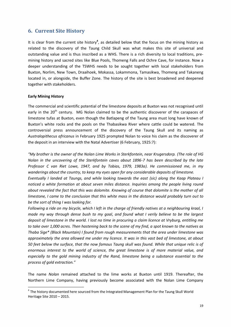
Early Mining History
The commercial and scientific potential of the limestone deposits at Buxton was not recognised until
early in the 20th century. MG Nolan claimed to be the authentic discoverer of the carapaces of
limestone tufas at Buxton, even though the Batlapeng of the Taung area must long have known of
Buxton’s white rocks and the pools on the Thabasikwa River where cattle could be watered. The
controversial press announcement of the discovery of the Taung Skull and its naming as
Australopithecus africanus in February 1925 prompted Nolan to voice his claim as the discoverer of
the deposit in an interview with the Natal Advertiser (6 February, 1925:7):
“My brother is the owner of the Nolan Lime Works in Sterkfontein, near Krugersdorp. (The role of HG
Nolan in the uncovering of the Sterkfontein caves about 1896-7 has been described by the late
Professor C van Riet Lowe, 1947, and by Tobias, 1979, 1983a). He commissioned me, in my
wanderings about the country, to keep my eyes open for any considerable deposits of limestone.
Eventually I landed at Taungs, and while looking towards the east (sic) along the Kaap Plateau I
noticed a white formation at about seven miles distance. Inquiries among the people living round
about revealed the fact that this was dolomite. Knowing of course that dolomite is the mother of all
limestone, I came to the conclusion that this white mass in the distance would probably turn out to
be the sort of thing I was looking for.
Following a ride on my bicycle, which I left in the charge of friendly natives at a neighbouring kraal, I
made my way through dense bush to my goal, and found what I verily believe to be the largest
deposit of limestone in the world. I lost no time in procuring a claim licence at Vryburg, entitling me
to take over 1,000 acres. Then hastening back to the scene of my find, a spot known to the natives as
Thaba Sige* (Black Mountain) I found from rough measurements that the area under limestone was
approximately the area allowed me under my licence. It was in this vast bed of limestone, at about
50 feet below the surface, that the now famous Taung skull was found. While that unique relic is of
enormous interest to the world of science, the great limestone is of more material value, and
especially to the gold mining industry of the Rand, limestone being a substance essential to the
process of gold extraction.”
The name Nolan remained attached to the lime works at Buxton until 1919. Thereafter, the
Northern Lime Company, having previously become associated with the Nolan Lime Company
4 The history documented here sourced from the Integrated Management Plan for the Taung Skull World
Heritage Site 2010 – 2015.

20
following a merger in about 1917, finally took over. It held the reigns until 1967 after which the
mining was undertaken under the name of Pretoria Portland Cement [PPC]. The kilns stopped
burning and the mine closed in 1977.
The site preserves remains and relics of almost the whole of the commercial and industrial part of
the mining village as well as some of the lime beneficiation infrastructure such as the bases of the
lime burning kilns. Unfortunately, after mining operations stopped, metal harvesting has resulted in
the total removal of the narrow gauge railway track as well as everything else that was made of
metal, including crushers and other mining installations. The result is that little sense can be made of
the remnant dumps, kilns, ore passes, and the like, and the visitor will gain little insight into the
processing of lime. It must be understood that the original site of the discovery it has not been
preserved because the entire history of the skull discovery is tied up with the story of lime
exploitation on a massive scale.
The history of the exploitation of the site as a large lime-quarry is therefore one of the first things
that the visitor should be informed of, and the entrance to the site should therefore be via the old
mining infrastructure at the foot of the hill. Another element supporting this suggestion is the sense
of arrival the visitor will experience after rounding the crest of the hill overlooking the Thabasikwa
gorge, particularly after traversing the rather bland landscape on the approach to the site from the
Mmabatho-Kimberley road.
Historical Events Leading to the Discovery of the Taung Skull
Cavitous areas occurred and still occur at several places within the various limestone tufas at Taung.
Some of these became filled with sediment and bones and other surface-derived materials such as
ostrich eggshell. In time, the pinkish or reddish patches of sediment became calcified to form rich
bone breccias: what the lime workers called impure limestone. It was from one such deposit that the
Taung fossil skull was discovered. Taung (formerly known as Taungs) is, therefore, the site of the first
discovery of the early hominid, Australopithecus africanus.
The first recorded discovery of fossilised bones at the Taung site was in 1919, when seven or eight
small monkey or baboon skulls were sent to the South African Museum, Cape Town. On 20 May,
1920, a paper on these fossils - very rare on the African continent - was read before the Royal
Society of South African by SH Haughton. Even at this early stage, Haughton suggested that these
extinct baboons “may extend back in point of time to a level contemporaneous with the early and
possibly pre-Pleistocene of Europe”. Then in November 1924, M de Bruyn, a quarry man employed at
the Buxton Lime Works, blasted out of one of the pinkish impure limestone deposits a petrified skull
and associated endocranial cast, which seemed to him to be much larger than those of the fossil
baboons of which he had previously recovered. The lime works manager, AE Spiers, saved the
specimen along with additional fossil baboon skulls.
A week or two later, RB Young, professor of Geology at the University of the Witwatersrand, visited
the Taung Quarry as a consultant to the Northern Lime Company, and arrived in Spiers’ office, where
the fossil in question was serving as a paperweight, according to one version of the story. Young had
been alerted to the presence of fossilised monkeys and baboons at Taung by Professor Raymond A

21
Dart, Professor of Anatomy at the same university, and a specialist in skulls and brain morphology.
Dart, in turn, had had his enthusiasm ignited by his only female medical student, Josephine Salmons,
who had shown him a well-preserved fossil Taung baboon skull from the Taung quarry which she
had obtained from Pat Izod, son of EG Izod, at the time a director of the Northern Lime Company.
Young made a selection of fossils to take back to Dart, fortunately choosing the endocranial cast and
the related piece of breccia which enclosed part of a skull and mandible. These he brought back to
Johannesburg, handing them to Dart on 28 November, 1924. The large endocast and skull fragments
embedded in the pinkish breccia proved to be part of the hominid Australopithecus africanus.
Dart set to work on the embedded skull with unconventional tools, such as sharpened knitting
needles and dental picks. After about a month, Dart managed to extract the precious fossil from the
cement-hard encasing breccia which enclosed it. He was able to recognise that the brain cast, skull
and jaw embodied an unprecedented blend of manlike and apelike features. Because of these
features, he was obliged to make the specimen the Type of a new genus and species - and family
(later subfamily) - which he named Australopithecus africanus, the southern ape of Africa. He
asserted that the Taung Child (the fossil sported a full set of milk teeth) was an ape-like higher
primate with rudimentary human-like anatomical features. Dart claimed that his new species was
ancestral to the genus Homo, and that it vindicated Darwin's 1871 prediction in the book The Ascent
of Man that Africa, and not Asia, was the cradle of humanity. It, therefore, filled the role of a missing
link. It must be noted that only this single ape-man or hominid fossil had been found in the entire
area of the huge limestone quarry at Taung, and that it is believed that it was a stroke of luck that it
found its way into the hands of Professor Dart, who was perhaps one of only two or three people in
the whole of South Africa at that time who were able to appreciate and give expression to its
uniqueness. The universal significance of the Taung Skull World Heritage Site is vested primarily in
this single unique specimen.
Subsequent History
Since 1925, sporadic research has revealed a wealth of other palaeontological and archaeological
deposits, many of which are still unexplored. It became evident that the site was occupied by Stone
Age people for much of the past hundred thousand years. Although the Taung Skull has an
entrenched niche in the history of palaeo-anthropological thought and ideas on humankind's most
distant ancestry, for a long time little was done to disseminate this evidence more widely, either
amongst local people or amongst visitors.
Further history of the site can be documented and more deeply understood by the Management
Authority and stakeholders involved in the planning and the management of the site. Of importance
is to remain focussed on how local people can help manage, as well as benefit from the TSWHS.

22
7. Review of Management Documents
Many documents related to the Taung Skull site and surrounding heritage resources have been
compiled, from research papers and dissertations, to management plans and tourism development
plans for the site. Table 2 lists and summarises the current management documents for the TSWHS.
Table 2: Summary of TSWHS Management Documents
Document Name
Description of Document
1. Cultural Heritage Resources Survey (CHRS) for the Taung Skull National Heritage Site 2003
This document provides a well-annotated inventory of the full spectrum of cultural and natural heritage resources of the Taung site and environs, from geological and Precambrian fossil resources to the present. Natural heritage resources, both botanical and zoological, have also been included. Surviving aspects of ‘Living Cultural Heritage’, such as oral traditions, and indigenous knowledge systems such as ethno-botany, have likewise been recorded. Gaps in the current state of knowledge have been identified for all heritage components. Specialists have commented on the heritage significance, on the scientific and educational potential of heritage elements, and their possible value to envisaged future tourism. Existing threats and risks to the sites have been identified, and suggestions made as to how these might be managed. Finally, the site and all its heritage resources have been assessed for its future possible tourism potential. Since it is the conservation of site significance which drives the Conservation Management Plan, the information contained in the Cultural Heritage Resources Survey forms the crucial frame of reference for the Integrated Management Plan 2010.
2. Conservation Management Plan (CMP) for the Taung Skull National Heritage Site 2004
This document provides an extended and elaborate list of management issues, with strategies and outcomes required to improve the conservation of heritage resources. The key management issues identified include:
Protection of World Heritage Values and meeting Convention obligations;
Compliance with National Heritage Status and World Heritage Status requirements;
Heritage Site Boundary and Fencing;
Link management of TSWHS to existing structures and previous initiatives;
Heritage Assets – protection, presentation and management issues;
Management of Biodiversity;
Site Specific Protection and Maintenance;
Management of Research;
Access Route;
Water Resource Management; and
Waste Management. 3. Business Plan
for Taung Skull World Heritage Site 2008
This document presents operating plans and costs and provides financial projections, measures for monitoring performance and a risk assessment. Three priority areas are identified for development, for which area sketch plans have been included, being the picnic site area, the entrance and parking area, and the monument area.
4. Taung Skull World Heritage Site Integrated Management Plan (IMP) 2010 - 2015
This leading document provides an integrated approach to management, planning and implementation. The Implementation Plan identifies priority areas of intervention including:
Determine research priorities;
Install competent Human Resources Capacity to execute management functions;
Upgrade infrastructure such as roads, water reticulation and site safety;
Finalise trails and pathways linking elements of the site; and
Conduct safety assessment and ensure risks are eliminated or mitigated.

23
Document Name
Description of Document
5. Biodiversity Report (as part of IMP 2010 - 2015)
Certain management issues have been raised and these need to be turned into practical,
action-orientated projects. These projects are identified and prioritised for the site and
are listed below:
Stabilise and make safe: unstable and loose areas need to be stabilised to make
them safe for fauna and flora to colonise. A specialist will need to be appointed to
plan, design and implement the construction of gabions and other structures to
stabilise and make the site less hazardous for humans and other biota.
Fencing: it is crucial for the site to be fenced entirely and that this fence is patrolled
continuously along with the removal and restriction of domestic animals from the
Core Area. This should also help to control the extent of fuel-wood harvesting in the
Core Area.
Introduce water points for domestic stock outside the Core Area and away from the
river: it will be necessary to put watering points in place before erecting the fence.
Monitoring system for riparian conservation:
- Red Data species - population census of Rennera stellata or the Daisy;
- Common reed beds - map of river structure and extent of current Phragmites
beds;
- Water quality - a range of sites to be established by a specialist to monitor water
quality; and
- Loose material stabilisation - construction of gabions to contain loose material
and monitoring the extent of river bank vegetation recovery (this includes
establishing habitat and if necessary to transplant cuttings of the endangered
species into appropriate places).
Monitoring system for terrestrial conservation:
- Alien clearing - alien clearing should target the Pepper trees (Schinus molle), for
eradication. In the CHRS, it is suggested that it be preserved as part of the
mining history. The wood is hard and durable and could be used for carving,
making furniture or as firewood. Its use could be seen as an alternative to
harvesting the indigenous trees from the site as is currently the case.
- Recovery of unstable and disturbed areas - there are various methods that can
be adopted for stimulating the recovery of unstable and barren areas. These
should use manual labour if possible. On flat barren areas it is advised that the
surface is loosened to make small one metre diameter shallow depressions in
the soil scattered on the surface and that brush from the pepper trees is stacked
on the ground in an attempt to add organic matter to the soil. This will increase
the chance of various plants establishing in these places.
Bio-prospecting: Neighbouring communities have for many years been collecting fuel
and medicinal plants from the TSWHS. It is essential that the Management Authority
takes a decision on whether or not the continuation of this practice is allowed. From
the biodiversity report, this is seen as an unsustainable practice and therefore it
should either be stopped or controlled.

24
Document Name
Description of Document
6. Socio-Economic Impact Assessment Report (as part of IMP 2010 - 2015)
The population in the vicinity of the Taung Skull World Heritage Site is rural in nature,
with villages concentrated along the Thabasikwa River as well as scattered into the
outlying areas. Altogether, there are over 100 villages consisting of more than 80 000
households and an estimated 250 000 people living in the Greater Taung Municipality.
The community in the immediate surroundings of the Taung Skull World Heritage Site is
an example of a rural community that is vulnerable to poverty, unemployment and
destitution. An opportunity to develop the region arose through the discovery of the
skull in 1924. The economic, social and human resources elements of the study area are
therefore in desperate need of intervention and upliftment. Unemployment in the study
area confirms this, with a high level of 57.8% of the sample population.
Developmental initiatives are therefore required to effect the transformation of the
region from a state of poverty and destitution to a state of livelihood sustainability. The
study area in question is poor and rural in nature, and is characterised by:
High unemployment;
A high proportion of income-poor households with high dependency levels;
A population with a low educational and skills base;
More than half (56.5%) of the sample population do not have access to transport,
and reach their daily destinations on foot;
About 13% of the sample households do not have access to telephones; and
More than half (50.8%) of the sample households earn a maximum of R1000 per
month, and 18.5% have no income at all.
The age profile statistics indicate a relatively young population, clustered between the 0-
4 and the 25-29 age bands. With an overall economic growth rate in the region
remaining very low, but with the population growth of economically active people, active
efforts to enhance economic growth opportunities are needed in order to prevent
increased vulnerability to poverty in this region.
7. Tourism Marketing Plan (as part of IMP 2010 - 2015)
This document serves as a vehicle to analyse current tourism related developments and
trends in and around the TSWHS, through site visits and research of primary and
secondary resources. Based on this research and site visits, recommendations were be
made on the various tourism related aspects which will support the development and
implementation of an IMP for the TSWHS. Discussions with various government officials
with an interest in the site have identified opportunities through the site which can be
summarised as follows:
The development of a second economy through tourism; and
The establishment of public private partnerships.
25
Document Name
Description of Document
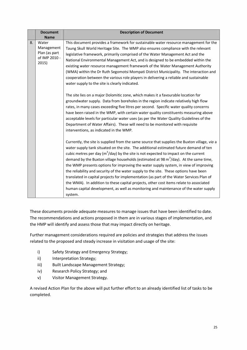
8. Water Management Plan (as part of IMP 2010 - 2015)
This document provides a framework for sustainable water resource management for the
Taung Skull World Heritage Site. The WMP also ensures compliance with the relevant
legislative framework, primarily comprised of the Water Management Act and the
National Environmental Management Act, and is designed to be embedded within the
existing water resource management framework of the Water Management Authority
(WMA) within the Dr Ruth Segomotsi Mompati District Municipality. The interaction and
cooperation between the various role players in delivering a reliable and sustainable
water supply to the site is clearly indicated.
The site lies on a major Dolomitic zone, which makes it a favourable location for
groundwater supply. Data from boreholes in the region indicate relatively high flow
rates, in many cases exceeding five litres per second. Specific water quality concerns
have been raised in the WMP, with certain water quality constituents measuring above
acceptable levels for particular water uses (as per the Water Quality Guidelines of the
Department of Water Affairs). These will need to be monitored with requisite
interventions, as indicated in the WMP.
Currently, the site is supplied from the same source that supplies the Buxton village, via a
water supply tank situated on the site. The additional estimated future demand of ten
cubic metres per day (m3/day) by the site is not expected to impact on the current
demand by the Buxton village households (estimated at 98 m3/day). At the same time,
the WMP presents options for improving the water supply system, in view of improving
the reliability and security of the water supply to the site. These options have been
translated in capital projects for implementation (as part of the Water Services Plan of
the WMA). In addition to these capital projects, other cost items relate to associated
human capital development, as well as monitoring and maintenance of the water supply
system.
These documents provide adequate measures to manage issues that have been identified to date.
The recommendations and actions proposed in them are in various stages of implementation, and
the HMP will identify and assess those that may impact directly on heritage.
Further management considerations required are policies and strategies that address the issues
related to the proposed and steady increase in visitation and usage of the site:
i) Safety Strategy and Emergency Strategy;
ii) Interpretation Strategy;
iii) Built Landscape Management Strategy;
iv) Research Policy Strategy; and
v) Visitor Management Strategy.
A revised Action Plan for the above will put further effort to an already identified list of tasks to be
completed.
26
8. The Cultural Landscape
A cultural landscape5 is a landscape designed, improved or at least affected by human activity,
whether deliberately or not. In other words, a cultural landscape refers to tangible human
modifications of a natural environment and the intangible meanings associated with that modified
landscape, like memories, traditions and stories.
The Application for Inclusion on the World Heritage List describes the Taung Skull Fossil Site as a
cultural landscape that encapsulates not only remains from proto-human Australopithecine times
over three million years ago, but from various segments of the Earlier, Middle and Late Stone Ages
to the present. Cultural landscapes typically tend to be layered, reflecting a range of activities over
time and the connection of ‘past, present and future are seamlessly connected’ (O'Hare 1997:47).
The TSWHS is no exception and provides rich layered tapestries of people, objects, events and times
that provides a specific texture and weave to this cultural landscape.
Examination and appreciation of the different heritage layers and their interrelationships ultimately
brings a deeper understanding and appreciation of the universal significance of the Taung Skull WHS.
The palaeontology and archaeology of the site has tremendous value and also provide a profound
context for the practice of local belief systems, rituals and traditions, by local Tswana and Xhosa
villagers.
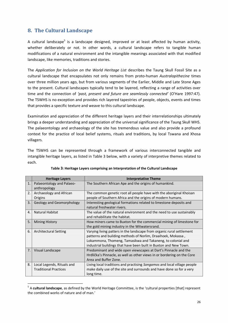
The TSWHS can be represented through a framework of various interconnected tangible and
intangible heritage layers, as listed in Table 3 below, with a variety of interpretive themes related to
each.
Table 3: Heritage Layers comprising an Interpretation of the Cultural Landscape
Heritage Layers Interpretative Theme 1. Palaeontology and Palaeo-
anthropology The Southern African Ape and the origins of humankind.
2. Archaeology and African Origins
The common genetic root all people have with the aboriginal Khoisan people of Southern Africa and the origins of modern humans.
3. Geology and Geomorphology Interesting geological formations related to limestone deposits and natural freshwater rivers.
4. Natural Habitat The value of the natural environment and the need to use sustainably and rehabilitate the habitat.
5. Mining History How miners came to Buxton for the commercial mining of limestone for the gold mining industry in the Witwatersrand.
6. Architectural Setting Varying living patters in the landscape from organic rural settlement patterns and building methods of Norlim, Draaihoek, Mokassa , Lokammona, Thomeng, Tamasikwa and Takaneng, to colonial and industrial buildings that have been built in Buxton and New Town.
7. Visual Landscape Predominant and wide open viewscapes at Dart’s Pinnacle and the Hrdlička’s Pinnacle, as well as other views in or bordering on the Core Area and Buffer Zone.
8. Local Legends, Rituals and Traditional Practices
Living local traditions and practising Songamos and local village people make daily use of the site and surrounds and have done so for a very long time.
5 A cultural landscape, as defined by the World Heritage Committee, is the ‘cultural properties [that] represent
the combined works of nature and of man.’

27
The current narrative related to the TSWHS, is the story of the Taung Child and the fossilised skull
found here in 1924. The palaeontological and archaeological aspects of the site have been well
documented and researched. There is however much more to explore in the TSWHS and many more
discoveries to be made. The interesting and rich geology of the site provides a specific point of
interest amongst all people interested in rocks and fossils, and these resources must be carefully
guarded and protected. The link to the mining history of the town has been documented, yet
requires more attention, and including focus on the intricate linkages to urban design, architecture
and visual landscape. Further research relate to the site would ideally be done through creating local
opportunities for local people to be trained and conduct research and documentation.
Tangible heritage like the pinnacles at the fossil discovery site, the caves and sites with old fossils,
the natural setting and river, the rocks and buildings constructed, and many more, are all linked to a
stories that provide meaning to the physical heritage symbol. Through understanding the story or
narrative about the specific object, the site and/or object gathers further meaning for and value to
the visitor. All the heritage layers have been well identified in the IMP 2010, and now require further
research, management and development.
9. Status Quo on Heritage Resources and Attributes
The various tangible and intangible heritage layers contain a multitude of heritage resources and
attributes, all intricately linked, and providing an interpretation of the history and value of the
TSWHS. These are catalogued in Table 3. The heritage resources and attributes are grouped
according to the proposed heritage layers, which can inform the mapping of the cultural landscape
by stakeholders. These layers can be mapped individually or in a multi-layered manner, to deepen
understanding and interpretation of the TSWHS. Table 3 presents the various heritage layers,
together with a list of tangible and intangible heritage resources and attributes, understanding that
all are ultimately intricately linked and integrated.

28
Table 4: Status Quo on Heritage Resources and Attributes
Heritage Resource/Attribute
Status Quo
Heritage Layer: Palaeontology and Palaeo-anthropology
1. Taung Skull Fossil and Site 1.1 The Taung Child Skull is currently being kept at the University of the Witwatersrand. 1.2 The deposits at Dart Pinnacle and the Hrdlička’s Pinnacle are secure, yet can be improved for safety and interpretive quality.
2. Precambrian Fossils 2.1 Very little coverage has been given to the fascinating Precambrian palaeontology of any of the fossil hominid sites. The dolomites which host the cavern sites or which have provided the limestone from which the travertine deposits of Taung have been accreted, is the source of unimaginably fossils of over 2224 million years old, which provide insights to some of the earliest preserved life forms on earth. They also provide evidence into the evolution of the atmosphere, and its gradual acquisition of all-important oxygen, vital to the existence of life on earth.
2.2 Precambrian resources of the site require further academic study, as well as field study in order to identify good examples to serve as viewing stations. Samples need to be collected both for scientific study and as examples for the heritage museum, in order to recognise a very significant part of the site significance.
2.3 Dolomite slabs have been used as seats in the picnic area. They provide a useful and almost indestructible construction material. 2.4 Dolomite stripping (such as occurs in the Cradle of Humankind) is a likely problem in the area. This certainly should be monitored in
order to determine the risk - it is very often the chert- and stromatolite-rich pieces that are removed because of their interesting surface patterning.
3. Fossilised Pollens 3.1 Palynology is the study of the fossil pollens, which in the case of the site are preserved in a small portion of the Equus Cave deposit, where both the sediment itself and fossil coprolites yielded significant results. This, and the potential for further study, make site protection for this locality a top priority, for it is in a particularly vulnerable state.
3.2 The field of palynology has recently been expanded by the study of phytoliths – these may become incorporated into deposits and
are fossilised. It has been established that the breccias of the site contain abundant phytoliths, and most of the Tufas and
sediments of important sites, like Equus Cave, are expected to have excellent potential for phytolith analysis. Scientific reportage
on this exciting new aspect of palaeontology is eagerly awaited.
3.3 Deposits of Hyrax dung, or hyracium, are also important because such deposits can build up over a period of thousands of years, trapping pollens and phytoliths as they accrete, which are very valuable, and steps should be taken to establish whether or not any are present within the Hyrax habitats that exist along the escarpment edge and within the quarry itself.
3.4 Speleothems, i.e. stalagmites, stalactites other flowstone formations can provide fossil pollen, as well as isotopic information used in dating deposits, and no further destruction of these potential sources of information should be allowed, such as still occurs at the ‘underground river’. The protection of the remaining undisturbed landscapes and patches of vegetation is an essential comparative element in studies such as these, and as such, they should be conserved as an integral component of the cultural landscape.
29
Heritage Resource/Attribute
Status Quo
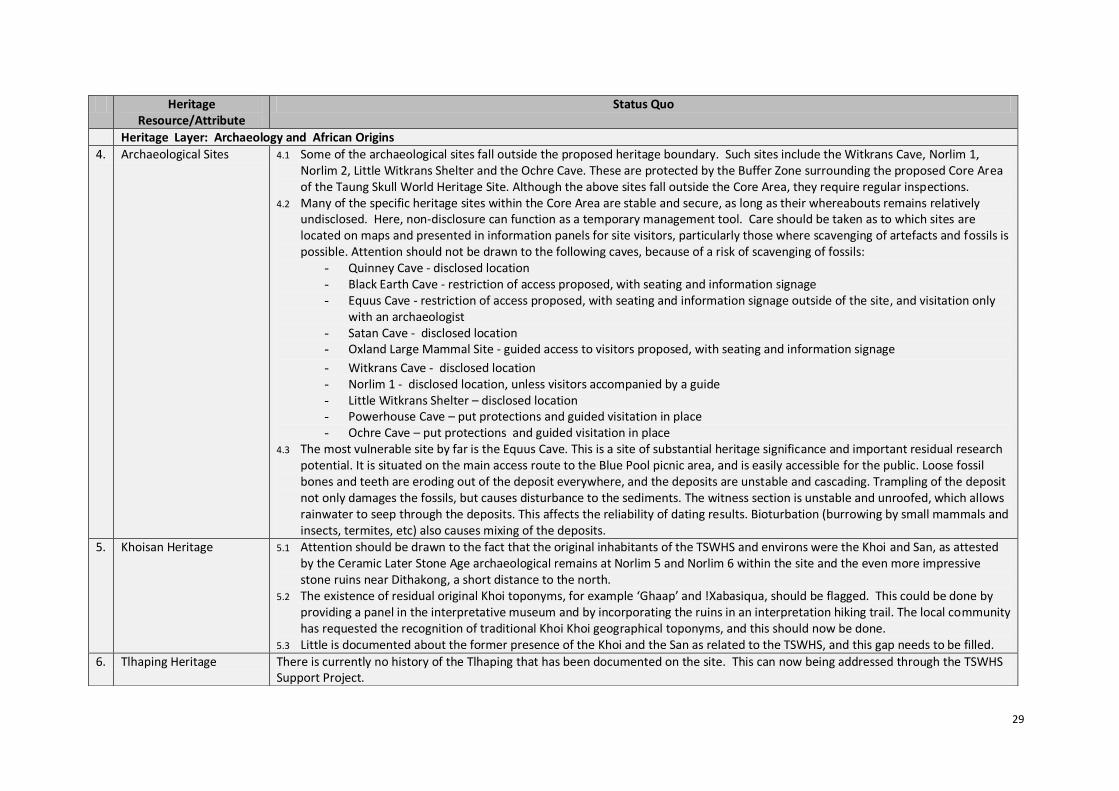
Heritage Layer: Archaeology and African Origins
4. Archaeological Sites 4.1 Some of the archaeological sites fall outside the proposed heritage boundary. Such sites include the Witkrans Cave, Norlim 1, Norlim 2, Little Witkrans Shelter and the Ochre Cave. These are protected by the Buffer Zone surrounding the proposed Core Area of the Taung Skull World Heritage Site. Although the above sites fall outside the Core Area, they require regular inspections.
4.2 Many of the specific heritage sites within the Core Area are stable and secure, as long as their whereabouts remains relatively undisclosed. Here, non-disclosure can function as a temporary management tool. Care should be taken as to which sites are located on maps and presented in information panels for site visitors, particularly those where scavenging of artefacts and fossils is possible. Attention should not be drawn to the following caves, because of a risk of scavenging of fossils:
- Quinney Cave - disclosed location - Black Earth Cave - restriction of access proposed, with seating and information signage - Equus Cave - restriction of access proposed, with seating and information signage outside of the site, and visitation only
with an archaeologist - Satan Cave - disclosed location - Oxland Large Mammal Site - guided access to visitors proposed, with seating and information signage
- Witkrans Cave - disclosed location - Norlim 1 - disclosed location, unless visitors accompanied by a guide - Little Witkrans Shelter – disclosed location - Powerhouse Cave – put protections and guided visitation in place - Ochre Cave – put protections and guided visitation in place
4.3 The most vulnerable site by far is the Equus Cave. This is a site of substantial heritage significance and important residual research potential. It is situated on the main access route to the Blue Pool picnic area, and is easily accessible for the public. Loose fossil bones and teeth are eroding out of the deposit everywhere, and the deposits are unstable and cascading. Trampling of the deposit not only damages the fossils, but causes disturbance to the sediments. The witness section is unstable and unroofed, which allows rainwater to seep through the deposits. This affects the reliability of dating results. Bioturbation (burrowing by small mammals and insects, termites, etc) also causes mixing of the deposits.
5. Khoisan Heritage 5.1 Attention should be drawn to the fact that the original inhabitants of the TSWHS and environs were the Khoi and San, as attested by the Ceramic Later Stone Age archaeological remains at Norlim 5 and Norlim 6 within the site and the even more impressive stone ruins near Dithakong, a short distance to the north.
5.2 The existence of residual original Khoi toponyms, for example ‘Ghaap’ and !Xabasiqua, should be flagged. This could be done by providing a panel in the interpretative museum and by incorporating the ruins in an interpretation hiking trail. The local community has requested the recognition of traditional Khoi Khoi geographical toponyms, and this should now be done.
5.3 Little is documented about the former presence of the Khoi and the San as related to the TSWHS, and this gap needs to be filled.
6. Tlhaping Heritage There is currently no history of the Tlhaping that has been documented on the site. This can now being addressed through the TSWHS Support Project.
30
Heritage Resource/Attribute
Status Quo
Heritage Layer: Geology and Geomorphology
7. Geology and Geomorphology
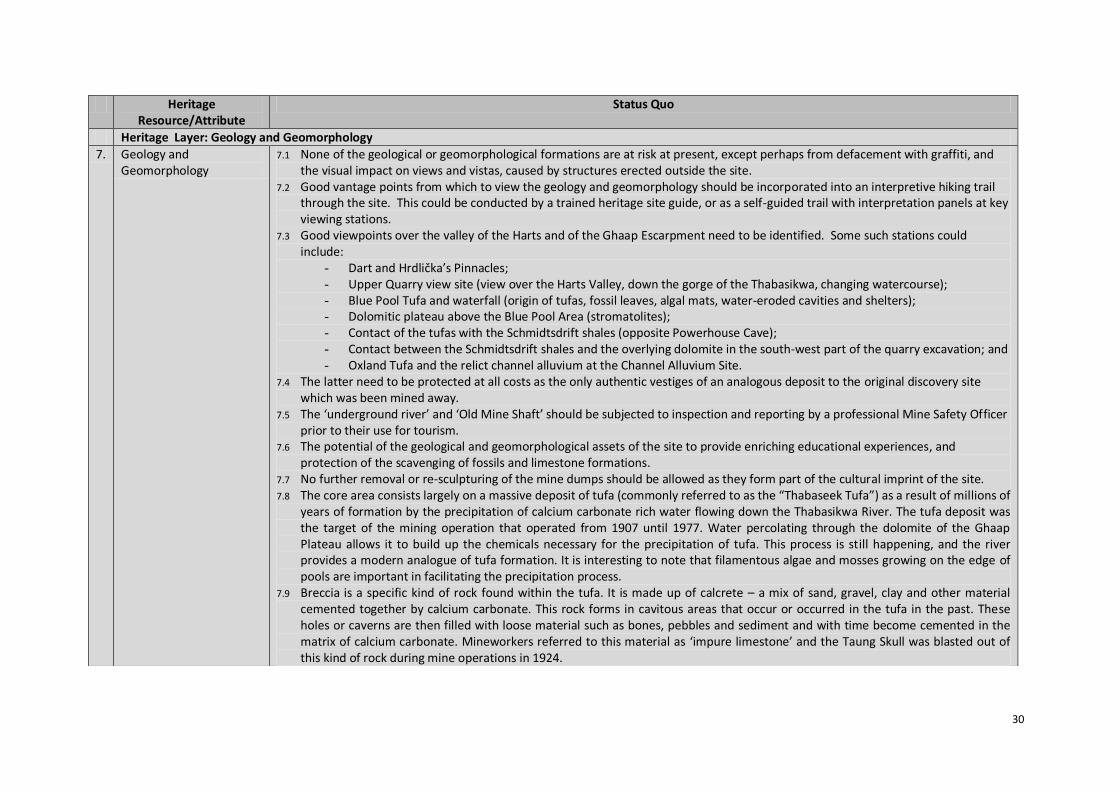
7.1 None of the geological or geomorphological formations are at risk at present, except perhaps from defacement with graffiti, and the visual impact on views and vistas, caused by structures erected outside the site.
7.2 Good vantage points from which to view the geology and geomorphology should be incorporated into an interpretive hiking trail through the site. This could be conducted by a trained heritage site guide, or as a self-guided trail with interpretation panels at key viewing stations.
7.3 Good viewpoints over the valley of the Harts and of the Ghaap Escarpment need to be identified. Some such stations could include:
- Dart and Hrdlička’s Pinnacles; - Upper Quarry view site (view over the Harts Valley, down the gorge of the Thabasikwa, changing watercourse); - Blue Pool Tufa and waterfall (origin of tufas, fossil leaves, algal mats, water-eroded cavities and shelters); - Dolomitic plateau above the Blue Pool Area (stromatolites); - Contact of the tufas with the Schmidtsdrift shales (opposite Powerhouse Cave); - Contact between the Schmidtsdrift shales and the overlying dolomite in the south-west part of the quarry excavation; and - Oxland Tufa and the relict channel alluvium at the Channel Alluvium Site.
7.4 The latter need to be protected at all costs as the only authentic vestiges of an analogous deposit to the original discovery site which was been mined away.
7.5 The ‘underground river’ and ‘Old Mine Shaft’ should be subjected to inspection and reporting by a professional Mine Safety Officer prior to their use for tourism.
7.6 The potential of the geological and geomorphological assets of the site to provide enriching educational experiences, and protection of the scavenging of fossils and limestone formations.
7.7 No further removal or re-sculpturing of the mine dumps should be allowed as they form part of the cultural imprint of the site. 7.8 The core area consists largely on a massive deposit of tufa (commonly referred to as the “Thabaseek Tufa”) as a result of millions of
years of formation by the precipitation of calcium carbonate rich water flowing down the Thabasikwa River. The tufa deposit was the target of the mining operation that operated from 1907 until 1977. Water percolating through the dolomite of the Ghaap Plateau allows it to build up the chemicals necessary for the precipitation of tufa. This process is still happening, and the river provides a modern analogue of tufa formation. It is interesting to note that filamentous algae and mosses growing on the edge of pools are important in facilitating the precipitation process.
7.9 Breccia is a specific kind of rock found within the tufa. It is made up of calcrete – a mix of sand, gravel, clay and other material cemented together by calcium carbonate. This rock forms in cavitous areas that occur or occurred in the tufa in the past. These holes or caverns are then filled with loose material such as bones, pebbles and sediment and with time become cemented in the matrix of calcium carbonate. Mineworkers referred to this material as ‘impure limestone’ and the Taung Skull was blasted out of this kind of rock during mine operations in 1924.

31
Heritage Resource/Attribute
Status Quo
Heritage Layer: Natural Habitat
8. Flora 8.1 A total of 129 species of flora are present in the TWHS. The site is on the edge of the Grikwaland West Centre of Endemism, and this fact should be promoted in the hiking trails and in panels in the interpretative museum. Named species of plants are featured along the hiking trails.
8.2 There are a number of issues that have been identified in previous documentation, including: - The lack of a fence permits free-ranging grazing of the site by numerous cattle, donkeys, goats and sheep. This has given
rise to overgrazing, and grazing-induced bush encroachment is occurring. Overgrazed areas are prone to rapid soil erosion. A livestock grazing plan needs to be negotiated with the communities, to limit grazing to a sustainable level, and on areas of veld that have the carrying capacity;
- Sustainable levels of wood harvesting must be determined and a system of regulation developed before uncontrolled harvesting destroys reserves; and
- The best shade tree within the quarry, the lime-loving pepper tree, is a potential alien invasive. Pending its declaration, the management plan will have to consider its control or possible replacement.
9. Fauna 9.1 There are 13 mammal, 74 bird, 8 reptile and 4 amphibian species that occur in TSWHS. There is a need for further research into the bat species present.
9.2 The cliffs above the Blue Pool support a breeding pair of Black Eagles. 9.3 There is a looming problem with baboon-human interactions, with baboon-proof rubbish bins being put in place, and prohibitions
placed on feeding of baboons. 9.4 The consequences and impact of a fence on the local fauna communities will require consideration.
10. Ecological Biomes 10.1 The Ghaap Escarpment biome and Thabasikwa riverine biome show elements of Kalahari Thornveld vegetation, this showing two interrelated yet distinct natural habitats that fall within the Core Area.
10.2 The TSWHS provides a habitat for Red Data Species, considered rare and threatened. 10.3 These biomes need to be carefully managed in order to reduce ecological impacts from the various current and proposed land
uses.
Heritage Layer: Mining History
11. Living Mineworkers Former mine workers are still resident in the area and have vital knowledge of the early history of the Lime Works and information needs to be gathered with them and documented.
12. Lime Workers’ Graveyard The lime workers’ graveyard alongside the Core Area is still regularly visited and needs to be further understood, documented and protected.
13. Quarry The quarry itself reflects a rather harsh and significant message to the amount of effort gone into mining, and the luck that occurred in 1924, through discovering the treasured Taung Child Skull. It bears testimony to how miners came looking for limestone, and found something of far greater value to humanity.

32
Heritage Resource/Attribute
Status Quo
14. Mining Buildings and Infrastructure
14.1 As far as the on-site mining history is concerned, many of the original mining buildings and some of the related infrastructure are still intact, although falling into a state of disrepair. The mine site and environs likewise preserves interesting industrial buildings and infrastructure. Of note are the Stone-built Power House, the old steel girder rail bridge over the Thabasikwa River and several other interesting mine buildings. These structures all form part of the cultural imprints on the TSWHS and should not be allowed to decay to the point that they are non-restorable. Many of the buildings form part of the history of Taung and should be stabilised, with a view to possible future restoration. Theft of usable building material is a problem.
14.2 Metal harvesting after the mine closed caused much of the mining technology to be removed from site, including the private branch railway line laid in 1936 from Taung to Buxton, and on to the smaller lime quarry at Thomeng. The lime-burning kilns were destroyed, probably in order to recover the refractory brick, made by the Cullinan Brick Factory near Olifantsfontein.
15. Lime Dumps 20.1 The mine dump formations have a significant presence on the site and give testimony to the vast amounts of material that was moved from the quarry during mining operations.
20.2 The mine dumps are unstable and need to be monitored and secured. They provide a significant safety risk and hazard and should not be ventured onto.
16. Heritage Objects 16.1 Koekepanne have been recovered from community and are displayed at the current entrance to the WHS. 16.2 Working utensils have been recovered from community and are also on display. 16.3 A Fire Extinguisher has been found on a farm in Amalia Area, and has been documented photographically.
Heritage Layer: Architectural Setting
17. Various Architectural Styles
17.1 The Buxton Village adjacent to the Norlim preserves several noteworthy architectural features, including an attractive stone church, rural ‘fossil’ post office, and several stone-built miners’ cottages which are worthy of restoration. This attractive townscape is worthy of being incorporated into a broader-based tourism product and offers economic opportunities to local residents. Tea shop, a general dealer and tourism shop to supply visitors are possibilities.
17.2 Although influenced by the establishment of mining, the village of Buxton and Norlim retains a strong rural feel and settlement pattern that brings significance to the setting and experience of the site.
17.3 The settlement pattern of the village, as well as surrounding villages, varies in pattern and if far more organic making use largely of local materials, with a strong dependency on concrete and brick in places. This rural urban setting also requires protection and research, and management requirements must be well adapted to meet local means.
17.4 Stone building methods are particularly prevalent and have been well incorporated into the development of the site at both the current entrance and the upgraded picnic area at Blue Pools.

33
Heritage Resource/Attribute
Status Quo
Heritage Layer: Visual Landscape
18. Views 18.1 A Buffer Zone around the Core Area will place management controls on the erection of structures which might impinge on the visual appreciation of geological, geomorphological and other scenic views, such as TV towers, power lines, cell phone towers and the like.
18.2 The route could be used to showcase traditional vernacular architectural styles and traditional farming practices, although it is understood that most people would prefer an RDP type of house. Any modern densification of the Mokassa rural residential area may affect the sense of travelling through a traditional rural district, which, because of the distance from the tarred road, adds to the visitor experience.
18.3 The Buffer Zone incorporates the portions of the villages of New Town, Draaihoek, Mokassa, Lokamonna, Takaneng, Tamasikwa and Thomeng and management of the landscape with these villages would go a long way to promote appropriate and sustainable land use options.
18.4 It is significant to note that the original discoverer of the Buxton limestone tufas had to struggle his way through thick bush all the way from Taung to the escarpment - an area which today is almost totally devoid of trees and shrubs. This provides a vector of change to be introduced into the landscape and how environmental change and adaption are already part of the way of living. The visual landscape of the Core Area itself and the surrounding Buffer Zone needs to be documented in order that the visual landscape is protected and well managed. The documentation of critical view points, view sheds and view lines is being conducted as part of the HIA study. Predominant views identified include the Dart and Hrdlička’s Pinnacles, Monument viewpoint over Buxton village and the Harts Valley, the Buxton village approach, the Norlim village approach, the Thabasikwe River valley, the mining works from the road and wide open scenic landscape views over the extent of the Buffer Zone.
18.5 Specifically, the views around the Dart Pinnacle and the Hrdlička’s Pinnacle must be preserved at all costs, as they provide the only ‘authentic’ element to the now non-existent discovery site.
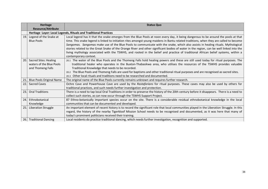
34
Heritage Resource/Attribute
Status Quo
Heritage Layer: Local Legends, Rituals and Traditional Practices
19. Legend of the Snake at Blue Pools
Local legend has it that the snake emerges from the Blue Pools at noon every day, it being dangerous to be around the pools at that time. This snake legend is linked to initiation rites amongst young maidens in Bantu related traditions, when they are called to become Sangomas. Sangomas make use of the Blue Pools to communicate with the snake, which also assists in healing rituals. Mythological stories related to the Great Snake of the Orange River and other significant bodies of water in the region, can be well linked into the living mythology associated with the TSWHS, and rooted in the belief and practice of traditional African belief systems, within a contemporary context.
20. Sacred Sites: Healing waters of the Blue Pools and Thomeng Falls
20.1 The water of the Blue Pools and the Thomeng Falls hold healing powers and these are still used today for ritual purposes. The traditional healer who operates in the Buxton-Thabasikwa area, who utilises the resources of the TSWHS provides valuable Traditional Knowledge that needs to be recorded.
20.2 The Blue Pools and Thomeng Falls are used for baptisms and other traditional ritual purposes and are recognised as sacred sites. 20.3 Other local rituals and traditions need to be researched and documented.
21. Blue Pools Original Name The original name of the Blue Pools currently remains unknown and requires further research.
22. Sacred Caves Ochre Cave and Powerhouse Cave are used by the Rastafarians for ritual purposes. These caves may also be used by others for traditional practices, and such needs further investigation and protection.
23. Oral Traditions There is a need to tap local Oral Traditions in order to preserve the history of the 20th century before it disappears. There is a need to collect such stories, as can now occur through the TSWHS Support Project.
24. Ethnobotanical Knowledge
87 Ethno-botanically important species occur on the site. There is a considerable residual ethnobotanical knowledge in the local communities that can be documented and developed.
25. Liberation Struggle An important element of recent history is to record the significant role that local communities played in the Liberation Struggle. In this regard, the history of the nearby Tigerkloof Mission School needs to be recognised and documented, as it was here that many of today’s prominent politicians received their training.
26. Traditional Dancing Local residents do practice traditional dancing, which needs further investigation, recognition and supported.

35
10. Site Zonation and Conceptual Development Plan
It is well recognised that the development of the site is essential for the effective use and enjoyment
by all visitors, leaving not only a positive experience, but also a lasting learning experience. As such
the site has been planned and zoned for different uses. A master plan exists for the site showing
different uses in different areas (refer Figure 6).
Development plans that have already been implemented, or are currently being implemented
include:
a) Establishment of green, yellow and brown walking trails and basic signage (complete);
b) Access road from the current entrance to Blue Pools picnic area (complete);
c) Upgrade of Blue Pools picnic area (near complete);
d) Changes to ablution block at Blue Pools picnic area (in progress);
e) Upgrade of road to Thomeng (in progress); and
f) Core Area boundary fence (in progress).
The remainder of the development plans currently under consideration are detailed in the Site
Analysis and Conceptual Development Plan, or Master Plan. Detailed Area Sketch Plans available
have been included into Appendix 2.
Components requiring further planning attention, as documented from discussions on the site
include:
a) Construction of a new entrance and related parking area;
b) Upgrade of monument site, including the construction of lookout point and boardwalk and
information signage at Hrdlička’s deposit;
c) Establishment of a museum/interpretation centre;
d) Restricting access to Black Earth Cave, seating and information signage;
e) Restricting access to Equus Cave, seating, information signage and weather protection; and
f) Providing access, seating and information signage at Oxland Large Mammal site.
The Master Plan for the sites was compiled in 2003 and may need to be reviewed and consolidated
to reflect the current ideas and intentions of the Management Authority. Such a revised
development plan would be best consolidated through conducting an intensive workshop on the
site, together with key and local stakeholders.

36
Figure 6: Site Zoning Plan
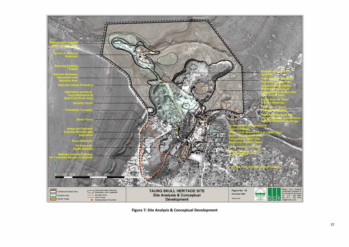
37
Figure 7: Site Analysis & Conceptual Development

38
11. Status Quo Remarks
The status quo remarks bring attention to pertinent and current issues at the TSWHS. The actions
required to address the points can be taken up in further detail in a revised action plan. The status
quo study of the TSWHS reveals the following points:
Implementation
1. Development on the site is underway and the road across the site, terminating at the Blue Pools
picnic site, has been constructed in a manner that blends well into the natural environment,
strengthening the experience of the sense of place. The use of natural stone in these
developments provides a sound foundation that can inform further design and construction on
the site.
Heritage Management
2. Heritage management is the primary function of the Management Authority, and the leading
document on the management of heritage at the TSWHS is the Integrated Management Plan
2010 – 2015. Appointments need to be made for all the staff positions identified in the IMP.
3. The site is rich in heritage with multiple and interrelated layers and dimensions. Some heritage
layers are well known, yet are not well protected, e.g. palaeontological and archaeological sites
like Equus Cave and Black Earth Cave, for instance. Other layers exist, are not well known, and
are not well protected, e.g. local stories and traditions, and the buildings on the site, for
instance.
4. The use of cultural landscape mapping has not yet been fully applied to the site. The current
emphasis and attention on palaeo-anthropology and archaeology has been necessary to inscribe
the site as at WHS. Now is the right time to highlight further heritage layers, like anthropology
and traditional knowledge for instance, to further enhance the value and meaning of the site.
The development of a cultural landscape map will go a long way to providing a better
understanding of the site to a broader group of stakeholders, especially the local communities of
Buxton, New Town, Norlim, Draaihoek, Mokassa, Lokammona, Tamasikwa, Takaneng and
Thomeng residing in or alongside the Buffer Zone and making daily use of the site and
surrounds. Such an exercise of cultural mapping yields the best results when done in
participation with stakeholders, thus embedding a Vision for and ownership of the site.
Site Planning and Development
5. Planning on the site is well progressed, with detailed planning and implementation completed
for the road to the picnic site at Blue Pools. Construction of the Blue Pools picnic site is near
complete. Other development components on the site require closer scrutiny and detailed
planning, like the proposed museum and entrance node at the Mine Manager’s House, for
instance. An intensive workshop on the site with all stakeholders will go a long way towards
consolidating the Site Development Plan/Master Plan, providing the opportunity to update the

39
plan and focus stakeholders on completing the establishment of the site to being fully
operational. A specific implementation plan with clear milestone dates will ensure the effective
realisation of these plans, which have been in the making for many years.
6. Capital investment into the site may need to be considered as related to the benefits that can be
gained from the development of the site over time. A cost-benefit analysis may be very well
placed at this stage of the planning and development process. It would provide a realistic
measure of what benefits may come from the site, and provide a necessary reference point
against which to discuss and debate local expectations created to date. A crisp and honest look
at the benefits will help to bring stakeholders to a realistic position of what can and should be
done to optimise the use and protection of the site.
7. A likely trap in planning is to replicate similar developments on other heritage sites, like
Maropeng for instance, expecting similar visitation, revenue and results. The unique value of the
TSWHS and particular rural sense of place and sense of community are of paramount
importance to the site. These should be kept central to designing a site that may attract the right
people. Original thinking rooted in the local reality is of critical importance to ensure the unique
and responsible development of the site, which ensures local benefit, local learning opportunity
and enriched visitor experiences. Such development needs to enhance the specific heritage
attributes of the site, which can be better and more deeply understood by stakeholders and
visitors all around. Visitor numbers and revenue generated need to inform planning and design.
8. Baseline documents that need to be compiled in order to effectively conduct the HIA are a
Critical View Point Analysis, as well as the compilation of a Building Catalogue for the Core Area,
providing information on the state, past use and future potential of the structures.
Research Management
9. There have been ongoing struggles related to research on the site. Researchers have not yet
been able to include local community members in their activities. Safety and security issues
around conducting research on the site are also well known, and may well stem from the
exclusionary approach in which research has been conducted on the site for many decades. The
management and permitting of research on the site can certainly be improved through the
development of a research policy that clearly defines, in part, the need that research
information is returned to the site, and that researchers take responsibility for the dissemination
of information. Inclusion of local community members in research activities is also crucial to the
protection of heritage on the site and will certainly improve relationships between researches,
the local community and the Management Authority.
Knowledge Management
10. Access to information about the site and what is planned for the site can certainly be improved.
It is fully recognised that resources are currently limited and such impede more effective access
to and dissemination of information. This matter will however be improved through the
implementation of the Support Project whereby the Management Authority has obtained
assistance to further improve and strengthen the implementation of research and development

40
on the site. Local learners and young people can also have increased access to library materials
and other interesting heritage information about the site.
Visitor Management
11. Currently the site has many safety issues and the current safety study is critical to the effective
and safe use of the site by visitors. Currently the primary use of the site is for recreation and
harvesting of resources, and these need to be very well managed in order to protect the OUV,
Authenticity and Integrity of the site. Visitor management is also crucial to managing the safety
on the site, and a site safety strategy can be given immediate attention and be implemented.
Such a strategy can be revised over time, as safety measures on the site change and improve,
together with site development.
Interpretation
12. Current interpretation activities on the site are ongoing with the Youth Ambassadors from
Buxton and many groups of leaner’s visiting the site on an annual basis. The current READ staff
on the site can be commended for their efforts, despite the lack of resources and struggles faced
in terms improving interpretation efforts. Signage is evident on the site, yet can be improved
through making heritage information more available. A well thought out and planned interactive
interpretation centre and well trained heritage guides would go a long way to making a visit to
the site far more interesting. These ideas and concepts have been long discussed and planned
for the site.
Local Community Involvement
13. The TSWHS has been inscribed on UNESCO Criteria vi), which states that ‘The site should be
directly or tangibly associated with events or living traditions, with ideas, or with beliefs, with
artistic and literary works of outstanding universal significance’. The local community must
therefore not be viewed as a stakeholder alone, but also as a heritage resource in which a rich
tapestry of stories and traditional practices exist, and who by their very location and cultural use
of the site, are inextricably linked to the OUV, Authenticity and Integrity of the site.
14. The Johannesburg Declaration 2002 on heritage management highlights that communities
should be empowered to remain at the centre of heritage management.6 This declaration thus
provides further impetus for the management of TSWHS to be well rooted and linked into the
local community, their daily activities and aspirations for the future.
15. There are ongoing activities involving local community members and much opportunity exists to
strengthen such involvement through the recognition and documenting of local stories and
traditions, as they are strongly related to the site, both in the past and current day reality.
Participation of local community members in this research and documentation is a critical
approach towards accruing local value and meaning to the heritage of the site, and the
opportunities than can be created through that over the long term.
6 UNESCO Johannesburg Declaration, 2002.
41
12. Way Forward
The information gained thus far and encapsulated in the current Status Quo Report provides many
good points for discussion. The report in its current draft form should be distributed to the Steering
Committee for further input and consideration. It may be useful for READ to prioritise actions and
‘burning issues’ from amongst those identified in the report, during the next SC meeting, if members
will study it beforehand. The information may also inform an overall implementation planning chart
for use by site management. It could also form the basis for a ‘Where are we now’ type of progress
chart, so one can understand the status quo of the site at a glance. An important use of the
information is to inform the development of the HMP and certainly the revision of the
Implementation Plan, which is due later this year.
A look at the status quo of the TSWHS quickly reveals that there are things on the go, and that this
site ‘is happening’. A significant amount of conceptual and detailed planning has occurred and time
has been spent detailing recommendations related to the better management of the site. Further
action is now required. Strengthened participatory planning will help all stakeholders to better
understand the site and work more closely together to strengthen the management of the site.
Attention can also be given to the living heritage and local people that can become more involved in
the management, through the existing Stakeholder Forum, for instance. The management of
heritage resources and attributes in TSWHS is all about the management of how people use the site,
and there is no better way of management than by managing together with these users. It is thus
essential that further focus now be placed on the management staff and the local people involved in
using the site, to see what support can be given to strengthen management through their ongoing
activities. This requires local capacity development and time.
The local community of Buxton and surrounding villages has a World Heritage Site as a local asset,
and if backed by united local support and continued local effort, this WHS can certainly stimulate the
local economy. The scale of benefit is directly dependent on the level of local interest, effort and
motivation. For well planned local economic development, New Town, Buxton, Norlim and
Draaihoek specifically need a Local Economic Development (LED) Plan that includes linkages to the
surrounding villages of Mokassa, Lokamonna, Takaneng, Tamasikwa and Thomeng. Here is an
opportunity for a local community to show South Africa and the world how local action can ignite
enduring local economic development that is well linked into the management and use of the
TSWHS. As such, the full value of the heritage resource at hand, would need to be harnessed, and
requires attention on making Taung Skull WHS a success.
The TSWHS also shows sustainability features, used as its potential to be developed into a major
educational asset for the country. It can also become an example of how the conservation of
heritage can help to support the local community, though this is not yet reflected in the status quo
(although a start has been made with the sewing project). Not many World Heritage Sites in Africa
have achieved the dream of heritage benefitting communities in tangible ways, and the TSWHS can
be one of them. The economy of scale is favourable here: the numbers of people living around the
site are not high, and considering that it is an economically depressed area, every little bit will help.

42
It is proposed that funding be sought so that the status quo of community livelihood be captured
soon, so that there is a baseline against which to measure the anticipated future successes. The
TSWHS Support Project could possibly be engaged here.
At the same time, the TSWHS should be an example of how development can occur while striving for
a light footprint at the same time. Sustainability considerations are a central issue. Already the
sparing use of water, reuse of local materials, and local and community initiatives that stimulate the
local economy are linked to the WHS. Stronger and diversified relationships can be further explored,
with strong relationships to learners and young people in Buxton being a top priority.
Participatory approaches to planning, mapping and development, conducted in a transparent
manner, can best support the long term success of the TSWHS Support Project. And there are no
better stakeholders that need to be involved than the young people, since it is they who will be
involved in the site well into the future.
The TSWHS project must continue to remain adaptive to changing needs and circumstances. The
management of the site must also continue to look for ways to include a broader group of
stakeholders willing to participate. As such a stronger group of people all working towards a focused
plan and united in a common effort can ensure the successful establishment and operation of the
TSWHS.
43
References
DACERD, 2003. Cultural Heritage Resources Survey of the Taung Skull National Heritage Site. Document submitted to SAHRHA by Bapela Cave Klapweijk on behalf of DACERD. DACERD, 2004. Conservation Management Plan for the Taung Skull National Heritage Site. Document submitted to SAHRHA by Bapela Cave Klapweijk on behalf of DACERD. DACERD, 2004. Nomination Dossier for the Taung Skull World Heritage Site. Document submitted to UNESCO. DACERD, 2008. Business Plan for the Taung Skull World Heritage Site. Department of Agriculture, Conservation and Environment of the North West Province. DACERD, 2010. Integrated Management Plan for the Taung Skull World Heritage Site 2010 - 2015. Document compiled by Reza Williams Business Consulting on behalf of DEACERD and submitted to UNESCO. DACERD, 2010. Biodiversity Report for the Taung Skull World Heritage Site. Document compiled by D Euston-Brown on behalf of Reza Williams Business Consulting on behalf of DEACERD and submitted to UNESCO. DACERD, 2010. Socio-Economic Impact Assessment for the Taung Skull World Heritage Site. Document compiled by Nassar Ahmed Omar on behalf of Reza Williams Business Consulting on behalf of DEACERD and submitted to UNESCO. DACERD, 2010. Tourism Marketing Plan for the Taung Skull World Heritage Site. Document compiled by Reza Williams Business Consulting on behalf of DEACERD and submitted to UNESCO. DACERD, 2010. Water Management Plan for the Taung Skull World Heritage Site. Document compiled by Reza Williams Business Consulting on behalf of DEACERD and submitted to UNESCO. O'Hare, D. 1997. Tourism and Small Coastal Settlements: a cultural landscape approach for urban design. Unpublished PhD thesis. Oxford Brookes University. UNESCO Johannesburg Declaration 2002. ‘World Heritage in Africa and Sustainable Development’. Declaration from the UNESCO and ICOMOS conference in Johannesburg, 2002.

44
Appendix 1: Status Quo Photographs
Photograph 1: Old Powerhouse, road and limestone stockpile in
Buxton Quarry
Photograph 2: Ruins of the former Buxton Lime Works from the
proposed Entrance
Photograph 3: The local shop in the TSWHS
Photograph 4: Stone building at current Entrance.
Photograph 5: Taung Child Skull Fossil Site in the quarry, guarded by
Dart’s Pinnacle (left) and Hrdlička’s Pinnacle (right)
Photograph 6: Limestone formation, or dolomite, typical of tufa
deposits and typically yielding many fossils.
Photograph 7: Young men on a donkey cart towards Buxton.
Photograph 8: Sacred healing waters at Thomeng Falls.

45
Appendix 2: Area Sketch Plans
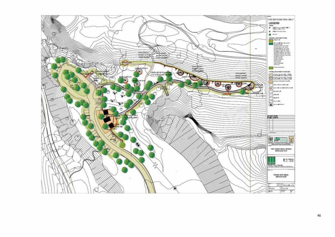
46

47
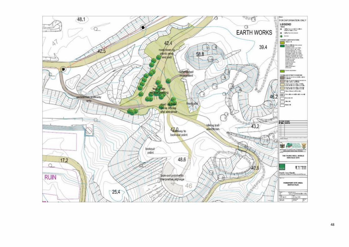
48

49