historical #01-r (experiment) - british columbia ... · may!2010!!!!!b.c.h.f.historicaltrails!!!!!...
TRANSCRIPT
B.C. HISTORICAL FEDERATION Interim Report of the Historical Trails and Sites November 2011 We have made continuing progress on obtaining information on Historic Trails from member societies
and others, but as this takes time and effort, all too many people tend to put off completion. We have made a personal request at many museums, and this should bring more replies. We hope that we have enough data to use for a website on Historic Trails.
HISTORIC SITES – We are looking into design of a new monument for Surveyor Walter Moberly
to be placed at the Wooden Head Park at Revelstoke, now that we have the support of the B C Historical Federation and the Revelstoke Community Heritage Commission. We are in the process of inviting the Association of B.C. Land Surveyors and the Association of Professional Engineers in B.C. for support and
funding. We are also hopeful that major funding for this monument can be obtained from the Columbia Basin Trust, as Revelstoke is an important part of the area they support.
Respectfully submitted -‐-‐ Tom Lymbery, Chairman
John Whittaker, Member
HISTORICAL TRAILS & SITES COMMITTEE OF THE B.C. HISTORICAL FEDERATION Box 38, Gray Creek, B.C. V0B 1S0 The B.C. Historical Federation supports the protection preservation and marking of historical trails, sites, relics, natural features and other objects and places of historical interest in British Columbia. With the intention of documenting a data for the Province we are asking each Member Society to give us a list from their district of: Five most historical trails ____________________________________ Five most important & historical monuments____________________ Five most important historical personages______________________ Are the above adequately described or promoted? Do any need to be into public focus? Please prioritize the trails and sites from one to five. We realize that five is a nominal number given the rich history of B.C., but with many historical societies we need to keep the numbers manageable in order to implement this project. Could we please have your reply as soon as possible? Please e-‐mail to [email protected] and [email protected] We very much appreciate your consideration and your help. Sincerely yours, Tom Lymbery, Chairman John Whittaker, Member
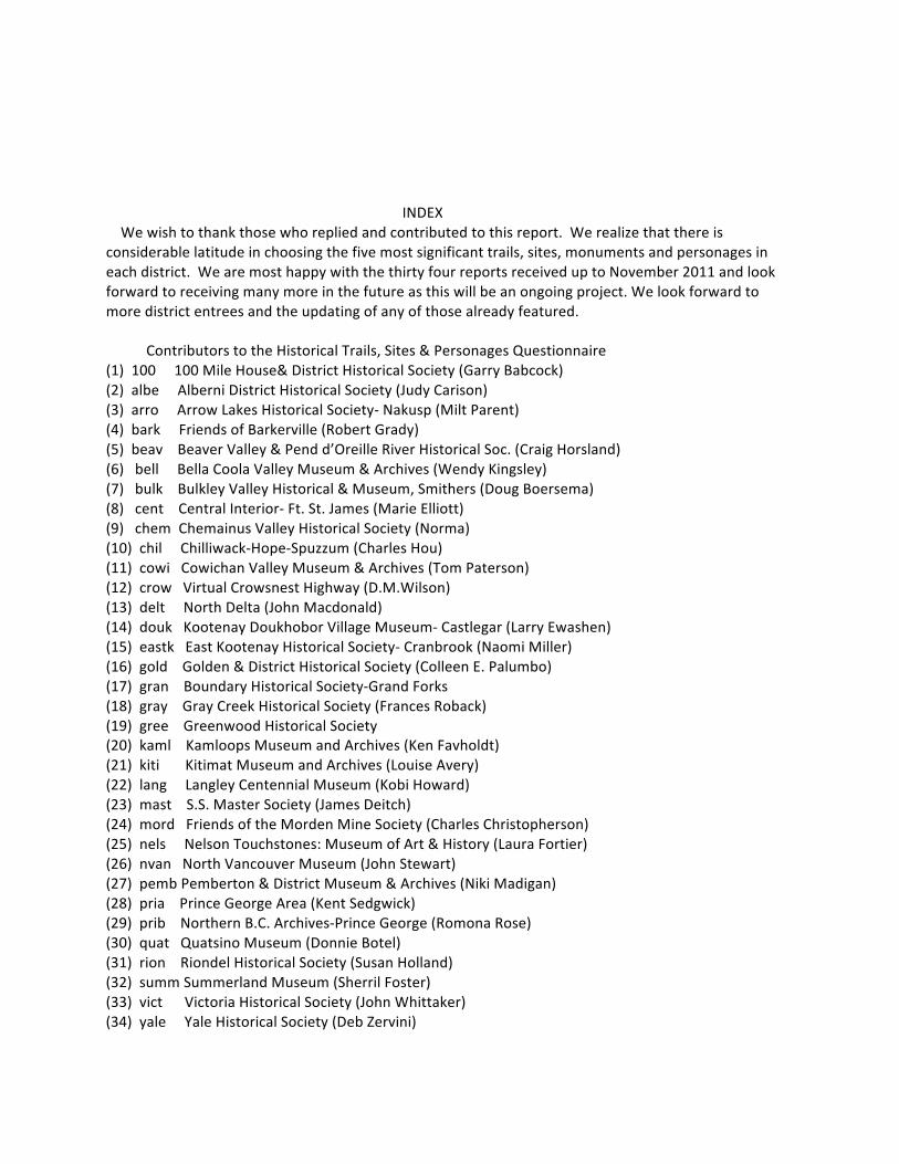
INDEX We wish to thank those who replied and contributed to this report. We realize that there is considerable latitude in choosing the five most significant trails, sites, monuments and personages in each district. We are most happy with the thirty four reports received up to November 2011 and look forward to receiving many more in the future as this will be an ongoing project. We look forward to more district entrees and the updating of any of those already featured. Contributors to the Historical Trails, Sites & Personages Questionnaire (1) 100 100 Mile House& District Historical Society (Garry Babcock) (2) albe Alberni District Historical Society (Judy Carison) (3) arro Arrow Lakes Historical Society-‐ Nakusp (Milt Parent) (4) bark Friends of Barkerville (Robert Grady) (5) beav Beaver Valley & Pend d’Oreille River Historical Soc. (Craig Horsland) (6) bell Bella Coola Valley Museum & Archives (Wendy Kingsley) (7) bulk Bulkley Valley Historical & Museum, Smithers (Doug Boersema) (8) cent Central Interior-‐ Ft. St. James (Marie Elliott) (9) chem Chemainus Valley Historical Society (Norma) (10) chil Chilliwack-‐Hope-‐Spuzzum (Charles Hou) (11) cowi Cowichan Valley Museum & Archives (Tom Paterson) (12) crow Virtual Crowsnest Highway (D.M.Wilson) (13) delt North Delta (John Macdonald) (14) douk Kootenay Doukhobor Village Museum-‐ Castlegar (Larry Ewashen) (15) eastk East Kootenay Historical Society-‐ Cranbrook (Naomi Miller) (16) gold Golden & District Historical Society (Colleen E. Palumbo) (17) gran Boundary Historical Society-‐Grand Forks (18) gray Gray Creek Historical Society (Frances Roback) (19) gree Greenwood Historical Society (20) kaml Kamloops Museum and Archives (Ken Favholdt) (21) kiti Kitimat Museum and Archives (Louise Avery) (22) lang Langley Centennial Museum (Kobi Howard) (23) mast S.S. Master Society (James Deitch) (24) mord Friends of the Morden Mine Society (Charles Christopherson) (25) nels Nelson Touchstones: Museum of Art & History (Laura Fortier) (26) nvan North Vancouver Museum (John Stewart) (27) pemb Pemberton & District Museum & Archives (Niki Madigan) (28) pria Prince George Area (Kent Sedgwick) (29) prib Northern B.C. Archives-‐Prince George (Romona Rose) (30) quat Quatsino Museum (Donnie Botel) (31) rion Riondel Historical Society (Susan Holland) (32) summ Summerland Museum (Sherril Foster) (33) vict Victoria Historical Society (John Whittaker) (34) yale Yale Historical Society (Deb Zervini)
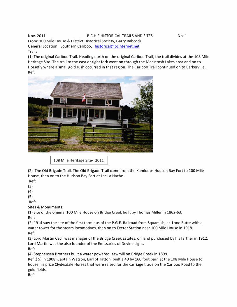
Nov. 2011 B.C.H.F.HISTORICAL TRAILS AND SITES No. 1 From: 100 Mile House & District Historical Society, Garry Babcock General Location: Southern Cariboo, [email protected] Trails (1) The original Cariboo Trail. Heading north on the original Cariboo Trail, the trail divides at the 108 Mile Heritage Site. The trail to the east or right fork went on through the Macintosh Lakes area and on to Horsefly where a small gold rush occurred in that region. The Cariboo Trail continued on to Barkerville. Ref:
(2) The Old Brigade Trail. The Old Brigade Trail came from the Kamloops Hudson Bay Fort to 100 Mile House, then on to the Hudson Bay Fort at Lac La Hache. Ref: (3) (4) (5) Ref: Sites & Monuments: (1) Site of the original 100 Mile House on Bridge Creek built by Thomas Miller in 1862-‐63. Ref: (2) 1914 saw the site of the first terminus of the P.G.E. Railroad from Squamish, at Lone Butte with a water tower for the steam locomotives, then on to Exeter Station near 100 Mile House in 1918. Ref: (3) Lord Martin Cecil was manager of the Bridge Creek Estates, on land purchased by his farther in 1912. Lord Martin was the also founder of the Emissaries of Devine Light. Ref: (4) Stephensen Brothers built a water powered sawmill on Bridge Creek in 1899. Ref :( 5) In 1908, Captain Watson, Earl of Tatton, built a 40 by 160 foot barn at the 108 Mile House to house his prize Clydesdale Horses that were raised for the carriage trade on the Cariboo Road to the gold fields. Ref
108 Mile Heritage Site-‐ 2011
100 Mile House… page 1A Personages: (1) Peter Skeene Ogden, Hudson Bay factor at Lac LaHache Ref: (2) Thomas Miller, builder of the original 100 Mile House, 1862/63 Ref: (3) Lord Martin Cecil, founder of the Emissaries of Divine Light-‐ a religious commune. Ref: (4) Stephenson Brothers who built a water-‐powered sawmill. Ref: (5) Earl of Tatton who raised the prize-‐winning Clydesdale horses.
May 2010 B.C.H.F. HISTORICAL TRAILS No: 2 From: Alberni District Historical Society, Judy Carson General Location: Mid Central Vancouver Island ONE: CNPR Rail Grade – Lots of interest and work being done on this one. It was started in 1912/13 – plan to link Victoria to the West Coast via Port Alberni and continue north. Ref: Explanation: Work stopped five mile south of Port Alberni at China Creek when WWI broke out. The section from China Creek south to Franklin River (8 km) has been cleared by volunteers as a trail (foot path only) and is being used by many now. Next section south to Headquarters (10 km) has had some work done but needs more funding. Section to Headquarters to Camp B (20 km) should be complete by May – it is being called Runners Trail to recognize the native trade route connection that existed between Lake Cowichan and the coast. Another 20 km remain to reach Lake Cowichan and the trails that go from there to Victoria. TWO: Log Train Trail – 25 km trail trending northwest of Port Alberni on rail bed abandoned since 1953. Ref: Explanation: Leased by Regional District from Dept. of Highways, maintained by volunteers. Status uncertain, pending decision of R.D. on responsibility. THREE: Horne Lake – Alberni Trail – an old trade route, but not used since the Stage Coach Road was built over a different pass in the 1890’s. Ref: Explanation: No traces remain on the ground because of repeated logging, but people still walk the approximate route on logging roads. Nanaimo Regional District has expressed interest in establishing a trail connection. FOUR: Rousseau Trail – built in the 1950’s as an access to ski area of Mt. Arrowsmith; lower section logged over in parts but still useable. Ref: Explanation: Upper section in a regional park, user maintained. FIVE: King Solomon’s Basin Trail – miners supply trail, build in 1898, probably used by horses. Ref: Explanation: Only last few kilometers remain, rest being built over by logging roads. Used maintained and getting very overgrown. General Comments:
May, 2010 B.C.H.F.HISTORICAL TRAILS AND SITES No 2A From: Alberni District Historical Society General Location: Mid Island Trails (1) SEE MORE DETAILED FORM (page 2) Ref: (2) Ref: (3) Ref: (4) Ref: (5) Ref: Comments: Monuments: (1) Six millionth tree planted by Macmillan Bloedel is at Maclean Mill National Historic Site-‐ planted ten years ago but might get forgotten since M.B. gone. Ref: (2) Stack of grindstones belonging to the first paper mill in B.C. (1890) now a current paper mill in a different location (status needs local oversight since ownership of paper mill keeps changing). Ref: (3) Location of first sawmill (1850) marked on surface of current Harbour Quay Ref: (4) Ref: (5) Ref Comments: Personages: (1) Gilbert Malcolm Sproat Ref: (2) Jerimiah Rogers Ref: (3) Captain Edward Stamp Ref: (4) George Clutesi (our best known citizen) Ref: (5) Rick Hanson & Kim Campbell have a connection to the area Ref: Comments: Additional Comments:
Feb 2011 B.C.H.F. HISTORICAL TRAILS No: 3 From: Arrow Lakes Historical Society-‐ Nakusp, Milt Parent General Location: Northern West Kootenay Trails ONE: Nakusp Wrap Around (most used) Circles Nakusp. Very accessible. Beautiful waterfront view. Ref: Explanation: TWO: Mac’s Trail. Accessible easily from Hot Springs Road. Can be driven or walked. One km. to Vicky’s View. One km. to next viewpoint. Will eventually be extended to the top of Kuskanax Mtn. Ref: Explanation THREE: Saddle Mtn. Trail, taxing but very exciting. Great view of Arrow Lakes and Nakusp. Trail starts from a high clear-‐cut. Lookout at the top. Ref: Explanation: FOUR: Summit/Nakusp Trail, former N.N.S. Rail Line. Great for biking. Down grade from lake to Nakusp. Accessible from Highway. Ref: Explanation: FIVE: Nakusp Hot Springs Trail, old historic trail used since 1894 Nine miles from town to springs. Interesting but a bit taxing. Many switchbacks Ref: Explanation: General Comments:
Feb 2011 B.C.H.F. HISTORICAL SITES & MONUMENTS No. 3A From: Arrow Lakes Historical Society-‐ Nakusp ONE: Leland Hotel, Nakusp waterfront Oldest hotel of its type continuously operating in B.C., built in 1892 Ref: Explanation: TWO: Nakusp Hot Springs Original site is complemented by visit new springs, old trail, falls and cedar grove trail. Ref: Explanation: THREE: Fosthall Falls. Access by boat Unique in that a boat can be navigated through a channel to a large pool beneath the falls. Ref: Explanation: FOUR: Saddle Mountain Lookout. Hard climb by trail but spectacular view. Appeals to younger folks who want an adventure and a challenge. Very rugged at top. Ref: Explanation: FIVE: Brooklyn Natural Bridge. Largest natural bridge in Canada. Can be visited by trail from Arrow Lakes. Needs better advertising and even some clearing to make the site more visible. Ref: Explanation: General Comments:
Feb 2011 B.C.H.F. HISTORICAL PERSONAGES No. 3B From Arrow Lakes Historical Society-‐ Nakusp ONE: Tom Abrie Entrepreneur who came to Nakusp in 1892 and invested heavily in stores, homes and halls to keep the town viable up until his death in 1935. Ref: Explanation: TWO: Captain Sanderson A historic character who navigated the Arrow Lakes in the 1880’s. A steamboat magnate, Sanderson started Halcyon Hot Springs and is noted for his strong interest in Arrow Lakes. Ref: Explanation: THREE: Alice Jowett A singular lady who braved the wild Lardeau country and its rugged prospectors there during the early mining days. A prospector herself, she is traditionally known the proprietor of the famous Windsor Hotel. (Lardeau) Ref: Explanation: FOUR: General Bernham, a doctor in WW1. He was decorated by the Montenegran government for his achievements in hospital building in that country. Under the auspices of the White Cross he took over Halcyon Hot Springs and then, running it more like a hospital, he became known as a true character for his unorthodox methods and resistance to following any regulations. Ref: Explanation: FIVE: Genelle brothers Assisted in setting Nakusp up as a viable town by starting the first sawmill there in 1893. Expansion led to the ownership of nine mills in B.C. under the name of Yale Columbia Lbr. Co. Their leadership led to the continuation of sawmilling and logging in Nakusp up to the present day. Ref: Explanation:
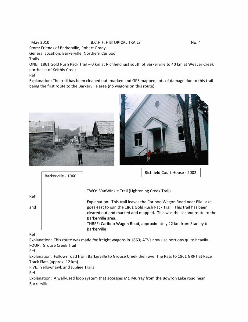
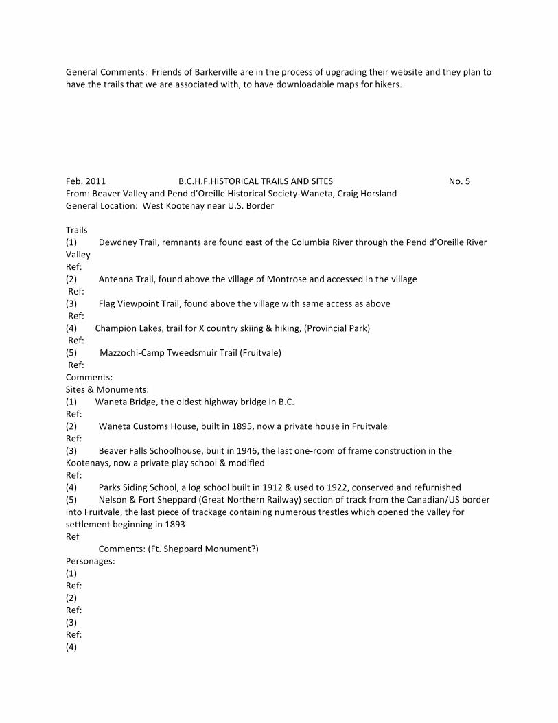
May 2010 B.C.H.F. HISTORICAL TRAILS No: 4 From: Friends of Barkerville, Robert Grady General Location: Barkerville, Northern Cariboo Trails ONE: 1861 Gold Rush Pack Trail – 0 km at Richfield just south of Barkerville to 40 km at Weaver Creek northeast of Keithly Creek Ref: Explanation: The trail has been cleaned out, marked and GPS mapped, lots of damage due to this trail being the first route to the Barkerville area (no wagons on this route)
TWO: VanWinkle Trail (Lightening Creek Trail) Ref:
Explanation: This trail leaves the Cariboo Wagon Road near Ella Lake and goes east to join the 1861 Gold Rush Pack Trail. This trail has been
cleared out and marked and mapped. This was the second route to the Barkerville area. THREE: Cariboo Wagon Road, approximately 22 km from Stanley to Barkerville
Ref: Explanation: This route was made for freight wagons in 1863; ATVs now use portions quite heavily. FOUR: Grouse Creek Trail Ref: Explanation: Follows road from Barkerville to Grouse Creek then over the Pass to 1861 GRPT at Race Track Flats (approx. 12 km) FIVE: Yellowhawk and Jubliee Trails Ref: Explanation: A well-‐used loop system that accesses Mt. Murray from the Bowron Lake road near Barkerville
Barkerville -‐ 1960 Richfield Court House -‐ 2002
General Comments: Friends of Barkerville are in the process of upgrading their website and they plan to have the trails that we are associated with, to have downloadable maps for hikers.
Feb. 2011 B.C.H.F.HISTORICAL TRAILS AND SITES No. 5 From: Beaver Valley and Pend d’Oreille Historical Society-‐Waneta, Craig Horsland General Location: West Kootenay near U.S. Border Trails (1) Dewdney Trail, remnants are found east of the Columbia River through the Pend d’Oreille River Valley Ref: (2) Antenna Trail, found above the village of Montrose and accessed in the village Ref: (3) Flag Viewpoint Trail, found above the village with same access as above Ref: (4) Champion Lakes, trail for X country skiing & hiking, (Provincial Park) Ref: (5) Mazzochi-‐Camp Tweedsmuir Trail (Fruitvale) Ref: Comments: Sites & Monuments: (1) Waneta Bridge, the oldest highway bridge in B.C. Ref: (2) Waneta Customs House, built in 1895, now a private house in Fruitvale Ref: (3) Beaver Falls Schoolhouse, built in 1946, the last one-‐room of frame construction in the Kootenays, now a private play school & modified Ref: (4) Parks Siding School, a log school built in 1912 & used to 1922, conserved and refurnished (5) Nelson & Fort Sheppard (Great Northern Railway) section of track from the Canadian/US border into Fruitvale, the last piece of trackage containing numerous trestles which opened the valley for settlement beginning in 1893 Ref Comments: (Ft. Sheppard Monument?) Personages: (1) Ref: (2) Ref: (3) Ref: (4)
Ref: Comments: Selecting five individuals from among those who developed these valleys is extremely difficult. We will leave it for another time.
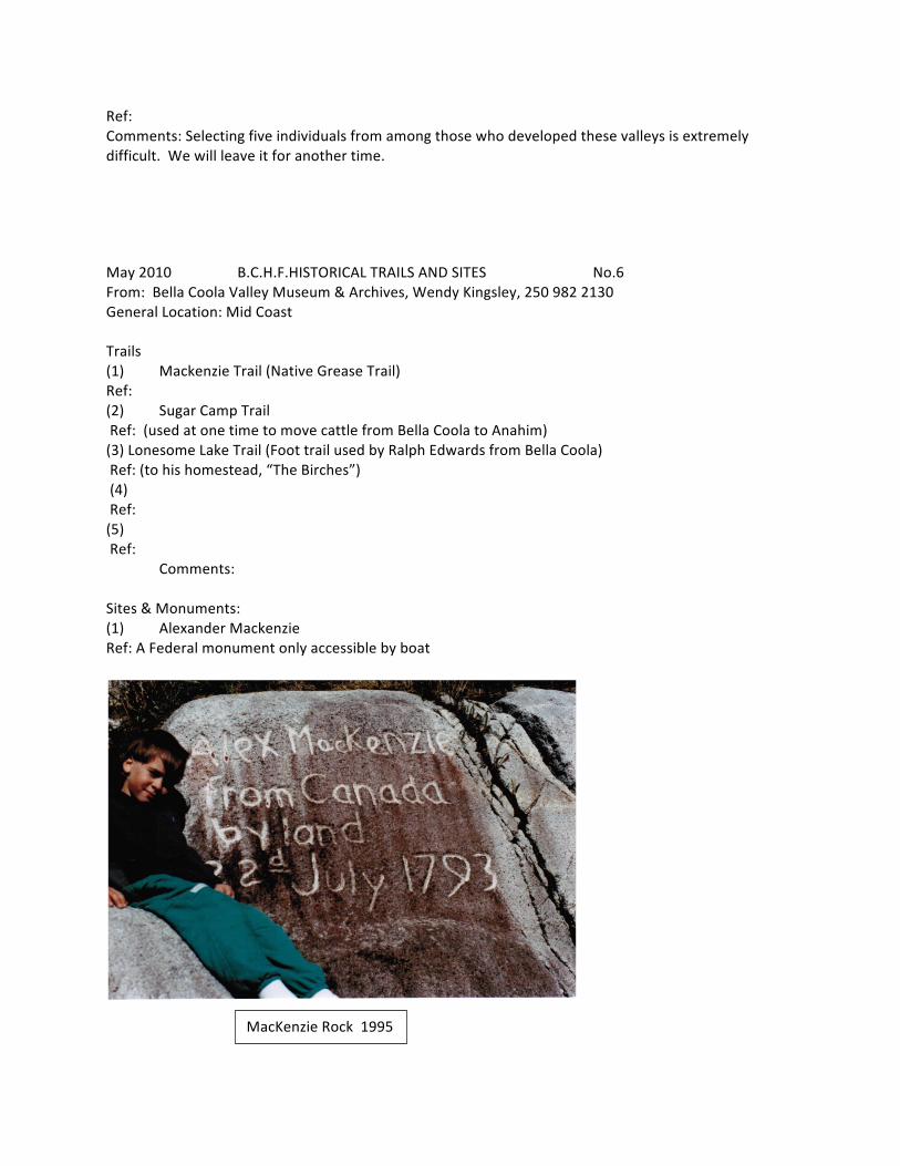
May 2010 B.C.H.F.HISTORICAL TRAILS AND SITES No.6 From: Bella Coola Valley Museum & Archives, Wendy Kingsley, 250 982 2130 General Location: Mid Coast Trails (1) Mackenzie Trail (Native Grease Trail) Ref: (2) Sugar Camp Trail Ref: (used at one time to move cattle from Bella Coola to Anahim) (3) Lonesome Lake Trail (Foot trail used by Ralph Edwards from Bella Coola) Ref: (to his homestead, “The Birches”) (4) Ref: (5) Ref: Comments: Sites & Monuments: (1) Alexander Mackenzie Ref: A Federal monument only accessible by boat
MacKenzie Rock 1995
(2) Ref: (3) Page 6A Ref: (4) Ref: (5) Ref Comments: Personages: (1) Alexander Mackenzie Ref: (2) Phillip Jacobsen Ref: (3) Reverend Christian Saugstad Ref: (4) Ralph Edwards Ref: (5) Clayton Mack Ref: Comments: Some of the above are not adequately described or promoted. Additional Comments:
Nov. 2011 B.C.H.F. HISTORIC TRAILS & SITES No. 7 From Bulkley Valley Historical and Museum, Smithers, Doug Boersema, [email protected]
General Location: Yellowhead Highway between Prince George and Prince Rupert.
Trails: 1. The Collins Telegraph trail was developed with the building of the Telegraph line to connect New York to Europe overland, through B.C., Alaska and Russia. It opened up the Bulkley Valley and was used as a main transportation link to bring in supplies, horses and beef by land. The trail is not marked but the Bulkley Valley Museum, Smithers, and the Telkwa Museum have informative displays to show its history and location. Parts are now followed by roads, horse and hiking sections and private farmland. Ref: 2. The Gold rush trail from Hazelton to the Germanson goldfields, via old First Nation trails through the Suskwa River Valley, Fort Babine and east from there. Ref: 3. A trail along the Pine Creek from Telkwa to the coal files along the Copper River (formerly known as the Zymoets River). Ref: 4. A supply road from Morricetown to the Cronan mine was located and cut open again about six years ago. Ref: 5. Old mining trails along the Telkwa River and on to Terrace. Parts are logging roads and the other parts can be traveled by horseback and quads or on foot. Ref: Sites and Monuments: 1. The abandoned site of the historic town of Aldermere, near Telkwa. It now has well maintained walking trails leading into it. Ref: 2. Fossil beds in Driftwood Park. Ref: 3. The St Stephens Anglican Church in Telkwa-‐ The first Anglican Church in the Bulkley Valley. 1910 Ref: 4. The Telkwa Barbecue Grounds was the focal point for the locals and visitors from Prince George to Prince Rupert who came to participate in beef from the pit barbeque, rodeo activities, horse races, baseball games and dances starting in 1912 and continuing to today. Special trains were run to bring in the visitors. Ref: 5. The town of Smithers was built in 1913, mostly on swampy ground to get around speculators, as the Division point between Prince Rupert and Fort George by the Grand Trunk Pacific Railway. Ref:
Page 7A Personages: 1. Wiggs O'Neil, a great promoter of the Bulkley Valley, a historian, interesting career and had a number of 'firsts' to his credit. Ref: 2. Joseph Coyle, He started the Interior News in 1910 and it is still being published under that name today. He invented the egg carton and a machine to cut and fool it together. This invention spread around the world. Ref: 3. Jack McNeil, The main promoter and business man in Aldermere, later in Telkwa and then in Smithers. Ref: 4. Gabe LaCroix, The first farmer in the Bulkley Valley and the person who brought in the first milk cow to the valley. Ref: 5. Tyee David. Also called David Francis who was a high chief of the Hagwilget Nation. He had a huge impact on relations with the Europeans, and was the first native to buy land to prevent being pushed out by the Europeans. Ref: Comments: Most of the above are promoted thought the local museums but more could be done to include them in the curriculum of the local schools.
May 2010 B.C.H.F. HISTORICAL TRAILS No: 8 From: Central Interior, Marie Elliott, [email protected] General Location: Throughout B.C. Interior ONE: Duzcho trail between Fort St. James and McLeod Lake and Nyan Wheti Trail between Fort St. James and Fraser Lake. Ref: http://www2.news.gov.bc.ca/news_releases_2005-‐2009/2008FOR0115-‐001219.htm “Fort St. James and New Caledonia” by Marie Elliott Explanation: Ancient Trails used by North West Company and Hudson’s Bay Company, 1805 to 1900’s, and then continued to be used by locals. They are presently being opened again. TWO: The Mackenzie/Nuxalk – Carrier Trail from Blackwater River to Bella Coola Ref: Explanation THREE: 1861 Cariboo Gold Rush Pack Trail from Keithley Creek to Williams Creek Ref: Explanation: Reopened 1998 FOUR: Telegraph Trail from Quesnel to Atlin Ref: Explanation: FIVE: The Precipice Trail, an ancient First Nations Trail from Atnarko River to Anahim Lake surveyed by Lt. Palmer during the Cariboo Gold Rush and used thereafter by white settlers. Ref: Explanation: The only route of the Bella Coola Valley until 1920 was completed in 1953. SIX: The Fur Brigade Trail from Fort Alexander to Vancouver (after 1847 to Fort Langley) Ref: Explanation: Only segments can be found in the Interior and is better marked in the Okanagan and through the Cascades to Yale and Hope.
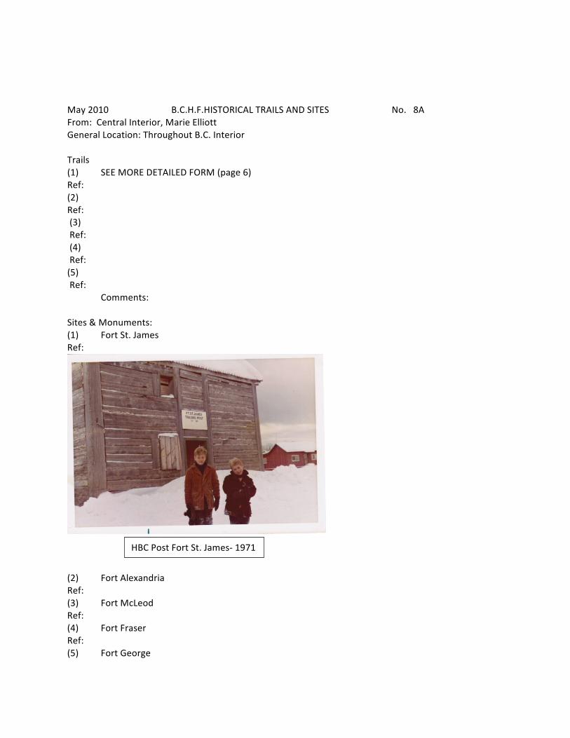
May 2010 B.C.H.F.HISTORICAL TRAILS AND SITES No. 8A From: Central Interior, Marie Elliott General Location: Throughout B.C. Interior Trails (1) SEE MORE DETAILED FORM (page 6) Ref: (2) Ref: (3) Ref: (4) Ref: (5) Ref: Comments: Sites & Monuments: (1) Fort St. James Ref:
(2) Fort Alexandria Ref: (3) Fort McLeod Ref: (4) Fort Fraser Ref: (5) Fort George
HBC Post Fort St. James-‐ 1971
Ref Page 8B Comments: All of the above could do with more promotion, but especially Fort George. The fur trade has been buried by the focus on the lumber Industry (See books “Gold and Grand Dreams” and “Fort St. James and New Caledonia” by Marie Elliott) Personages: (1) Alexander Mackenzie Ref: (2) Simon Fraser Ref: (3) John Stuart Ref: (4) Chief Kwah, Fort St. James Ref: (5) John Bowron Ref: Comments: Additional Comments:

Feb. 2011 B.C.H.F.HISTORICAL TRAILS AND SITES No. 9 From: Chemainus Valley Historical Society, Norma General Location: Middle Vancouver Island, East Coast Trails (1) Askew Park Trails Ref: (2) Hermit Trails Ref: (3) Chemainus Lake Trails Ref: (4) Kim Park (sunken airplane site) Ref: (5) __ Ref: Comments: Sites & Monuments: (1) St. Michael’s and All Angels Church Ref: (2) Chemainus Wooden Bridge Ref: (3) Chemainus Cemetery and Westholme Cemetery Ref: (4) Chemainus Saw Mill (est.!890’s) Ref: (5) Horseshoe Bay Inn Ref Comments: Personages: (1) The Askew’s Ref: (2) Billy Thomas Ref: (3) Hong Hing Ref: (4) The Howe’s Ref: (5) H.R. McMillan Ref: Comments: Additional Comments:
Feb. 2011 B.C.H.F.HISTORICAL TRAILS AND SITES No. 10 From: Chilliwack–Hope-‐Spuzzun, Charles Hou, [email protected] General Location: Eastern Fraser Valley and Fraser Canyon Trails (1) Fur Brigade Trail 1848-‐9, Chilliwack Lake & Creek Ref: (2) Fur Brigade Trail, 1849-‐60, Dewdney Ref: (3) Dewdney-‐Watcolm Mail Trail Ref: (4)Harrison-‐ Lillooet Gold Rush Trail Ref: (5) Chilliwack Lake to Silver Creek Ref: Comments: Sites & Monuments: (1) Port Douglas, Ref: (2) 29 Mile house Ref: (3) Spuzzum Ref: (4) Lake Mountain Ref: (5) Alexandra Lodge Ref Comments: Personages: (1) Chief Pahallak Ref: (2) A.C. Anderson Ref: (3) Henry Peers Ref: (4) Donald Manson Ref: (5) James Murray Yale Ref: Comments: Additional Comments:
. May, 2010 B.C.H.F.HISTORICAL TRAILS AND SITES No. 11 From: Cowichan Museum & Archives, Tom Paterson, [email protected] General Location: Duncan Area, between Victoria and Nanaimo Trails (1) Trans Canada Trail (former CNR line, Victoria-‐Youbou) Ref: (2) Cowichan Valley Trail (former CPR/E&N line, Duncan-‐Lake Cowichan) Ref: (3) Tidewater Line (former CNR line, Cowichan Bay-‐Deerholme) Ref: (4) Mt. Tzuhalem-‐Genoa Bay Ref: (5) Ref: Comments: Monuments: (1) Kinsol Trestle (over Koksilah River) Ref: (2) Butter/Old Stone Church (near mouth of Cowichan River) Ref: (3) Cliffside (Last Spike E&N RR – Shawnigan Lake) Ref: (4) Fairbridge School/Chapel Ref: (5) Mt. Prevost War Memorial Ref (6) Keating Farm (House) Comments: Personages: (1) William Smithe, Premier Ref: (2) Mayo Singh, Lumber baron Ref: (3) E.J. Hughes, Artist Ref: (4) Herb Doman, Lumber baron Ref: (5) Simon Charlie, Cowichan carver Ref: (6) Vice-‐Admiral Rollo Mainguy, RCN
(7) Charles F. Hoey, V.C. Comments:
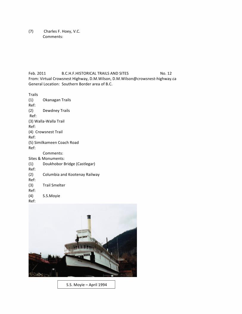
Feb. 2011 B.C.H.F.HISTORICAL TRAILS AND SITES No. 12 From: Virtual Crowsnest Highway, D.M.Wilson, D.M.Wilson@crowsnest-‐highway.ca General Location: Southern Border area of B.C. Trails (1) Okanagan Trails Ref: (2) Dewdney Trails Ref: (3) Walla-‐Walla Trail Ref: (4) Crowsnest Trail Ref: (5) Similkameen Coach Road Ref: Comments: Sites & Monuments: (1) Doukhobor Bridge (Castlegar) Ref: (2) Columbia and Kootenay Railway Ref: (3) Trail Smelter Ref: (4) S.S.Moyie Ref:
S.S. Moyie – April 1994
Page12A (5) Grand Forks Airport Ref Comments: Personages: (1) Frederick Augustus Heinze Ref: (2) Daniel Chase Corbin Ref: (3) James Baker Ref: (4) Louisa Allison Ref: (5) James Jerome Hill Ref: Comments, Allison, not well enough known Additional Comments:
May 2010 B.C.H.F.HISTORICAL TRAILS AND SITES No. 13 From: John Macdonald, 778 883 5572 General Location: North Delta, Lower Mainland Trails (1) Kennedy Trail – follows high ground across North Delta & Surrey to Mud Bay Ref: Personal research done by John Macdonald Trail built by James Kennedy in 1861 from his Lot 15 pre-‐emption in what later became the Annieville area of North Delta (2) Ref: (3) Ref: (4) Ref: (5) Ref: Comments: Sites & Monuments: (1) Ref: (2) Ref: (3) Ref: (4) Ref: (5) Ref Comments: Personages: (1) Ref: (2) Ref: (3) Ref: (4) Ref: (5) Ref: Comments: Additional Comments:
May, 2010 B.C.H.F.HISTORICAL TRAILS AND SITES No. 14 From: Kootenay Doukhobor Museum-‐ Castlegar, Larry Ewashen General Location: Castlegar, Southern Part of West Kootenay Trails (1) Trans-‐Canada Trail Ref: (2) Skatabo Trail Ref: (3) Ref: (4) Ref: (5) Ref: Sites & Monuments: (1) David Thompson Statue Ref: (2) Doukhobor Suspension Bridge built 1913 Ref: (3) H.S.M.B.C. Historic Site Ref: (4) Ref: (5) Ref Comments:

Page 14A Personages: (1) Peter V. Verigin, H.S.M.B.C., person of historical significance Ref: Plaque pending (2) Doukhobors Move to B.C., HSMBC event of national significance Ref: Plaque pending (3) Ref: (4) Ref: (5) Ref: Comments: (John Charters) Additional Comments:
National Doukhobor Heritage Site -‐ 2009

May, 2010 B.C.H.F.HISTORICAL TRAILS AND SITES No. 15 From: East Kootenay Historical-‐ Cranbrook, Naomi Miller, [email protected] General Location: Cranbrook, Southern East Kootenay Trails (1) Dewdney Trail Ref:
(2) Howse Pass Trail Ref:
(3) McGinty Trail (North Star Mine to Kootenay River when ore was shipped by sternwheeler to Montana) Ref: (4) Walla Walla Trail (Supply route west side of Kootenay River before Spokane was a center. Ref: (5) Kalispell Trail (approximate location of Highway 93) Ref:
End of Dewdney Trail – 2008
Howse Pass Trail -‐1962 No need to cross Blaeberry River today

Monuments: Page 15A (1) David Thompson and Charlotte (small statue at Invermere) Ref: (2) Great Divide at Yoho–Banff National Park Boundary on Highway 1A Ref: (3) Ghost Rider -‐ Fernie Ref: (4) St. Eugene Church near Cranbrook Ref: (5) Ref Personages: (1) David Thompson Ref: (2) Father Nicholas Coccola Ref: (3) Katherine Clark (at times the only white woman at Galbraith’s Ferry – Fort Steele 1882-‐1894)) Ref: (4) William Adolf Baille-‐Grohman Ref: (5) Captain Frank Armstrong of river boat fame Ref: (6) Colonel James Baker Additional Comments:
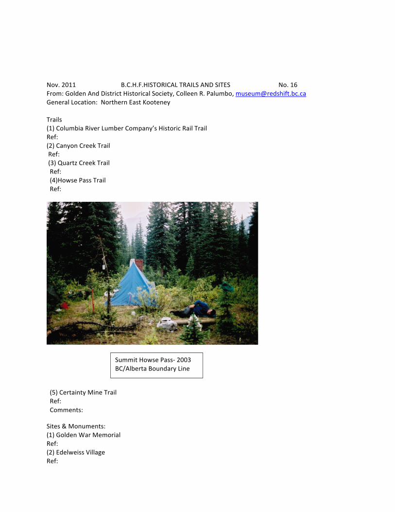
Nov. 2011 B.C.H.F.HISTORICAL TRAILS AND SITES No. 16 From: Golden And District Historical Society, Colleen R. Palumbo, [email protected] General Location: Northern East Kooteney Trails (1) Columbia River Lumber Company’s Historic Rail Trail Ref: (2) Canyon Creek Trail Ref: (3) Quartz Creek Trail Ref: (4)Howse Pass Trail Ref:
(5) Certainty Mine Trail Ref: Comments:
Sites & Monuments: (1) Golden War Memorial Ref: (2) Edelweiss Village Ref:
Summit Howse Pass-‐ 2003 BC/Alberta Boundary Line
(3) Timber Frame Pedestrian Bridge Page 16A Ref: (4) Ref: (5) Ref: Personages: (1) Baptiste Morigeau, a Metis man who opened the first store in the community Ref: (2) The Swiss Guides-‐ Brought to Canada by the C.P.R. to guide visitors in the mountains and aid in the overall experience. Ref: (3) David Thompson and Charlotte Small-‐ the Star Gazer and his Metis wife who mapped one sixth of the continent. Ref: (4) Captain Francis Armstrong-‐ Riverboat Captain who opened navigation on the Upper Columbia River. Ref: (5) William Wenman-‐ A local businessman who started the first local museum. Ref:
Comments:
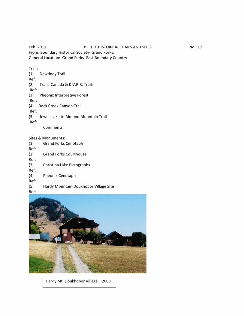
Feb. 2011 B.C.H.F.HISTORICAL TRAILS AND SITES No. 17 From: Boundary Historical Society-‐ Grand Forks, General Location: Grand Forks-‐ East Boundary Country Trails (1) Dewdney Trail Ref: (2) Trans-‐Canada & K.V.R.R. Trails Ref: (3) Pheonix Interpretive Forest Ref: (4) Rock Creek Canyon Trail Ref: (5) Jewell Lake to Almond Mountain Trail Ref: Comments: Sites & Monuments: (1) Grand Forks Cenotaph Ref: (2) Grand Forks Courthouse Ref: (3) Christina Lake Pictographs Ref: (4) Pheonix Cenotaph Ref: (5) Hardy Mountain Doukhobor Village Site Ref:
Hardy Mt. Doukhobor Village _ 2008

Comments: Page 17A Personages: (1) Ranulph R. Gilpin Ref: (2) Sidney R. Almond Ref: (3) R.A. (Volcanic) Brown Ref: (4) John J. Verigin Sr. Ref: (5) Lois Haggen Ref: Comments: Additional Comments:
May, 2010 B.C.H.F.HISTORICAL TRAILS AND SITES No. 18 From: Gray Creek Historical Society, Frances Roback [email protected] General Location: Easterly side of Kootenay Lake Trails (1) Rose Pass Trail Ref: (2) Trail from Pilot Bay to Crawford Bay Ref: (3) Old Single-‐tract Road between Gray Creek & Crawford Bay, developed from a trail Ref: (4) Original St. Mary’s to Gray Creek Trail via Gray Creek Pass Ref: (5) Cemetery Trail, which provided steep foot access to Gray Creek Cemetery before the road was built Ref: Monuments and Sites (1) Gray Hall and School, built 1912, remains a vital community hub 98 years later Ref: (2) Old Gray Creek Store, provided essential service to residents, travelers and campers for circa 65 years, still stands as a Gray Creek landmark Ref: (3) Golden Pine, originally home to fruit rancher, Leonard Clark and his wife, famous writer Catherine Anthony Clark. Now home to Sacred Journeys. Ref: (4) Redding Cabin, the oldest building in Gray Creek, built in 1890’s by Gray Creek’s first settler, John Redding and his partner, Gray, the cabin was renamed Little Log in the 1930’s when it became a rental cabin for campers. Now moved to Gray Creek Hall, Redding Cabin will be rehabilitated for community use. Ref: (5) Gray Cemetery with its unique Lych Gate, Memorial Wall and community’s 100 year time capsule, has been the peaceful home to all for over 85 years. Ref (6) Pilot Bay Smelter (7) Pilot Bay Lighthouse Personages: (1) Henry E. Croasdaile, landowner and developer, who founded the Gray Creek settlement in 1908 by bringing in both postal service and sternwheeler service Ref: (2) Henry Rose, local miner, prospector, convicted murderer Ref: …cont. on next page 18A
Page 18A Personages (cont.) Continued from p. 18 (3) Arthur W. Lymbery, a man synonymous with Gray Creek community origins. He was a solicitor, fruit rancher, storekeeper, postmaster, founder of the Gray Creek Auto Camp and Gray Creek Regatta. Ref: (4) Catherine Anthony Clark, early Gray Creek settler and award-‐winning author of children’s storybooks (5) Farmer, hunter and trapper, Thomas Oliver and his wife, Eliza Oliver, who raised their twelve children after Thomas’ early death in 1922. Together, Thomas and Eliza founded the Oliver Family of Gray Creek, who have actively served the community for over one hundred years. Ref: Additional Comments: Are the above adequately described or promoted? No -‐ All deserve more promotion. Most if not all have been the subject of Tom Lymbery’s monthly local history column, “Tom’s Corner”, in the local newspaper, East Shore Mainstreet. Some have been featured in displays in the Gray Creek Hall and some, eg., the history of the Gray Creek Hall, have received more widespread attention, eg., in talks (Susan Hulland on Henry Rose), and in BC History (Tom Lymbery, on the Gray Creek Hall) Do any need to be brought into the public focus? All have historical significance locally, and in some cases regionally and nationally (eg. Catherine Anthony Clark; Henry Croasdaile; Rose Pass; Gray Creek Pass). All five people listed here are great Gray Creek characters whose stories should have wider coverage. All five historical trails on the list and seven historical sites on the extended list, need protection and preservation – bringing them into the public focus would help to raise public awareness.
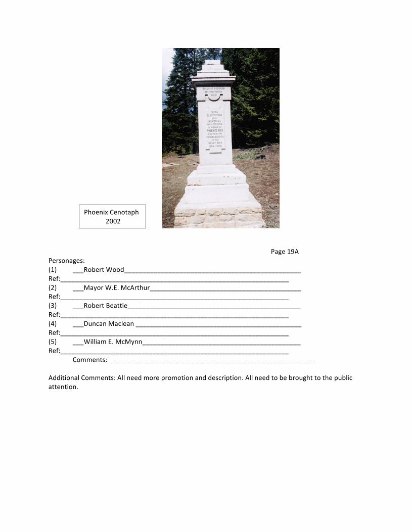
May, 2010 HISTORICAL TRAILS AND SITES No. 19 From: Greenwood Historical Society General Location: Central Boundary Country Trails (1) ____Dewdney Trail_____________________________________________ Ref:______________________________________________________________ (2) ____Kettle Valley Railroad_________________________________________ Ref:_______________________________________________________________ (3) ___Great Northern Railway_________________________________________ Ref: ______________________________________________________________ (4) ___C.P.R. spur to Motherload_______________________________________ Ref: ______________________________________________________________ (5) ___Jubilee Trail_________________________________________________ Ref:______________________________________________________________ Monuments: (1) ___Smoke stack and Smelter Site___________________________________ Ref:______________________________________________________________ (2) ___West Kootenay Power_________________________________________ Ref:______________________________________________________________ (3) ___Tunnel of Flags (east of Greenwood)_____________________________ Ref:______________________________________________________________ (4)________City Hall (Courthouse and Post Office)__________________________ Ref:______________________________________________________________ (5)_________Phoenix Cenotaph____________________________________________ Ref:
Page 19A Personages: (1) ___Robert Wood________________________________________________ Ref:______________________________________________________________ (2) ___Mayor W.E. McArthur_________________________________________ Ref:______________________________________________________________ (3) ___Robert Beattie_______________________________________________ Ref:______________________________________________________________ (4) ___Duncan Maclean _____________________________________________ Ref:______________________________________________________________ (5) ___William E. McMynn___________________________________________ Ref:______________________________________________________________ Comments:________________________________________________________ Additional Comments: All need more promotion and description. All need to be brought to the public attention.
Phoenix Cenotaph 2002
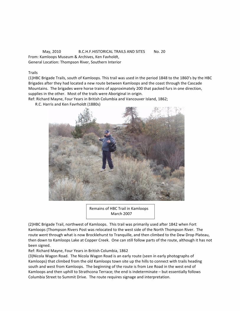
May, 2010 B.C.H.F.HISTORICAL TRAILS AND SITES No. 20 From: Kamloops Museum & Archives, Ken Favholdt, General Location: Thompson River, Southern Interior Trails (1)HBC Brigade Trails, south of Kamloops. This trail was used in the period 1848 to the 1860’s by the HBC Brigades after they had located a new route between Kamloops and the coast through the Cascade Mountains. The brigades were horse trains of approximately 200 that packed furs in one direction, supplies in the other. Most of the trails were Aboriginal in origin. Ref: Richard Mayne, Four Years in British Columbia and Vancouver Island, 1862; R.C. Harris and Ken Favrholdt (1880s)
(2)HBC Brigade Trail, northwest of Kamloops. This trail was primarily used after 1842 when Fort Kamloops (Thompson Rivers Post was relocated to the west side of the North Thompson River. The route went through what is now Brocklehurst to Tranquille, and then climbed to the Dew Drop Plateau, then down to Kamloops Lake at Copper Creek. One can still follow parts of the route, although it has not been signed. Ref: Richard Mayne, Four Years in British Columbia, 1862 (3)Nicola Wagon Road. The Nicola Wagon Road is an early route (seen in early photographs of Kamloops) that climbed from the old Kamloops town site up the hills to connect with trails heading south and west from Kamloops. The beginning of the route is from Lee Road in the west end of Kamloops and then uphill to Strathcona Terrace; the end is indeterminate – but essentially follows Columbia Street to Summit Drive. The route requires signage and interpretation.
Remains of HBC Trail in Kamloops March 2007
Ref: Kamloops Museum and Archives Page 20A (4)Shuswap Road. Shuswap Road (also known as Old Shuswap Road or East Shuswap) is a route along the north side of the Thompson between the Tk’emlups Indian Reserve and a site across from Monte Creek. This route was used by the brigades when Fort Kamloops was located on the northeast corner of the river junction between 1822 and 1841. At Monte Creek in the south side of the south Thompson, the horse brigades swam across the river, shallow and placid at this point. The present paved road is likely the exact route of the old trail. Interpretative signage is needed. Ref: Old maps (5) Bill Miner Trail. Bill Miner was the infamous train robber who held up the first train in Canada near Mission in 1904 before doing it again east of Kamloops in 1906. On that occasion, Miner with his two accomplices held up the CPR Transcontinental east of Kamloops thinking it was laden with cash. Unfortunately for them, they obtained only $15 and some liver oils from the baggage car and proceeded southwards towards Douglas Lake. The route they took is known from various local accounts and is described in a recent book. The route, although it traverses private land, as well as public land, could be reconstructed and signed in parts. Ref: Peter Grauer, Interred in their Bones: Bill Miner in Canada, 1903-‐07 (2006)
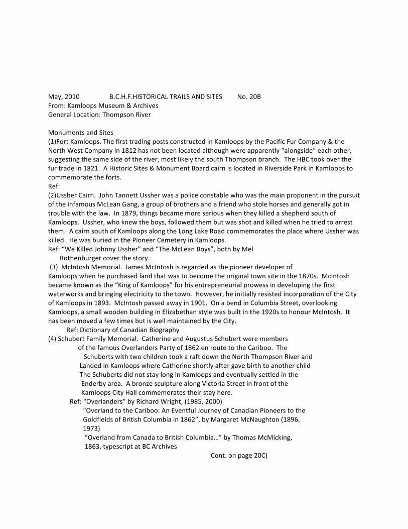
May, 2010 B.C.H.F.HISTORICAL TRAILS AND SITES No. 20B From: Kamloops Museum & Archives General Location: Thompson River Monuments and Sites (1)Fort Kamloops. The first trading posts constructed in Kamloops by the Pacific Fur Company & the North West Company in 1812 has not been located although were apparently “alongside” each other, suggesting the same side of the river, most likely the south Thompson branch. The HBC took over the fur trade in 1821. A Historic Sites & Monument Board cairn is located in Riverside Park in Kamloops to commemorate the forts. Ref: (2)Ussher Cairn. John Tannett Ussher was a police constable who was the main proponent in the pursuit of the infamous McLean Gang, a group of brothers and a friend who stole horses and generally got in trouble with the law. In 1879, things became more serious when they killed a shepherd south of Kamloops. Ussher, who knew the boys, followed them but was shot and killed when he tried to arrest them. A cairn south of Kamloops along the Long Lake Road commemorates the place where Ussher was killed. He was buried in the Pioneer Cemetery in Kamloops. Ref: “We Killed Johnny Ussher” and “The McLean Boys”, both by Mel Rothenburger cover the story. (3) McIntosh Memorial. James McIntosh is regarded as the pioneer developer of Kamloops when he purchased land that was to become the original town site in the 1870s. McIntosh became known as the “King of Kamloops” for his entrepreneurial prowess in developing the first waterworks and bringing electricity to the town. However, he initially resisted incorporation of the City of Kamloops in 1893. McIntosh passed away in 1901. On a bend in Columbia Street, overlooking Kamloops, a small wooden building in Elizabethan style was built in the 1920s to honour McIntosh. It has been moved a few times but is well maintained by the City. Ref: Dictionary of Canadian Biography (4) Schubert Family Memorial. Catherine and Augustus Schubert were members of the famous Overlanders Party of 1862 en route to the Cariboo. The Schuberts with two children took a raft down the North Thompson River and Landed in Kamloops where Catherine shortly after gave birth to another child The Schuberts did not stay long in Kamloops and eventually settled in the Enderby area. A bronze sculpture along Victoria Street in front of the Kamloops City Hall commemorates their stay here. Ref: “Overlanders” by Richard Wright, (1985, 2000) “Overland to the Cariboo: An Eventful Journey of Canadian Pioneers to the Goldfields of British Columbia in 1862”, by Margaret McNaughton (1896, 1973) “Overland from Canada to British Columbia…” by Thomas McMicking, 1863, typescript at BC Archives Cont. on page 20C)
Page 20C Sites (cont.) (5) Philip A. Gaglardi. Born in 1913 near Mission, Gaglardi was best known as the colourful Minister of Highways under W.A.C. Bennett’s Social Credit Government from 1952 to 1968. He was forced to resign from Cabinet in 1968 over allegations that he flew relatives in a government jet. He earned the nick-‐name “Flyin’ Phil” for his jet-‐setting as well as his speeding tickets while “testing” the highways he built. Gaglardi later served as Mayor of Kamloops from 1988 to 1990. Gaglardi was also a Pentecostal Minister at Calvary Temple in downtown Kamloops. A life-‐size bronze sculpture of Gaglardi has recently been erected at the site of his Church in a square named in his honour. The sculpture is by local artist, Terry Norlander, who also worked on the Schubert Memorial. Ref: The best account of Gaglardi’s life is by former Kamloops Mayor and Editor of the Kamloops Daily News Mel Rothenburger titled, “Friend O’Mine” (1991)
May 2010 B.C.H.F.HISTORICAL TRAILS AND SITES No. 20D From: Kamloops Museum and Archives General Location: Thompson River Personages: (1) Samuel Black, originally an employee of the NW Company, became an HBC Chief Factor who lived in Kamloops for a decade in the 1830’s. He is most well-‐known for his explorations of Northern B.C. in the 1820’s, searching for the source of the Finlay River. Unfortunately, he appeared to be disliked by some of the local Native people and was murdered at Fort Kamloops in 1841, which resulted in the removal of the post to the west side of the North Thompson River. According to the HBC accounts, when his corpse was to be transported to Fort Vancouver to be interred there, it fell into Monte Creek and was buried nearby. His remains have not been located. A small monument to Black is located in Riverside Park in Kamloops. Ref: Dictionary of Canadian Biography (2) Chief Louis was a hereditary Chief of the Tk’emlups Indian Band from the early 1850’s until his death in 1915. Born around 1828, he witnessed dramatic changes to his people including the gold rushes of the late 1850’s and early 1860’s, the establishment of the first reserves, and sadly, the decimation of his people by a smallpox epidemic in 1862. He encouraged the establishment of the first school on the Indian Reserve, believing his people should be educated and learn skills. Also known as Petit Louis because of his short stature, he was well-‐respected by his people and led several trips and petitions to Ottawa and England to appeal for justice regarding their land claim. Ref: Dictionary of Canadian Biography (3) John Freemont Smith. A black, born in the Danish West Indies in 1859, J.F. Smith travelled to Europe before coming to British Columbia. He settled in the Kamloops area in the early 1890s and tried various jobs including farming and mining in the North Thompson valley. He then tried politics and was elected Alderman for two terms. Afterwards he was an Indian Agent for the Kamloops area. His middle name has been spelled Fremont, but the original spelling as shown on a building that he owned in downtown Kamloops spelled it with two “e”s, suggesting his family’s slave heritage. Contrary to popular accounts, he is not the first black man to enter politics in B.C. or Canada. Ref: Dictionary of Canadian Biography (4) Peter Wing. Known as the first mayor of any city in North America of Chinese descent, Wing was the son of a landless Cantonese peasant who came to Kamloops in 1901. Wing was born in Kamloops in 1914. In 1934 he became a Member of the Kamloops Board of Trade and was first elected Alderman in 1960. He then served as Mayor of Kamloops for three terms starting in 1966 during a period of considerable growth for Kamloops. During his term as mayor, he was also President of the Union of B.C. Municipalities. In 1976 he was made a member of the Order of Canada and later the Order of British Columbia. He passed away in 2007 in Vancouver. Ref: Terrance Roth, “The Peasant’s Gold: The Story of Peter Wing” (1998) (5)Len Marchand The first Aboriginal M.P. in Canada, Marchand still lives in Kamloops. Born in 1933, he was educated at UBC and the University of Idaho where he studied agriculture, and became a research scientist at the Kamloops Research Station. He worked as a special assistant for two federal Cabinet Ministers in Ottawa before embarking on his political career. Marchand was elected in 1968 as Liberal M.P. for Kamloops-‐Cariboo, the first Aboriginal person to be elected to Parliament since Louis Riel. In 1976 he became the first Aboriginal to serve in the Federal Cabinet under Prime Minister Trudeau. He was defeated in the 1979 election and became Administrator for the Nicola Valley Indian Administration in Merritt. In 1984 he became Honorary Chief of the Okanagan Nation and in the same year was named to the Senate, finally retiring in 1997. Marchand was named to the Order of Canada in 1999.
Ref: Encyclopaedia of British Columbia
March 2011 B.C.H.F. HISTORIC TRAILS & SITES No. 21 From: Kitimat Museum and Archives, Louise Avery 250 632 8950 General Location: Northern Coast, [email protected] Five most historic trails Kitimat to Terrace Mail Route 1. Mount Elizabeth Trail 2. Clague Mountain Trail 3. Centennial Trail (part circles Minette Bay) 4. Robinson Lake and Ridge Trail Five most important and historic sites 1. Corduroy Road 2. CN Station 3. Nechako Centre 4. Century House 5. Canadian Legion Five most important historical personages 1. George Anderson 2. Elizabeth Anderson Varley 3. Reverend Raley 4. Rudolf Braun 5. Sam Lindsay Are the above adequately described or promoted? Somewhat Do any need to be brought into the public focus? Yes
Feb. 2011 B.C.H.F.HISTORICAL TRAILS AND SITES No. 22 From: Langley Centennial Museum, Kobi Howard, 604 888 3922 General Location: Southwestern Mainland Trails (1) Allard Crescent Ref: (2) Smuggler’s Semiahmoo Trail Ref: (3) Glover Road Ref: (4) Telegraph Trail Ref: (5) Old Yale Road Comments: Chosen for their importance in providing the earliest transportation routed and regional links between Fort Langley and the region (including the Interior), as well as for links they provided locally. Sites & Monuments: (1) Derby Town site Ref: (2) Hudson’s Bay Company House & National Historic Site Ref: (3) Hudson’s Bay Company Farm – Langley Prairie – modern day Milner Ref: (4) Murrayville Traveller’s Hotel – Murray’s Corners Ref (5) Fort Langley CNR – Langley Station Comments: Recognition could be given to the early Kwantlen First Nations settlements that existed along the Fraser River. Also such sites as Alex Houston Residence and out buildings (first private farm) and the BCER Right of Way. Personages: (1) Thomas Langley, a prominent stock holder in the management of the Hudson’s Bay Company who never actually came to the area. Ref: (2) Ref: (3) Ref: (4) Ref: (5) Ref: Comments:
May, 2010 B.C.H.F.HISTORICAL TRAILS AND SITES No. 23 From: S.S. Master Society, Jamea Dietch, 604 684 0950 General Location: Steveston, Lower Mainland Trails (1) Ref: (2) Ref: (3) Ref: (4) Ref: (5) Ref: Comments: Sites & Monuments: (1) S.S. Master Ref: Currently moored at Britannia Heritage Shipyard (2) Fraser Shipyard, New Westminster Ref: (3) Old Evan Coleman Shipyard Ref: Now Ocean Cement on Granville Island (4) Ref: (5) Ref Comments: Personages: (1) Ref: (2) Ref: (3) Ref: (4) Ref: (5) Ref: Comments: Additional Comments:
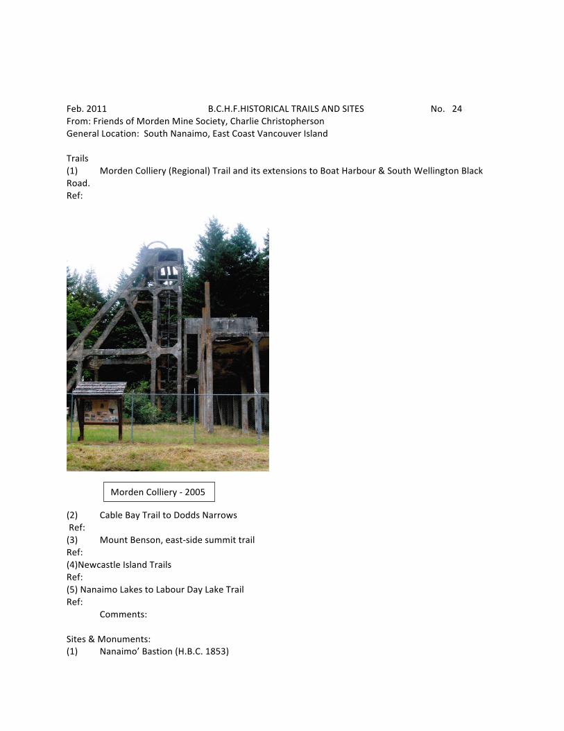
Feb. 2011 B.C.H.F.HISTORICAL TRAILS AND SITES No. 24 From: Friends of Morden Mine Society, Charlie Christopherson General Location: South Nanaimo, East Coast Vancouver Island Trails (1) Morden Colliery (Regional) Trail and its extensions to Boat Harbour & South Wellington Black Road. Ref:
(2) Cable Bay Trail to Dodds Narrows Ref: (3) Mount Benson, east-‐side summit trail Ref: (4)Newcastle Island Trails Ref: (5) Nanaimo Lakes to Labour Day Lake Trail Ref: Comments: Sites & Monuments: (1) Nanaimo’ Bastion (H.B.C. 1853)
Morden Colliery -‐ 2005
Ref: Page 24A (2) Gallows Point Lighthouse (two early 1852-‐3 hangings, coal-‐mine shaft 1891, steamer Oscar explosion in 1913, 16 men killed 1918. Ref: (3) Nanaimo Courthouse (Rattenbury 1896) Ref: (4) Morden Colliery Mine (Pacific Coast Mining Company 1913) Ref (5) Native rock escarpment along Cliff St., that sets the character of the downtown landscape Comments: The escarpment is not sufficiently recognized as an historic landscape feature, which helped to accentuate the early pioneer mining town of Nanaimo as a near island Personages: (1) Mark Bate, Nanaimo’s first mayor Ref: (2) Robert Dunsmuir Ref: (3) Sam Robbins (community-‐conscious mine manager from 1884 to June 1903) Ref: (4) George Norris (published first edition of Nanaimo Free Press April 15, 1874) Ref: (5) Parker Williams represents the first two socialists to be elected MLA’s in B.C. in 1903 Ref: Comments: (5 cent candy revolt)
Feb, 2011 B.C.H.F. HISTORIC TRAILS & SITES No. 25 From: Touchstones Nelson: Museum of Art and History, Laura Fortier, [email protected] General Location: West Kootenay Five most historic trails -‐-‐-‐-‐-‐-‐-‐ 1. Kokanne Glacier Park Trails 2. Pilot Bay Trails 3. Dewdney Trail (Salmo) 4. Mill Creek (Harrop) 5. Great Northern Railway Trail Five most important and historic sites -‐-‐-‐-‐-‐-‐-‐ 1. Lakeside Park and Streetcar #23 2. Baker Street 3. Bonnington Falls Power Plant 4. CPR Transfer Wharf 5. Gyro Park Five most important historical personages -‐-‐-‐-‐-‐-‐-‐-‐-‐-‐-‐ 1. Dr. Isabella and Edward Charles Arthur 2. Peter “the Lordly” Verigin (Castlegar) 3. John Houston 4. Hampton Gray 5. Selwyn Blaylock (Trail) Arthurs not adequately promoted-‐possibly name a street after them?
May 2010 B.C.H.F. HISTORICAL TRAILS No: 26 From: North Vancouver Museum, John Stewart, 778 883 5572 General Location: Lower Mainland ONE: Lillooet Cattle Trail, also known as Lillooet-‐Burrard Cattle Trail and also as the Lillooet Trail. Ref: http://www.en.wikipedia.org/wiki/Lillooet_Cattle_Trail Explanation: An unusual and daring public works undertaking by the Province of British Columbia in 1877. It was the largest 19th Century public works expenditure, at $35,000., of the new province since it’s joining Canada in 1871. TWO: Varley Trail Ref: http://www.dnv.org/upload/documents/parks/varley.htm Explanation: This trail is named in honour of renowned Group of Seven artist and former Lynn Valley resident, Frederick Varley. Born in Sheffield, England, in 1881, Varley immigrated to Canada in 1912 at the urging of school mate and fellow artist, Arthur Lismer. The Varley Trail invites people to explore, as Varley once did, and to be inspired by what he saw. This trail honours the work and legacy of an artist of undying, national accomplishment. THREE: Capilano Canyon Ref: http://www.trails.com/tcatalog_trail.aspx?trailid=HGC007-‐044 Explanation: The walker in this scenic valley lying between the twin communities of North and West Vancouver has a number of outings from which to choose, ranging from various circuits in Capilano Regional Park itself to an upriver approach, following in part a one-‐time railway right-‐of-‐way that links Keith Road in West Vancouver with the Cleveland Dam. FOUR: The Grouse Grind Ref: http://www.grousemountain.com/Summer/summer-‐activities/vancouver-‐bc-‐hiking-‐trails-‐trips/grouse-‐grind.asp Explanation: Hikers were first recorded on Grouse Mountain back in 1894 when a hunting party shot a blue grouse bird and named the mountain in the bird’s honour. The Grouse Grind as we know it today was first developed in 1981 by mountaineers looking for a challenging, aerobic workout to sustain them for their longer hikes. They began by following the existing B.C. Mountaineering Club Trail which still exists today. People soon wanted a steeper route which was completed in the winter of 1983. FIVE: Baden-‐Powell Trail named after notable founder of the Boy Scout Movement. Ref: http://en.wikipedia.org/wiki/Robert_Baden-‐Powell._1st_Baron_Baden-‐Powell Explanation: The first 42 km of the Baden-‐Powell Trail is the main route in a large system of North Shore Mountain trails. It extends all the way from Horseshoe Bay (west) to Deep Cove (east). Because it is not intended as one long hike, but rather as several shorter ones, it can be accessed from several points. General Comment: Above information is but a fraction of this submission.
May 2010 B.C.H.F. HISTORICAL SITES & MONUMENTS No.26A From: North Vancouver Museum (section 2) ONE: Walter Draycott Statue, a bronze statue of a seated Walter Draycott is on the north east corner of Mountain Highway & Lynn Valley Road. Ref: http://www.dnv.org/article.asp?a=1735&c=657 Explanation: Draycott portrays himself as a loyal, talented and energetic soldier as well as a sketcher/writer. He ultimately settled in the Lynn Valley. In 1912 he bought three plots of land on what was later to become Draycott Road. Appointed as official sketcher in WW1 in the Canadian Army. He was severely wounded. Later, involved with Vancouver Boy Scouts, appointed Justice of the Peace and became a prominent member of the Lynn Valley community. TWO: District of North Vancouver Centennial Monument Ref: Explanation: This monument is in a park on the East side of Seymour River within easy walking distance from a spur of the Seymour Parkway accessible from Seymour River Place. The face of the monument marks the arrival of pioneer C.J.P (J.C.P.) Phipps. THREE: North Vancouver Cenotaph Ref: http://www.cdli.ca/monuments/bc/NorthVan.htm Explanation: Located in Victoria Park, was constructed in 1923 in memory of the citizens of the City & the District of North Vancouver who gave their lives during the First World War. FOUR: North Vancouver Sailor’s Memorial Ref: http://www.cdli.ca/monuments/bc/northvan3.htm Explanation: In May 1986 the Sailor’s Memorial was constructed in memory of the men and women of the Royal Canadian Navy, Volunteer Reserves, Reserves, Women’s Service & the Merchant Navy. Located at Waterfront Park. FIVE: Joe Bustemente Trumpet Ref: http://www.artsalivenorthshore.ca/PA_artwork_home.cfm?PublicArtID=30 Explanation: The sculpture, designed by Richard Wojciechowski, makes reference to a figure in local history. In 1900 Joe Bustemente, a one-‐armed Chilean mariner, was retained to blow his trumpet to direct the ferry captain to the North Vancouver wharf. This was particularly important in fog or at night. General Comment: Above information is but a fraction of this submission.
May 2010 B.C.H.F. HISTORICAL PERSONAGES No. 26B From North Vancouver Museum (Section 3) ONE: George Vancouver Ref: http://www.en.wikipedia.org/wiki/George_Vancouver Explanation: George Vancouver entered the harbour in 1792 and described the North Shore as having snow-‐topped mountains and forest down to the water’s edge. Vancouver was the first European to enter Burrard Inlet. TWO: Sewell Prescott Moody bought a mill in bankruptcy and turned it into a profit making enterprise. Ref: http://www.en.wikipedia.org/wiki/Sewell_Moody Explanation: In 1864 he purchased the Pioneer Mills, the first industrial plant on the inlet. So-‐called Moodyville now lies entirely within the City of North Vancouver. . THREE: Hugh Nelson invested in Sewell Moody’s mill and went on to become the second Lieutenant-‐Governor of British Columbia. Ref: http://www.biographi.ca/009004-‐119.01-‐e.php?&id_nbr=6332&interval=20&&PHPSESSID=c8h4fqqi2fnmvv7rq94sv59nrl Explanation: Businessman, politician and office holder. Born 1830 in Larne, N. Ireland, died March 1893 in London, England. FOUR: James Cooper Keith, Financier Ref: http://.www.cnv.org/server.aspx?c=3&i=526 Explanation: J.C. Keith has been little acknowledged. He was born in Scotland but moved to Victoria in 1876. He acquired extensive land holdings in North Vancouver and became a member of the first North Vancouver Council. He was the first manager of the Bank of British Columbia [in Vancouver] and a past president of the Vancouver Board of Trade. He was considered a strong supporter for the incorporation of the City of Vancouver. FIVE: Clarence Wallace, Industrialist, born 1893 Ref: http://.www.en.wikipedia.org/wiki/Clarence_Wallace Explanation: Born in Vancouver, fought in WW1, wounded at Ypres. After the war he became president of his father’s business, Burrard Dry Dock. During WWII He built ships for war and was made a Commander of the Order of the British Empire in 1946. From 1950 to 1955 he was the Lieutenant-‐Governor of British Columbia. He died in 1982. General comment: The above information is but a fraction of this submission.
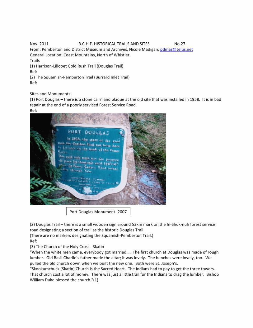
Nov. 2011 B.C.H.F. HISTORICAL TRAILS AND SITES No.27 From: Pemberton and District Museum and Archives, Nicole Madigan, [email protected] General Location: Coast Mountains, North of Whistler. Trails (1) Harrison-‐Lillooet Gold Rush Trail (Douglas Trail) Ref: (2) The Squamish-‐Pemberton Trail (Burrard Inlet Trail) Ref: Sites and Monuments (1) Port Douglas – there is a stone cairn and plaque at the old site that was installed in 1958. It is in bad repair at the end of a poorly serviced Forest Service Road. Ref:
(2) Douglas Trail – there is a small wooden sign around 53km mark on the In-‐Shuk-‐nuh forest service road designating a section of trail as the historic Douglas Trail. (There are no markers designating the Squamish-‐Pemberton Trail.) Ref: (3) The Church of the Holy Cross -‐ Skatin “When the white men came, everybody got married…. The first church at Douglas was made of rough lumber. Old Basil Charlie’s father made the altar; it was lovely. The benches were lovely, too. We pulled the old church down when we built the new one. Both were St. Joseph’s. “Skookumchuck [Skatin] Church is the Sacred Heart. The Indians had to pay to get the three towers. That church cost a lot of money. There was just a little trail for the Indians to drag the lumber. Bishop William Duke blessed the church."(1)
Port Douglas Monument-‐ 2007
Page 27A “The Church of the Holy Cross was built in 1905 in the First Nations village of Skookumchuck, known as Skatin by the Stl’atl’imx people. It is located beside the Lillooet River on BC’s first inland Gold Rush route. Local First Nations craftsmen laboured for years on the elaborately carved altar and finely worked wood details of this remarkable carpenter gothic style church. Designated as a National Historic Site by the Federal government in 1981, the church continues today as a place of worship and ceremony for people in the surrounding communities. The Ama Liisaos Heritage Trust Society is raising funds for its conservation. (2) In 2008 The Skatin Church of the Holy Cross was featured on History TV's "Saving Places" show. Sharon Syrette came to the Pemberton Museum in 2008 to gather research about the church as part of an effort to save the building. It was designated a National Historic site in the 1980’s. Margaret and Slim Fougberg were advocates of saving the church and there is a good amount of information in the Pemberton Museum archives about the building. Ref: Watch a trailer of the "Saving Places" episode. Get more info about the efforts of the Ama Lusaos Heritage Trust Society. http://www.pembertonmuseum.org/blog/2010/6/3/skatin-‐church/ Ref: (1) Decker, Fougberg, Ronayne, ‘Pemberton – History of Settlement, (Pemberton Pioneer Women, 1977), p. 29 (2) Peters, Yvonne A.M., Syrette, Sharon E., ‘Spirit in the Land – Our Place of Prayers’,
(Victoria: Trafford Publishing, 2006), p.1
Nov. 2011 B.C.H.F. Historical Personages No.27B From Pemberton and District Museum and Archives (1) Alexander Caulfield Anderson -‐ 1846 “...in 1846, Alexander Caulfield Anderson travelled through this country with the purpose: to decide if [Hudson Bay] company horses could make their way from the Fraser to present-‐day Mount Currie and on, by way of Lillooet and Harrison Lakes, to Langley. By now, the lower Columbia River, the main link with the interior, was American, and for that reason Governor Simpson considered a new route “most highly important”.”(3) Ref: (3) ‘Pemberton – History of Settlement’, p.47 (2) James Douglas – 1858 The first Governor of B.C. in 1858. He initiated the first Public Works project in the newly formed colony of British Columbia in 1858 to ensure the movement of people and freight into the goldfields. This initial road to the interior through Port Pemberton led to the permanent settlement of the Pemberton Valley and the goldfields beyond. Ref: (3) Lieutenant H. Spencer Palmer of the Royal Engineers. He completed the first engineered survey of the Harrison-‐Lillooet Trail and supervised trail construction. Early construction included the building of a coffer dam to bring Tenas Lake level to the same as Lillooet to allow for passage of a steam wheeler. “The following is a report on the Harrison-‐Lillooet route by Lt. H. Spencer Palmer (Royal Engineer) for Col. R.S. Moody – Dec 12, 1858. The survey was conducted in May 1858 and construction of the trail followed soon after. Port Douglas to 10 Mile – follow the ravine to Burnt Plateau and gain good descent to Ten Mile. Cross the river at Sixteen Mile House and proceed. Simple construction of a fairly level road to the camp is possible. The land looks good for cultivation, the timber being scanty. The ‘camp’ is 6 miles from Tenas Lake. Here the river must be crossed onto a Lil’wat trail which could be converted to a good wagon road. Continue trail to south end of Lillooet Lake where an excellent Lil’wat trail exists, passing through agricultural land. However I have a suggestion to make Twenty Eight Mile the southern terminus. The two lakes are connected by a small river and differ in elevation by 10 feet. By building a dam where the water leaves Tenas, the two lakes could be brought to the same level. Steamers could then travel year round. The town of “Pemberton” stands on a wretched rocky site but is the most favourable starting point for the Birkenhead Portage. The trail on leaving Port Pemberton follows a ravine and runs through a natural pass in the Cascade Range for 24 miles. No deviation from the present route would be necessary. 17 miles from Pemberton, the trail runs along a lake at the summit of the pass. It is called Summit Lake [Gates Lake] and from either end there is a descent to the Fraser River. Regarding the portage between Anderson and Seton Lakes, the difference in level is 50 feet. Several locks would be necessary for boats. An easier solution would be to run goods over a tramway.’”(4) (4) Pemberton Museum, The Pemberton Gazette, p2. (4) Marcus Smith 1873. He was the leader of the first railway survey which established the Squamish-‐Pemberton trail. This newly surveyed trail led to the second influx of settlers in the 1890’s who travelled to Pemberton to pre-‐
empt, confident that the rail would soon come. “In 1873, Marcus Smith, the leader of the first railway survey party in this area, was attempting to locate a line for the first Canadian transcontinental railway Page 27C and wanted to cross more or less directly from the Pacific Ocean to Yellowhead Pass. He supervised a survey that brought him up from the head of Howe Sound and on by way of the Birkenhead River, Anderson and Seton Lakes, to Lillooet, following the route the Pacific Great Eastern Railway would take forty years later.”(5) Ref: (5) ‘Pemberton – History of Settlement‘, p. 59 (5) John Currie – 1885. In 1851, at the age of seventeen, John Currie had emigrated from Scotland. His family settled in Quebec, but he ran away from home and struck off for the California gold-‐fields. Like many miners, he later travelled north to the Cariboo where he would have met McDonald, his partner in Pemberton. With his partners, Dugland McDonald and Owen Williams, he held 960 acres on which he pastured livestock. In 1888 Currie and McDonald applied for a survey of District Lots 164 and 165, an area including the old secondary school site and extending south beyond the line where trains would be running twenty six years later. In 1895, ten years or more after Currie settled in Pemberton with his Lillooet Indian wife, the federal government established a post office in his farm to serve settlers scattered throughout the valley and over Pemberton Portage. John managed the Post Office and small store in his farm for many years. The Curries had three children, two sons and a daughter. The towering mountain in Pemberton bears his name. (6) Ref: (6) Ibid, p. 65-‐67 (6) James Stager – 1911. Chief of The Pemberton Band [Lil’wat Nation] and one of the signatories of the Declaration of the Lillooet Tribe 1911, which asserted sovereignty of the Stl’atl’imx speaking communities. The Declaration of the Lillooet Tribe is an important document in the history of relations between First Nations and the governments of Canada and the Province of B.C. Signed in Spences Bridge on May 10, 1911 by a committee of Chiefs of the Stl’atl’imx peoples, taken down by anthropologist James Teit, it is an assertion of sovereignty over traditional territories as well as a protest against alienations of land by settlers at Seton Portage, British Columbia in 1911. This document has guided negotiations regarding ownership and traditional uses of the land in the region ever since. Chief James Stager began advocating for the Pemberton band as early as 1900. “There was no shortage of Lillooet who wanted to farm, as long as suitable land was available. Chief James Stager went after an Indian agent to get him to lobby for more and better land for the Pemberton Band in 1900. On March 12, he sent this letter to Agent Devlin: “…we [are] going to tell you that we make a meeting one night talking about our land. We think that we are too many in the meadows. Many boys are growing, [and they will] soon be [men] and married so we want more land…Nearly all the meadows are water when [it] is high water. The land we want is right across of us where we use to live in winter time. You know we been asking the same land before, and you say that one white man take the land…Why didn’t he come and build a house…We think we can raise some apple trees on the land we want. We think you can help us because you the agent of us. If you was here now about this time, [you would see] mud nearly a foot and half [is] right [up] the front of the houses every time when [it] is raining….We think that [there] would be great trouble if a Whiteman lives nearby of us because the Indians have a great many cattle, horses and pigs. If you find out what you think of what we ask you, please write up and tell us as soon as you can….Yours truly, Chief James Stager.”(7) “From Anderson Lake [Reserve Commissioner Peter] O’Reilly travelled over the abandoned road to another tribal village in the Pemberton Meadows. He reported to have met with Chief Stager, 203 of his people, and to have seen eighty-‐seven horses, fifty head of cattle, stacks of hay, potatoes and vegetables. Chief Stager, according to the Commissioner, said the land on which the principal village

and church stood had been reserved for his people by Governor Douglas in 1858 or 1860. O’Reilly replied that no record of this reserve allocation was on the Land Office books, which were the Page 27D documents the commissioner appeared to consult during his trip through Lillooet territory. He estimated that the entire valley, ringed by mountains, measured some 9000 acres including meadows, which were often flooded, and some swamp land. The commissioner then recognized the tribal people’s ownership of the valley. However, he also found that almost every acre had been either pre-‐empted or recorded for purchase by white people twenty years earlier, so he passed the buck to the chief commissioner of the province’s Land and Works Department, and stuck to reserving only village sites, fishing stations, some flood land and some of the land recognized by Governor Douglas”.(8) “It was the same story in Pemberton (also referred to as Mt. Currie Band) according to Chief Stager: “Not only our title but our fishing, hunting and everything that we used to live on in the old days – the government has taken it all and left us nothing. All my people are poor and living thin. Everything that we should live on now the government has taken hold of it, even the timber. Chief Stager’s people could not possibly live off the land reserved for their use. He said, “There are 315 men, women and children, and while the reserve looks large….there is just one quarter of it we can use – the rest is under water. “Dykes were needed urgently in Pemberton Meadows, but the Lillooet could not afford to build them. Land recently reserved for the Band had a lot of good forest land, but the Lillooet of Pemberton “Meadows were not allowed to cut the timber. When they bought a small sawmill they were informed that their timber had been given to white people. Chief Stager stated that his men could not get jobs from white people in the area. That meant they either had to leave to earn a living, or live in poverty on the reserve. Those who stayed tried to build a school for their children. But the money ran out. What little cash people had coming from trapping fur animals. But traditional trapping areas, like hunting and fishing grounds, were being encroached upon by white people”. (9) Ref: (7) Drake – Terry, Joanne, ‘The Same as Yesterday’, (Lillooet: Lillooet Tribal Council, 1989), p. 206 (8) Ibid (9) Ibid, p.265 (7) James Alexander Teit -‐ 1912 (15 April 1864 — 30 October 1922). He was an anthropologist and photographer who worked with Franz Boas to study Interior Salish First Nations peoples in the late 19th and early 20th centuries. His work was first published in the “Jesup North Pacific Expedition” edited by Franz Boas; Vol. II, V. “The Lillooet Indians”. This is the earliest ethnographic study done on the Coast Salish in this region, and potentially in B.C. Franz Boas is considered the grandfather of cultural Anthropology and modern ethnographic techniques. James Teit was instrumental in documenting the grievances of the Lillooet peoples concerning their territories and assisted a delegation of chiefs in writing the “Declaration of the Lillooet Tribe in 1911”. “Meanwhile Teit was busy compiling information of the Lillooet whom he estimated as 1600 people throughout Lillooet territory in 1903. Helped by Chief James Stager, Teit traversed Lower Lillooet territory four times – twice on horseback, once on foot, and once by canoe. He spent time in every village to gather information.”(10) Ref: (10) Ibid, p.218 (8) Professor Gordon R. Elliott, son of pioneer residents of this area: Ray Elliott, a homesteader and packer, and Margaret Mellish, the second school teacher, was the consultant and editor of the Pemberton – History of a Settlement” book written by Decker, Fougberg and Ronayne. “Professor Gordon Elliott was to Margaret Laurence what Ira Dilworth was to Emily Carr: A steady, persuasive literary editor guiding the writer towards excellence....Gordon Raymond Elliott was a British Columbian through and through. Other than brief jaunts to distant shores, he never really left the
province. He spent his earliest years in Pemberton and in Williams Lake. His father, Raymond, was a nearly illiterate butcher and his mother Margaret (nee Mellish) was a schoolteacher and a devotee of Page 27E the public library that encouraged her only son’s voracious appetite for books. In 1974....he challenged a generation of Canadian literary criticism on 19th century novels, saying standard texts such as those published by the New Canadian Library were abridged, bowdlerized and unreliable. The confrontation led to the establishment of the Centre for Editing Early Canadian Texts, a group of scholars who produced and authorized original texts of at least six Canadian 19th century novels. Over the years, Prof. Elliott edited hundreds of Canadian texts including British Columbia: A History by Margaret Ormsby (1958), Pemberton: The History of a Settlement (1977). He also wrote Barkerville, Quesnell and the Cariboo Gold Rush (1978), Guide to the Neighbourhood Pubs of the Lower Mainland (1983), and Pick of the Neighbourhood Pubs of B.C. (1986). Gordon was born in Pemberton B.C. on April 19th, 1920. He died in Vancouver on Dec 14th, 2006.”(11) Ref: (11) Noreen Shannon, “Special to the Globe & Mail”, Toronto, 2006 (9) Frances Decker, Margaret Fougberg, and Mary Ronayne – compiled the records that support the book “Pemberton – History of a Settlement” published in 1977. These records form the basis of the archives held by the Pemberton Museum and Archives Society. Shortly after organizing, the Pemberton Women’s Institute began to collect material for a local history. Frances Decker, Margaret Fougberg and the late Kathleen Lundgren formed the first history committee [1943] and were joined in 1973 by Mary Ronayne. The wish to make our work available to more than only members of the Institute developed into a plan to publish a book. Teas and sales of work raised considerable funds for this purpose, but were insufficient in the mid-‐seventies, even with a generous gift from the late Margaret Green. Fortunately an organization knows as the Pemberton Pioneer Woman, an organization of older members and friends of the Institute, applied successfully for a Federal government New Horizons grant, for which we are extremely grateful;. We are grateful also for assistance from Nelville Wrigley of Hemlock Printers Ltd. In 1974 we were fortunate in securing the aid of Gordon R. Elliott, son of pioneer residents of this area…As our consultant his experience and his concerned attention to every phase in the preparation of this history have helped immeasurably.”(12) Ref: (12) “Pemberton – History of Settlement”, p. 4 (9B) Margaret Fougberg: “Margaret was born on Bowen Island on December 21, 1910 and passed away peacefully at Lionsgate Hospital on March 8, 2010, after living for a short time at Inglewood Care Centre….Margaret was a dedicated teacher, as many students in several B.C. communities will testify. She taught at Chilco, Lasquiti Island, Claydon Bay, Bowen Island, Surrey and Pemberton. She met her husband in Pemberton and they were married in 1939. She continued teaching in Pemberton Secondary School where she was instrumental in enrolling First Nations students from Mt. Currie Band of Lil’wat Nation into the Pemberton School. She retired from teaching in the early 70’s. With her husband she was active in the creation of the wonderful Pemberton Museum and, as well, in 1977 she collaborated in writing and publishing, Pemberton – History of a Settlement. Her interest in history led her and Thord (Slim) to become involved in saving the Church of the Holy Cross at Skatin Nation, a church of great historic significance. In 1986, they were the recipients of an Award of Merit from the B.C. Museums Association. In 1985, the Howe Sound School District gave a plaque expressing appreciation for their years of trusteeship and contribution to outdoor education. The archive of both the Pemberton and Bowen Island Museums will continue to benefit from Margaret’s years of historic research. She moved back to Bowen Island with her husband in 1990, where they lived near the Collins Farmhouse, Margaret’s family home.”(13) Ref: (13) “Obituary”, Vancouver Province, Vancouver, March 19, 2010 (9A) Frances Effie Decker:
“On February 17, 1986, Frances Effie Decker, aged 91, of Vancouver B.C. and formerly of Pemberton B.C., passed away peacefully at Mount Saint Joseph Hospital….Mrs. Decker was a member of the Page 27F Squamish Chapter of the Eastern Star Number 57. She was also a lifetime member of the Pemberton Women’s Institute” [from copy of Obituary published in Vancouver Province? – Pemberton and District Museum and Archives MG 23.] “A long-‐time resident of Pemberton, Frances Effie Decker died at Mount St. Joseph’s Hospital in Vancouver on 17th February, 1986. She was predeceased by her husband Jack in 1972 and is survived by her four children. She was born Frances Booth at Lyn in Leeds county, Ontario on December 20th, 1894. Left motherless at an early age, she spent her school years as a convent boarder. She came west to Vancouver in 1914, where she worked as a legal secretary until her marriage to Jack Decker two years later. The couple lived first at Lake Buntzen, moving to a ranch 14 miles from Lone Butte around 1920. In 1927, looking to improve their prospects, they moved their young family to the more fertile land of the Pemberton Valley, settling of the farm now owned by the Valleau family. The next few years were busy ones for Frances, raising her four children, cooking, sewing, helping Jack on the farm, gardening, raising chickens, canning and making sure that the grocery bill did not exceed $15 a month. In May of 1933, Frances started out her long and dedicated community involvement as secretary of the newly formed Pemberton Branch of the Women’s Auxiliary to the Missionary Society of the Church of England in Canada – Pemberton’s first women’s club. Much of their efforts in the depression years were concentrated on sending old clothes and layettes to the destitute settlers of the Cariboo for Frances remembered her old neighbours….. Frances also served as the secretary to the Pemberton Meadows School Boards and was for 25 years a member of the Squamish Chapter of the Order of the Eastern Star. But her crowning achievements were to come through the Pemberton Women’s Institute which she helped to organize and was the first president in 1940. She went on to serve the North Fraser District, advancing to provincial level as director in 1954 and finally president for the 1959-‐60 terms. During her term the Women’s Institute Office was reorganized and efficient system of bookkeeping set up. Frances in office training was invaluable to her then. “The history book ‘Modern Pioneers’ was published during her term and in 1959 she went as a delegate from B.C. to the world conference of the Associated Country Women of the World held in Edinburgh. This conference sparked her lifelong interest in international affairs and in particular the work of UNICEF and the Unitarian Services of Canada. It was during this period she was appointed to the Provincial Indian Advisory Board….. Always interested in writing, Frances contributed a weekly news column to the Bridge River and Lillooet newspaper in the fifties. In 1949 she won the Tweedsmuir Cup, given by the Federated Women’s Institutes of Canada for the best essay in all of Canada on ‘What the Women’s Institute Means today’. 1977 saw the publication of ‘Pemberton – History of a Settlement’ of which Frances was a co-‐author. That same year she received the Silver Jubilee Medal for the village of Pemberton for ‘worthy and devoted service’. She will be remembered in Pemberton for the wide variety of her interests and her zest for life.”(14) Ref: (14) “Pemberton pioneer had a long and busy life.”, The Citizen. Thursday, February 27, 1986 (9C) Mary (Molly) Ronayne. She and her husband Clifford still live in the Pemberton Valley and are in their late 90’s. Molly arrived in Pemberton in 1948, after travelling from Surrey, England by boat and across the country by rail to Vancouver. She began working at the Pemberton Hotel and then Warren Taillerfer’s store and she met her husband Clifford within a month of arriving. Clifford and Molly married in August 1949 and had four children. When asked how she came to know Margaret and Frances she says, “In those days you knew everyone.”(15) Molly had attended Secretarial School in England and her mother gave her a second
hand typewriter that she brought to Canada with her. Molly explained that she wrote the final section of the book, “Into the Modern Era” and did some research. She believes Margaret had begun working Page 27G on the book prior to her arrival to Pemberton in 1948, demonstrating how long the project went on. She claims Margaret did the majority of the writing of the first section of the book. Frances Decker did a tremendous amount of research and got the project rolling as early as 1943 via the Women’s Institute. Molly said all three women worked on the project in their homes for many years. Eventually, Professor Gordon Elliott served as a consultant and editor and she thinks they worked with Gordon for a few years. Margaret Fougberg handled the first and second publications of the book. Ref: (15) Madigan, Nicole, “Interview with Molly Ronayne” Pemberton: Pemberton Museum, p.1 Margaret and Thord (Slim) Fougberg donated countless hours of time and effort to establish the Pemberton and District Museum and Archives Society. They were honoured with a Golden Service Anniversary Award in 2008, recognizing the meaningful contribution they made throughout their lives to preserve and promote British Columbia history. For Margaret’s biography please see Obituary quoted above. (10) Thord (Slim) Fougberg: “Slim Fougberg died in Lion’s Gate Hospital, on Monday November 27, 1995 at the age of 90, having been born on September 01, 1905 in Pitea, Sweden. In 1926 he immigrated to Canada and literally worked his way across the country, tackling a variety of jobs on the way, and in 1928 arrived in British Columbia. In 1929 he went to work in a mill in Pemberton, the place he called home for 61 years. There he met and married Margaret Collins of Bowen Island and from, there left to join the Canadian army. Returning in 1945, somewhat worse for wear, he gradually became more and more involved with his adopted frontier community and, before moving to Bowen, effectively changed it forever. Slim was a worker. The mill failed and for 10 winters he went trapping up the Lillooet River; in 1939 he drove for Pemberton Express. In 1931, he had started farming, but wartime injuries were sending him back to Shaughnessy Hospital so often, that in 1956, he sold the land. Selling the farm, however, left him free to accept more local responsibilities. He became involved with the Howe Sound School Board. From 1972 to 1978 he chaired that School Board as well as the Squamish-‐Lillooet Regional District; being a chair of the board made him also a member of the Union Board of Health. In 1968 Capilano College opened and recognized him as one of its founders. In 1975 he was in on establishing the Coast Mountain Outdoor School. A member of the B.C. Historical Society, he furthered an interest in local history, pushing for publication of the first book about the community and helping to create, in 1983, Pemberton’s fine museum. These concerns fell nicely into line with his sympathetic views of the native peoples and their culture at Mt. Currie. On top of all of this he still have energy enough to serve on the executive of the Boy Scouts and to drive school sports teams to competitions around the province. Such dedication can be confirmed through the archives and through provincial documents, and such dedication has brought him many tributes besides the many diners in his honour and medals from the federal and provincial governments. As early as 1965, the Squamish Times, named him Citizen of the Year; a 1982 editorial in the Whistler Question, praised him for ‘helping to direct and structure the community in which (he) lived.’ “What cannot be effectively documented, however, is that warm and human and sometimes overwhelming personality. That huge frame. That joyful smile. That all enveloping handshake. That curiosity, that hunkering down by the side of the road to poke at a bit of grass. That sharing of his tomato crop, his berries and his onions, his books and magazines, his love of life.
Slim Fougberg became a part of the frontier to which he had come; but, without necessarily being conscious that he was doing so, he helped change that frontier; he softened it, made it more humane, more warm and considerate. He had presence; his stature commanding, his accent appealing, his Page 27H laughter contagious; he always knew the right word at the right time, knew when to crack a joke and when to say nothing, knew how to dress for either farm or festival. Slim will be missed, especially by those who knew him as a great Canadian, as the Ultimate Immigrant, as a person who leaves his old world, a person dedicated to community and to accepting responsibility for it, a person at home in our frontier society but at the same time attempting to make it less rough and ready, less wild and woolly, less full of annoying fleas.”(16) Ref: (16) “Fougberg was a Great Canadian”, Undercurrent, December 15, 1995
Resources: (1)Decker, Fougberg, Ronayne; “Pemberton History of a Settlement”. Pemberton, B.C.: 1977. (2)Drake-‐Terry, Joanne. “The Same as Yesterday“. Lillooet Tribal Council: 1989. (3)Palmer, Lieutenant H. R.E.; “Report on the Harrison and Lillooet Route….”. May, 1859. (4)Syrette, Sharon E., Peters, Yvonne A.M. “Spirit in the Land – Our Place of Prayers” . Ama Liisaos Heritage Trust Society; Mission B.C.: 2005. Globe and Mail; “Gordon Elliott”, Special to the Globe and Mail by Noreen Shannon, Toronto, 2006. Vancouver Province; “Obituaries – Fougberg, Margaret Linklater (Nee Collins)”. Friday March 19, 2010 The Citizen. “Pemberton Pioneer had a long busy life”, Thursday February 27th, 1986. Pemberton and District Museum and Archives -‐ Gazette, “Archival materials supplied for Gazette publication celebrating BC 150, 1846-‐2008”.
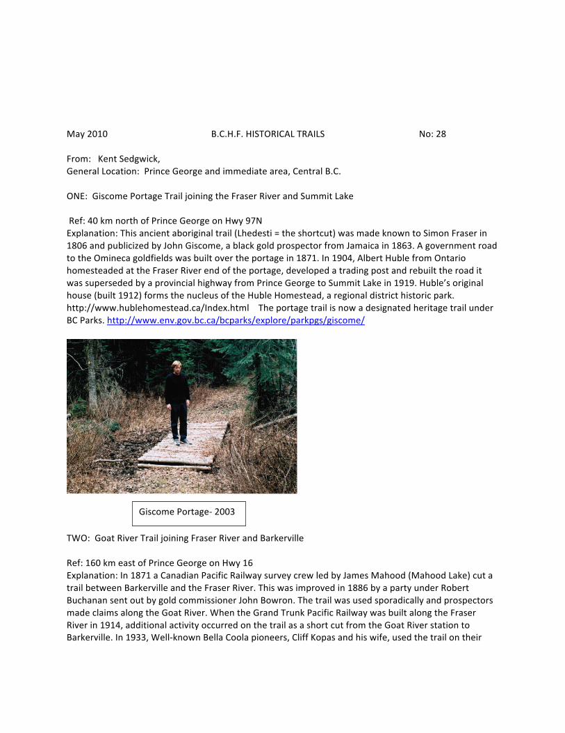
May 2010 B.C.H.F. HISTORICAL TRAILS No: 28 From: Kent Sedgwick, General Location: Prince George and immediate area, Central B.C. ONE: Giscome Portage Trail joining the Fraser River and Summit Lake Ref: 40 km north of Prince George on Hwy 97N Explanation: This ancient aboriginal trail (Lhedesti = the shortcut) was made known to Simon Fraser in 1806 and publicized by John Giscome, a black gold prospector from Jamaica in 1863. A government road to the Omineca goldfields was built over the portage in 1871. In 1904, Albert Huble from Ontario homesteaded at the Fraser River end of the portage, developed a trading post and rebuilt the road it was superseded by a provincial highway from Prince George to Summit Lake in 1919. Huble’s original house (built 1912) forms the nucleus of the Huble Homestead, a regional district historic park. http://www.hublehomestead.ca/Index.html The portage trail is now a designated heritage trail under BC Parks. http://www.env.gov.bc.ca/bcparks/explore/parkpgs/giscome/
TWO: Goat River Trail joining Fraser River and Barkerville Ref: 160 km east of Prince George on Hwy 16 Explanation: In 1871 a Canadian Pacific Railway survey crew led by James Mahood (Mahood Lake) cut a trail between Barkerville and the Fraser River. This was improved in 1886 by a party under Robert Buchanan sent out by gold commissioner John Bowron. The trail was used sporadically and prospectors made claims along the Goat River. When the Grand Trunk Pacific Railway was built along the Fraser River in 1914, additional activity occurred on the trail as a short cut from the Goat River station to Barkerville. In 1933, Well-‐known Bella Coola pioneers, Cliff Kopas and his wife, used the trail on their
Giscome Portage-‐ 2003
2003
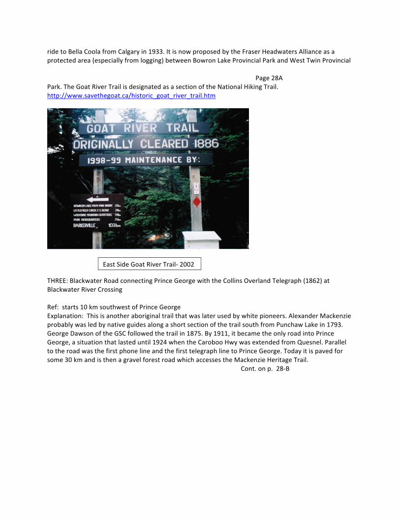
ride to Bella Coola from Calgary in 1933. It is now proposed by the Fraser Headwaters Alliance as a protected area (especially from logging) between Bowron Lake Provincial Park and West Twin Provincial Page 28A Park. The Goat River Trail is designated as a section of the National Hiking Trail. http://www.savethegoat.ca/historic_goat_river_trail.htm
THREE: Blackwater Road connecting Prince George with the Collins Overland Telegraph (1862) at Blackwater River Crossing Ref: starts 10 km southwest of Prince George Explanation: This is another aboriginal trail that was later used by white pioneers. Alexander Mackenzie probably was led by native guides along a short section of the trail south from Punchaw Lake in 1793. George Dawson of the GSC followed the trail in 1875. By 1911, it became the only road into Prince George, a situation that lasted until 1924 when the Caroboo Hwy was extended from Quesnel. Parallel to the road was the first phone line and the first telegraph line to Prince George. Today it is paved for some 30 km and is then a gravel forest road which accesses the Mackenzie Heritage Trail. Cont. on p. 28-‐B
East Side Goat River Trail-‐ 2002
Page 28B FOUR: Ref: Explanation: FIVE: Ref: Explanation: General Comments:
May 2010 B.C.H.F. HISTORICAL SITES & MONUMENTS No. 28C From: Kent Sedgwick General Location: Prince George and immediate area ONE: Lheitli T’enneh (Fort George band) graveyard Ref: In Fort George Park, Prince George Explanation: This cemetery is probably the most significant historic site in Prince George. It developed about 1875 when a small church was built adjacent to Fort George, the HBC post. As many as 300 burials took place. In 1913, the Lheitli T’enneh were displaced some 15 km up the Fraser River from Prince George when the Grand Trunk Pacific Railway bought their reserve for a townsite. The sale agreement stated the graveyard was to “remain undisturbed”. Nevertheless, human remains and headstones were disturbed and destroyed when the city undertook construction of Fort George Park for the 1958 B.C. centennial. After 1973, the occasional burial of elders again took place. The cemetery is a legal Indian Reserve within the city park. At the band’s insistence, it has now been tastefully fence and hedged by the city to define it from the surrounding park area. TWO: Arctic -‐Pacific Lakes on the continental divide Ref: 90 km northeast of Prince George Explanation: This historic pass through the Rocky Mountains is where Alexander Mackenzie, following aboriginal instructions, made the crossing from the Peace River (Arctic) to the Fraser River (Pacific) watersheds in 1793 on the culmination of his first crossing of North America. It remains remote wilderness and is in a BC Provincial Park. http://www.env.gov.bc.ca/bcparks/explore/parkpgs/arctic_pacific_lks/ THREE: Alexander Mackenzie National Historic Monument Ref: in Fort George Park, Prince George Explanation: This is a national monument for Alexander Mackenzie’s journey to the Pacific Ocean in 1793. It was relocated from another site in 1985, the centennial of Parks Canada. The original monument, dedicated by Judge Howay in 1925, was in a less-‐desirable location in downtown Prince George. http://www.cnc.bc.ca/__shared/assets/2009sedgwick-‐monument-‐pdf16288.pdf FOUR: Grand Canyon on the Upper Fraser River Ref: 95 km east of Prince George Explanation: This famous and very dangerous canyon near Sinclair Mills became known to the Overlanders of 1862 who travelled down the Fraser River to the Cariboo goldfields. They sometimes used a portage trail around the canyon. It consists of two Cont. on p 28D
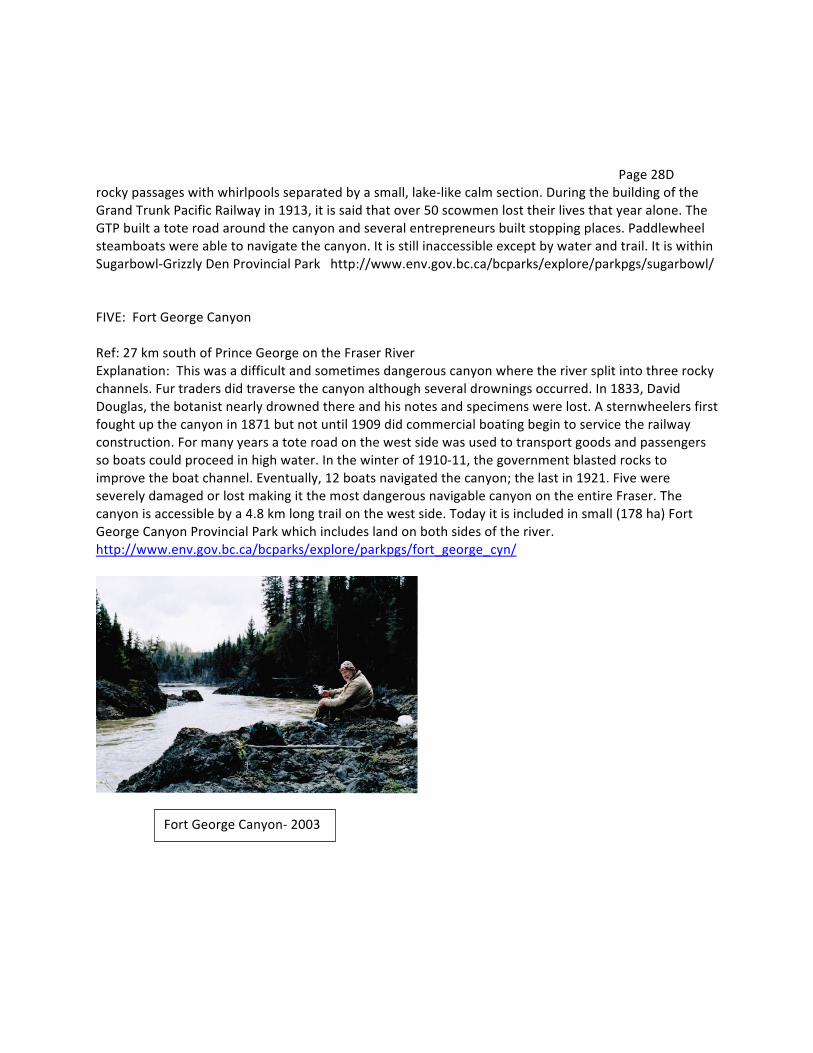
Page 28D rocky passages with whirlpools separated by a small, lake-‐like calm section. During the building of the Grand Trunk Pacific Railway in 1913, it is said that over 50 scowmen lost their lives that year alone. The GTP built a tote road around the canyon and several entrepreneurs built stopping places. Paddlewheel steamboats were able to navigate the canyon. It is still inaccessible except by water and trail. It is within Sugarbowl-‐Grizzly Den Provincial Park http://www.env.gov.bc.ca/bcparks/explore/parkpgs/sugarbowl/ FIVE: Fort George Canyon Ref: 27 km south of Prince George on the Fraser River Explanation: This was a difficult and sometimes dangerous canyon where the river split into three rocky channels. Fur traders did traverse the canyon although several drownings occurred. In 1833, David Douglas, the botanist nearly drowned there and his notes and specimens were lost. A sternwheelers first fought up the canyon in 1871 but not until 1909 did commercial boating begin to service the railway construction. For many years a tote road on the west side was used to transport goods and passengers so boats could proceed in high water. In the winter of 1910-‐11, the government blasted rocks to improve the boat channel. Eventually, 12 boats navigated the canyon; the last in 1921. Five were severely damaged or lost making it the most dangerous navigable canyon on the entire Fraser. The canyon is accessible by a 4.8 km long trail on the west side. Today it is included in small (178 ha) Fort George Canyon Provincial Park which includes land on both sides of the river. http://www.env.gov.bc.ca/bcparks/explore/parkpgs/fort_george_cyn/
Fort George Canyon-‐ 2003
Feb. 2011 B.C.H.F.HISTORICAL TRAILS AND SITES No. 29 From: Northern B.C. Archives-‐ Prince George, Ramona Rose, [email protected] General Location: Interior of Central B.C. Trails (1) Blackwater ‘Grease’ Trail, Prince George Ref: (2) ___ Ref: (3) ___ Ref: (4) __ Ref: (5) __ Ref: Comments: Sites & Monuments: (1) Cottonwood Island, Prince George Ref: (2) ___ Ref: (3) Ref: (4) Ref: (5) Ref Comments: Personages: (1) Alexander Mackenzie Ref: (2) Ref: (3) Ref: (4) Ref: (5) Ref: Comments: Additional Comments:
Feb. 2011 B.C.H.F.HISTORICAL TRAILS AND SITES No. 30 From: Quatsino Museum, Donnie Botel, [email protected] General Location: Northern Vancouver Island Trails (1) Becker’s Trail. Hecate Cove to Colony Lake Ref: (2) Drake Island Trail, from Quiet Cove (Phamplet Cove) to other side of the island. Ref: (3) Ref: (4) Ref: (5) Ref: Sites & Monuments: (1) Norgard’s Store, site of present day Quatsino Lodge (fishing lodge) C. 1895. Ref: (2) Bergh’s Store in Bergh Cove-‐ now Government Dock. Ref: (3) Quiet Cove (Phamplet Cove) on Drake Island-‐ once at stop clinic (operated from 1910-‐15) Ref: (4) Olaf’s School House, now an Anglican Church-‐ Quatsino’s oldest building (near Government Dock). Built 1897 Ref: (5) Ed Evenson’s Hotel-‐ also operated Telegraph Station. Present day Eagle Manor Hotel. Ref Personages: (1) Nordstroms, two brothers, Christian and Charles Fredrick arrived in 1895 with their five children (m. Halverson, Speck, Johnson, Barnett.) Ref: (2) Evensons, Even and Ellie and their son Eddijus, wife Louise arrived in 1894 and raised nine children (m. Lind, Kindsey, Stout, Sullivan, Henry, Hanson, and Baker.) Ref: (3) Leesons, Jobe and Anna with son Ben arrived in Winter Harbour in 1889. Ref: (4) Frigons, Edward in Koprino in 1889. In Quiet Cove in 1885 with wife and two children Ref: (5) Skedins, August and Erica and five children arrived in 1894 Ref: Comments:
Nov. 2011 B.C.H.F. Historical Trails and Sites No.31 From: Riondel Historical Society (Crawford Bay), Susan Hulland, Location: Kootenay Lake, East Side Trails (1) Preacher Creek Trail to T O’Shanter/ Plaid Lake-‐ used when building the dam. Ref: (2) Pilot Bay Lighthouse Trail in Pilot Bay Marine Park to lighthouse. Ref: (3) Sawmill Trail in Pilot Bay Marine Park to historic sawmill site. Ref: (4) Several trails on Crown lands on Pilot Peninsula over Crown Land including the William Fraser/Post Office Trails. Ref: (5) Trail from Crawford Bay to Pilot Bay Ref: Sites & Monuments (1) Pilot Bay Lighthouse Ref: (2) Harrison Memorial Church. Ref: (3) Wedgwood Manor. Ref: (4) Pilot Bay Smelter and Townsite. Ref: (5) X-‐Ray Lake/Silver Hills Mine and tramway in Crawford Creek Valley. Ref: Personages (1) William Bayliss, artist Ref: (2) Commander and Lucy Harrison, gentry. Ref: (3) Tom Lytle Family, (esp. Lorna Lytle), keeper of community history. Ref: (4) Topsy Gunther, pioneer woman, history keeper. Ref: (5) William Fraser, civic leader, scouts, board of education, etc. Comments:
May 2010 B.C.H.F. HISTORICAL TRAILS No: 32 From: Summerland Museum, Sherril Foster, 250 494 9395 General Location: South Okanagan ONE: Okanagan Fur Brigade Trail/Cariboo Gold Rush Trail Ref: Explanation: Summerland has the only preserved section of the Fur Brigade Trail and the Encampment Site, Priest Camp Historic Park TWO: Centennial Trail. The trail was in use to connect West Summerland to Summerland (Lower Town) for almost one hundred years. Ref: Explanation: It was officially completed with historic signage during Summerland’s Centennial year in 2006 THREE: Giant’s Head Mountain Trail. This trail was built in the 1950’s and has been continually improved since that time. Ref: Explanation: Giant’s Head Mountain is a remnant of an ancient volcano in the center of Summerland. FOUR: Trans Canada Trail through Summerland. The trail follows a route of the Kettle Valley Railway through Summerland beginning at the Trout Creek Bridge, the highest crossing on the original line. Ref: Explanation: FIVE: Granite City Trail. Granite City was the third largest city in B.C. in 1886. Ref: Explanation: This trail from Summerland was used to provide supplies to Granite City before other transportation routes were completed. General comments:
May 2010 B.C.H.F. HISTORICAL SITES & MONUMENTS No. 32A From: Summerland Museum, (Section two) ONE: Priest Camp. First non-‐Native settlement in Okanagan Valley. Established 1845. Ref: Explanation: It is the first non-‐Native settlement in B.C. that was not fortified. TWO: Okanagan College (Baptist) Ref: Explanation: First College in B.C., was affiliated with McMaster University in Ontario (1906-‐1915) THREE: Summerland Ornamental Gardens (1916) Ref: Explanation: Plant trials carried on at the Dominion Experimental Farm at Summerland, established 1914. FOUR: Lowertown. First site of Summerland on Okanagan Lake. Ref: Explanation: Spirit Square, Lakeside Walking Path, Former CPR barge slip, a few heritage buildings. FIVE: Barclay Ranch House, built in 1888-‐1889. Ref: Explanation: It was the home of George N. Barclay, owner of a large cattle ranch in the Trout Creek area before Summerland was established. Comments:
May 2010 B.C.H.F. HISTORICAL PERSONAGES No. 32B From Summerland Museum (Section 3) ONE: Lord Thomas Shaughnessy-‐ founder of Summerland Ref: Explanation: He was president of the C.P.R. from 1899-‐ 1918 and, more than any other Canadian, he was responsible for the opening of the West, including B.C. TWO: Mary Spencer Ref: Explanation: Well-‐known B.C. photographer who captured train robber Bill Miner on film. . THREE: George Ryga Ref: Explanation: Famous Canadian playwright FOUR: Irvine Adams Ref: Explanation: One of North America’s foremost pastel artists FIVE: Dr. J. Allen Harris Ref: Explanation: Co-‐discoverer of the rare earth Element 61 or Illinium and first Okanagan M.L.A. from Summerland at the age of 26.
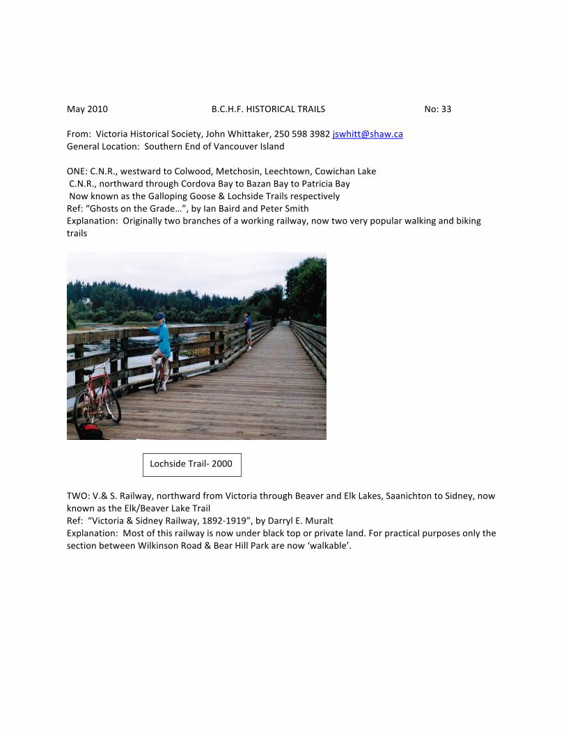
May 2010 B.C.H.F. HISTORICAL TRAILS No: 33 From: Victoria Historical Society, John Whittaker, 250 598 3982 [email protected] General Location: Southern End of Vancouver Island ONE: C.N.R., westward to Colwood, Metchosin, Leechtown, Cowichan Lake C.N.R., northward through Cordova Bay to Bazan Bay to Patricia Bay Now known as the Galloping Goose & Lochside Trails respectively Ref: “Ghosts on the Grade…”, by Ian Baird and Peter Smith Explanation: Originally two branches of a working railway, now two very popular walking and biking trails
TWO: V.& S. Railway, northward from Victoria through Beaver and Elk Lakes, Saanichton to Sidney, now known as the Elk/Beaver Lake Trail Ref: “Victoria & Sidney Railway, 1892-‐1919”, by Darryl E. Muralt Explanation: Most of this railway is now under black top or private land. For practical purposes only the section between Wilkinson Road & Bear Hill Park are now ‘walkable’.
Lochside Trail-‐ 2000
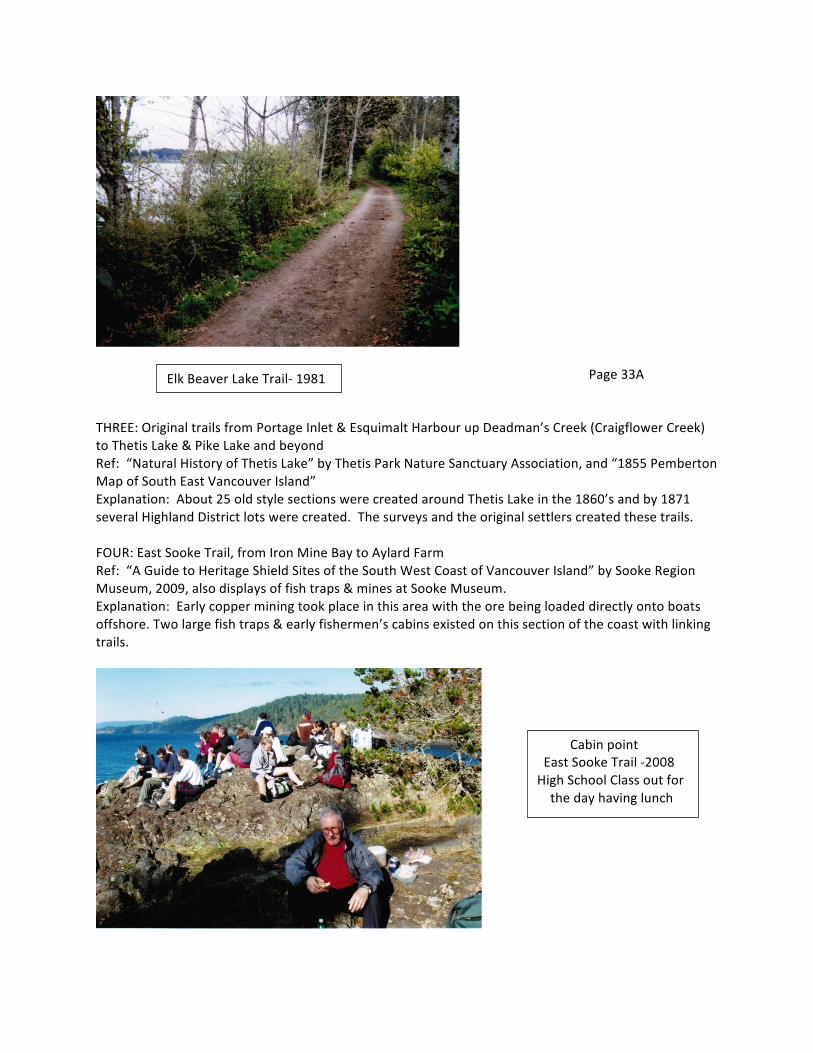
Page 33A THREE: Original trails from Portage Inlet & Esquimalt Harbour up Deadman’s Creek (Craigflower Creek) to Thetis Lake & Pike Lake and beyond Ref: “Natural History of Thetis Lake” by Thetis Park Nature Sanctuary Association, and “1855 Pemberton Map of South East Vancouver Island” Explanation: About 25 old style sections were created around Thetis Lake in the 1860’s and by 1871 several Highland District lots were created. The surveys and the original settlers created these trails. FOUR: East Sooke Trail, from Iron Mine Bay to Aylard Farm Ref: “A Guide to Heritage Shield Sites of the South West Coast of Vancouver Island” by Sooke Region Museum, 2009, also displays of fish traps & mines at Sooke Museum. Explanation: Early copper mining took place in this area with the ore being loaded directly onto boats offshore. Two large fish traps & early fishermen’s cabins existed on this section of the coast with linking trails.
Elk Beaver Lake Trail-‐ 1981
Cabin point East Sooke Trail -‐2008 High School Class out for the day having lunch
Page 33B FIVE: Original trails lying between Sooke River & Veitch Creek and between Empress Mt. and Mt. Braden. Ref: “At the End of the Trail from Victoria”, Del Hall Explanation: This general area is honeycombed with historical trails from the turn of the century and the area abuts the original trail to Sooke River & Leechtown. It is still for the most part a semi-‐wilderness area and not very well known. General Comment: Almost all the original Victoria area trails are now covered by subdivision or roads; therefore emphasis has been placed on 2nd and 3rd generation trails.
May 2010 B.C.H.F. HISTORICAL SITES & MONUMENTS No. 33C From: Victoria, Historical Society (Section 2) ONE: Esquimalt Naval Harbour which includes Fort Rodd Hill, H.M.C.S. Dry Dock, Naden and Fisgard Light House Ref: “Esquimalt Naval Base” by Major F.V. Longstaff; “Fort Rodd Hill & Fisgard Light House”, Vol. 1&2, National Historic Sites, Parks Canada, 1998-‐99, “Commemorative of Ecological Integrity at Historical Sites”, by Dale Mumford, Museum Round Up, No. 190; “Esquimalt Base in 1863”, by Thom Stilt, The Bulletin, Spring 1978 Explanation: The Esquimalt Naval Harbour cannot be underestimated as to its importance. These four sites and others within the harbour are extremely significant. TWO: Craigflower Farm & School House Ref: The Craigflower Story by Craigflower Woman’s Institute, 1967. Explanation: One of the original Hudson’s Bay Farms and the oldest standing school house in the west THREE: Helmcken House & monument in Elliot Square to both Douglas & Helmcken Ref: A monument in Elliot Square explains the significance of the site. Explanation: Douglas’ House was demolished decades ago, only Helmcken House & original St. Ann’s schoolroom remain. FOUR: Monument commemorating the re-‐discovery by Captain Charles William Barkley of the Strait of Juan de Fuca and the subsequent further explorations by others. Ref: “B.C. from Earliest Times to the Present”, Vol. 1 (a good overview) by E.O.S. Scholefield, “Spanish Explorations in the Strait of Juan de Fuca” by H.B. Wagner and “The Remarkable World of Francis Barkley 1769-‐1845” by Beth Hill Explanation: Stone cairn on top of prominent rocky Gonzales hill (about 2 miles east of the Parliament buildings) briefly outlines history of the strait with Captains Barkley, Meares, Gray, Vancouver and Quadra. FIVE: Chinatown & Gate of Harmonious Interest Ref: “The Forbidden City within Victoria” by David Chuenyan Lai; “Gold Mountain” by Anthony Chan; and “Urban Archaeology, Where is it?” by Gary & Karen Pearson Explanation: At one time Victoria Chinatown was the largest area of Chinese population west of the Great Lakes except for the City of San Francisco.
May 2010 B.C.H.F. HISTORICAL PERSONAGES No. 33D From Victoria Historical Society (Section 3) ONE: Sir James Douglas Ref: “James Douglas: Servant of Two Empires” by Derek Pethick and “Old Square Toes and His Lady, The Life of James and Amelia Douglas” by John Adams Explanation: Founder of British Columbia TWO: Joseph Despard Pemberton Ref: “My Father, Joseph Despard Pemberton”, B.C.H.Q. Vol. VIII, No. 2, by Harriet Susan Sampson; “Colonization of Vancouver Island 1849-‐1859” by Richard Mackie; “The L.S. Group of B.C.’s First Land Surveyors” by Hugh Barrington Cotton Explanation: First Surveyor General & Land Commissioner on Vancouver Island and when need arose extending onto the B.C. mainland before it became a separate colony. THREE: John Sebastian Helmcken Ref: “The Reminiscences of Dr. John Sebastion Helmcken” by Dorothy Blakey-‐Smith Explanation: One of three who negotiated B.C. entry into Confederation & Victoria’s most prominent early medical doctor. FOUR: Francis Mawson Rattenbury Ref: “Rattenbury” by Terry Reksten, and “Francis Rattenbury and B.C: Architecture and Challenge in the Imperial Age” by Anthony A. Barrett and Rhodri Windsor Liscombe. Explanation: Probably Victoria’s premier architect around the turn of the century FIVE: Emily Carr Ref: “Emily Carr” by Doris Shadbolt & “Emily Carr” by Marie Tippet Explanation: Victoria’s best known artist
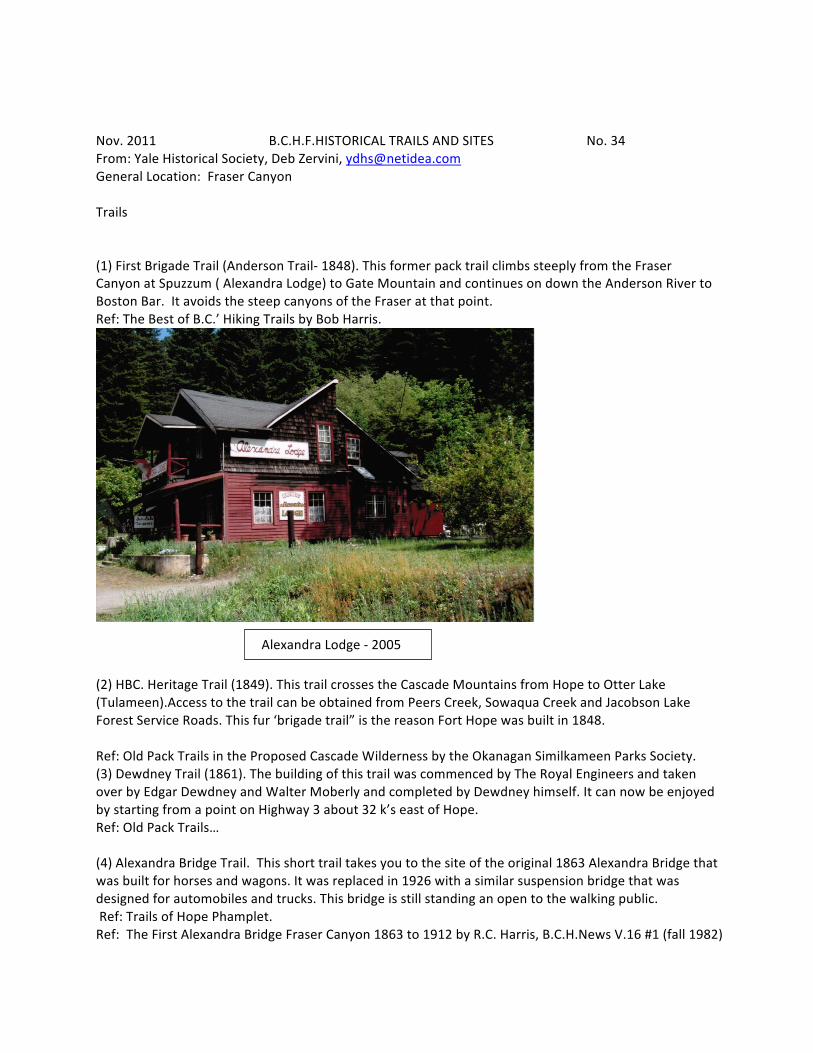
Nov. 2011 B.C.H.F.HISTORICAL TRAILS AND SITES No. 34 From: Yale Historical Society, Deb Zervini, [email protected] General Location: Fraser Canyon Trails (1) First Brigade Trail (Anderson Trail-‐ 1848). This former pack trail climbs steeply from the Fraser Canyon at Spuzzum ( Alexandra Lodge) to Gate Mountain and continues on down the Anderson River to Boston Bar. It avoids the steep canyons of the Fraser at that point. Ref: The Best of B.C.’ Hiking Trails by Bob Harris.
(2) HBC. Heritage Trail (1849). This trail crosses the Cascade Mountains from Hope to Otter Lake (Tulameen).Access to the trail can be obtained from Peers Creek, Sowaqua Creek and Jacobson Lake Forest Service Roads. This fur ‘brigade trail” is the reason Fort Hope was built in 1848. Ref: Old Pack Trails in the Proposed Cascade Wilderness by the Okanagan Similkameen Parks Society. (3) Dewdney Trail (1861). The building of this trail was commenced by The Royal Engineers and taken over by Edgar Dewdney and Walter Moberly and completed by Dewdney himself. It can now be enjoyed by starting from a point on Highway 3 about 32 k’s east of Hope. Ref: Old Pack Trails… (4) Alexandra Bridge Trail. This short trail takes you to the site of the original 1863 Alexandra Bridge that was built for horses and wagons. It was replaced in 1926 with a similar suspension bridge that was designed for automobiles and trucks. This bridge is still standing an open to the walking public. Ref: Trails of Hope Phamplet. Ref: The First Alexandra Bridge Fraser Canyon 1863 to 1912 by R.C. Harris, B.C.H.News V.16 #1 (fall 1982)
Alexandra Lodge -‐ 2005
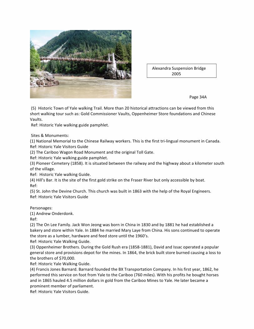
Page 34A (5) Historic Town of Yale walking Trail. More than 20 historical attractions can be viewed from this short walking tour such as: Gold Commissioner Vaults, Oppenheimer Store foundations and Chinese Vaults. Ref: Historic Yale walking guide pamphlet.
Sites & Monuments: (1) National Memorial to the Chinese Railway workers. This is the first tri-‐lingual monument in Canada. Ref: Historic Yale Visitors Guide (2) The Cariboo Wagon Road Monument and the original Toll Gate. Ref: Historic Yale walking guide pamphlet. (3) Pioneer Cemetery (1858). It is situated between the railway and the highway about a kilometer south of the village. Ref: Historic Yale walking Guide. (4) Hill’s Bar. It is the site of the first gold strike on the Fraser River but only accessible by boat. Ref: (5) St. John the Devine Church. This church was built in 1863 with the help of the Royal Engineers. Ref: Historic Yale Visitors Guide Personages: (1) Andrew Onderdonk. Ref: (2) The On Lee Family. Jack Won Jeong was born in China in 1830 and by 1881 he had established a bakery and store within Yale. In 1884 he married Mary Laye from China. His sons continued to operate the store as a lumber, hardware and feed store until the 1960’s. Ref: Historic Yale Walking Guide. (3) Oppenheimer Brothers. During the Gold Rush era (1858-‐1881), David and Issac operated a popular general store and provisions depot for the mines. In 1864, the brick built store burned causing a loss to the brothers of $70,000. Ref: Historic Yale Walking Guide. (4) Francis Jones Barnard. Barnard founded the BX Transportation Company. In his first year, 1862, he performed this service on foot from Yale to the Cariboo (760 miles). With his profits he bought horses and in 1865 hauled 4.5 million dollars in gold from the Cariboo Mines to Yale. He later became a prominent member of parliament. Ref: Historic Yale Visitors Guide.
Alexandra Suspension Bridge 2005

Page 34B (5) Lady Jane Franklin. Her historic search for her husband captured the hearts and spirits of the miners that inhabited the area during the Gold Rush. Today, her memory and her contribution to the area, lives on within St. John the Divine Church as well as the Lady Franklin Rock that sits proudly in the Fraser River. Ref: Historic Yale Walking Guide.
Nov. 2011 B.C.H.F. HISTORICAL TRAILS No:
(Section One -‐ example long form for trails) From: General Location: ONE: Ref: Explanation: TWO: Ref: Explanation THREE: Ref: Explanation: FOUR: Ref: Explanation: FIVE: Ref: Explanation: General Comments:

May 2011 B.C.H.F. HISTORICAL SITES & MONUMENTS No. (Section Two -‐ example long form for sites and monuments) From: ONE: Ref: Explanation: TWO: Ref: Explanation: THREE: Ref: Explanation: FOUR: Ref: Explanation: FIVE: Ref: Explanation:

May 2011 B.C.H.F. HISTORICAL PERSONAGES No. From (Section Three -‐ example for long form for persons) ONE: Ref: Explanation: TWO: Ref: Explanation: . THREE: Ref: Explanation: FOUR: Ref: Explanation: FIVE: Ref: Explanation:
Feb. 2011 B.C.H.F.HISTORICAL TRAILS AND SITES No. (Example of short form for all three categories) From: General Location: Trails (1) Ref: (2) Ref: (3) Ref: (4) Ref: (5) Ref: Comments: Sites & Monuments: (1) Ref: (2) Ref: (3) Ref: (4) Ref Comments: Personages: (1) Ref: (2) Ref: (3) Ref: (4) Ref: (5) Ref: Comments: Additional Comments:

