historical maps of the region around denton county, texas maps_research... · historical maps of...
TRANSCRIPT
Historical Maps of the Region Around
Denton County, Texas
By Mike Ludeman
Monograph TX-01 Oct. 2011
Denton County Area Historical Maps
Mike Ludeman 2 February 26, 2015
Denton County Area Historical Maps By
Mike Ludeman [email protected]
Introduction
This Research Note was compiled out of a desire to have quick access to some of the early Texas maps which showed the development of the area around Denton County in the 19th Century. Not all maps of the period were included. A preference was given to maps which showed towns, roads or mail routes, and later, railroads. In some instances, the maps in successive editions of an Atlas were identical, and the later map was not included. In other instances, a map would show no or very few man-made features beyond the county boundaries, and these were not included as well. For each map, an area roughly equivalent to that represented by the nine counties surrounding Denton was cropped from a larger digital image, and inserted onto the page. No effort was made to try and present each of these maps to the same scale, but they will be close to the same. There are many sources of historical maps on the Internet, but the web site for the David Rumsey Map Collection is perhaps the most comprehensive. For this reason, it was the choice for selection of scanned images for this Research Note.
Denton County Area Historical Maps
Mike Ludeman 3 February 26, 2015
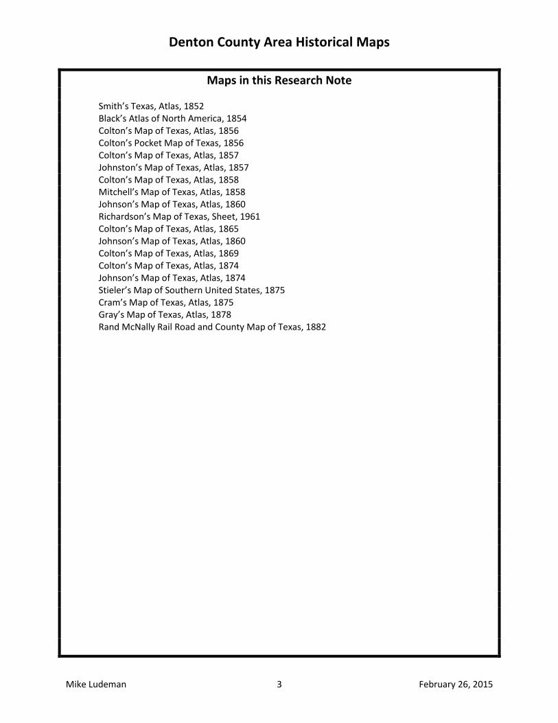
Maps in this Research Note Smith’s Texas, Atlas, 1852
Black’s Atlas of North America, 1854 Colton’s Map of Texas, Atlas, 1856 Colton’s Pocket Map of Texas, 1856 Colton’s Map of Texas, Atlas, 1857 Johnston’s Map of Texas, Atlas, 1857 Colton’s Map of Texas, Atlas, 1858 Mitchell’s Map of Texas, Atlas, 1858
Johnson’s Map of Texas, Atlas, 1860 Richardson’s Map of Texas, Sheet, 1961
Colton’s Map of Texas, Atlas, 1865 Johnson’s Map of Texas, Atlas, 1860
Colton’s Map of Texas, Atlas, 1869 Colton’s Map of Texas, Atlas, 1874 Johnson’s Map of Texas, Atlas, 1874 Stieler’s Map of Southern United States, 1875 Cram’s Map of Texas, Atlas, 1875 Gray’s Map of Texas, Atlas, 1878 Rand McNally Rail Road and County Map of Texas, 1882
Denton County Area Historical Maps
Mike Ludeman 4 February 26, 2015
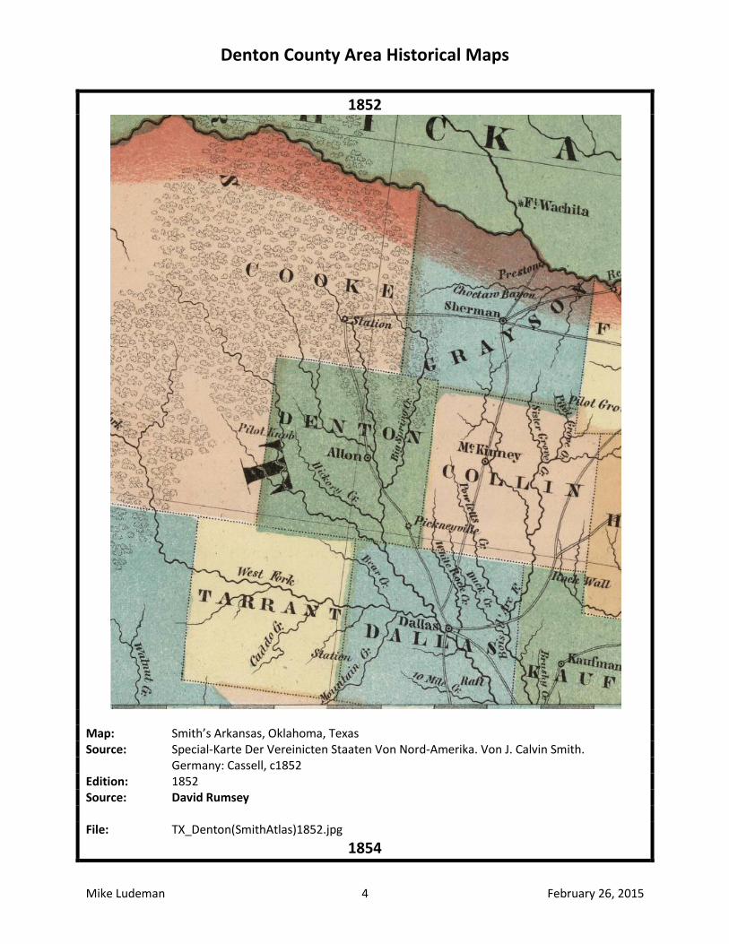
1852
Map: Smith’s Arkansas, Oklahoma, Texas Source: Special-Karte Der Vereinicten Staaten Von Nord-Amerika. Von J. Calvin Smith. Germany: Cassell, c1852 Edition: 1852 Source: David Rumsey File: TX_Denton(SmithAtlas)1852.jpg
1854
Denton County Area Historical Maps
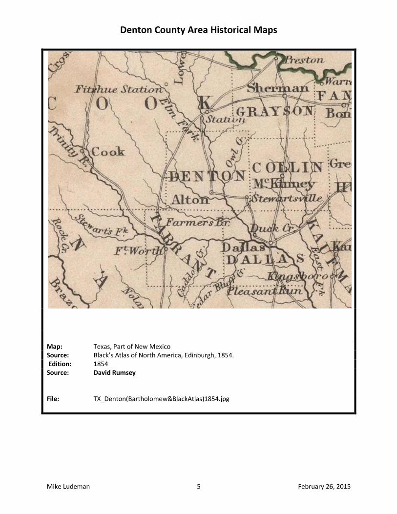
Mike Ludeman 5 February 26, 2015
Map: Texas, Part of New Mexico Source: Black’s Atlas of North America, Edinburgh, 1854. Edition: 1854 Source: David Rumsey File: TX_Denton(Bartholomew&BlackAtlas)1854.jpg
Denton County Area Historical Maps
Mike Ludeman 6 February 26, 2015
1856
Map: Colton’s Texas Source: Colton’s Atlas of the World, New York: J. H. Colton & Company, 1856 Edition: 1856 Source: David Rumsey File: TX_Denton(ColtonAtlas)1856.jpg
Denton County Area Historical Maps
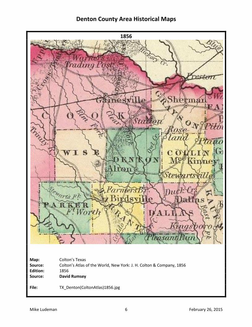
Mike Ludeman 7 February 26, 2015
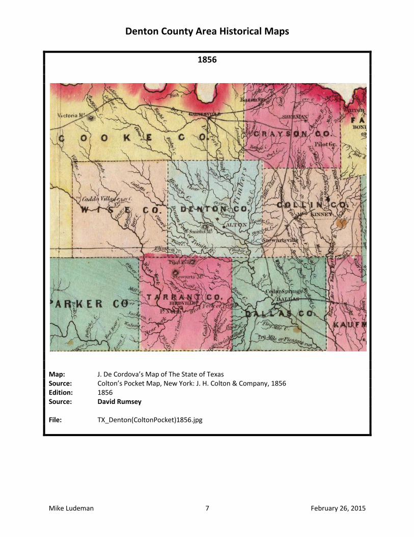
1856
Map: J. De Cordova’s Map of The State of Texas Source: Colton’s Pocket Map, New York: J. H. Colton & Company, 1856 Edition: 1856 Source: David Rumsey File: TX_Denton(ColtonPocket)1856.jpg
Denton County Area Historical Maps
Mike Ludeman 8 February 26, 2015
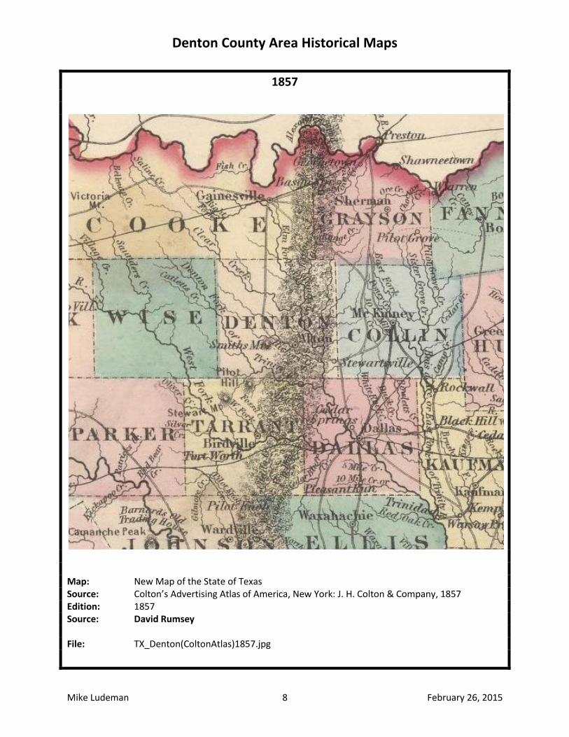
1857
Map: New Map of the State of Texas Source: Colton’s Advertising Atlas of America, New York: J. H. Colton & Company, 1857 Edition: 1857 Source: David Rumsey File: TX_Denton(ColtonAtlas)1857.jpg
Denton County Area Historical Maps
Mike Ludeman 9 February 26, 2015
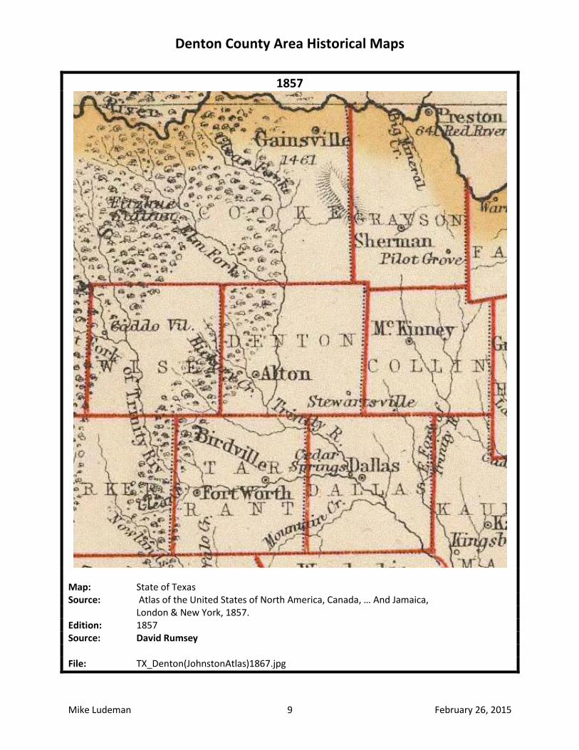
1857
Map: State of Texas Source: Atlas of the United States of North America, Canada, … And Jamaica, London & New York, 1857. Edition: 1857 Source: David Rumsey File: TX_Denton(JohnstonAtlas)1867.jpg
Denton County Area Historical Maps
Mike Ludeman 10 February 26, 2015
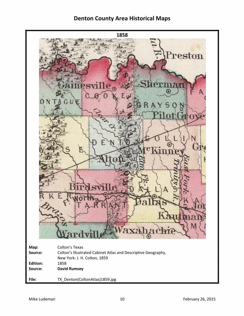
1858
Map: Colton’s Texas Source: Colton’s Illustrated Cabinet Atlas and Descriptive Geography, New York: J. H. Colton, 1859 Edition: 1858 Source: David Rumsey File: TX_Denton(ColtonAtlas)1859.jpg
Denton County Area Historical Maps
Mike Ludeman 11 February 26, 2015
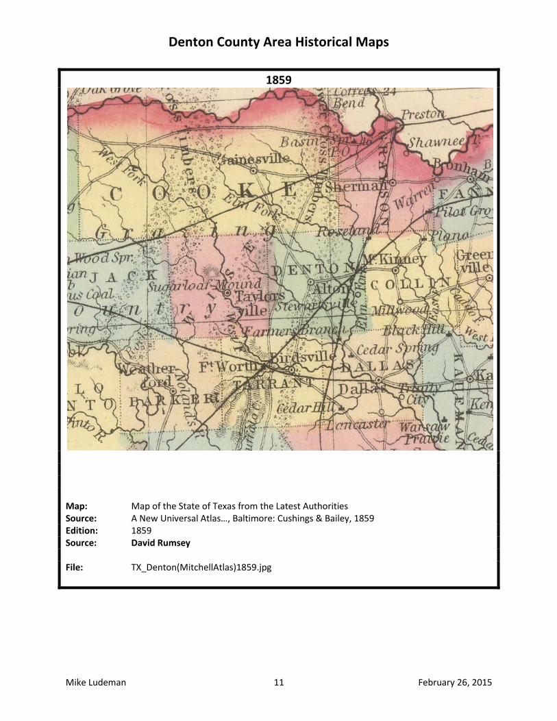
1859
Map: Map of the State of Texas from the Latest Authorities Source: A New Universal Atlas…, Baltimore: Cushings & Bailey, 1859 Edition: 1859 Source: David Rumsey File: TX_Denton(MitchellAtlas)1859.jpg
Denton County Area Historical Maps
Mike Ludeman 12 February 26, 2015
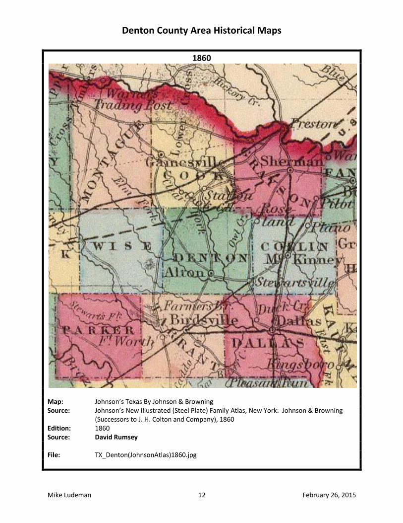
1860
Map: Johnson’s Texas By Johnson & Browning Source: Johnson’s New Illustrated (Steel Plate) Family Atlas, New York: Johnson & Browning (Successors to J. H. Colton and Company), 1860 Edition: 1860 Source: David Rumsey File: TX_Denton(JohnsonAtlas)1860.jpg
Denton County Area Historical Maps
Mike Ludeman 13 February 26, 2015
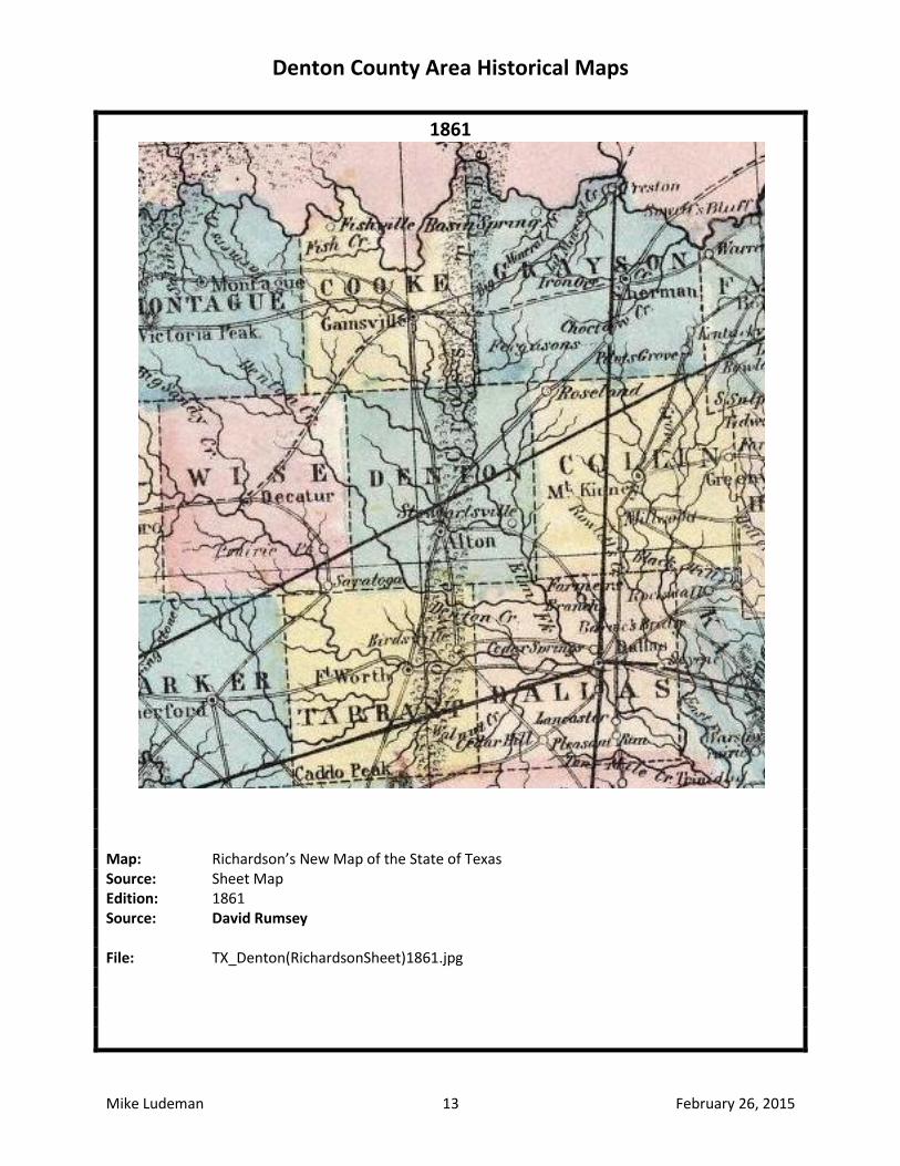
1861
Map: Richardson’s New Map of the State of Texas Source: Sheet Map Edition: 1861 Source: David Rumsey File: TX_Denton(RichardsonSheet)1861.jpg
Denton County Area Historical Maps
Mike Ludeman 14 February 26, 2015
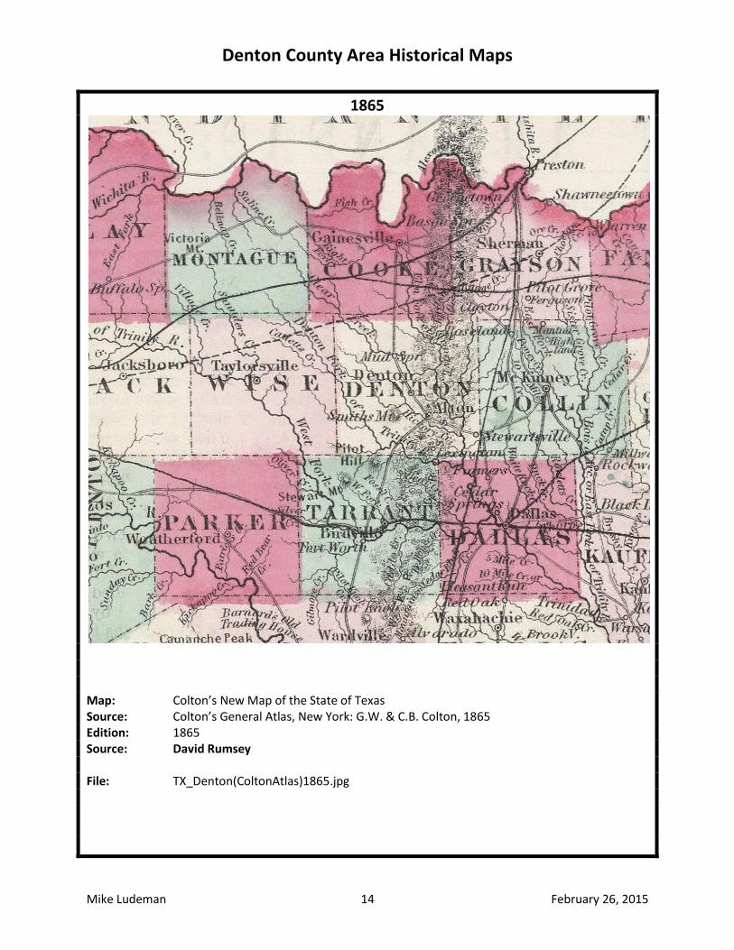
1865
Map: Colton’s New Map of the State of Texas Source: Colton’s General Atlas, New York: G.W. & C.B. Colton, 1865 Edition: 1865 Source: David Rumsey File: TX_Denton(ColtonAtlas)1865.jpg
Denton County Area Historical Maps
Mike Ludeman 15 February 26, 2015
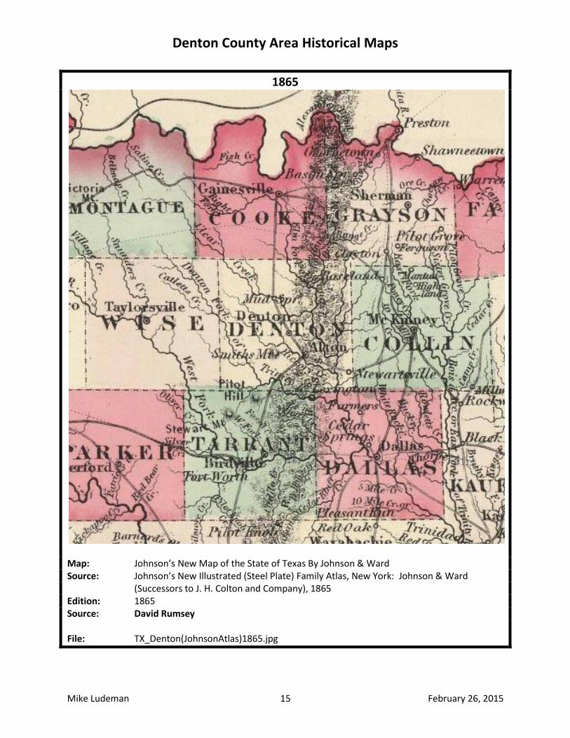
1865
Map: Johnson’s New Map of the State of Texas By Johnson & Ward Source: Johnson’s New Illustrated (Steel Plate) Family Atlas, New York: Johnson & Ward (Successors to J. H. Colton and Company), 1865 Edition: 1865 Source: David Rumsey File: TX_Denton(JohnsonAtlas)1865.jpg
Denton County Area Historical Maps
Mike Ludeman 16 February 26, 2015
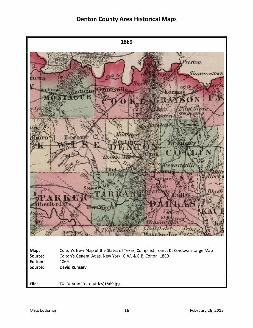
1869
Map: Colton’s New Map of the States of Texas, Compiled from J. D. Cordova’s Large Map Source: Colton’s General Atlas, New York: G.W. & C.B. Colton, 1869 Edition: 1869 Source: David Rumsey File: TX_Denton(ColtonAtlas)1869.jpg
Denton County Area Historical Maps
Mike Ludeman 17 February 26, 2015
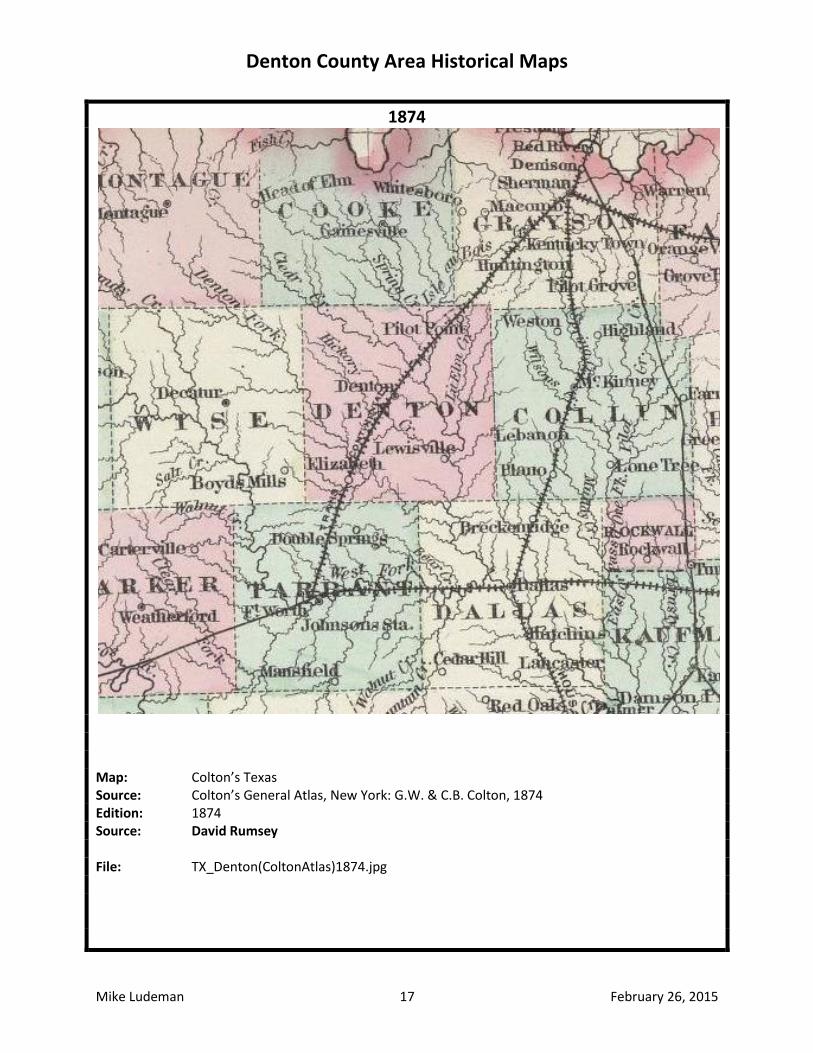
1874
Map: Colton’s Texas Source: Colton’s General Atlas, New York: G.W. & C.B. Colton, 1874 Edition: 1874 Source: David Rumsey File: TX_Denton(ColtonAtlas)1874.jpg
Denton County Area Historical Maps
Mike Ludeman 18 February 26, 2015
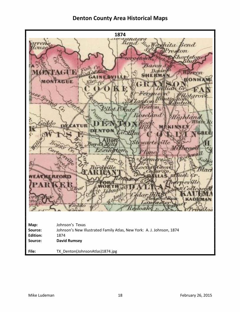
1874
Map: Johnson’s Texas Source: Johnson’s New Illustrated Family Atlas, New York: A. J. Johnson, 1874 Edition: 1874 Source: David Rumsey File: TX_Denton(JohnsonAtlas)1874.jpg
Denton County Area Historical Maps
Mike Ludeman 19 February 26, 2015
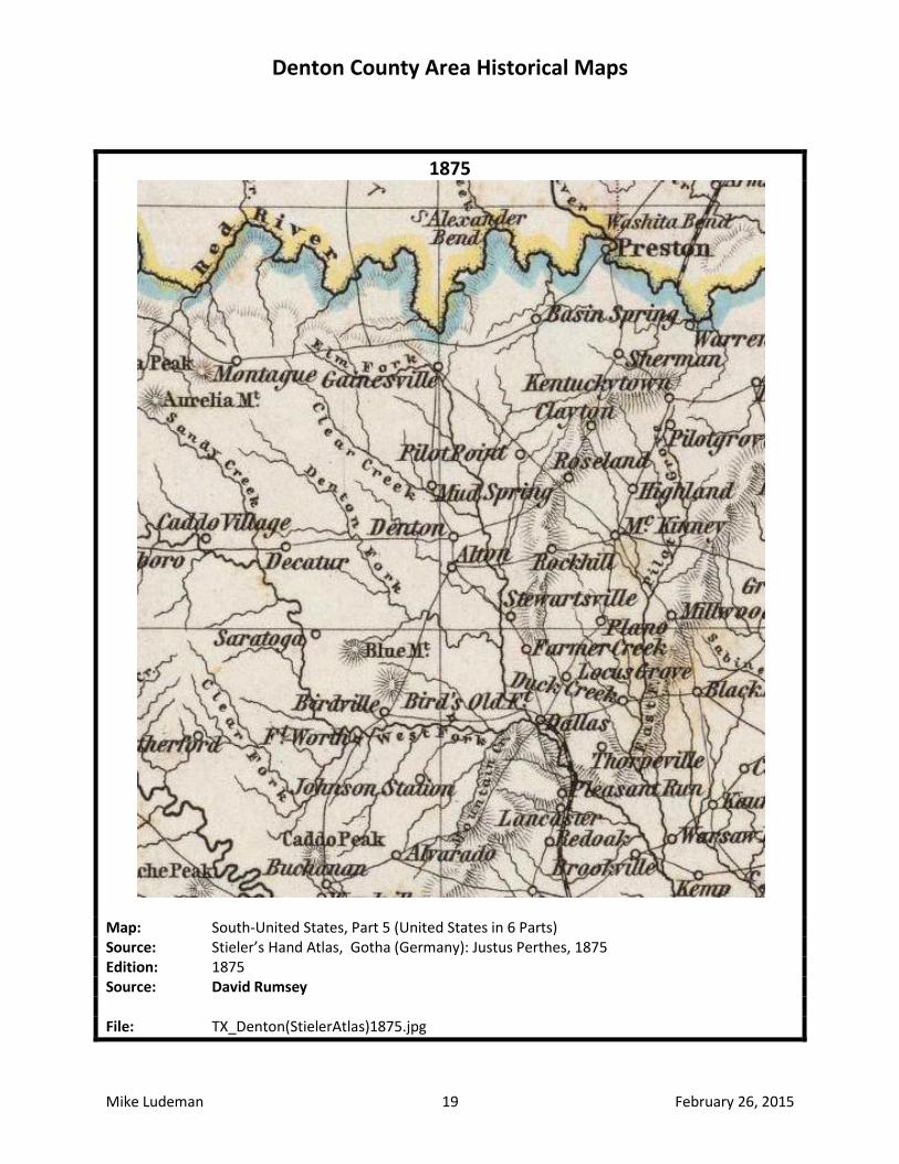
1875
Map: South-United States, Part 5 (United States in 6 Parts) Source: Stieler’s Hand Atlas, Gotha (Germany): Justus Perthes, 1875 Edition: 1875 Source: David Rumsey File: TX_Denton(StielerAtlas)1875.jpg
Denton County Area Historical Maps
Mike Ludeman 20 February 26, 2015
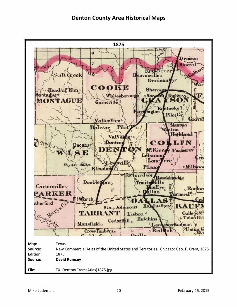
1875
Map: Texas Source: New Commercial Atlas of the United States and Territories. Chicago: Geo. F. Cram, 1875 Edition: 1875 Source: David Rumsey File: TX_Denton(CramsAtlas)1875.jpg
Denton County Area Historical Maps
Mike Ludeman 21 February 26, 2015
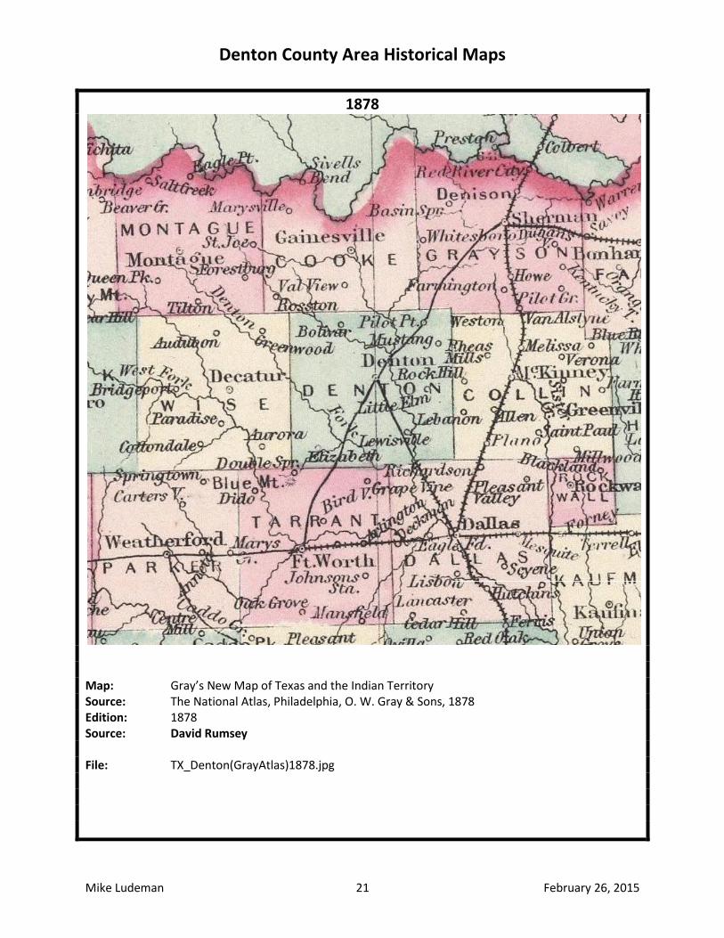
1878
Map: Gray’s New Map of Texas and the Indian Territory Source: The National Atlas, Philadelphia, O. W. Gray & Sons, 1878 Edition: 1878 Source: David Rumsey File: TX_Denton(GrayAtlas)1878.jpg
Denton County Area Historical Maps
Mike Ludeman 22 February 26, 2015
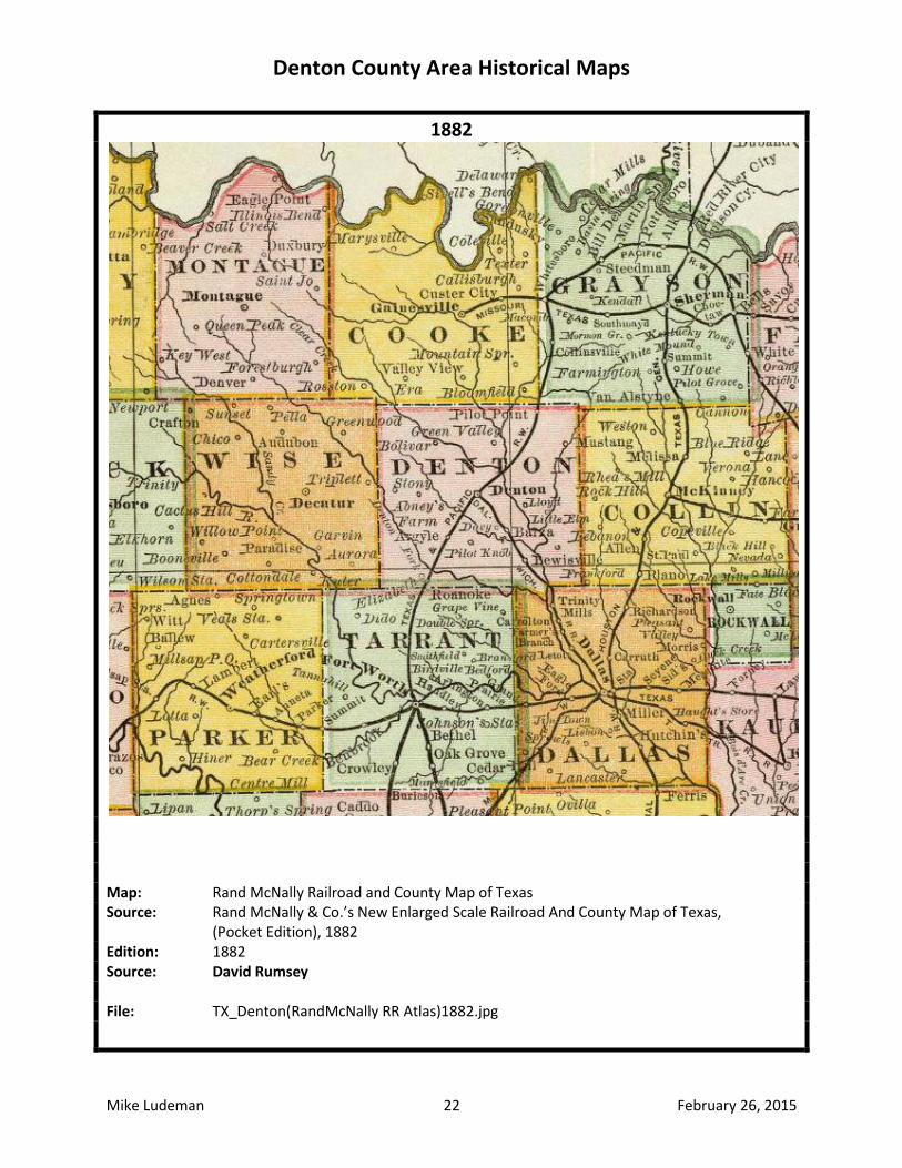
1882
Map: Rand McNally Railroad and County Map of Texas Source: Rand McNally & Co.’s New Enlarged Scale Railroad And County Map of Texas, (Pocket Edition), 1882 Edition: 1882 Source: David Rumsey File: TX_Denton(RandMcNally RR Atlas)1882.jpg

Denton County Area Historical Maps
Mike Ludeman 23 February 26, 2015
1884
Map: County Map of the State of Texas Source: Mitchell’s New General Atlas, Philadelphia: William M. Bradley & Bro., 1884 Edition: 1884 Source: David Rumsey File: TX_Denton(MitchellAtlas)1884.jpg
Denton County Area Historical Maps
Mike Ludeman 24 February 26, 2015
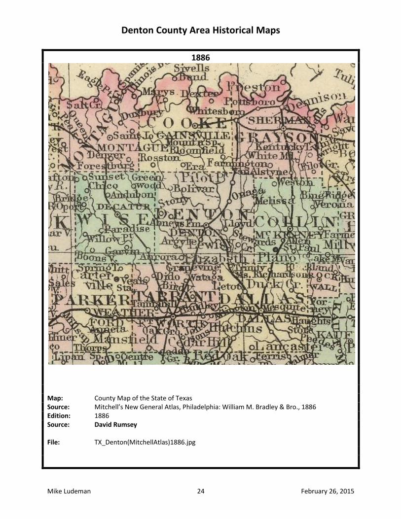
1886
Map: County Map of the State of Texas Source: Mitchell’s New General Atlas, Philadelphia: William M. Bradley & Bro., 1886 Edition: 1886 Source: David Rumsey File: TX_Denton(MitchellAtlas)1886.jpg
Denton County Area Historical Maps
Mike Ludeman 25 February 26, 2015
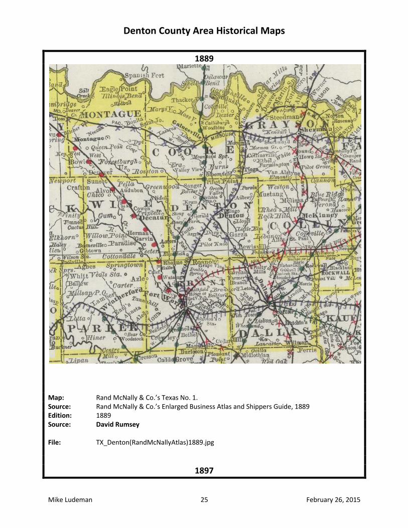
1889
Map: Rand McNally & Co.’s Texas No. 1. Source: Rand McNally & Co.’s Enlarged Business Atlas and Shippers Guide, 1889 Edition: 1889 Source: David Rumsey File: TX_Denton(RandMcNallyAtlas)1889.jpg
1897
Denton County Area Historical Maps
Mike Ludeman 26 February 26, 2015
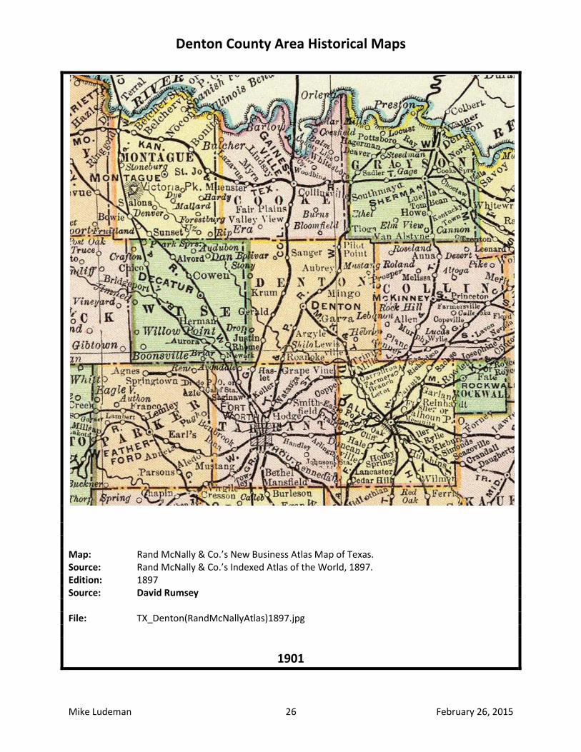
Map: Rand McNally & Co.’s New Business Atlas Map of Texas. Source: Rand McNally & Co.’s Indexed Atlas of the World, 1897. Edition: 1897 Source: David Rumsey File: TX_Denton(RandMcNallyAtlas)1897.jpg
1901
Denton County Area Historical Maps
Mike Ludeman 27 February 26, 2015
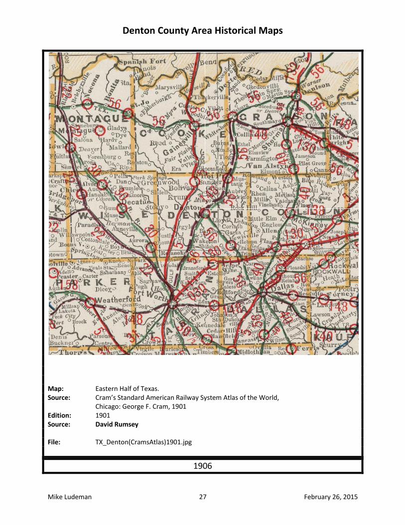
Map: Eastern Half of Texas. Source: Cram’s Standard American Railway System Atlas of the World, Chicago: George F. Cram, 1901 Edition: 1901 Source: David Rumsey File: TX_Denton(CramsAtlas)1901.jpg
1906
Denton County Area Historical Maps
Mike Ludeman 28 February 26, 2015
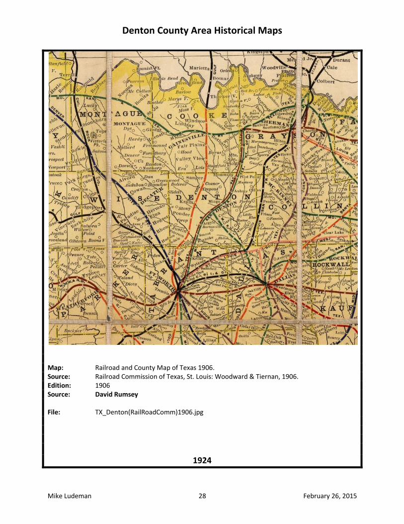
Map: Railroad and County Map of Texas 1906. Source: Railroad Commission of Texas, St. Louis: Woodward & Tiernan, 1906. Edition: 1906 Source: David Rumsey File: TX_Denton(RailRoadComm)1906.jpg
1924
Denton County Area Historical Maps
Mike Ludeman 29 February 26, 2015
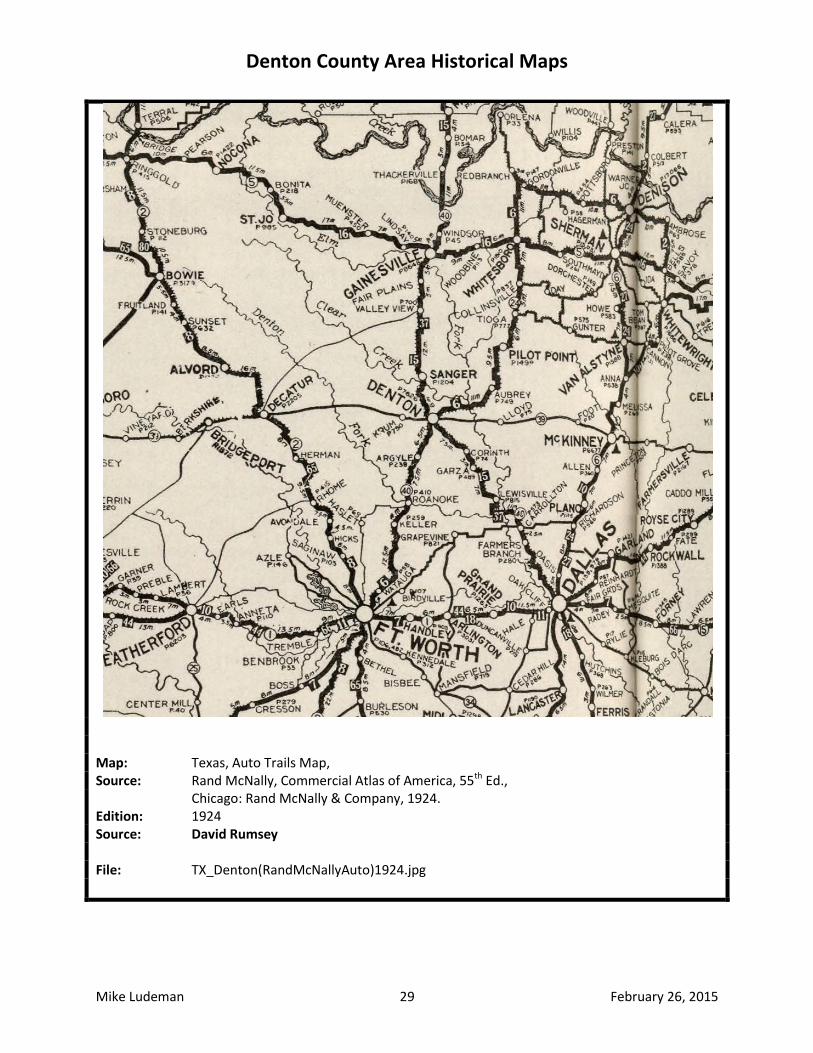
Map: Texas, Auto Trails Map, Source: Rand McNally, Commercial Atlas of America, 55th Ed., Chicago: Rand McNally & Company, 1924. Edition: 1924 Source: David Rumsey File: TX_Denton(RandMcNallyAuto)1924.jpg