history darwin and the hms beagle 1831-1836 studied barnacles
TRANSCRIPT

HistoryHistory
• Darwin and the hms Beagle 1831-1836
• Studied barnacles

HMS ChallengerHMS Challenger led by led by Sir Charles Sir Charles WyvilleWyville Thomson Thomson (1830-1882) (1830-1882)
FindingsFindings
• 4,717 new species;
• The first systematic plot of currents and temperatures in the ocean;
• A map of bottom deposits much of which has remained current to the present;
• An outline of the main contours of the ocean basins; and
• The discovery of the mid-Atlantic Ridge; 1,800 feet, findings such as:

Charles Wyville ThomasCharles Wyville Thomas
• Spearheaded the challenger expedition

Alexander AgassizAlexander Agassiz
• 1877
• Studied the collaboration of marine animals.
• Founded Woods Hole Oceanographic Institute.

HabitatHabitat
•Where an organism lives

Ocean BasinOcean Basin
•Depressions filled with sea water that
we call oceans


PacificPacific
•Largest and deepest

Atlantic & IndianAtlantic & Indian
•About half the size as the Pacific & almost as deep

Figure 2.1Figure 2.1

ArcticArctic
•Smallest and shallowest

DensityDensity•Mass per unit
volume
•D = m/V

Earth's StructureEarth's Structure• Inner core: 0-1200 km• Outer core: 1200-2500 km• Mantle: 2500-6300 km• Crust: Outer most 100 km

Oceanic CrustOceanic Crust•Crust directly under oceans
•thin & dense
•made of mostly basalt

Continental CrustContinental Crust• Crust containing the continents
• thick & less dense
• Made of mostly granite

Plate TectonicsPlate Tectonics
• The Earth’s crust is made up of many plate
that are in constant motion

PangaeaPangaea
• Original supercontinent containing all of the
present day continents


Plate BoundaryPlate Boundary• Crack between plates
• Where two plate meet
• Fault line
• Rift

Plate Boundaries and Geologic Plate Boundaries and Geologic ProcessesProcesses
• The lithosphere is fragmented into fourteen major tectonic plates
• Plates are moving across the Earth's surface in different directions and at different velocities.
• Many geologic processes, such as plutonism, volcanism, and earthquakes result from the interaction of plates along their boundaries


Types of BoundariesTypes of Boundaries• Mid-ocean Ridges
• Subduction Boundary
• Shear Boundary
• Mountain Range


Mid-Ocean RidgeMid-Ocean Ridge• Divergent boundaries
• Spreading center
• Continuous chain of volcanic submarine mountains that encircle the globe
• Like seams on a baseball


Convergent boundariesConvergent boundaries
• formed between two plates that are moving toward one another
• 2 forms
• Subduction
• Collisional

SubductionSubduction• When an oceanic plate
slides under another plate
• Both volcanic and earthquake activity occur
• Forms very deep trenches
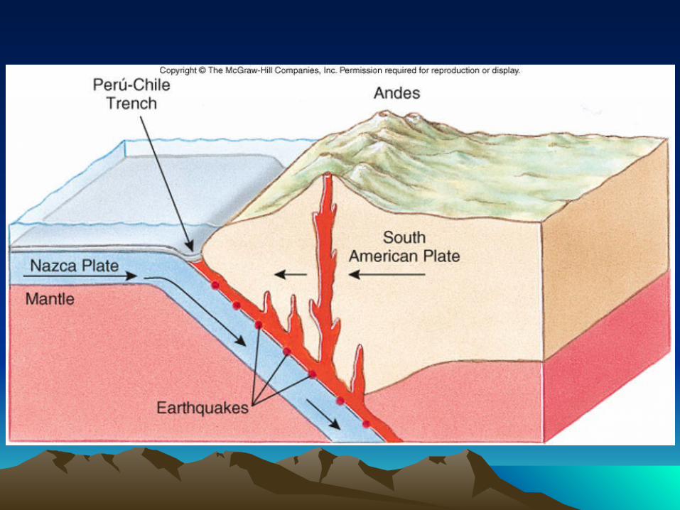


Figure 2.7Figure 2.7

Collisional BoundaryCollisional Boundary
• Mountain Range
• Forms when two continental plates collide


Shear (transform) Shear (transform) BoundaryBoundary
• When two plates slide parallel to each other
• Only earthquake activity
• San Andreas Fault


Hot SpotHot Spot• Forms when there is
enough heat upwelling to form a volcano, but not
enough to form a mid-ocean ridge


Active MarginActive Margin• A continental margin that is
geologically active
• A continental margin near a plate boundary
• USA’s west coast

Continental MarginContinental Margin
• Where the continent meets the sea

Passive MarginPassive Margin• A continental margin with no
geological activity
• A continental margin not near a plate boundary
• USA’s east coast

SedimentSediment• Loose material like sand or
mud that settles to the bottom of any body of water
• Sediment thickness increases as you move from m-o-r

Sediment is the word geologists Sediment is the word geologists use for loose pieces of minerals use for loose pieces of minerals
and rock. and rock.

Types of SedimentTypes of Sediment• Lithogenous: from a non-living source
• Biogenous: from a living source

Calcareous OozeCalcareous Ooze• Carbon based sediment
• Sediment containing calcium carbonate
• CaCO3

Siliceous OozeSiliceous Ooze• Silicon based sediment
• Sediment containing silicon dioxide or silicates
• SiO2 or SiO4-4

Ocean bottom sediment Ocean bottom sediment mapmap
Ocean bottom sediment map. Lithogenous Ocean bottom sediment map. Lithogenous areas are mauve, biogenous areas are areas are mauve, biogenous areas are
purple and brown (purple = siliceous ooze, purple and brown (purple = siliceous ooze, brown = calcareous ooze), and brown = calcareous ooze), and hydrogenous areas are blue.hydrogenous areas are blue.

SeamountsSeamounts
•Oceanic volcanoes that do not penetrate
the surface of the ocean


GuyotsGuyots
• Flat-topped seamounts
• Seamounts that are no longer active

GuyotsGuyots

Hydrothermal VentHydrothermal Vent
• Oceanic hot spot where hot gases escape
through the ocean floor


Black SmokerBlack Smoker• Another name for
hydrothermal vents
• As hydrogen sulfide gas precipitates in cold water, you get a black precipitate


Passive Margins Passive Margins PartsParts
• Continental shelf
• Shelf break
• Continental slope
• Continental rise
• The Abyss

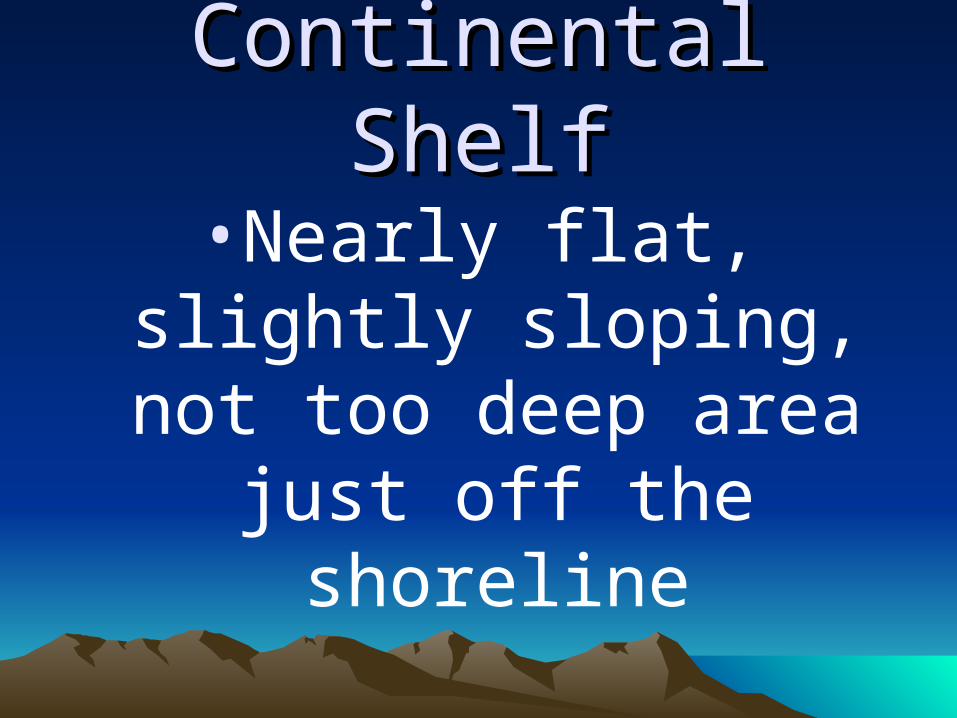
Continental ShelfContinental Shelf
• Nearly flat, slightly sloping, not too deep
area just off the shoreline

Atlantic Continental ShelfAtlantic Continental Shelf

Shelf BreakShelf Break
• Where the continental shelf abruptly breaks off
into a steep slope

Continental SlopeContinental Slope
• The steeply sloping part of the margin that goes from the shelf break to
the ocean floor

Continental RiseContinental Rise
• Where sediment builds up between the slope
and the abyss

The AbyssThe Abyss•The Ocean Floor
•The Abyssal plain

PelagicPelagic
• In the water column or at any depth in the sea

Pelagic ZonesPelagic Zones
• Epipelagic• Mesopelagic• Bathopelagic• Abyssopelagic• Hadopelagic

Epipelagic ZoneEpipelagic Zone
• Surface water where light can penetrate & photosynthesis can take place
• Photic zone

Mesopelagic Mesopelagic ZoneZone
Middle zone, just Middle zone, just below the epipelagic below the epipelagic
where no light where no light penetrates, but is penetrates, but is
shadowyshadowy
Twilight zoneTwilight zone

Bathopelagic ZoneBathopelagic Zone• Deep ocean water where no
light penetrates and it is pitch black
• Complete darkness

Abyssopelagic ZoneAbyssopelagic Zone
• The water near the sea floor
• Bottom water

Hadopelagic ZoneHadopelagic Zone
• Sea water in the deep trenches
• Trench water

The Deep SeaThe Deep Sea• Because the bathopelagic,
abyssopelagic, & hadopelagic zones are so similar, they are lumped together as the deep sea