hlei45307 001r camberwell magistrates court sera · 2018-05-24 · hlei45307/ma/001r – camberwell...
TRANSCRIPT

www.rpsgroup.com/uk
PRIVATE & CONFIDENTIAL
November 2016
Our Ref: HLEI45307/001R RPS Health, Safety & Environment 35 New Bridge Street London EC4V 6BW Tel: 020 7280 3240 Email: [email protected]
CAMBERWELL GREEN MAGISTRATES COURT 15 D'EYNSFORD ROAD, CAMBERWELL GREEN SE5 7UP SITE ENVIRONMENTAL RISK ASSESSMENT (SERA) FOR
HM COURTS & TRIBUNALS SERVICE (HMCTS)

www.rpsgroup.com/uk
QUALITY MANAGEMENT
Report Status: Final
Project Reference: HLEI45307
Name: Signature:
Report Author: Michael Andrews
Technical Reviewer: Alison Cadge
Date 25th November 2016
This report has been prepared in the RPS Group Quality Management System to British Standard EN ISO 9001:2008
RPS Health, Safety & Environment is part of the RPS Group Plc with over 5,000 staff based at over 85 offices located throughout the UK, Ireland and the Netherlands and in the USA, Canada, the Russian Federation, Australia, Malaysia, Singapore and Abu Dhabi. RPS offers
an unparalleled range of commercially focused services relating to property and land due-diligence, site development and geo-environmental investigations (including liability reviews, planning feasibility, EIAs and flood risk, energy & sustainability assessments).
RPS Health, Safety & Environment (London office) is certified to Environmental Management Standard ISO 14001.
www.rpsgroup.com/uk
CONTENTS
PAGE
1 INTRODUCTION ..................................................................................................................................... 4
2 EXECUTIVE SUMMARY AND RECOMMENDATIONS ......................................................................... 6
3 SITE ENVIRONMENTAL RISK ASSESSMENT .................................................................................... 9
• SECTION A: LAND USE
• SECTION B: ENVIRONMENTAL SETTING
• SECTION C: ENVIRONMENTAL RISK ASSESSMENT
APPENDICES
A. SITE LOCATION AND BOUNDARY PLANS
B. HISTORICAL ORDNANCE SURVEY MAPS

HLEI45307/MA/001R – Camberwell Green Magistrates Court 4 of 22
November 2016
1 INTRODUCTION
This Site Environmental Risk Assessment (SERA) report has been prepared by RPS Health, Safety & Environment (RPS) for the benefit of HM Courts & Tribunals Service (HMCTS) and their professional advisors. Aim The aim of the report is to provide an initial environmental risk assessment of the site. The report structure has been designed to enable RPS to determine whether the site constitutes a low, moderate or high risk from an environmental / ground contamination perspective. If further work is required to determine the level of environmental risk, a recommendation is made explaining the nature of the work. A statement is also made on the acceptability of the site as lending security from an environmental risk perspective. This is provided on the basis of ‘normal’ bank lending arrangements, which is taken to be approximately 60% loan to value ratio (LTV). Scope The scope is composed of the following three sections:
• Section A - a review of the current and historical uses of the site; • Section B - a review of the environmental setting of the site; and • Section C - an environmental risk assessment of the information presented in Sections A and B.
The SERA is essentially a desk study, with information obtained from published maps, reports and any recent work undertaken by RPS. No attempt has been made to obtain information from trade directories or environmental regulators (the Environment Agency and the Local Authority) unless specified. No site inspection has been undertaken and no soil sampling or other analyses have been carried out. Methodology Environmental regulators use the ‘contaminant-pathway-receptor linkage’ concept when assessing the risk posed by a contaminated site and for a liability to arise each part of the contaminant linkage must be present. Section A of the SERA provides information relating to the ‘contaminant’ through a study of current and historical land uses, and the environmental setting information in Section B relates to the ‘pathway’ and ‘receptor’ parts. Information is obtained from a number of sources as described below. Details of the site location, the current and proposed site uses and the nature of the transaction have been provided by the client. Section A - Land Use: This establishes the likelihood for former and current site uses to have caused significant ground contamination. Information about the history of the site has been obtained through a review of historical maps at 1:10,000, 1:2,500 and 1:1,250 scales and Historical Building Plans (where available). The accuracy of maps cannot be guaranteed and it should be recognised that different conditions on site may have existed between the various map surveys. Section B - Environmental Setting: This describes the environmental setting of the site since, irrespective of the level of contamination on the site, if the location is not ‘sensitive’ to this contamination there is a reduced risk of an environmental liability. The geological sequence underlying the site and the approximate depths of strata are provided by maps published by the British Geological Survey (BGS) 1:50,000 scale. The hydrogeological classification is obtained from Aquifer designations from the Environment Agency (EA). Groundwater quality information is taken from the relevant River Basin Management Plan published by the EA. The location of surface watercourses is obtained from an inspection of available maps. Surface water quality information is taken from the relevant River Basin Management Plan published by the EA.

HLEI45307/MA/001R – Camberwell Green Magistrates Court 5 of 22
November 2016
The level of flood risk is obtained from readily available EA records, normally from the EA website. Flood risk from fluvial and tidal sources is considered. Radon is a radioactive gas produced naturally from certain types of geology. This report uses the Indicative Atlas of Radon in England and Wales (2007) produced by the Health Protection Agency (HPA) and the BGS to determine whether the site is located in an area at risk from radon. Where potential issues are identified, a site-specific radon report is obtained from the HPA and BGS to provide an estimate of the probability of the site being affected. Where further recommendations are made, these are in accordance with the Building Research Establishment’s guidance (BR211: Protective Measures for New Buildings, 2007) and the Management of Health and Safety Regulations at Work 1999. Sites located within areas potentially subject to past coal mining activities are identified using information provided on The Coal Authority website. Areas of residential housing and schools are considered to be more ‘sensitive’ to contamination than industrial or business areas. For this reason, the presence of a residential area or school is recorded from OS maps if located within 50m of the site. Section C - Risk Ranking: The risk ranking uses the information in Sections A and B of the assessment to place the site within categories of high, moderate and low environmental risk (or in between). The environmental risk classification for the site takes into account the potential for regulatory or third party liability, the possible impact on value & saleability and the potential for extra-ordinary environment-related development costs. Terms of Reference The report provides available factual data for the site obtained only from the sources described in the text and related to the information provided by the client. The desk study information is not necessarily exhaustive and further information relevant to the site may be available from other sources. No responsibility can be accepted by RPS for inaccuracies in the data supplied by any other party. This report is written in the context of an agreed scope of work and should not be used in a different context. Furthermore, new information, improved practices and changes in legislation may necessitate a re-interpretation of the report in whole or in part. The report is provided for sole use by the client and is confidential to them and their professional advisors. No responsibility whatsoever for the contents of the report will be accepted to any person other than the client unless otherwise agreed. The copyright in the written materials shall remain the property of RPS but with a royalty-free perpetual licence to the client deemed to be granted on payment in full to RPS by the client of the outstanding amounts. These terms apply in addition to the RPS ‘Standard Terms and Conditions’ (or in addition to another written contract which may be in place instead thereof) unless specifically agreed in writing. In the event of a conflict between these terms and the Standard Terms, the Standard Terms shall prevail.

HLEI45307/MA/001R – Camberwell Green Magistrates Court 6 of 22
November 2016
2 EXECUTIVE SUMMARY & RECOMMENDATIONS
SITE DETAILS
Site Name & Address Camberwell Green Magistrates Court, 15 D'Eynsford Road, Camberwell Green, London SE5 7UP
Grid Reference TQ 326 769 Size Approx. 0.37 ha
Current Status DISUSED Proposed Use UNCHANGED �OPERATIONAL � REDEVELOP
OTHER OTHER
Comments Magistrates court Unchanged
Reason for Report BUYING Site Details FREEHOLD �SELLING � LEASEHOLD
REVALUATION OWNER/OCCUPIER
REFINANCE INVESTMENT
SUMMARY
Section A: Land Use
Significance: LowSite: From the earliest available mapping (1876) the site was
occupied by terraced housing in the north and south with unlabelled, possibly commercial / light industrial buildings in the centre of the site with an associated above ground storage tank. The majority of the buildings on site had been demolished by 1951 and ruins were present in the northwest of the site. The remaining buildings were demolished by c.1972 when the current magistrate’s court had been constructed.
Surrounds: Surrounding land uses have included an Engineering Works located approximately 40m east of the site (c.1972 to c.1983) and a Works (c.1896 to c.1973) then Warehouse (c.1973 to present) located approximately 80m north of the site.

HLEI45307/MA/001R – Camberwell Green Magistrates Court 7 of 22
November 2016
Section B: Environmental Setting
Sensitivity: ModerateComments: The site is currently commercial in use and comprises complete
hardstanding and building cover with a basement present across the majority of the site. It is situated within a predominantly residential setting. The site is underlain by Secondary A Aquifers relating to the Kempton Park Gravel Formation, Lambeth Group and Thanet Sand Formation. Beneath this is a Principal Aquifer relating to the Upper Chalk Formation. The site is not located within a groundwater SPZ and the underlying groundwater chemical quality has been classified as ‘poor’. The site is located within an indicative tidal floodplain of the River Thames, which is located approximately 2.7km northwest of the site. The site benefits from tidal flood defences. Overall, the sensitivity of the environmental setting is considered to be low to moderate.
Section C: Overall Risk
Risk: LowComments: The current land use is not considered to be a potentially
significant source of contamination. A fuel oil store is marked in the current building plans. However, this is within the building and any spills are likely to be contained within the concrete floor of the basement. Historically a tank was present in the west of the site. However, any contamination (if present) associated with past land uses would likely have been removed during the excavation of the current basement. There is the potential for a limited degree of contamination to be present beneath parts of the subject site associated with the historical presence of an Engineering Works to the east of the site. However, any contamination identified beneath / in the vicinity of the site is unlikely to be considered to be attributable to the subject site. The site is currently commercial in use (i.e. reduced sensitivity) and comprises complete hardstanding and building cover which will limit the potential for any site users to come into contact with the underlying ground. Overall, the risk of an environmental liability (e.g. third party liability or regulatory action) relating to ground contamination is considered to be low whilst the site remains in its current use and form.
Acceptability as Security from an Environmental Risk Perspective based on a normal lending scenario:
YES � NO NOTDETERMINED
HLEI45307/MA/001R – Camberwell Green Magistrates Court 8 of 22
November 2016
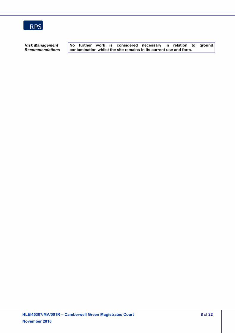
Risk Management Recommendations
No further work is considered necessary in relation to ground contamination whilst the site remains in its current use and form.

HLEI45307/MA/001R – Camberwell Green Magistrates Court 9 of 22
November 2016
3 SITE ENVIRONMENTAL RISK ASSESSMENT
SECTION A: LAND USE
Current Site Use The site is currently occupied by a magistrate’s court. Plans of the building indicate a basement car park to be present across the west of the site outside of the building footprint. A basement is present across the remainder of the building occupied by a large plant room including a ‘Fuel Oil Store’.
Proposed Use RPS is unaware of any proposed change of use at the site.
Historical Use From the earliest available mapping (1876) the site was occupied by terraced housing in the north and south with unlabelled, possibly commercial / light industrial buildings in the centre of the site with an associated above ground storage tank. The majority of the buildings on site had been demolished by 1951 and ruins were present on site indicating bomb damage during World War II. The remaining buildings were demolished by 1972 and the current magistrate’s court had been constructed. (See further details in tables below)
On-site Land Use Features Dates The north off the site comprised a row of terraced housing facing Waterloo Road to the north. The south of the site comprised a row of terraced housing facing D’Eynsford Road to the south. Several unlabelled, possibly commercial or light industrial, buildings were present in the centre of the site located between the two rows of terraced housing. An above ground storage tank was present in the west of the site associated with these buildings.
1876 - c.1951
Then the two rows of terraced housing had been demolished, except for three properties in the northeast of the site. A ‘ruin’ was present in the north west corner of the site. Several unlabelled buildings were present in the plot of land toward the centre of the site.
1951 - c.1972
Then all remaining structures on site had been demolished and a single building, labelled as a Magistrates Court, had been constructed occupying the eastern two thirds of the site. The site remains in this layout at present.
1972 - present
Surrounding Features (250m radius) Orientation Distance Dates Engineering Works West 40m 1972 - c.1983 Brewery Then Works Then Warehouse
North 80m 1876 - c.1896 1896 - c.1973 1973 - present
Brewery West 100m 1877 - c.1896 Tramway Depot Then Garage
West 200m 1896 - c.1971 1971 - present
Engineering Works Southeast 190m 1953 - c.1983 Corn Mill Then Warehouse
West 200m 1916 - c.1973 1973 - recent
Timber Yard Then Works
Northwest 210m 1916 - c.1951 1951 - recent
Stone Yard Northwest 210m 1916 - c.1951 Laundry North 220m 1916 - recent Mineral Water Works South 250m 1896 - c.1916

HLEI45307/MA/001R – Camberwell Green Magistrates Court 10 of 22
November 2016
SECTION B: ENVIRONMENTAL SETTING
GEOLOGY & HYDROGEOLOGY
Geological Sequence:
British Geological Survey mapping indicates the following stratigraphic sequence in the site vicinity:
• Kempton Park Gravel Formation (Quaternary) – This formation comprises sand and gravel and is likely to be around 5m in thickness beneath the site.
• Lambeth Group (Palaeogene) – This formation comprises clay sand and silt and is likely to be around 20m in thickness beneath the site.
• Thanet Sand Formation (Palaeogene) – This formation comprises sand and is likely to be around 10m in thickness beneath the site.
• Lewes Nodular Chalk Formation (Cretaceous) – This formation comprises chalk and is likely to be a few hundred metres in thickness beneath the site.
Made Ground is likely to be present across the site as a result of past construction and demolition activities. No site investigation reports or borehole logs have been reviewed to verify this.
Hydrogeological Classification:
Environment Agency mapping indicates that the site overlies a Secondary A Aquifer relating to the Kempton Park Gravel Formation. These formations are formed of permeable layers capable of supporting water supplies at a local scale, in some cases forming an important source of base flow to rivers. This is underlain by Secondary A Aquifers relating to the Lambeth Group and Thanet Sand formation. This is further underlain by a Principal Aquifer relating to the Lewes Nodular Chalk Formation. These formations provide a high level of water storage and may support water supply and / or river base flow on a strategic scale. The site is not located within a groundwater Source Protection Zone. Under the Water Framework Directive, the Environment Agency’s local River Basin Management Plan classifies groundwater chemical quality within the Greenwich Tertiaries beneath the site as ‘poor’ quality.
SURFACE WATER
Surface Watercourses:
No surface water features are recorded within 1km of the site.
Fluvial / Tidal Flood Risk:
According to the Environment Agency (EA) flood map, the site is located within Flood Zone 3, with the annual probability of flooding classified as greater than 1 in 200 (>0.5%). The floodplain appears to be associated with the River Thames (tidal stretch) 2.7km northwest of the site. However, the site benefits from flood defences which afford a high standard of protection. The Thames tidal defences are generally considered to provide a 1 in 1000 year standard of protection. Therefore, the site would only be affected by flooding from the Thames in the event that the flood defences failed.
HLEI45307/MA/001R – Camberwell Green Magistrates Court 11 of 22
November 2016
NATURAL IMPACTS
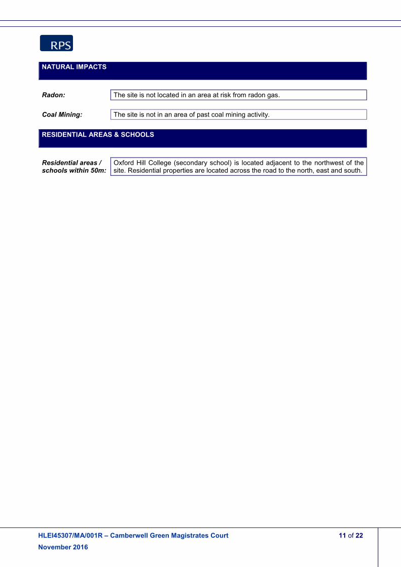
Radon: The site is not located in an area at risk from radon gas.
Coal Mining: The site is not in an area of past coal mining activity.
RESIDENTIAL AREAS & SCHOOLS
Residential areas / schools within 50m:
Oxford Hill College (secondary school) is located adjacent to the northwest of the site. Residential properties are located across the road to the north, east and south.

HLEI45307/MA/001R – Camberwell Green Magistrates Court 12 of 22
November 2016
SECTION C: ENVIRONMENTAL RISK ASSESSMENT
Land Use Significance: Low
Comments: The site is currently in use as a Magistrates Court. Building plans indicate there to be a fuel oil store currently in the basement. Given its location within the building, likely above concrete floors, the potential for impact on the underlying ground is limited. Historically, an area in the centre of the site was occupied by several unlabelled, possibly commercial or light industrial buildings with an associated tank from at least 1876 to c.1951. However, any minor contamination associated with this past land use would likely have been removed during the excavation of the current basement across the site. Historical site uses in the surrounding area have included an Engineering Works located approximately 40m to the east of the site (c.1972 to c.1983). Given the permeable geology beneath the site there is the potential for a minor degree of contamination to be present beneath and in the vicinity of the site sourced from the nearby Engineering Works. Overall, the likelihood of significant contamination existing beneath the site is considered to be low.
Environmental Setting Sensitivity: Moderate
Comments: The site is currently commercial in use and comprises complete hardstanding and building cover. It is situated within a predominantly residential setting, with residential flats located to the north, east and south of the site, with a secondary school adjacent to the northwest. The site is underlain by Secondary A Aquifers relating to the Kempton Park Gravel Formation, Lambeth Group and Thanet Sand Formation. Beneath this is a Principal Aquifer relating to the Upper Chalk Formation. The site is not located within a groundwater SPZ and the underlying groundwater chemical quality has been classified as poor, reducing the sensitivity of the groundwater. The site is located within an indicative tidal floodplain of the River Thames, which is located approximately 2.7km northwest of the site. However, the site benefits from tidal flood defences. Overall, the sensitivity of the environmental setting is considered to be moderate.
Overall Environmental Risk: Low
Comments: The current land use is not considered to be a potentially significant source of contamination. A fuel oil store is marked in the current building plans. However, this is within the building and any spills are likely to be contained within the concrete floor of the basement. Historically a tank was present in the west of the site. However, any contamination (if present) associated with past land uses would likely have been removed during the excavation of the basement across the site. There is the potential for a limited degree of contamination to be present beneath parts of the subject site

HLEI45307/MA/001R – Camberwell Green Magistrates Court 13 of 22
November 2016
associated with the historical presence of an Engineering Works to the east of the site. However, any contamination identified beneath / in the vicinity of the site is unlikely to be considered to be attributable to the subject site. The site is currently commercial in use (i.e. reduced sensitivity) and comprises complete hardstanding and building cover which will limit the potential for any site users to come into contact with the underlying ground. Overall, the risk of an environmental liability (e.g. third party liability or regulatory action) relating to ground contamination is considered to be low whilst the site remains in its current use and form.

HLEI45307/MA/001R – Camberwell Green Magistrates Court 14 of 22
November 2016
APPENDIX A
Site Location and Boundary Plans
HLEI45307/MA/001R – Camberwell Green Magistrates Court 15 of 22
November 2016
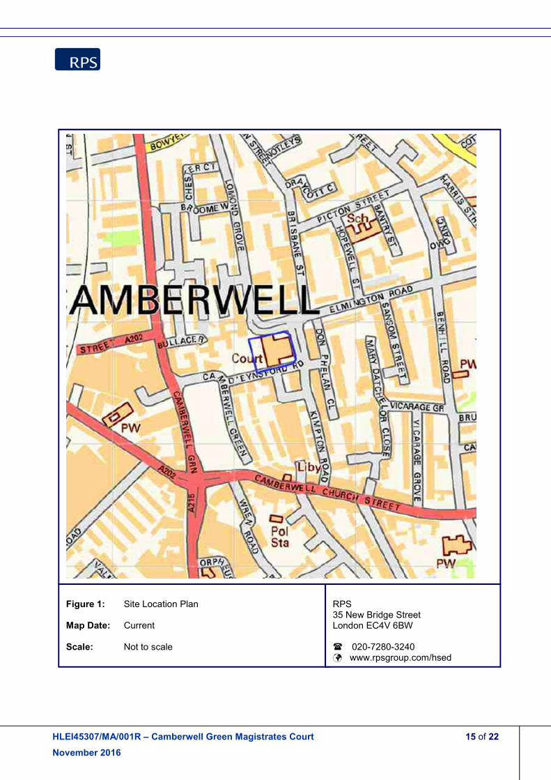
Figure 1: Site Location Plan Map Date: Current Scale: Not to scale
RPS 35 New Bridge Street London EC4V 6BW � 020-7280-3240 � www.rpsgroup.com/hsed

HLEI45307/MA/001R – Camberwell Green Magistrates Court 16 of 22
November 2016
Figure 2: Aerial Photograph Map Date: Current Scale: Not to scale
RPS 35 New Bridge Street London EC4V 6BW � 020-7280-3240 � www.rpsgroup.com/hsed

HLEI45307/MA/001R – Camberwell Green Magistrates Court 17 of 22
November 2016
APPENDIX B
Historical Ordnance Survey Maps

HLEI45307/MA/001R – Camberwell Green Magistrates Court 18 of 22
November 2016
Figure 3: Historical Map Extract Map Date: 1876 Scale: Not to scale
RPS 35 New Bridge Street London EC4V 6BW � 020-7280-3240 � www.rpsgroup.com/hsed

HLEI45307/MA/001R – Camberwell Green Magistrates Court 19 of 22
November 2016
Figure 4: Historical Map Extract Map Date: 1916 Scale: Not to scale
RPS 35 New Bridge Street London EC4V 6BW � 020-7280-3240 � www.rpsgroup.com/hsed

HLEI45307/MA/001R – Camberwell Green Magistrates Court 20 of 22
November 2016
Figure 5: Historical Map Extract Map Date: 1951 Scale: Not to scale
RPS 35 New Bridge Street London EC4V 6BW � 020-7280-3240 � www.rpsgroup.com/hsed

HLEI45307/MA/001R – Camberwell Green Magistrates Court 21 of 22
November 2016
Figure 6: Historical Map Extract Map Date: 1972 Scale: Not to scale
RPS 35 New Bridge Street London EC4V 6BW � 020-7280-3240 � www.rpsgroup.com/hsed

HLEI45307/MA/001R – Camberwell Green Magistrates Court 22 of 22
November 2016
Figure 7: Historical Map Extract Map Date: 1991 Scale: Not to scale
RPS 35 New Bridge Street London EC4V 6BW � 020-7280-3240 � www.rpsgroup.com/hsed