hurl elkhorn 50k run - wordpress.com · hurl elkhorn 50k run ... turn left and start uphill at the...
TRANSCRIPT

HURL ELKHORN 50K RUN
DETAILED COURSE DESCRIPTION
The race starts and finishes at the Willard Creek
Trailhead at the end of Forest Service Road 4014.
Primitive camping is available. There are no
amenities other than porta-potties, which will be
delivered sometime the day before the race. The
race starts at 7:00 am. The finish cut off time is
10:00 pm.
COURSE DESCRIPTION
Note – all distances and elevation gain and loss are based on tracings from quad maps, and therefore
are approximate. These tracings indicate the course is approximately 32.7 miles (52.5K) long with
approximately 7,875 feet of elevation gain and 7,875 feet of elevation loss.
Start to Jackson Creek Aid Station (4 miles, 6.5K )
Runners will be on single track trail, Forest Service Trail 347, almost immediately from the start. Don’t
start at the front of the pack if you expect to take 15 hours to finish! It is will be light at the start….no
need to carry a light. Within the first ¼ mile, the trail widens out enough to pass. The course follows
Trail 347 generally uphill for the first mile, then downhill to the first creek crossing. Quickly after
crossing McClellan Creek, Trail 347 dead ends into Trail 302. Turn left and continue downhill on Trail
302. Stay on Trail 302, generally downhill, for approximately 1.5 miles until it dead ends into Trail 343.
Turn right on Trail 343. Follow Trail 343, which is generally a gradual uphill, to its intersection with Trail
344. Jackson Creek Aid Station (4 miles, 6.5K) is located at this intersection. Elevation gain = 508 feet.
Elevation loss = 800 feet.
Jackson Creek Aid Station to Tepee Creek Aid Station (8 miles, 13K)
Leave Jackson Creek Aid Station on Trail 344. You’ll gain elevation, encounter some rolling terrain, then
lose all the elevation you gained. You’ll encounter your second creek crossing where Jackson Creek runs
down the trail. From this point you’ll start the first major climb, gaining roughly 1,100 feet in 1.5 miles.
There are cow and game paths crossing the trail along this section, and a couple of tricky corners so
keep an eye out for course markers. There are also two more crossings of Jackson Creek. After the 3rd
crossing of Jackson Creek, the trail disappears in a meadow. The course parallels Jackson Creek, watch
for markings. Trail 344 will dead end into Trail 301 at the top of the climb. Turn right on Trail 301 and
cross the log bridge over Jackson Creek toward Casey Meadows.

This section of Trail 301 continues slightly upwards as you contour the mountainside. At approximately
8 miles, the trail enters a meadow and the trail disappears. Watch for rock cairns and course markers as
the trail takes a sharp turn to the left and starts dropping gradually into Casey Meadows. There are
numerous cow and game trails through Casey Meadows, so pay close attention to course markers. Stay
on Trail 301. You must encounter two Forest Service Trail Signs in Casey Meadows, and must cross two
creeks. Turn left and start uphill at the second sign which is just beyond the second creek crossing.
This climb is very rocky and steep in places but the trail is easy to follow. Continue on Trail 301 past Trail
374. The trail eventually levels out and then turns downhill. After numerous downhill switchbacks you’ll
hit Tepee Creek. The trail turns right and follows the creek into Tepee Creek Aid Station (12 miles,
19.3K). Elevation gain = 2,490 feet. Elevation loss = 2,135 feet.

Right Turn at First Forest Service sign
in Casey Meadows
Left turn at
second Forest
Service Sign in
Casey
Meadows
Tepee Creek to Elk Park
Aid Station (4 miles,
6.5K)
From Tepee Creek Aid
Station turn uphill on Trail
302. The trail follows
McClellan Creek for awhile
but eventually climbs
away from the creek, with
numerous uphill
switchbacks at the head of
the McClellan Creek Basin.
Following a brief downhill
the trail continues
climbing through more
switchbacks over the top
of the ridge, and a short downhill into Elk Park Aid Station (16 miles, 25.7K). Elevation gain = 2,360 feet.
Elevation loss = 243 feet.
Elk Park to Tizer Creek Aid Station (5.5 miles – 9K)
From Elk Park Aid Station, go right on Trail 113. The trail is fairly level for about a mile before eventually
turning downhill and
entering a series of
meadows. The trail
disappears in the
meadows so pay
close attention to the
course markers. The
trail is easy to follow
in the sections of
forest between the
meadows. Below the
last meadow, as the
trail gets closer to
Wilson Creek, it
passes through some
wet areas with tall
grass making the trail
hard to find.
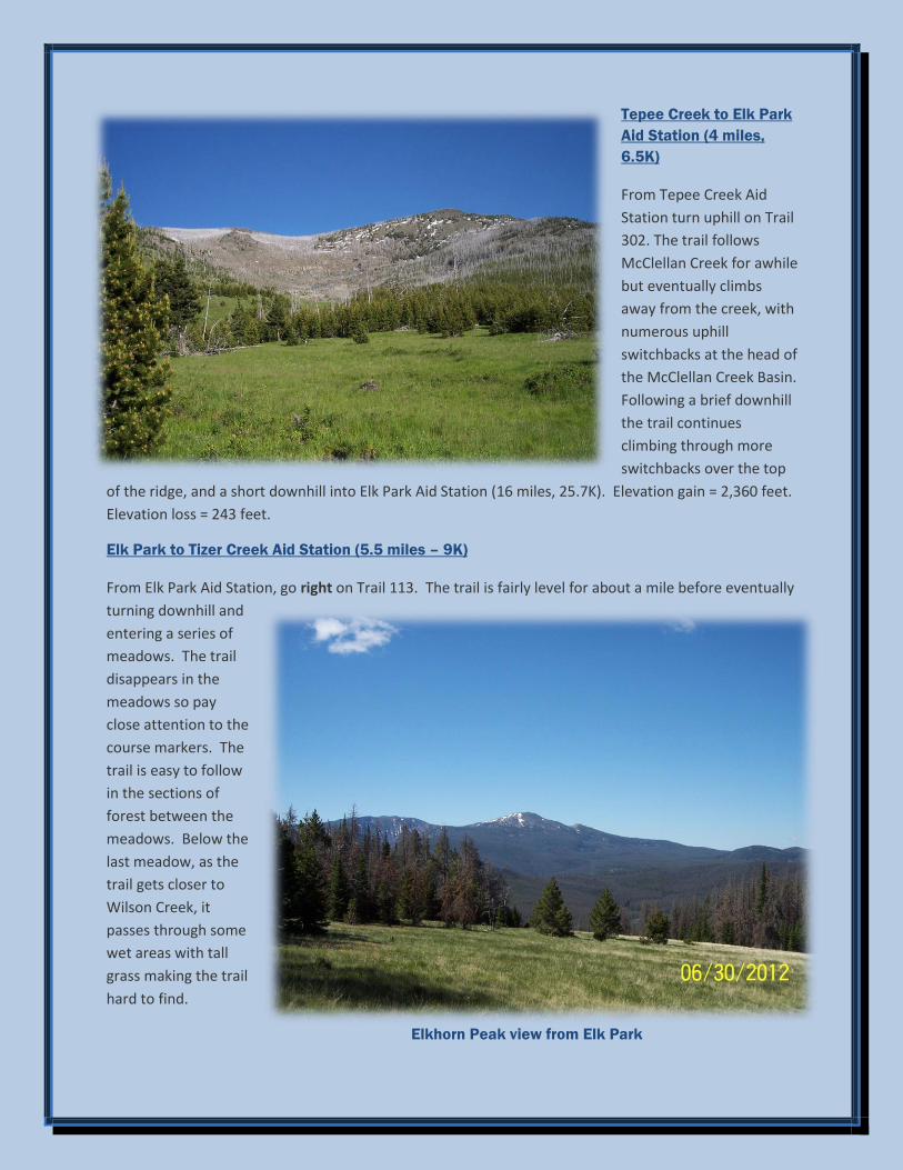
Elkhorn Peak view from Elk Park

Fortunately it should be well trampled down by the 50 mile runners. Once you get to Wilson Creek the
trail follows the creek
downstream (left) to
Forest Service Road
4032. 50 k runners
must turn left on Road
4032. Road 4032 is a
primitive, mostly
double track road. The
road is a generally a
gradual downhill with
Wilson Creek to your
right. Nice running
here. (NOTE: 50 mile
runners turn right here,
cross the creek and
start a long
uphill….don’t blow it).
Turn left at intersection of Road 4032
Continue on Road 4032,
past the trailhead for
Moose Creek Trail 114.
You are now on a short
out and back section
and if you start up
Moose Creek now you
will cut off 2.5 miles
(4K) of the course and
miss Tizer Creek Aid
Station. We will
assume you didn’t
complete the full
course if you are not
checked in or out of
Tizer Creek Aid Station,
and you won’t be an
official finisher.
Intersection of Road 4032 and Trail 114. Follow Road 4032 to the right.

Continue on Road 4032, past the next trailhead for Trail 114 which follows Wilson Creek downstream.
Just past this trailhead Road 4032 crosses Wilson Creek and continues to angle to the right away from
Wilson Creek (if you take Trail 114 downstream you will go way off course into a vast roadless area, and
you may spend at least one night in the mountains). When Road 4032 veers sharply to the left, go
straight ahead on Trail 352.
Intersection of Road 4032 and Trail 352. Take Trail 352.
Stay on Trail 352 uphill through the forest. Just over the crest of the climb the trail veers left through a
meadow and disappears. Watch for course markers. You will be in meadows/heavy grass until you
intersect Road 4032 again. Continue straight (downhill) on Road 4032 and very shortly you are at Tizer
Creek Aid Station (21.5 miles, 34.5K). Elevation gain = 546 feet. Elevation loss = 1,455 feet.

Above: Intersection of Trail 113 and Road 4032. Below: Intersection of Road 4032 and Trails
114 and 352.

Tizer Creek to Elk Park Aid Station (5 miles – 7.5K)
From the Aid Station, head back (uphill) on primitive Forest Service Road 4032. While climbing watch for
Trail 352 which angles off to the left. This intersection is very easy to miss. Trail 352 continues uphill
thru a meadow without a visible trail. You’ll enter the forest near the top of the short climb. The trail is
very easy to follow through the forest, heads downhill, and intersects with Road 4032 again. Go left on
Road 4032. Stay on the road across Wilson Creek and past the trailhead of Trail 114 following the creek
downstream (if you take Trail 114 downstream you will go way off course into a vast roadless area, and
you will likely be spending at least one night in the mountains). Turn right on the second trailhead,
Moose Creek Trail 114. Trail 114 starts out as a primitive road, there is a locked gate across the road to
keep out vehicles. Just beyond the gate you pass a cabin on your right and a trailer on your left. If you
don’t see these within a few minutes of leaving Road 4032 you are not on going the right way. The
primitive road eventually fades out to single track trail. You stay near Moose Creek, uphill, crossing
Moose Creek. Once the trail leaves Moose Creek it passes through some meadows where the trail is
faint so watch for the course markings. From Airplane Park the trail continues a long uphill through the
forest. You will eventually cross a meadow (last opportunity to view Elkhorn Peak – watch for rock
cairns and course markers across the meadow) and reach the intersection with Trail 113. Turn left on
Trail 113 and you’ll be at Elk Park Aid Station in a minute (turn right on Trail 113 and you’ll be heading
towards a vast roadless area and may spend at least one night in the mountains). You have completed
the last major climb when you enter Elk Park Aid Station (26 miles, 41.8K). Elevation gain = 1,430 feet.
Elevation loss = 529 feet.
Trail 352
angles to
the left from
Road 4032
just out of
Tizer Creek
Aid Station

Trail 352 angles to the left from Road 4032 just out of Tizer Creek Aid Station
Running on Trail
352

Elkhorn
Skyline from
Spring
Meadow
Elk Park to Tepee Creek
Aid Station (4 miles – 6K)
You ran this section the other
direction earlier, and you’ve
got it made from here. Leave
the Aid Station to the right on
Trail 302 for a short uphill
over the ridge, then downhill
through the steep, rocky
switchbacks to McClellan
Creek. The trail continues
downhill generally along
McClellan Creek. Continue to
the intersection with Trail
301 and the Tepee Creek Aid
Station (30 miles, 48K).
Elevation gain = 243 feet.
Elevation loss = 2,360 feet.

Tepee Creek to Finish (2
miles – 4K)
Continue straight ahead on
Trail 302, downhill from the aid
station. Approximately ½ mile
from the aid station turn left
on Trail 347. This is the trail
you started out on many hours
earlier. The trail crosses
McClellan Creek, continues
gradually uphill, then downhill
toward the finish at the Willard
Creek Trailhead (52.5K).
Elevation gain = 410 feet.
Elevation loss = 470 feet.
Congratulations, you have
finished the HURL Elkhorn 50K!