iassist, stanford, usa 28 may 2008 web 2.0 data visualisation tools stuart macdonald disc-uk...
Post on 18-Dec-2015
214 views
TRANSCRIPT

IASSIST, Stanford, USA28 May 2008
Web 2.0 Data Visualisation Tools
Stuart Macdonald
DISC-UK Datashare Project Officer
EDINA National Data Centre & Edinburgh University Data Library
IASSIST, Stanford, USA28 May 2008
Context
• DISC-UK DataShare (http://www.disc-uk.org/datashare.html)
• A JISC-funded collaborative project led by EDINA at the University of Edinburgh, with the University of Oxford, the London School of Economics (LSE) and the University of Southampton. Our central aim is to develop a model for the deposit of research datasets in institutional repositories (IRs).
• Alternative mechanisms for researchers to share data beyond the IR.
IASSIST, Stanford, USA28 May 2008
Data Visualisation:
The set of techniques used to turn a set of data into visual insight. It aims to give the data a meaningful representation by exploiting the powerful discerning capabilities of the human eye*.
* Edinburgh Online Graphics Dictionary – http://homepages.inf.ed.ac.uk/rbf/GRDICT/grdict.htm

IASSIST, Stanford, USA28 May 2008
Spatial Data Visualisation
• Programmableweb - http://www.programmableweb.com/tag/mapping - map or spatial mash-up ‘resource discovery tool’
• GeoCommons – http://geocommons.com/ - ‘brings intelligence to the GeoWeb, unleashing tools and data’ (downloadable as CSV, KML, Shape)
• SRON & KMNI • BODC• U.S. National Snow and Ice Data Center• USGS Earthquake Hazards Program
• UNHCR layer in Google Earth – mash together news, images, video, statistical databases relating to refugees across the globe via the “Google Earth Outreach programme” - http://www.unhcr.org/events/47f48dc92.html

IASSIST, Stanford, USA28 May 2008
• UCL Centre for Advanced Spatial Analysis - http://www.casa.ucl.ac.uk/
• GeoVue – one of the 7 nodes of the National Centre for e-Social Science set up to develop ‘new kinds of virtual urban environments’ (VUEs) through which users can participate in furthering their understanding of cities
• Demonstrators – • link publicly available datasets such as Population Census to non-proprietary
mapping e.g. visualising a neighbourhood's geodemographic profile using different area classifications through Google Maps - http://www.londonprofiler.org/
• Linking 2D and 3D map data to real-time pollution data using open mapping utilities
• Engage in other forms of collaboration e.g. Virtual London (via Second Life)
IASSIST, Stanford, USA28 May 2008
• …and there’s more• John Hopkins University’s Interactive Map Tool
• Supports digital field assignments allowing users to create custom mashups using a variety of digital media, text and data – http://www.cer.jhu/index.cfm?pageID=351
• Minnesota Interactive Internet Mapping Project• A mapping application that provides maps and imagery similar to Google Maps –
claims to be data rich, interactive, secure, easy to use, have analytical capabilities - http://maps.umn.edu/
• Research at Pompeu Fabra University, Barcelona• Researchers mining spatial-temporal data provided by geotagged Flickr photos of
urban locations – http://www.giradin.org/fabien/tracing/
• Thematicmapping.org• A project (initialised by a master's thesis in GIS at University of Edinburgh) to
investigate the use of geobrowsers for thematic mapping - http://blog.thematicmapping.org/

IASSIST, Stanford, USA28 May 2008
Numeric Data Visualisation Tools:
• ‘Open’ ethos – anyone can upload/download or use data• Commercial Services embracing Web 2.0 business models• Collaborative• Easy to use
But …
• Ephemeral nature of web• Not trusted repositories / archives• if it’s computer generated and looks good it must be right!
• Palimpsest Project - http://research.google.com

IASSIST, Stanford, USA28 May 2008
Numeric Data Visualisation Tools:
• Data360 - (http://www.data360.org)
• Many Eyes - (http://services.alphaworks.ibm.com/manyeyes/home)
• Swivel - (http://www.swivel.com/)
• Gapminder – (http://www.gapminder.org/downloads/applications/)
• StatCrunch – (http://www.statcrunch.com/)
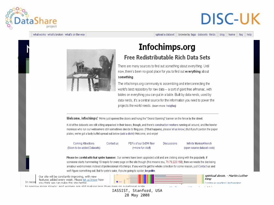
• Graphwise – (http://www.graphwise.com/)• Numbrary – (http://numbrary.com/)• Infochimps – (http://infochimps.org/home)
• Dabble – (http://dabbledb.com/)
• Open Economics – (http://www.openeconomics.net/)
IASSIST, Stanford, USA28 May 2008

IASSIST, Stanford, USA28 May 2008
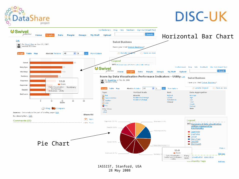
Comparison of 8 Web 2.0 numeric data visualisation tools
Upload data file
IASSIST, Stanford, USA28 May 2008
Horizontal Bar Chart
Pie Chart

IASSIST, Stanford, USA28 May 2008
Macro-data Visualisation
• OECD Country Statistical Profiles – OECD statistics in SDMX (Statistical Data Mark-up eXchange) - http://stats.oecd.org/nawwe/csp/default.html
• IMF Data Mapper - http://www.imf.org/external/datamapper/index.php
• Stat@tlas Europe - An online atlas of European statistical themes hosted by the Federal Statistical Office of Switzerland
• Eurostat Tables Graphs Maps (TGM) - an interactive user interface to Eurostat data

IASSIST, Stanford, USA28 May 2008
• Are such utilities a flash in the pan or here to stay?
• Are they more appealing for researchers than institutional repositories?
• Do they lack gravitas for academic purposes?
• Can/should institutions support the use of these tools?
• Do such ‘open data’ resources contribute to the ‘Global Database’?
Food for thought ….