importing openstreetmap data into arcgis - location-aware
TRANSCRIPT
Importing OpenStreetMap data into ArcGIS
Different ArcGIS versions
• This process is different for different ArcGIS versions. Click below for your version:– ArcGIS v9.3.1 SP1– ArcGIS v10
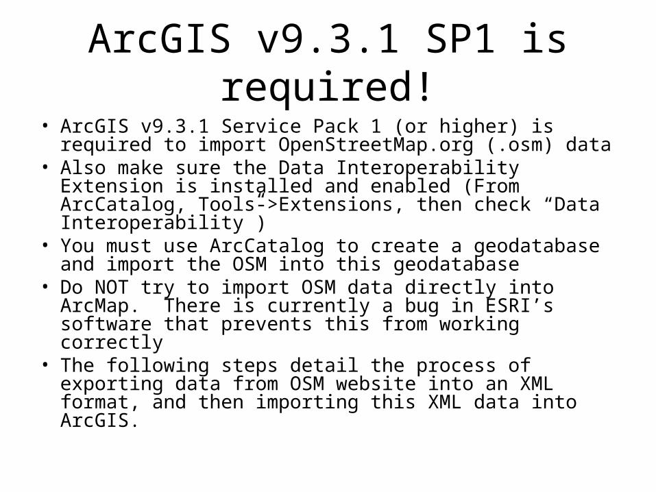
ArcGIS v9.3.1 SP1 is required!• ArcGIS v9.3.1 Service Pack 1 (or higher) is required to
import OpenStreetMap.org (.osm) data• Also make sure the Data Interoperability Extension is
installed and enabled (From ArcCatalog, Tools->Extensions, then check “Data Interoperability”)
• You must use ArcCatalog to create a geodatabase and import the OSM into this geodatabase
• Do NOT try to import OSM data directly into ArcMap. There is currently a bug in ESRI’s software that prevents this from working correctly
• The following steps detail the process of exporting data from OSM website into an XML format, and then importing this XML data into ArcGIS.
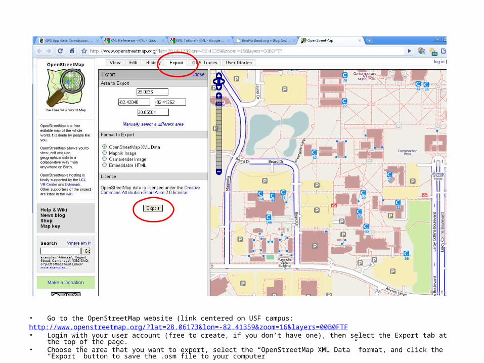
• Go to the OpenStreetMap website (link centered on USF campus:http://www.openstreetmap.org/?lat=28.06173&lon=-82.41359&zoom=16&layers=00B0FTF• Login with your user account (free to create, if you don’t have one), then select the Export tab at the top of the page.• Choose the area that you want to export, select the “OpenStreetMap XML Data” format, and click the “Export” button to save the .osm file to your
computer
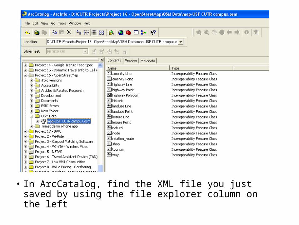
• In ArcCatalog, find the XML file you just saved by using the file explorer column on the left
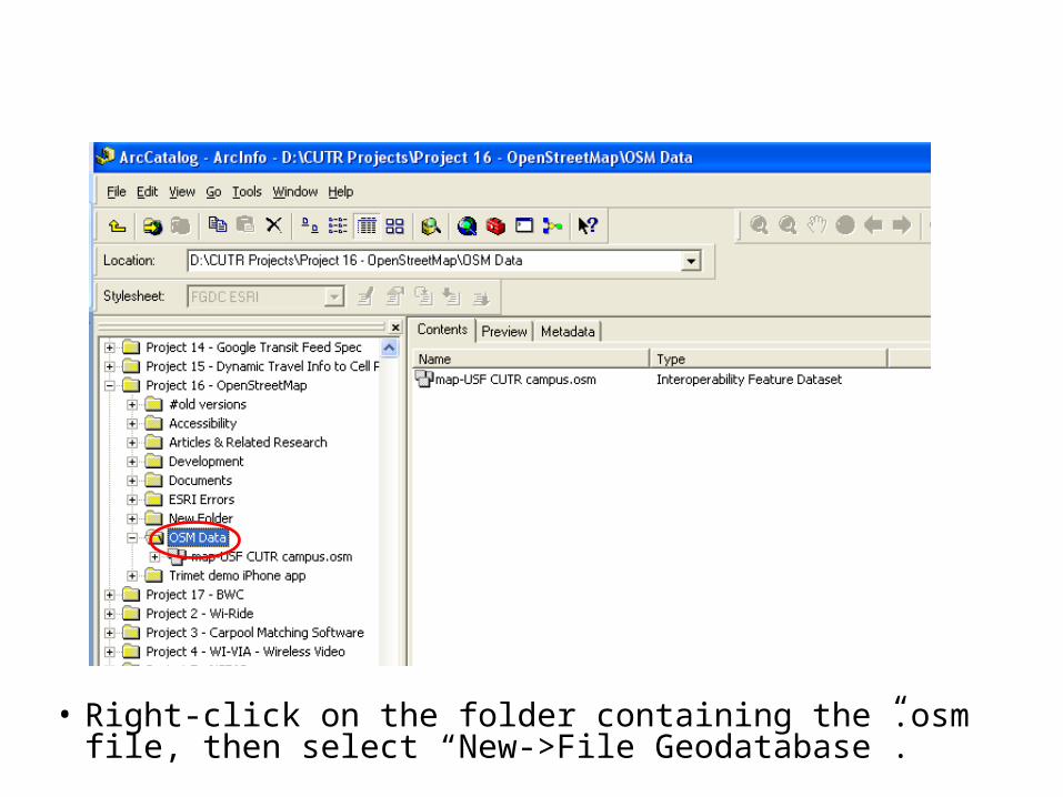
• Right-click on the folder containing the .osm file, then select “New->File Geodatabase”.
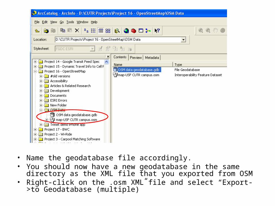
• Name the geodatabase file accordingly. • You should now have a new geodatabase in the same directory as the
XML file that you exported from OSM• Right-click on the .osm XML file and select “Export->to Geodatabase
(multiple)”
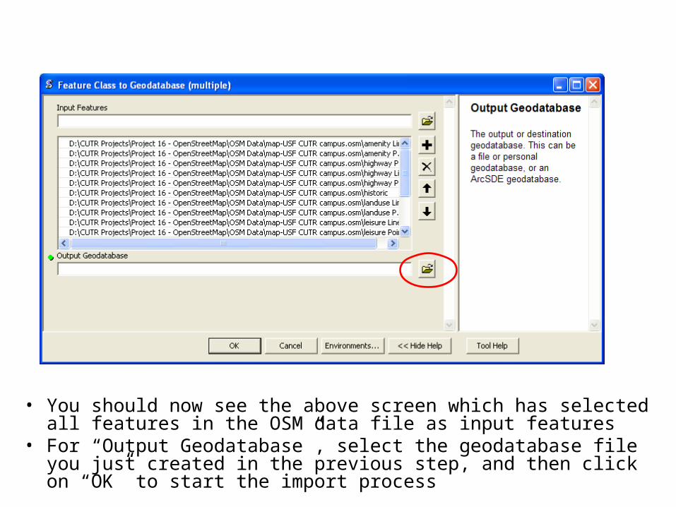
• You should now see the above screen which has selected all features in the OSM data file as input features
• For “Output Geodatabase”, select the geodatabase file you just created in the previous step, and then click on “OK” to start the import process
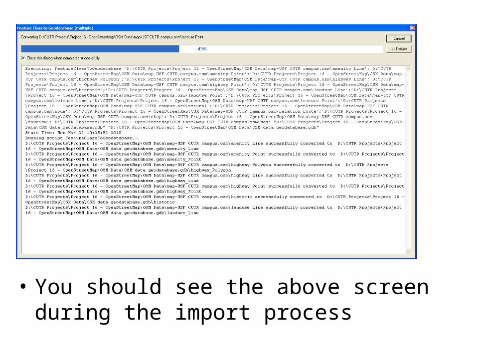
• You should see the above screen during the import process
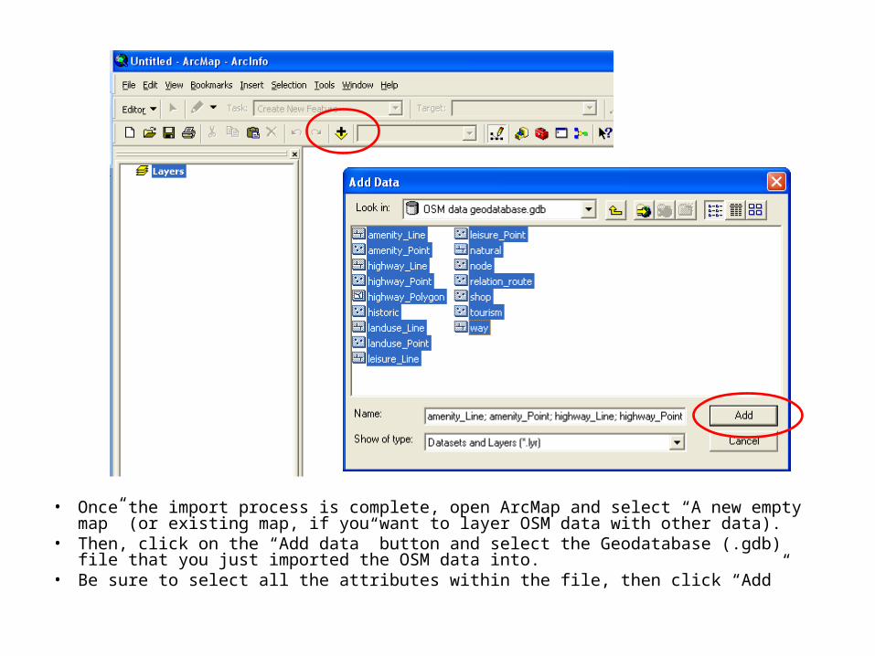
• Once the import process is complete, open ArcMap and select “A new empty map” (or existing map, if you want to layer OSM data with other data).
• Then, click on the “Add data” button and select the Geodatabase (.gdb) file that you just imported the OSM data into.
• Be sure to select all the attributes within the file, then click “Add”
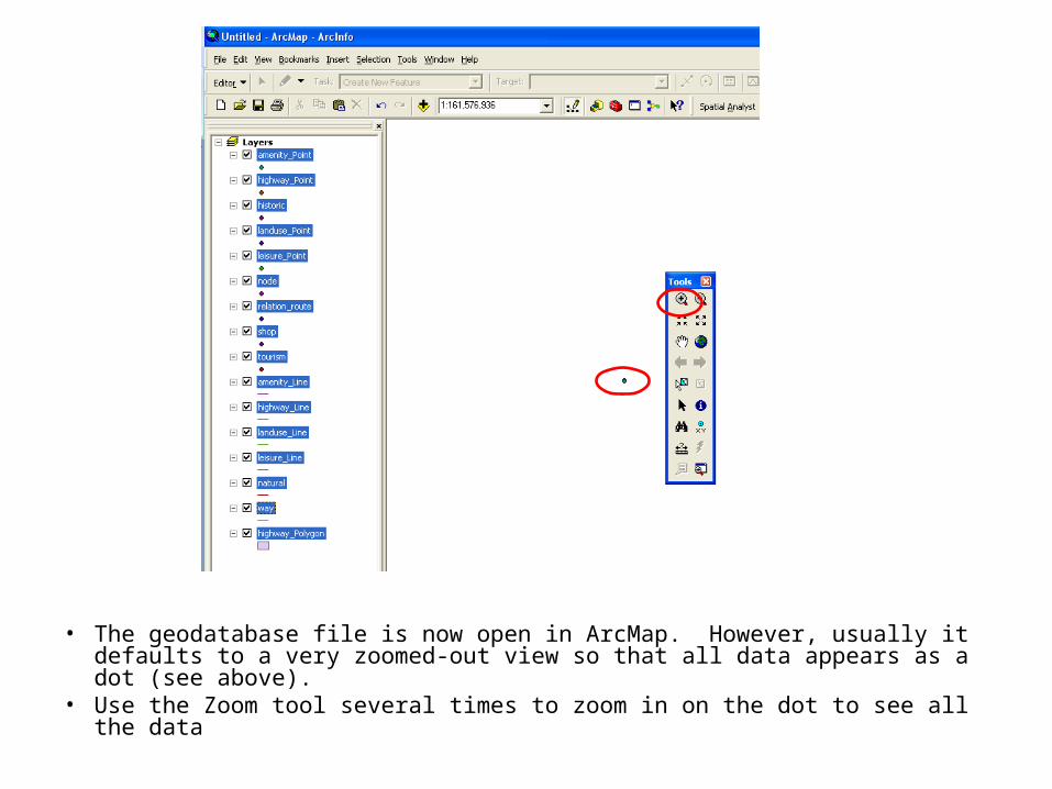
• The geodatabase file is now open in ArcMap. However, usually it defaults to a very zoomed-out view so that all data appears as a dot (see above).
• Use the Zoom tool several times to zoom in on the dot to see all the data

• You should now see all the OSM data in ArcMap! You can use all the normal ArcGIS tools and queries now on all the data attributes
Following slides are for ArcGIS 10
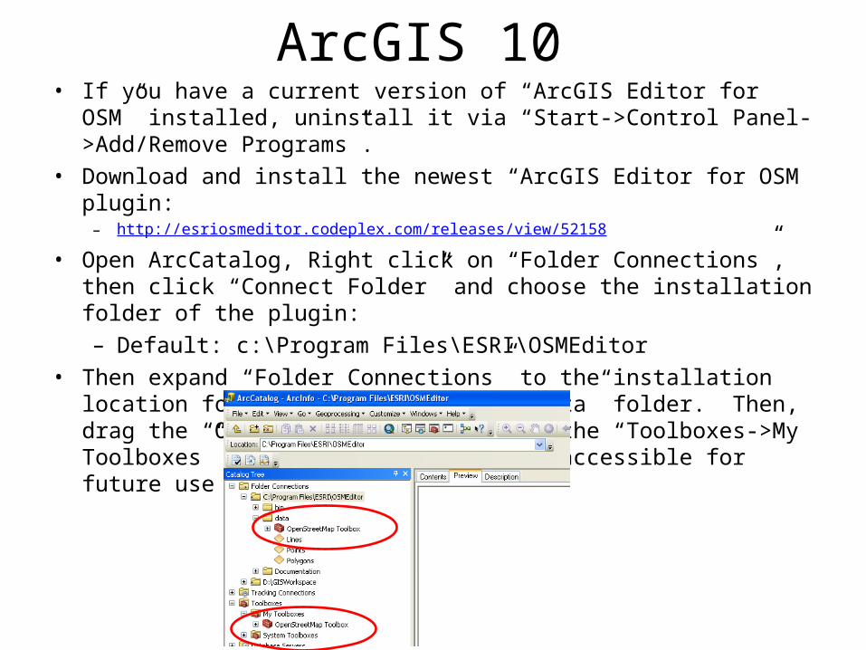
ArcGIS 10• If you have a current version of “ArcGIS Editor for OSM” installed,
uninstall it via “Start->Control Panel->Add/Remove Programs”.• Download and install the newest “ArcGIS Editor for OSM plugin:
– http://esriosmeditor.codeplex.com/releases/view/52158
• Open ArcCatalog, Right click on “Folder Connections”, then click “Connect Folder” and choose the installation folder of the plugin:– Default: c:\Program Files\ESRI\OSMEditor
• Then expand “Folder Connections” to the installation location for the plugin, and the “data” folder. Then, drag the “OpenStreetMap Toolbox” to the “Toolboxes->My Toolboxes” folder to make it easily accessible for future use
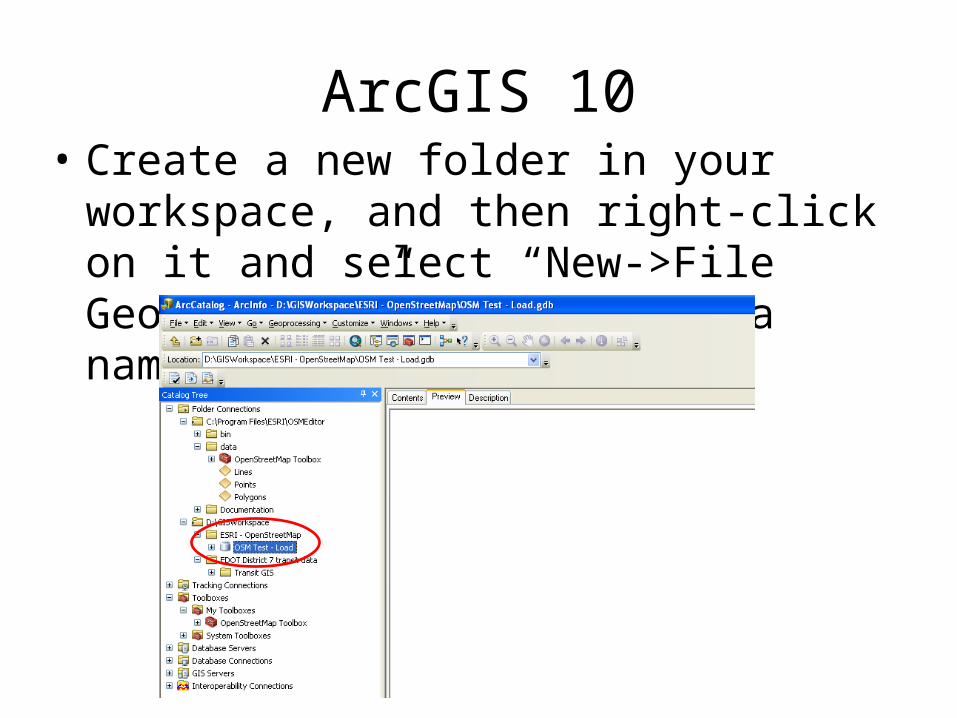
ArcGIS 10• Create a new folder in your workspace, and
then right-click on it and select “New->File Geodatabase”, and give it a name
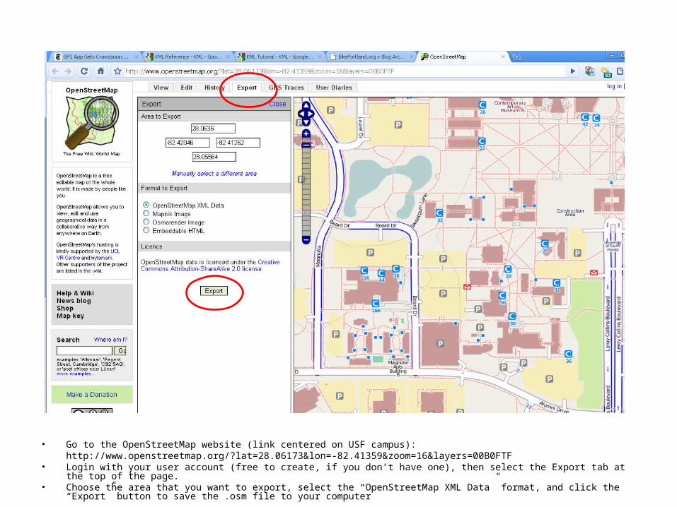
• Go to the OpenStreetMap website (link centered on USF campus):http://www.openstreetmap.org/?lat=28.06173&lon=-82.41359&zoom=16&layers=00B0FTF
• Login with your user account (free to create, if you don’t have one), then select the Export tab at the top of the page.• Choose the area that you want to export, select the “OpenStreetMap XML Data” format, and click the “Export” button to save the .osm file to your
computer
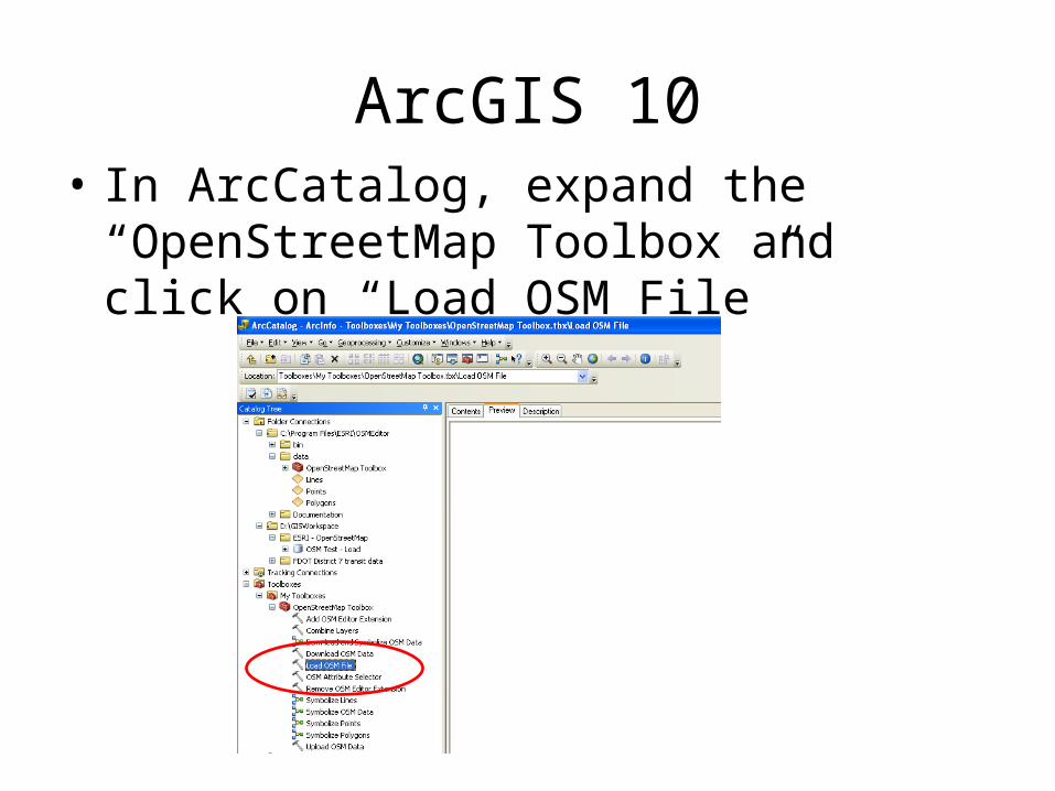
ArcGIS 10• In ArcCatalog, expand the “OpenStreetMap
Toolbox and click on “Load OSM File”
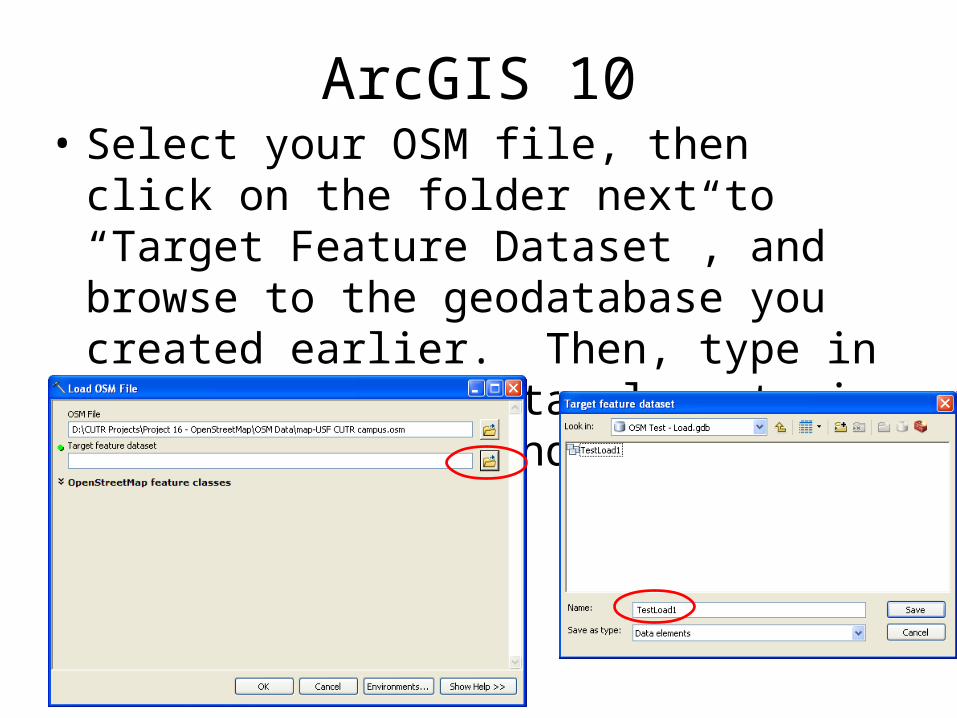
ArcGIS 10• Select your OSM file, then click on the folder
next to “Target Feature Dataset”, and browse to the geodatabase you created earlier. Then, type in a name for the Data elements in the geodatabase and click “Save” then “Ok”.
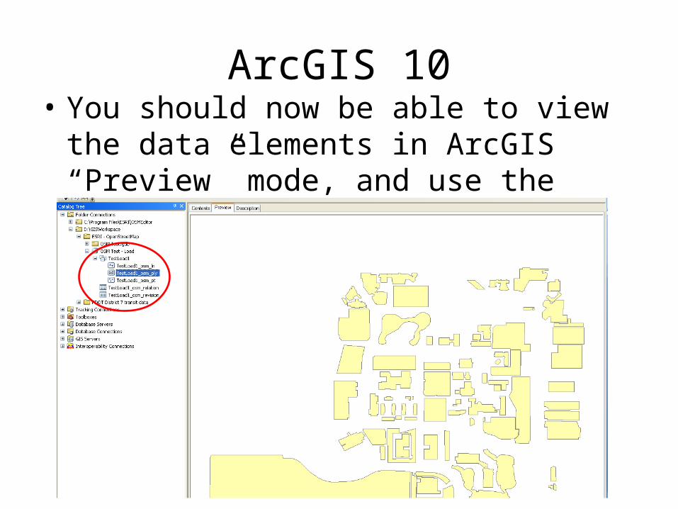
ArcGIS 10• You should now be able to view the data
elements in ArcGIS “Preview” mode, and use the geodatabase like normal!
About
V2.0Created by:
Sean J. Barbeau, M.S. Comp.Sci.Research Associate Center for Urban Transportation Research University of South Florida 4202 E. Fowler Avenue, CUT100 Tampa, FL 33620-5375 813.974.7208 2D barcode813.974.5168 (fax) [email protected] USF Location-Aware Information Systems Lab