improvements in data source collection in antarctica
TRANSCRIPT

31
Improvements in Data Source Collection in Antarctica
James E. Frodge, Chester V. Clogston and Arthur M. Cayette SPAWAR Systems Center, Charleston, SC
1. Introduction
It is a goal of Aviation Technical Services (ATS) to use all available resources to improve short term forecasting to nearly 100% mission accuracy level and to improve mid-range forecasting for an improved mission planning capability. In addition, we are also working toward a better understanding of cyclic patterns, which would allow the National Science Foundation a reasonable representation of the number of years required for extended planning purposes. All this is incumbent upon increasing the amount of data, the ability to access data, and the utilization of data in the forecast process. There is more data available than currently utilized for a host of reasons, such as poor communications from sites or lack of awareness that other groups or agencies may be collecting it. Technological improvements need to be made to ensure quality data is collected and distributed in real-time to have the greatest impact in research and operations. 2. Improvements
ATS continues to move forward with infrastructure improvement. We’ve gone from a weather office with a single 100-MHz personal computer with a 9600-baud modem to a series of Windows NT based workstations networked to an undedicated T-1 line. The Internet capability has allowed McMurdo Weather (Mac Weather) to significantly increase the amount of data flow into and out of the office. Access to multiple models, observations collected and transmitted to the Global Telecommunications System (GTS), and the ability to communicate to other forecasters/modelers have all contributed to increased accuracy of forecasts.
Other impacts have been the launch of the National Oceanic and Atmospheric Administration NOAA-16 polar orbiting satellite, which has brought us back to the point we were before NOAA-14 went astray. A coverage blackout that was nearly 7 hours in duration is now back to just under 5 hours. This outage continues to be during the middle of flight operations. We also installed a simple receiver with a limited use omni-directional antenna. It was hoped that this would fill the gap during the operational day between the NOAA and Defense Meteorological Satellite Program (DMSP) passes by capturing automatic picture
transmission imagery from passes of the Russian polar orbiting satellite constellation (METEOR). A grid system installation has improved the use of this tool. This aging system was shut down during the 2000-01 season. Japan’s Geostationary Meteorological Satellite (GMS-5) assists with intercontinental flights, vapor winds, and construction of composite images. This system's coverage is decreasing with age.
We have improved our resources in the data acquisition area as well. We’ve gone from 2 automated surface observing systems (ASOS), and 1 AIR radar wind sounding (RAWIN) system to 2 ASOS, 13 automatic weather stations (AWS), 2 Portable ASOS (PASOS) and 1 global positioning system (GPS) RAWIN system. In addition, we have procured new meteorological (MET) Kits to improve camp observations. How this has made an impact is:
a) GPS RAWIN has decreased the wind failure rate to 5% from a high of 25% with the AIR RAWIN system.
b) 2 PASOS, one on each Tower at the active airfields, modified to meet synoptic and outside continental United States (OCONUS) reporting requirements.
c) Aging ASOS remaining on site to support Pegasus runway and provide extended data collection.
d) AWS network area expansion with the addition of 13 AWS sites placed to provide advanced indications of weather events (Fig. 1).
e) Provision of new MET Kits to include a ceilometer and visibility sensor for larger camp operations to increase the accuracy of these important observations. Three initiatives for this season are a
direct link to the AWS on Odell Glacier, collection and transmission of continental aircraft report (AIREP) data, and the collection and distribution of extended Terra Nova Bay (TNB) data. The weather data link to Odell Glacier will provide greater frequency of weather data and easier access to information at this emergency landing field. The second initiative for this coming season is receiving TNB weather data. The Italians have up to 11 AWS sites (Fig. 2) and take an upper air

32
sounding as well. We are working with them to collect as much data as possible and put it into the GTS. The benefit of the TNB data will greatly improve our ability to quantify systems approaching from the north and most importantly, making the data available for research and assimilation into the global and mesoscale models.
Fig. 1. Current AWS Locations.
Fig. 2. Italian AWS Locations near TNB (Midpoint AWS, further inland, not shown). 3. Computer Modeling
As forecasters we can’t begin to measure the impact computer modeling has had over the recent years to the improvement of accuracy in forecasting. This is especially true for forecasting in McMurdo. In the past we relied on one global model, the Navy Operational Global Atmospheric Prediction System (NOGAPS) from the Navy’s
Fleet Numerical Meteorology and Oceanography Center (FNMOC), which provided an 81km grid. Since the improvement in our connectivity we now are able to utilize products from not only FNMOC and their NOGAPS model, but the Air Force Weather Information Network (AFWIN) standard version of the the Pennsylvania State University / National Center for Atmospheric Research (NCAR) Fifth Generation Mesoscale Model (MM5), the National Centers for Environvental Prediction (NCEP) Aviation model (AVN), and most recently an experimental model, the Antarctic Mesoscale Prediction System (AMPS) from NCAR, which employs a version of the MM5 with polar modifications developed by the Polar Meteorology Group at the Byrd Polar Research Center (BPRC). The AMPS model was implemented as a result of the May 2000 Antarctic Weather Forecasting Workshop, held at BPRC. The availability of all of these models to the forecaster has drastically improved the ability to provide an accurate forecast. A brief synopsis of the models and what they provide us are:
a) AFWIN MM5 1. 45-km MM5 covering continent 2. 15-km for Ross Island which is being
activated for the full period this operating season
3. Agreement to implement polar modification when validated
b) FNMOC support with the Optimum Path Aircraft Routing System (OPARS) and NOGAPS.
c) AMPS MM5 (non-operational) 1. 90-km MM5 covering most of Southern
Hemisphere 2. 30-km MM5 covering continent 3. 10-km over Ross Island 4. Very receptive to improvements and
modifications d) NCEP’s AVN long range trend support with
14 day outlook
4. Future potential improvements As far forward as we have come in the last
few seasons, it’s a small step in the direction we need to go. The only way to continue to improve is to look into and plan for future improvements. Currently Mac weather has proposed initiatives, for the near future, that will continue are movement down the right path. Some of these are:
a) Weather camera installations at the active
runway and a potential to extend to remote locations
33
b) Weather radar. We are currently looking into a small system for testing at McMurdo
c) Extended data distribution using NOAA Port and a potential addition of a Local Data Manager (LDM) server to use Unidata’s Internet Data Distribution (IDD) system. We are working with the University Corporation for Atmospheric Research (UCAR) and NOAA to distribute as much data as possible
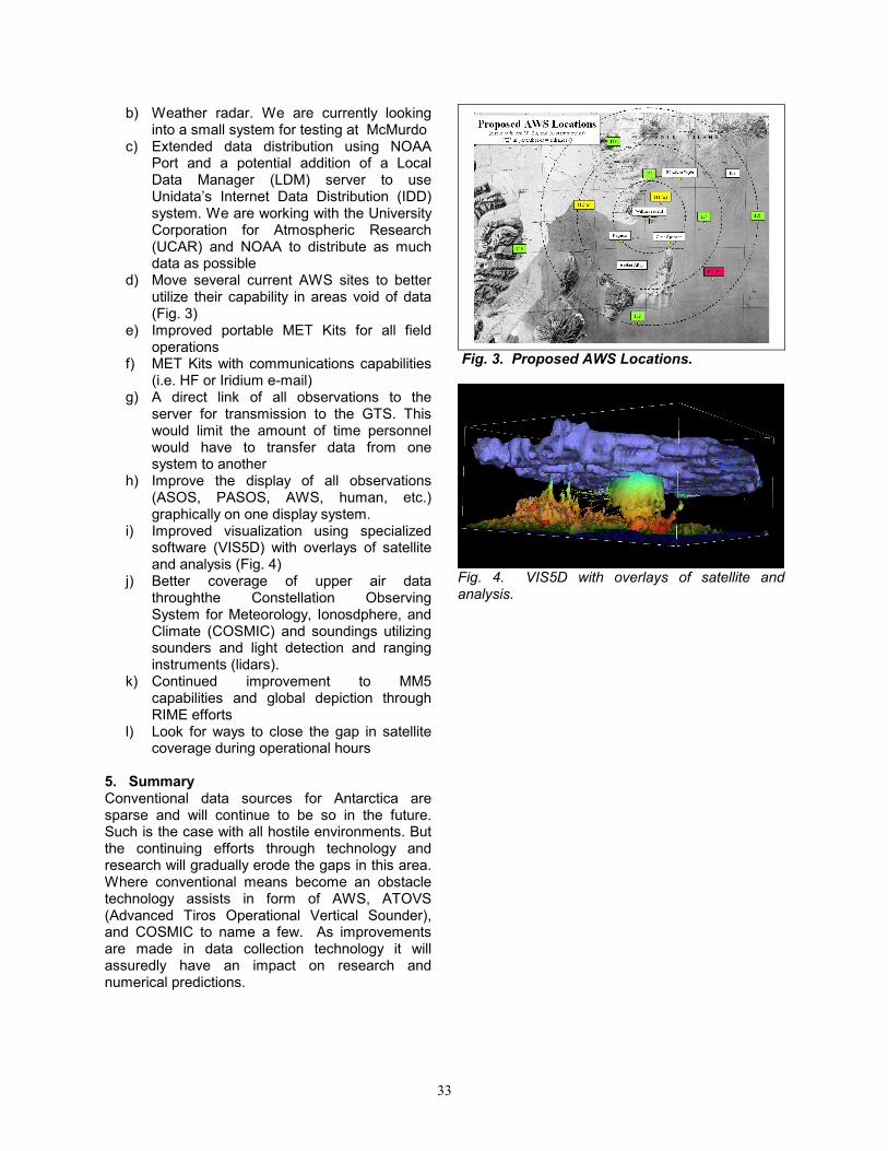
d) Move several current AWS sites to better utilize their capability in areas void of data (Fig. 3)
e) Improved portable MET Kits for all field operations
f) MET Kits with communications capabilities (i.e. HF or Iridium e-mail)
g) A direct link of all observations to the server for transmission to the GTS. This would limit the amount of time personnel would have to transfer data from one system to another
h) Improve the display of all observations (ASOS, PASOS, AWS, human, etc.) graphically on one display system.
i) Improved visualization using specialized software (VIS5D) with overlays of satellite and analysis (Fig. 4)
j) Better coverage of upper air data throughthe Constellation Observing System for Meteorology, Ionosdphere, and Climate (COSMIC) and soundings utilizing sounders and light detection and ranging instruments (lidars).
k) Continued improvement to MM5 capabilities and global depiction through RIME efforts
l) Look for ways to close the gap in satellite coverage during operational hours
5. Summary Conventional data sources for Antarctica are sparse and will continue to be so in the future. Such is the case with all hostile environments. But the continuing efforts through technology and research will gradually erode the gaps in this area. Where conventional means become an obstacle technology assists in form of AWS, ATOVS (Advanced Tiros Operational Vertical Sounder), and COSMIC to name a few. As improvements are made in data collection technology it will assuredly have an impact on research and numerical predictions.
Fig. 3. Proposed AWS Locations.
Fig. 4. VIS5D with overlays of satellite and analysis.