initial orbit determination through optical observations by … · initial orbit determination...
TRANSCRIPT

INITIAL ORBIT DETERMINATION THROUGH OPTICAL OBSERVATIONS
by
Brett R. Wilson
A senior thesis submitted to the faculty of
Brigham Young University - Idaho
in partial fulfillment of the requirements for the degree of
Bachelor of Science
Department of Physics
Brigham Young University - Idaho
July 2016


Copyright © 2016 Brett R. Wilson
All Rights Reserved


BRIGHAM YOUNG UNIVERSITY - IDAHO
DEPARTMENT APPROVAL
of a senior thesis submitted by
Brett R. Wilson
This thesis has been reviewed by the research committee, senior thesis coor-dinator, and department chair and has been found to be satisfactory.
Date Stephen McNeil, Advisor/Chair
Date Evan Hansen, Senior Thesis Coordinator
Date Brian Tonks, Committee Member
Date David Oliphant, Committee Member

vi

ABSTRACT
INITIAL ORBIT DETERMINATION THROUGH OPTICAL OBSERVATIONS
Brett R. Wilson
Department of Physics
Bachelor of Science
Understanding the current and future position of the objects in earth orbit is
important to national security and the safety of manned space flight. When
a new object is sighted in orbit, the path of the orbit needs to be determined.
Before the invention of radar this could only be done using the right ascen-
sion, declination angles and time. This method is still used to increase the
accuracy of radar measurements. The use of optical observations instead of
radar measurement was chosen because it is an important step to understand
how orbiting objects can be measured from a rotating earth. Angle data
is collected from the earth and converted into a coordinate system that is
not rotating. The angle data does not include the distance from the earth


to the satellite. Using three sets of measurements the orbit of the satellite
can be determined. This was done for the Moon as well as the international
space station. The distance from the center of the earth to the satellite is
determined and compared to known values.


ACKNOWLEDGMENTS
I would like to thank my adviser Dr. McNeil for his mentorship as I
researched and wrote my thesis. In addition to my adviser I would like to
thank my thesis committee Brother Oliphant and Brother Tonks for reviewing
my work. I would also like to thank Brother Hansen for the time he spent with
me in class and outside of class helping me become a better writer. Lastly I
would like to thank my wife Gidianny For her support both financially and
emotionally while I wrote my thesis.


Contents
Table of Contents xiii
List of Figures xv
1 Introduction and Background 11.1 Space Situational Awareness . . . . . . . . . . . . . . . . . . . . . . . 11.2 Importance of Orbit Determination for Earth Satellites . . . . . . . . 21.3 Laplace’s Method for Orbit determination . . . . . . . . . . . . . . . 2
2 Methods 52.1 Observation . . . . . . . . . . . . . . . . . . . . . . . . . . . . . . . . 62.2 Coordinate Systems . . . . . . . . . . . . . . . . . . . . . . . . . . . . 82.3 Sidereal Time . . . . . . . . . . . . . . . . . . . . . . . . . . . . . . . 9
2.3.1 Calculating Greenwich Mean Sidereal Time (GMST) . . . . . 102.3.2 Calculating Local Sidereal Time . . . . . . . . . . . . . . . . . 11
2.4 Ellipsoid Earth Model . . . . . . . . . . . . . . . . . . . . . . . . . . 112.5 Calculating the Position Vectors . . . . . . . . . . . . . . . . . . . . . 13
2.5.1 Line of Site Unit Vectors . . . . . . . . . . . . . . . . . . . . . 132.5.2 Position Vectors . . . . . . . . . . . . . . . . . . . . . . . . . . 14
3 Results 193.1 Observations . . . . . . . . . . . . . . . . . . . . . . . . . . . . . . . . 193.2 Sidereal Time Angles . . . . . . . . . . . . . . . . . . . . . . . . . . . 213.3 Station Coordinates With Respect to Time . . . . . . . . . . . . . . . 213.4 Line of Sight Unit Vector With Respect to Time . . . . . . . . . . . . 223.5 Results for the Moon . . . . . . . . . . . . . . . . . . . . . . . . . . . 223.6 Results for a Low Earth Orbit Satellite . . . . . . . . . . . . . . . . . 233.7 Error Analysis . . . . . . . . . . . . . . . . . . . . . . . . . . . . . . . 233.8 Comparison . . . . . . . . . . . . . . . . . . . . . . . . . . . . . . . . 25
xiii
xiv CONTENTS
4 Conclusion 274.1 Outcome . . . . . . . . . . . . . . . . . . . . . . . . . . . . . . . . . . 274.2 Further Research . . . . . . . . . . . . . . . . . . . . . . . . . . . . . 27
4.2.1 Calculating Orbital Elements . . . . . . . . . . . . . . . . . . 284.2.2 Polynomial Fit . . . . . . . . . . . . . . . . . . . . . . . . . . 28
A MATLAB Code 33
B Calculating Orbital Elements 41

List of Figures
2.1 Scope for measuring the azimuthal and elevation angles of the Moon . 72.2 Angular relationship between SEZ and IJK frames [1] . . . . . . . . . 102.3 Earth cross-section [1] . . . . . . . . . . . . . . . . . . . . . . . . . . 122.4 Position Vector Geometry . . . . . . . . . . . . . . . . . . . . . . . . 15
3.1 ISS Data Point 1 [3] . . . . . . . . . . . . . . . . . . . . . . . . . . . 193.2 ISS Data Point 2 [3] . . . . . . . . . . . . . . . . . . . . . . . . . . . 203.3 ISS Data Point 3 [3] . . . . . . . . . . . . . . . . . . . . . . . . . . . 203.4 Error from ISS Measurements . . . . . . . . . . . . . . . . . . . . . . 243.5 Error from Moon Measurements . . . . . . . . . . . . . . . . . . . . . 25
4.1 Right Ascension and Declination data with polynomial fits . . . . . . 29
xv


Chapter 1
Introduction and Background
1.1 Space Situational Awareness
The field of space situational awareness (SSA) is comprised of knowing what is in
orbit around earth, where it is now located and where it will be located in the future.
This is important to national security and the safety of manned space flight. Initial
orbit determination is a computerized and mostly automated process. It is a problem
that Laplace, Gauss, Newton and Euler all worked on without the aid of a computer.
The method that Laplace used for orbit determination provides an understanding
of the physics of orbit determination and thus provides a good entry point into the
field of space situational awareness. A solid understanding of the Laplace method
for orbit determination gives the background needed to understand other methods
and enter the field of SSA.
1
2 Chapter 1 Introduction and Background
1.2 Importance of Orbit Determination for Earth
Satellites
In order to protect its assets in space the United States maintains a list of objects
in earth orbit.[1] This list is used to calculate when objects such as the international
space station and any other orbiting object are on a collision course. When two
items are on a collision course one of them can either raise or lower its orbit in order
to avoid the collision. Orbit determination is also important to national security.
The United States tracks the satellites of foreign powers, ballistic missiles as well as
identifying other objects in orbit.[1] When a new earth satellite is detected its orbit
needs to be determined. One Method of determining the position and future orbit
of a satellite is by using Laplace’s method for orbit determination.
1.3 Laplace’s Method for Orbit determination
This paper shows how Laplace’s method can be used to make an initial orbit determi-
nation. In order to gain a better understanding of the physics of orbit determination
the method Laplace used will be introduced. This method uses instruments and
techniques that would have been available to Laplace. MATLAB has been employed
to take care of the repetitious arithmetic that is required for calculating dates, it-
eratively solving functions and least squares fitting. A computer is not needed to
solve the problem; it was only used to save time. The method Laplace presented is
demonstrated with angular data collected from the international space station as well

1.3 Laplace’s Method for Orbit determination 3
as for the Moon. The focus of the paper is to demonstrate how the Laplace method
can be used to determine the position vector of an earth satellite. A knowledge of
orbits is used to find the position and then three positions can be used to predict
the orbit.

4 Chapter 1 Introduction and Background

Chapter 2
Methods
Using the Laplace method of orbital determination to find the position vector for a
satellite at a specific time requires three observations. Each of these three observa-
tions need to include three numbers, the elevation angle, the azimuthal angle and
the universal time (UT1). Because the observations are taken in a spinning reference
frame they need to be converted into a reference frame that is not spinning. This
requires the observer to know the angle (local sidereal time) which the earth has spun
since the observing station was aligned with the x axis of the non-rotating reference
frame. In order to find the local sidereal time the Greenwich sidereal time must also
be known. When converting from the topocentric coordinate system located on the
surface of the earth into the geocentric coordinate system the non-spherical shape of
the earth needs to be taken into account. Before calculating the position vector for
the satellite an equation for a unit vector with respect to time needs to be formed.
Once the unit vector and its derivatives have been calculated it can be used along
5

6 Chapter 2 Methods
with the vector that points from the center of the earth to the observing station to
calculate the position vector of the satellite.
2.1 Observation
The two fundamental tools for orbit determination are radar and optical telescopes.
When used together these tools can be used to calculate a highly accurate orbit, ac-
curate enough to calculate the position of the satellite at a future time. Radar data
returns highly accurate velocity and distance information however it lacks angular
resolution. Optical observations however return highly accurate angular resolution
but poor velocity and distance measurements. The Laplace method uses optical
observations to calculate distance measurements that are inherent to radar measure-
ments.
The methods chosen to observe satellites in low earth orbit and for satellites in
a high orbit were different. The Moon is in a high earth orbit so it moves slowly
across the sky. Right ascension and declination angles for the Moon could be taken
using a scope because of the slow relative movement between the observing station
and the Moon. The Moon was centered in the scope and the right ascension was
measured using a compass and the declination was measured using a protractor.
The scope was home-built using a meter stick two pieces of card stock and a tripod.
The apparatus gave measurements accurate to one degree for both right Ascension
and declination. This data was within one degree when compared to the data from
the Naval Observatory; however it did not contain the accuracy (˘0.1˝) needed to

2.1 Observation 7
calculate the orbital parameters. Because of this limitation the data from the Navel
Observatory was used to find the position vector for the Moon.
Figure 2.1 Scope for measuring the azimuthal and elevation angles of theMoon
Data for the international space station, which is a satellite in low earth orbit,
was collected from the space station live streaming provided by satflate.[3] When
the space station was in the sky at the observation location three data points were
collected by taking screen shots of the tracking data. The only measurements used
from the data provided by the tracking system were the azimuthal angle, elevation
angle and the time. These are the three data points that would be available if the
data was taken using an optical telescope.
8 Chapter 2 Methods
2.2 Coordinate Systems
The coordinate system that measurements are taken in is referred to as the station
coordinate system or the topocentric-horizon coordinate system. In the station co-
ordinate system the z axis points to the zenith, the x axis points south towards the
horizon and the y axis points east towards the horizon.This system with the origin
located on the surface of the earth were the observations are made is often reefed to
as the SEZ coordinate system. Optical observations in this coordinate system are
measured in azimuth and elevation angles. The azimuthal angle is measured east-
ward form the south and the elevation is the angle measured up from the horizon.
In order to transform these measurements into an inertial reference frame recording
an accurate time of observation is also important.
The coordinate system that the measurements are transformed into is the geocentric-
equatorial coordinate system. In this system the x y plane is formed by the equatorial
plane. The Z axis points north with the origin at the center of the earth. The x axis
points in the direction of the vernal equinox and the y direction is 90 degrees coun-
terclockwise form that in the equatorial plane. This coordinate system is referred to
as the XYZ coordinate system. The transformation matrix used to transform from
the SEZ coordinate system to the XYZ coordinate system is given in equation 2.1.
In equation 2.1 θ is the local sidereal time or the angle that separates the observation
location and the vernal equinox and L is the latitude of the observing station.

2.3 Sidereal Time 9
»
—
—
—
—
–
I
J
K
fi
ffi
ffi
ffi
ffi
fl
“
»
—
—
—
—
–
sinpLqcospθq ´sinpθq cospLqcospθq
sinpLqsinpθq cospθq cospLqsinpθq
´cospLq 0 sinpLq
fi
ffi
ffi
ffi
ffi
fl
»
—
—
—
—
–
S
E
Z
fi
ffi
ffi
ffi
ffi
fl
(2.1)
2.3 Sidereal Time
In order to transform vectors in SEZ into IJK components the spin of the earth needs
to be taken into account. To do this the angle θ between the vernal equinox and the
longitude of the observation site needs to be calculated. This angle is called local
sidereal time.
θ “ θg ` λE
The angle θg is the angle between the vernal equinox and Greenwich England at the
time of observation. The angle λE is the angle between Greenwich England and the
observation location (i.e. geographic longitude).

10 Chapter 2 Methods
Figure 2.2 Angular relationship between SEZ and IJK frames [1]
2.3.1 Calculating Greenwich Mean Sidereal Time (GMST)
The angle between Greenwich England and the vernal equinox is calculated by count-
ing how many times the earth has rotated with respect to the stars since a known
time where Greenwich and the vernal equinox were aligned. Most formulas to cal-
culate this use the Julian date which is the number of days since noon Greenwich
mean time on January, 1st 4713 BC. [2]
JD “ 24553004.5` day of year` fraction of day from 0h UT
2.4 Ellipsoid Earth Model 11
Once the Julian date has been calculated it can be used to calculate the GMST.
GMST “ 24110.54841` 8640184.812866 ˚JD´ 2451545.0
365.25
Because the GMST needs to be calculated for each optical or radar measurement a
code to calculate it has been included in appendix A. [4]
2.3.2 Calculating Local Sidereal Time
Once the the Greenwich mean sidereal time is calculated and is in converted to
degrees the local sidereal time can be obtained. This is done by adding the longitude
of the observing station to the Greenwich mean sidereal time as seen in equation 2.3.
2.4 Ellipsoid Earth Model
The local sidereal time defines the angle between the vernal equinox and a plane that
cuts through the center of the earth and contains the rotational axis. In order to
define the stations coordinates a point on the plane must be defined. The observing
station is on the surface of the earth and the surface of the earth is a certain distance
above sea level. A point of the plane is defined using the latitude and elevations of
the observing station. The earth is not however a perfect sphere, it has a slight pear
shape.[1] To simplify the mathematics the cross-section of the earth can be modeled
using an ellipse. Although not a perfect model an ellipse gives a good approximation.
The ecentricity of the earth is e “ 0.08182.[1]

12 Chapter 2 Methods
Figure 2.3 Earth cross-section [1]
Using the fact that the line normal to an elipse is given by ´dx{dz and the angle
L is the latitude the point on the ellipse can be calculated.
x “ |ae
a
1´ e2 sin 2pLq` elevation| cosL (2.2)
z “ |aep1´ e
2qa
1´ e2 sin 2pLq` elevation| sinL (2.3)
The Vector from the center of the earth to the observing station ~Rptq defines the
station coordinates.
~Rptq “ x cos θptqI ` x sin θptqJ ` zK (2.4)

2.5 Calculating the Position Vectors 13
2.5 Calculating the Position Vectors
When an object that is in Earth orbit is observed with the naked eye from the Earth
it is a difficult task to figure out how far away the satellite is. In order to accurately
describe the position of and distance to a satellite a position vector is calculated.
Each observation is converted into a unit vector that points toward the satellite
(L), these vectors are called the line of sight unit vectors. Once the line of sight
unit vector with respect to time has been calculated it can be used to calculate the
position vector (~r).
2.5.1 Line of Site Unit Vectors
The line of sight unit vector Li can be calculated for each measurement that is taken
of the satellite. Li is a unit vector that points to the satellite. Like all unit vectors
it has a magnitude of one and points in a certain direction.
Li “
»
—
—
—
—
–
LI
LJ
LK
fi
ffi
ffi
ffi
ffi
fl
“
»
—
—
—
—
–
cospEliq cospAziq
cospEliq sinpAziq
sinpEliq
fi
ffi
ffi
ffi
ffi
fl
(2.5)
In order to calculate the range and the range rate the first and second derivatives
of Li with respect to time,9Li,
:Li need to be calculated.
There are two different ways to calculate9Li and
:Li. The method chosen depends
on the type of data that is available. If only three data points are available, which is
often the case when a new satellite is discovered,9Li and
:Li will need to be numerically
differentiated as shown below. [1]

14 Chapter 2 Methods
Liptq “pt´ t2qpt´ t3q
pt1 ´ t2qpt1 ´ t3qL1 `
pt´ t1qpt´ t3q
pt2 ´ t1qpt2 ´ t3qL2 `
pt´ t1qpt´ t2q
pt3 ´ t1qpt3 ´ t2qL3 (2.6)
9Liptq “
2t´ t2 ´ t3pt1 ´ t2qpt1 ´ t3q
L1 `2t´ t1 ´ t3
pt2 ´ t1qpt2 ´ t3qL2 `
2t´ t1 ´ t2pt3 ´ t1qpt3 ´ t2q
L3 (2.7)
:Liptq “
2
pt1 ´ t2qpt1 ´ t3qL1 `
2
pt2 ´ t1qpt2 ´ t3qL2 `
2
pt3 ´ t1qpt3 ´ t2qL3 (2.8)
If a larger number of observations are available then a least squares polynomial
fit can be used to fit the data. Once a polynomial has been fit the first and second
derivatives can easily be found. This method is more accurate but often there is not
a lot of data available for initial orbit determination.
2.5.2 Position Vectors
The position vector can be defined as ~r “ ρL` ~R as shown in figure 2.4, where ρ is
the magnitude to the line of sight vector.

2.5 Calculating the Position Vectors 15
Figure 2.4 Position Vector Geometry
After ~Rptq and Lptq have been obtained ~r “ ρL ` ~R can be differentiated twice
with respect to time to obtain ~:r “ 2 9ρ~9L` :ρ~L` ρ
~:L`~:R. ~:r is the acceleration due to
gravity and can be replaced with ´µ ~rr3
giving equation 2.9
~L:ρ` 2~9L 9ρ` p
~:L`µ
r3~Lqρ “ ´p
~:R ` µ~R
r3q (2.9)
Cramer’s rule is then used to solve equation 2.9 for ρ. In order to solve for ρ the
determinate of the coefficients (equation 2.10) from equation 2.9 is used.
D “
∣∣∣∣∣∣∣∣∣∣Li 2 9Li
:Li ` µLi
r3
Lj 2 9Lj:Lj ` µ
Lj
r3
Lk 2 9Lk:Lk ` µ
Lk
r3
∣∣∣∣∣∣∣∣∣∣(2.10)
Equation 2.10 can be simplified to equation 2.11.

16 Chapter 2 Methods
D “ 2
∣∣∣∣∣∣∣∣∣∣Li
9Li:Li
Lj9Lj
:Lj
Lk9Lk
:Lk
∣∣∣∣∣∣∣∣∣∣(2.11)
The result of applying Cramer’s rule to equation 2.11 is equation 2.12.
Dρ “ ´2
∣∣∣∣∣∣∣∣∣∣Li
9Li:Ri
Lj9Lj
:Rj
Lk9Lk
:Rk
∣∣∣∣∣∣∣∣∣∣´ 2
µ
r3
∣∣∣∣∣∣∣∣∣∣Li
9Li Ri
Lj9Lj Rj
Lk9Lk Rk
∣∣∣∣∣∣∣∣∣∣(2.12)
For simplification the first and second determinate of equation 2.12 will be replaced
with D1 and D2. Solving equation 2.12 for ~ρ yields equation 2.13.
~ρ “ ´2D1
D´
2µD2
r3D(2.13)
Having solved for ρ it can be substitute into ~r “ ρL` ~R dotted with itself.
r2 “ ~ρ2 ` 2~ρL ¨ ~R `R2 (2.14)
The substitution of ρ into equation 2.14 yields the eighth order equation 2.17which
has been simplified by defineing q and f as seen below.
q “ ´2µD2
D(2.15)
f “ ´2D1
D(2.16)
0 “ r6f 2` 2r3fq ` q2 ` 2r6fL ¨ ~R ` 2r3qL ¨ ~R ` r6 ~R2
´ r8 (2.17)

2.5 Calculating the Position Vectors 17
Equation 2.17 can be solved using Newtons iterative method. Having solved for r
in the case of the international space station as well as the Moon the results section
will compare the calculated values with the known values.

18 Chapter 2 Methods

Chapter 3
Results
3.1 Observations
The three observations for the international space station are seen in the three images
below and the data that was used from these three images is shown in table 3.1.
Figure 3.1 ISS Data Point 1 [3]
19

20 Chapter 3 Results
Figure 3.2 ISS Data Point 2 [3]
Figure 3.3 ISS Data Point 3 [3]
Table 3.1 ISS Observations
Observation # Latitude Longitude Year Month Day Hour Minute Second Az angle El angle Elevation RC
1 43.813˝ -111.809˝ 2016 4 26 17 21 1 238.5˝ 17.4˝ 0.0002325
2 43.813˝ -111.809˝ 2016 4 26 17 23 24 2.9˝ 86.8˝ 0.0002325
3 43.813˝ -111.809˝ 2016 4 26 17 25 42 57.3˝ 17.8˝ 0.0002325

3.2 Sidereal Time Angles 21
Table 3.2 contains the data used from the Naval Observatory. It was used to
calculate the distance to the moon at the time of observation.
Table 3.2 Moon Observations
Observation # Latitude Longitude Year Month Day Hour Minute Second Az angle El angle Elevation RC
1 43.813˝ -111.809˝ 2016 3 19 14 10 0 96.1˝ 6.6˝ 0.0002325
2 43.813˝ -111.809˝ 2016 3 19 17 40 0 141.6˝ 39.5˝ 0.0002325
3 43.813˝ -111.809˝ 2016 3 19 23 50 0 251.5˝ 18.8˝ 0.0002325
3.2 Sidereal Time Angles
Each observation was taken at a different time so each observation has a different
local sidereal time angle. Each observation and the corresponding local sidereal time
angle is listed in table 3.3. These angles were calculate using the local sidereal time
code in appendix A.
Table 3.3 Sidereal Time Angles
Observation # θ ISS θ Moon
1 3.584˝ 278.3˝
2 4.181˝ 330.9˝
3 4.758˝ 63.64˝
3.3 Station Coordinates With Respect to Time
Using the equatorial radius (ae) of 6356.785 km, eccentricity of the Earth (e) of
0.08182, station elevation of 0.00023251 earth radii and station latitude of 43.813˝

22 Chapter 3 Results
the effects of the ellipsoid Earth were calculated.
x “ 0.7229 (3.1)
z “ 0.6889 (3.2)
When the x and z values are entered into equation 2.4 the station coordinates (~R)
with respect to local sidereal time is known.
~Rptq “ 0.7229 cos θptqI ` 0.7229 sin θptqJ ` 0.6889K (3.3)
3.4 Line of Sight Unit Vector With Respect to
Time
Using the information collected so far the equation for the line of sight unit vector
with respect to time can be formulated using equation 2.6.
LISSpθq “ 0.6798x` 0.0525Y ` 0.7314z
LMoonpθq “ 1.000x´ 0.0039Y ` 0.0064z
3.5 Results for the Moon
The Moon was calculated to be 298 earth radii from the center of the earth at the
time of the middle observation. this is over five times the average distance from the
earth to the moon. Although the calculated and actual distance to the moon are not
the same, we were able to tell the the moon is far from the earth.

3.6 Results for a Low Earth Orbit Satellite 23
3.6 Results for a Low Earth Orbit Satellite
The calculated distance from the center of the earth to the international space station
was 1.145 earth radii. The actual distance from the center of the earth is 1.0638 earth
radii. The calculated distance to the ISS was 1.08 times the actual distance.
3.7 Error Analysis
Matlab was used to calculate the error in the magnitude of the position vector re-
sulting form measurement error. The program that calculates the magnitude of the
position vector was run one million times to create a distribution of possible answers,
each time randomly selecting input values that are within the range of the error for
the measurements as shown in table 3.4. The error parameters shown in the table
are for the International space station. The only error that is diffrent for the Moon
is the time is ˘.5 minutes.
Table 3.4 Measurement Error
Measurement Error
El ˘0.1˝
Az ˘0.1˝
Elevation ˘10´8 Earth radii
Time ˘0.5 s
Latitude ˘ 0.001 ˝
Longitude ˘ 0.001 ˝
Figure 3.5 shows the magnitude of the position vector vs. the number of instances
for the International Space Station. From the data used to make the distribution in

24 Chapter 3 Results
figure 3.5, σ was calculated to be σ “ 0.01 earth radii or 64 kilometers. The error
makes the calculated value for the magnitude of the position vector 1.15˘ .01 earth
radii or 7326˘ 65 km. The actual magnitude of the position vector at the calculated
time was 6778˘ 1 km. The calculated magnitude was7326˘ 65 km. The calculated
error from the measurements does not include the actual magnitude or ~r. From this
comparison it can be concluded that the accuracy in the measurements is not the
greatest source of error in the model.
Figure 3.4 Error from ISS Measurements
For the moon the calculate value for the distance to the moon is five times the
actual. The error calculations show that the actual distance to the moon lies within

3.8 Comparison 25
the calculated measurement error.
Figure 3.5 Error from Moon Measurements
3.8 Comparison
The code returns distances that are larger than the actual distances. There are a
number of possible causes to the exaggerated distances. One reason for the error in
the distances could be the section of the orbit that was used was to small. For the
calculations in this paper less than ten percent of the orbit was used. Using greater
than ten percent of the orbit would decrease the error and increase the accuracy of
the results. The code is run with three data points. Altering the code to include

26 Chapter 3 Results
more than three data points would also decrease the error and increase the accuracy
of the results.
Although the results do not exactly match the actual data the program does
indicate whether a satellite is close to or far away from the earth.We guessed that the
larger the section of an orbit used in a calculation the more accurate the magnitude
of the position vector will be. The data for the Moon spanned 9 hours comprising
only one percent of the Moons orbit. The data taken from the international space
station spans 4.68 minutes this is 5 percent of the 92.6 minute period. As we guessed
the observations the spanned the greater percentage of the orbit were more accurate.

Chapter 4
Conclusion
4.1 Outcome
Laplace’s method of orbit determination was used to calculate the vector to an
orbiting object using only angles, time and the observation location on the Earth.
The magnitude of the position vector was compared to the altitude of the satellite.
It was shown that Laplace’s method for orbit determination can be used to calculate
the distance to an object in orbit around the Earth.
4.2 Further Research
There are many ways to improve what was done in this paper. A few of the methods
to improve the accuracy or the results are listed below. When secondary data from a
down range observation site is available the data can be used to improve the accuracy
of the orbit. The data is used to do a differential correction to the satellites orbit.
27

28 Chapter 4 Conclusion
This could be accomplished for the international space station without changing
location. The data for the space station could be collected the same as stated in
section 2.1 and then a down range location could be selected on the computer and a
second set of data could be collected for that location.
In addition to the Laplace method for orbit determination that was used above
there is a second common method that was invented by Gauss. The Gauss method
could be used as well to compare results.
4.2.1 Calculating Orbital Elements
In addition to improving the results the the position vector the orbital elements
can be calculated. After the three coplanar position vectors have been obtained the
orbital elements can be calculated. The vector algebra used to calculate the orbital
elements is shown in appendix B.
4.2.2 Polynomial Fit
When a large number of right ascension and declination data points are available
an equation with respect to time for the line of sight vectors ( ~Li) can be fit to the
data. This can be accurately done using a least squares polynomial fit. This is a
more accurate method than using the equations 2.6 through 2.8 for ~Li. In figure 4.1
the right ascension and declination data for the Moon with the polynomial fits is
graphed. This process returns a polynomial that describes how the right ascension
and declination change with time. Putting this information into equation B.11 gives
an equation for the line of sight unit vectors with respect to time, the derivative of

4.2 Further Research 29
this equation can easily be taken with respect to time.
Figure 4.1 Right Ascension and Declination data with polynomial fits
In order to obtain an equation for the station coordinates with respect to time
a sine function was fit to the data. This was done by minimizing chi squared. An
initial guess for the parameters of the sine function was made and chi squared was
calculated. A MATLAB program then adjusted the parameters using the linear least
squares fitting method until chi squared was at a minimum.

30 Chapter 4 Conclusion

Bibliography
[1] Bate Mueller Whit. Fundamentals of Astrodunamics. Dover Publications, 1971.
isbn: 9780486600611.
[2] Nautical Almanac Office. The Astronomical Almanac. Naval Observatory, 2004.
[3] Live ISS Tracking and Predictions. url: http://www.satflare.com/iss/.
[4] Seidelmann Urban. Explanatory Supplement to the Astronomical Almanac 3rd
edition. University Science Books.
31

32 BIBLIOGRAPHY
Appendix A
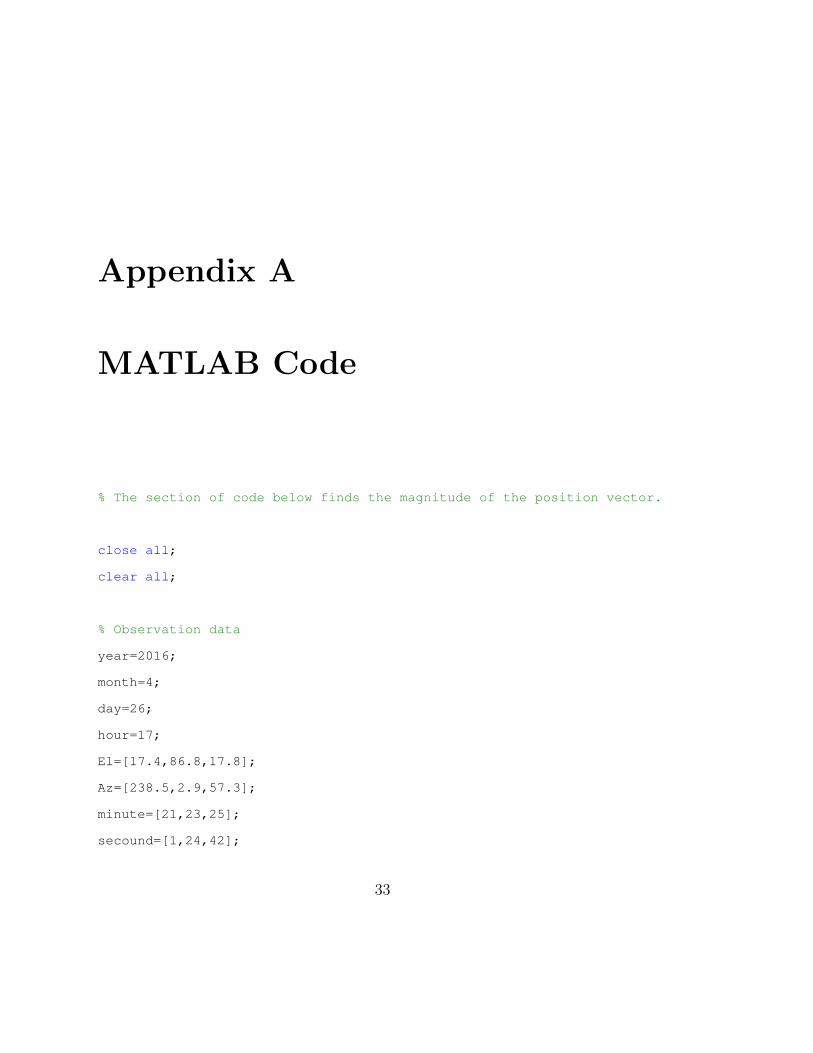
MATLAB Code
% The section of code below finds the magnitude of the position vector.
close all;
clear all;
% Observation data
year=2016;
month=4;
day=26;
hour=17;
El=[17.4,86.8,17.8];
Az=[238.5,2.9,57.3];
minute=[21,23,25];
secound=[1,24,42];
33

34 Chapter A MATLAB Code
latitude=43.813; % Of observing station
longitude=-111.809; % Of observing station
elevation=0.00023251274; % Of observing station
ae=1; % average earth radii in average earth radii
ec=0.08182; % Eccentricity of the surface of the earth
sid=86164.09054; % Seconds in a day.
% Calculates the x value for the station coordinates based off of the
% ellipsoid Earth model.
x=abs(ae/sqrt(1-ecˆ2*sind(latitude)ˆ2)+elevation)*cosd(latitude)
%
theta=[localSiderealTime(year,month,day,hour,minute(1),secound(1),...
longitude),localSiderealTime(year,month,day,hour,minute(2),...
secound(2),longitude),localSiderealTime(year,month,day,hour,...
minute(3),secound(3),longitude)];
theta0=localSiderealTime(year,month,day,0,0,0,longitude);
% DRot1,2&3 are the rotation matrixes that will transform the line of sight
% unit vectors (L1,2&3) from the SEZ to the XYZ reference frame.
DRot1 = [sind(latitude)*cos(theta(1)),-sin(theta(1)),cosd(latitude)*...
cos(theta(1));sind(latitude)*sin(theta(1)),cos(theta(1)),...
cosd(latitude)*sin(theta(1));-cosd(latitude),0,sind(latitude)];
DRot2 = [sind(latitude)*cos(theta(2)),-sin(theta(2)),cosd(latitude)*...
cos(theta(2));sind(latitude)*sin(theta(2)),cos(theta(2)),...
cosd(latitude)*sin(theta(2));-cosd(latitude),0,sind(latitude)];
DRot3 = [sind(latitude)*cos(theta(3)),-sin(theta(3)),cosd(latitude)...
*cos(theta(3));sind(latitude)*sin(theta(3)),cos(theta(3)),...

35
cosd(latitude)*sin(theta(3));-cosd(latitude),0,sind(latitude)];
% Converts each time from hour minute and second to seconds.
t1=hour*60*60+minute(1)*60+secound(1);
t2=hour*60*60+minute(2)*60+secound(2);
t3=hour*60*60+minute(3)*60+secound(3);
% Select the time when you want to calculate the position vector.
t=t2;
% Line of sight unit vector for each of the three observations
L1=DRot1*[cos(El(1)*pi()/180)*cos(pi()-Az(1)*pi()/180);...
cos(El(1)*pi()/180)*sin(pi()-Az(1)*pi()/180);sin(El(1)*pi()/180)];
L2=DRot2*[cos(El(2)*pi()/180)*cos(pi()-Az(2)*pi()/180);...
cos(El(2)*pi()/180)*sin(pi()-Az(2)*pi()/180);sin(El(2)*pi()/180)];
L3=DRot3*[cos(El(3)*pi()/180)*cos(pi()-Az(3)*pi()/180);...
cos(El(3)*pi()/180)*sin(pi()-Az(3)*pi()/180);sin(El(3)*pi()/180)];
% Line of sight unit vector with respect to time and
% its first and second derivatives
L=((t-t2)*(t-t3))/((t1-t2)*(t1-t3)).*L1+((t-t1)*(t-t3))/...
((t2-t1)*(t2-t3)).*L2+((t-t1)*(t-t2))/((t3-t1)*(t3-t2)).*L3;
Ld=(2*t-t2-t3)/((t1-t2)*(t1-t3)).*L1+(2*t-t1-t3)/...
((t2-t1)*(t2-t3)).*L2+(2*t-t1-t2)/((t3-t1)*(t3-t2)).*L3;
Ldd=2/((t1-t2)*(t1-t3)).*L1+2/...
((t2-t1)*(t2-t3)).*L2+2/((t3-t1)*(t3-t2)).*L3;
% Station coordinates R and the second derivative of R, Rdd

36 Chapter A MATLAB Code
R=[x*cos(theta0+t/sid*2*pi());x*sin(theta0+t/sid*2*pi());...
0.688939127608169];
Rdd=[-5.2885*10ˆ-9*x*cos(theta0+t/sid*2*pi());-5.2885*10ˆ-9*x*...
sin(theta0+t/sid*2*pi());0];
% Constants in the eighth order polynomial
D1=det([L,Ld,Rdd]);
D2=det([L,Ld,R]);
D=2*det([L,Ld,Ldd]);
mu=1.53623*10ˆ-6; % Gravitational parameter in earth radiiˆ3/secondˆ2.
f=-2*D1/D;
q=-2*mu*D2/D;
ddd=dot(L,R);
su=sum(R.ˆ2);
r=2; % Guess where to start the iterative solving method
z=zeros(1,20); % Array initialization to track the iterative solving loop.
% The for loop below uses Newtons iterative solving method to solve the
% eighth order polynomial for the magnitude of the position vector.
for i=1:20 % iterative solving loop
rplus=r-(fˆ2*rˆ6+2*f*q*rˆ3+qˆ2+2*f*dot(L,R)*rˆ6+2*q*dot(L,R)*rˆ3-rˆ8+...
sum(R.ˆ2)*rˆ6)/(6*fˆ2*rˆ5+6*f*q*rˆ2+12*f*dot(L,R)*rˆ5+6*q*dot(L,R)...
*rˆ2-8*rˆ7+6*sum(R.ˆ2)*rˆ5);
r=rplus;
z(1,i)=r;
end

37
% Display the magnitude of the position vector.
r
% Uncomment the plot below to see if the position vector has converged.
%plot(z
%Turns the Greenwich Mean Siderial time into local siderial time
function [theta]=localSiderealTime(year,month,day,hour,minute,secound,longitude)
% Calls the Greenwich Mean Sidereal Time funcion
[Gh,Gm,Gs]=greenwichMeanSiderealTime(year,month,day,hour,minute,secound);
% turnst he longetude into hours minutes and secounds
localHours=longitude/360*24;
plusLh=floor(localHours);
plusLm=floor((localHours-plusLh)*60);
plusLs=(localHours-plusLh-plusLm/60)*60*60;
% adds the longitude to the Greenwich Mean Siderial time
Lh=Gh+plusLh;
Lm=Gm+plusLm;
Ls=Gs+plusLs;
% the if statements make sure that there are the correct number of hours
% minutes and secounds in the day
if Ls >= 60;
Ls=Ls-60;
Lm=Lm+1;
end

38 Chapter A MATLAB Code
if Lm >= 60
Lh=Lh+1;
Lm=Lm-60;
end
if Lh >= 24
Lh=Lh-24;
end
Lh;
Lm;
Ls;
% gives the local sidereal time in radians and degrees
theta=(Lh+Lm/60+Ls/60/60)/24*2*pi(); % radians
thetad=theta*180/(2*pi()); % degrees
% This function calculates the Greenwich Mean Sidereal Time
function [Gh,Gm,Gs]=greenwichMeanSiderealTime(year,month,day,hour,...
minute,secound)
% Calls the Julian Date funcion
JD=julianDate(year,month,day,hour,minute,secound);
% Brings the greenwich maridian inline with the vernal equinox
D=JD-2451545.0;
GMSTNotReduced = 18.697374558 + 24.06570982441908*D;
GMST = mod(GMSTNotReduced,24);
% turns the GMST into the hour miniute and secound format
Gh=floor(GMST);

39
Gm=floor((GMST-Gh)*60);
Gs=(GMST-Gh-(Gm/60))*60*60;

40 Chapter A MATLAB Code

Appendix B
Calculating Orbital Elements
First the ~D, ~N and ~S vectors are calculated.
~D “ ~r1 ˆ ~r2 ` ~r2 ˆ ~r3 ` ~r3 ˆ ~r1 (B.1)
~N “ r3~r1 ˆ ~r2 ` r1~r2 ˆ ~r3 ` r2~r3 ˆ ~r1 (B.2)
~S “ pr2 ´ r3q~r1 ` pr3 ´ r1q~r2 ` pr1 ´ r2q~r3 (B.3)
With the ~D, ~N and ~S vectors calculated the orbital elements can calculated. In
order for ~D, ~N and ~S to describe a possible orbit ~D and ~N can not be equal to zero
and ~D ¨ ~N must be grater than zero.
e “S
D, eccentricity (B.4)
~Q “~S
S(B.5)
~W “N
N(B.6)
~P “ ~Qˆ ~W, semi-latus rectum (B.7)
41

42 Chapter B Calculating Orbital Elements
a “P
1´ e2, semi-major axis (B.8)
period “ 2π
c
a3
mu(B.9)
~B “ ~D ˆ ~r (B.10)
L “1
?DN
(B.11)
~V “L
r~B ` L~S, velocity (B.12)
From these orbital elements any other orbital element can be calculated.