initiatives toward digital malaysia -...
TRANSCRIPT
Initiatives Toward Digital Malaysia
Dato’ Prof. Sr Dr. Abdul Kadir bin TaibJabatan Ukur dan Pemetaan Malaysia (JUPEM)
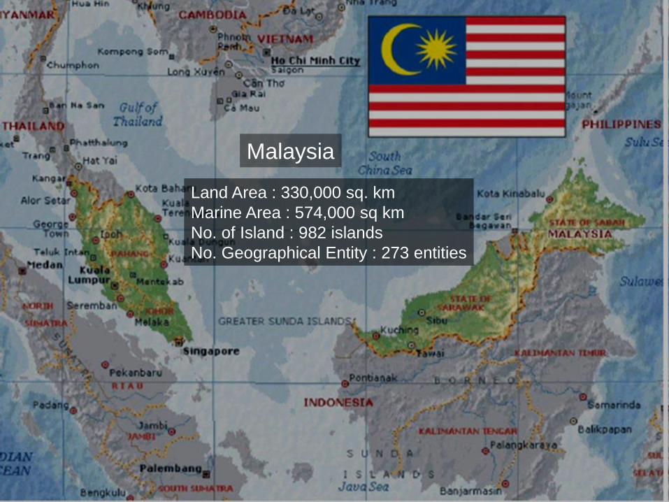
Land Area : 330,000 sq. km
Marine Area : 574,000 sq km
No. of Island : 982 islands
No. Geographical Entity : 273 entities
Malaysia
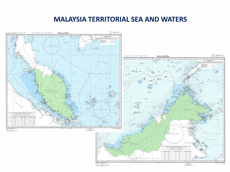
MALAYSIA TERRITORIAL SEA AND WATERS
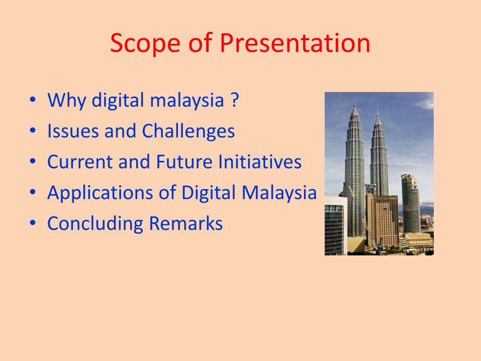
Scope of Presentation
• Why digital malaysia ?
• Issues and Challenges
• Current and Future Initiatives
• Applications of Digital Malaysia
• Concluding Remarks
Why Digital Malaysia?
• E-Government and C-Government
• Spatially Enabled Government (SEG)
• Spatially Enabled Society (SES)
• Land Governance
• Ubiquitous GIS
• Sustainable Development
• Millennium Development Goals (MDG)
• New Economic Model (NEM)
• Government Transformation Program (GTP)
• Developed Country by 2020 (Vision)
• Delivery System (Fast, Efficient and Effective)
Digital Malaysia
• It can contributes toward government services to the society such as:– e-government and c-government– policy and administration through cost
reduction,– public safety through more efficient emergency
services,– improved utilities infrastructure,– better management of health services, and– environmental sustainability, etc.
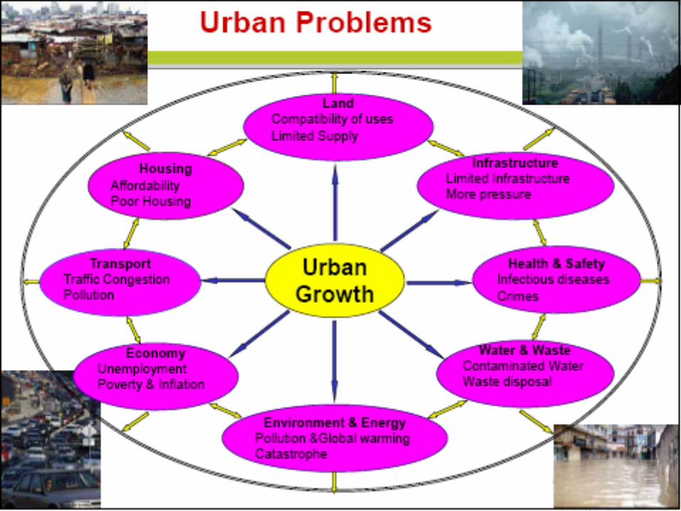
Issues an Challenges…
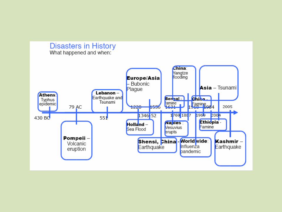
We are living in an increasingly complex and rapidly changing world….
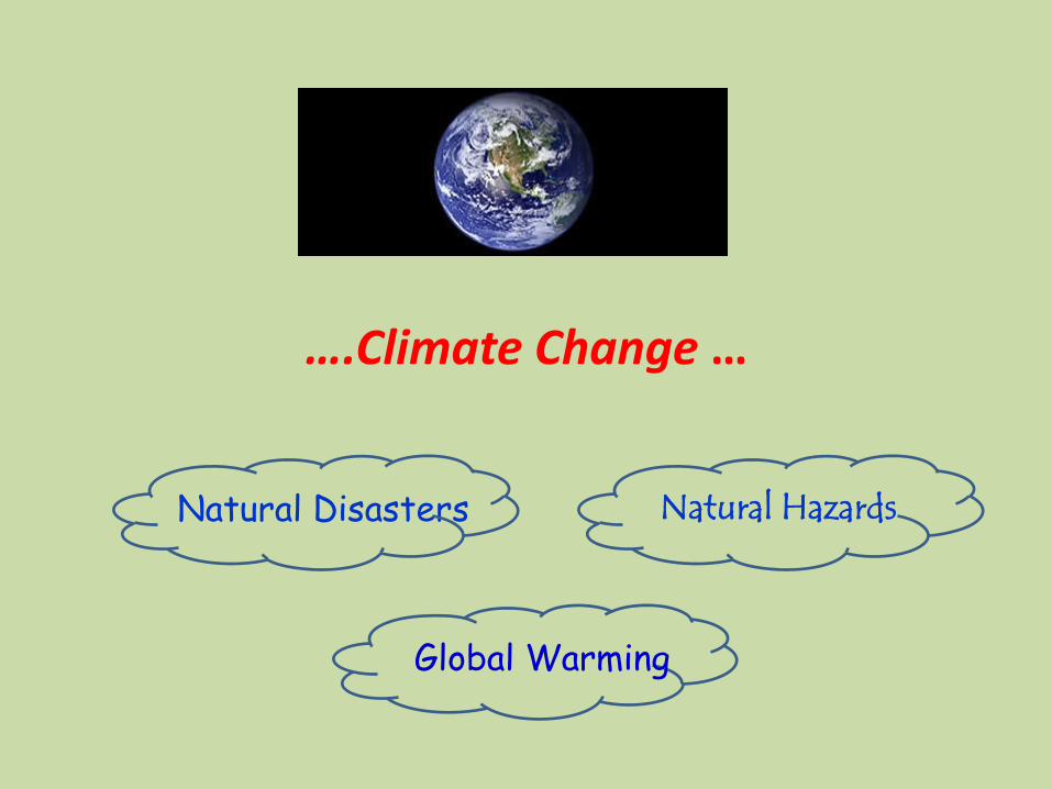
….Climate Change …
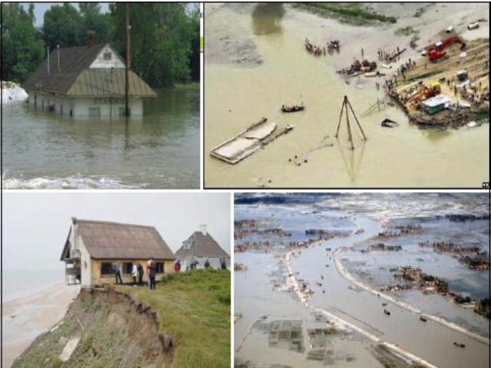
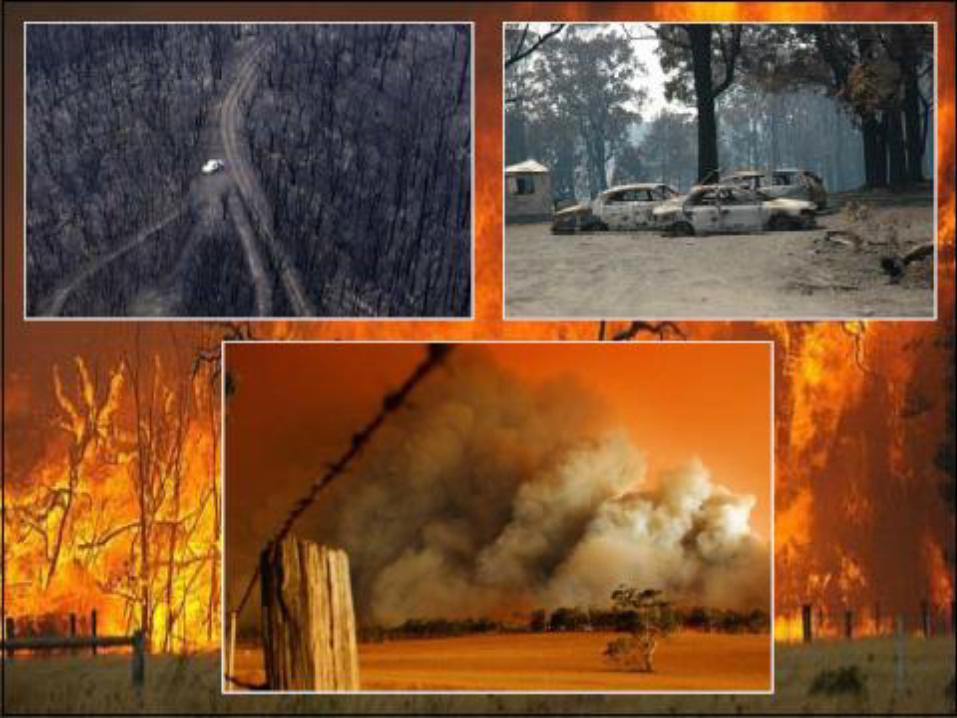
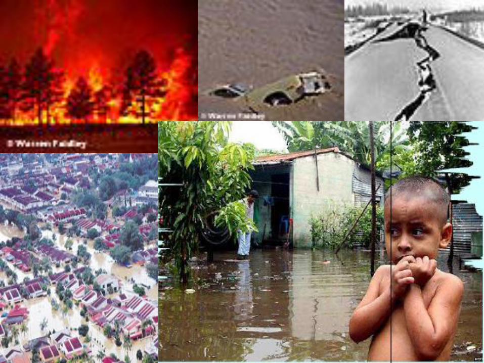
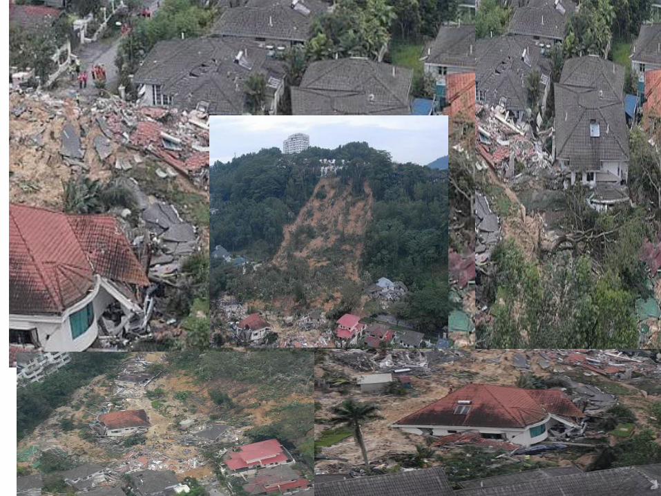
Natural Disasters Natural Hazards
Global Warming
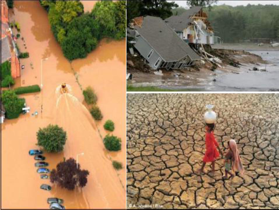
Natural Disasters happen when the effects of a natural hazard cause
serious problems for the people they affect, either in maintaining or
improving their standard of living. This can be an economic effect
(destroying crops for example), a social one (e.g. families being
separated), or both.
Natural hazards are things like earthquakes, volcanic eruptions,
landslides, tsunamis, floods and drought - any physical event that
happens naturally. They are caused by changes in the atmosphere, the
earth’s surface or the sea or other body of water. They can happen
quickly, called a rapid onset hazard, or build up gradually, called a slow
onset hazard. They can happen over smaller, local areas or affect
countries, regions or the whole world – some even happen in space, on
the sun for example.
What causes Natural Disasters and Hazards ?

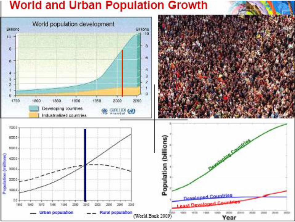
Global Issues andChallenges…
• World and Urban Population Growth
• Climate Change
• Sustainability
• MDGs
• Societal challengesthe global financial crisis, natural disasters and environmental information sharing
• ….
global challenges facing humanity
● Sustainable development
● Clean water
● Population & resources
● Democratisation
● Long-term perspectives
● Global convergence of IT
● Rich-poor gap
● Health issues
● Capacity to decide
● Peace & conflict
● Status of women
● Transnational organised crime
● Energy
● Science & technology
● Global ethics
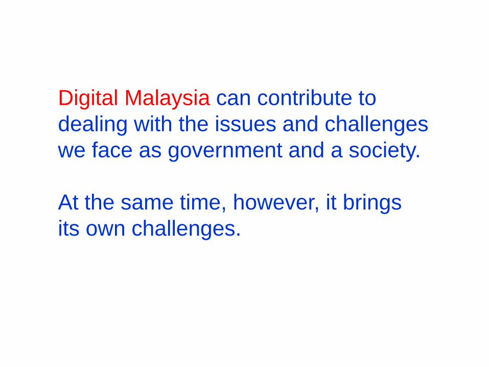
Digital Malaysia can contribute to
dealing with the issues and challenges
we face as government and a society.
At the same time, however, it brings
its own challenges.
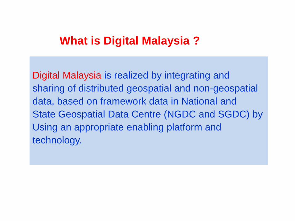
Digital Malaysia is realized by integrating and
sharing of distributed geospatial and non-geospatial
data, based on framework data in National and
State Geospatial Data Centre (NGDC and SGDC) by
Using an appropriate enabling platform and
technology.
What is Digital Malaysia ?
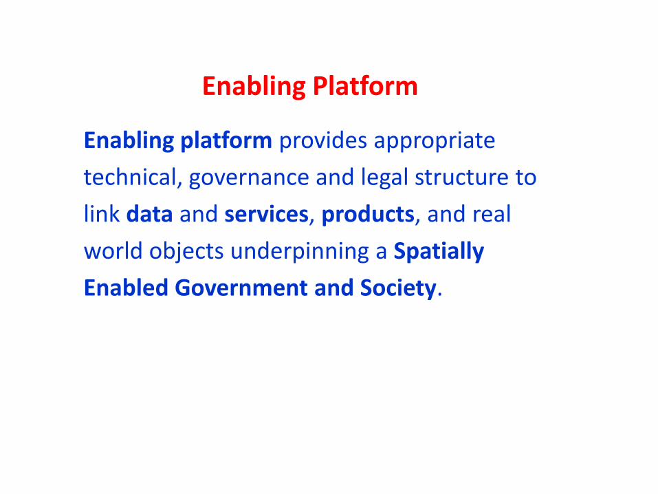
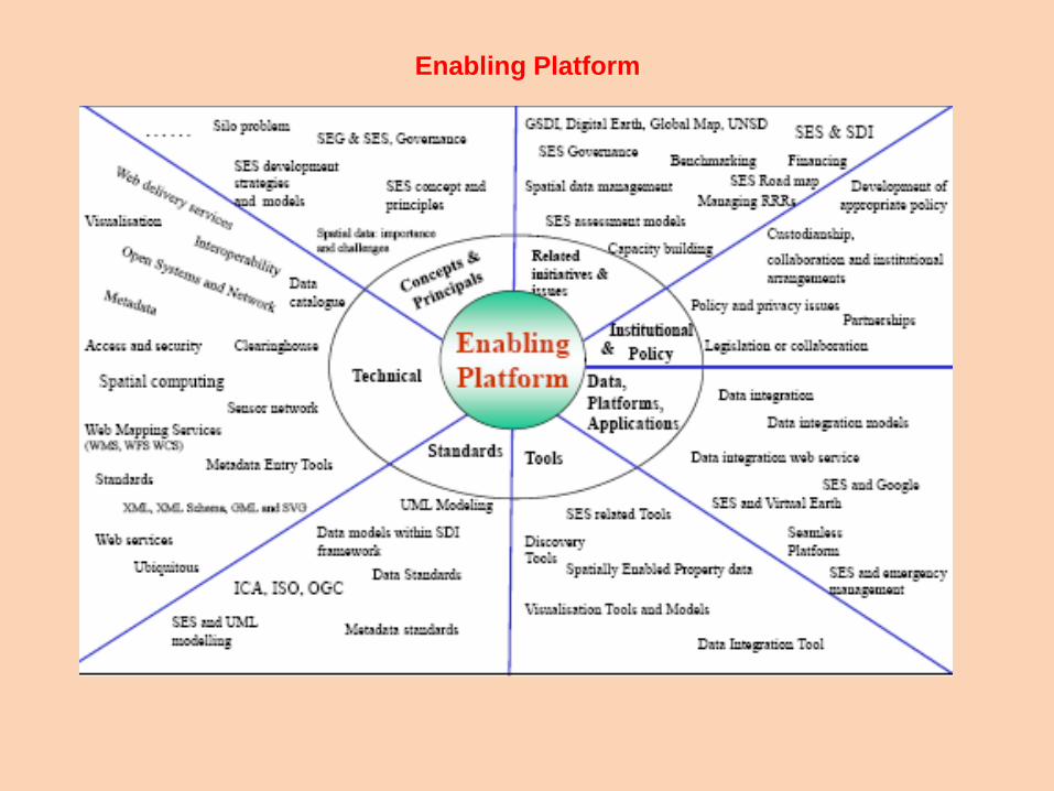
Enabling Platform
Enabling platform provides appropriate
technical, governance and legal structure to
link data and services, products, and real
world objects underpinning a Spatially
Enabled Government and Society.
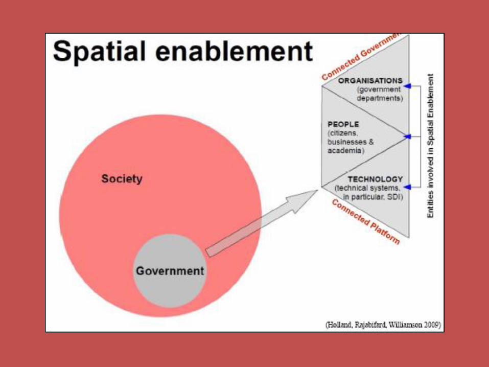
Enabling Platform
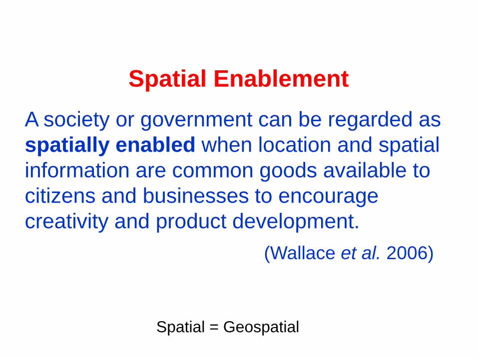
A society or government can be regarded as
spatially enabled when location and spatial
information are common goods available to
citizens and businesses to encourage
creativity and product development.
(Wallace et al. 2006)
Spatial Enablement
Spatial = Geospatial
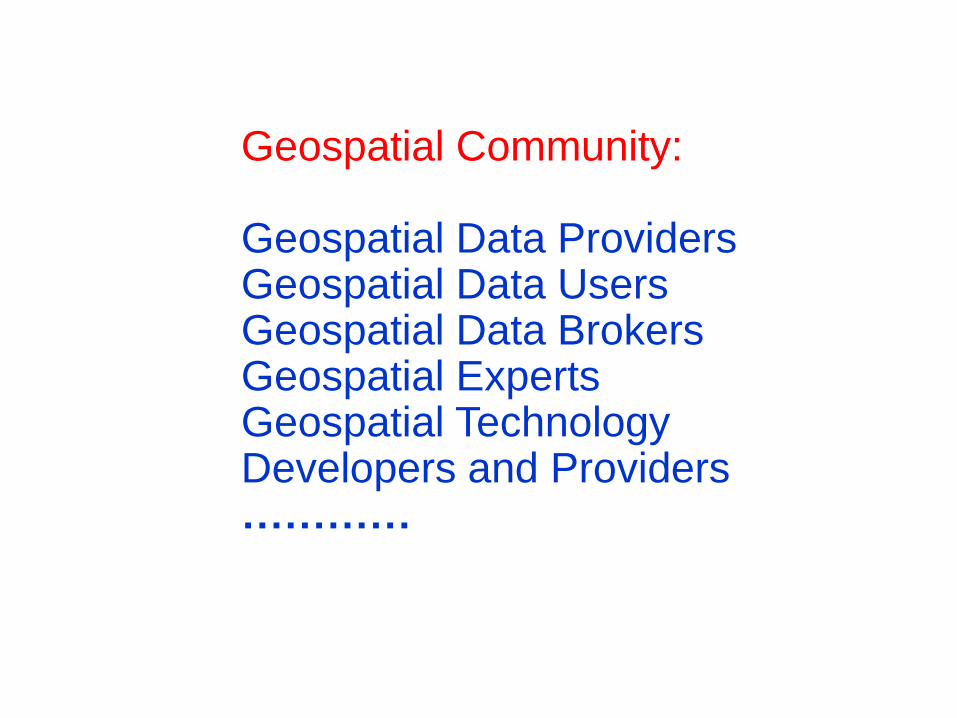
Geospatial Community:
Geospatial Data ProvidersGeospatial Data UsersGeospatial Data BrokersGeospatial ExpertsGeospatial Technology Developers and Providers…………
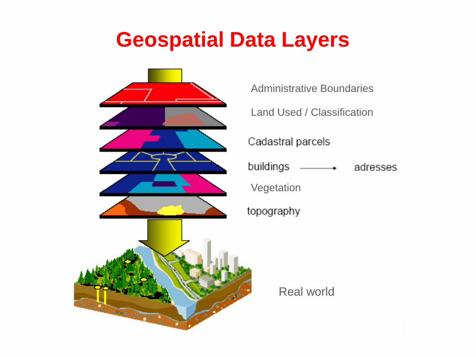
Geospatial Data Layers
Administrative Boundaries
Land Used / Classification
Vegetation
Real world
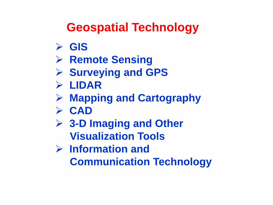
GIS
Remote Sensing
Surveying and GPS
LIDAR
Mapping and Cartography
CAD
3-D Imaging and Other
Visualization Tools
Information and
Communication Technology
Geospatial Technology
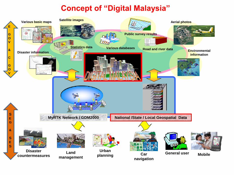
Various databasesStatistics data
Public survey results
Road and river dataDisaster information
Environmental
information
Satellite images
General user
Various basic maps
MyRTK Network / GDM2000
Aerial photos
National /State / Local Geospatial Data
Disaster
countermeasures
Urban
planningLand
managementCar
navigationMobile
Concept of “Digital Malaysia”
E
G
O
V
&
C
G
O
V
SE
G
&
SE
S
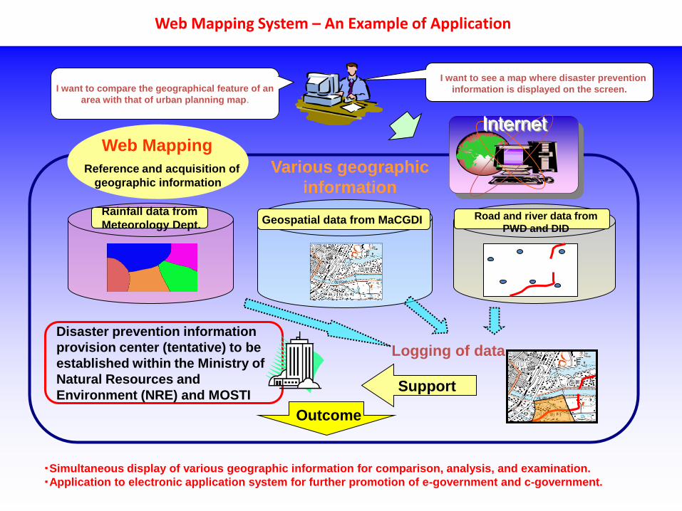
Web Mapping System – An Example of Application
I want to see a map where disaster prevention
information is displayed on the screen.
Rainfall data from
Meteorology Dept.
Various geographic
information
I want to compare the geographical feature of an
area with that of urban planning map.
Logging of data
Disaster prevention information
provision center (tentative) to be
established within the Ministry of
Natural Resources and
Environment (NRE) and MOSTI
InternetWeb Mapping
Reference and acquisition of
geographic information
Support
Geospatial data from MaCGDI
・Simultaneous display of various geographic information for comparison, analysis, and examination.
・Application to electronic application system for further promotion of e-government and c-government.
Outcome
Road and river data from
PWD and DID
CURRENT AND FUTURE
INITIATIVES TOWARD DIGITAL MALAYSIA
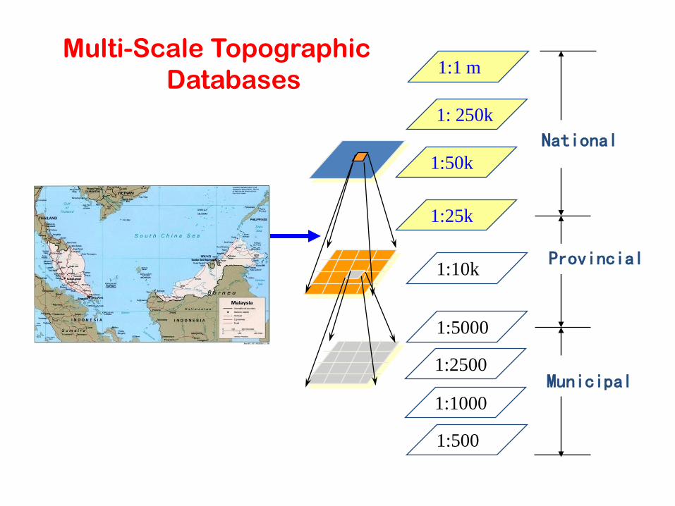
1:1 m
1: 250k
1:50k
1:25k
1:10k
1:2500
National
1:5000
1:1000
Provincial
Municipal
1:500
Multi-Scale Topographic
Databases
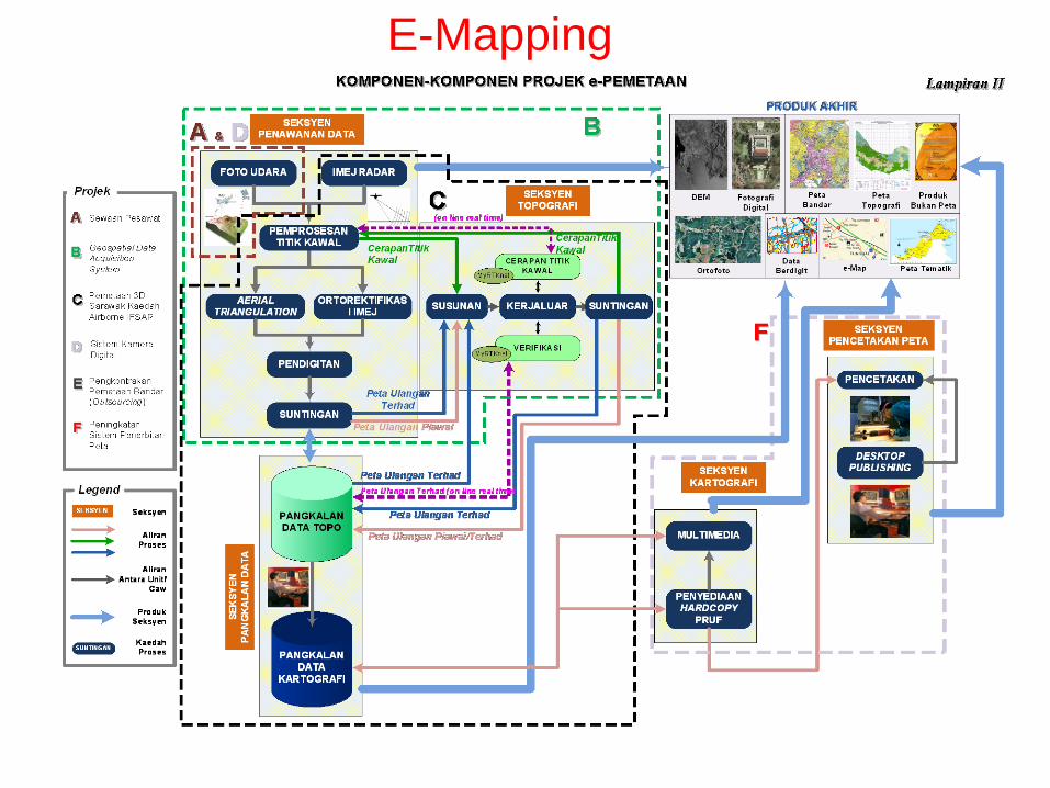
E-Mapping
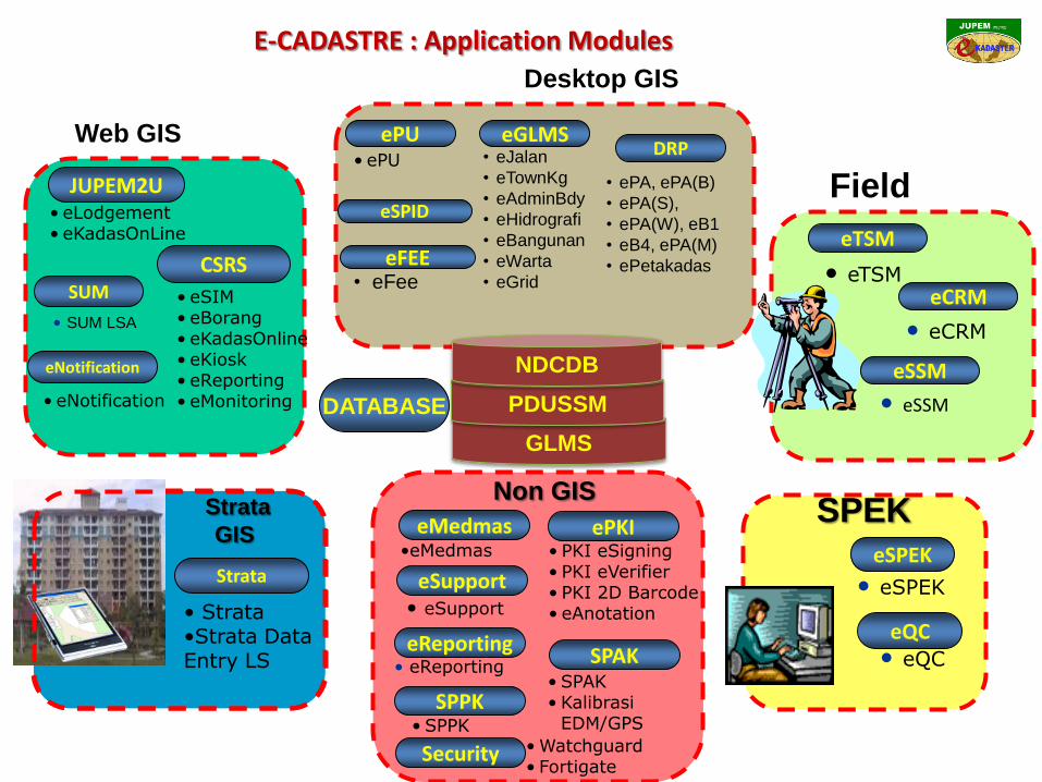
E-CADASTRE : Application Modules
• eLodgement• eKadasOnLine
JUPEM2U
CSRS
eNotification
• eSIM• eBorang• eKadasOnline• eKiosk• eReporting• eMonitoring• eNotification
• eTSM
• eCRM
• eSSM
eCRM
eTSM
eSSM
Field
Strata
• Strata•Strata Data Entry LS
Strata
GIS
SUM
eQC
eSPEK
SPEK
• eSPEK
• eQC
• SUM LSA
DATABASE
• eSupport
• Watchguard • Fortigate
• SPAK• Kalibrasi
EDM/GPS
• PKI eSigning• PKI eVerifier• PKI 2D Barcode• eAnotation
•eMedmas
eReporting
eSupport
ePKIeMedmas
• eReporting
Non GIS
SPAK
Security
SPPK• SPPK
ePUDRP
eGLMS• ePU • eJalan
• eTownKg
• eAdminBdy
• eHidrografi
• eBangunan
• eWarta
• eGrid
• ePA, ePA(B)
• ePA(S),
• ePA(W), eB1
• eB4, ePA(M)
• ePetakadaseFEE• eFee
GLMS
PDUSSM
NDCDB
eSPID
Web GIS
Desktop GIS
4
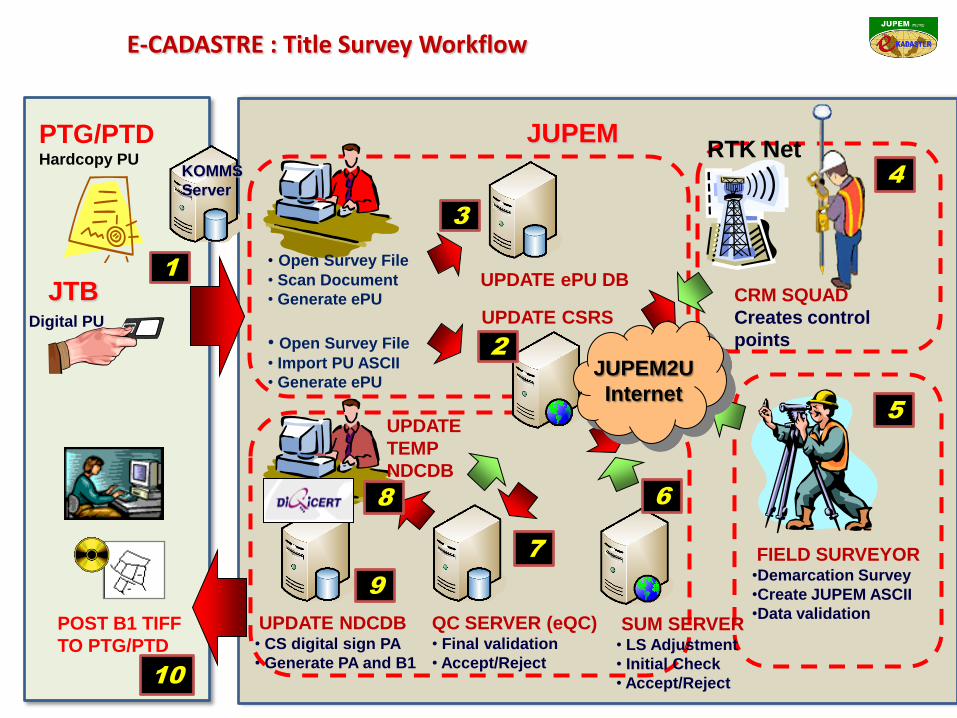
E-CADASTRE : Title Survey Workflow
JUPEM
Digital PU
PTG/PTDHardcopy PU
UPDATE ePU DB
SUM SERVER• LS Adjustment
• Initial Check
• Accept/Reject
FIELD SURVEYOR•Demarcation Survey
•Create JUPEM ASCII
•Data validation
CRM SQUAD
Creates control
points
QC SERVER (eQC)• Final validation
• Accept/Reject
UPDATE
TEMP
NDCDB
UPDATE NDCDB• CS digital sign PA
• Generate PA and B1
RTK Net
POST B1 TIFF
TO PTG/PTD
JTB
• Open Survey File
• Scan Document
• Generate ePU
• Open Survey File
• Import PU ASCII
• Generate ePU
UPDATE CSRS
JUPEM2U
Internet
KOMMS
Server
3
2
4
5
6
7
1
8
9
10
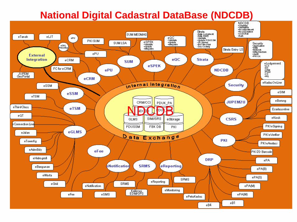
National Digital Cadastral DataBase (NDCDB)
NDCDB
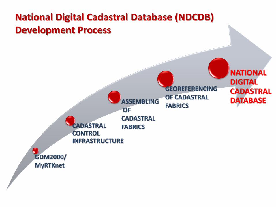
National Digital Cadastral Database (NDCDB)Development Process
GDM2000/MyRTKnet
CADASTRAL CONTROL INFRASTRUCTURE
ASSEMBLINGOFCADASTRAL FABRICS
GEOREFERENCINGOF CADASTRALFABRICS
NATIONAL DIGITAL CADASTRAL DATABASE
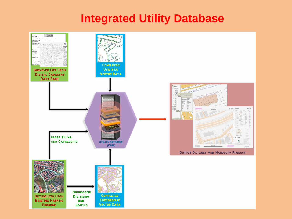
Integrated Utility Database
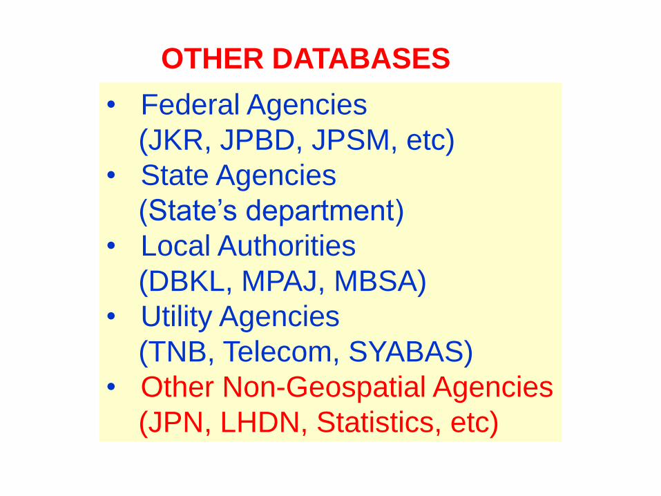
OTHER DATABASES
• Federal Agencies
(JKR, JPBD, JPSM, etc)
• State Agencies
(State’s department)
• Local Authorities
(DBKL, MPAJ, MBSA)
• Utility Agencies
(TNB, Telecom, SYABAS)
• Other Non-Geospatial Agencies
(JPN, LHDN, Statistics, etc)
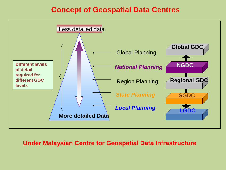
Global Planning
National Planning
Region Planning
State Planning
Local Planning
Global GDC
NGDC
Regional GDC
SGDC
LGDCMore detailed Data
Different levels
of detail
required for
different GDC
levels
Less detailed data
More detailed Data
Concept of Geospatial Data Centres
Under Malaysian Centre for Geospatial Data Infrastructure

GDC DATA QUALITY & STANDARD
40
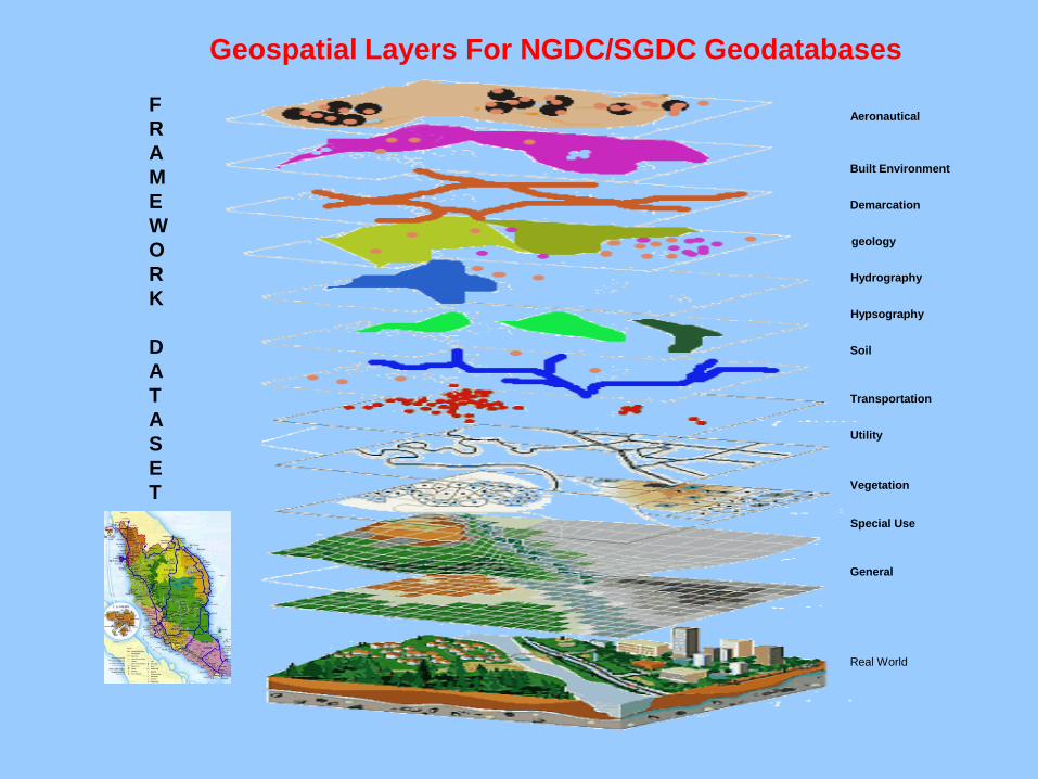
Aeronautical
Built Environment
Demarcation
geology
Hydrography
Hypsography
Soil
Transportation
Utility
Vegetation
Special Use
General
F
R
A
M
E
W
O
R
K
D
A
T
A
S
E
T
Geospatial Layers For NGDC/SGDC Geodatabases
Real World
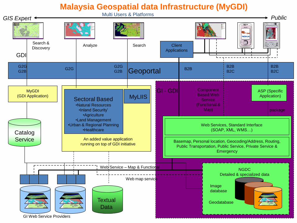
Multi Users & PlatformsGIS Expert
GDI
GeoportalG2G
G2BG2G
G2G
G2BB2B
B2B
B2C
B2B
B2C
MyLIISSectoral Based•Natural Resources
•Inland Security’
•Agriculture
•Land Management
•Urban & Regional Planning
•Healthcare
An added value application
running on top of GDI initiative
GI - GDI Component
Based Web
Service
(Functional &
Map) package
ASP (Specific
Application)
Web Services, Standard Interface
(SOAP, XML, WMS…)
Basemap, Personal location, Geocoding/Address, Routing,
Public Transportation, Public Service, Private Service &
Emergency
Catalog
Service
MyGDI
(GDI Application)
Textual
Data
NGDC
Detailed & specialized data
Image
database
Geodatabase
GI Web Service Providers
Client
Applications
Public
Web Service – Map & Functional
Web map service
Search &
DiscoveryAnalyze Search
Malaysia Geospatial data Infrastructure (MyGDI)
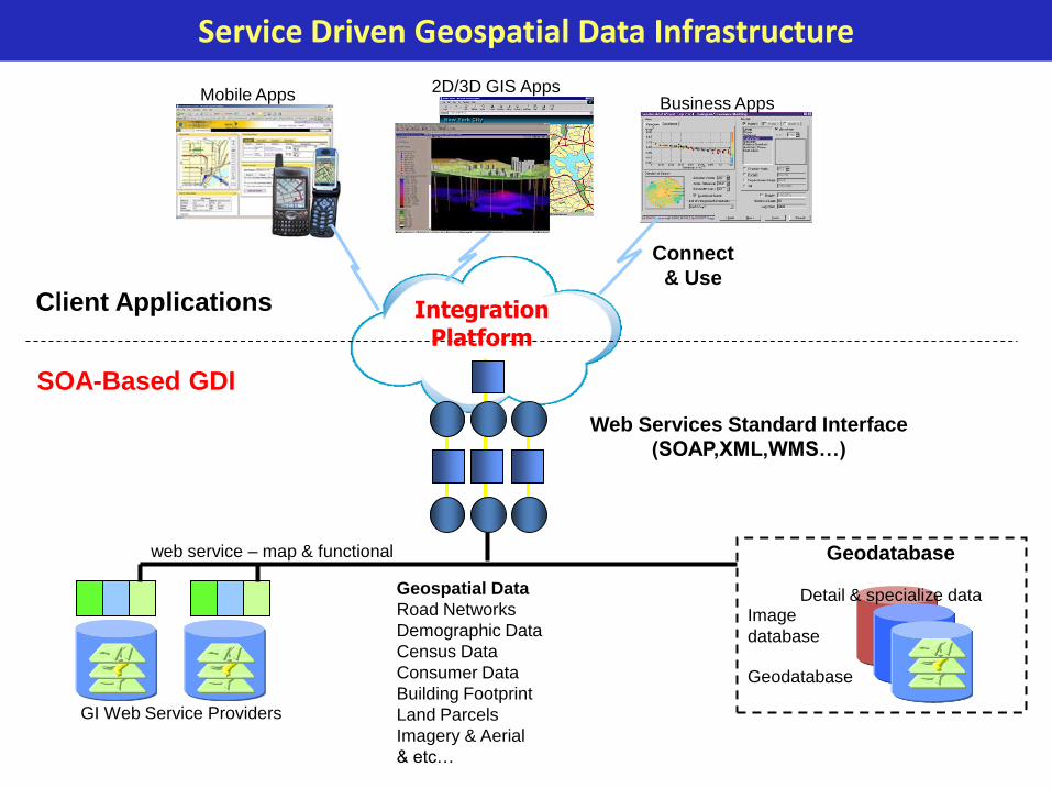
GI Web Service Providers
Geodatabase
Geodatabase
Image
database
web service – map & functional
Detail & specialize dataGeospatial Data
Road Networks
Demographic Data
Census Data
Consumer Data
Building Footprint
Land Parcels
Imagery & Aerial
& etc…
Mobile Apps 2D/3D GIS AppsBusiness Apps
Web Services Standard Interface
(SOAP,XML,WMS…)
SOA-Based GDI
Client Applications
Connect
& Use
Service Driven Geospatial Data Infrastructure
IntegrationPlatform
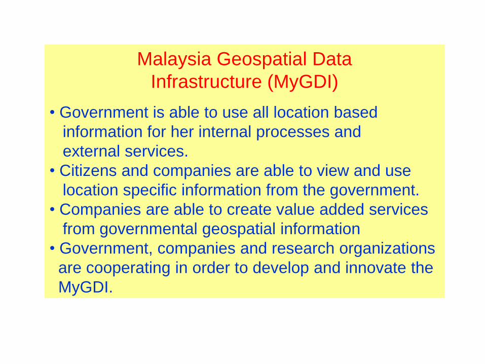
Malaysia Geospatial Data
Infrastructure (MyGDI)
• Government is able to use all location based
information for her internal processes and
external services.
• Citizens and companies are able to view and use
location specific information from the government.
• Companies are able to create value added services
from governmental geospatial information
• Government, companies and research organizations
are cooperating in order to develop and innovate the
MyGDI.

Mutipurpose Cadastre Infrastructure
3-Dimensional City Models
Street Addresses
Building/Facilities
Satellite Images
NGDC/SGDC (GDM2000)
NDCDB (GDM2000)
National / State Geospatial Database(Server MyGDI National/State)
National / State NDCDB (JUPEM HQ / State)

Integration Of NDCDB With High Resolution Satellite Image – create a simple Multipurpose
Cadastre(MPC)
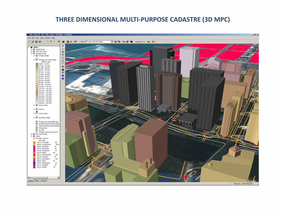
THREE DIMENSIONAL MULTI-PURPOSE CADASTRE (3D MPC)
48
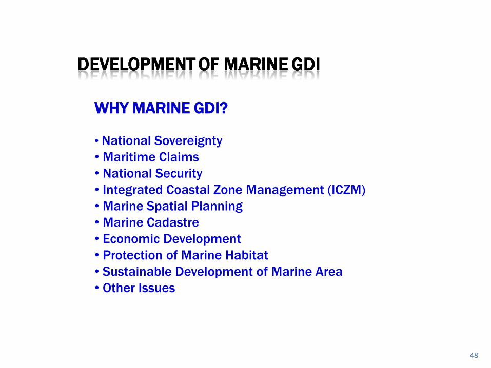
WHY MARINE GDI?
• National Sovereignty
• Maritime Claims
• National Security
• Integrated Coastal Zone Management (ICZM)
• Marine Spatial Planning
• Marine Cadastre
• Economic Development
• Protection of Marine Habitat
• Sustainable Development of Marine Area
• Other Issues
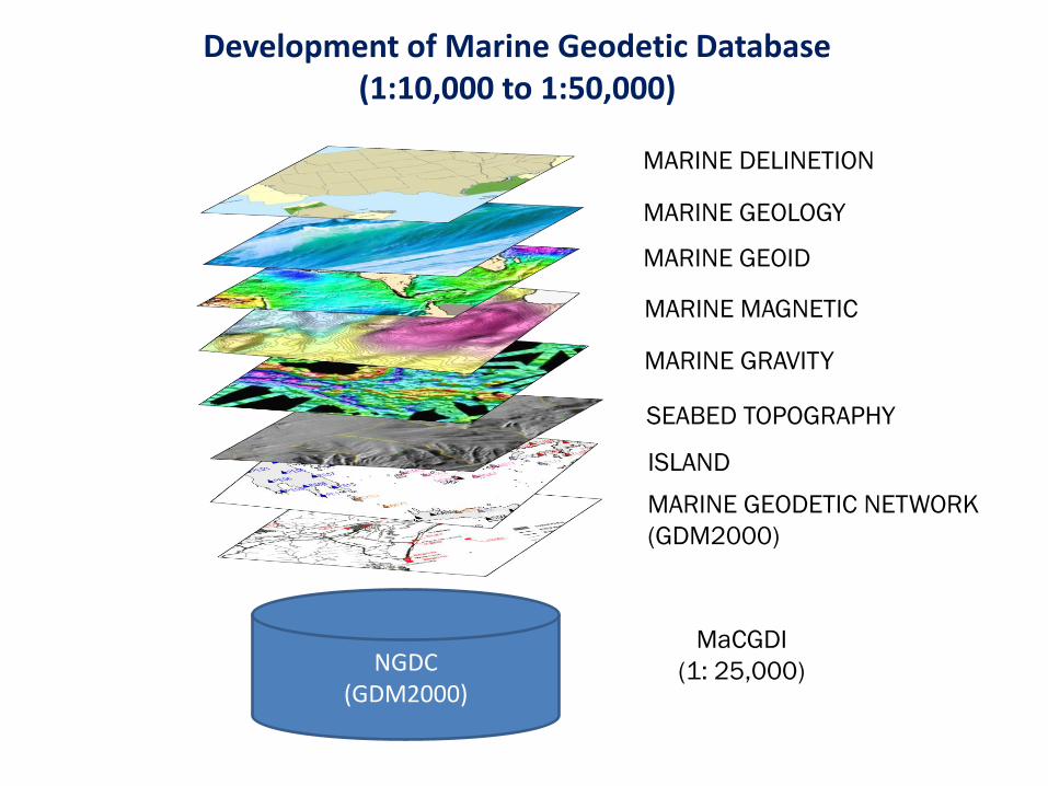
Development of Marine Geodetic Database(1:10,000 to 1:50,000)
NGDC(GDM2000)
MARINE DELINETION
MARINE GEOLOGY
MARINE GEOID
MARINE MAGNETIC
MARINE GRAVITY
SEABED TOPOGRAPHY
MARINE GEODETIC NETWORK
(GDM2000)
MaCGDI
(1: 25,000)
ISLAND
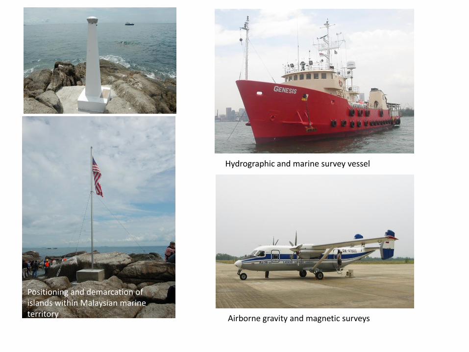
Hydrographic and marine survey vessel
Positioning and demarcation of islands within Malaysian marine territory Airborne gravity and magnetic surveys
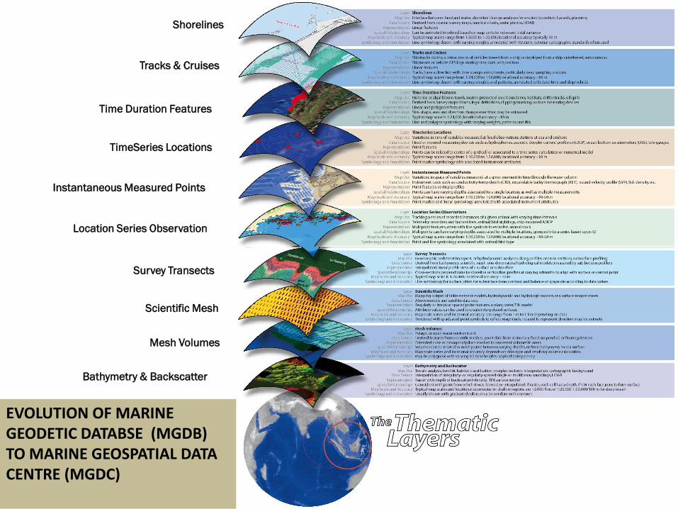
Shorelines
Tracks & Cruises
Time Duration Features
TimeSeries Locations
Instantaneous Measured Points
Location Series Observation
Survey Transects
Scientific Mesh
Mesh Volumes
Bathymetry & Backscatter
EVOLUTION OF MARINE GEODETIC DATABSE (MGDB) TO MARINE GEOSPATIAL DATA CENTRE (MGDC)
APPLICATIONS OF DIGITAL MALAYSIA
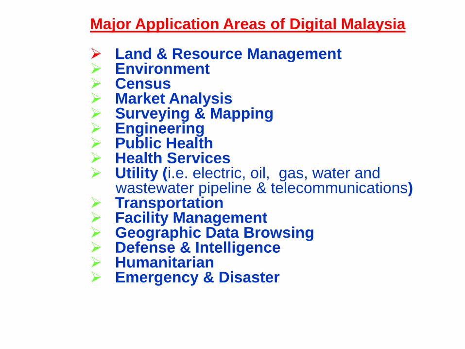
Major Application Areas of Digital Malaysia
Land & Resource Management Environment Census Market Analysis Surveying & Mapping Engineering Public Health Health Services Utility (i.e. electric, oil, gas, water and
wastewater pipeline & telecommunications) Transportation Facility Management Geographic Data Browsing Defense & Intelligence Humanitarian Emergency & Disaster
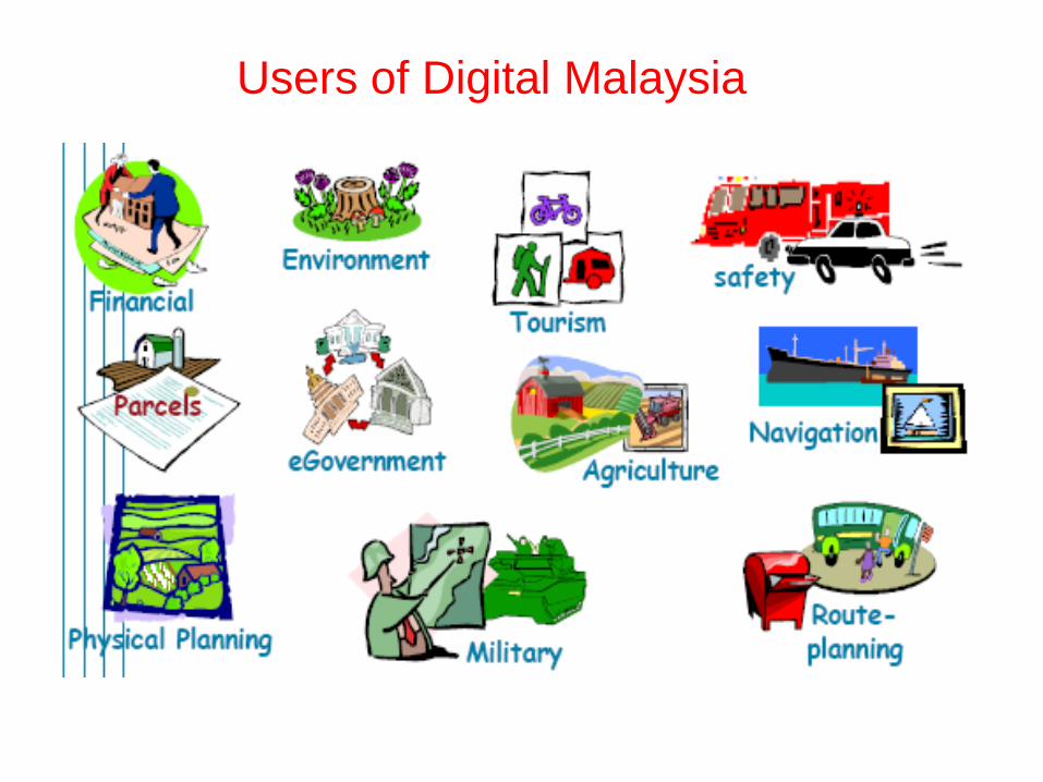
Users of Digital Malaysia

SPATIALLY ENABLED GOVERNMENT (SEG)
Economic Development
Land Administration
Public Works
Urban & Regional Planning
Real Estate And Facilities Management
National Security
Public Safety
Tourism
Integrated Coastal Zone Management (ICZM)
Sustainable Development
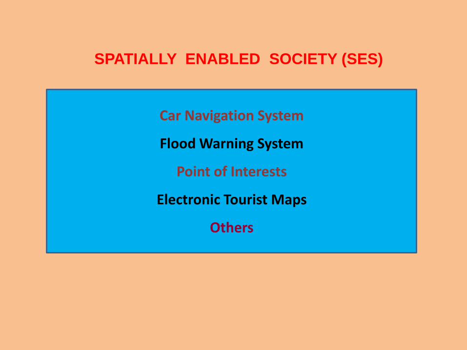
SPATIALLY ENABLED SOCIETY (SES)
Car Navigation System
Flood Warning System
Point of Interests
Electronic Tourist Maps
Others
Concluding Remarks
Digital Malaysia is a concept of realizing a virtual space of Malaysia,
consisting of various geospatial and non-geospatial information which
can be connected through c-government initiative such as Malaysia
Geospatial Data Infrastructure (MyGDI). The geospatial and non-geospatial
community in government and public sectors can communicate online and
in real time by using internet at anytime and anyplace including mobile
phones.
There are many e-government initiatives by federal departments, state
agencies and local authorities which involved geospatial data
collection, processing, analysis and dissemination for various applications.
We need to connect them through MyGDI for the purpose of sharing and
exchanging those information as well as optimizing their benefits and usage
among government and non-government agencies and also the general
public.
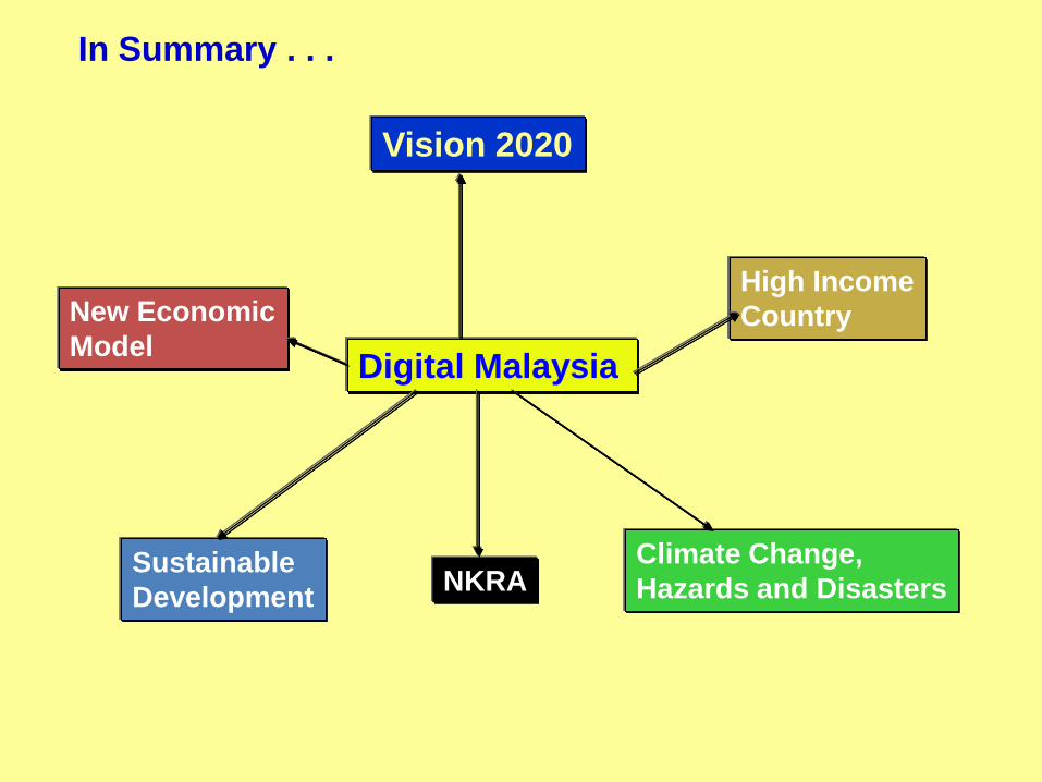
Digital Malaysia
Vision 2020
New Economic
Model
High Income
Country
Sustainable
Development
Climate Change,
Hazards and DisastersNKRA
In Summary . . .
End Of Presentation
Thank youEnd of Presentation
Thank you