interoperability of geological data: first icgc inspire geological data model
TRANSCRIPT

INTEROPERABILITY OF GEOLOGICAL DATA:
First ICGC INSPIRE Geological Data Model.
Dolores Boquera, Carme Puig, Xavier Berástegui and Jordi Escriu

INDEX
Next 15 minutes: ICGC OUR CHALLENGE WHY INSPIRE? BEFORE MODELLING… WORKFLOW FACED PROBLEMS AND ADOPTED SOLUTIONS. RESULTS LESSON LEARNED WHAT IS THE NEXT….
2
INSPIRE Conference 2016. Barcelona, 26th- 30th September.

Introducing the ICGCOrigins & mission
Institute Cartographic and Geologic de Catalunya is the official Catalan mapping & geological agency, belonging to the Catalan Government and aiming to deliver to users valued geographic and geological information and services.Founded in 1982 (ICC).Institutional and commercial activities.Multidisciplinary aspects on Geomatics & Geology.
3
INSPIRE Conference 2016. Barcelona, 26th- 30th September.

4
INSPIRE Conference 2016. Barcelona, 26th- 30th September.
INSPIRE represents an excellent opportunity to fill the gap between multiple representation models to a single geological object oriented data model
OUR CHALLENGE…….Why INSPIRE?
Multiple representation models portrayal
oriented.
WMS ICGC Geoportal
Printed geological
maps series
Each geological map series has a specificportrayal-oriented data model (CAD).Geological data are not interoperable.
Today
Data models for cartographical
production (CAD)
Single geological data model and repository for datastorage and management.Ready to build geological maps “on demand” and othergeological information services and products.Interoperable databases derived from UML models andschemas.
GeoSciMLextensions
INSPIRE DS GE-Core model +
- ICGC Geoportal- Maps “On demand”
Cartographic production
Open Data ServicesWMS, WFS, WCS
INSPIRE compliant
geological data model
Tomorrow

Before start modelling…
5
INSPIRE Conference 2016. Barcelona, 26th- 30th September.
We assume that:
- Regional Geology knowledge and field mapping experience are required to build ageological data model.
Geologic Units
Natural landscape
Geologic features
Geologicalmap units

Before start modelling…
6
INSPIRE Conference 2016. Barcelona, 26th- 30th September.
We assume that:
- Regional geology knowledge and field experience are required to build a geologicalmodel.- The geological information resolution is related with the graphical scale so we
consider as a Geological Collection each published geological maps series.
Geological map at 1:250 000- 6 geological units
For a given area…
Geological map at 1:50 000- 12 geological units
Geological map at 1:25 000- 31 geological units

Before start modelling…
7
INSPIRE Conference 2016. Barcelona, 26th- 30th September.
We assume that:
- Regional geology knowledge and field experience are required to build a geologicalmodel.- Regarding geological information resolution, we consider as a Geological collection
each published geological paper maps series.
- We start modelling geologic maps at scale 1:250.000 and we will continue withbigger scales, 1:50.000 and 1:25.000.
1:25K1:50K1:250K
Geological collections’ data models
1:25K
1:50K
1:250K

Workflow
INSPIRE Conference 2016. Barcelona, 26th- 30th September.
Detailed study
Informationextraction
Problems and
solutionsResults
8

Workflow. Detailed study.
INSPIRE Conference 2016. Barcelona, 26th- 30th September.
INSPIRE Data Specification on Geology
GeoSciML models v3.2 (last version 4.0 )
Analysis application schemas on the web
FeatureCatalogueINSPIRE UML class diagrams
CGI Geoscience vocabularies service
Vocabularies used in GeoSciML from CGI
(commission for the management and Application of GeoScience Information).
Annex CCodeLists
Annex D Data model extensions
9

Workflow
INSPIRE Conference 2016. Barcelona, 26th- 30th September.
Detailedstudy
Informationextraction
Problemsand
solutionsResults
10

11
LithostratigraphicUnit
Borehole
Folds
ShearDisplacementFeature
Geologic Map of Catalunya 1:250.000 (pub. 1989) Structural Map of Catalunya 1:250.000 (pub. 2014)
DeformationUnit
Workflow. Information extraction from geological published maps at 1:250 000 scale.
INSPIRE Conference 2016. Barcelona, 26th- 30th September.

Workflow
INSPIRE Conference 2016. Barcelona, 26th- 30th September.
Detailedstudy
Informationextraction
Problemsand
solutionsResults
1. Implicit geological information2. To avoid information loss3. Terms equivalences4. Stratigraphic time scale correlation
12

13
INSPIRE Conference 2016. Barcelona, 26th- 30th September.
NaturalGeomorphologicFeature?
GeologicEvent?CompositionPart?
Regional geological knowledge is again required.
Applying expert geologic criteria.
Other information sources: regional studies and bibliography.
Some geological information required by INSPIRE_IR are not always evident in publishedmaps.
Workflow. Problems faced. Implicit Information.
How do we proceed?

14
INSPIRE Conference 2016. Barcelona, 26th- 30th September.
Contact?
Metamorphic Description?
Using public data model extensionsGeoSciML & CGI Vocabularies
Workflow. Problems faced. To avoid information loss.
Some geological information in published maps are not required in INSPIRE DataSpecification.
How do we proceed to avoid losses information ?

15
INSPIRE Conference 2016. Barcelona, 26th- 30th September.
Looking for the best possible equivalencebetween ICGC terms and INSPIRE code listsCGI vocabularies.If any equivalence can be stablished:Proposing a new term to be added to theINSPIRE code lists.
Annex C Data Specification CodeLists
ICGC geologic terms
CGI Controlled Vocabulary
Workflow. Problems faced. Equivalences of geological terms.
ICGC geologic terminology not always fits with INSPIRE proposed terms .
How do we proceed?

16
INSPIRE Conference 2016. Barcelona, 26th- 30th September.
INSPIRE requirement ICS timescale.
Taking the name of the era instead of that of thestage leads to a loss of information.
It will be improved when we model bigger scalegeological collections.
The geologic time-scales are not static!
Workflow. Problems faced. Correlation geological timescales.
Geologic timescale used in published geological maps is not the same version required byINSPIRE_DS, so some correlations are needed.
How do we proceed?

Workflow
INSPIRE Conference 2016. Barcelona, 26th- 30th September.
Detailedstudy
Informationextraction
Problemsand
solutionsResults
17
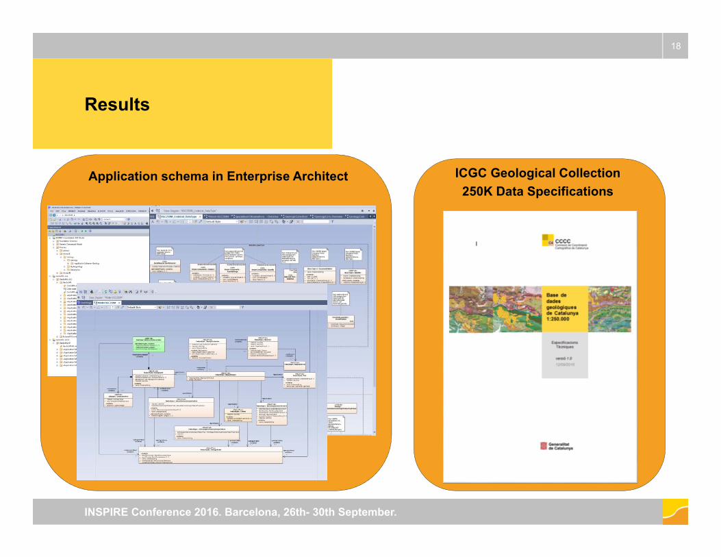
Results
18
INSPIRE Conference 2016. Barcelona, 26th- 30th September.
Application schema in Enterprise Architect ICGC Geological Collection 250K Data Specifications

19
INSPIRE Conference 2016. Barcelona, 26th- 30th September.
The benefits of close cooperation between experts indifferent field (basically geologist, data modelers,..) withsimilarities to the work of INSPIRE Thematic Workinggroups for Data Specification.
Lessons learned
Implementing INSPIRE is an excellent opportunity to fill the gap between multiple representation models to a single geological object oriented data model
To avoid information losses is essential to focus on data concepts not only in technology.

What’s the next…
20
INSPIRE Conference 2016. Barcelona, 26th- 30th September.
We are going to model the geologic
collection 50K taking as a core the
geologic collection 250K UML model.
1:25K
1:50K
1:250K

Thank you for yourattention
Institut Cartogràfic i Geològicde CatalunyaParc de Montjuïc,E-08038 Barcelona41º22’12” N, 2º09’20” E (ETRS89)
[email protected]/ICGCatfacebook.com/ICGCat
Tel. (+34) 93 567 15 00Fax (+34) 93 567 15 67
21
INSPIRE Conference 2016. Barcelona, 26th- 30th September.