introducing web-based decision tools for environmental watershed management bernie engel and roxanne...
Post on 21-Dec-2015
218 views
TRANSCRIPT

Introducing Web-Based Decision Tools for Environmental Watershed Management
Bernie Engel and Roxanne MitchellAgricultural & Biological EngineeringPurdue [email protected]

Outline
L-THIA (Long-Term Hydrologic Impact Assessment)SEDSPEC (peak rates of runoff and erosion and runoff structures)

Long-Term Hydrological Impact Assessment
(L-THIA)

40% 10%
50%Natural Cover
15%
55%30%
75-100% Impervious
35%
30%
35% 35-50% Impervious
Land Use Decisions Affect Runoff, Recharge, and Water Quality

Most communities respond to this with a mix of reactive and proactive strategies, including planning

L-THIABased on the rainfall – land cover – runoff analysis
method already used in many communities
Input: Land Use Pattern(s) + Soils Pattern
Process: Daily Runoff and Pollutant Loading Calculations (30 years)
Output: Average Annual Runoff and NPS loads for Specific Land Use Patterns

A little history….
Northeast Ohio, 1992: “Our wetlands are failing”
Local Planners: Need model to assess impact of land use change on hydrology.
Reality: Available models were data intensive and complex – and getting more so.
The Aim: To develop a user-friendly model using basic available data for land use and soils, in response to the needs of planners and local environmental groups.

L-THIA
Originally a simple spreadsheet program
Now a simple web tool
GIS extension version also available

• L-THIA Web
http://www.ecn.purdue.edu/runoff/lthianew
So how do you do it?
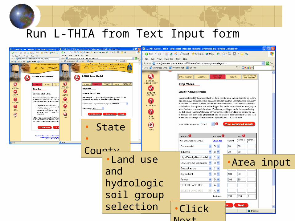
Run L-THIA from Text Input form
• State• County
•Land use and hydrologic soil group selection
•Area input
•Click Next

Tables and charts for interpretation

How is L-THIA Used?Near Columbus, OH – significance of urbanization on runoff and water qualityTriangle Park, NC – comprehensive land use planNASA KSC, FL – impacts of historical land use changeNortheast OH – land use planning policy assessment; wetland protectionIndianapolis, IN – historical impactsKokomo, IN – TMDL development

SEDSPEC Introduction
SedSpec assists in analyzing runoff and erosion problemsProvides information about runoff and erosion control structuresProvides peak runoff estimation using
Rational methodTR55
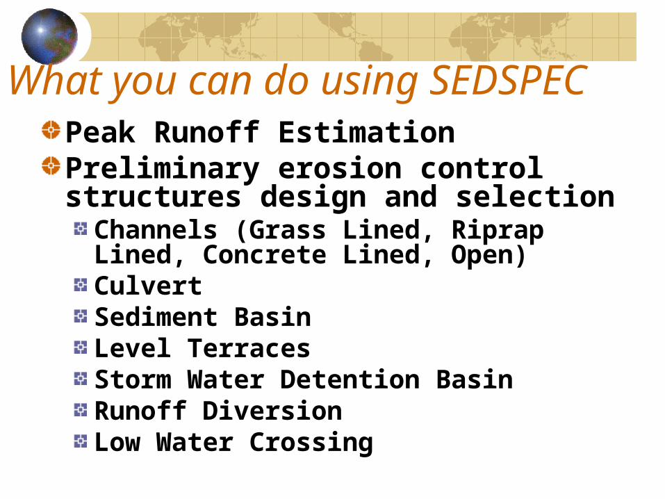
What you can do using SEDSPECPeak Runoff EstimationPreliminary erosion control structures design and selection
Channels (Grass Lined, Riprap Lined, Concrete Lined, Open) Culvert Sediment Basin Level Terraces Storm Water Detention Basin Runoff Diversion Low Water Crossing

Where you start
pasture.ecn.purdue.edu/~sedspec pasture.ecn.purdue.edu/~watergen

Summary
L-THIASEDSPEC
http://www.ecn.purdue.edu/runoff/lthianewhttp://pasture.ecn.purdue.edu/~sedspec