introduction -- puyallup tribe salmon report 2010
DESCRIPTION
Yearly report by the Puyallup Tribe of Indians, summarizing salmon and other fish populations in the Puyallup River watershed.TRANSCRIPT
WRIA 10: PUYALLUP/WHITE RIVER WATERSHED
PUYALLUP TRIBAL FISHERIES Page I 2009-2010 ANNUAL SALMON, STEELHEAD, AND BULL TROUT REPORT
TABLE OF CONTENTS
Introduction…………………………………………………………………......……............................................
Puyallup, White and Carbon River Watershed Map...................................................................................
Antler Creek (Unofficial Name)………………………………………………………………………………
Boise Creek…………………………………………………………………......……….........................................
Buckley USACE Fish Trap (White River)...……………………………………….......…................................
Canyon Creek……………………..……………………………………………………..…....................................
Canyon Falls Creek………….…………………………………………..…………....................………….……..
Carbon River……………………………………………………......……………….....................………….……..
Clarks Creek…………………………………………………………….…………......………….……….………..
Clarks Creek Salmon Hatchery: Puyallup Tribe of Indians Facility..........................................................
Clear Creek…………………………………………………………......…………….…..............….......................
Clearwater River……………………………………………………......……………..............…..…….…………
Coal Mine Creek............................................................................................................................................
Cow Skull (Unofficial Name)……………………………………………………………………….…………
Deer Creek……………………………………………………………......…………..............................................
Diru Creek Salmon Hatchery: Puyallup Tribe of Indians Facility.............................................................
Discovery Creek (Unofficial Name)………………………………………………………………………………………
Electron Diversion & Fish By-pass Facility (Puyallup River)…………….......................…..……………....
Fennel Creek (Kelly Creek)………………………………………………………………………..………………
Fiske Creek……………………………………………………………...............……......…......…........................
Fox Creek……………………………………………………….……................…......…………….………………
Fryingpan Creek............................................................................................................................................
Greenwater River……………………………………………………….............……........…….……....................
Huckleberry Creek…………………………………………………………....................…….……………………
Hylebos Creek……………………………………………………………......................……........….....................
Kapowsin Creek…………………………………………………………...................……………………....……..
Kellog Creek……………………………………………………………….............…………………………......…..
Klickitat Creek………………………………………………………..............……………......………………..….
LeDout Creek………………………………………………………….............…………...........................…
Lodi Creek ……………………………………………………………………………………………………….
Meadow Creek…………………………………………………………………………………………………
Mowich River………………………………………..………………….............………..........................….......….
Niesson Creek……………………………………………………….............……….................................…….....
No Name Creek (Unofficial Name).........................................................................................................................
Ohop Creek…………………………………………….……………….............…..…............................…
Parallel Creek (Unofficial Name)………………………………………………………………………….....
Puyallup River………………………………………………................…….........…………………………….......
Puyallup River Juvenile Salmonid Production Assessment Project (Smolt Trap).....................................
Rody Creek…………………………………………………………........………...…....................................…..…
Rushingwater Creek…………………….....…………………………….…..............………………….............…
Salmon Creek (Strawberry Creek)……………...……………………………......................................…..…....
Salmon Tributary……………………………………………………….............…...............................................
Shaw Creek…………………………………………………………………………………………………….
III-XXXVIII
XXXIX
1-2
3-8
9-15
16-18
19-23
24-27
28-32
33-36
37-40
41-45
46-47
48-50
51-52
53-58
59-60
61-62
63-68
69-70
71-73
74-75
76-78
79-81
82-83
84-88
89-90
91-93
94-95
96
97
98-99
100-101
102-104
105-106
107-108
109-112
113-114
115-116
117-118
119-123
124-126
127-128
WRIA 10: PUYALLUP/WHITE RIVER WATERSHED
PUYALLUP TRIBAL FISHERIES Page II 2009-2010 ANNUAL SALMON, STEELHEAD, AND BULL TROUT REPORT
TABLE OF CONTENTS Silver Creek...........................................................................................................................................
Silver Springs Creek……………………………………………...………...............................…........….....
South Prairie Creek....……………………..……………………….…….…….......................……………
Squally Creek…...…………………………..………………..……………….........…..............................…
Sunrise Creek…………………………………………………………………………………………………...
Swan Creek…………………………………..……………………….……....................…………….......….
Swift Creek……………………………………………………………………………………………………….
Voights Creek………………………………..………………………………….........………….....……….......
White River (Stuck)………………………………..……………...…………………...........…......….......….
Wilkeson Creek…………………………..……………………………....…….........................…….............
Winzig Creek (Unofficial Name)..........................................................................................................
Wright Creek………………………………………………….…………………………………………………
Appendix A: Seasonal Comparisons of Spawning Ground Counts and Buckley Trap Counts
for Adult Salmon and Steelhead.
Chinook/Coho.................................................................................................................
Chum/Steelhead.............................................................................................................
Pink..................................................................................................................................
Appendix B: Salmon Distribution and Spawning Utilization (Maps).
Chinook.............................................................................................................................
Coho................................................................................................................................
Chum...............................................................................................................................
Pink.................................................................................................................................
Steelhead.........................................................................................................................
Appendix C: Bull Trout and Steelhead Redd Locations (GPS Maps).
Bull Trout Redds...........................................................................................................
Steelhead Redds………………………………………………………….…………………..
Appendix D: 2009-2010 Salmon, Steelhead, and Bull Trout Spawning Data.
Chinook............................................................................................................................
Bull Trout..........................................................................................................................
Pink………………………………………………………………………………………………
Coho...................................................................................................................................
Chum…….......................................................................................................................
Steelhead……………………………………………………………………………………....
Appendix E: Adult and Juvenile Fish Plants and Releases……………...………………………………
Appendix F: 2007-2010 Bull Trout Captured in USACE Fish Trap, Buckley, White River………..
129-130
131-132
133-137
138-139
140-141
142-145
146
147-149
150-151
152-155
156-157
158-160
162
163
164
166
167
168
169
170
172-178
179-186
188-191
192-194
195-198
199-203
204-207
208-211
213
215-220
WRIA 10: PUYALLUP/WHITE RIVER WATERSHED
PUYALLUP TRIBAL FISHERIES Page III 2009-2010 ANNUAL SALMON, STEELHEAD, AND BULL TROUT REPORT
INTRODUCTION
Puyallup/White River Watershed
The Puyallup/White River Watershed is identified as Watershed Resource Inventory Area 10 (WRIA 10) by
the Washington State Department of Ecology. Hylebos and Wapato creeks are part of WRIA 10, yet are
independent drainages that flow directly into Commencement Bay. The Puyallup/White River Watershed
provides over 1,300 linear river miles (RM) of drainage over an area greater than 1,000 square miles. The
three major river drainages include the Puyallup, White, and Carbon rivers which flow almost entirely
within Pierce County, in addition to part of South King County. All three river systems originate from
north and west slope glaciers located on Mt. Rainier. The Carbon and White rivers converge with the
Puyallup River at RM 17.8 and RM 10.4 respectively.
The White River is a significant tributary to the Puyallup River, with a drainage area nearly twice that of
the Puyallup. However, the White and Puyallup drainages are often viewed and managed as two distinct
and separate entities. This management approach is due in part because prior to 1906, the White River
did not flow into the Puyallup. Salo and Jagielo (1983) described that prior to 1906; the majority of the
White River flowed north towards Elliot Bay. Despite this northern course, some of the water from the
White often flowed south into the Puyallup through the Stuck River channel. In November of 1906, a flood
event mobilized a tremendous amount of wood debris that blocked the north flowing channel in what is
now downtown Auburn. The blockage forced the river to avulse and find a new channel. This newly
created diversion sent nearly the entire White River flow down through the Stuck River channel into the
Puyallup; more than doubling the size of the Puyallup River drainage. In 1915, a concrete structure was
constructed, thereby permanently diverting the White River into the Puyallup.
The Puyallup River continues flowing west from its confluence with the White River until it reaches Com-
mencement Bay in the city of Tacoma. An extensive system of levees, approximately 90 miles, was con-
structed along the Puyallup, White, and Carbon rivers from the early through mid 20th century. Several
significant fish bearing tributaries feed these mainstem rivers, including the Clearwater River, Greenwater
River, Mowich River; as well as Huckleberry, Boise, and South Prairie creeks.
The mean annual flow of the Puyallup River over the first 86 year gauged history was 2,922 cfs. The larg-
est flood of record was 57,000 cfs and occurred in December 1933. Most of the large flood events have oc-
curred in the months of November and December in response to heavy rains on a substantial snow pack.
The minimum low flow defined as the 90%-exceedance level for the Puyallup was 1,156 cfs. Over the past
20 years there has been a trend of decreasing low flows (Sumioka 2004). The Puyallup River at Puyallup
flow gage (#12101500) was activated in 1915 and is located at RM 6.6.
The Puyallup, Carbon, and Mowich rivers originate from glaciers located on Mt. Rainier; all conveying a
tremendous volume of fluvial materials which contributes to the dynamic nature of the system. The high
sediment loads are responsible for the braided channel morphology characteristic of broad unconfined val-
ley segments which are quite prevalent throughout the upper reaches. Channel gradients in the upper ba-
sins are typically moderate- to- moderately steep, with a high riffle-low pool character. River and stream
bedding consists mainly of Tertiary sedimentary rock and other products created by ancient volcanic activi-
ty. Substrate size within active river channels is typically large; consisting primarily of large gravels, cob-
WRIA 10: PUYALLUP/WHITE RIVER WATERSHED
PUYALLUP TRIBAL FISHERIES Page IV 2009-2010 ANNUAL SALMON, STEELHEAD, AND BULL TROUT REPORT
ble and boulders. Significant quantities of LWD are present within channel migration zones; however, a
considerable amount of the larger wood which is deposited during high flow events and settles on the high-
er bars is detached from, or perched well above active channels during average flow regimes, thereby re-
ducing any habitat creating interactions. Headwater tributaries are typically non-glacial and are characte-
rized by confined steep valley channels with comparatively short, low-to-moderate gradient anadromous
reaches.
The Puyallup River has been severely impacted by over a century of land and water resource exploitation,
including damming and substantial water diversions; considerable riparian alterations; dewatering and
low instream flow regimes; as well as, significant channel manipulation. These impacts have lead to a dis-
cernible deterioration in the land and hydrological behavior of this river system by causing water flow of
poorer quality, quantity, and timing. Several limiting factors have been recognized in regards to the
healthy function of stream habitat and salmonid populations in the watershed; including lost or diminished
habitat connectivity and migration corridors; fragmentation and reduction of habitat quality; diminished
water quality; fish entrainment; entrapment; unknown species interactions; and potential climate change
impacts.
Downstream (outside) of the National Park boundaries, the Puyallup River courses through industrial fo-
restlands, as well as National Forest land; but primarily through private timber company ownership’s. As
a result, a prolific transportation network of roads extends throughout the basin. The transportation net-
work within the Upper Puyallup Basin consists almost entirely of unimproved roads developed and utilized
primarily for timber harvesting; as well as, hunting, recreational activities, hydroelectric operations, and
wildlife/fisheries applications. Road density in timber production areas may approach as much as six lineal
miles per square mile. Current road networks and bridge emplacements along the Puyallup and Mowich
rivers directly interact or alter the hydrology within the upper basin. Roads have contributed many of
their trademark problems such as landslides, slope failures, altered hydrology; as well as, culvert and
bridge projects which can effect upstream migration and increased levels of sedimentation within effected
drainages.
PSE’s Electron diversion dam and headworks is the only human-made obstacle preventing or disrupting
through-migration of salmonids. PSE’s hydro project directly diverts up to 400 cfs. of water (unscreened)
from the Puyallup River at river mile 41.7. This structure/operation contributes, in whole or in part, to
many of the impact issues previously stated. In the fall of 2000, PSE and the Puyallup Tribe completed
construction of a 1.1 million dollar fish ladder circumventing the diversion; thereby restoring anadromous
fish passage for the first time since 1904. To insure habitat connectivity and migratory accessibility for
bull trout and other salmonids, minimum in-stream flows below the Electron diversion were established in
1997 (Puyallup Tribe of Indians and Puget Sound Energy 1997). There are no known barriers above the
water diversion preventing fish from migrating throughout the upper basin.
The long-standing presence of private industry, primarily hydroelectric and commercial timber harvesting;
in addition to the repercussions of recreational uses and negative air and water quality, have all created
lasting impacts on the upper watershed. These impacts include; loss of in-stream large woody debris and
LWD recruitment; stream bank modifications; increased sedimentation issues and slope failures due to de-
forestation; unsatisfactory RMZ management; new road construction; road failures, and road decommis-
sioning or abandonment. A great deal of the forestland throughout the Upper Puyallup Basin has been
harvested at least once, and in many instances twice; leading to many of the wide-ranging issues common
WRIA 10: PUYALLUP/WHITE RIVER WATERSHED
PUYALLUP TRIBAL FISHERIES Page V 2009-2010 ANNUAL SALMON, STEELHEAD, AND BULL TROUT REPORT
with deforestation. Air and water quality issues vary from measurable levels of airborne contaminants
which have been detected in Mt. Rainier National Park; including heavy metals and pesticides discovered
in samples of snow, soil and fish (Landers et al. 2008).
Watershed Salmonids The Puyallup/White River Watershed supports several species of salmonids, including Chinook (Oncorhy-
chus tshawytscha), coho (O. kisutch), chum (O. keta), pink (O. gorbuscha), sockeye (O. nerka), steel-
head/rainbow trout (O. mykiss), cutthroat (O. clarki), bull trout (Salvelinus confluentus), and non-native
brook trout (S. fontinalis). Puget Sound Chinook and coastal-Puget Sound bull trout are currently listed
as ―threatened‖ under the U.S. Federal Endangered Species Act (ESA). In May of 2007, after a year of in-
vestigation, the National Marine Fisheries Service (NMFS) announced the listing of Puget Sound steelhead
as ―threatened‖ under ESA. The ESA listing of steelhead offers protection for naturally spawned steel-
head; however, it does not offer protection for the rainbow trout, the fresh water resident form of the spe-
cies.
Each of the eight Pacific salmonid species present in the Puyallup/White River system exhibits unique life-
history strategies. However, the five major Pacific salmon species (Chinook, coho, chum, pink, and sock-
eye) all share some common life-history characteristics. Pacific salmon are all anadromous; meaning, fish
spawn and reside in fresh water; however, the instream residence time varies considerably by and within
species. Salmon will eventually emigrate (smoltification) to marine waters where they will continue to fo-
rage and grow until they return to fresh water as sexually mature adults to reproduce. Furthermore, these
species will only reproduce once (semelparous) during their life cycle. This single reproductive event re-
quires tremendous amounts of energy and effort, as well as proper spawning site selection to be successful.
Therefore, the end result of this reproductive strategy is that all five major species of Pacific salmon will
die as a result of this reproductive process. Nevertheless, this sole reproductive strategy is very successful
due to the considerable degree of energy put into producing vast amounts of gametes (eggs and sperm),
thus ensuring the survival of at least some offspring. Other salmonid species; such as steelhead, cutthroat,
and bull trout, may reproduce more than once (iteroparous) during their life cycle.
All female salmonids are oviparous (producing eggs that hatch outside the body), and during the act of
spawning the male and female will release gametes in a simultaneous effort. Eggs released by the female
drift to the bottom and are actively buried in the substrate creating an egg pocket. A redd is the excavated
site formed in the substrate from multiple spawning events, and typically contains several egg pockets.
The rate of development and growth varies between species, and is greatly influenced by water tempera-
ture (Piper et al. 1986; Groot and Margolis 1991). As fish age, they lay down annual growth rings on their
scales; these scales are often collected to determine age, in addition to important growth and environmen-
tal factors.
Early Salmonid Development
During the act of spawning, males and females release gametes (eggs and sperm) in a simultaneous effort.
The fertilization of eggs occurs rather quickly. The membrane surrounding each egg is gas permeable, and
is initially quite malleable. Penetration of a single spermatozoon into the egg (through the micropyle) will
create a reactionary process preventing the infiltration of additional spermatozoa. However, once eggs exit
the female and are exposed to water, each egg will begin to take up water causing the internal pressure of
the egg to increase and swell (Alderdice et al. 1984). This process causes the outer membrane of the egg to
WRIA 10: PUYALLUP/WHITE RIVER WATERSHED
PUYALLUP TRIBAL FISHERIES Page VI 2009-2010 ANNUAL SALMON, STEELHEAD, AND BULL TROUT REPORT
firm up or ―water harden‖; whereby, closing the micropyle and preventing fertilization in as little as 30
seconds (Groot and Margolis 1991). Once an egg is fertilized it goes through three phases of development
prior to hatching (cleavage, epiboly, and organogenesis). Some of the water properties influencing salmo-
nid egg survival and development are temperature, dissolved oxygen, and velocity (McNeil 1966; Leman
1993; Peterson and Quinn 1996). The rate of development and growth varies between species, and is sig-
nificantly influenced by water temperature (Piper et al. 1986; Beacham and Murray 1990; Groot and Mar-
golis 1991). For example, coho salmon take 50 days to hatch in water that is 10°C (50°F); other Pacific
salmon species take between 47-65 days to hatch at the same temperature. Stream bed characteristics
and water properties are additional factors that are imperative to the survival and development of salmo-
nid eggs and larvae.
Upon hatching, young salmonid larvae (alevins) are unable to feed and are not fully developed; therefore,
they remain within the interstitial spaces of the gravel substrate while continuing to grow and further de-
velop. Young alevins do; however, posses a considerable yolk sack necessary to fuel their prolonged growth
and developmental needs. Alevins are also relatively tolerant of dewatering and low dissolved oxygen le-
vels for several hours after hatching. Although buried, developing alevins have a sense of up and down
(geotaxis), and if the substrate size allows, they will often migrate vertically and horizontally throughout
the substrate depending on light stimulus (Phototaxis) and the level of dissolved oxygen available in the
water (Heard 1964; Carey and Noakes 1981; Groot and Margolis 1991; Quinn 2005). Alevins will migrate
toward the surface of the substrate when their yolk sacks are absorbed (buttoned-up). Emergence of the
newly (or nearly) buttoned-up fry occurs during the late winter and early spring; however, this emergence
point is dependent on the species; as well as the spawn timing of the parents.
The duration of time newly emerged fry spend instream varies by species and within species (see species
descriptions for more information). Depending on the species, salmon fry will emigrate to marine waters
within days or weeks upon emergence, or remain in fresh water for an extensive period of time to rear (sev-
eral months or years). Both adaptive strategies have advantages and disadvantages in regards to growth
and survival. Fish that emigrate early and at a small size to more productive and possibly warmer marine
waters will grow faster; yet, face increased mortality due to a substantial increase in predators and their
smaller size. Fish that rear in fresh water will grow slower (less available food, colder water), but face a
lower predation risk, and will be larger (lower mortality risk) when they emigrate to the marine environ-
ment.
Anadromous salmon and steelhead salmon will inevitably emigrate to marine waters (smolts). For young
migrating salmon and steelhead this process of ―smoltification‖ is complex. Smolts will undergo behavior-
al; as well as, tremendous internal and/or external physiological changes including body metamorphosis,
coloration changes, and metabolic changes. In addition, smolts must take on the osmoregulation adapta-
tions necessary to make the transition from a fresh water environment to a marine environment. The phy-
siological process of osmoregulation involves the forceful governing of the osmotic pressure of bodily fluids
in order to maintain internal stability, or homeostasis, of the body's water content. In the case of fish, it
essentially prevents a fish’s bodily fluid from becoming too dilute or too concentrated with salt. Fish in
freshwater actively expel excess water to conserve salt; whereas fish in marine waters actively excrete salt
to maintain homeostasis. This process of osmoregulation is critical when making the transition from fresh
water to salt water, or when undertaking the reverse procedure. Fish, such as salmonids, with this ability
to tolerate and adapt to such a wide range of salinity are known as euryhaline species. Fish that make the
WRIA 10: PUYALLUP/WHITE RIVER WATERSHED
PUYALLUP TRIBAL FISHERIES Page VII 2009-2010 ANNUAL SALMON, STEELHEAD, AND BULL TROUT REPORT
transition to the marine environment successfully may spend several months, or years, foraging and grow-
ing in the more productive marine waters before returning to freshwater to spawn.
Spawning Site Selection
Spawning site selection for salmonids is critical to insure offspring survival. Stream bed characteristics
and water properties are important factors in the survival and development of salmonids eggs and larvae.
Some of the water properties influencing salmonid egg survival and development are temperature, dis-
solved oxygen, and velocity (McNeil 1966; Leman 1993; Peterson and Quinn 1996). Substrate size and
density are primary factors involved in the permeability of bottom materials (Wicket 1958; McNeil and Ah-
nell 1964; McNeil 1966). Temperature dictates the rate of development and metabolic level of salmonids
from earliest development through adulthood. Adequate levels of dissolved oxygen must be present in the
water to support energetic demands of growing embryos and fry. Dissolved oxygen levels vary with stream
topography (Peterson and Quinn 1996), as well as temperature and depth (Leman 1993). Survival depends
on oxygenated water reaching the buried eggs and larvae within a redd site. Sources of intergravel water
include ground water and surface water (McNeil 1966).
Having established the fact that oxygenated water is important for survival and development; velocity of
delivery is also important (Leman 1993). Salmon may be able to detect variation in water velocity more
readily than substrate quality (Witzel and MacCrimmon 1983). The variations in velocity are often influ-
enced by different substrate types; salmonids may choose, indirectly, suitable substrate size for redd sites
based on water velocity (Shirvell and Dungey 1983).
The rate of oxygen utilization varies with development (McNril 1966; Peterson and Quinn 1996). As meta-
bolic demands of developing salmon utilize the available oxygen; more must be supplied. The velocity
(rate) at which oxygenated water can be delivered is largely governed by the general size and density of
substrate materials. McNeil (1966) states: ―The permeability of bottom materials is a function of particle
compaction, arrangement, and size.‖ According to McNeil and Ahnell (1964) the velocity of intergravel wa-
ter is related to the size of the bottom materials. Smaller materials (fines) decrease the velocity of water
through redds. Wicket (1958) showed that the survival of pink and chum salmon eggs and larvae increased
with the increased permeability of the stream bed. All of the previously discussed issues are important fac-
tors to consider when addressing glacially driven river systems like the Puyallup, White, and Carbon riv-
ers.
Spawning Behavior
Aggression is an integral aspect of spawning behavior in Pacific salmon (Oncorhychus) species (Chebanov
et al. 1983; Keenley and Dupuis 1988; Quinn et al. 1996). Several factors influence the frequency and focus
of male aggression, including the operational sex ratio (OSR) (Quinn et al. 1996), size of the male (Cheba-
nov et al. 1983; Foote 1989; Keenleyside and Dupuis 1991), density of spawners (Chebanov 1991, 1994) and
an individual’s status (Schroder 1973; Chebanov et al. 1983). The OSR represents the number of ripe
(ready to reproduce) male to the number of ripe females. Variations in the OSR affect the frequency of ag-
gression in males; changes lead to an increase (low OSR) or decrease (high OSR) in aggressive behavior
(Quinn et al. 1996). Aggression can be displayed in several forms (Mork 1995); including charging, chasing,
biting, fighting, as well as, lateral and frontal displays. Mork (1995) reported that lateral movements,
charging, chasing, and biting were often the preferred methods of aggression displayed by salmon under
study. Aggression is not only focused towards the same species, but other species as well.
WRIA 10: PUYALLUP/WHITE RIVER WATERSHED
PUYALLUP TRIBAL FISHERIES Page VIII 2009-2010 ANNUAL SALMON, STEELHEAD, AND BULL TROUT REPORT
The size of the male affects his position in the hierarchal structure and his success in spawning (Chebanov
1983; Foote 1989). Larger males are more successful at securing females and are therefore more often in
the position of dominance. Females prefer to mate with larger males (Foote 1989) and may delay spawning
if courted by small males. Holding a dominate position leads to increased encounters with other males who
are trying to displace him, or attempting to mate with the female (Chebanov et al. 1983; Chebanov 1994).
A change in the density of spawners leads to changes in the frequency of aggression. As the densities of
spawning fish increases, so will the number of aggressive actions (Schroder 1973; Parenskiy 1990); this
holds true for both males and females. Furthermore, at lower densities, aggressive actions decrease.
An individual’s status may also determine the frequency and focus of aggressive actions. Schroder (1973)
describes how dominate or ―Alpha‖ males take up positions just behind the females and shift from side to
side defending their territory and females. Satellite males line up behind the dominate male. These sub-
dominate males defend their positions in the chain. The natural drive to mate with females often leads to
aggressive interactions between males. The success of males also depends on the level of aggression di-
rected toward other males (Chebanov et al. 1983). Females compete with other females for nesting sites
(Schroder 1973, 1981; Keenleyside and Dupuis 1988). Female’s attempt to defend their nests (redds)
against other female’s attempts to overtake them, and guard sites to prevent superimposition (displacing or
covering over) of their eggs (Schroder 1981; Keenleyside and Dupuis 1988). Females dig their nests and
guard them until they die, or are displaced by another female (Schroder 1973).
Chinook Salmon (O. tshawytscha)
Puget Sound Chinook stocks were listed on the federal register of endangered species in 1999, and are cur-
rently designated as ―threatened.‖ Two distinct stocks of Chinook are present in the Puyallup/White River
system. They include the White River Spring Chinook (springer or spring-run) and Puyallup River Fall
Chinook (fall or fall-run). White River Spring Chinook are the only Spring Chinook stock existing in the
Puget Sound region and are unique due to their genetic and life-history traits (WDFW et al. 1996). This
unique stock of Chinook was classified as distinct in the 1992 Washington State Salmon and Steelhead In-
ventory (WDFW et al. 1993). Microsatellite DNA analysis of Chinook from the White River shows a dis-
tinct mixture of spring and fall-run Chinook stocks (Shaklee and Young 2003; Ford et al. 2004). Ford et al.
(2004) reported that approximately 60% of Chinook smolts sampled above the Buckley diversion dam at
RM 24.3 were spring-run, and 40% were fall-run; whereas, smolts sampled below the dam were approx-
imately 42% springers and 58% falls.
Spring Chinook enter the freshwater river system as early as May, and hold in the river until spawning
commences in mid August. Adults generally return as three-to-four-year-olds; however, the age of adult
Chinook returning to spawn can range between two-to-five years. Although the majority of documented
spawning occurs in the larger tributaries, such as the Greenwater and Clearwater rivers; mainstem spawn-
ing by Spring Chinook in the upper White River has been documented by PTF biologists via radio teleme-
try studies (Ladley et al. 1996). Spring Chinook spawning also occurs throughout the lower (below RM
24.3) White River. Egg to fry emergence of young Chinook takes approximately 90-110 days depending on
water temperature. The majority of juvenile Spring Chinook (80%) migrate to salt water as subyearlings (0
age- less than one year old) (Dunston 1955). DNA and aging analysis of adult (NOR) Chinook collected
from the USACE trap in Buckley and integrated into the Muckleshoot’s White River Spring Chinook pro-
gram, showed that 77% of the springers sampled migrated to salt water as subyearlings (Johnson unpub-
lished work). Aging data from 2,879 readable scale samples taken by PTF biologists from Chinook cap-
tured in the USACE Fish trap (1994-2008); revealed 91.73% of Chinook sampled (springers & falls) mi-
WRIA 10: PUYALLUP/WHITE RIVER WATERSHED
PUYALLUP TRIBAL FISHERIES Page IX 2009-2010 ANNUAL SALMON, STEELHEAD, AND BULL TROUT REPORT
grated as sub-yearlings. Recalling; however, that Ford et al. (2004) reported that approximately 60% of
Chinook smolts sampled above the Buckley diversion dam were spring-run, and 40% were fall-run.
Escapement data for White River Spring Chinook has been collected from fish captured in the U.S. Army
Corps of Engineers’ (USACE) fish trap on the White River near the city of Buckley since 1941. After 1950,
there was a steep decline in the number of Spring Chinook captured in trap. Spring Chinook escapements
dropped under 1,000 fish annually after 1955; continued to drop to as few as 66 fish in 1977, and dipped
down to only 6 fish in 1986. This precipitous decline prompted the State of Washington and South Puget
Sound tribes to implement a recovery plan in the mid 70s (WDFW et al. 1996). The recovery plan involved
starting a program involving the artificial propagation of wild and captive brood stocks. Currently, there
are two Spring Chinook programs in operation; the Muckleshoot Indian Tribe’s hatchery on the White Riv-
er and WDFW’s Minter Creek program. These artificial propagation programs in conjunction with the use
of acclimation ponds, continues to be an integral part of restoring the run to near historic levels.
Puyallup River Fall Chinook are endemic throughout the Puyallup River, Carbon River, Lower White Riv-
er, plus many of the tributaries associated with these mainstem river systems. A large component of the
adult fall spawners are hatchery origin from the WDFW Fall Chinook program operated on Voights Creek.
In 2004, the Puyallup Tribe began operation of its own Fall Chinook hatchery (@RM 1) on Clarks Creek
which is a tributary to the lower Puyallup River (RM 5.8). The Puyallup River Fall Chinook Baseline Re-
port (WDFW 2000) states that genetic testing has shown similarities in both hatchery and wild Puyallup
River Fall Chinook, with those of Chinook stocks found in several other watersheds within the Puget
Sound region. The similarities are likely due to significant numbers of Fall Chinook imported to these wa-
tersheds from the Green River hatchery. Although Spring Chinook are known to spawn in the Puyallup
River system, the straying rate is significantly less than that of Puyallup River origin Fall Chinook. Addi-
tional evidence shows a significant number of Puyallup River Fall Chinook stray into the White River sys-
tem to spawn. Carcass sampling from 2003 to 2008 on Boise Creek, a tributary to the White, showed 47-
64% of Chinook sampled to be of hatchery origin (fall-run) due to the presence of a coded-wire-tag and/or
adipose fin clip.
Puyallup River Fall Chinook enter the Lower Puyallup River in June, and continue to move through the
system as late as November. The majority of spawning activity occurs from September through late Octo-
ber, with the exception of some lower tributaries which often have fish present through early November.
Initial spawning generally commences in the upper watershed; while the lower river and tributaries com-
monly experience active spawning beyond the time that live fish are even observed in the upper watershed.
The age of adult Fall Chinook returning to spawn can range between two-to-five years of age. However,
the largest components of adult returns are made up of four-year-olds; with a smaller proportion returning
as three-year-olds.
The majority of post emergent fry spend a moderate period of time residing instream before migrating to
marine waters. Trapping data from a rotary screw trap in the lower Puyallup River showed that 99.7%
(n=911) of wild out-migrant Chinook caught were subyearlings (Berger and Williamson 2005). Chinook
downstream migration in the Puyallup begins as early as February and runs well into the last week of Au-
gust, with the peak of the exodus taking place around the end of May. Berger and Williamson (2005), re-
ported that sub-yearling Chinook sampled varied in length from 40-100mm during the trapping season
(February 26-August 16), with significant size increases occurring throughout the season. The average
fork length of Chinook measured from February through mid June was 65.18mm (range 42-83). Yet, the
WRIA 10: PUYALLUP/WHITE RIVER WATERSHED
PUYALLUP TRIBAL FISHERIES Page X 2009-2010 ANNUAL SALMON, STEELHEAD, AND BULL TROUT REPORT
minimum size range did not exceed 60mm until after June 5th. Data results from 2007 showed the aver-
age fork length of sub-yearling Chinook captured from mid February to August was 67.36mm (range 39-95)
(Berger et al. 2007).
Coho Salmon (O. kisutch)
Coho are prevalent throughout the Puyallup/White River Watershed, with several of the lower and mid
range drainages experiencing some escapement. Coho are frequently observed spawning as high as Silver
Springs on the White River (RM 60.5), and a limited number make their way into the habitat available
above Puget Sound Energy’s Electron Diversion Dam on the Puyallup River (RM 41.7). Although the ma-
jority of coho in the system are primarily tributary spawners, some mainstem spawning occurs along the
peripheries of the main river channels and in the lower velocity side channels. Key spawning areas for co-
ho include South Prairie Creek, Boise Creek, Clearwater River, Greenwater River, Huckleberry Creek; as
well as Fox Creek on the Puyallup.
The WDFW hatchery on Voights Creek has artificially propagated coho since 1917, having in the past in-
corporated fry and smolts from other drainages, including Big Soos Creek, Minter Creek, Garrison Springs,
George Adams Creek; as well as the Skagit and Washougal rivers. Voights Creek currently produces ap-
proximately 800,000; 100% mass marked (adipose clip) pre-smolts annually, of which 100,000 to 200,000
are transferred to acclimation ponds in the upper Puyallup Watershed when available. Hatchery fish from
Voights Creek are released in April and generally move rapidly downstream. The majority of wild coho ju-
veniles rear in freshwater for over a year (18 months) before migrating to marine waters. Wild smolt out-
migration runs from March through the first part of July, with peak migration occurring near mid May.
Smolt trapping data in 2005 on the Puyallup River indicated that approximately 91% of wild coho smolts
migrated to marine waters as yearlings (Berger and Williamson 2005). However, there is a small class of
subyearlings and two year old smolts.
The vast majority of coho spend over a year in saltwater before returning to freshwater to spawn as three-
year-olds. A small component of coho return to spawn as two-year-olds; yet, the age of fish returning to
spawn can range between two-to-four years. The Puyallup Tribe’s test fisheries data consistently shows
adult coho entering the lower Puyallup River system in early August. Spawning surveys and USACE
Buckley trap data show coho continue to move through the system as late as February. The majority of
spawning occurs from mid September through late December, with peak spawning around the end of Octo-
ber through the first part of November. The South Prairie Creek drainage has a unique late run of coho
that spawn well into February and early March. Hundreds of adult coho are often observed holding in
South Prairie Creek in December prior to moving into upper tributaries, such as Coal Mine and Spiketon
creeks to spawn.
Chum Salmon (O. keta)
Chum salmon are numerous and widespread throughout the lower and mid-river system. Chum have been
observed spawning as high as Boise Creek on the White River (RM 23.5), Fox Creek on the Puyallup (RM
29.5), and as high as river mile 8.5 on the Carbon and river mile 12 on South Prairie Creek. Chum are
mass spawners, frequently utilizing the habitat found in the placid flows of primary side channels and sec-
ondary ephemeral side channels established along the major mainstem rivers. Also commonly utilized are
the shallower outer margins of the mainstem rivers; nevertheless, most of the spawning efforts are focused
in the numerous smaller tributaries located off the lower Puyallup and White rivers, as well as South Prai-
WRIA 10: PUYALLUP/WHITE RIVER WATERSHED
PUYALLUP TRIBAL FISHERIES Page XI 2009-2010 ANNUAL SALMON, STEELHEAD, AND BULL TROUT REPORT
rie Creek. A split stock of wild and hatchery origin chum are present in the Puyallup/White system. Ge-
netic testing of 900 chum tissue samples collected throughout the watershed by Puyallup Tribal Fisheries
biologists, implied a difference between lower Puyallup River chum (Clarks, Diru, Swan and Clear creeks)
and upper river chum (Carbon River, White River, Salmon Tributary, South Prairie Creek, Fennel and Ca-
nyonfalls creeks) (Ford and Schwenke 2004).
The Puyallup Tribe began rearing and releasing chum from its Diru Creek Hatchery facility, a small tribu-
tary to Clarks Creek on the lower Puyallup River, in 1979. The Puyallup Tribe currently raises 1.5 to 2.7
million-chum smolts annually for release into the lower Puyallup River. This program significantly aug-
ments a tribal river fishery and All Citizen purse seine fishery in East and West Pass in Puget Sound.
This stock originated initially from Chambers Creek. Eliminating the need to import chum from outside
the Puyallup/White River Watershed, the Puyallup Tribe began propagating chum for its own program at
Diru Creek in 1993. The Puyallup Tribe’s chum program releases 1,000 to 3,000 pounds annually based on
available brood stock returns to Diru Creek Hatchery. Currently, this is the only chum supplementation
program operating in the Puyallup/White River Watershed.
Adult chum salmon enter the Puyallup River as early as the second week in October. An early run of chum
in Fennel Creek and the Carbon River can be observed spawning as early as the end of October. In most of
the rivers and tributaries, active spawning occurs from the middle of November through the end of Janu-
ary, with peak spawning occurring in mid December. Scale data collected by Puyallup Tribal Fisheries
(PTF) from commercial gill-net fisheries in the lower Puyallup and Diru Creek Hatchery returns, show
most adult spawners returning as three-to-four-year-olds. During most years, adult spawners are predo-
minately four-year-olds (>50%) with a small contingency of two and five-year-olds (< 4%). Instream resi-
dence time for newly emerged chum is short, emerging from the gravel in late winter to early spring, juve-
niles move quickly downstream to the marine waters of Commencement Bay. Since 2001, the Puyallup
Tribal Fisheries Department has operated a rotary screw fish trap on the lower Puyallup (RM 10.6). Trap-
ping data reports downstream migrating chum are captured in the trap as early as the first week of March,
with peak out-migration occurring during the first quarter of May (Berger and Williamson 2005).
Pink Salmon (O. gorbuscha)
Pink salmon in the Puyallup/White River system return on odd years to spawn. The range and habitat uti-
lized by pink salmon throughout the watershed has changed considerably over the past several spawning
seasons. Washington Department of Fisheries biologists, in a 1975 publication, describe pink salmon utili-
zation to be almost exclusively limited to the mainstem Puyallup River; the lower Carbon and White rivers;
South Prairie Creek and Fennel Creek (Williams et al. 1975). This description of pink salmon utilization
was generally accurate until 2003, when an unprecedented number of adult pink salmon returned to the
Puyallup/White River Watershed. Washington Department of Fish and Wildlife escapement data from
1959 to 2001 shows the number of adult pinks returning to the Puyallup system ranged from 2,700 to
49,000, with an average seasonal return of 19,400. Pink escapement estimates obtained from WDFW re-
ported an estimated pink return of 185,000 during the 2003 run; and in 2005 the escapement was esti-
mated at over 466,000 (Scharpf 2006). The adult pink escapement for 2007 is estimated at well over
600,000, and just over 1.2 million in 2009.
For the first time since 1941, significant numbers of pink salmon were transported above Mud Mountain
Dam to spawn in the Upper White River (2003-2009), and the West Fork of the White. Substantial num-
WRIA 10: PUYALLUP/WHITE RIVER WATERSHED
PUYALLUP TRIBAL FISHERIES Page XII 2009-2010 ANNUAL SALMON, STEELHEAD, AND BULL TROUT REPORT
bers of pinks were observed in several key tributaries, including Huckleberry Creek, as well as the Green-
water (past George Creek at RM 12) and Clearwater rivers. In addition, several pink spawners have been
documented in Cripple; Pinochle and Wrong creeks, and in 2007, pinks were observed as high as Sunrise
Creek at river mile 63. The Puyallup and Carbon River drainages have not experienced the same signifi-
cant expansion of pink salmon the White River has over the past few years. Even so, pink escapements
have been exceedingly high throughout the mainstem Puyallup River below river mile 27.5; as well as the
lower Carbon River, South Prairie, Wilkeson, and Fennel creeks.
All pink salmon in the Puyallup/White system are wild. Adult pink migration and spawning coincides with
Chinook, with pinks entering the river as early as mid-July, and spawning from late August through mid-
November. Like chum, pinks are mass spawners; frequently utilizing the habitat found in the placid flows
of primary side channels and secondary ephemeral side channels established along the major mainstem
rivers. Also commonly utilized are the shallower outer margins of the mainstem rivers, although, much of
the spawning efforts are centered on the numerous main river tributaries. Peak spawning occurs from late
September to early October, with fry emerging from late fall through winter. Residence time instream is
limited, with smolt out migration running from February to June, with the peak out migration occurring at
the end of March. The production estimate for the 2003 pink brood year, calculated 1,988,441 out-migrants
(Berger and Williamson 2004); estimates for the 2005 brood year was 7,095,017 pink smolts (Berger et al.
2006); estimates for 2007 was 14,936,007 pink smolts (Berger et al. 2008). After two years in the marine
environment, adults return to spawn as two-year-olds, hence the odd year only spawning. The unique life
history of pink salmon does make the species more susceptible to stochastic events, which can have an im-
measurable impact on an entire year class.
Sockeye Salmon (O. nerka)
Due to their diminutive numbers, sockeye are seldom seen or documented throughout most of the Puyal-
lup/White River basin. Thus, sockeye are generally considered insignificant and are treated with little re-
gard. The exception to this generalization is the USACE trap on the WhiteRiver in Buckley, which pro-
vides a rare opportunity to collect data on adult sockeye. Each year from 1983 to 2008, between 5 and 378
(annual average of 42) adult upstream migrants were captured and transported above Mud Mountain
Dam. It is currently undetermined how many, if any, of the adult sockeye are native to the system or are
strays from other watersheds. Migrating adults are caught in the trap from mid July through early Sep-
tember. Sockeye transported to the upper White are often observed in several of the major tributaries, in-
cluding the Greenwater River, Clearwater River, Huckleberry Creek, and Silver Springs. Spawn timing
runs from mid September through October, coinciding with Chinook, pink, and coho spawners. Sockeye
often utilize similar spawning habitat as Chinook and coho, which is evident by the fact that sockeye are
regularly seen spawning side-by-side with these other species. Spawning sockeye are easily distinguished
from other salmon species by their distinctive bright red bodies and green heads. Post emergence, juvenile
sockeye spend one-to-two years (typically two years) rearing in freshwater before migrating to marine wa-
ters. After two-to-three years in saltwater, the majority of adults return to spawn as four-year-olds.
Steelhead/Rainbow Trout (O. mykiss)
Both steelhead and rainbow trout are present throughout the Puyallup/White River Watershed. The steel-
head is simply an anadromous form of rainbow trout; offspring from either steelhead or rainbow trout can
become anadromous, or remain in freshwater (resident form) their entire lives. In May of 2007, NOAA’s
National Marine Fisheries Service released a statement regarding the listing of Puget Sound steelhead as
WRIA 10: PUYALLUP/WHITE RIVER WATERSHED
PUYALLUP TRIBAL FISHERIES Page XIII 2009-2010 ANNUAL SALMON, STEELHEAD, AND BULL TROUT REPORT
―threatened‖ under ESA. The ESA protection covers naturally spawned steelhead, in addition to a couple
of hatchery stocks. However, the ESA protection does not pertain to rainbow trout.
Steelhead are generally categorized as winter-run or summer-run, depending on the time of the year they
return to freshwater river systems to reproduce. Unlike other pacific salmonid species, steelhead can
spawn more than once (iteroparous) during their life-cycle. Scales collected from 1984 to 2005 by Puyallup
Tribal Fisheries biologists at the USACE trap on the White River, and analyzed by WDFW, show an aver-
age of 5% (range 0-26.4%) repeat spawners returning annually (commonly females). Puyallup/White river
winter-run steelhead generally enter the river system beginning in winter (January), and continue through
spring (June), whereas summers migrate during late spring and summer seasons. Summer and winter-run
steelhead enter freshwater systems in various degrees of reproductive maturation (Pauley et al. 1986).
Summer steelhead enter river systems immature, and will not be ready to spawn until the following spring;
whereas, winter steelhead will be ripe (mature) enough to spawn within a few months or less after entering
freshwater (Pauley et al. 1986). The major distribution of winter-run steelhead includes many of the coast-
al and Puget Sound river systems such as the Humptulips, Quinalt, Chehalis, Hoh, Bogachiel, Soleduc,
Skagit, Skykomish, Snoqualmie, Green, Puyallup and Nisqually rivers. Winter-run steelhead are also
present in several river systems along the lower Columbia River. Summer-run steelhead distribution in
the Puget Sound includes the Skagit, Stilliguamish, Skykomish and Green rivers.
The majority of steelhead returning to the Puyallup/White River system are winter-run. However, a few
Summer-run strays, likely from the Green or Skykomish rivers, are caught annually during August and
September in the lower Puyallup; as well as the USACE trap on the White River. Therefore, steelhead are
often present in the watershed throughout the year. The main run of hatchery origin winter steelhead
(Voights Creek production ceased in 2009) enters the Puyallup River in November, with the peak of the run
occurring in mid December. On the White River, steelhead are occasionally caught in the USACE trap as
early as late December. Although, most fish don’t start migrating towards the upper reaches until March.
The winter run continues through June, with peak migration occurring in mid-to-late April through early
May. Puyallup Tribal Fisheries spawning ground data shows peak spawning takes place in the upper
Puyallup and White River basins in late April to early May; and in the lower White River, peak spawning
occurs typically in mid-late May.
Steelhead spawners frequently utilize the mainstem Puyallup, White, and Carbon rivers; although, the ma-
jority of spawning takes place in many of the associated tributaries. Some of the major tributaries on the
White River supporting winter steelhead include Boise Creek, in addition to the Clearwater and Greenwa-
ter rivers. Along the Puyallup River, the upper reach tributaries of Kellog, Niesson and Ledout creeks,
support the majority of spawners. In addition, the roughly five miles of mainstem river channel below the
Electron diversion dam (RM 41.7) consistently experiences a small number of spawners as well. The habi-
tat above Electron has been accessible since the completion of a 215 foot fish ladder in the fall of 2000.
Steelhead are known to be accessing the reach above the Electron Dam, yet little is known about spawning
or rearing utilization and distribution. Currently, the only information available is from aerial surveys con-
ducted on the upper Puyallup and Mowich rivers in the spring of 2005 and 2006. Surveys conducted in
2006, reveal limited steelhead spawning activity in the mainstem Puyallup River, and no spawning activity
in the Mowich.
The Carbon River mainstem, below river mile 11, has consistently supported steelhead spawners. Spawning
ground survey data from 1995 to 2006, shows an average of 15.8 redds annually (range 0-54) in the mains-
WRIA 10: PUYALLUP/WHITE RIVER WATERSHED
PUYALLUP TRIBAL FISHERIES Page XIV 2009-2010 ANNUAL SALMON, STEELHEAD, AND BULL TROUT REPORT
tem Carbon; however, escapement has dropped significantly over the last few years. South Prairie Creek, a
substantial tributary to the Carbon River, has long been the one of the most significant salmon and steel-
head drainage in the Puyallup basin. Survey data obtained from WDFW shows the average number of
steelhead redds observed in South Prairie from 1999 to 2005, was 133 (range 32-196). Voights Creek, on the
lower Carbon, also experiences a small steelhead escapement.
After fertilized eggs are deposited in the gravel substrate, the embryonic development and emergence of fry
takes between 4-8 weeks depending on water temperature. Juvenile steelhead will rear in freshwater for 1-
4 years before migrating to marine waters in the spring. Scale data from 792 adult winter steelhead cap-
tured in the USACE trap from 1985 to 2004 shows the majority of young wild winter steelhead migrate to
saltwater after 2 years in freshwater (81.6%). Approximately 2.5% of the steelhead sampled spent 1 year in
freshwater, 15.6% three-years, and less than 0.25% four-years before out-migrating. None of the steelhead
sampled spent more than 4 years residing in freshwater. Nearly all hatchery reared steelhead, if grown to a
large enough size (five fish-to-the-pound, or 90 grams each); will migrate to saltwater shortly upon release
as yearlings (one-year-old plus fish). After spending between 1-4 years in saltwater; adult winter steelhead
will return to the Puyallup/White system at 3-7 years of age. Typically, most fish return after 2-3 years in
saltwater as 4-year-olds (56%) and 5-year-olds (34%).
Prior to January, 2009, WDFW conducted the only long-term winter steelhead supplementation program in
the basin. Each spring, the Washington Department of Fish and Wildlife’s hatchery on Voights Creek re-
leased yearling fish into the system. In 2005, the Voights Creek facility released over 207,000 adipose
clipped steelhead, and over 231,000 in 2004 (Berger and Williamson 2005). Brood-stock for this program
have originated from several different drainages, including the Humptulips, Bogachiel, and Skagit rivers;
as well as Chambers and Tokul creeks. From 1980 to 2000, the Puyallup Tribe operated a winter steelhead
program at the Diru Creek facility. The brood-stock for this supplementation program came from the
coastal Quinalt River system. During the 20 year span of program, the tribe released between 8,237 and
116,957 yearling smolts annually into the Puyallup system. The Diru Creek program was successful, with
an average of 915 (range 364-1,144) adults returning annually from 1993 to 1999. Unfortunately, the pro-
gram was discontinued due the lack of water necessary to rear steelhead year round.
In 2006, the Puyallup Tribe, in partnership with WDFW and the Muckleshoot Indian Tribe, began artifi-
cially propagating White River winter steelhead. Rearing young steelhead is an integral part of the White
River winter steelhead pilot project, a program designed to increase winter steelhead escapement in the
White River. With the temporary closure of WDFW’s Voights Creek hatchery in January of 2009, the
Puyallup Tribe has assumed the majority of responsibility for continuing this important restoration effort.
Steelhead brood-stock collected from the White River USACE fish trap in Buckley are currently held,
spawned, incubated, and reared at the Puyallup Tribe’s Diru Creek hatchery for a year. After rearing for a
year, and when the fish are of size (approximately 17 fish per pound), the pre-smolts are transported to the
Muckleshoot hatchery on the White River to acclimate before being released.
The winter steelhead stocks in the Puyallup basin have been declining since 1990. The precipitous decline
within just the past several years has created serious concern among fisheries managers. Factor(s) respon-
sible for the decline in steelhead escapement are unknown, especially when other salmon species are expe-
riencing relatively good success. Escapement numbers for the USACE trap in Buckley during 2005 (152
adults) was the lowest ever recorded since 1941. South Prairie Creek averaged 150 redds annually (range
93-196) from 1999 to 2004; however, only 32 redds were observed in 2005. Fortunately, escapement has
Chum spawning
WRIA 10: PUYALLUP/WHITE RIVER WATERSHED
PUYALLUP TRIBAL FISHERIES Page XV 2009-2010 ANNUAL SALMON, STEELHEAD, AND BULL TROUT REPORT
increased over the past few seasons. Decreased numbers of redds have been observed in several other
drainages as well; yet a few, such as Boise Creek on the White River, have experienced comparatively
stronger returns in spite of the basin wide declines. The smolt trapping program operated by the Puyallup
Tribe’s Fisheries department on the Puyallup River has observed a substantial decrease in the number of
steelhead smolts captured from 2003 to 2005 (average 62.6 [range 39-77] from 2003-2005 vs. average of 315
[range 156-539] from 2000-2002) (Berger and Williamson 2005). The previous numbers don’t include the
steelhead escapement for the White River due to the traps location approximately 0.2 miles above the
White/Puyallup confluence.
During the spring of 2006, in response to the declining number of winter steelhead, the Puyallup and
Muckleshoot Tribes; as well as the Washington Department of Fish and Wildlife, began a steelhead sup-
plementation pilot project developed for the White River. The primary goal of this project is to restore the
run to a strong self-sustaining population. The pilot project utilizes captured wild brood stock from the
USACE trap in Buckley to generate approximately 35,000+ yearling smolts. The 2010 season has shown
the best return success to date with 298 program fish (out of 521 total fish captured) retuning to Buckley.
The success or failure of this project will likely determine if an additional supplementation program will be
implemented on the Puyallup River (Wilkeson Creek Hatchery).
Bull Trout (Salvelinus confluentus)
Bull trout have existed historically throughout many Pacific Northwest coastal and inland rivers, streams,
lakes, reservoirs and marine waters; from southern Alaska to northern California, and inland to Idaho,
western Montana and northern Nevada (Fraley and Shepard 1989, Buchanan et al. 1997, Rieman et al.
1997, High et al. 2008). On November 1, 1999, all bull trout in the coterminous United States were listed
as ―threatened‖ on the federal register of endangered species by the U.S. Fish and Wildlife Service (USFWS
1999). Bull trout are a cold water species sensitive to deleterious changes in water quality (Selong et al.
2001, Dunham et al. 2003); as well as the fragmentation and loss of habitat (Rieman and McIntyre 1995).
Bull trout require unobstructed migration corridors and connectivity of rivers, streams, and other water
bodies (Rieman and McIntyre 1993) in order to provide access to spawning, rearing, foraging, and overwin-
tering habitats. Currently, five local bull trout populations are identified and managed within the Puyal-
lup River Watershed Core Area; they consist of the (1) Carbon River; (2) Greenwater River; (3) Upper
Puyallup and Mowich Rivers; (4) Upper White River; and (5) West Fork White River (USFWS 2004a). A
core unit is describe as all components necessary to provide bull trout lasting refuge and long-term survival
(USFWS 2004a). Four primary components of a completely functioning core area include: (1) sufficient fish
distribution and supporting habitat; (2) adult abundance; (3) reproductive productivity trend; and (4) habi-
tat connectivity and genetic exchange (USFWS 2004a). In addition, the following seven key factors were
developed by the USFWS (2004a & 2009) as a means to conserve and identify bull trout and their habitat;
(1) Conserve opportunity for diverse life-history expression; (2) Conserve opportunity for genetic diversity;
(3) Ensure bull trout are distributed across representative habitats; (4) Ensure sufficient connectivity
among populations; (5) Ensure sufficient habitat to support population viability; (6) Consider threats; and
(7) Ensure sufficient redundancy in conserving population units.
Bull trout belong to a group of fishes called char (genus Salvelinus), a subgroup of the family Salmonidae.
Char include dolly varden (S. malma); white spotted char (S. leucomaenis); Arctic char (S. alpinus); brook
trout (S. fontinalis), and lake trout (S. namaycush). Morphologically, bull trout and dolly vardon are nearly
indistinguishable; however, genetic and morphometric analysis in the late 1970s distinguished that bull
WRIA 10: PUYALLUP/WHITE RIVER WATERSHED
PUYALLUP TRIBAL FISHERIES Page XVI 2009-2010 ANNUAL SALMON, STEELHEAD, AND BULL TROUT REPORT
trout and dolly vardon are in fact different species (Cavender 1978). The bull trout is actually more closely
related to the Asiatic white-spotted char (Cannings and Ptolemy 1998). In addition, regional research has
established that both bull trout and dolly vardon reside sympatrically in several Western Washington riv-
ers and streams (Leary and Allendorf 1997).
To determine the specie(s) of char present in the Puyallup/White River system, tissue samples from over
110 char were collected by Puyallup Tribal Fisheries (PTF) biologists for genetic analysis. Most of the
samples collected were from char captured in the US Army Corps of Engineers (USACE) fish trap on the
White River, as well as a limited number collected from Puget Sound Energy’s (PSE) Electron forebay on
the Puyallup River, and one sample came from the Lower Puyallup River near Commencement Bay. Re-
sults from the genetic analysis disclosed that all samples collected were bull trout, with no indication of
hybridization (Baker et al. 2003). To date, there has been no affirmation of dolly vardon in the Puyallup
River Watershed. Bull trout are endemic to the Puyallup, Carbon, and White River drainages in which
they exhibit primarily residential and fluvial life history traits. Although diminished, the Puyallup Wa-
tershed also supports the anadromous life history form of bull trout. Resident bull trout reside in smaller
headwater tributaries, while fluvial bull trout frequently utilize mainstem rivers and tributaries to forage
and overwinter. During the fall, migratory bull trout journey from spawning and rearing habitats in the
upper watershed to foraging and overwintering habitats located lower in the river system. From spring
through early summer, migrant bull trout commence their upstream journey to cooler spawning, rearing,
and foraging refugium high in the watershed where spawning will occur during the month of September
(Ladley et al. 2008, Marks et al. 2009). In response to changing habitat and reproductive needs, migratory
bull trout in the White River travel up to 75 miles or more between the lower river and headwaters located
in or near Mt. Rainier N.P. To accomplish this, bull trout require unobstructed migration corridors and
connectivity of streams and rivers in order to provide them with access to spawning, rearing, foraging, and
overwintering habitats. Currently, the genetic relationships and population(s) size of bull trout within the
Puyallup core area is undetermined. The National Park Service has ongoing bull trout surveys, distribu-
tion, and genetic (DeHaan et al. 2008) efforts being conducted within Mt. Rainier National Park boarders.
Bull trout are primarily piscivorous (fish eaters). However, they are opportunistic feeders, feeding on a va-
riety of prey items depending on their particular life history strategy and stage of development. Adults
feed almost exclusively on other fish, including a range of salmon and trout species; as well as other resi-
dent fish species. Juveniles feed on aquatic invertebrates, including stoneflies (Plecoptera), caddisflies
(Trichoptera), and mayflies (Ephemeroptera). Bull trout require a healthy aquatic environment in order to
survive and prosper. They need an environment that provides the prey base; in addition to the rearing and
reproductive habitat necessary to ensure their continued survival and reproductive success. Bull trout are
endemic to the Puyallup, Carbon, and White River drainages. Currently the population dynamics of bull
trout within the watershed is unknown. However, since the Coastal Puget Sound listing in 1999, the
Puyallup Tribal Fisheries department has made a focused effort on collecting biological data; as well as
spacial information on bull trout distribution and utilization. Documented areas of utilization include the
lower and upper mainstems of the Puyallup, White, Carbon and Mowich rivers. Currently, the best docu-
mentation of bull trout utilization exists on the White River. The Upper White River provides some of the
preeminent critical habitat for bull trout spawning and rearing. Surveys of numerous headwater tributa-
ries along the White River and the West Fork White within Mt. Rainier National Park during the summer
of 2000, revealed the presence of adult and juvenile bull trout in several of the drainages (Marks unpub-
lished work).
WRIA 10: PUYALLUP/WHITE RIVER WATERSHED
PUYALLUP TRIBAL FISHERIES Page XVII 2009-2010 ANNUAL SALMON, STEELHEAD, AND BULL TROUT REPORT
Each year, from 1999 through 2010, between 14 to 91 (annual average of 44.6) adult upstream migrants
were captured in the USACE trap on the White River and transported above Mud Mountain Dam. This
trap and haul operation conducted by the U.S. Army Corps of Engineers has been functioning since 1941.
Data gathered by PTF on these captured fish strongly indicates both fluvial and anadromous life history
traits. Fluvial bull trout utilize the main river system and tributaries to forage as adults; yet, migrate to
their natal streams or other spawning tributaries to reproduce. Anadromous fish migrate downstream to
forage in more productive marine waters.
Spawning ground surveys conducted by Puyallup Tribe Fisheries biologists on Klickitat Creek during the
2002 through 2006 seasons, observed floy tagged adult fish previously captured in the USACE trap, spawn-
ing with non-tagged fish. It is surmised that most of the unmarked fish observed were fluvial bull trout
entering from the mainstem river, since adults are rarely observed in the smaller spawning tributaries pre-
or-post spawning. However, it is undetermined what component of adults spawners, if any, are residents.
Further research is needed to understand and identify the life history patters and population dynamics of
bull trout in the White River. Addressing this issue, in 2006 and 2007, Puyallup Tribe Fisheries biologist
conducted extensive bull trout migration telemetry studies and redd surveys along the upper White River
and West Fork White River; focusing heavily on the headwaters located within Mt. Rainier National Park.
The study results showed that the cold high elevation mountain streams located within the National Park
provide the majority of the critical bull trout spawning habitat in the basin. The study involved surgically
implanting bull trout captured in the USACE trap with LOTEC radio transmitters (10 fish in 2006, 19 in
2007). The radio tagged bull trout were then tracked for 6 months as they made their upstream migrations
to spawning sites in the upper White River; as well as their post-spawning migrations downstream. Dur-
ing the 2006 study, seven of the ten bull trout spawned in tributaries located on the mainstem of the White
River within Mt. Rainier National Park; one spawned in Lodi Creek on the West Fork within the park, and
another in Silver Creek (lowest observed spawning elevation @2600’)just a half mile outside of the National
Park. In 2007, 8 radio tagged bull trout were observed spawning in tributaries located on the White River
inside the National Park. Two other bull trout were tracked up the West Fork White near Lodi Creek.
Far less is known about bull trout utilization in the Puyallup, Carbon and Mowich rivers.
The Upper Puyallup Basin encompasses the Mowich River; North and South Forks of the Puyallup; as well
as the mainstem Puyallup River. The upper basin supports several species of salmonids including bull
trout, Chinook (Oncorhychus tshawytscha), coho (O. kitsutch), pink (O. gorbuscha), sockeye (O. nerka),
steelhead/rainbow trout (O. mykiss), and cutthroat trout (O. clarki). Bull trout have been observed in all
three river systems, yet spawning has only been documented in the upper Carbon River within Mt. Rainier
National Park. Bull trout spawning throughout the watershed occurs primarily during the first three
weeks in September, however, spawning has been observed taking place from the last week of August
through the first week of October. Bull trout are iteroparous (have the ability to spawn more than once);
therefore, recovering pre-or-post spawn mortalities for examination is extremely rare. Spawners in the up-
per White River tributaries are observed utilizing various sized substrate from small gravels to small cob-
ble. Redds are often constructed in the tail-out of pools and along the channel margins. Embryonic devel-
opment is slow (depending on water temperatures); it may take between 165-235 days for eggs to hatch and
for alevin to absorb their yolk (Pratt 1992). Bull trout fry emerge in late winter and early spring. Young
fry can often be seen by mid March foraging in the lateral habitat along the upper mainstem White River
and associate tributaries.
WRIA 10: PUYALLUP/WHITE RIVER WATERSHED
PUYALLUP TRIBAL FISHERIES Page XVIII 2009-2010 ANNUAL SALMON, STEELHEAD, AND BULL TROUT REPORT
Several tributaries within the Upper Puyallup River Basin have been identified as potential or know bull
trout occupied habitats (USFWS 2004a, Marks et al. 2010). However, several seasons of bull trout spawn-
ing surveys and telemetry studies conducted on the White River have shown that in addition to well estab-
lished occupied habitats; bull trout frequently exploit small, often unknown or unidentified tributaries of
ephemeral or intermittent flow (Marks et al. 2010). Unlike the Upper White River, much of the headwater
habitat located within the Upper Puyallup Basin falls outside of the National Park border; where land use
is extensive and resource protections are diminished. Bull trout habitat throughout the Puyallup and
White rivers has been severely impacted by over a century of land and water resource exploitation; includ-
ing, damming and substantial water diversions, considerable riparian alterations (deforestation), dewater-
ing and low instream flow regimes, as well as significant channel manipulation. These impacts have lead
to a marked deterioration in land and hydrological behavior within these river systems by causing water
flow of poorer quality, quantity and timing. Several limiting factors are involved with regards to the
healthy function of stream habitat and bull trout populations in the watershed; including lost or dimi-
nished habitat connectivity and migration corridors (human-made fish passage barriers), fragmentation
and reduction of habitat quality (entrainment, transportation networks, forest management practices and
operations, direct water withdrawal); in addition to, water quality, fish entrainment and entrapment, un-
known species interactions, and potential climate change impacts (changes in flow regimes, scour effects,
thermal variations, changes in water chemistry).
Point specific areas of human-made fish migration barriers or obstacles include Puget Sound Energy’s
Electron hydroelectric facility (Puyallup River); the operation diverts up to 400 cfs. from the Puyallup River
at RM 41.7. For 96 years (1904-2000) the diversion dam completely isolated the population(s) of bull trout
established throughout the 26+ miles of habitat upstream of the structure; thereby, stemming the genetic
flow from bull trout (populations) located elsewhere in the basin, or watershed, for several generations. A
similar diversion dam and flume intake is located on the White River near the city of Buckley. In addition,
Mud Mountain Dam, an impassable man-made earthen dam designed for flood control, is located on the
White River just over 5 miles upstream of the diversion dam. These three structures/operations contribute,
in whole or in part, to many of the impact issues stated above. A prolific transportation network of paved
and unimproved roads extends throughout both watersheds. Additionally, the upper White River Wa-
tershed has a network of trails utilized by hikers, horseback riders and mountain bikers. The transporta-
tion network within the Upper Puyallup Basin consists almost entirely of unimproved roads developed and
utilized primarily for timber harvesting; as well as, hunting, recreational activities, hydroelectric opera-
tions, and wildlife and fisheries applications. The transportation networks within the Upper White River
basin consist of both paved and unimproved roadways. Lands in timber production areas are densely
roaded with some sections approaching six lineal miles per square mile. Roads have contributed many of
their trademark problems such as landslides, slope failures, altered hydrology, as well as culvert and
bridge projects which can effect upstream migration, and increased levels of sedimentation within effected
drainages. Current, as well as former major transportation lines such as highway 410, Sunrise Park Road
and the USFS access road #74, in addition to several other road networks and bridge emplacements along
the Puyallup and White rivers, all directly interact or alter the hydrology within both upper watersheds.
Like the Puyallup, The Upper White River Basin has a vast network of unpaved roads developed and uti-
lized primarily for timber harvesting; as well as, recreational, wildlife, and fisheries applications.
The long-standing presence of private industry, primarily hydroelectric and commercial timber harvesting;
in addition to recreational uses and the repercussions of negative air and water quality issues, have all
produced lasting impacts on the upper watersheds. These impacts include; loss of in-stream large woody
debris and LWD recruitment, stream bank modifications, increased sedimentation issues and slope failures
WRIA 10: PUYALLUP/WHITE RIVER WATERSHED
PUYALLUP TRIBAL FISHERIES Page XIX 2009-2010 ANNUAL SALMON, STEELHEAD, AND BULL TROUT REPORT
due to deforestation, unsatisfactory RMZ management; in addition to, new road construction, road failures,
and road decommissioning. A great deal of the aforementioned forestland has been harvested at least once,
and in many cases twice; leading to many of the wide-ranging issues common with deforestation. Air and
water quality issues vary from measurable levels of airborne contaminants which have been detected in
Mt. Rainier National Park; including heavy metals and pesticides discovered in samples of snow, soil and
fish. Additional private industrial impacts include the substantial 2006 diesel fuel spill (estimated @18,000
gal.) into Silver Creek, a documented bull trout spawning stream. The spill emanated from Puget Sound
Energy’s back-up electrical generation station on Crystal Mountain.
Harvest
For thousands of years the native populations looked to the Puyallup River as a critical resource. In De-
cember of 1854, the Puyallup Tribe along with several other Western Washington tribes, signed the Treaty
of Medicine Creek with territorial governor Isaac Stevens (1818-1862). In accordance with the treaty of
Medicine Creek, the tribes agreed to reside on appointed reservations, which further required them (the
treaty tribes) to relinquish much of their historic fishing and hunting lands. However, fishing and hunting
rights were addressed in article 3 of the treaty which states in part:
―The right of taking fish, at all usual and accustomed
grounds and stations, is further secured to said Indians
in common with all citizens of the territory‖
The rights of natives to fish would be protested and challenged many times, yet the tribe’s treaty right to
fish their usual and accustomed areas (U&A) was reaffirmed in February 1974, by Judge George Boldt
(Case number C70-9213; U.S. vs. Washington, also known as ―The Boldt Decision‖). This historic decision
allowed treaty member tribes a right to take 50% of the annual harvestable returns. As a result of the
Boldt decision, treaty tribes also became responsible for managing their own fisheries. Today, the Puyallup
Tribe continues to view the Puyallup and White rivers as a valuable cultural and economical resource to be
protected. In a cooperative effort with state and federal regulatory agencies, the Puyallup Tribe has be-
come an integral link in ―Co-Managing‖ the fisheries and water resources of the Puyallup/White River Wa-
tershed.
The Puyallup tribe currently targets Fall Chinook, coho and chum in its net fishery on the Lower Puyallup
River. As a protection and enhancement measure, the Puyallup Tribe has not targeted Spring Chinook in
its commercial fishery for over 30 years. The goal for all target species is to maintain a harvestable stock
by ensuring that a sizable escapement component successfully makes it to the spawning grounds to repro-
duce. Timing and fishing efforts are focused on harvesting the stronger hatchery stocks of Fall Chinook,
coho and chum, while protecting the smaller stocks of wild fish. A harvest biologist with the Puyallup
Tribe manages the fishery to prevent overharvest and to protect species of concern. The Puyallup Tribal
Fisheries Department works closely with biologists from other state, federal, and tribal agencies to deter-
mine the tribal fishing regulations for each season.
In conjunction with tribal fishing, the Puyallup River system has long supported a significant sport fishery
as well. Sport fishing regulations and laws are managed and enforced by the Washington Department of
Fish and Wildlife. The sport anglers in the Puyallup basin target several species, including Chinook, coho,
pink, chum, and steelhead. In the Washington State Sport Catch Report for the 2001-2002 season, (Man-
ning and Smith 2005) reported, based on catch data received from anglers, that 14,292 salmon were har-
WRIA 10: PUYALLUP/WHITE RIVER WATERSHED
PUYALLUP TRIBAL FISHERIES Page XX 2009-2010 ANNUAL SALMON, STEELHEAD, AND BULL TROUT REPORT
vested in the Puyallup system. Harvest summary results reported by WDFW shows 359 steelhead were
caught (284-winter/75-summer) during the 2001-2002 season (WDFW 2004). Seasons and limits (quantity,
size, origin: wild or hatchery, type of gear used, fishing areas) are specifically set for each target species to
prevent overharvesting and to protect threatened or depressed stocks such as bull trout, Spring Chinook,
and wild winter steelhead.
In addition to in-river sport fishing and local tribal harvests, salmon produced in the Puyallup/White River
system are harvested outside of the watershed by commercial, sport, and other tribal fisheries. Significant
numbers of Puyallup/White River produced salmon are caught annually in the Puget Sound, and fisheries
ranging from Oregon to Alaska. Coded wire tag recovery data shows that out of 448 tags recovered from
Voights and Diru Creek Fall Chinook releases (1997 brood-year), approximately 36% were harvested in the
tribal net fishery in the Puyallup, 17.4% were recovered from hatchery returns, 20% were caught in Puget
Sound and Washington ocean fisheries, 0.4% in Oregon marine waters, 25% in Canadian fisheries, and
0.4% in Alaskan fisheries.
Tags recovered from 1,063 White River Spring Chinook (1993-1994, zero age brood-years), which generally
reside in Puget Sound waters as adults, shows 78% of tags recovered were from hatchery returns, 16%
were from the Puget Sound sport fishery, and 4% from Canadian sport and commercial fisheries. Tag re-
covery data for 1994 through 1996 coho brood-years show out of 450 tags recovered, 23% were from coho
caught in the Puget Sound sport fishery, 3% in Washington ocean sport fishing, 3% in the Canadian ocean
sport fishery, 15% were caught in the tribal net fishery in the Puyallup, and 55% were recovered from hat-
chery returns.
Limiting Factors Affecting Fish Populations The following pages addressing limiting factors (through flood control history) was written by Russ Ladley and originally printed in the 2000
Puyallup River Fall Chinook Baseline Report. The following version has been edited and updated since originally drafted in 1999.
Over 45 miles of levee exists along the Puyallup and Carbon rivers. As a result, habitat restoration and
enhancement actions must emphasize the need to promote freedom for stream channel movement and nat-
ural floodplain processes. Within the Salmon Recovery Planning Act, limiting factors are defined as ―condi-
tions that limit the ability of habitat to fully sustain populations of salmon.‖ Clearly, levees which block
access to peripheral habitat and reduce the available area of active channel have had a limiting affect on
the fish production. Channel confinement by levees has dramatically reduced availability of suitable
spawning habitat. Setback levees are the solutions to this problem but unfortunately, are years away. The
first setback levee project on the Puyallup River (RM 24-26) is an outstanding example of what can be ac-
complished and the many benefits that are possible. In the short period since completion the river has
braided and migrated forming a natural meander pattern that has reduced gradient. The lower average
velocity has permitted retention of gravel material that was previously scoured away under high velocity
flows. Channel braiding and large woody debris recruitment has added channel complexity and estab-
lished productive spawning and rearing habitat where it did not previously exist.
Development is the greatest threat to habitat restoration and enhancement. Communities such as Orting
are experiencing rapid growth but unfortunately have not provided sufficient setback from floodways and
critical areas. Development within both Sumner and Puyallup has, in many cases, encroached so close to
the levee that any setback opportunity has either been lost or is so costly to be prohibitive. Further ―infil-
ling‖ will diminish restoration opportunities and at the same time increase dependency upon structural
flood management alternatives.
WRIA 10: PUYALLUP/WHITE RIVER WATERSHED
PUYALLUP TRIBAL FISHERIES Page XXI 2009-2010 ANNUAL SALMON, STEELHEAD, AND BULL TROUT REPORT
Commencement Bay/Puyallup River Estuary
The Port of Tacoma is today the third largest commercial shipping terminus in the western U.S. Since
1880, a wide variety of activities associated with industrialization and commerce have affected the physi-
cal, chemical and biological functions of the Puyallup River estuary. The physical change involves the
transformation of 5,700 acres of intertidal wetlands and mudflats into uplands suitable for commercial and
industrial development. In 1982, the federal government ranked Commencement Bay amongst the most
hazardous waste sites in the U. S. and portions of the area were officially designated as Superfund sites
under CERCLA. The Commencement Bay/Nearshore Tideflats (CB/NT) was later added to the National
Priorities List (NPL) after fish, shellfish and sediments were found to contain elevated levels of harmful
substances.
Commencement Bay is surrounded by industrial, commercial and residential development and is one of the
most highly modified and stressed estuaries in Puget Sound (Shreffler et al. 1992). The Tacoma Pierce
County Health Department has identified approximately 480 point and non-point sources that discharge
into Commencement Bay (Rogers et al. 1983). The first step in cleanup actions involves source control.
The industries that have contributed to this dubious distinction include, shipbuilding, coal gasification, pe-
troleum storage and refining, ore handling and smelting, wood products storage, burning, and manufactur-
ing, including Kraft pulp bleaching, chemical storage and manufacturing, solvent processing and many
others.
The chemical and biological impacts associated with industrial process contamination have proven the
most difficult and costly to assess. After nearly 15 years of study, we are just beginning to understand the
full extent of contamination. Although some sites have been remediated, cleanup in many areas is still
years away. Research related to fish health and/or injury resulting from contamination is far from conclu-
sive. However, work by Varanasi et al. (1993) indicates juvenile Chinook are susceptible to PCB uptake in
polluted estuaries. Furthermore, this contamination has been linked to suppression of the immuno-
response system in these fish.
Restoration planning of the CB/NT area is the responsibility of the Natural Resource Damage Trustees.
This group includes the NOAA, USFWS, DOE, DNR, WDFW, and the Puyallup and Muckleshoot tribes.
The Trustees are charged with restoring injured natural resources. The approach they will use is outlined
in the Commencement Bay Restoration Plan and Final Programmatic Environmental Impact Statement
(1997). Because of the dramatic loss of intertidal wetland and salt marsh habitat during the last 120 years,
restoration planning and CB/NT mitigation projects will require the conversion of subtidal or upland habi-
tat into intertidal habitat.
Sewage Treatment Facilities
At the present time there are six wastewater treatment plants (WWTP) which discharge directly to the
Puyallup and Carbon rivers. These are Carbonado, Wilkeson, South Prairie, Orting, Sumner, and Puyal-
lup. The outfall from the City of Tacoma’s WWTP was moved from the Puyallup River to Commencement
Bay in 1990. That outfall extends 1200-feet offshore and discharges 38 MGD at a depth of 150-feet. The
Puyallup plant is now the largest facility discharging directly to the river with a volume of 3.765-MGD dry
weather (10.72 MGD wet weather and 9.46-MGD annual average). Most of the existing WWTP’s provide
secondary treatment. Both Puyallup and Orting plants were recently expanded to provide both increased
WRIA 10: PUYALLUP/WHITE RIVER WATERSHED
PUYALLUP TRIBAL FISHERIES Page XXII 2009-2010 ANNUAL SALMON, STEELHEAD, AND BULL TROUT REPORT
capacity as well as advanced treatment. The Wilkeson plant and South Prairie plant are undersized for
current capacity. The City of Sumner WWTP has a permitted capacity of 2.62 MGD. Sumner employs
chlorine disinfection and sulfur dioxide dechlorination. The actual outfall diffuser is located on the White
River 0.4 mile upstream of the confluence with the Puyallup River.
Pierce County is presently evaluating its sewer system within the context of a programmatic EIS. This is
being done as part of Comprehensive Plan requirements to prepare and update a long-range service plan.
The concepts under review include centralized treatment where all potential sewer service areas will route
to the Chambers Creek Regional WWTP. This concept differs from the current decentralized treatment
that utilizes facilities based on watershed or sub-watershed proximity and maximizes gravity flow. One of
the major concerns with this alternative relates to instream flow loss resulting from the transfer of water
out of basin. All of the alternatives under consideration have controversial impacts as does the no-action
alternative. Defining the impacts of increased wastewater discharge on fisheries, fish habitat, and the
state’s antidegradation policy for groundwater are significant and complex matters. Although these issues
apply to both centralized and decentralized systems, fisheries impacts are probably greater with a decen-
tralized system because of required plant capacity increases necessary to accommodate future growth.
Upper Puyallup River
The Upper Puyallup Basin had been void of anadromous fish between the construction of the Electron Dam
in 1904 and the completion of the 215 foot fish ladder in 2000. The Electron Hydro-project involves a water
diversion dam located at RM 41.7, 10.5 miles of flume, a forebay for sediment removal, power generation
station and transmission equipment. The project operates under a 400-cfs water right but seldom if ever
operates under that volume. Typical operating flows utilize about 350-cfs withdrawal. In 1997 the Puyal-
lup Tribe entered into a Resource Enhancement Agreement (REA) with Puget Sound Energy, the project
owner/operator, to begin fisheries restoration efforts within the project affected area. The REA includes
provisions for the maintenance of minimum instream flows within the project bypass (a 10.1-mile reach of
the Puyallup River formerly subject to withdrawal of all water save for tributary inflow).
Excellent spawning habitat exists throughout the Upper Puyallup Watershed, including upstream of the
PSE diversion dam. Adult Chinook were reintroduced to the Upper Puyallup River in 1999. Surplus Chi-
nook from the WDFW Voights Creek Hatchery were trucked and released at three different locations to
maximize disbursement. Subsequent surveys revealed excellent results. Additional adult Chinook plants
have been made annually when surplus fish were available.
The REA also provided for construction and operation of rearing ponds for coho and Chinook supplementa-
tion. The fish production potential of the upper Puyallup is unknown. However, over 26 miles of stream
habitat exists above the dam which becomes accessible following completion of the Electron Dam fish lad-
der in the fall of 2000. The ladder is designed to operate with at least 40-cfs and incorporates a modified
weir and rock design.
The REA also provides for minimum instream flows which were not previously required despite established
state law. Under the REA, PSE will provide 60-cfs year- round in the bypass reach. This will increases to
80-cfs during the four-month period from July 15 and November 15 to facilitate adult salmon migrating
upstream. Water spilled at the dam in conjunction with tributary and spring flow accretion will provide
sufficient flow for upstream passage.
WRIA 10: PUYALLUP/WHITE RIVER WATERSHED
PUYALLUP TRIBAL FISHERIES Page XXIII 2009-2010 ANNUAL SALMON, STEELHEAD, AND BULL TROUT REPORT
Completion of the fish ladder was the centerpiece of the REA. Viable fish habitat must be accessible to
realize full production potential. The absence of anadromous fish above Electron Dam prior to 2000 has in
all likelihood biased the scrutiny and regulatory oversight of past land use, forest practice and road con-
struction/maintenance actions.
Hancock Forest Resource Group (formally Camble Group L.L.C.) is the primary private landowner in this
WAU but the federal government has considerable holdings as well. The bulk of the Forest Service owner-
ship is contiguous with the Mount Rainier National Park and located on the east headwaters. Primary tri-
butaries to the upper Puyallup include: Neisson Creek, Kellogg Creek, LeDout Creek, Swift Creek, Deer
Creek, Mowich River and the North Fork Puyallup River. In addition, numerous small-unnamed wall base
channels parallel the Puyallup River and provide prime rearing habitat. Because of the large basin size
(110,080 acres) and the quality of habitat available, recovery efforts are a high priority for the Tribe.
Carbon River
The Carbon River flows 33 miles before reaching the Puyallup River near the City of Orting and has a
mean annual flow of 664-cfs. The Carbon supports all five species of salmon as well as steelhead, cutthroat
and bull trout. Hancock Forest Resource Group and the US Forest Service have roughly equal land owner-
ship in this 92,000-acre WAU. Approximately 66,000-acres are in federal ownership, including National
Park designation. The upper 12 miles of the Carbon River in the vicinity of Carbonado and Fairfax are
deeply incised in a bedrock gorge which restricts human access. A number of small tributaries enter in this
reach but plunge vertically into the river and hence, are not fish bearing. The lower 8.5 miles of the river
are artificially confined with a network of levees built and maintained by Pierce County for flood control
purposes. This reach of the Carbon also supports a number of naturally spawning Chinook, chum, and
steelhead. Productive habitat is severely limited due to confinement between levees and levee/culvert
blockages of wall base channels.
South Prairie Creek
South Prairie Creek has long been considered the heart of the Puyallup River fisheries resource. Although
returns have declined over the past twenty years, it remains one of the top producers in the Puyallup River
system. No other stream in the Puyallup/White basin, except for Boise Creek on the White River, is as
productive in terms of both spawning density (number of spawners per mile) and total escapement size.
The 15.4-miles of anadromous habitat in South Prairie Creek support more Chinook, pink, chum and steel-
head than the entire 68 miles of the mainstem Puyallup River. Resource protection within this drainage is
therefore paramount. Land use policy and water allocation are two issues that will play a critical role in
the long-term viability of this unique drainage.
South Prairie Creek was placed on the state 303-(d) list in 1997 for water temperature excursions. This is
alarming particularly because the causal mechanism is not evident. South Prairie Creek flows westward
within a steep valley and is bordered by a relatively healthy RMZ throughout much of its course. The fact
that the excursion was measured on private timberlands is all the more mysterious. Perhaps ambient wa-
ter temperatures are naturally warm in this system. Further monitoring will hopefully help edify this
enigma.
In response to the high priority listing for watershed analysis by the Department of Natural Resources
(DNR) for this WAU, a stream typing review was completed in 1997. This updated information will be an
WRIA 10: PUYALLUP/WHITE RIVER WATERSHED
PUYALLUP TRIBAL FISHERIES Page XXIV 2009-2010 ANNUAL SALMON, STEELHEAD, AND BULL TROUT REPORT
asset for this proposed culvert assessment work. Hancock is the largest landowner (31%) in the basin fol-
lowed by the USFS (17%) and Plum Creek (10%). Additionally, 30% of the basin area is mixed residential
and agricultural lands. There are approximately 52 miles of stream in the watershed, including tributa-
ries.
Lower Puyallup River
Two primary landform processes are responsible for the current configuration of the Puyallup River valley;
glaciation and deposition of alluvial materials. The valley is bordered by uplands made up of unstratified
till deposits that were carried by moving ice. They consist of clay, sand and gravel and boulders. Tills are
generally stable and well compacted from the weight of glacial ice they once supported.
The valley walls often lack the same compaction and consist primarily of sand and gravel. This material is
open and loose. This geological makeup makes them prime candidates for aggregate materials commonly
used for Portland cement and structural fill. This high demand resource explains the proliferation of gra-
vel mines in such areas. The primary component of the floodplain is alluvial deposits from streams and
rivers. This material is made up of fine sand, silt and clay. These are the nutrient rich soils that brought
agricultural fame to the Puyallup valley. Prior to flood control projects, alluvial materials were deposited
on the valley floor during seasonal flood events.
The ―Limiting Factors Analysis‖ for the Puyallup River Basin completed by the Washington State Conser-
vation Commission (WCC 1999) found the lower section of the Puyallup River to function primarily as a
transportation corridor having lost most of its riparian habitat, spawning habitat, and rearing habitat.
Tidal influence can extend upstream to approximately RM 6.0. The salinity halocline has been observed as
far upstream as Interstate 5 (WDOT).
Solutions to today’s absence of estuarine habitat focus on introducing historical processes, functions and
conditions where possible. Although the Commencement Bay tide-flats area may never again resemble
pre-European settlement conditions, many opportunities remain to improve upon current conditions. In
the fall of 2008, the Puyallup Tribe completed construction of one of its most prevalent watershed restora-
tion projects to date. The Sha Dadx (Frank Albert Road) wetland restoration project, located on the lower
Puyallup River, created a 12-acre off-channel wetland habitat for salmonids and other freshwater resident
fish. The project was instrumental in reestablishing an old disconnected oxbow and low lying wetland to
the mainstem river. The reclaimed habitat was lost during the construction of the lower river levee system
in the early 1900’s. In response to the loss of nearly an entire estuarine ecosystem that once existed, the
creation of this critical and necessary lower river environment will provide overwintering, as well as forag-
ing opportunities for young juvenile salmon. In addition, this habitat will offer the benefits that the estu-
aries once provided to out migrating (smolting) salmon during the transition from fresh water to salt water.
Flood Control History
The flood control history described in the White River Spring Chinook Recovery Plan also applies to much
of the Puyallup and Carbon rivers. Essentially, flood control was achieved through a combination of prac-
tices such as dredging, straightening, revetment and levee construction. The most intensive application of
these methods was directed toward the lower Puyallup River from the confluence of the White River to
Commencement Bay. In this 10.4-mile stretch, the river is channeled and constrained within a concrete
trapezoidal revetment. This effort was initiated by a legislative Act in 1913 which created the Inter-
County River Improvement District. This entity was a joint King and Pierce County entity was established
WRIA 10: PUYALLUP/WHITE RIVER WATERSHED
PUYALLUP TRIBAL FISHERIES Page XXV 2009-2010 ANNUAL SALMON, STEELHEAD, AND BULL TROUT REPORT
to address flooding problems that primarily originated on the White River but which have the greatest im-
pact on the lower Puyallup River.
The bulk of the gravel mining has traditionally taken place in the vicinity of Orting both on the Carbon and
Puyallup rivers. Both rivers are tightly confined by levees, which further fuels the perceived need for gra-
vel removal. When a gravel bar is deposited after high flow events, the obvious perception is that it is
blocking the channel and must be removed. Many local residents believe gravel mining is an essential
component of flood prevention. Public visibility has been an important factor in siting gravel removal op-
erations. The problem with this is that we are recruiting and familiarizing more and more people to the
practice who will likely acquire the sentiment that gravel extraction is necessary for flood safety. Gravel
removal operations have ceased since the listing of Chinook in 2000. Surprisingly, there is little if any
scientific data that supports gravel removal as a viable means of flood protection. On the other hand, if
residents understood the fact that the flood carrying capacity of the Carbon and Puyallup rivers is less
than the 100-year flood at numerous locations (Prych 1988) then they might acknowledge the need for ad-
ditional land acquisitions and/or setback levee construction. They might also be less willing to purchase
homes located in close proximity to the floodway.
The annual volume of gravel material removed from the Puyallup and Carbon rivers has not been well do-
cumented. However, more recently, HPA data reveal a trend toward diminishing volumes. Part of this re-
lates to increased concerns about impacts to fish habitat and related difficulties in permitting. Pierce
County Water Programs (formerly River Improvement) targets gravel removal sites in proximity to public
facilities. Bridges and levees that are prone to material buildup (aggradation) are typically at the top of
the list for gravel removal.
The Department of Natural Resources had the option of charging royalties on aggregate materials mined
from waters of the state. The term waters of the state apply to navigable waters which have been deter-
mined to be the Puyallup River downstream of the confluence with the Carbon River (RM 17.3). Ideally,
mining royalties could be collected and applied to WRIA based mitigation, enhancement and/or land acqui-
sition programs.
On the Puyallup River upstream of Orting, RM 21-25, Pierce County has emphasized property acquisition
in lieu of costly maintenance repairs and reconstruction. In fact, since the inception of the property acqui-
sition program in 1991, Pierce County has acquired 21 homes and over 500 acres of floodplain area. This
approach was taken to reduce maintenance expenditures associated with repetitive losses of high-risk levee
facilities.
In 1997 a 2-mile long setback levee was constructed on the right-bank of the Puyallup between RM 23 and
25. Over 123 acres of public land was added to the floodplain as part of the levee setback. The expanded
floodplain will allow flood flow energy to dissipate over a greater area thereby reducing scour depth and
providing greater channel stability. In late 2006, a 6000 foot levee set-back was completed upstream of the
Calistoga Bridge near the Old Soldiers Home in the town of Orting. This new set-back added over 55 acres
to the floodplain within this reach. Freedom from levee confines has permitted natural fluvial processes to
reengage the surrounding landscape. Already significant and beneficial changes are apparent. The
wooded bottom lands are being flooded, scoured and are forming a diverse floodplain providing characteris-
tic physical and biological features and functions that have been absent since the levees were constructed
some 50 years ago.
WRIA 10: PUYALLUP/WHITE RIVER WATERSHED
PUYALLUP TRIBAL FISHERIES Page XXVI 2009-2010 ANNUAL SALMON, STEELHEAD, AND BULL TROUT REPORT
Property buyout and setback programs must be encouraged. Although expensive, this approach represents
the best opportunity for reestablishing natural production. The levee setbacks should be considered only
the first in a long list of habitat recovery projects. Additional restoration opportunities offering flood pro-
tection benefits are discussed in the Puyallup Tribes, Restoration Site Catalog (Ladley and Smith, 1999).
However, there are many more sites that can be added to this list to provide significant habitat additions.
Recently released rule language governing take propose significant restrictions to current land use policies.
For example, the newly acquired recognition of channel migration zone (CMZ) will be a key element within
the evolving ESA § 4(d) rule now being packaged by the Tri-County governments. It is possible that levee
repairs in repetitive loss locations may conflict with CMZ management principles currently under devel-
opment. This issue is also pertinent to the NMFS concept of properly functioning conditions (PFC). Rule
language in the Federal Register reads: properly functioning conditions is the sustained presence of natu-
ral habitat forming processes in a watershed (e.g. riparian community succession, bedload transport, preci-
pitation runoff pattern, channel migration) that are necessary for the long term survival of the species
through the full range of environmental variation. Gravel mining operations clearly affect three of the four
italicized elements.
In 1997, at the request of the Puyallup Tribe, Pierce County formed an ad hoc committee on gravel mining.
After the February 8, 1996 flood event, a renewed interest in flood protection and gravel removal arose.
Pierce County went as far as to prepare a public bid package for the removal of 1-million cubic yards of
gravel from the Puyallup River system. Fortunately, no action was taken. The committee addressed local
demand for riverine aggregate materials while at the same time recognized the need to protect fish and
their habitat. The group was instrumental in approving gravel removal proposals and for the first time
used current spawning survey data to minimize adverse impacts to significant spawning habitat.
Vegetation management is another important component of flood management in the Puyallup River, par-
ticularly on levees and/ or revetment. For over 65 years vegetation was actively managed to limit size and
distribution. The general theory follows that any vegetation that covers revetments may hide obvious signs
of structural weakness or potential problems. Root structures from trees were also perceived as a threat to
levee integrity. Root balls torn out by flooding or high wind may expose the underlying levee fill material.
Without the armor layer to provide protection a levee can rapidly unravel and is susceptible to catastrophic
failure.
The Puyallup Tribe has entered in to a levee vegetation management agreement with both Pierce County
and the Corps of Engineers. The Corps has flood facility jurisdiction on the lower Puyallup River from RM
3.0 to the mouth. Pierce County has jurisdiction upstream of RM 3.0 to RM 8.26 on the Carbon and to RM
27 on the Puyallup. These agreements were designed to reform levee management practices and reduce
habitat injury associated with levee maintenance. The agreements specify where and what vegetation is
permissible both on and/or near revetment structures. The arrangement provides for both structural in-
spection needs and a modicum of fisheries habitat requirements. Since the agreements were adopted, levee
vegetation has flourished. Although riparian conditions are still far from ideal, the existing vegetation
does provide an important shading function.
Spawning Ground Escapement
WRIA 10: PUYALLUP/WHITE RIVER WATERSHED
PUYALLUP TRIBAL FISHERIES Page XXVII 2009-2010 ANNUAL SALMON, STEELHEAD, AND BULL TROUT REPORT
The Puyallup Tribe of Indians Fisheries Division has conducted extensive spawning ground escapement
surveys for salmon, steelhead, and bull trout in the Puyallup/White River Watershed since 1991. Monitor-
ing the escapement of the reproductive component of a fish population is a significant and essential man-
agement tool. It’s important to understand as much about a species in order to make fundamental man-
agement decisions, and to determine if those decisions implemented are effective. The following lists the
primary underlying principles behind conducting such widespread and intensive field surveys.
Assessing wild spawning fish returns and hatchery straying within the system.
Determining adult migration and run timing within various drainages.
Mapping the distribution and habitat utilization of spawners within the watershed.
Monitoring and assessing abundance trends of endemic salmonid species.
Monitoring threatened species, including Chinook, steelhead, and bull trout.
Determining if current recovery actions for threatened species is working.
Evaluating harvest management regulations for targeted in-river species.
The Washington Department of Fish and Wildlife regularly conducts surveys on several key drainages, in-
cluding the Clearwater River and Wilkeson Creek for steelhead; as well as South Prairie Creek for Chinook
and steelhead. Precise escapement for the upper White River drainage is known, given that all adult sal-
mon and steelhead that spawn in the upper White are first captured in the USACE fish trap, then trans-
ported and released above Mud Mountain Dam (MMD @ RM 29.6). Therefore, surveys conducted on the
upper White River are done primarily to determine fish distribution and spawning success. Adult spawn-
ing data is especially important regarding Spring Chinook, since adult production monitoring is an integral
part of the White River Spring Chinook Recovery Plan.
Fall and early winter survey conditions are often marked by extremely low, turbid flows. Early in the Chi-
nook run, flows in the main stem river side channels and tributaries are often too low to allow fish access to
these key spawning habitat areas. The resulting focus by Chinook on mainstem spawning is therefore ex-
tremely difficult to document due to highly turbid conditions in the Puyallup, White, and Carbon rivers.
Low water visibility during the spring often affects the late steelhead surveys in the mainstem rivers as
well. Most of this report summarizes spawning ground data gathered from August through June of each
spawning season. Chinook (pink in odd years) surveys commence in mid August and continue through the
first week of November, with peak spawning occurring around the later part of September into early Octo-
ber. The window for bull trout reproduction is quit brief; with the majority of spawning taking place dur-
ing the first three weeks of September. Coho are observed on the spawning grounds the mid-part of Sep-
tember through late December, peaking around the end of October through the first part of November (up-
per South Prairie creeks experiences a late run into February/March). Chum spawn as early as the end of
October (Fennel Creek), continuing through the first half of February, hitting their spawning peak in mid
to late December. Steelhead (winter run) surveys begin in mid-March and conclude in mid-June. However,
do to the occurrence of both summer and winter steelhead, adult steelhead are often present in the Puyal-
lup/White River Watershed year round. Most streams are surveyed by foot, with the exception of the
Puyallup, White and Carbon rivers, as well as South Prairie Creek, which are floated by raft. Peak spawn-
WRIA 10: PUYALLUP/WHITE RIVER WATERSHED
PUYALLUP TRIBAL FISHERIES Page XXVIII 2009-2010 ANNUAL SALMON, STEELHEAD, AND BULL TROUT REPORT
(1) Trapazoidal Approximation
AUC= (ti-ti-1) (xi+xi-1)
ing in the upper watershed occurs in late April to early May; while peak spawning in the lower river sys-
tem occurs mid-to-late May.
Data collected for all species during spawning surveys include the number of live and dead fish observed
throughout the survey reach. With respect to Chinook, steelhead, and bull trout; the number and locations
of redds are also documented. Redds are marked with flagging, and the redd locations are collected using a
hand held GPS unit. Maps are generated from the GPS data collected, showing the redd locations for Chi-
nook, bull trout, and steelhead (Appendix C). Significant carcass sampling is conducted for adult Chinook
and coho throughout the watershed. Carcasses are examined for fin clips (―marked fish‖ removal of adipose
or ventral fin) and checked for coded wire tags (CWT’s) with a metal detecting wand. Chinook carcasses
with a left or right ventral clip are White River Spring Chinook from acclimation ponds located above Mud
Mountain Dam. Carcasses with an adipose clip or a combination adipose clip and CWT, are hatchery ori-
gin Fall Chinook. Adult coho carcasses are examined for adipose clips and CWT’s. Coho carcasses with no
marks or CWT’s are considered wild, whereas coho with a missing adipose, and / or CWT’s, are considered
hatchery origin fish. The snouts are removed from carcasses with detectable CWT’s, labeled, and then for-
warded to the Washington Department of Fish and Wildlife for identification.
A tremendous void exists pertaining to knowledge or facts regarding bull trout and other salmonid species
distribution and utilization within the Upper Puyallup. Identifying and assessing the tributary and
mainstem habitat available along more than 26 miles of the Upper Puyallup River Basin supporting bull
trout, Chinook, coho, and steelhead will provide an invaluable foundation for future conservation, restora-
tion, and recovery actions. Evaluating physical and biological data collected on salmonids in the Upper
Puyallup will assist in differentiating genetic diversity among basin populations and aid in recovery plan-
ning and implementation. However, such extensive undertakings require additional funding to accom-
plish. Yet, continuing efforts are being made by the Puyallup Tribe to increase and expand the survey cov-
erage area in order to improve escapement estimates. Improved effort is especially needed in expanding
bull trout and steelhead survey areas.
To date, only modest effort has been applied toward surveying the habitat above the Electron diversion
dam on the Puyallup River, as well as the mainstem White above Mud Mountain Dam, or the habitat
above the upper Carbon River Gorge. Through limited survey observations, along with data collected from
adult and juvenile fish caught in the Electron forebay, it is know that Chinook, coho, and steelhead are ac-
cessing and spawning in the upper reach of the Puyallup, as well as the Mowich River. Unfortunately, a
very limited amount of data has been collected on escapement and spawning distribution of fish in the up-
per Puyallup River basin.
Adult Salmon and Steelhead Escapement Estimates
It is important to note that the numbers of live fish observed and
represented in the graphs are an accumulation of all fish seen
throughout the survey season. The total number of live fish ob-
served does not depict the actual estimated escapement which is
derived through statistical analysis (AUC method). Starting with 2005, Chinook, coho, and chum salmon
species escapement estimates both redd based and AUC will be available. The area-under-the-curve me-
thod used for most of the salmon escapement estimates is the trapezoidal approximation (English et al.
1992; Bue et al. 1998). This equation is used to calculate escapement when the beginning and end of a sur-
n
i=2 2
_________
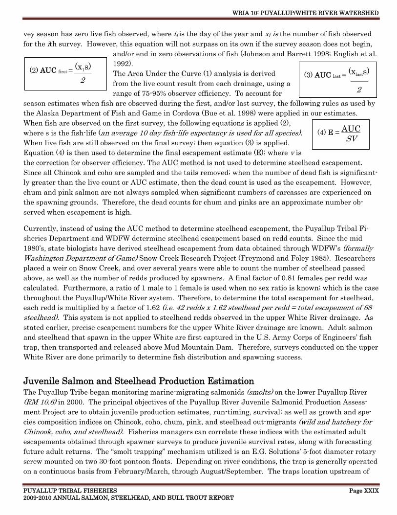
WRIA 10: PUYALLUP/WHITE RIVER WATERSHED
PUYALLUP TRIBAL FISHERIES Page XXIX 2009-2010 ANNUAL SALMON, STEELHEAD, AND BULL TROUT REPORT
(3) AUC last = (xlasts)
(2) AUC first = (x1s)
(4) E = AUC
2
vey season has zero live fish observed, where ti is the day of the year and xi is the number of fish observed
for the ith survey. However, this equation will not surpass on its own if the survey season does not begin,
and/or end in zero observations of fish (Johnson and Barrett 1998; English et al.
1992).
The Area Under the Curve (1) analysis is derived
from the live count result from each drainage, using a
range of 75-95% observer efficiency. To account for
season estimates when fish are observed during the first, and/or last survey, the following rules as used by
the Alaska Department of Fish and Game in Cordova (Bue et al. 1998) were applied in our estimates.
When fish are observed on the first survey, the following equations is applied (2),
where s is the fish-life (an average 10 day fish-life expectancy is used for all species).
When live fish are still observed on the final survey; then equation (3) is applied.
Equation (4) is then used to determine the final escapement estimate (E); where v is
the correction for observer efficiency. The AUC method is not used to determine steelhead escapement.
Since all Chinook and coho are sampled and the tails removed; when the number of dead fish is significant-
ly greater than the live count or AUC estimate, then the dead count is used as the escapement. However,
chum and pink salmon are not always sampled when significant numbers of carcasses are experienced on
the spawning grounds. Therefore, the dead counts for chum and pinks are an approximate number ob-
served when escapement is high.
Currently, instead of using the AUC method to determine steelhead escapement, the Puyallup Tribal Fi-
sheries Department and WDFW determine steelhead escapement based on redd counts. Since the mid
1980’s, state biologists have derived steelhead escapement from data obtained through WDFW’s (formally
Washington Department of Game) Snow Creek Research Project (Freymond and Foley 1985). Researchers
placed a weir on Snow Creek, and over several years were able to count the number of steelhead passed
above, as well as the number of redds produced by spawners. A final factor of 0.81 females per redd was
calculated. Furthermore, a ratio of 1 male to 1 female is used when no sex ratio is known; which is the case
throughout the Puyallup/White River system. Therefore, to determine the total escapement for steelhead,
each redd is multiplied by a factor of 1.62 (i.e. 42 redds x 1.62 steelhead per redd = total escapement of 68
steelhead). This system is not applied to steelhead redds observed in the upper White River drainage. As
stated earlier, precise escapement numbers for the upper White River drainage are known. Adult salmon
and steelhead that spawn in the upper White are first captured in the U.S. Army Corps of Engineers’ fish
trap, then transported and released above Mud Mountain Dam. Therefore, surveys conducted on the upper
White River are done primarily to determine fish distribution and spawning success.
Juvenile Salmon and Steelhead Production Estimation
The Puyallup Tribe began monitoring marine-migrating salmonids (smolts) on the lower Puyallup River
(RM 10.6) in 2000. The principal objectives of the Puyallup River Juvenile Salmonid Production Assess-
ment Project are to obtain juvenile production estimates, run-timing, survival; as well as growth and spe-
cies composition indices on Chinook, coho, chum, pink, and steelhead out-migrants (wild and hatchery for
Chinook, coho, and steelhead). Fisheries managers can correlate these indices with the estimated adult
escapements obtained through spawner surveys to produce juvenile survival rates, along with forecasting
future adult returns. The ―smolt trapping‖ mechanism utilized is an E.G. Solutions’ 5-foot diameter rotary
screw mounted on two 30-foot pontoon floats. Depending on river conditions, the trap is generally operated
on a continuous basis from February/March, through August/September. The traps location upstream of
2
2
2 _________
2
_________
SV
WRIA 10: PUYALLUP/WHITE RIVER WATERSHED
PUYALLUP TRIBAL FISHERIES Page XXX 2009-2010 ANNUAL SALMON, STEELHEAD, AND BULL TROUT REPORT
the confluence with the White River excludes making production estimates for the White. However; fishe-
ries managers agree there is a significant need for assessing juvenile salmon and steelhead production in
the White River. Although the Puyallup Tribe has possessed a rotary screw trap to employ on the White
River since 2002; the lack of adequate site locations, theft, and extreme vandalism have prevented trapping
operations from being conducted on a continuous long term basis.
Salmon and Steelhead Hatchery Production There are currently four hatcheries located within the Puyallup/White River Watershed producing Spring
Chinook, Fall Chinook, coho, chum, and steelhead. In addition to the terminal hatchery production, sup-
plementary Spring Chinook are transferred from the WDFW Minter Creek hatchery facility, to acclimation
ponds located in the upper White River. The Puyallup Tribe operates two hatcheries on the Puyallup; in
addition, the Muckleshoot tribe operates a facility on the White River, and WDFW operates a facility on
Voights Creek, a tributary to the Carbon River. The Puyallup Tribe’s salmon hatcheries on the lower
Puyallup are located on Clarks Creek and Diru Creek. Clarks Creek Salmon Hatchery is located at RM 1
on Clarks Creek (10.0027). The Clarks Creek facility was constructed in order to address several fish man-
agement, and water supply issues; including minimizing the straying of adult Fall Chinook reared by the
tribe; providing space for rearing and acclimating White River Spring Chinook, chum and winter steelhead
if necessary; creating an independent and self sustaining Fall and Spring Chinook program for the tribe; as
well as providing a reliable water supply to rear and expand fish production.
In 2004, the Puyallup Tribal Fisheries Department began acclimating and releasing Fall Chinook from the
Clarks Creek facility, thereby discontinuing all Chinook releases from the Diru Creek Hatchery. In early
2005, construction of a new incubation building was completed at Clarks Creek. The incubation building
houses 32 incubator stack; each stack is capable of holding up to 77,000 Chinook eggs. This provides for a
total capacity of approximately 2.5 million eggs. Once fish are ready to be moved from the incubators, they
can be place in one of the 16 aluminum raceway-troughs and hand feeding can begin. The troughs are 16
feet in length with a flow rate of up to 25 gpm. When the fish are approximately 500 to the pound, they are
transferred to one of the cement lined ponds. Holding the Chinook in the cement pond is only temporary
until they are large enough in size, usually in March/April, to be massed marked via an automated tagger.
Once tagged, the fish are planted in one of the two natural acclimation ponds until they are released in late
May or early June.
Diru Creek Hatchery is primarily a chum facility (Diru Creek is a tributary to Clarks Creek); however, the
Puyallup Tribe is currently rearing around 25,000+ steelhead pre-smolts as well. The Puyallup Tribe cur-
rently raises 1.5 to 2.3 million chum smolts for release into the lower Puyallup River. This program signif-
icantly augments a Tribal river fishery and All Citizen purse seine fishery in East and West Pass in Puget
Sound. This stock originated initially from Chambers Creek. Puyallup Tribal Fisheries releases 1,000 to
3,000 pounds annually based on available brood stock returns to Diru Creek Hatchery. The program was
started in 1991 and has become self-sustaining.
In 2006, the Puyallup Tribe, in partnership with WDFW and the Muckleshoot Tribe, began artificially
propagating White River winter steelhead. Rearing young steelhead is an integral part of the White River
winter steelhead pilot project, a program designed to increase winter steelhead escapement in the White
River. With the temporary closure of WDFW’s Voights Creek hatchery in January of 2009, the Puyallup
Tribe has assumed the majority of responsibility for continuing this important restoration effort. Steelhead
Chum spawning
WRIA 10: PUYALLUP/WHITE RIVER WATERSHED
PUYALLUP TRIBAL FISHERIES Page XXXI 2009-2010 ANNUAL SALMON, STEELHEAD, AND BULL TROUT REPORT
brood-stock collected from the White River USACE fish trap in Buckley are currently held, spawned, incu-
bated, and reared at the Puyallup Tribe’s Diru Creek hatchery for a year. After rearing for a year and fish
are of size (approximately 17 fish per pound), the pre-smolts are transported to the Muckleshoot hatchery
on the White River to acclimate before being released (data available under the Buckley and Diru Cr. sec-
tions in this report).
The Muckleshoot Tribe operates a Spring Chinook hatchery on the White River near the City of Buckley.
Since 1994, the Puyallup tribe has operated ponds used for acclimating Spring Chinook which are planted
in March, and released in May or early June. The Spring Chinook plants are an integral part of the White
River Spring Chinook recovery plan. The juvenile Spring Chinook originated from the Muckleshoot White
River Hatchery and WDFW’s hatchery on Minter Creek. Between 100,000 to 900,000+ Spring Chinook
from the WDFW Minter Creek and the Muckleshoot White River hatchery are transported to the acclima-
tion ponds in early spring, and released in late spring.
Spring Chinook are mass marked with left or right ventral fin clips before being planted in acclimation
ponds. Odd brood years (year the fish were spawned) are marked with left ventral fin clips, and even brood
years with right ventral clips. These fish can later be immediately identified and aged when caught at the
USACE fish trap in Buckley, and then transported above Mud Mountain dam to spawn naturally. The
five-acclimation ponds the Puyallup Tribe operates are satellite facilities to the White River and Minter
Creek Spring Chinook hatcheries. Unfortunately, several of the ponds are non-operational due to flood
damage. The acclimation ponds are located in the upper White River Watershed on the Clearwater River
(currently non- operational), Cripple Creek (currently non- operational), two ponds on Huckleberry Creek
(upper pond currently non- operational), and the newly constructed (operational since 2008) Greenwater
River pond near George Creek. Production levels vary, but average around 400,000+ smolts; however,
numbers of available smolts fluctuates based on available brood stock. The ponds collectively have a typi-
cal rearing capacity of approximately 837,000+ zero age smolts (fish less than 1 year old).
Fish and Habitat Restoration
One of the Puyallup Tribe’s most significant restoration goals is to rebuild depressed Chinook stocks and
remove them from ESA listing. The Puyallup Tribe operates eight acclimation ponds in the Puyal-
lup/White River Watershed. Three of the acclimation ponds are used for reestablishing fall Chinook and
coho into a 26+ mile reach of the Upper Puyallup River above Electron Dam (RM 41.7). The Electron di-
version dam had been an anadromous barrier for 97 years (1904-2000). A 215 foot fish ladder was con-
structed, and completed in the fall of 2000. Using acclimation ponds, limiting harvest, and making sub-
stantial gains in habitat restoration, the tribe will be able to accomplish this task. Levee setbacks, oxbow
reconnections both inter tidal and upland, Commencement Bay cleanup, and harvest cutbacks have al-
ready been initiated. Acclimation ponds are a proven method for increasing fish numbers on the spawning
grounds. Hatchery rearing 200,000+ Fall Chinook for acclimation ponds in the upper Puyallup River is a
key component to restoration goals. Five additional acclimation ponds are located in the upper White River
drainage (only 2 ponds are currently functional); including the newest pond located on the Greenwater Riv-
er which was constructed during the summer of 2007 and has been operational since 2008. These ponds
are used for reestablishing White River Spring Chinook back into their endemic range. Hatchery rearing
up to 900,000+ Spring Chinook for acclimation ponds in the upper White River is a fundamental part of the
White River Spring Chinook recovery plan. In addition to the rearing and acclimation of juveniles, surplus
live adult Fall Chinook from the WDFW Voights Creek hatchery have been planted in the upper Puyallup
WRIA 10: PUYALLUP/WHITE RIVER WATERSHED
PUYALLUP TRIBAL FISHERIES Page XXXII 2009-2010 ANNUAL SALMON, STEELHEAD, AND BULL TROUT REPORT
drainage when surplus fish were available. In addition, the Puyallup-White River winter steelhead stocks
have been in serious decline for the past several years.
In 2006, the Puyallup Tribe, in partnership with WDFW and the Muckleshoot Tribe, began artificially
propagating White River winter steelhead. Rearing young steelhead is an integral part of the White River
winter steelhead pilot project, a program designed to increase winter steelhead escapement in the White
River. With the temporary closure of Voights Creek hatchery in January of 2009, the Puyallup Tribe has
assumed the majority of responsibility for the continuance of this vital fish enhancement project. Steel-
head brood stock collected from the White River are currently held, spawned, incubated, and reared at the
Puyallup Tribe’s Diru Creek hatchery for a nearly a year before being transported to the Muckleshoot’s
hatchery on the White River to acclimate. Steelhead are acclimated and released in late May (3 months);
at which time they have reached approximately 6-8 fish per pound.
In the fall of 2008, the Puyallup Tribe completed construction of one of its most prevalent watershed resto-
ration projects to date. The Sha Dadx (Frank Albert Road) wetland restoration project, located on the low-
er Puyallup River, created a 17-acre off-channel wetland habitat for salmonids and other freshwater resi-
dent fish. The project was instrumental in reestablishing an old disconnected oxbow; in addition to a low
lying wetland back into the mainstem river. The reclaimed habitat was originally lost during the construc-
tion of the lower river levee system in the early 1900s. In response to the loss of nearly an entire estuarine
ecosystem that once existed, the creation of this critical and necessary lower river environment will provide
overwintering; as well as foraging opportunities for young juvenile salmon. In addition, this habitat will
offer some of the benefits that the estuary once provided to out migrating (smolting) salmon during the
transition from fresh water to salt water.
About This Annual Report
The information and spawning data contained within this report is not all inclusive of the entire wa-
tershed, but rather focuses on those stream and river segments known to support the majority of spawners.
Over the past several season, the Puyallup/White River system has experienced a broad range in adult es-
capement, range and distribution for all salmon species, especially pinks. Over 540,000 pink salmon were
transported above Mud Mountain Dam on the White River in 2009. In addition to increased pink returns,
Chinook and coho escapements have experienced changes as well, this has made it necessary to survey
more river miles to cover the expanding distribution for all species and determine the spawning escape-
ment/success.
This report is organized alphabetically by stream name, project or facility. If applicable, each includes riv-
er miles surveyed, the WRIA designation, as well as a description of the drainage, project or facility. Most
of the data is graphically represented by species, showing the total number of live fish, dead fish, and redds
counted throughout the spawning season. In addition, yearly species comparisons are presented when
three or more years of survey data is available. If less than three years of data is available, or if a particu-
lar drainage was not surveyed with any regularity, or if few fish were observed, no graphs are presented.
However, raw survey data for each stream and river surveyed can be found in Appendix D. Some graphs in
this report were generated using data collected by WDFW. Also included in this report is information and
data collected from several other Puyallup Tribal Fisheries projects, including the U.S. Army Corps of En-
gineers (USACE) fish trap on the White River; PSE’s Electron forebay fish bypass facility; The Puyallup
Tribal Fisheries Puyallup River juvenile salmonid production assessment project (smolt trap); and the
Puyallup Tribe of Indians salmon hatcheries on Clarks and Diru creeks.
WRIA 10: PUYALLUP/WHITE RIVER WATERSHED
PUYALLUP TRIBAL FISHERIES Page XXXIII 2009-2010 ANNUAL SALMON, STEELHEAD, AND BULL TROUT REPORT
REFERENCES
Alderdice, D.F., J.O.T. Jensen, and F.P.J. Velsen. 1984. Measurement of hydrostatic pressure in salmonid
eggs. Can. J. Zool. 62:1977-1987
Beacham, T.D., and C.L. Murray. 1990. Temperature, Egg Size, and Development of Embryos and Alevins
if Five Species of Pacific Salmon: A Comparative Analysis. Trans. Amer. Fish. Soc. 119:927-945
Baker, J.D., P. Moran, and R.C. Ladley. 2002. Nuclear DNA identification of migrating bull trout cap-
tured at the Puget Sound Energy diversion dam on the White River, Washington State. Molecular Ecol-
ogy (2003) 12, 557-561
Berger, A., and K. Williamson. 2004. Puyallup River Juvenile Salmonid Production Assessment Project
2004. Puyallup Tribal Fisheries Division, Puyallup, WA.
Berger, A., and K. Williamson. 2005. Puyallup River Juvenile Salmonid Production Assessment Project
2005. Puyallup Tribal Fisheries Division, Puyallup, WA.
Berger, A., R. Conrad, and M. Parnel. 2006. Puyallup River Juvenile Salmonid Production Assessment
Project 2006. Puyallup Tribal Fisheries Division, Puyallup, WA.
Berger, A., R. Conrad, and J. Paul. 2007. Puyallup River Juvenile Salmonid Production Assessment
Project 2007. Puyallup Tribal Fisheries Division, Puyallup, WA.
Berger, A., R. Conrad, and J. Paul. 2008. Puyallup River Juvenile Salmonid Production Assessment
Project 2008. Puyallup Tribal Fisheries Division, Puyallup, WA.
Bue, B.G., S.M. Fried, S. Sharr, D.G. Sharp, J.A. Wilcock, and H.J. Geiger. 1998. Estimating salmon
escapement using area-under-the-curve, aerial observer efficiency, and stream-life estimates: The
Prince William Sound pink salmon example. North Pac. Anadr. Fish. Comm. Bull. 1: 240-250
Cannings, S. G., and J. Ptolemy. 1998. Rare freshwater fish of British Columbia. BC Ministry of Environ-
ment, Lands and Parks, Victoria, BC.
Carbon River Watershed Analysis. May 1998, Mount Baker Snoqualmie National Forest
Carey, W. E., and D. L. G. Noakes. 1981. Development of photo behavioral responses in young rainbow
trout, Salmo gairdneri Richardson. Journal of Fish Biology Volume 19, Issue 3, Pages285 – 296. 1981
The Fisheries Society of the British Isles
Cavender, T.M. 1978. Taxonomy and distribution of bull trout (Salvelinus confluentus) from the American
Northwest. California Fish and Game.64 (3): 139-174.
Chebanov, N.A. et al. 1983. Effectiveness of spawning of male sockeye salmon, Oncorhynchus nerka (Sal-
monidae), of differing hierarchical rank by means of genetic-biochemical markers. Ichthyolo., 23: 51-55.
Chebanov, N.A. 1991. The effects of spawner density on spawning success, egg survival, and size structure
of the progeny of sockeye salmon, Oncorhynchus nerka. Ichthyolo., 31: 103-109.
WRIA 10: PUYALLUP/WHITE RIVER WATERSHED
PUYALLUP TRIBAL FISHERIES Page XXXIV 2009-2010 ANNUAL SALMON, STEELHEAD, AND BULL TROUT REPORT
Chebanov, N.A. 1994. Behavioral mechanisms of density regulation in Pacific salmon genus Oncorhyn- chus during spawning. 1. An analysis of the results of field experiments with sockeye salmon O. nerka.
Ichthyolo., 34: 51-61. Commencement Bay Nearshore /Tideflats Record of Decision. 1989. EPA Region
10. Seattle, WA.
Dunston, W. 1955. White River downstream migration. Puget Sound Stream Studies (1953-1956).
Washington Department of Fisheries, Olympia, WA.
English, K.K., R.C. Bocking, and J.R Irvine. 1992. A robust procedure for estimating salmon escapement
based on the area-under-the-curve method. Can. J. Fish. Aquat. Sci. 49: 1982.
Foote, C.J. 1989. Female mate preferences in Pacific salmon. Animal Behavior, 38: 721-723
Ford, M.J., and P. Schwenke. 2004. Report to the Puyallup Tribe Fisheries Division regarding genetic va-
riation among samples of chum salmon collected in the Puyallup River. Watershed Northwest Fisheries
Science Center, Conservation Biology Division, Seattle, WA.
Ford, M.J., T. Lundrigan, and M. Baird. 2004. Population Structure of White River Chinook Salmon
Draft Report. Watershed Northwest Fisheries Science Center, Conservation Biology Division, Seattle,
WA.
Governor’s Salmon Recovery Office. 1999. Statewide strategy to recover salmon – extinction is not an op-
tion. State of Washington. 325 pages with appendices.
Groot, C., and L. Margolis. 1991. Pacific Salmon Life Histories. University of British Columbia Press,
Vancuver, B.C., Canada. 564pp.
Johnson, B.A., and B.M. Barrett. 1988. Estimation of salmon escapement based on stream survey data.
Regional Inf. Rep. 4K88-35, Alaska Department of Fish and Game, Division of Commercial Fisheries,
Kodiak, Alaska.
Johnson, R. (2006) Information presented to the White River Spring Chinook Technical Committee re-
garding DNA and age results for unmarked (NOR) Chinook at the USACE Buckley trap that were sub-
sequently incorporation into the White River hatchery program. Unpublished document.
Heard, W. R. 1964. Phototactic behavior of emerging sockeye salmon fry. Animal Behavior 12(2—3):382—
388. Heiser, D. W. 1969.
Keenleyside, M.H.A., and H.M.C Dupuis. 1988. Courtship and spawning competition in pink salmon
(Oncohynchus gorbuscha). Can. J. Zool. 66: 262-265.
Ladley, R.C., and B. E. Smith. 1999. Restoration Opportunities on the Puyallup River, Restoration Site
Catalog. Puyallup Tribal Fisheries, Puyallup, WA. 66pp.
Ladley, R.C., B. E. Smith, and M.K. MacDonald. 1996. White River Spring Chinook Migration Behavior
Investigation. Puyallup Tribe Fisheries Division, Puyallup, WA.
Leary, R.F., and F.W. Allendorf. 1997. Genetic Confirmation of Sympatric Bull Trout and Dolly Vardon in
Western Washington. Trans. Amer. Fish. Soc. 126:715-720.

WRIA 10: PUYALLUP/WHITE RIVER WATERSHED
PUYALLUP TRIBAL FISHERIES Page XXXV 2009-2010 ANNUAL SALMON, STEELHEAD, AND BULL TROUT REPORT
Leman, V.N. 1993. Spawning sites of chum salmon, Oncorhynchus keta: Microhydrological regime and va-
ribility of progeny in redds (Kamachatka River basin). Journal of Ichthyology, 33 (2): 104-143
Manning, T., and S. Smith. 2005. Washington State Sport Catch Report 2001. Washington Department of
Fish and Wildlife, Fish Program Science Division. Olympia, Wa.
Marks, E.L. (2000). Surveys to determine the presence or absence of bull trout in river and stream dran-
ages within Mount Rainier National Park during the summer of 2000. Unpublished work. National
Park Service, Division of Natural Resources, Longmire, WA.
McNeil, W.J., and W.H. Ahnell. 1964. Success of pink salmon spawning relative to size of spawning bed
matrials. U.S. Fish and Wildl. Serv., Special Scientific Report – Fisheries No. 407: 20pp.
McNeil, W.J. 1966. Effects of the spawning bed environment on the reproduction of pink and chum sal-
mon. U.S. Fish and Wildl. Serv. Fish. Bull. 65: 495-523.
Mork, O.I. 1995. Aggressive behavior of two size classes of four salmonid species. Fisken Og Havet. NR.
19pp. Pauley, G.B., Bortz, B.M., and Shepard, M.F. 1986. Species profiles: life histories and environ-
mental requirements of coastal fishes and invertebrates (Pacific Northwest) -- steelhead trout. U.S.
Fish and Wildl. Serv. Biol. Rep. 82(11.62). U.S. Army Corps of Engineers, TREL-82-4. 24pp.
Peterson, N.P., and T.P. Quinn. 1996. Spacial and temporal variation in dissolved oxygen in natural egg
pockets of chum salmon, in Kennedy Creek, Washington. Fish Biol. 48: 131-143
Piper, R.G. et al. 1982. Fish Hatchery Management. United States Department of the Interior, Fish and
Wildlife Service, Washington D.C. 517pp.
Pratt, K.L. 1992. A review of bull trout life history. Pages 5-9 in P.J. Howell and D.V. Buchanan, editors.
Proceedings of the Gearhart Mountain Bull trout workshop. Oregon Chapter of the American Fisheries
Society, Corvallis.
Prych, E.A. 1987. Flood –carrying capacities and changes in channels of the lower Puyallup, White and
Carbon Rivers in Western Washington: U. S. Geological Survey Water-Resources Investigation Report
87-4129, 71pp.
Quinn, T.P. et al. 1996. Behavioral tactics of male sockeye (Onchorynchus nerka) under varying opera-
tion-
al sex ratios. Ethology 102, 304-322.
Quinn, T.P. 2005. The behavior and ecology of Pacific salmon and trout. American Fisheries Society,
Bethesda, MD, and Univ. of Washington Press, Seattle, WA. 378pp.
Salo, E.O., and T.H. Jagielo. 1983. The Status of the anadromous fishes of the White-Puyallup River sys-
tem. Report submitted to the Seattle District United States Army Corps of Engenieers, Seatle, Wa.
200pp.
Shaklee, J.B., and S.F. Young. 2003. Microsatellite DNA Analysis and Run Timing of Chinook Salmon in
the White River (Puyallup River Basin). Genetics Laboratory, Conservation Biology Unit, Science Divi-
sion, Fish Program. Washington Department of Fish and Wildlife, Olympia, WA.
Sheridan, W.L. 1962. Water flow through a salmon spawning riffle in Southeastern Alaska. U.S. Fish and
WRIA 10: PUYALLUP/WHITE RIVER WATERSHED
PUYALLUP TRIBAL FISHERIES Page XXXVI 2009-2010 ANNUAL SALMON, STEELHEAD, AND BULL TROUT REPORT
Wildl. Serv., Special Scientific Report Fisheries No. 407: 20pp.
Shirvell, C.S., and R.G. Dungey. 1983. Micro-habitats chosen by brown trout for feeding and spawning in
rivers. Trans. Amer. Fish. Soc. 102: 312-316
Shreffler, D.K., C.A. Simenstad, and R.M. Thom. 1992. Juvenile salmon foraging in a restored estuarine
wetland Can. J. Fish. Aquat. Sci. 47: 2079-2084.
Simenstad, C.A. 1999. Commencement Bay aquatic ecosystem assessment – ecosystem scale restoration
for juvenile salmon recovery. Prepared for City of Tacoma, Washington Department of natural Re
sources, U.S. Environmental Protection Agency. 51 pp.
Sumioka, S.S. 2004. Trends in streamflow and comparisons with instream flows in the lower Puyallup
River Basin, Washington: U.S. Geological Survey Scientific Investigations Report 2004-5016, 46 p.
Varanasi, U. et al. 1993. Contaminant exposure and associated biological effects in juvenile Chinook sal-
mon (Onchorynchus tshawytscha) from urban and non-urban estuaries of Puget Sound. NOAA Technic-
al
Memorandum NMFS-NWFSC-8 76 pp and appendices.
Washington Conservation Commission. 1999. Salmon habitat limiting factors report for the Puyallup Riv-
er basin. (Water Resource Inventory Area 10) 126 pp.
Washington Department of Fish and Wildlife. 2004. 2001-2002 Steelhead Harvest Summary (run cor-
rected). Washington Department of Fisheries, Olympia, WA.
Washington Department of Fisheries, Washington Department of Wildlife and Western Washington Treaty
Indian Tribes. 1993. 1992 Washington state salmon and steelhead stock inventory. Washington De-
partment of Fisheries, Olympia, WA.
Washington Department of Fish and Wildlife, Puyallup Indian Tribe and Muckleshoot Indian Tribe. 1996.
Recovery Plan for White River Spring Chinook Salmon. WDFW, Olympia WA.
Washington Department of Fish and Wildlife and Puyallup Indian Tribe. 2000. Puyallup River Fall Chi-
nook Baseline Report. Washington Department of Fisheries, Olympia, WA.
Wicket, W.P. 1958. Review of certain environmental factors affecting the production of pink and chum
salmon. Journal of Fisheries Research Board of Canada. 15: 1103-1126
Williams, R.W., R.M. Laramie, and J.J Ames. 1975. A catalog of Washington streams and salmon utilize-
tion, volume 1-Puget Sound Region. Washington Department of Fisheries, Olympia, WA.
Witzel, L.D., and H.R. MacCrimmon. 1983. Redd-site selection by brook trout and brown trout in South-
western Ontario streams. Trans. Amer. Fish. Soc. 112: 760-771
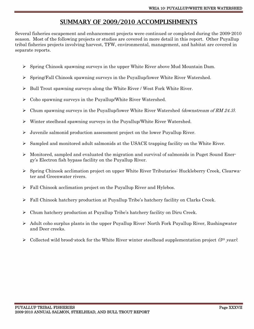
WRIA 10: PUYALLUP/WHITE RIVER WATERSHED
PUYALLUP TRIBAL FISHERIES Page XXXVII 2009-2010 ANNUAL SALMON, STEELHEAD, AND BULL TROUT REPORT
SUMMARY OF 2009/2010 ACCOMPLISHMENTS
Several fisheries escapement and enhancement projects were continued or completed during the 2009-2010
season. Most of the following projects or studies are covered in more detail in this report. Other Puyallup
tribal fisheries projects involving harvest, TFW, environmental, management, and habitat are covered in
separate reports.
Spring Chinook spawning surveys in the upper White River above Mud Mountain Dam.
Spring/Fall Chinook spawning surveys in the Puyallup/lower White River Watershed.
Bull Trout spawning surveys along the White River / West Fork White River.
Coho spawning surveys in the Puyallup/White River Watershed.
Chum spawning surveys in the Puyallup/lower White River Watershed (downstream of RM 24.3).
Winter steelhead spawning surveys in the Puyallup/White River Watershed.
Juvenile salmonid production assessment project on the lower Puyallup River.
Sampled and monitored adult salmonids at the USACE trapping facility on the White River.
Monitored, sampled and evaluated the migration and survival of salmonids in Puget Sound Ener-
gy’s Electron fish bypass facility on the Puyallup River.
Spring Chinook acclimation project on upper White River Tributaries: Huckleberry Creek, Clearwa-
ter and Greenwater rivers.
Fall Chinook acclimation project on the Puyallup River and Hylebos.
Fall Chinook hatchery production at Puyallup Tribe’s hatchery facility on Clarks Creek.
Chum hatchery production at Puyallup Tribe’s hatchery facility on Diru Creek.
Adult coho surplus plants in the upper Puyallup River: North Fork Puyallup River, Rushingwater
and Deer creeks.
Collected wild brood-stock for the White River winter steelhead supplementation project (5th year).
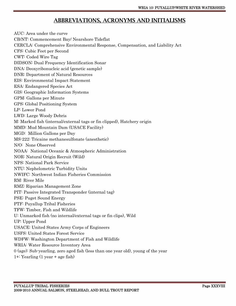
WRIA 10: PUYALLUP/WHITE RIVER WATERSHED
PUYALLUP TRIBAL FISHERIES Page XXXVIII 2009-2010 ANNUAL SALMON, STEELHEAD, AND BULL TROUT REPORT
ABBREVIATIONS, ACRONYMS AND INITIALISMS
AUC: Area under the curve
CB/NT: Commencement Bay/ Nearshore Tideflat
CERCLA: Comprehensive Environmental Response, Compensation, and Liability Act
CFS: Cubic Feet per Second
CWT: Coded Wire Tag
DIDSON: Dual Frequency Identification Sonar
DNA: Deoxyribonucleic acid (genetic sample)
DNR: Department of Natural Resources
EIS: Environmental Impact Statement
ESA: Endangered Species Act
GIS: Geographic Information Systems
GPM: Gallons per Minute
GPS: Global Positioning System
LP: Lower Pond
LWD: Large Woody Debris
M: Marked fish (internal/external tags or fin clipped), Hatchery origin
MMD: Mud Mountain Dam (USACE Facility)
MGD: Million Gallons per Day
MS-222: Tricaine methanesulfonate (anesthetic)
N/O: None Observed
NOAA: National Oceanic & Atmospheric Administration
NOR: Natural Origin Recruit (Wild)
NPS: National Park Service
NTU: Nephelometric Turbidity Units
NWIFC: Northwest Indian Fisheries Commission
RM: River Mile
RMZ: Riparian Management Zone
PIT: Passive Integrated Transponder (internal tag)
PSE: Puget Sound Energy
PTF: Puyallup Tribal Fisheries
TFW: Timber, Fish and Wildlife
U: Unmarked fish (no internal/external tags or fin clips), Wild
UP: Upper Pond
USACE: United States Army Corps of Engineers
USFS: United States Forest Service
WDFW: Washington Department of Fish and Wildlife
WRIA: Water Resource Inventory Area
0 (age): Sub-yearling, zero aged fish (less than one year old), young of the year
1+: Yearling (1 year + age fish)