introduction to gps introduction to gps. earth circumference 24,900 miles rotation 1,038...
TRANSCRIPT

IntroductionTo GPS
IntroductionTo GPS

EarthCircumferenc
e24,900
Miles
Rotation1,038
Miles/Hour1 Day Cycle

Moon1/4 Size of the Earth
Distance from Earth
239,000 Miles

Feasibility studies begun in Feasibility studies begun in 1960’s.1960’s.
Pentagon appropriates funding Pentagon appropriates funding in 1973.in 1973.
First satellite launched in 1978.First satellite launched in 1978. System declared fully System declared fully
operational in April, 1995.operational in April, 1995. Open to the public, 2000.Open to the public, 2000.
The History of GPSThe History of GPS

How does GPS work?How does GPS work? Stations on earth, and a GPS Stations on earth, and a GPS
receiver, the distances receiver, the distances between each of these points between each of these points can be calculated. can be calculated.
The distance is calculated The distance is calculated based on the amount of time based on the amount of time it takes for a radio signal to it takes for a radio signal to travel between these points.travel between these points.
Using satellites in the sky, Using satellites in the sky, ground allows the GPS ground allows the GPS receiver to know where you receiver to know where you are, in terms of latitude and are, in terms of latitude and longitude, on the earth.longitude, on the earth.
The more satellites the GPSr can “see”, the more accurate The more satellites the GPSr can “see”, the more accurate your reading.your reading.
The GPSr must “see” the satellites, so it does not work The GPSr must “see” the satellites, so it does not work well in dense forests, inside caves, underwater, or inside well in dense forests, inside caves, underwater, or inside buildings.buildings.

Components of the Components of the SystemSystem
User segmentUser segment GPS antennas & receiver/processorsGPS antennas & receiver/processors PositionPosition VelocityVelocity Precise timingPrecise timing Used byUsed by
AircraftAircraft Ground vehiclesGround vehicles ShipsShips IndividualsIndividuals

Handheld GPS ReceiversHandheld GPS Receivers Garmin eTrexGarmin eTrex
~$100~$100 Garmin-12Garmin-12
~$150~$150 Casio GPS Casio GPS
wristwatchwristwatch ~$300~$300
The GPS StoreThe GPS Store

GPS Satellite VehicleGPS Satellite Vehicle Four atomic clocksFour atomic clocks Three nickel-cadmium Three nickel-cadmium
batteriesbatteries Two solar panelsTwo solar panels
Battery chargingBattery charging Power generationPower generation 1136 watts1136 watts
S band antenna—satellite S band antenna—satellite controlcontrol
12 element L band 12 element L band antenna—user antenna—user communicationcommunication
Block IIF satellite vehicle Block IIF satellite vehicle (fourth generation)(fourth generation)

GPS SatellitesDistance from
Earth12,000 Miles
2 Orbits in 24 HoursTravel 7,000 MPH
Powered by Solar Energy

SatellitesGPS satellites are controlled and operated by the Dept. of Defense.
24 satellites in orbit dedicated to GPS.
6 satellites are within view of any location at one time, provided that physical terrain, or structures do not block them.
Satellites constantly transmit their locational information and time data.

Slide 28


Space 24 satellites 12,000 miles above Earth Orbit twice daily At least 4 satellites in view Distance from Earth to Moon - 256,000 miles

Military.Military. Search and rescue.Search and rescue. Disaster relief.Disaster relief. Surveying.Surveying. Marine, aeronautical and terrestrial Marine, aeronautical and terrestrial
navigation.navigation. Remote controlled vehicle and robot Remote controlled vehicle and robot
guidance.guidance. Satellite positioning and tracking.Satellite positioning and tracking. Shipping.Shipping. Geographic Information Systems (GIS).Geographic Information Systems (GIS). Recreation.Recreation.
User SegmentUser Segment

GPS receiver allows you to pinpoint your GPS receiver allows you to pinpoint your location, anywhere in the world, based on location, anywhere in the world, based on latitude and longitude coordinates.latitude and longitude coordinates.
It can tell you in what direction you are heading.It can tell you in what direction you are heading.
It can show you:It can show you:
how fast you are goinghow fast you are going
your altitudeyour altitude
a map to help you arrive at a destinationa map to help you arrive at a destination
What does a GPS receiver What does a GPS receiver do?do?

Signal From One Signal From One SatelliteSatellite
Signal From One Signal From One SatelliteSatellite
The receiver is somewhere on this sphere.

Signals From Two Signals From Two SatellitesSatellites
Signals From Two Signals From Two SatellitesSatellites

Three Satellites Three Satellites (2D Positioning)(2D Positioning)Three Satellites Three Satellites (2D Positioning)(2D Positioning)

Three Dimensional Three Dimensional (3D) Positioning(3D) Positioning
Three Dimensional Three Dimensional (3D) Positioning(3D) Positioning

System PerformanceSystem Performance Standard Positioning Standard Positioning
SystemSystem 100 meters horizontal 100 meters horizontal
accuracyaccuracy 156 meters vertical accuracy156 meters vertical accuracy Designed for civilian useDesigned for civilian use No user fee or restrictionsNo user fee or restrictions
Precise Positioning Precise Positioning SystemSystem 22 meters horizontal accuracy22 meters horizontal accuracy 27.7 meters vertical accuracy27.7 meters vertical accuracy Designed for military useDesigned for military use

DGPS Site
x+30, y+60
x+5, y-3
True coordinates = x+0, y+0
Correction = x-5, y+3
DGPS correction = x+(30-5) and y+(60+3)
True coordinates = x+25, y+63
x-5, y+3
Real Time Differential Real Time Differential GPSGPS
Real Time Differential Real Time Differential GPSGPS
DGPS ReceiverReceiver

How GPS WorksOkay, you’re lost, you have amnesia, and you have absolutely no idea where you are. You go up to someone, and like a good amnesiac you ask, “Where Am I?” This person tells you that you are 625 miles from Boise, Idaho. You say, sarcastically, “Wow, that’s some great information. Thanks Buddy.”

We’re Getting Closer
You still have absolutely no idea where you are, so once again you go up to someone and ask, “Where Am I?” This person tells you that you’re 690 miles from Minneapolis. You just scratch your head, but then you start to remember what you learned in GPS class, and, with the US map in your pocket to guide you, you proceed.

Now We Know! You see a another smiling
face and ask “where am I” one more time. This time you get the reply “you are 615 miles from Tucson. The light pops on in your brain. It’s all clear now. You draw three circles extending in the radii of 625 miles from Boise, 690 from Minneapolis, and 615 miles from Tucson. The circles intersect in Denver! Aren’t you glad that you took this class?

GPS by TrilaterationGPS Distance D = Speed of Light x
Time; or D = CT
D

Sources of Signal Sources of Signal InterferenceInterference
Sources of Signal Sources of Signal InterferenceInterference
Earth’s Atmosphere
Solid Structures
Metal Electro-magnetic Fields

Obstruction

WaypointWaypoint A waypoint is based on coordinates A waypoint is based on coordinates
entered into a GPS receiver’s memory.entered into a GPS receiver’s memory. It can be either a saved position fix, or It can be either a saved position fix, or
user entered coordinates.user entered coordinates. It can be created for any remote point It can be created for any remote point
on earth.on earth. It must have a receiver designated It must have a receiver designated
code or number, or a user supplied code or number, or a user supplied name.name.
Once entered and saved, a waypoint Once entered and saved, a waypoint remains unchanged in the receiver’s remains unchanged in the receiver’s memory until edited or deleted.memory until edited or deleted.

Planning a Navigation Planning a Navigation RouteRoute
Planning a Navigation Planning a Navigation RouteRoute
Start= Waypoint

How A Receiver Sees How A Receiver Sees Your RouteYour Route
How A Receiver Sees How A Receiver Sees Your RouteYour Route

What is Geocaching?What is Geocaching? All around the world, people have hidden All around the world, people have hidden
“caches” and posted the coordinates on a “caches” and posted the coordinates on a website.website.
Anyone can go on the site and write down or Anyone can go on the site and write down or download the coordinates of the cache to their download the coordinates of the cache to their GPS and go find it.GPS and go find it.
Once you have found a cache, you can go on Once you have found a cache, you can go on the site and report your findingsthe site and report your findings
This activity started in May of 2000, when the This activity started in May of 2000, when the government lifted the “Selective Availability” government lifted the “Selective Availability” of the GPS signals so that consumer GPS of the GPS signals so that consumer GPS devices where as accurate at the military devices where as accurate at the military devices.devices.
There are over 300,00 active caches in 222 There are over 300,00 active caches in 222 countries.countries.

How do I start to How do I start to Geocache?Geocache?
Go to Go to www.geocaching.comwww.geocaching.com (or other geocache site) (or other geocache site)
Click on “Hide and Seek” Click on “Hide and Seek”
Enter a zip code, city and state or coordinates Enter a zip code, city and state or coordinates near where you want to hunt.near where you want to hunt.
Note the level of difficulty, the type of cache and Note the level of difficulty, the type of cache and when it was last found.when it was last found.
Once you have selected a cache to hunt for, you Once you have selected a cache to hunt for, you can:can:
Download or manually enter the “waypoint” Download or manually enter the “waypoint” to your GPSto your GPS
Print out the page with the coordinates, hint Print out the page with the coordinates, hint and logsand logs

Types of CachesTypes of Caches Traditional caches- can be any size; Traditional caches- can be any size;
usually have a log book or paper and a pencil for you usually have a log book or paper and a pencil for you to signto sign
trinkets or items to trade with items you have broughttrinkets or items to trade with items you have brought May contain a “Travel Bug”May contain a “Travel Bug”
Micro caches- small containers, such as film canisters or Micro caches- small containers, such as film canisters or magnetic key cases; usually only have a log in them for magnetic key cases; usually only have a log in them for you to signyou to sign
Virtual Caches- The spot is the cache itself. May be a Virtual Caches- The spot is the cache itself. May be a historic site, a place with a unique activity, or scenic historic site, a place with a unique activity, or scenic sights.sights.
Multi-tier caches- have clues inside for you to follow to Multi-tier caches- have clues inside for you to follow to get to the next cache which may lead to another cacheget to the next cache which may lead to another cache
Benchmarks- these are permanent markers placed Benchmarks- these are permanent markers placed around the US government for surveying purposes. Some around the US government for surveying purposes. Some people enjoy seeing how many of these markers they can people enjoy seeing how many of these markers they can find.find.

Geocaching SitesGeocaching Sites Geocaching.com Geocaching.com http://www.geocaching.comhttp://www.geocaching.com - Number 1 site for - Number 1 site for
geocaching; the one that started it allgeocaching; the one that started it all
Navicache.com Navicache.com http://www.navicache.comhttp://www.navicache.com - Number 2 web site for - Number 2 web site for geocachinggeocaching
Geocacher’s Creed Geocacher’s Creed http://www.geocreed.info/http://www.geocreed.info/
Today’s Cacher Today’s Cacher http://www.todayscacher.comhttp://www.todayscacher.com - online magazine for - online magazine for geocachersgeocachers
Geocacher University Geocacher University http://www.geocacher-u.comhttp://www.geocacher-u.com
Markwell’s FAQ’s Markwell’s FAQ’s http://members.aol.com/_ht_a/marklent60544/myhomepage/Geocachihttp://members.aol.com/_ht_a/marklent60544/myhomepage/Geocaching/markwellgcfaq.htmng/markwellgcfaq.htm
Buxley's Geocaching Waypoint Buxley's Geocaching Waypoint http://brillig.com/geocachinghttp://brillig.com/geocaching
KeenPeople.com KeenPeople.com http://www.keenpeople.comhttp://www.keenpeople.com
The First 100 Geocaches The First 100 Geocaches http://members.cox.net/pkpublic/index.htmlhttp://members.cox.net/pkpublic/index.html
Geocaching with Kids Geocaching with Kids http://www.eduscapes.com/geocaching/kids.htmhttp://www.eduscapes.com/geocaching/kids.htm

Educational Educational ResourcesResources From a Distance- NASA site with Information and From a Distance- NASA site with Information and
Lesson Plans Lesson Plans http://wwwedu.ssc.nasa.gov/fad/default.asphttp://wwwedu.ssc.nasa.gov/fad/default.asp
All About GPS (tutorial) All About GPS (tutorial) http://www.trimble.com/gps/index.htmlhttp://www.trimble.com/gps/index.html
GIS and GPS Lesson Plan Resources GIS and GPS Lesson Plan Resources http://www.gis2gps.com/GIS/lessons/lessons.htmlhttp://www.gis2gps.com/GIS/lessons/lessons.html
What is Latitude and Longitude What is Latitude and Longitude http://www.rain.org/campinternet/gis/gis-lat-long-whathttp://www.rain.org/campinternet/gis/gis-lat-long-whatis.htmlis.html
How GPS Receivers Work How GPS Receivers Work http://electronics.howstuffworks.com/gps.htmhttp://electronics.howstuffworks.com/gps.htm
GPS Guide for Beginners (PDF download) GPS Guide for Beginners (PDF download) http://www.garmin.com/aboutGPS/manual.htmlhttp://www.garmin.com/aboutGPS/manual.html
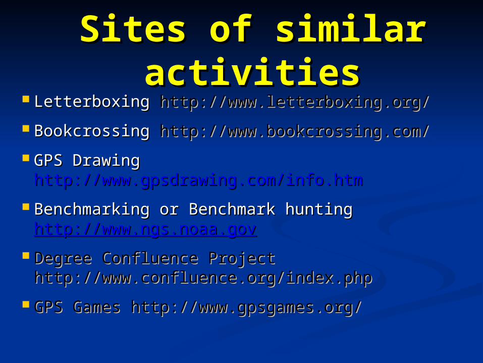
Sites of similar Sites of similar activitiesactivities
Letterboxing Letterboxing http://www.letterboxing.org/http://www.letterboxing.org/
Bookcrossing Bookcrossing http://www.bookcrossing.com/http://www.bookcrossing.com/
GPS Drawing GPS Drawing http://www.gpsdrawing.com/info.htmhttp://www.gpsdrawing.com/info.htm
Benchmarking or Benchmark hunting Benchmarking or Benchmark hunting http://www.ngs.noaa.govhttp://www.ngs.noaa.gov
Degree Confluence Project Degree Confluence Project http://www.confluence.org/index.phphttp://www.confluence.org/index.php
GPS Games http://www.gpsgames.org/GPS Games http://www.gpsgames.org/

CitationsCitations Dixon, Conrad. Using GPS. 2nd ed. Dixon, Conrad. Using GPS. 2nd ed.
Dobbs Ferry: Sheridan House, 1999.Dobbs Ferry: Sheridan House, 1999.
Letham, Lawrence. GPS Made Easy. Letham, Lawrence. GPS Made Easy. Seattle: The Mountaineers, 1996.Seattle: The Mountaineers, 1996.
McNamara, Joel. Geocaching for McNamara, Joel. Geocaching for Dummies. Hoboken: Wiley Publishing, Dummies. Hoboken: Wiley Publishing, 2004.2004.