introduction to gps - itu · •the original intent of the global positioning system was to develop...
TRANSCRIPT

Introduction to GPS
AIM• Provide basic idea about GPS and GNSS
• Understand the different type of receivers
• Understand the GNSS accuracy
• Choose correct GNSS receiver for ground control establishment
• Understand GNSS processing methods
Question
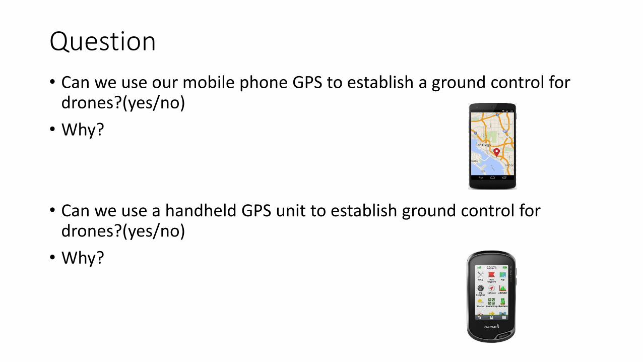
• Can we use our mobile phone GPS to establish a ground control for drones?(yes/no)
• Why?
• Can we use a handheld GPS unit to establish ground control for drones?(yes/no)
• Why?
Question
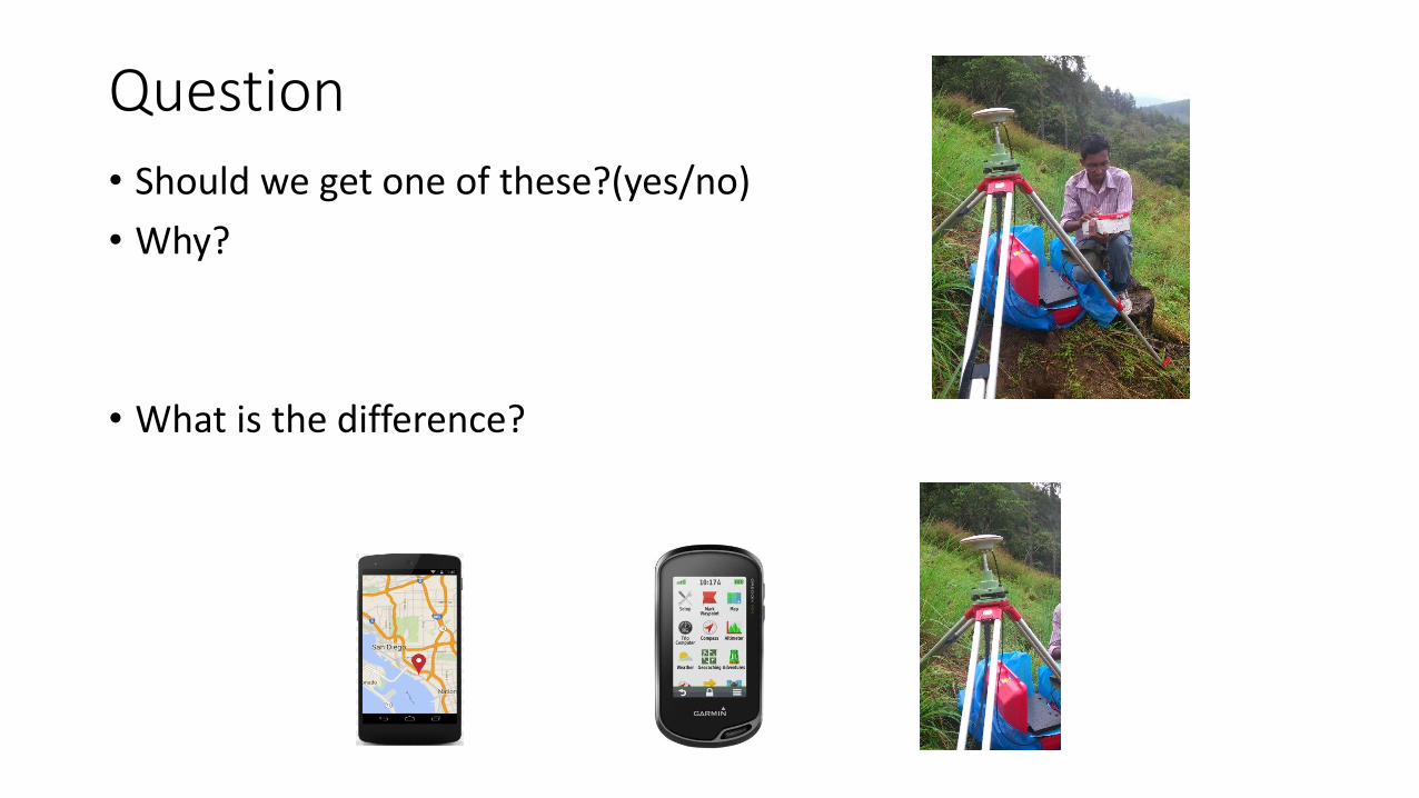
• Should we get one of these?(yes/no)
• Why?
• What is the difference?

What is GPS?
• The original intent of the Global Positioning System was to develop an all-weather, 24-hour, truly global navigation system to support the positioning requirements for the armed forces of the U.S. and its allies.
• First satellite launched in 1978
• The total investment by the U.S. military in the GPS system to date is well over $10 BILLION!
What is GPS?
• Although the primary goal is to provide positioning capabilities to the U.S. armed forces and its allies, GPS is freely available to all users.
• The number of civilian users is already far greater than the military users, and the applications are growing rapidly.
• The U.S. military however still operates several "levers" with which they control the performance of GPS.

The Launch of GPS• DOD sponsored project puts satellites
into orbit
• First Sat launched in 1978
• 24 Sats by mid 1990s
• 31 Currently operational in orbit, with more coming
• A fundamental change in how positioning is done
• What GPS has changed?

GPS Constellation
• All GPS satellites are placed in 6 MEO (Medium Earth Orbits) s.
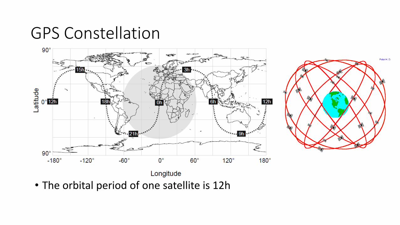
GPS Constellation
• The orbital period of one satellite is 12h
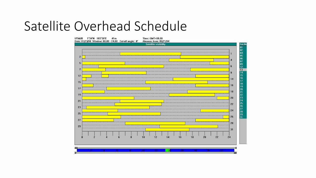
Satellite Overhead Schedule

Concept of GPS
Distance = Travel Time x Speed of Sound
Speed of sound= 340.29 m/s
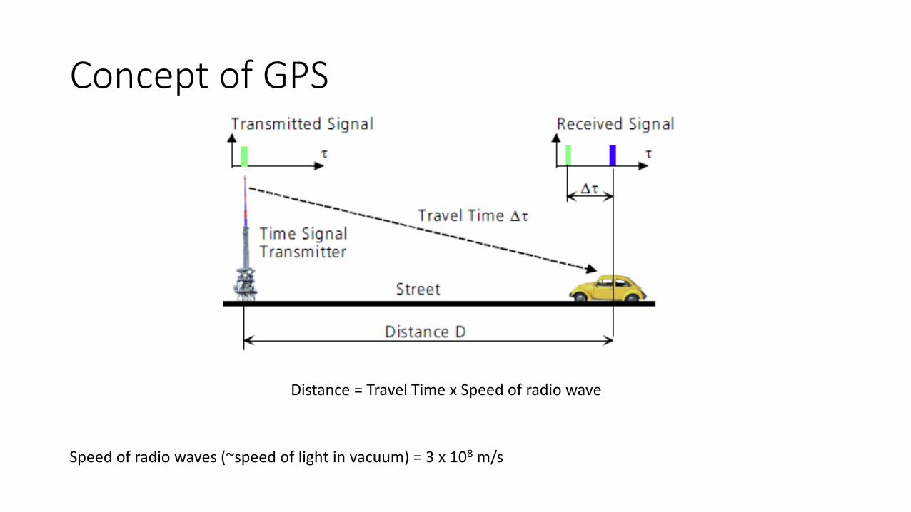
Concept of GPS
Distance = Travel Time x Speed of radio wave
Speed of radio waves (~speed of light in vacuum) = 3 x 10⁸ m/s


Concept of GPS
Repeat, repeat, repeat
Control Segment
Space Segment
User Segment
Monitor Stations
GroundAntennasMaster Station
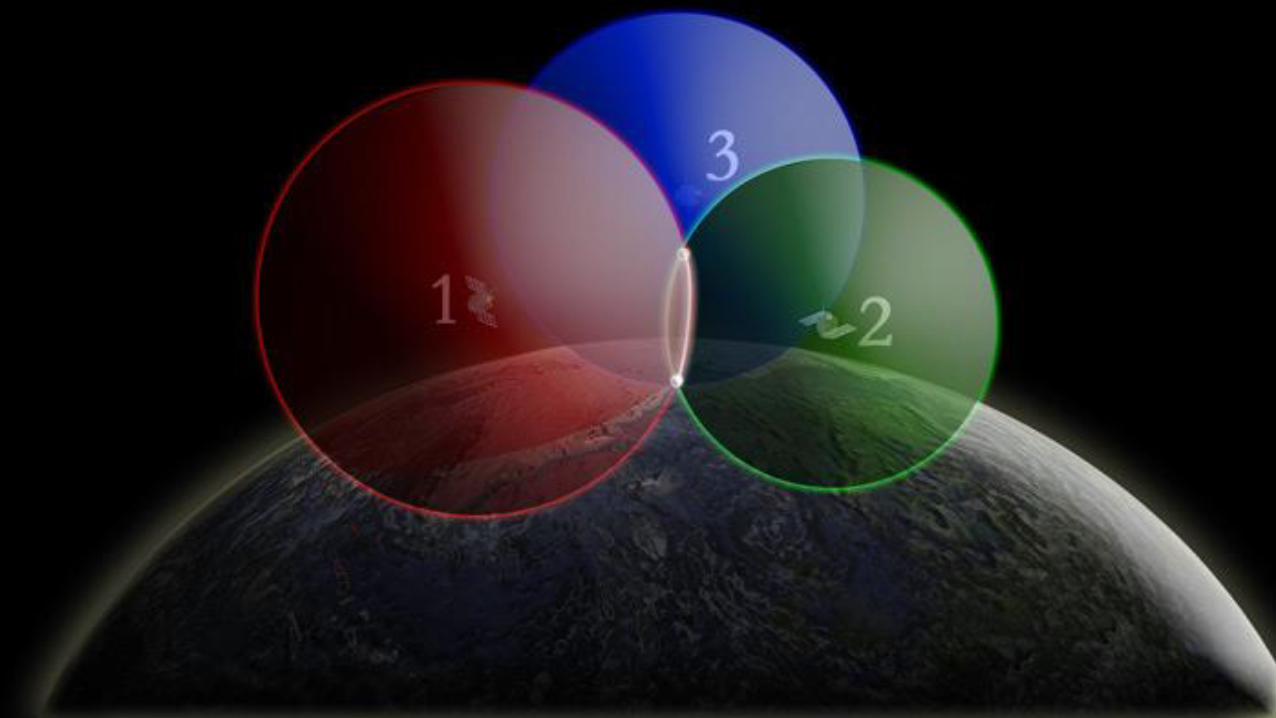
1. Find the satellites
2. Know where the satellites
are
3. Figure out D=CxT
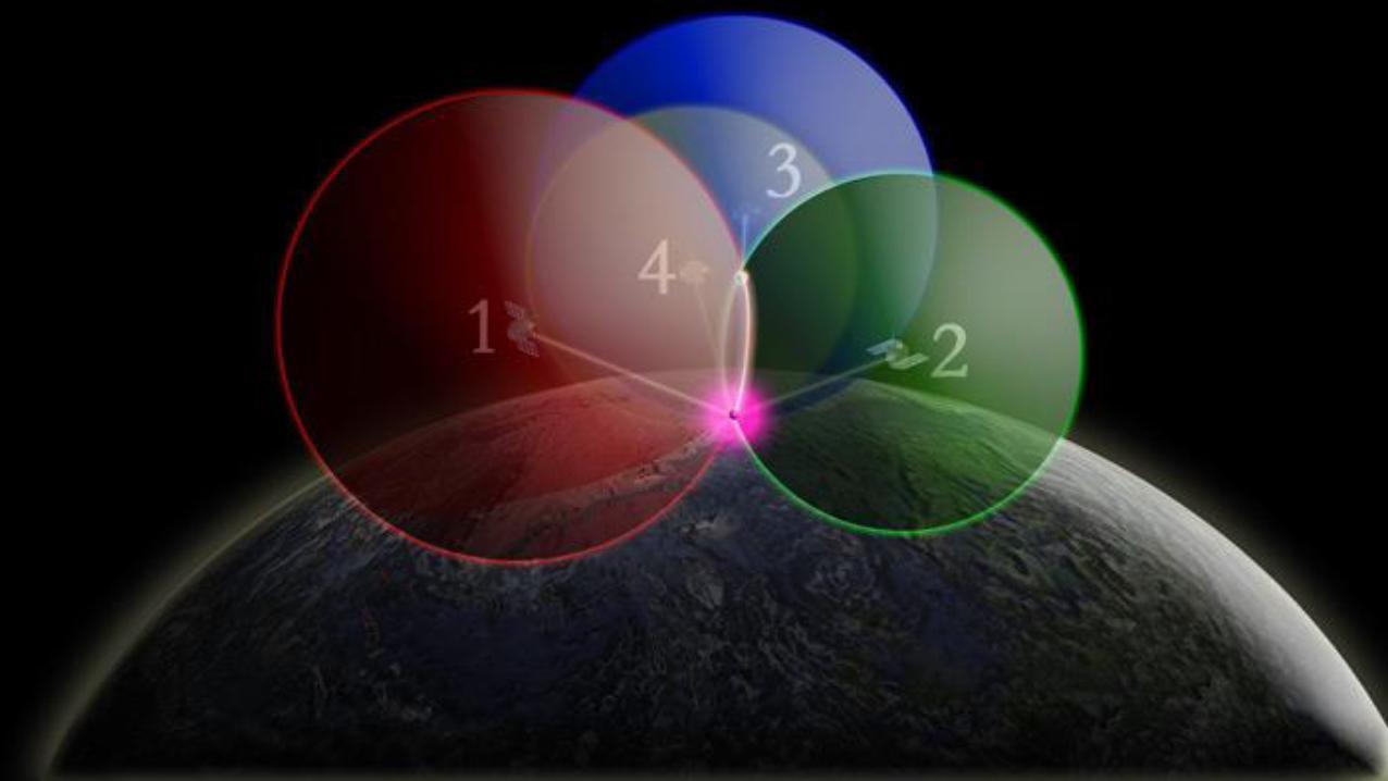
4. Trilaterate
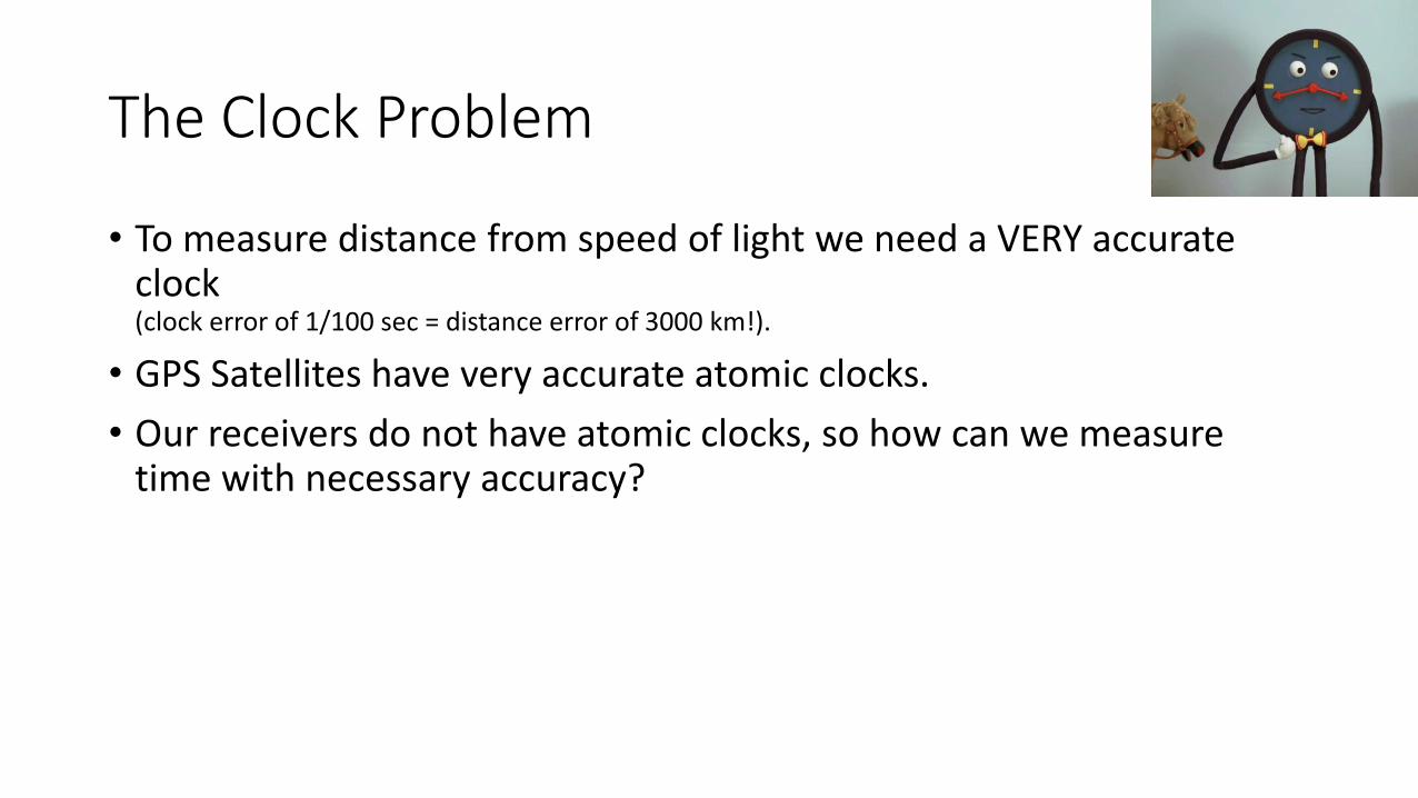
The Clock Problem
• To measure distance from speed of light we need a VERY accurate clock(clock error of 1/100 sec = distance error of 3000 km!).
• GPS Satellites have very accurate atomic clocks.
• Our receivers do not have atomic clocks, so how can we measure time with necessary accuracy?
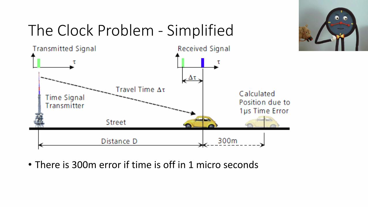
The Clock Problem - Simplified
• There is 300m error if time is off in 1 micro seconds

The Clock Problem - Solved
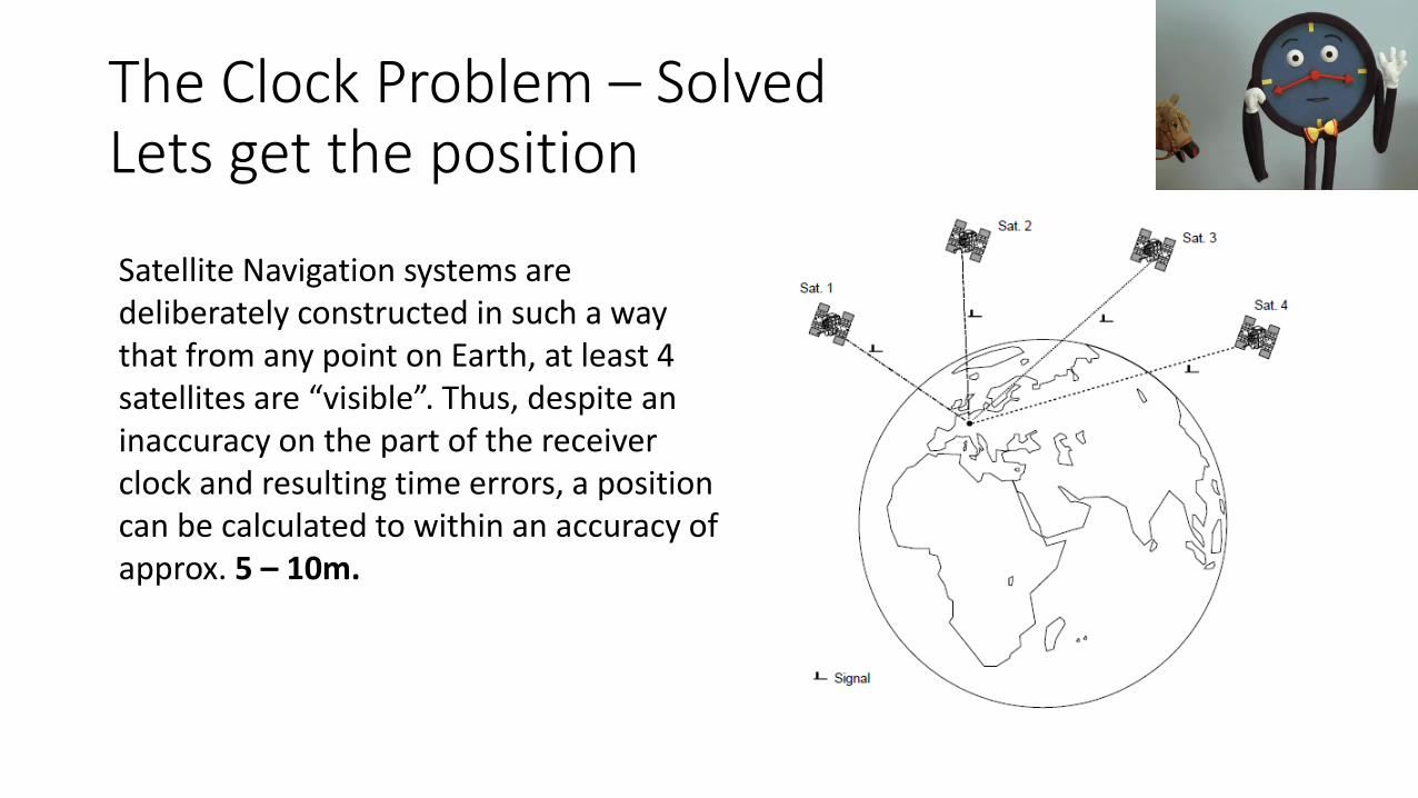
The Clock Problem – SolvedLets get the position
Satellite Navigation systems are deliberately constructed in such a way that from any point on Earth, at least 4 satellites are “visible”. Thus, despite an inaccuracy on the part of the receiver clock and resulting time errors, a position can be calculated to within an accuracy of approx. 5 – 10m.

Satellite Position
• Must know position of at least 4 satellites and range from same satellites to determine receiver location.
• How?
• Satellites must tell you (receiver) something
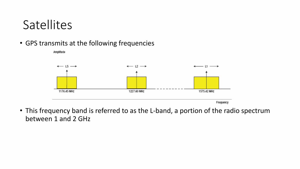
• GPS transmits at the following frequencies
• This frequency band is referred to as the L-band, a portion of the radio spectrum between 1 and 2 GHz
Satellites

Satellites
Psuedo-Random Code
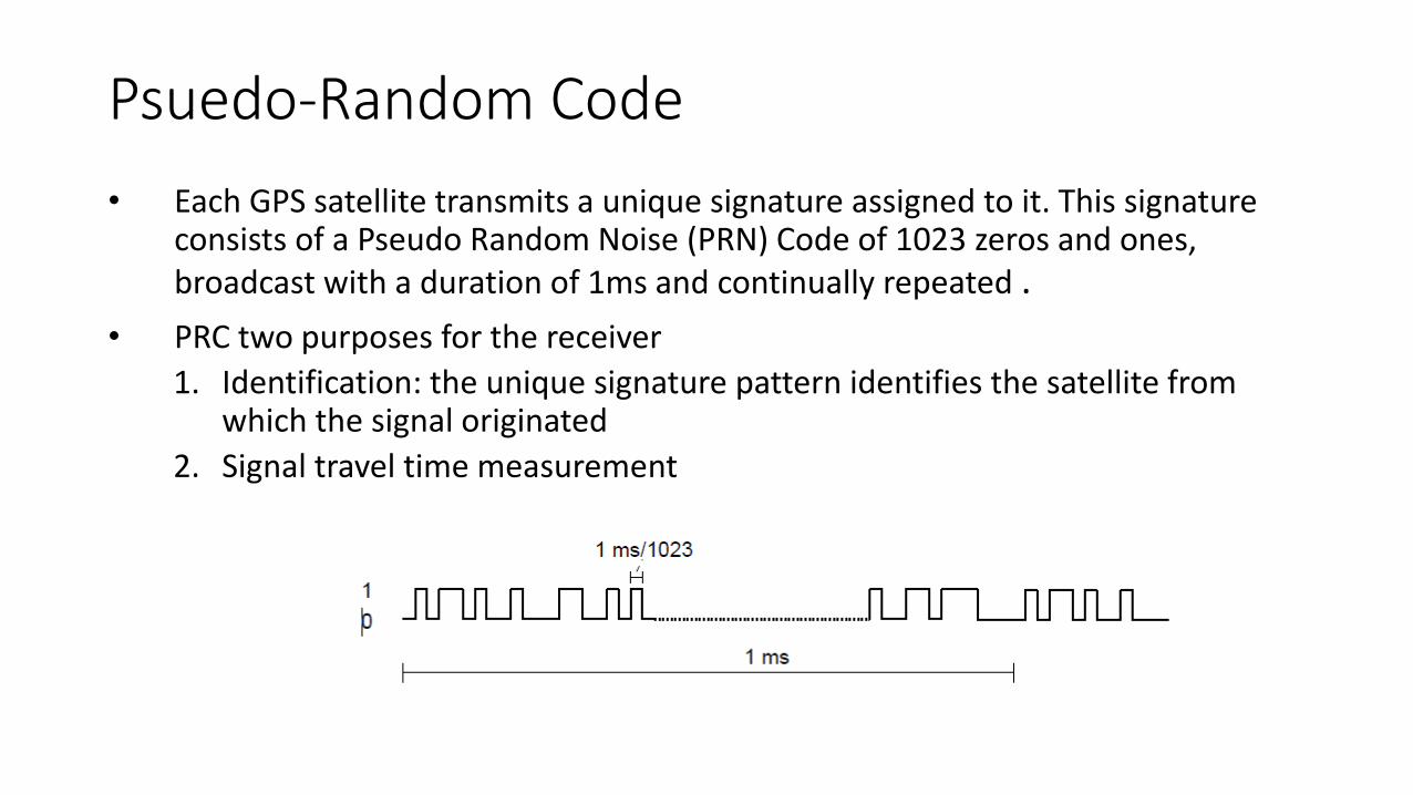
• Each GPS satellite transmits a unique signature assigned to it. This signature consists of a Pseudo Random Noise (PRN) Code of 1023 zeros and ones, broadcast with a duration of 1ms and continually repeated .
• PRC two purposes for the receiver
1. Identification: the unique signature pattern identifies the satellite from which the signal originated
2. Signal travel time measurement
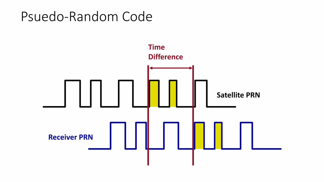
Receiver PRN
Satellite PRN
Time Difference
Psuedo-Random Code
PRC Synchronization
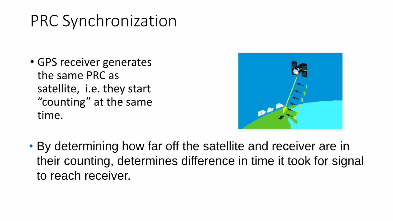
• GPS receiver generates the same PRC as satellite, i.e. they start “counting” at the same time.
• By determining how far off the satellite and receiver are in
their counting, determines difference in time it took for signal
to reach receiver.
PRC Synchronization
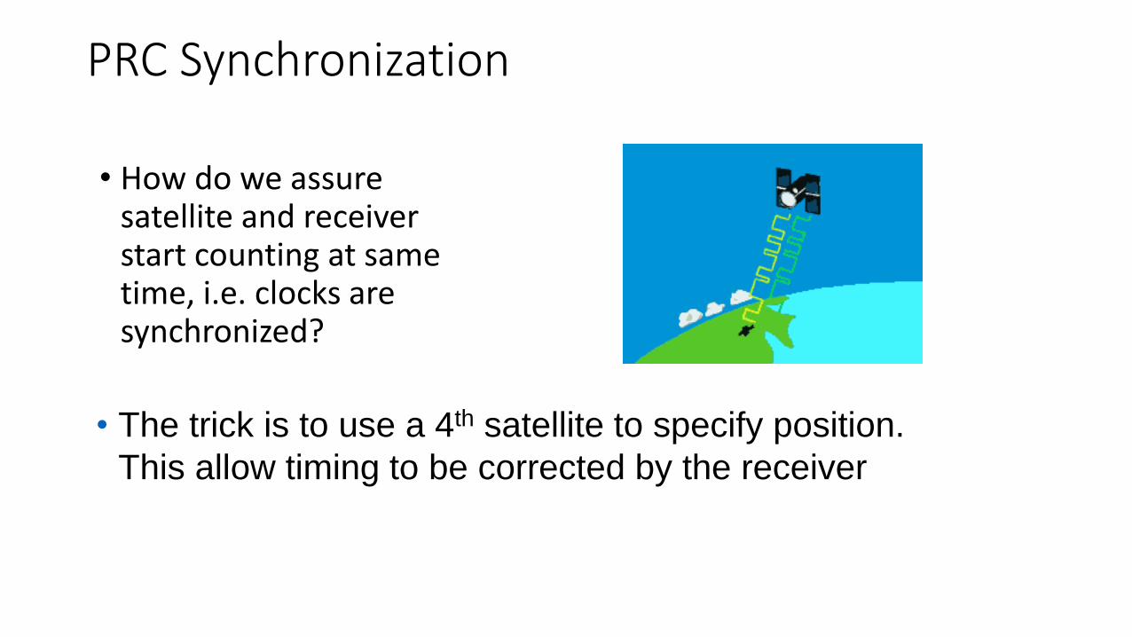
• How do we assure satellite and receiver start counting at same time, i.e. clocks are synchronized?
• The trick is to use a 4th satellite to specify position.
This allow timing to be corrected by the receiver
Navigation Message• L1 transmits a navigation message, the coarse acquisition (C/A) code which is
freely available to public. An encrypted precision (P) code, called the P(Y) code (restricted access), is transmitted on both L1 and L2.
• Navigation message includes the following information:• GPS date and time• Satellite status and health• Satellite ephemeris data, which allows the receiver to calculate the satellite’s
position.• Almanac, which contains information and status for all GPS satellites
• The P(Y) code is for military use, and provides better interference rejection than the C/A code.
• Newer GPS satellites now transmits L2 C/A code (L2C), providing a second publicly available code to civilian users.
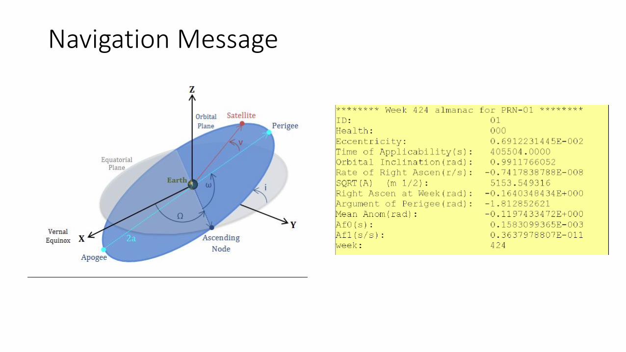
Navigation Message
Position Calculation
What is the satellite I am looking at PRC
What is the range from the satellite Synchronized PRC (How much the PRC has shifted)
Satellite position Navigation message, ephemeris data
With these information from 4 satellites, the position of the receiver can be solved !
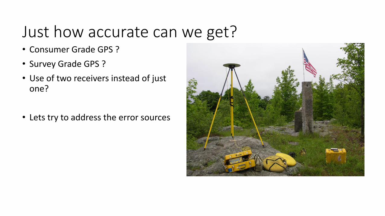
Just how accurate can we get?• Consumer Grade GPS ?
• Survey Grade GPS ?
• Use of two receivers instead of just one?
• Lets try to address the error sources
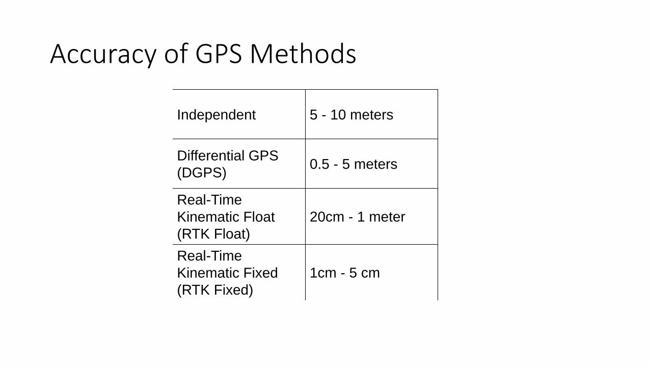
Accuracy of GPS Methods
Independent 5 - 10 meters
Differential GPS
(DGPS)0.5 - 5 meters
Real-Time
Kinematic Float
(RTK Float)
20cm - 1 meter
Real-Time
Kinematic Fixed
(RTK Fixed)
1cm - 5 cm

Good News for GPS Users
Between 1st and 3rd May 2000, the National Geodetic Survey/NOAA compared the accuracy of GPS determined navigation positions at its Continuous Reference Station with and without Selective Availability.•With SA turned on, 95% of solutions were within a radius of 45 meters
•With SA turned off, 95% of the estimated (horizontal) positions were within 6.3 meters.
"The decision to discontinue Selective Availability is the latest measure in an ongoing effort to make GPS more responsive to civil and commercial users worldwide…This increase in accuracy will allow new GPS applications to emerge and continue to enhance the lives of people around the world.“
President Bill Clinton, May 1, 2000

Improvement of GPS after S/A turned off
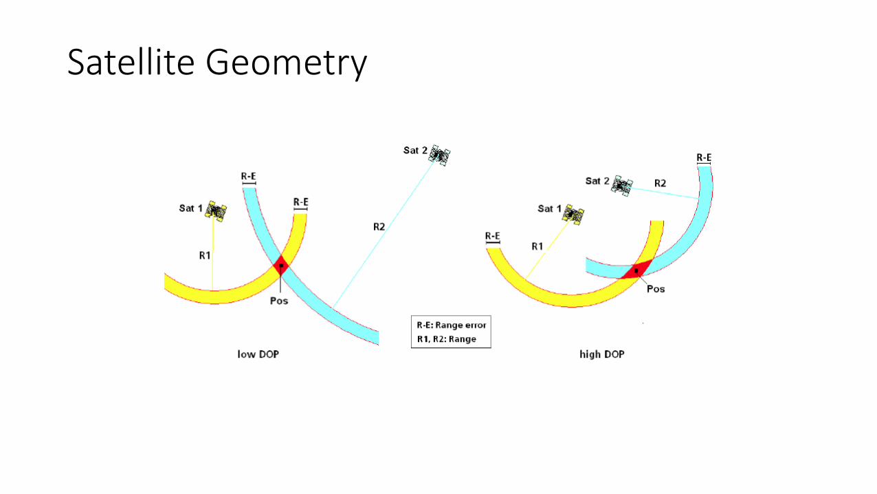
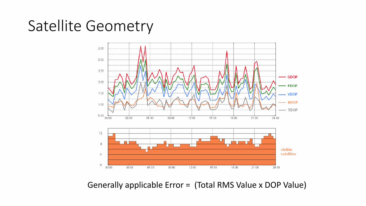
Satellite Geometry
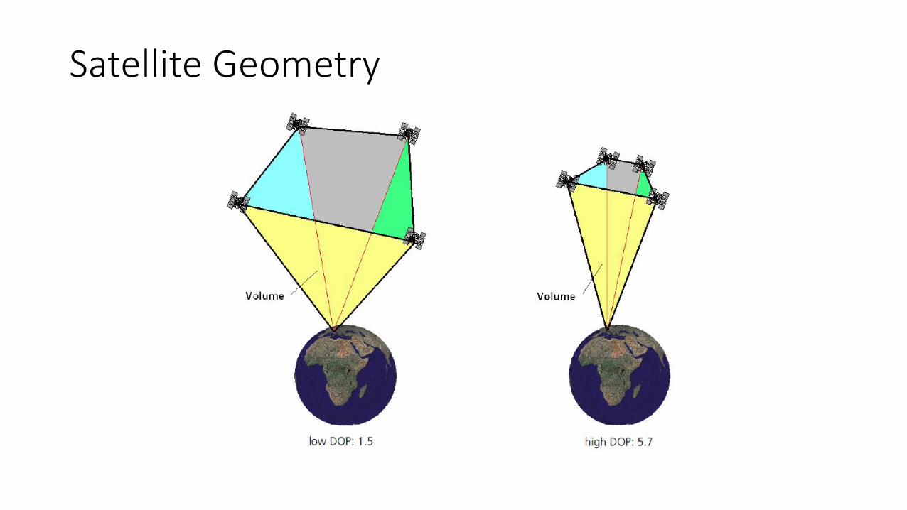
Satellite Geometry
Satellite Geometry
Generally applicable Error = (Total RMS Value x DOP Value)
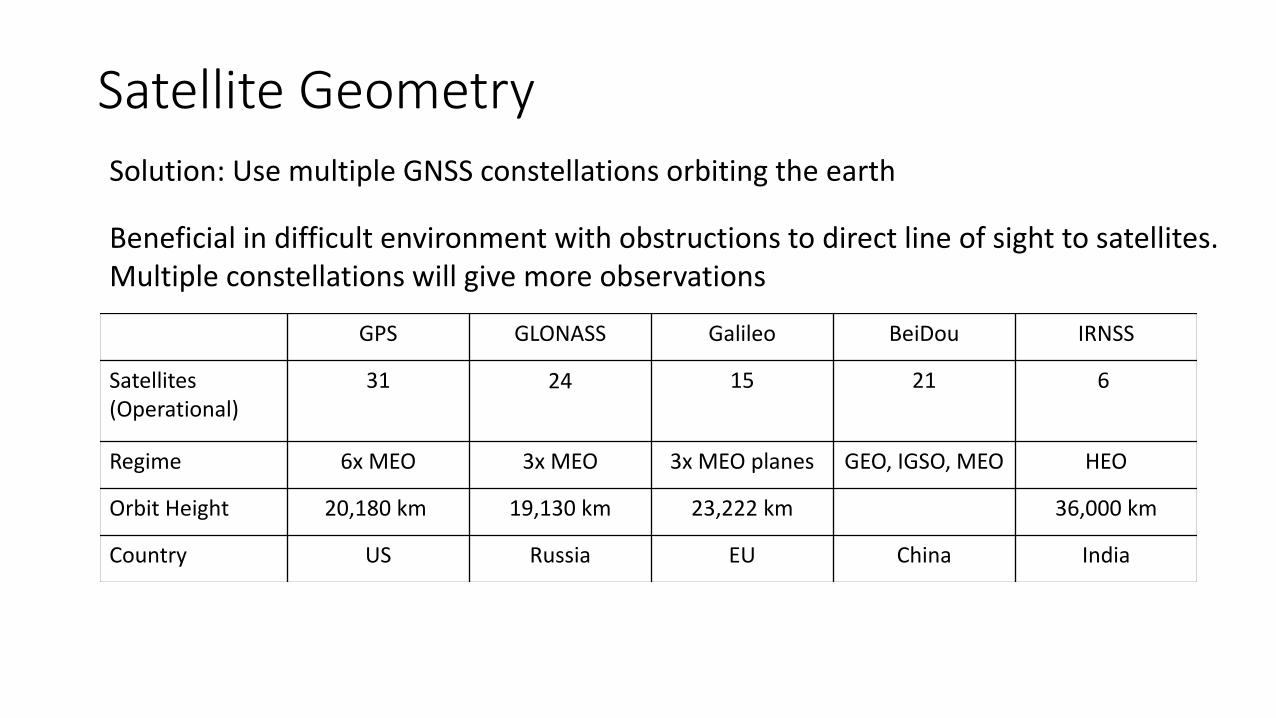
Satellite GeometrySolution: Use multiple GNSS constellations orbiting the earth
Beneficial in difficult environment with obstructions to direct line of sight to satellites. Multiple constellations will give more observations
GPS GLONASS Galileo BeiDou IRNSS
Satellites(Operational)
31 24 15 21 6
Regime 6x MEO 3x MEO 3x MEO planes GEO, IGSO, MEO HEO
Orbit Height 20,180 km 19,130 km 23,222 km 36,000 km
Country US Russia EU China India
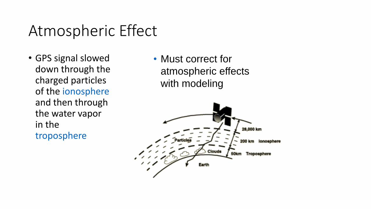
Atmospheric Effect
• GPS signal slowed down through the charged particles of the ionosphereand then through the water vapor in the troposphere
• Must correct for
atmospheric effects
with modeling

Propagation• To determine accurate positions, we need to know the range to the satellite. This
is the direct path distance from the satellite to the user equipment
• The signal will “bend” when traveling through the earth’s atmosphere
• The ionosphere contributes to most of the atmospheric error. It resides at 70 to 1000 km above the earth’s surface.
• Free electrons resides in the ionosphere, influencing electromagnetic wave propagation
• This “bending” increases the amount of time the signal takes to travel from the satellite to the receiver
• The computed range will contain this propagation time error, or atmospheric error
• Since the computed range contains errors and is not exactly equal to the actual range, we refer to it as a “pseudorange”
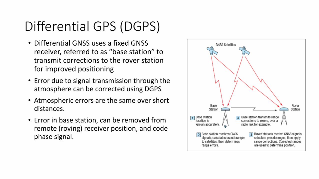
Differential GPS (DGPS)• Differential GNSS uses a fixed GNSS
receiver, referred to as “base station” to transmit corrections to the rover station for improved positioning
• Error due to signal transmission through the atmosphere can be corrected using DGPS
• Atmospheric errors are the same over short distances.
• Error in base station, can be removed from remote (roving) receiver position, and code phase signal.
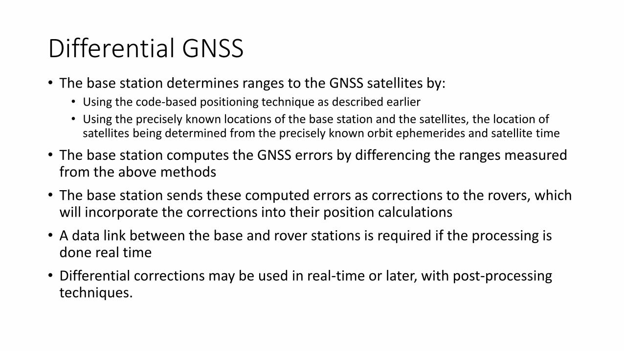
• The base station determines ranges to the GNSS satellites by:• Using the code-based positioning technique as described earlier
• Using the precisely known locations of the base station and the satellites, the location of satellites being determined from the precisely known orbit ephemerides and satellite time
• The base station computes the GNSS errors by differencing the ranges measured from the above methods
• The base station sends these computed errors as corrections to the rovers, which will incorporate the corrections into their position calculations
• A data link between the base and rover stations is required if the processing is done real time
• Differential corrections may be used in real-time or later, with post-processing techniques.
Differential GNSS
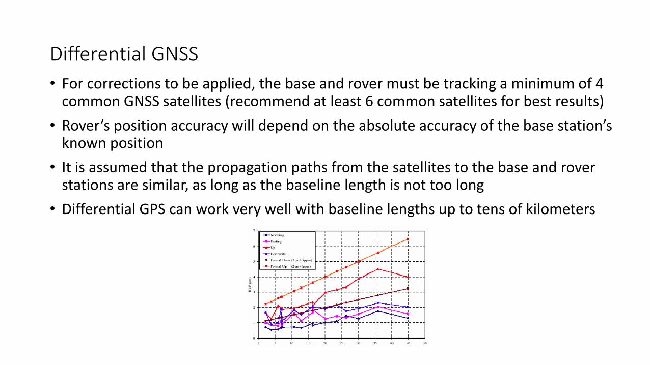
• For corrections to be applied, the base and rover must be tracking a minimum of 4 common GNSS satellites (recommend at least 6 common satellites for best results)
• Rover’s position accuracy will depend on the absolute accuracy of the base station’s known position
• It is assumed that the propagation paths from the satellites to the base and rover stations are similar, as long as the baseline length is not too long
• Differential GPS can work very well with baseline lengths up to tens of kilometers
Differential GNSS

Where to Get Differential Corrections• From freely available services:
• www.igs.org/network
• https://cddis.nasa.gov/Data_and_Derived_Products/GNSS/GNSS_data_and_product_archive.html
• Establish your own base station• For Sri Lanka:
http://www.survey.gov.lk/surveyweb/Home%20English/Geodetic%20Services.php

Code vs. Carrier Phase
• Satellites generate Code Phase and Carrier Phase signals.
• Code phase is used by hand-held GPS
• Carrier phase used by surveying instruments, navigational systems

RTK (Differential Carrier GPS)
• RTK is based on using many (~5 satellites) to resolve timing.
• Produces very accurate measurements because using carrier phase.
• Requires advance tracking of satellites, and better signal resolution (bigger antennae and more power)
Eliminate ionospheric effect in single positioning
• Ionospheric delay are frequency dependent. It can be virtually eliminated by calculating the range using both L1 and L2
• The troposphere, the lowest layer of the Earth’s atmosphere, contributes to delays due to local temperature, pressure and relative humidity
• Tropospheric delay cannot be eliminated the way ionospheric delay can be
• It is possible to model the tropospheric delay then predict and compensate for much of the error

Modernization of GPS
Multi-Path
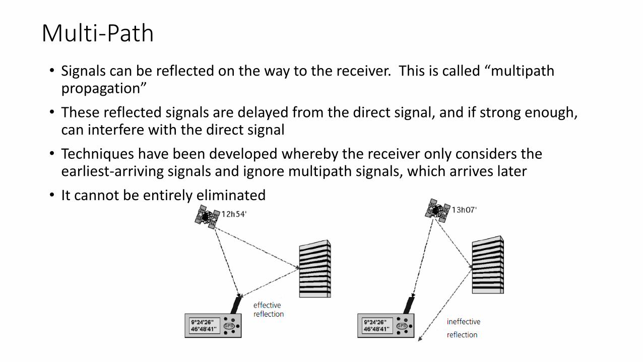
• Signals can be reflected on the way to the receiver. This is called “multipath propagation”
• These reflected signals are delayed from the direct signal, and if strong enough, can interfere with the direct signal
• Techniques have been developed whereby the receiver only considers the earliest-arriving signals and ignore multipath signals, which arrives later
• It cannot be entirely eliminated
Multi-Path
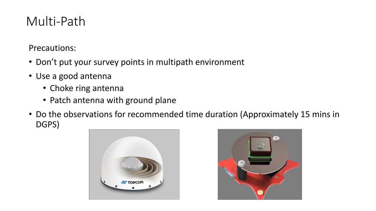
Precautions:
• Don’t put your survey points in multipath environment
• Use a good antenna
• Choke ring antenna
• Patch antenna with ground plane
• Do the observations for recommended time duration (Approximately 15 mins in DGPS)
Summary• GNSS satellites know their time and orbit ephemerides very accurately
• Timing accuracy is very important. The time it takes a GNSS signal to travel from satellites to receiver is used to determine distances (range) to satellites
• 1 microsecond = 300m, 1 nanosecond = 30 cm.
• Small deviations in time can result in large position errors
• All of the satellites use onboard atomic clocks to maintain synchronized signals, which are transmitted over the same frequency (for GPS L1 - 1575.42 MHz).
• Receivers need at least 4 satellites to obtain a position. If more are available, these additional observations can be used to improve the position solution
• GNSS signals are modulated by a unique pseudorandom digital sequence, or code. Each satellite uses a different pseudorandom code
• Receivers know the pseudorandom code for each satellite. This allows receivers to correlate (synchronize) with the GNSS signal to a particular satellite
• Through code correlation, the receiver is able to recover the signal and the information they contain
GNSS receivers we can use for GCP establishment
• Recall – We need marker accuracy at least 1/3 of pixel resolution in order to establish accurate ground control
• Which means we need cm level accuracy in most scenarios
• GNSS solution: RTK
• Receiver requirements: • RTK capability (ability to measure both carrier phase and pseudo range)
• Build quality
Survey grade solutions
Will cost around 10K - 20K USD
Trimble
• https://geospatial.trimble.com/products-and-solutions/gnss-systems
JAVAD
• https://www.javad.com/jgnss/products/receivers/triumph-ls.html

Other Solutions
Piksi Multi
https://www.swiftnav.com/

Other Solutions
• NovAtel OEM7700™• https://www.novatel.com/products/gnss-
receivers/oem-receiver-boards/oem7-receivers/oem7700/

Low Cost Solutions
Ublox NEO-M8P
Ublox high precision GNSS receiver
https://www.u-blox.com/en/product/neo-m8p-series
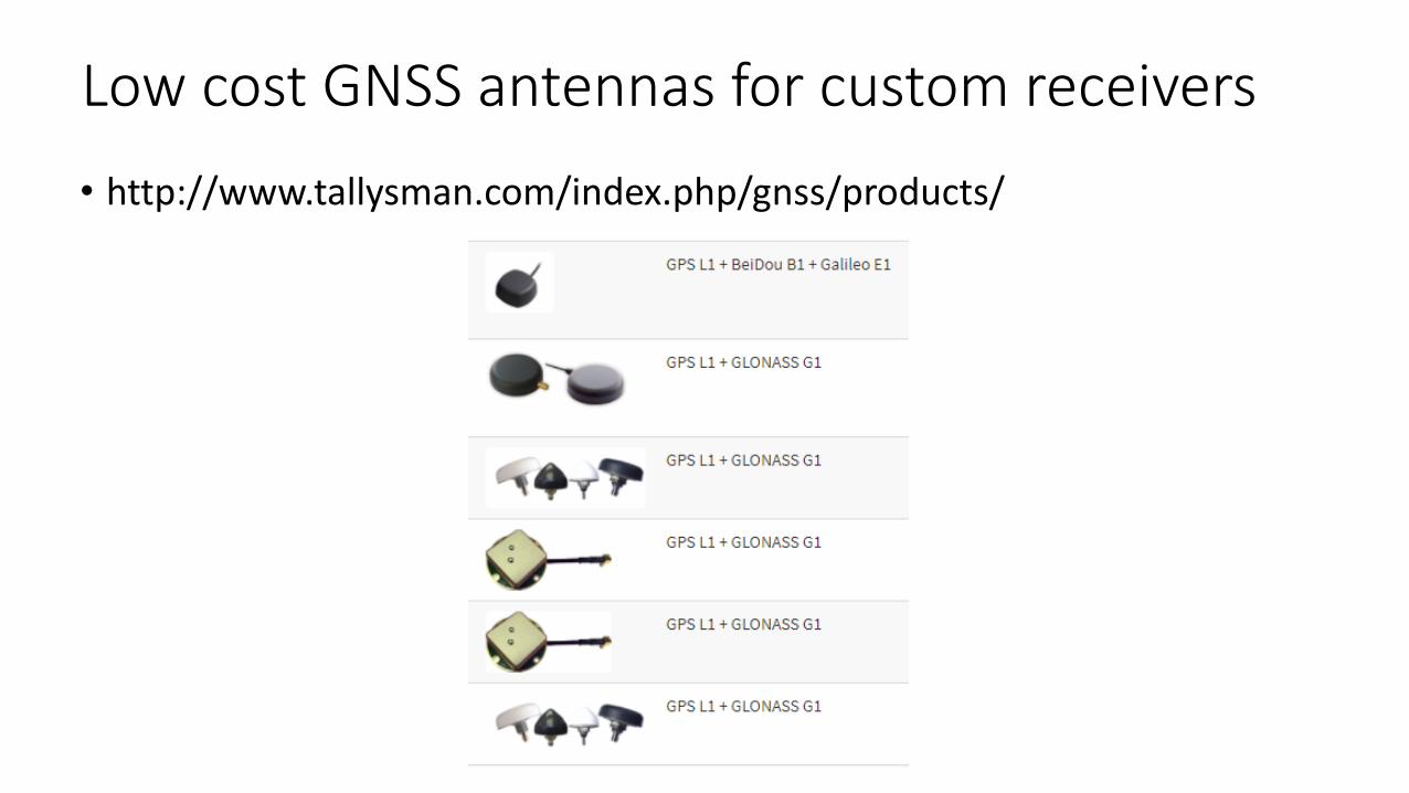
Low cost GNSS antennas for custom receivers
• http://www.tallysman.com/index.php/gnss/products/
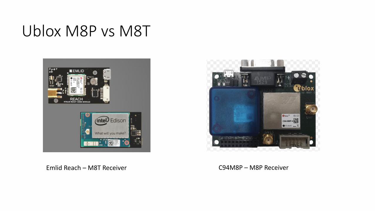
Ublox M8P vs M8T
Emlid Reach – M8T Receiver C94M8P – M8P Receiver
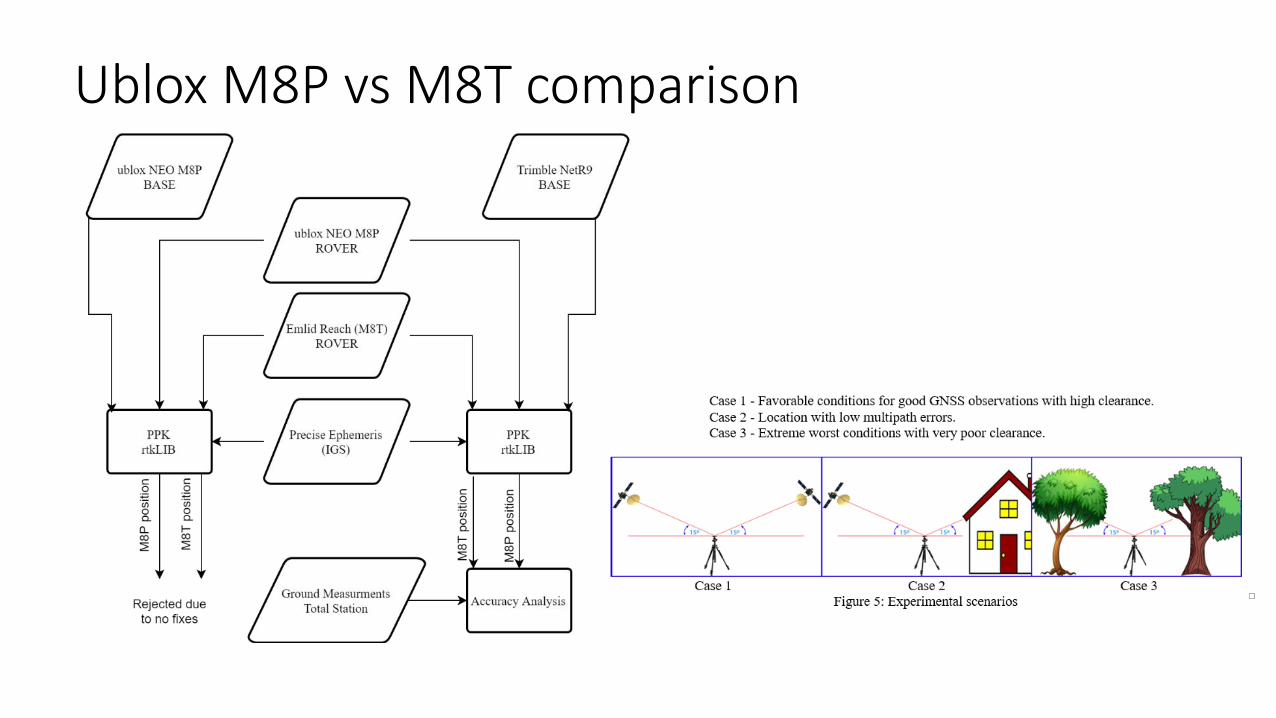
Ublox M8P vs M8T comparison

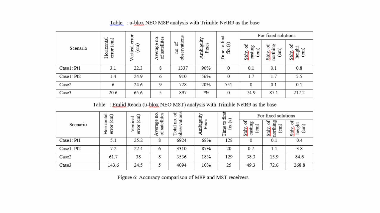
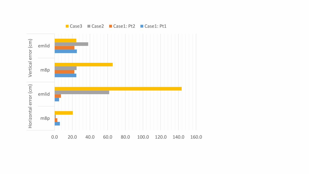
0.0 20.0 40.0 60.0 80.0 100.0 120.0 140.0 160.0
m8p
emlid
m8p
emlid
Ho
rizo
nta
l err
or
(cm
)V
erti
cal e
rro
r (c
m)
Case3 Case2 Case1: Pt2 Case1: Pt1

Reference
• GNSS compendium by ublox
• Introduction to the Global Positioning System (GPS) – Slides by Casey Brennan
• GLY 560: GIS for Earth Scientists
………………………………………………………….END……………………………………………………