ip-s3 hd1 - geo-matching.com · ip-s3 hd1. the lightweight, compact ip-s3 hd1 offers a high-density...
TRANSCRIPT

Compact, High-Density 3D Mobile Mapping System
• Integrated, turnkey solution
• Ultra-compact design
• Multiple lasers minimize scanning shades
• Unparalleled ease-of-use
• No user calibration required
• Full integration of cloud and images
IP-S3 HD1

The lightweight, compact IP-S3 HD1 offers a high-density point cloud with colorful image overlays for the ultimate in feature recognition and mapping detail. The IP-S3 HD1 bundles the longstanding experience of Topcon in mobile mapping systems in a small package. Accurate vehicle positions are obtained using three technologies: A dual frequency GNSS receiver establishes a geospatial position; an Inertial Measurement Unit (IMU) provides vehicle attitude; and connection to the vehicle or external wheel encoder obtains odometry information.
The IP-S3 HD1 system includes a single sensor head of LiDAR containing lasers oriented to cover roadside features up to 100 m away. The panoramic, high-resolution 30 megapixel camera is included to collect images in fixed distance intervals. All sensor inputs are recorded and time stamped to a common clock driven by the IP-S3 HD1.
Use the powerful, all-in-one Mobile Master Field and Office software suite to collect and process geo-referenced LiDAR and/or digital imaging data into colorful 3D representation which can be exported to third party software. Matching techniques and ground control functionality help optimize precision and absolute accuracy. Mobile Master software provides a simple interface for combining, viewing and working with your various sensor data collected from the IP-S3 HD1.
The IP-S3 HD1 quickly provides high-accuracy data and dynamic imaging for any mapping project. The easily mounted vehicle system can map data at normal travel speeds for roadway surface condition assessments and roadside feature inventories. Safety is increased by removing pedestrians from the travelled lanes. Other applications include pipelines, utilities, as-builts, construction progress monitoring and risk management.
IP-S3 HD1 Compact, High Density 3D Mobile Mapping System
High Definition Laser Scanner• Capture high-resolution, high-density 3D point clouds • Included software projects data into 3D global coordinates with accurate time stamps• Produce geo-referenced panoramas
Vehicle Wheel Encoder• Enhances accuracy and reliability • Detects rotation of the wheel • Only one wheel encoder required
Imaging Component• Panoramic 30 megapixel camera• Add-on additional imagery sensors for enhanced clarity
Positioning Component• Determine precise vehicle position and attitude • Integrated dual frequency GNSS receiver • Inertial Measurement Unit
IP-S3 HD1 Hardware Features• Small and lightweight system
• Simple mount and dismount from vehicle
• High-precision point cloud
IP-S3 HD1 Software Features• All-in-one processing software
• Advanced matching and ground control functionality
• Full featured accuracy reporting
• Extensive projections and geoids exports
• Segment point clouds to facilitate import into third party applications
IP-S3 HD1 InstallationThis turnkey solution is delivered fully calibrated and ready to deploy. No pre-data collection setup steps are necessary. Very easy to mount and unmount.

FIELD-TO-FINISH WORKFLOW
MAP
Drive vehicle through route Pull features from point cloud and
make measurements
MapMapping with the IP-S3 HD1 allows you to collect more data in less time. A complete dataset is collected while keeping field personnel safe inside a vehicle.
All inclusive Mobile Master Field software ensures successful data collection by importing pre-defined routes, checking sensor status while driving, displaying roads already covered on the map, and playing back datasets while in field.
ProcessEasily process your data with Mobile Master Office software. Get high-precision with automatic pass and intersection matching. Achieve high-accuracy with control point matching. Produce colorized scans with images and excellent data visualization and utilization. Generate accuracy reports and optimize data to suit downstream applications for any client requirements.
Export data to GIS or CAD
EXTRACT DELIVER
IP-S3 HD1 is a turn-key package including all hardware, software, training and support for a complete field-to-finish mapping solution.
PROCESS
Process, optimize data and export scans
ExtractMobile Master Office software easily moves the data to a point cloud extraction software of your choice such as Topcon ScanMaster, Orbit Asset Inventory software, Autodesk Recap, or Bentley PointTools. Point clouds and images from Mobile Master Office can be projected into any of an extensive list of coordinate systems minimizing required workflow steps.
DeliverExport extracted information into GIS and CAD deliverables, enabling the use in down-stream workflows.
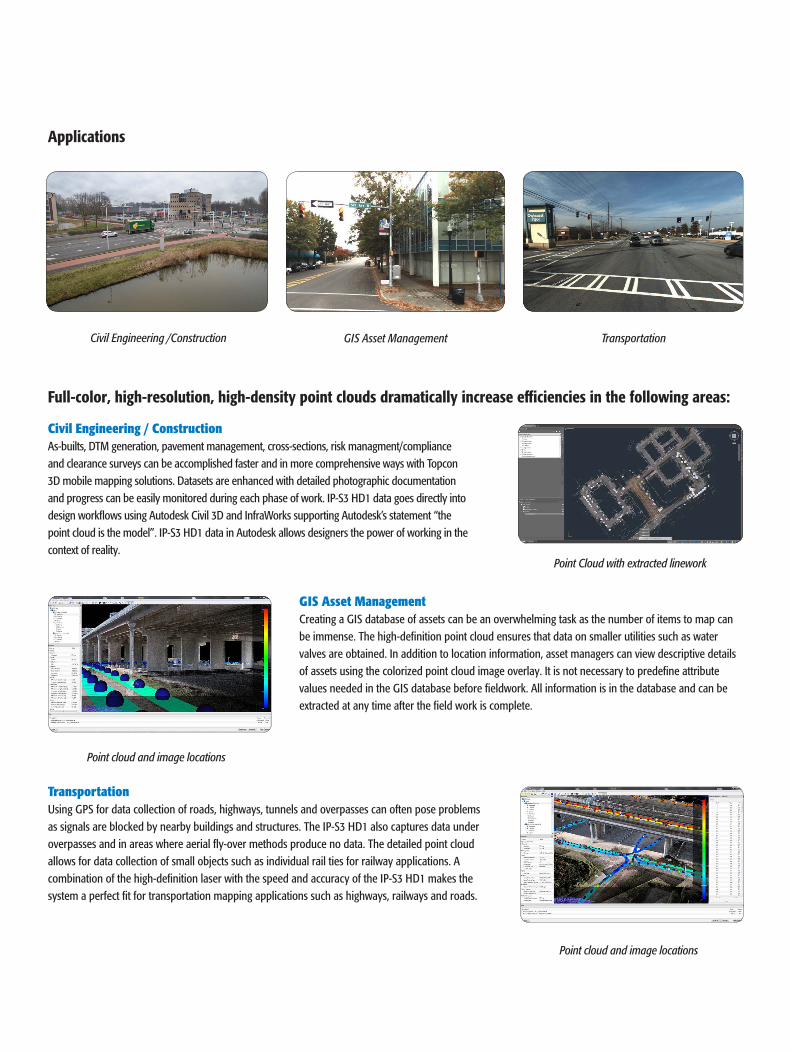
Civil Engineering /Construction GIS Asset Management Transportation
Full-color, high-resolution, high-density point clouds dramatically increase efficiencies in the following areas:
Civil Engineering / ConstructionAs-builts, DTM generation, pavement management, cross-sections, risk managment/compliance and clearance surveys can be accomplished faster and in more comprehensive ways with Topcon 3D mobile mapping solutions. Datasets are enhanced with detailed photographic documentation and progress can be easily monitored during each phase of work. IP-S3 HD1 data goes directly into design workflows using Autodesk Civil 3D and InfraWorks supporting Autodesk’s statement “the point cloud is the model”. IP-S3 HD1 data in Autodesk allows designers the power of working in the context of reality.
GIS Asset ManagementCreating a GIS database of assets can be an overwhelming task as the number of items to map can be immense. The high-definition point cloud ensures that data on smaller utilities such as water valves are obtained. In addition to location information, asset managers can view descriptive details of assets using the colorized point cloud image overlay. It is not necessary to predefine attribute values needed in the GIS database before fieldwork. All information is in the database and can be extracted at any time after the field work is complete.
TransportationUsing GPS for data collection of roads, highways, tunnels and overpasses can often pose problems as signals are blocked by nearby buildings and structures. The IP-S3 HD1 also captures data under overpasses and in areas where aerial fly-over methods produce no data. The detailed point cloud allows for data collection of small objects such as individual rail ties for railway applications. A combination of the high-definition laser with the speed and accuracy of the IP-S3 HD1 makes the system a perfect fit for transportation mapping applications such as highways, railways and roads.
Point Cloud with extracted linework
Point cloud and image locations
Point cloud and image locations
Applications

PRIMARY FEATURES
Data Storage and Power Management
360o Digital Camera
Laser Scanner
GNSS Antenna
Odometry Data from External Wheel Encoders
IP-S3 HD1
Logging Display
32 lasers,calibrated by Topcon
Multiple lasers provide optimum coverage
High Definition Laser ScannerThe IP-S3 HD1 high-definition laser scanner collects 700,000 points-per-second at a range of 100 m. It has a 360° horizontal and a 30° vertical field of view to increase data collection coverage and minimize laser shadowing. With those features, the system remains lightweight making it the lightest and most compact high-precision system available today.
Your local Authorized Topcon dealer is:
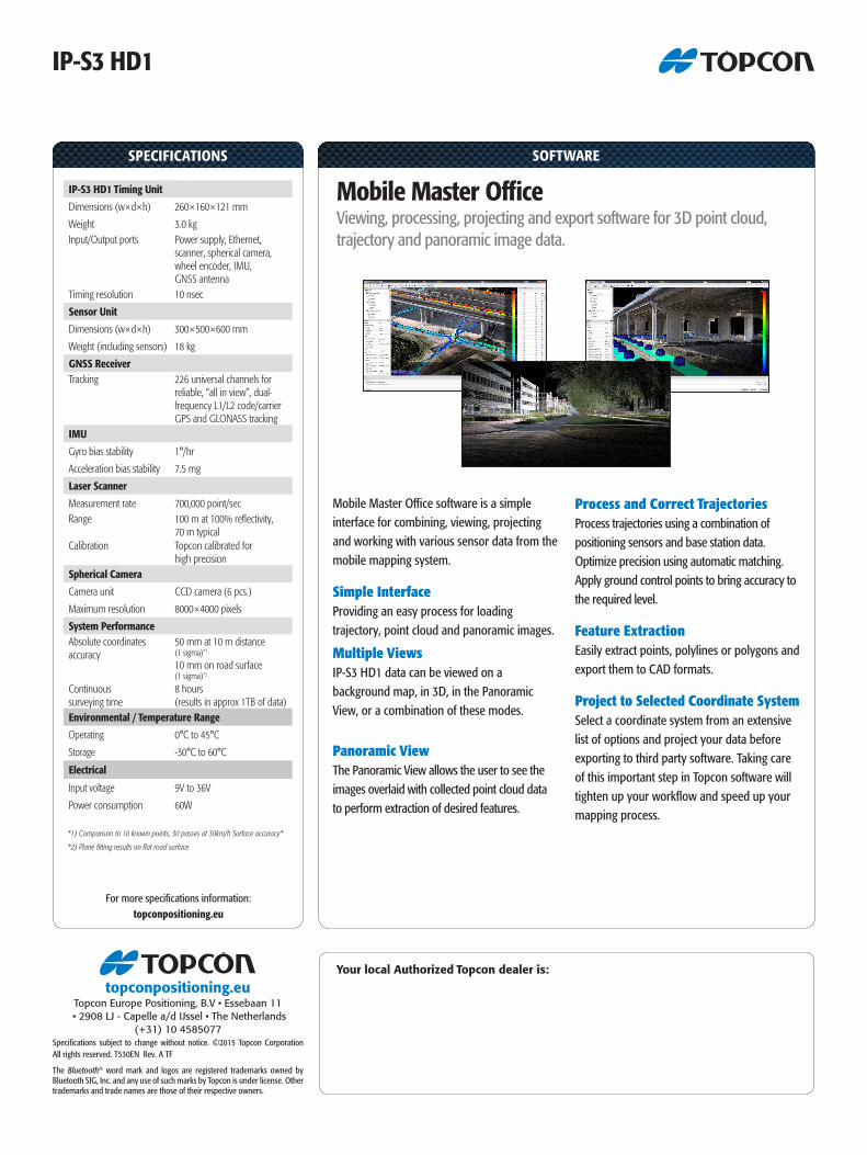
SPECIFICATIONS
For more specifications information:topconpositioning.eu
SOFTWARE
IP-S3 HD1
IP-S3 HD1 Timing Unit Dimensions (w×d×h) 260×160×121 mm
Weight 3.0 kg Input/Output ports Power supply, Ethernet,
scanner, spherical camera,wheel encoder, IMU, GNSS antenna
Timing resolution 10 nsec
Sensor Unit Dimensions (w×d×h) 300×500×600 mm
Weight (including sensors) 18 kg
GNSS Receiver Tracking 226 universal channels for
reliable, “all in view”, dual-frequency L1/L2 code/carrier GPS and GLONASS tracking
IMU Gyro bias stability 1°/hr
Acceleration bias stability 7.5 mg
Laser Scanner Measurement rate 700,000 point/sec Range 100 m at 100% reflectivity,
70 m typical Calibration Topcon calibrated for
high precision Spherical Camera Camera unit CCD camera (6 pcs.)
Maximum resolution 8000×4000 pixels
System Performance Absolute coordinates accuracy
50 mm at 10 m distance (1 sigma)*1
10 mm on road surface (1 sigma)*2
Continuous surveying time
8 hours (results in approx 1TB of data)
Environmental / Temperature Range Operating 0°C to 45°C
Storage -30°C to 60°C
Electrical
Input voltage 9V to 36V
Power consumption 60W
*1) Comparison to 10 known points, 30 passes at 30km/h Surface accuracy*
*2) Plane fitting results on flat road surface
Mobile Master Office software is a simple interface for combining, viewing, projecting and working with various sensor data from the mobile mapping system.
Simple InterfaceProviding an easy process for loading trajectory, point cloud and panoramic images.
Multiple ViewsIP-S3 HD1 data can be viewed on a background map, in 3D, in the Panoramic View, or a combination of these modes.
Panoramic ViewThe Panoramic View allows the user to see the images overlaid with collected point cloud data to perform extraction of desired features.
Process and Correct TrajectoriesProcess trajectories using a combination of positioning sensors and base station data.Optimize precision using automatic matching. Apply ground control points to bring accuracy to the required level.
Feature ExtractionEasily extract points, polylines or polygons and export them to CAD formats.
Project to Selected Coordinate SystemSelect a coordinate system from an extensive list of options and project your data before exporting to third party software. Taking care of this important step in Topcon software will tighten up your workflow and speed up your mapping process.
Mobile Master Office Viewing, processing, projecting and export software for 3D point cloud, trajectory and panoramic image data.
Specifications subject to change without notice. ©2015 Topcon Corporation All rights reserved. T530EN Rev. A TF
The Bluetooth® word mark and logos are registered trademarks owned by Bluetooth SIG, Inc. and any use of such marks by Topcon is under license. Other trademarks and trade names are those of their respective owners.
topconpositioning.euTopcon Europe Positioning, B.V • Essebaan 11
• 2908 LJ - Capelle a/d IJssel • The Netherlands(+31) 10 4585077