ipenz engineering heritage record report bend report 2013.pdf · ipenz engineering heritage record...
TRANSCRIPT
1
IPENZ Engineering Heritage Record Report
Horseshoe Bend Suspension Bridge Written by: Simon Daisley Date: 4 February 2013
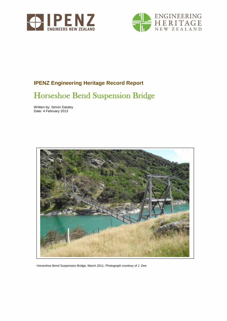
Horseshoe Bend Suspension Bridge, March 2011. Photograph courtesy of J. Dee
IPENZ Engineering Heritage Report 2
Horseshoe Bend Suspension Bridge
Contents
A. General information ........................................................................................................... 3
B. Description ......................................................................................................................... 5
Summary ................................................................................................................................. 5
Historical narrative .................................................................................................................... 6
Social narrative ........................................................................................................................ 6
Physical narrative ................................................................................................................... 11
C. Assessment of significance ............................................................................................. 15
D. Supporting information ...................................................................................................... 16
Bibliography ........................................................................................................................... 16
IPENZ Engineering Heritage Report 3
Horseshoe Bend Suspension Bridge
A. General information
Name: Horseshoe Bend Suspension Bridge
Alternative names: Horseshoe Bend Bridge
Location: 10 km south-east of Millers Flat, Otago
Geo-reference: Latitude -45.722, Longitude 169.471
Legal description: Part river bed
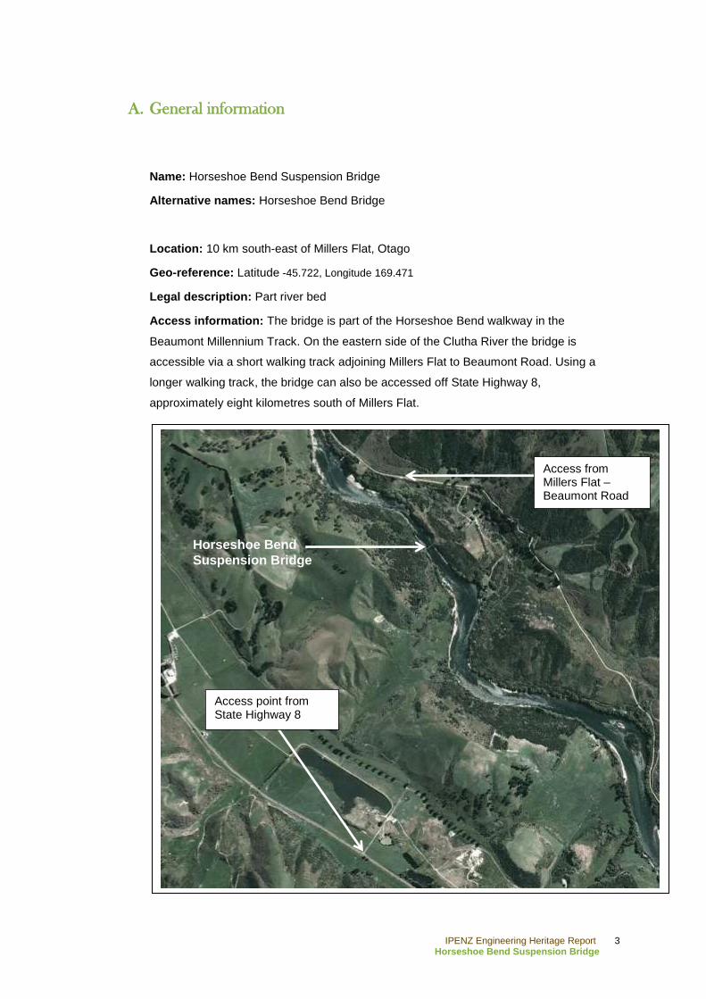
Access information: The bridge is part of the Horseshoe Bend walkway in the
Beaumont Millennium Track. On the eastern side of the Clutha River the bridge is
accessible via a short walking track adjoining Millers Flat to Beaumont Road. Using a
longer walking track, the bridge can also be accessed off State Highway 8,
approximately eight kilometres south of Millers Flat.
Horseshoe Bend Suspension Bridge
Access from Millers Flat – Beaumont Road
Horseshoe Bend
Suspension Bridge
Access point from State Highway 8
IPENZ Engineering Heritage Report 4
Horseshoe Bend Suspension Bridge
City/District Council: Central Otago District Council
IPENZ category: Engineering Work
IPENZ subcategory: Infrastructure – Bridge
IPENZ Engineering Heritage number: 2273
Date registered: 2007
Other IPENZ recognition: N/A
Other heritage recognition: N/A
IPENZ Engineering Heritage Report 5
Horseshoe Bend Suspension Bridge
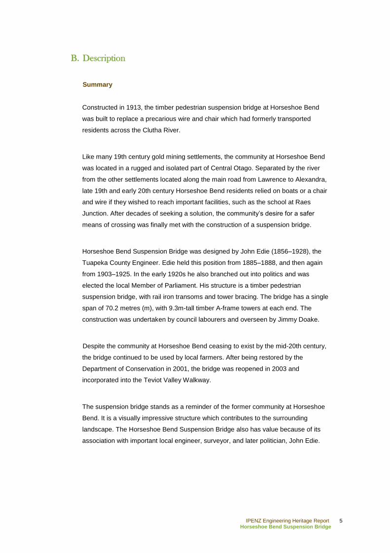
B. Description
Summary
Constructed in 1913, the timber pedestrian suspension bridge at Horseshoe Bend
was built to replace a precarious wire and chair which had formerly transported
residents across the Clutha River.
Like many 19th century gold mining settlements, the community at Horseshoe Bend
was located in a rugged and isolated part of Central Otago. Separated by the river
from the other settlements located along the main road from Lawrence to Alexandra,
late 19th and early 20th century Horseshoe Bend residents relied on boats or a chair
and wire if they wished to reach important facilities, such as the school at Raes
Junction. After decades of seeking a solution, the community‟s desire for a safer
means of crossing was finally met with the construction of a suspension bridge.
Horseshoe Bend Suspension Bridge was designed by John Edie (1856–1928), the
Tuapeka County Engineer. Edie held this position from 1885–1888, and then again
from 1903–1925. In the early 1920s he also branched out into politics and was
elected the local Member of Parliament. His structure is a timber pedestrian
suspension bridge, with rail iron transoms and tower bracing. The bridge has a single
span of 70.2 metres (m), with 9.3m-tall timber A-frame towers at each end. The
construction was undertaken by council labourers and overseen by Jimmy Doake.
Despite the community at Horseshoe Bend ceasing to exist by the mid-20th century,
the bridge continued to be used by local farmers. After being restored by the
Department of Conservation in 2001, the bridge was reopened in 2003 and
incorporated into the Teviot Valley Walkway.
The suspension bridge stands as a reminder of the former community at Horseshoe
Bend. It is a visually impressive structure which contributes to the surrounding
landscape. The Horseshoe Bend Suspension Bridge also has value because of its
association with important local engineer, surveyor, and later politician, John Edie.
IPENZ Engineering Heritage Report 6
Horseshoe Bend Suspension Bridge
Historical narrative
From its headwaters in Lake Wanaka to its final destination at Molyneux Bay in the
Pacific Ocean, the Clutha River is the longest river in the South Island.1 Its total water
catchment, the largest in New Zealand, covers an area of 21,022 square kilometres.
This causes the river to have the largest volume of water in New Zealand.2 The
geography of the river, as it winds its way south across Central Otago, consists of
steep gorges and beaches. Over time these geographical features assisted in the
formation of natural deposits of gold.3
Although run holders had already settled parts of Central Otago, it was the discovery
of gold in 1861 by Gabriel Read, a Tasmanian prospector, which led to the
development of many settlements in Central Otago. The news of his discovery
resulted in a surge of prospectors descending on the region hoping to make their
fortunes in the creeks and riverbeds of Central Otago.4 In 1862 the goldfields at
Dunstan (now the township of Alexandra) were settled.5 In order to reach this new
settlement, prospectors setting out from Dunedin were forced to traverse a rough trail
known as the Dunstan Road.6
In that same year the settlement of Roxburgh was formed on the eastern banks of the
Clutha, at its junction with the Teviot River, after Andrew Young and James
Woodhouse discovered gold in the latter.7 Although both sides of the Clutha were
mined, the eastern bank returned better results. To the south of Roxburgh, at a point
in the river named Horseshoe Bend, further traces of gold were discovered in 1863.
The yield there was so successful that the settlement quickly swelled to a population
of 300 miners. Like many other mining settlements, the population was only
temporary and by 1865 most had moved on, reducing the number of inhabitants to
1 'Clutha River', from An Encyclopaedia of New Zealand, edited by A. H. McLintock, originally published in 1966. Te
Ara - the Encyclopedia of New Zealand, URL: http://www.TeAra.govt.nz/en/1966/clutha-river/1 (updated 23 April
2009)
2 „Clutha River,‟ Land and Water New Zealand, URL: http://landandwater.co.nz/councils-involved/otago-regional-
council/clutha-river/ (accessed 28 December, 2012); „The nature of New Zealand‟s water environment,‟ in State of
NZ‟s Environment, Ministry for the Environment, URL:
http://www.mfe.govt.nz/publications/ser/ser1997/html/chapter7.6.html (accessed 28 December 2012)
3 Gerald Cunningham, Illustrated History of Central Otago and the Queenstown Lakes District (Auckland: Reed,
2005), pp.117-118.
4 Cunningham, pp.43, 46
5 Malcolm McKinnon, 'Otago places – Manuherikia,' Te Ara - the Encyclopedia of New Zealand, URL:
http://www.TeAra.govt.nz/en/otago-places/15 (updated 26 November 2010)
6 Cunningham, p.67
7 Ibid., p.118
IPENZ Engineering Heritage Report 7
Horseshoe Bend Suspension Bridge
72.8 Gold continued to be mined in the area, however, by the turn of the century the
population at Horseshoe Bend had dwindled to 30.9
With the Dunstan Road being snowbound in winter a new route to the goldfields was
required.10
One of the alternatives was the Knobby Range Road. Connected to
Dunedin via the settlement of Lawrence, this route crossed the Beaumont River, a
tributary of the Clutha, and wound its way along the Clutha‟s east bank before
crossing the Teviot. From there it continued northwards to the Dunstan goldfields.
However, this route was also plagued by snow.11
By 1864 a ferry crossing the Clutha
had been established at Beaumont, which led to the creation of a new route along the
western bank of the river. The success of this new route led to Roxburgh transferring
its settlement to the western banks of the Clutha.12
With the western route now the
favoured means of reaching the Dunstan goldfields, the settlements on the eastern
bank became isolated from the main route of traffic which ran between Lawrence and
Alexandra.13
Although it possessed a small wattle and daub Union Church, the settlement at
Horseshoe Bend did not have a post office or a school for its children.14
The nearest
school was at Raes Junction to the west of the river. With no proper means of
crossing the Clutha many of the parents were forced to row their children across in
dinghies. When faced with these difficulties, the community at the “Bend” requested
that the Tuapeka County Council construct a wire and chair as a means of crossing
the river, which they agreed to do in 1885. Completed in 1887, the wire and chair
were originally situated upstream from the community, behind a farmhouse. However,
the eastern wire anchor was higher than that on the western bank, causing the chair
to travel at an alarming rate from that direction.15
It was also problematic that it could
only carry one person at a time, and the children had difficulty pulling the chair back
up across the river.16
Subsequently, the wire and chair were relocated several times
in an attempt to alleviate residents‟ concerns.17
8 John Hall Jones, Goldfields of Otago: an illustrated history (Invercargill: Craig Printing, 2005), pp.55-56
9 Department of Conservation, Horseshoe Bend Bridge interpretation panel, date unknown, located at east end of
bridge in March 2011
10 Cunningham, p.67
11 Jones, pp.63, 65
12 A.R. Tyrrell, River punts and ferries of southern New Zealand (Dunedin: Otago Heritage Books, 1996), p.86
13 Department of Conservation, Horseshoe Bend Bridge interpretation panel
14 Robin Marks, Hammer and tap: shaping Tuapeka country 1876-1976 (Dunedin: John McIndoe Limited, 1977),
p.122
15 Tyrrell, p.90 ; „Evening Sitting,‟ Tuapeka Times, 14 March 1885, p.3
16 Department of Conservation, Horseshoe Bend Bridge interpretation panel
17 Tyrrell, p.90; Marks, p.125
IPENZ Engineering Heritage Report 8
Horseshoe Bend Suspension Bridge
By 1909 pressure for a bridge seems to have been gathering momentum to replace
the wire and chair, “a not-to-be-regarded-as-by-any-means-safe method for school
children to cross [the river]”.18
The Council had approved the idea several years
earlier but nothing had happened as yet.19
In 1911 P. Madden, John Cullen, William
G. Meyer and John H. Meyer wrote to the Council to replace the old and degraded
wire and chair with a proper footbridge.20
They were assisted by the manager at
nearby Beaumont Station, who was willing to give the Council £50 if they agreed to
construct a bridge that would allow for the crossing of sheep.21
The Government was
also prepared to share construction cost with the County Council.22
A year later, plans for the bridge were finally confirmed in the Tapanui Courier.23
The
bridge was designed by John Edie (1856–1928), the Tuapeka County Engineer.24
Edie had come to New Zealand from England as a child, being educated here before
entering the public service as a surveying cadet in 1874. During this time he worked
predominantly in Southland and Central Otago, gaining the skills which led to him
becoming the Tuapeka County Engineer in 1885. This only lasted a few years until
the Council‟s financial situation saw his position disestablished. From 1888 to 1903
he worked for the Survey Department and privately, specialising in surveying water
courses, before returning to his former role with Tuapeka County. In the early 1920s
he was also the local Member of Parliament.25
Edie was a foundation member of the
New Zealand Institute of Surveyors, as well as the New Zealand Society of Civil
Engineers (now IPENZ).26
The construction was undertaken by council employees, overseen by Jimmy
Doake.27
The bridge was finally completed in 1913. Although a celebration had been
intended to accompany the opening, the weather caused it to be cancelled and
18
„Horseshoe Bend,‟ Tuapeka Times, 3 November 1909, p.4
19 Tyrrell, p.90; Marks, p.125
20 Marks, p.127
21 „Horseshoe Bend‟
22 „Public Works Estimates,‟ Otautau Standard and Wallace County Chronicle, 24 October 1911, p.7
23 Marks, p.127
24 Geoffrey Thornton, Bridging the gap: early bridges in New Zealand 1830 – 1939 (Auckland: Reed, 2001), p.202
25 F. W. Furkert, Early New Zealand Engineers, Wellington, Reed, 1953, p.160; „Tuapeka Count Council,‟ Tuapeka
Times, 19 September 1888, p.3
26 C. A. Lawn, The Pioneer Land Surveyors of New Zealand, Part IV: Biographical Notes, New Zealand Institute of
Surveyors, 2005, p.355. URL:
http://www.surveyors.org.nz/sites/all/files/PART%20IV%20THE%20PIONEER%20LAND%20SURVEYORS%20OF%
20NEW%20ZEALAND.pdf (accessed 30 January 2013); W. L. Newnham, Learning Service Achievement: Fifty years
of engineering in New Zealand, Wellington, New Zealand Institute of Engineers, 1971, p.374
27 Thornton (2001), p.202
IPENZ Engineering Heritage Report 9
Horseshoe Bend Suspension Bridge
instead the councillors received the thanks of the community at a meeting held in
September.28
Throughout the first half of the 20th century the settlement at Horseshoe Bend
continued to decline and by 1948 only a few residents remained.29
The decline
continued until there was no settlement left at the “Bend”. Despite this, farmers
occasionally used the bridge to transport stock across the river.30
In 1997 the Roxburgh Community Board incorporated the bridge into the Teviot
Valley Walkway. As a result, the Department of Conservation commissioned a pre-
condition report in 1998. The report found that the bridge was in a derelict state. The
dugout rock which surrounded the ground anchors had allowed for water to pool,
which had led to corrosion of the cables, while the timber frames were suffering from
rot. Damage had also been caused by debris during high flooding in 1995.31
In 2000
temporary decking was overlaid on the bridge. Following an engineer‟s report in
2001, further restoration was done in order for it to meet safety standards.32
In 2003
the bridge was officially reopened by David Parker, the Member of Parliament for
Otago.
The Department of Conservation continued to manage the bridge until the
responsibility was passed to the Central Otago District Council. Today it remains in
use and is a feature of a walking and cycle track.
28
Marks, p.128
29 A.H.H. Webster, Teviot tapestry: a history of the Roxburgh-Millers Flat District (Dunedin: Whitcombe and Tombs,
1948), p.46
30 Webster, p.96
31 Department of Conservation, „Certificate of inspection and test: Horseshoe Bend Suspension Bridge‟ (May 23
2001)
32 Geoffrey Thornton, „Heritage Assessment Programme: Horseshoe Bend Bridge Clutha River‟ unpublished report
written for IPENZ (2007), p.2
IPENZ Engineering Heritage Report 10
Horseshoe Bend Suspension Bridge
Social narrative
The rugged terrain of New Zealand meant that the construction of bridges, many of
which were in remote areas, was always going to be a challenge for colonial
engineers.33
Many early bridges were simply washed away by flash floods, and in
regions that were sparsely populated, such as Central Otago, travellers often had to
go to great lengths to find a suitable crossing. The dangers posed by river crossings
were such that drowning came to be known as “the New Zealand death”.34
Near Horseshoe Bend there stands a poignant reminder of the dangers early colonial
settlers faced when crossing turbulent rivers such as the Clutha. Just south of the
bridge, on the eastern bank, are two headstones. They mark the graves of two men.
The first is that of an unknown man whose drowned corpse was found on the western
beach of horseshoe bend prior in the 1860s. The second is that of William Rigney,
who was later found to be responsible for carving the word‟s “somebody‟s darling lies
buried here,” into the anonymous grave marker.35
Cut off from the main public amenities, such as schooling and postal services, the
community at Horseshoe Bend were aware of the risk the river posed each time they
were forced to cross it. The school children who had to cross the gorge using the
1887 wire and chair displayed courage lacking in councillors and county engineers
who inspected it but were unwilling to use it.36
The Horseshoe Bend Suspension Bridge therefore made life for the small
community‟s residents much easier, as it offered a quicker and safer route of access.
They also would have no longer felt so isolated from the communities on the western
bank.
Despite connecting them with the western communities, the footbridge could not halt
the gradual reduction of the population at Horseshoe Bend. Although the settlement
eventually ceased to exist after the mid-20th century, the bridge was still used by
nearby farmers to transport their livestock across the Clutha River. Other than this,
the bridge remained largely unnoticed by people who had no incentive to cross the
33
Jock Phillips, 'Bridges and tunnels - Building bridges and tunnels,' Te Ara - the Encyclopedia of New Zealand,
URL: http://www.TeAra.govt.nz/en/bridges-and-tunnels/2 (updated 26 November 2010)
34 Eileen McSaveney, 'Floods - New Zealand‟s number one hazard,' Te Ara - the Encyclopedia of New Zealand, URL:
http://www.TeAra.govt.nz/en/floods/1 (updated 2 March 2009)
35 McKinnon
36 Department of Conservation, Horseshoe Bend Bridge interpretation panel
IPENZ Engineering Heritage Report 11
Horseshoe Bend Suspension Bridge
Clutha at such a remote location. Even those travelling on State Highway 8 would
remain unaware of its existence due to it being obscured from the road by a row of
hills.
However, it was the interest in the development of walking and mountain biking trails
in the Central Otago region in the last decade of the 20th century which saw the
bridge eventually incorporated into the Teviot Valley Walkway and restored in 2001.
The bridge is now part of a section of the walking route known as Horseshoe Bend
Track.37
Therefore, although the settlement at Horseshoe Bend may have long since
vanished, the bridge still continues to play an important role in the leisure activities of
the wider Roxburgh community and visitors to the area.
37
„Horseshoe Bend Track,‟ Central Otago – A world of difference, URL: http://www.centralotagonz.com/horseshoe-
bend-track (accessed 28 December 2012)
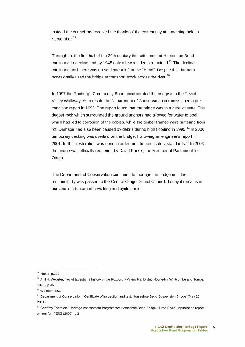
Figure 1: Plaque commemorating the restoration and opening of the walkway in 2003, 2011.
Photograph courtesy of J. Dee.
IPENZ Engineering Heritage Report 12
Horseshoe Bend Suspension Bridge
Physical narrative
Suspension bridges were particularly popular in Central Otago in the late 19th and
early 20th centuries, with some well-known examples including the Kawarau Gorge
Suspension Bridge (1879–1880), Alexandra Bridge (1879–1882), and the Skippers
Canyon Suspension Bridge (1898–1901).
When confronted with swift rivers like the Clutha, a suspension bridge was a practical
choice because, if constructed as a single span structure, they do not require
midstream piers, which were susceptible to scouring, and sometimes failure during
floods.38
Another attractive feature of suspension bridges is that they were relatively
cheap because they could be constructed reasonably quickly, leading to savings on
labourers‟ wages.39
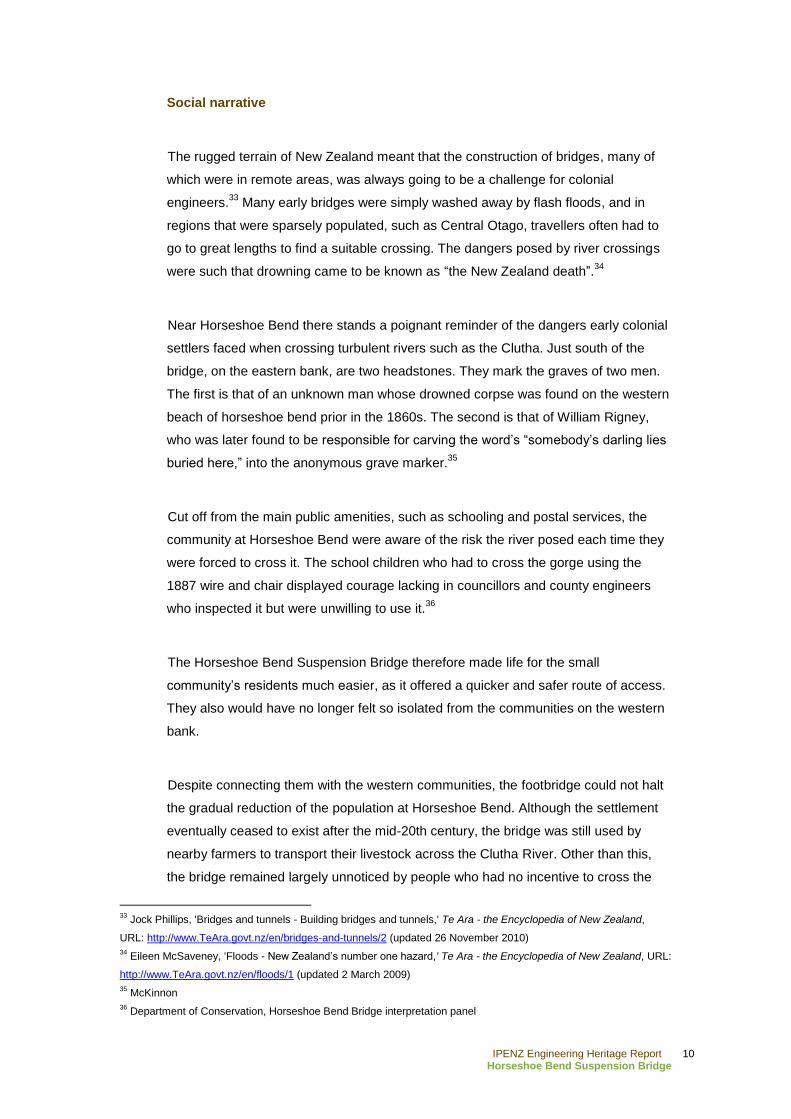
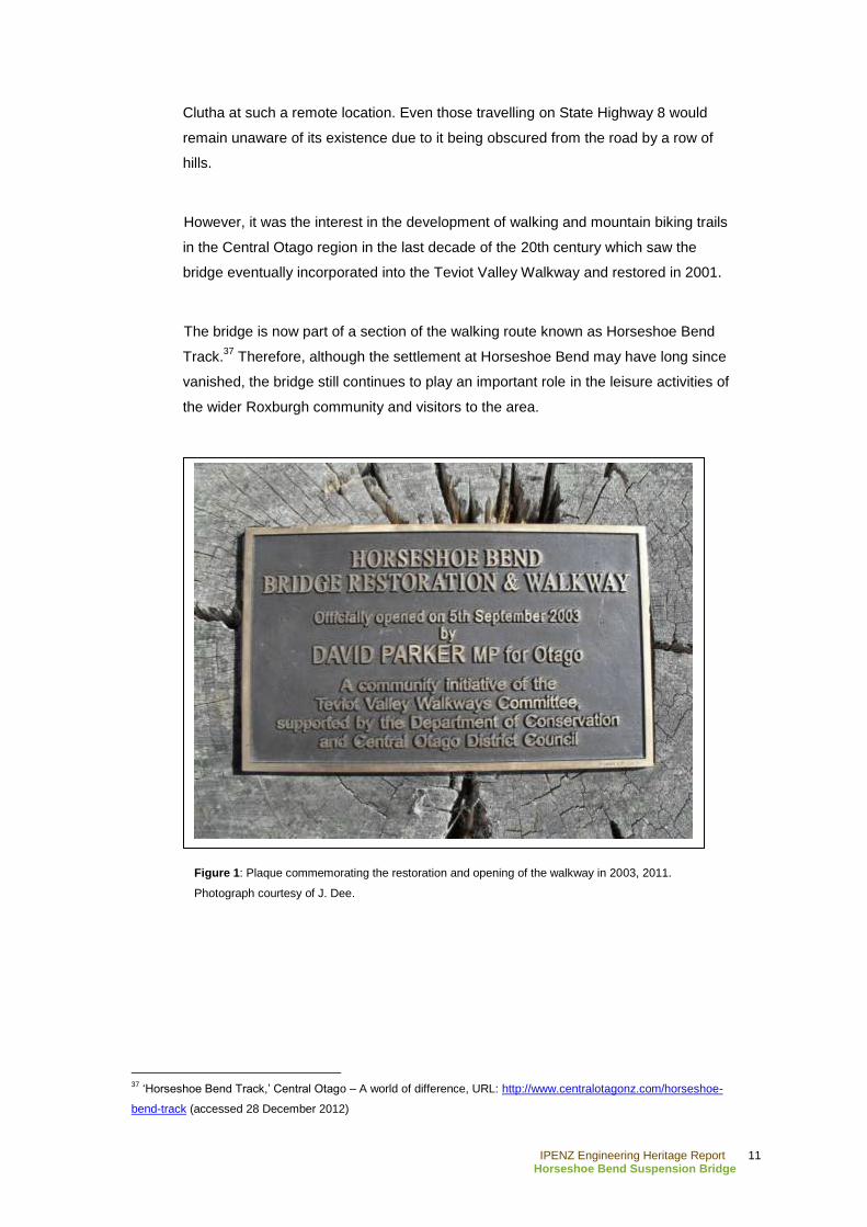
Constructed in 1913, the Horseshoe Bend Suspension Bridge crosses the Clutha
River with a span of 70.2m. The timber decking is set upon transoms made out of
38
Thornton (2007), p.1
39 Thornton (2001), p.176
Figure 2: Timber A-frame
towers of the suspension bridge,
2011. Photograph courtesy of J.
Dee
IPENZ Engineering Heritage Report 13
Horseshoe Bend Suspension Bridge
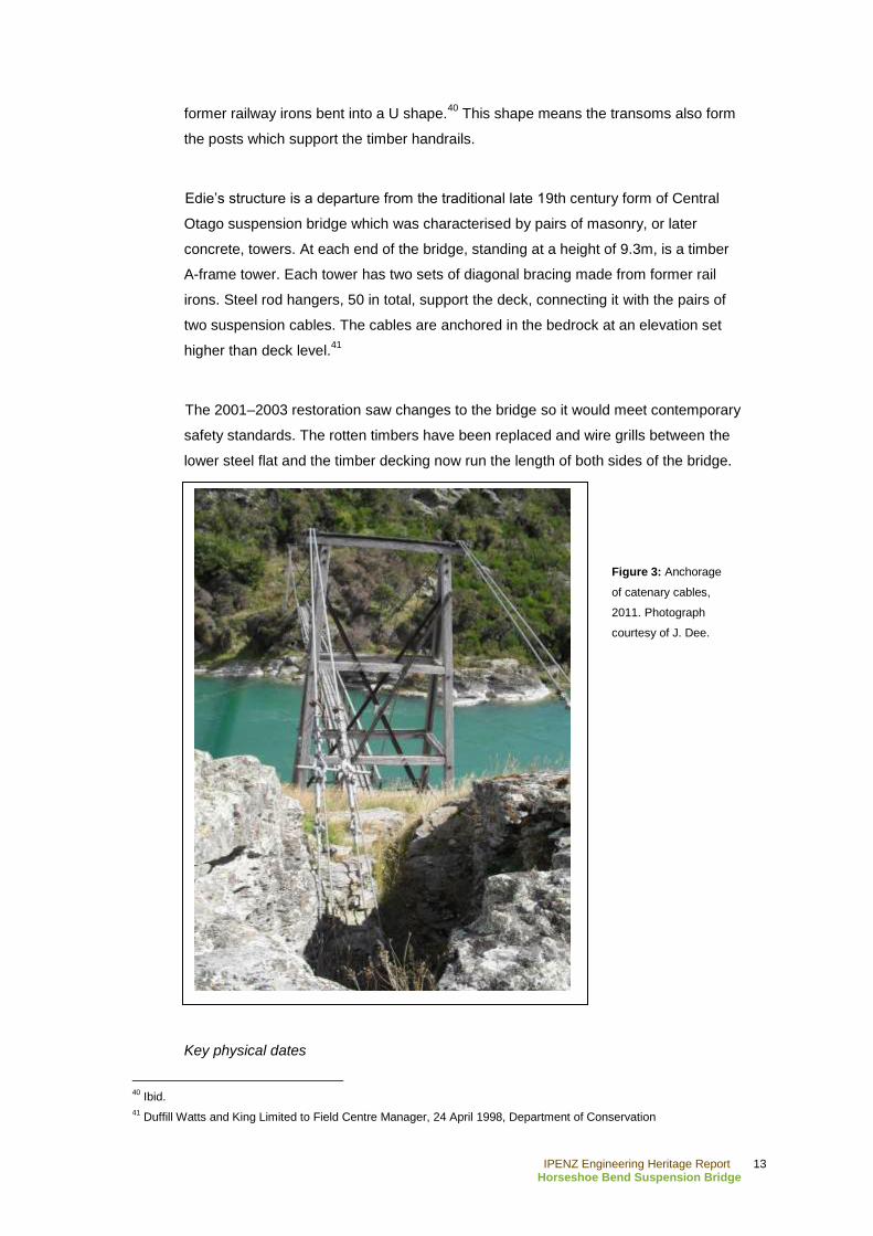
former railway irons bent into a U shape.40
This shape means the transoms also form
the posts which support the timber handrails.
Edie‟s structure is a departure from the traditional late 19th century form of Central
Otago suspension bridge which was characterised by pairs of masonry, or later
concrete, towers. At each end of the bridge, standing at a height of 9.3m, is a timber
A-frame tower. Each tower has two sets of diagonal bracing made from former rail
irons. Steel rod hangers, 50 in total, support the deck, connecting it with the pairs of
two suspension cables. The cables are anchored in the bedrock at an elevation set
higher than deck level.41
The 2001–2003 restoration saw changes to the bridge so it would meet contemporary
safety standards. The rotten timbers have been replaced and wire grills between the
lower steel flat and the timber decking now run the length of both sides of the bridge.
Key physical dates
40
Ibid.
41 Duffill Watts and King Limited to Field Centre Manager, 24 April 1998, Department of Conservation
Figure 3: Anchorage
of catenary cables,
2011. Photograph
courtesy of J. Dee.

IPENZ Engineering Heritage Report 14
Horseshoe Bend Suspension Bridge
1913 Constructed
2000 Temporary decking overlaid on bridge
2001–2003 Restoration
IPENZ Engineering Heritage Report 15
Horseshoe Bend Suspension Bridge
C. Assessment of significance
Built in 1913, the suspension bridge at Horseshoe Bend has historical value as one of
the few physical reminders of that settlement established during the Central Otago
gold rush. It was socially important because its construction finally offered the
isolated community a safe means of crossing the dangerous waters of the Clutha
River.
The Horseshoe Bend Suspension Bridge has some engineering value as an early
20th century adaption of the popular type of Central Otago bridge from the 19th
century. Being designed by John Edie, the Tuapeka County Engineer, it is also
closely associated with this important local engineer and surveyor and later politician.
Now a feature and means of accessing the Horseshoe Bend Track, the bridge
continues to have some social value facilitating the leisure activities of the Teviot
Valley Walkway. Situated in a picturesque river gorge, the bridge is also an
interesting visual element of the landscape.
Therefore, Horseshoe Bend Suspension Bridge is of sufficient engineering heritage
significance to merit inclusion on the IPENZ Engineering Heritage Record.
IPENZ Engineering Heritage Report 16
Horseshoe Bend Suspension Bridge
D. Supporting information
Bibliography
Archival/Primary sources
Department of Conservation, Certificate of inspection and test: Horseshoe Bend
Suspension Bridge, 23 May 2001
Department of Conservation, Duffill Watts and King Limited to Field Centre Manager.
24 April 1998
Department of Conservation, Horseshoe Bend Bridge interpretation panel
Thornton, Geoffrey, „Heritage Assessment Programme: Horseshoe Bend Bridge
Clutha River,‟ Unpublished report, IPENZ, 2007
Published sources
Cunningham, Gerald, Illustrated History of Central Otago and the Queenstown Lakes
District. Auckland: Reed, 2005
Jones, John Hall, Goldfields of Otago: an illustrated history. Invercargill: Craig
Printing, 2005
Macnicol, Duncan and Margaret Trotter, I, Duncan, from Skippers, Invercargill, D. &
Nancy Macnicol, 1988
Marks, Robin, Hammer and tap: shaping Tuapeka Country 1876 – 1976, Dunedin:
John McIndoe Limited, 1977
Thornton, Geoffrey, Bridging the Gap: early bridges in New Zealand, 1830 – 1939,
Auckland: Reed, 2001
Tyrrell, A. R., River punts and ferries of southern New Zealand. Dunedin: Otago
Heritage Books, 1996
IPENZ Engineering Heritage Report 17
Horseshoe Bend Suspension Bridge
Webster, A. H. H., Teviot tapestry: a history of the Roxburgh-Millers Flat District.
Dunedin: Whitcombe and Tombs, 1948
Electronic sources
„Clutha River,‟ Land and Water New Zealand, URL:
http://landandwater.co.nz/councils-involved/otago-regional-council/clutha-river/
(accessed 28 December, 2012)
„Horseshoe Bend Track,‟ Central Otago – A world of difference, URL:
http://www.centralotagonz.com/horseshoe-bend-track (accessed 28 December 2012)
„The nature of New Zealand‟s water environment,‟ in State of NZ‟s Environment,
Ministry for the Environment, URL:
http://www.mfe.govt.nz/publications/ser/ser1997/html/chapter7.6.html (accessed 28
December 2012)
Available from Papers Past, URL: http://paperspast.natlib.govt.nz/cgi-bin/paperspast
Otautau Standard and Wallace County Chronicle, 24 October 1911
Tuapeka Times, 14 March 1885, 19 September 1899, 3 November 1909
Available from Te Ara – the Encyclopedia of New Zealand, URL: www.TeAra.govt.nz
'CLUTHA RIVER.' from An Encyclopaedia of New Zealand, edited by A. H.
McLintock. Originally published in 1966
McKinnon, Malcolm, 'Otago places'
McSaveney, Eileen, 'Floods - New Zealand‟s number one hazard'
Phillips, Jock, 'Bridges and tunnels - Building bridges and tunnels'
Swarbrick, Nancy, 'Country schooling - Wider options: 1900s–1930s'