iv. integrated and coordinated approach to management...
TRANSCRIPT
Chapter IV: Integrated and Coordinated Approach to Management of Ocean Resources 1
Ocean Resources Management Plan 2013 PUBLIC REVIEW DRAFT 2012
IV. Integrated and Coordinated Approach to Management of Ocean Resources
Introduction This chapter discusses multiple approaches to the management of ocean resources, and thus the importance of integration and coordination. Topics covered include:
Which federal, state, and county agencies are involved Framework for National Ocean Policy Marine Management Areas and Sanctuaries Place-Based Ocean and Coastal Resource Management
National Ocean Policy is new since the 2006 ORMP. The National Ocean Policy and the National Priority Objectives call for a framework for implementation: The Pacific Regional Ocean Partnership and the Hawai‘i Sub-Regional Ocean Partnership, which are both in the early stages of formation. The National Ocean Policy, with nine priority objectives, recommends as one of the priorities developing coastal and marine spatial planning as a comprehensive, integrated, and regionally-based tool for planning and managing coastal and marine uses. Place-based management is critical, and it involves both government and the community working in alliance. There is a role for traditional management practices of the land and the sea. Appendix A at the end of this plan provides selective resources and references for community organizations seeking funding and further involvement as stewards of the ocean.
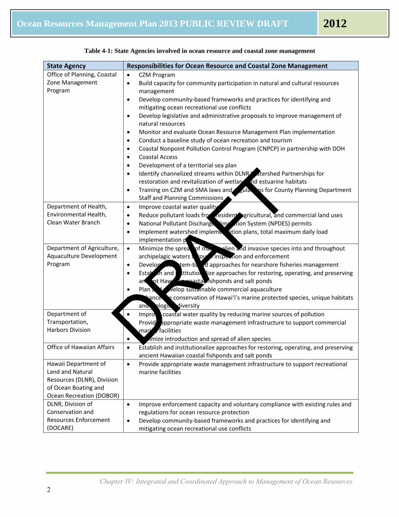
State, Local and Federal Agencies: Who Does What? Many government agencies and authorities participate in the management of ocean and coastal resources. While there are overlaps in interest, each governmental agency has its own roles and responsibilities. The OP-CZM Program recently published Sustainable Management of the Islands (December 2011), which describes the network of resource agencies for coastal zone management and ocean resource protection. Agencies involved in ocean resource and coastal zone management are shown in Table 4-1 for state government, Table 4-2 for local agencies and Table 4-3 for federal agencies.
DRAFT
Chapter IV: Integrated and Coordinated Approach to Management of Ocean Resources 2
Ocean Resources Management Plan 2013 PUBLIC REVIEW DRAFT 2012
Table 4-1: State Agencies involved in ocean resource and coastal zone management
State Agency Responsibilities for Ocean Resource and Coastal Zone Management Office of Planning, Coastal Zone Management Program
CZM Program
Build capacity for community participation in natural and cultural resources management
Develop community‐based frameworks and practices for identifying and mitigating ocean recreational use conflicts
Develop legislative and administrative proposals to improve management of natural resources
Monitor and evaluate Ocean Resource Management Plan implementation
Conduct a baseline study of ocean recreation and tourism
Coastal Nonpoint Pollution Control Program (CNPCP) in partnership with DOH
Coastal Access
Development of a territorial sea plan
Identify channelized streams within DLNR Watershed Partnerships for restoration and revitalization of wetland and estuarine habitats
Training on CZM and SMA laws and regulations for County Planning Department Staff and Planning Commissions
Department of Health, Environmental Health, Clean Water Branch
Improve coastal water quality
Reduce pollutant loads from resident, agricultural, and commercial land uses
National Pollutant Discharge Elimination System (NPDES) permits
Implement watershed implementation plans, total maximum daily load implementation plans
Department of Agriculture, Aquaculture Development Program
Minimize the spread of marine alien and invasive species into and throughout archipelagic waters through inspection and enforcement
Develop ecosystem‐based approaches for nearshore fisheries management
Establish and institutionalize approaches for restoring, operating, and preserving ancient Hawaiian coastal fishponds and salt ponds
Plan and develop sustainable commercial aquaculture
Enhance the conservation of Hawai‘i’s marine protected species, unique habitats and biological diversity
Department of Transportation, Harbors Division
Improve coastal water quality by reducing marine sources of pollution
Provide appropriate waste management infrastructure to support commercial marine facilities
Minimize introduction and spread of alien species
Office of Hawaiian Affairs Establish and institutionalize approaches for restoring, operating, and preserving ancient Hawaiian coastal fishponds and salt ponds
Hawaii Department of Land and Natural Resources (DLNR), Division of Ocean Boating and Ocean Recreation (DOBOR)
Provide appropriate waste management infrastructure to support recreational marine facilities
DLNR, Division of Conservation and Resources Enforcement (DOCARE)
Improve enforcement capacity and voluntary compliance with existing rules and regulations for ocean resource protection
Develop community‐based frameworks and practices for identifying and mitigating ocean recreational use conflicts
DRAFT

Chapter IV: Integrated and Coordinated Approach to Management of Ocean Resources 3
Ocean Resources Management Plan 2013 PUBLIC REVIEW DRAFT 2012
State Agency Responsibilities for Ocean Resource and Coastal Zone Management DLNR, Division of Forestry and Wildlife (DOFAW)
Reduce soil erosion from upland forest ecosystems and conservation lands
Enhance the conservation of Hawai‘i’s marine protected species, unique habitats and biological diversity
Natural Area Reserves System
Formalizing Watershed Partnerships
Commission on Water Resource Management (CWRM)
Commission on Water Resource Management permits and enforcement
Establish criteria to determine water availability and sustainable yield analyses for aquifers and watersheds
Develop long‐range plans for the protection, conservation, and management of water resources
Formulate drought management plans
Implement Commission policies, procedures, and rules on stream protection and instream flow standards, water development, and usage established in conformance with the State Water Code
DLNR, Office of Conservation and Coastal Lands (OCCL)
Fisheries management
Protected area management
Hawaiian fishpond reconstruction and fishpond repair programmatic permit
Hawaiian salt ponds
Beach Access
OCCL aquaculture permitting, including management guidelines
Conservation District Use Applications
Hawai‘i Shoreline Management Plan
DLNR Coastal Erosion Management Plan (COEMAP)
OCCL Small Scale Beach Nourishment Program (SSBN)
DLNR Comprehensive Coastal Policy
Coastal Hazard Mitigation Guidebook
Beach Vulnerability Rating Project (BVR)
Historical Shoreline Erosion Studies (Kaua‘i, O‘ahu, Maui)
Shoreline Assessment Model (SAM)
Enforce removal of unauthorized coastal structures
Enforce Act 160 (encroaching vegetation
Public‐private partnerships for beach restoration
University of Hawai‘i
UH Economic Research Organization (UHERO)
School of Ocean and Earth Science and Technology (SOEST)
Pacific Islands Ocean Observation System (PacIOOS)
Sea Grant Sea Grant College Program, Center for Island Climate Adaptation & Policy (ICAP)
Works with OP‐CZM on economic studies
Works with OP‐CZM on water quality monitoring, climate change, shoreline erosion, beach loss mitigation, marine invasive species, educational curriculum on coastal and ocean resources
Coastal Hazard Mitigation Guidebook
Historical Shoreline Erosion Studies (Kaua‘i, O‘ahu, Maui)
National ocean observing network
Data management, data archive, and data visualization
DRAFT
Chapter IV: Integrated and Coordinated Approach to Management of Ocean Resources 4
Ocean Resources Management Plan 2013 PUBLIC REVIEW DRAFT 2012
Table 4-2: County Agencies involved in ocean resource and coastal zone management
County Agency Responsibilities for Ocean Resource and Coastal Zone Management
Department of Planning and Permitting, O‘ahu Department of Planning (Maui, Kaua‘i, Hawai‘i)
Enforcement of building codes
Issuance of building permits
Issuance of Special Management Area (SMA) permits
Best Management Practices (BMPs)
Land Use or Zoning Ordinances as tool for land‐ocean connection, includes SMA and subdivision ordinances
Coastal erosion studies
Enforcement of public beach/shoreline access
Partnerships for beach restoration projects
Board of Water Supply Watershed management plans
Watershed partnerships/watershed protection and restoration projects and programs
Environmental Services Department, O‘ahu Wastewater Department or Public Works Departments (Maui, Kaua‘i, Hawai‘i)
Water quality monitoring
Oversight of county‐owned sewer system, including repair, maintenance and construction
Replacement of cesspools
Inventory of individual wastewater disposal systems in coastal areas
Develop appropriately scaled wastewater treatment systems in coastal areas with planned growth
Enforcement of storm‐water discharges
Table 4-3: Federal Agencies involved in ocean resource and coastal zone management
Federal Agency Responsibilities for Ocean Resource and Coastal Zone Management
Office of The White House
National Ocean Council
National Ocean Policy
Department of Homeland Security, U.S. Coast Guard
Lighthouses
Protection of US Exclusive Economic Zone from foreign encroachment (200 nautical miles from shore)
Enforcing domestic fisheries law
Works in collaboration with Fisheries Management Councils and NOAA Fisheries
Marine Protected Species, Endangered Species Act
U.S. Department of Agriculture, Natural Resources Conservation Service
Conservation Innovation Grants
Conservation technical assistance
Healthy Forests Reserve Program
Healthy Watersheds Initiative
Watershed Protection and Flood Prevention Program
Agricultural Water Enhancement Program
Wetlands Reserve Program
Water management
DRAFT
Chapter IV: Integrated and Coordinated Approach to Management of Ocean Resources 5
Ocean Resources Management Plan 2013 PUBLIC REVIEW DRAFT 2012
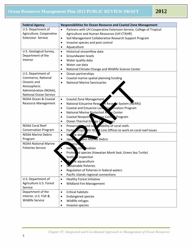
Federal Agency Responsibilities for Ocean Resource and Coastal Zone Management
U.S. Department of Agriculture, Cooperative Extension Service
Partners with UH Cooperative Extension Service, College of Tropical Agriculture and Human Resources (UH CTAHR)
Soil Management Collaborative Research Support Program
Invasive species and pest control
Aquaculture
U.S. Geological Survey, Department of the Interior
Historical streamflow data
Groundwater levels
Water quality data
Water use data
National Climate Change and Wildlife Science Center
U.S. Department of Commerce, National Oceanic and Atmospheric Administration (NOAA), National Ocean Service
Ocean partnerships
Coastal marine spatial planning funding
National Marine Sanctuaries
NOAA Ocean & Coastal Resource Management
Coastal Zone Management
National Estuarine Research Reserve System (NERRS)
Coastal and Estuarine Land Conservation Program
National Marine Protected Areas Center
Coastal Nonpoint Pollution Control Program
Ocean Thermal Energy Conversion
NOAA Coral Reef Conservation Program
Preservation and sustainability of coral reefs
Partnerships with NOAA Line Offices to work on coral reef issues
NOAA Marine Debris Program
Marine debris
Japan Tsunami Marine Debris
NOAA National Marine Fisheries Service
Aquaculture
Habitat conservation
Protected species (Hawaiian Monk Seal, Green Sea Turtle)
Seafood inspection
Marine aquaculture
Sustainable fisheries
Regulation of fisheries in federal waters
Pacific islands regional connections
U.S. Department of Agriculture U.S. Forest Service
Healthy Forest Initiative
Wildland Fire Management
Department of the Interior, U.S. Fish & Wildlife Service
Critical habitats
Endangered species
Wildlife refuges
Invasive species
DRAFT
Chapter IV: Integrated and Coordinated Approach to Management of Ocean Resources 6
Ocean Resources Management Plan 2013 PUBLIC REVIEW DRAFT 2012
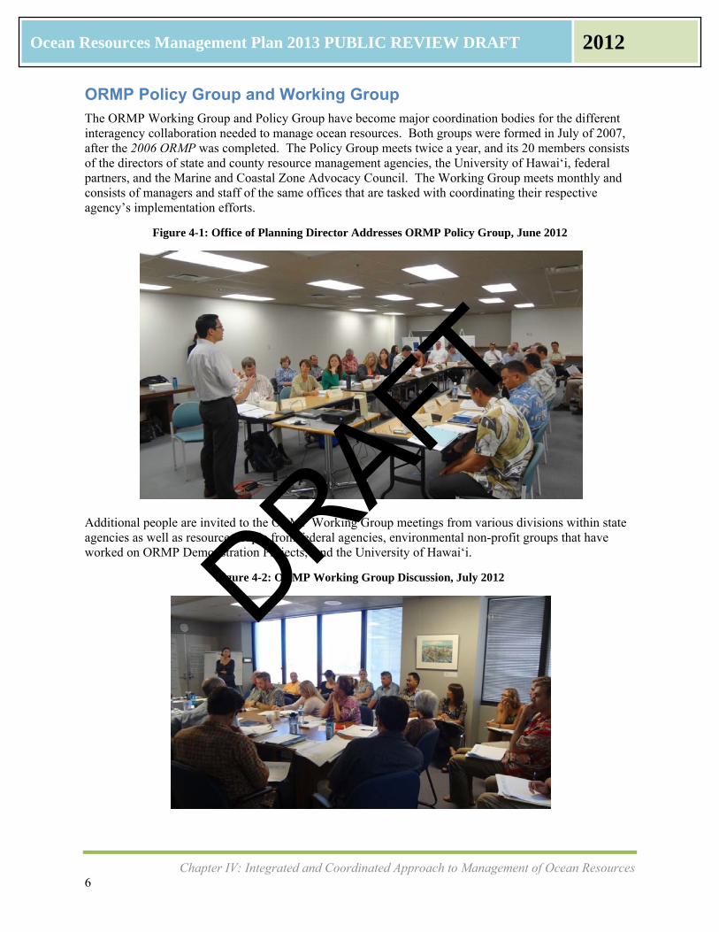
ORMP Policy Group and Working Group The ORMP Working Group and Policy Group have become major coordination bodies for the different interagency collaboration needed to manage ocean resources. Both groups were formed in July of 2007, after the 2006 ORMP was completed. The Policy Group meets twice a year, and its 20 members consists of the directors of state and county resource management agencies, the University of Hawai‘i, federal partners, and the Marine and Coastal Zone Advocacy Council. The Working Group meets monthly and consists of managers and staff of the same offices that are tasked with coordinating their respective agency’s implementation efforts.
Figure 4-1: Office of Planning Director Addresses ORMP Policy Group, June 2012
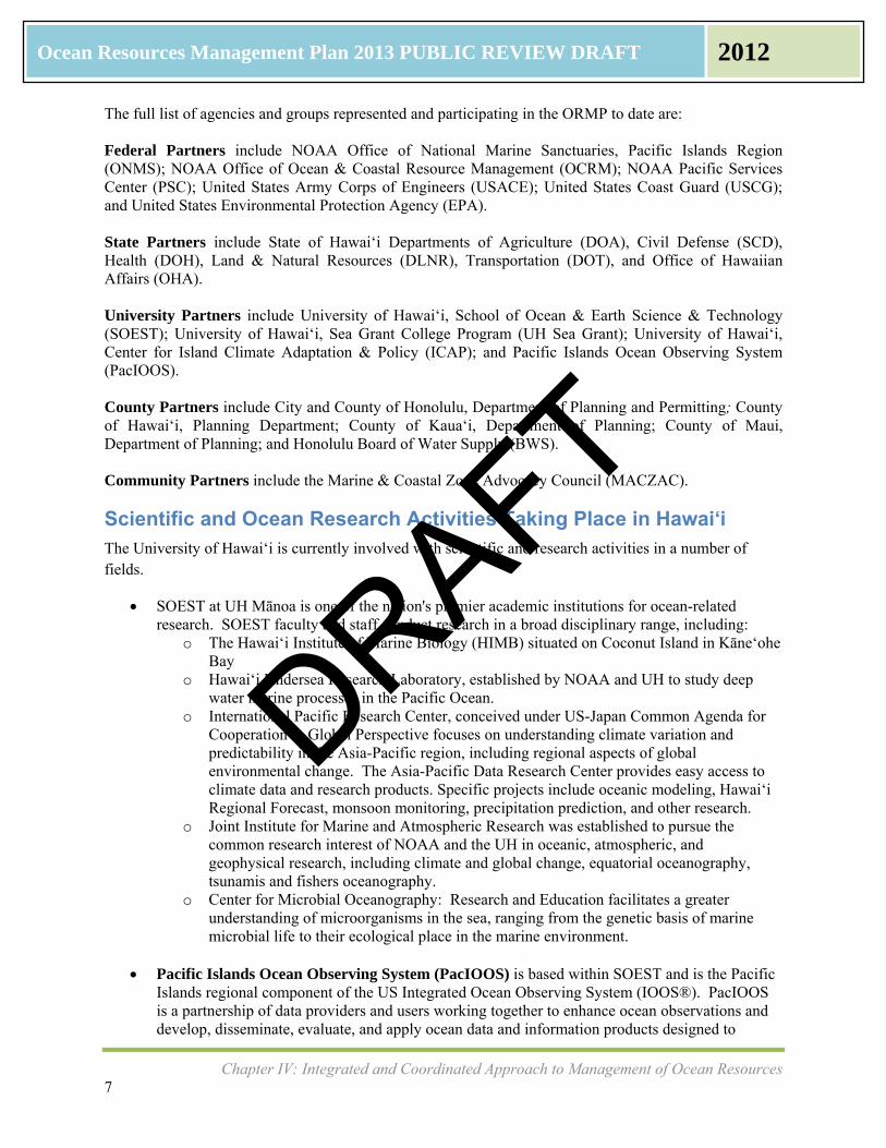
Additional people are invited to the ORMP Working Group meetings from various divisions within state agencies as well as resource people from federal agencies, environmental non-profit groups that have worked on ORMP Demonstration Projects, and the University of Hawai‘i.
Figure 4-2: ORMP Working Group Discussion, July 2012
DRAFT
Chapter IV: Integrated and Coordinated Approach to Management of Ocean Resources 7
Ocean Resources Management Plan 2013 PUBLIC REVIEW DRAFT 2012
The full list of agencies and groups represented and participating in the ORMP to date are: Federal Partners include NOAA Office of National Marine Sanctuaries, Pacific Islands Region (ONMS); NOAA Office of Ocean & Coastal Resource Management (OCRM); NOAA Pacific Services Center (PSC); United States Army Corps of Engineers (USACE); United States Coast Guard (USCG); and United States Environmental Protection Agency (EPA). State Partners include State of Hawai‘i Departments of Agriculture (DOA), Civil Defense (SCD), Health (DOH), Land & Natural Resources (DLNR), Transportation (DOT), and Office of Hawaiian Affairs (OHA). University Partners include University of Hawai‘i, School of Ocean & Earth Science & Technology (SOEST); University of Hawai‘i, Sea Grant College Program (UH Sea Grant); University of Hawai‘i, Center for Island Climate Adaptation & Policy (ICAP); and Pacific Islands Ocean Observing System (PacIOOS). County Partners include City and County of Honolulu, Department of Planning and Permitting; County of Hawai‘i, Planning Department; County of Kaua‘i, Department of Planning; County of Maui, Department of Planning; and Honolulu Board of Water Supply (BWS). Community Partners include the Marine & Coastal Zone Advocacy Council (MACZAC).
Scientific and Ocean Research Activities Taking Place in Hawai‘i The University of Hawai‘i is currently involved with scientific and research activities in a number of fields.
SOEST at UH Mānoa is one of the nation's premier academic institutions for ocean-related research. SOEST faculty and staff conduct research in a broad disciplinary range, including:
o The Hawai‘i Institute of Marine Biology (HIMB) situated on Coconut Island in Kāneʻohe Bay
o Hawai‘i Undersea Research Laboratory, established by NOAA and UH to study deep water marine processes in the Pacific Ocean.
o International Pacific Research Center, conceived under US-Japan Common Agenda for Cooperation in Global Perspective focuses on understanding climate variation and predictability in the Asia-Pacific region, including regional aspects of global environmental change. The Asia-Pacific Data Research Center provides easy access to climate data and research products. Specific projects include oceanic modeling, Hawai‘i Regional Forecast, monsoon monitoring, precipitation prediction, and other research.
o Joint Institute for Marine and Atmospheric Research was established to pursue the common research interest of NOAA and the UH in oceanic, atmospheric, and geophysical research, including climate and global change, equatorial oceanography, tsunamis and fishers oceanography.
o Center for Microbial Oceanography: Research and Education facilitates a greater understanding of microorganisms in the sea, ranging from the genetic basis of marine microbial life to their ecological place in the marine environment.
Pacific Islands Ocean Observing System (PacIOOS) is based within SOEST and is the Pacific
Islands regional component of the US Integrated Ocean Observing System (IOOS®). PacIOOS is a partnership of data providers and users working together to enhance ocean observations and develop, disseminate, evaluate, and apply ocean data and information products designed to
DRAFT
Chapter IV: Integrated and Coordinated Approach to Management of Ocean Resources 8
Ocean Resources Management Plan 2013 PUBLIC REVIEW DRAFT 2012
address the environmental, economic and public safety needs of stakeholders who call the Pacific Islands home. The organization's major goal is to make data understandable and useable for researchers, resource managers, and the public. Within Hawai‘i, PacIOOS research and development includes: A system of models that assimilate direct observations in order to produce a comprehensive
ocean state prediction for the main Hawaiian Islands: o Circulation Models: Ocean circulation and current forecasts are made daily using
the Regional Ocean Modeling System (ROMS) for the Main Hawaiian Islands, with increased resolution for O‘ahu.
o Wave Modeling: Ocean waves are forecast daily using WaveWatch III (WWIII) and Simulating Waves Nearshore (SWAN) models with domains that extend throughout the entire Pacific with increasing resolution for each of the main Hawaiian Islands and the Mariana Islands.
o Atmospheric Modeling: The Weather Research and Forecasting (WRF) model produces daily atmospheric forecasts covering all of the Hawaiian Islands as well as detailed forecasts for each of the main Hawaiian Islands.
A sensor network measuring water quality (conductivity/salinity, temperature, pressure, chlorophyll, turbidity and in some locations, also pH, dissolved oxygen and CO2
An array of wave buoys, measuring height, direction and period throughout Hawai‘i : An array of sensors conducting biological monitoring (satellite tags and passive and acoustic
instrumentation) to track the behavior, movement and population dynamics of marine mammals, reef fish, and pelagics such as sharks and tuna.
An array of High Frequency Radio systems to monitor surface currents real-time along the south shore of O‘ahu. Expanding to include the Leeward Coast of O‘ahu and Hilo on Hawai‘i Island as well.
Operational products that forecast wave inundation, high sea levels, coastal erosion, nearshore wave and current hazards, and impacts of sea-level rise in low-lying communities.
Integration projects that present data and information collected through the system above into user-friendly tools and services: o PacIOOS Website (www.pacioos.org) includes data servers where users can access and
download data for free and store data long term. Real-life applications include dynamic mapping of endangered species, such as the Hawaiian monk seal
o PacIOOS Voyager is an interactive online mapping platform that uses Google Maps as a foundation for data overlays. Data are incorporated directly from PacIOOS servers as well as from other data providers. Historical, current, and forecast data are available, as are dynamic and static data layers. Users can access Voyager for free to visualize, save, embed, download, and combine thousands of data layers in an easy-to-use platform.
o PacIOOS Explorer is a free data service providing GIS or map-based information to the insular Pacific. This web mapping service (WMS) and geospatial database is a unique service of PacIOOS and acts to fulfill a more robust demand for geospatial cataloging, computations, and analysis. The WMS allows users to directly query the database, then make, save, and print maps and overlays as well as conduct geospatial analyses.
University of Hawai‘i Sea Grant College Program works in collaboration with SOEST and the National Oceanic and Atmospheric Administration (NOAA). Sea Grant is dedicated to improving the understanding and stewardship of marine and coastal resources in the state and region. UH Sea Grant includes centers for Sustainable Aquaculture, Marine Science Education, and Island Climate Adaptation and Policy. Recent publications include “Research Priorities in the Insular Pacific: Transforming Research into Regional Management.”
DRAFT
Chapter IV: Integrated and Coordinated Approach to Management of Ocean Resources 9
Ocean Resources Management Plan 2013 PUBLIC REVIEW DRAFT 2012
UH Sea Grant is hosting the NOAA Coastal Storms Program to foster community resilience to coastal hazards that focuses on funds and resources in the US Pacific Island coastal communities to help reduce and mitigate the risk from coastal storm and weather hazards and climate change. The program provides an array of tools, products and services, including improved observing systems, forecast models, decision support tools, assessments, community best practices and guidance, socioeconomic information, training and outreach/extension activities to enhance community resilience. Specific programs include
Coastal inundation mapping, including storm surge and hurricane inundation mapping Developing Pacific storms climatology, Pacific Climate Information system (PaCIS), Climate
Extremes in the Pacific Integrated Case Studies (EPICS) to support vulnerability assessment and adaptation planning
Developing a Pacific Region GPS Met Network Improving the national spatial reference system in the Pacific Islands Assessing land-based toxic runoff and coral reef ecosystem resilience in the Pacific Islands
The Pacific Regional Integrated Sciences and Assessments (Pacific RISA) program supports Pacific island and coastal communities to mitigate and adapt to the impacts of climate variability and change. The agency conducts research in water resources, management, coastal impacts and disaster risk management. The Pacific Islands Regional Climate Assessment (PIRCA) is a collaborative effort aimed at assessing the state of climate knowledge, impacts and adaptive capacity in Hawai‘i and the US affiliated Pacific Islands. PIRCA provides information to federal, state and local government agencies, non-governmental agencies, businesses, and community groups, with priority focus on preserving freshwater resources and minimizing the impacts of drought, fostering community resilience to the impacts of sea-level rise, coastal inundation and extreme weather, and sustaining marine, freshwater, and terrestrial ecosystems. Research topics involve:
Climate variability and change science, including historical observations, trends, and climatology,
Freshwater resource sustainability, flow trends, groundwater recharge, demographic stresses Sea level rise and coastal inundation projections and scenarios, current and projected coastal
hazards and impacts, Ecosystem assessments including climate effects on ocean acidification and coral health,
SLR impacts on ecosystems, saltwater intrusion, and species/habitat responses to precipitation and temperature changes.
The University of Hawai‘i has recently committed to a collaborative Sustainability Initiative for the campus, involving new staff clustered around the statewide program. UH Sea Grant competed with other departments across the University of Hawai‘i system and won funding for this important and groundbreaking initiative. The cluster includes five new tenured staff in the fields and schools of economy, engineering, oceanography, architecture, planning, Hawaiian Studies, and ocean agriculture. The program will be focused on the three areas of water, energy and transportation, and while each staff member is housed in one of the five schools, they are also required to dedicate 25% of their time to collaborative work in the Sustainability Initiative, in separate offices housed at UH Sea Grant.
DRAFT
Chapter IV: Integrated and Coordinated Approach to Management of Ocean Resources 10
Ocean Resources Management Plan 2013 PUBLIC REVIEW DRAFT 2012
National Ocean Policy Vision
“To achieve an American whose stewardship ensures that the ocean, our coasts, and the Great Lakes are healthy and resilient, safe and productive, and understood and treasured so as to promote the well-being, prosperity, and security of present and future generations.”
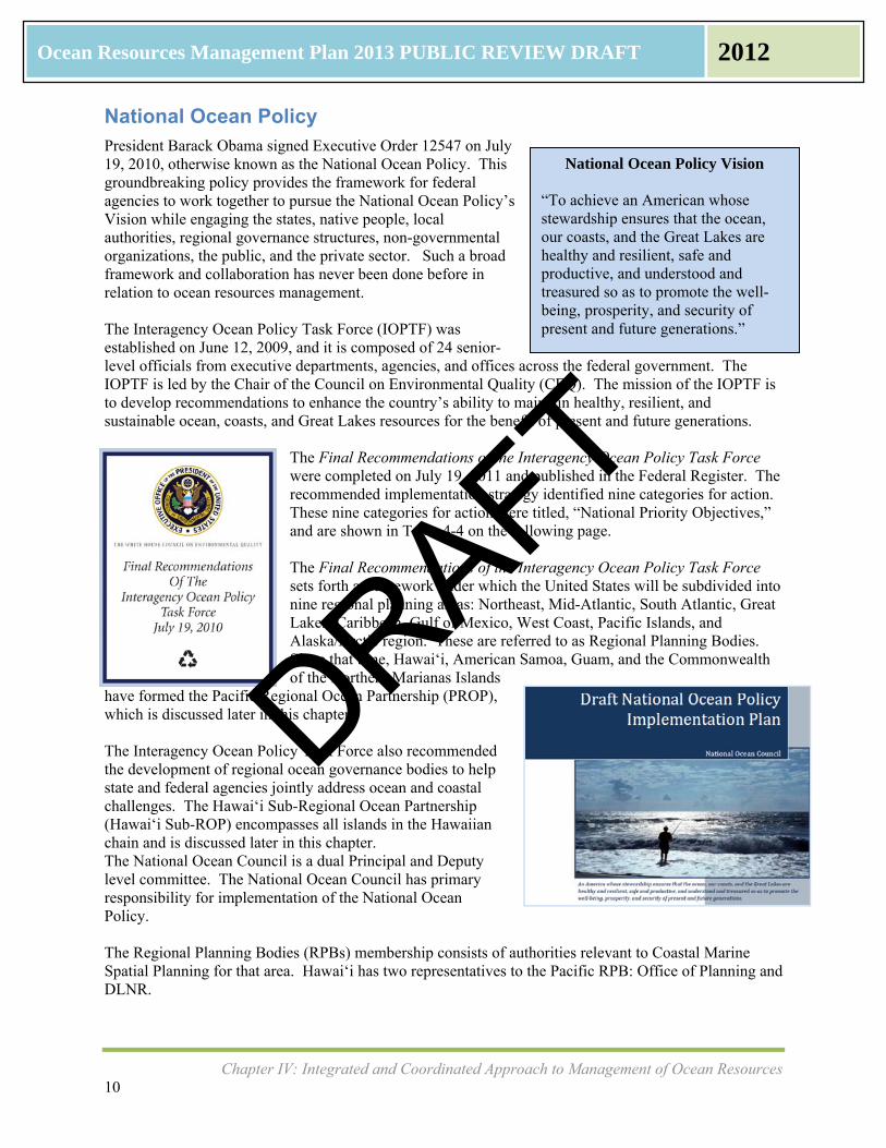
National Ocean Policy President Barack Obama signed Executive Order 12547 on July 19, 2010, otherwise known as the National Ocean Policy. This groundbreaking policy provides the framework for federal agencies to work together to pursue the National Ocean Policy’s Vision while engaging the states, native people, local authorities, regional governance structures, non-governmental organizations, the public, and the private sector. Such a broad framework and collaboration has never been done before in relation to ocean resources management. The Interagency Ocean Policy Task Force (IOPTF) was established on June 12, 2009, and it is composed of 24 senior-level officials from executive departments, agencies, and offices across the federal government. The IOPTF is led by the Chair of the Council on Environmental Quality (CEQ). The mission of the IOPTF is to develop recommendations to enhance the country’s ability to maintain healthy, resilient, and sustainable ocean, coasts, and Great Lakes resources for the benefit of present and future generations.
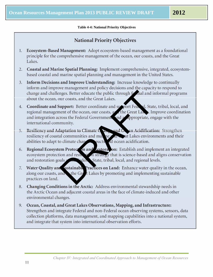
The Final Recommendations of the Interagency Ocean Policy Task Force were completed on July 19, 2011 and published in the Federal Register. The recommended implementation strategy identified nine categories for action. These nine categories for action were titled, “National Priority Objectives,” and are shown in Table 4-4 on the following page. The Final Recommendations of the Interagency Ocean Policy Task Force sets forth a framework under which the United States will be subdivided into nine regional planning areas: Northeast, Mid-Atlantic, South Atlantic, Great Lakes, Caribbean, Gulf of Mexico, West Coast, Pacific Islands, and Alaska/Arctic region. These are referred to as Regional Planning Bodies. Since that time, Hawaiʻi, American Samoa, Guam, and the Commonwealth of the Northern Marianas Islands
have formed the Pacific Regional Ocean Partnership (PROP), which is discussed later in this chapter. The Interagency Ocean Policy Task Force also recommended the development of regional ocean governance bodies to help state and federal agencies jointly address ocean and coastal challenges. The Hawai‘i Sub-Regional Ocean Partnership (Hawai‘i Sub-ROP) encompasses all islands in the Hawaiian chain and is discussed later in this chapter. The National Ocean Council is a dual Principal and Deputy level committee. The National Ocean Council has primary responsibility for implementation of the National Ocean Policy. The Regional Planning Bodies (RPBs) membership consists of authorities relevant to Coastal Marine Spatial Planning for that area. Hawai‘i has two representatives to the Pacific RPB: Office of Planning and DLNR.
DRAFT
Chapter IV: Integrated and Coordinated Approach to Management of Ocean Resources 11
Ocean Resources Management Plan 2013 PUBLIC REVIEW DRAFT 2012
Table 4-4: National Priority Objectives
DRAFT
Chapter IV: Integrated and Coordinated Approach to Management of Ocean Resources 12
Ocean Resources Management Plan 2013 PUBLIC REVIEW DRAFT 2012
National Priority Objectives
The nine National Priority Objectives align well with the 2006 ORMP Perspectives, Management Goals, and Strategic Actions. Table 4-5 below shows each of the National Priority Objectives and then groups them by the Three ORMP Perspectives.
Table 4-5: National Priority Objectives and ORMP Goals
National Priority Objective ORMP Goal
1. Ecosystem‐Based Management 6. Regional Ecosystem Protection and
Restoration
Perspective 1: Connecting Land and Sea
ORMP adopts place‐based as a foundational principal, which applies to nearshore fisheries, coral reefs, sea grasses, and other resources.
This goal addresses soil erosion and pollutant loads.
7. Water Quality and Sustainable Practices on Land
8. Changing Conditions in the Arctic
Perspective 2: Preserving Our Ocean Heritage
2. Coastal and Marine Spatial Planning 3. Inform Decisions and Improve
Understanding 4. Coordinate and Support 5. Resiliency and Adaptation to Climate
Change and Ocean Acidification 9. Ocean, Coastal, and Great Lakes
Observations, Mapping, and Infrastructure
Perspective 3: Promoting Collaborative Governance and Stewardship
ORMP aims to build capacity for community participation in resource management through education and outreach
Updated ORMP includes PROP and Hawai‘i Sub‐ROP
Climate change adaptation is included Actions under National Priority Objective #8 Changing Conditions in the Arctic are geographic specific. However, changing conditions in the Arctic are linked to climate change and the warming of the oceans, which in turn can contribute to ocean acidification, coral bleaching, and the degradation and habitat loss of entire reefs. The changing conditions in the Arctic are being monitored by the U.S. Integrated Ocean Observing System (IOOS) and continued collaboration with PacIOOS. For this ORMP Update, several emerging ocean resources management issues were added to the goals, objectives and strategic actions of the ORMP. These emerging issues address several National Priority Objectives such as #2 Coastal and Marine Spatial Planning, #5 Resiliency and Adaptation to Climate Change and Ocean Acidification, #8 Changing Conditions in the Arctic, and #9 Ocean, Coastal, and Great Lakes Observations, Mapping, and Infrastructure.
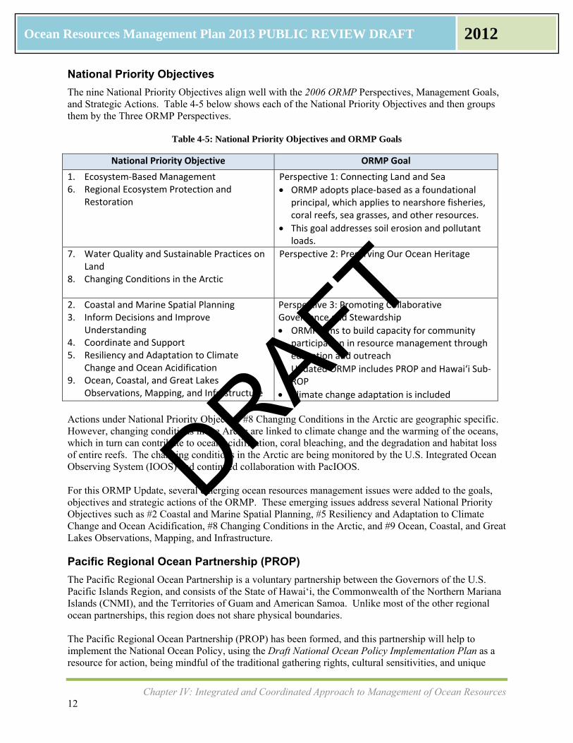
Pacific Regional Ocean Partnership (PROP)
The Pacific Regional Ocean Partnership is a voluntary partnership between the Governors of the U.S. Pacific Islands Region, and consists of the State of Hawai‘i, the Commonwealth of the Northern Mariana Islands (CNMI), and the Territories of Guam and American Samoa. Unlike most of the other regional ocean partnerships, this region does not share physical boundaries. The Pacific Regional Ocean Partnership (PROP) has been formed, and this partnership will help to implement the National Ocean Policy, using the Draft National Ocean Policy Implementation Plan as a resource for action, being mindful of the traditional gathering rights, cultural sensitivities, and unique
DRAFT
Chapter IV: Integrated and Coordinated Approach to Management of Ocean Resources 13
Ocean Resources Management Plan 2013 PUBLIC REVIEW DRAFT 2012
View the Signed PROP Agreement here: http://manage.hawaii.gov/gov/newsroom/press-releases/PROP_signed_082212.pdf
geographic considerations. The National Ocean Council’s Draft National Ocean Policy Implementation Plan (January 2012) is guided by four themes: 1) adopt ecosystem-based management; 2) obtain, use, and share the best science and data; (3) promote efficiency and collaboration; and 4) strengthen regional efforts. The University of Hawai‘i Social Science Research Institute was awarded a grant in January 2012 to serve as the Principle Investigator and cover administrative expenses to support the development of the PROP. A Governor’s Agreement to formalize the working relationships between the four jurisdictions in the PROP was signed on August 22, 2012. The mission of the PROP is to assist the four jurisdictions to identify coastal and ocean management priorities that require a coordinated regional response and increased collaboration to effectively address these issues. The actions of the PROP will complement, and take advantage of, other ongoing regional efforts while respecting individual state policy making requirements. While just formed in the summer of 2012, the structure will include an Executive Group, a Steering Group, Action Coordination Teams, and Supporting Partners.
Hawai‘i Sub-Regional Ocean Partnership (Hawai‘i Sub-ROP)
The Office of Planning, representing Hawaii’s ORMP partners, was awarded $250,000 through the NOAA Regional Ocean Partnership Funding Program in January 2012. This funding is to facilitate stakeholder engagement and foster the development of the Hawai’i Sub-Regional Ocean Partnership (Hawai‘i Sub-ROP). The Hawai‘i Sub-ROP encompasses the main Hawaiian islands as well as the Northwestern Hawaiian Islands, a span of 1,523 miles. This area includes the 12 nautical mile Territorial Sea and the 200 nautical mile Exclusive Economic Zone. The ocean area covered by the Hawai‘i Sub-ROP is co-managed by the State of Hawai‘i Department of Land and Natural Resources (DLNR) and the Federal Government. The State of Hawai‘i waters are defined as any shores or water between the three nautical mile limit and the mean high tide mark on the shores of the islands of the State of Hawai‘i, and enforcement in this area is the responsibility of the DLNR Division of Conservation and Resources Enforcement. Federal waters under the jurisdiction of the United States are patrolled by the U.S. Coast Guard up to the U.S. Economic Exclusion Zone, which is any water within 200 nautical miles of shore. The Northwestern Hawaiian Islands are within the Papahānaumokuākea Marine National Monument, which is co-managed by NOAA, the U.S. Fish and Wildlife Service, and the State of Hawai‘i DLNR. The Hawaiian Islands Humpback Whale National Marine Sanctuary, which includes the waters between Maui, Moloka‘i, and Lāna‘i, the north shore of Kaua‘i, and the north and southeast shores of O‘ahu, is co-managed by NOAA and State of Hawai‘i DLNR. The Hawai‘i Sub-ROP is meant to ensure meaningful engagement and coordination of partners and the public through natural and cultural resource management processes in Hawai‘i, with the goals and objectives of the ORMP forming the basis. It will also ensure consistency with federal objectives. While many engaged stakeholders and informal partnerships have formed as a result of implementing the ORMP, a major objective of the Hawai‘i Sub-ROP is to formalize these partnerships. ORMP stakeholders who manage and protect Hawai‘i’s coastal and ocean resources are members of the ORMP Policy and Working Groups. Additional stakeholder groups such as coastal communities, recreational users, Native Hawaiian cultural practitioners, tourists, commercial interests, families and individuals will also have opportunities to participate in the Sub-Regional Ocean Partnership for Hawai‘i.
DRAFT
Chapter IV: Integrated and Coordinated Approach to Management of Ocean Resources 14
Ocean Resources Management Plan 2013 PUBLIC REVIEW DRAFT 2012
Coastal and Marine Spatial Planning
Coastal and marine spatial planning (CMSP) is one of the National Priority Objectives and is seen as an important tool for implementing the National Ocean Policy. CMSP for the Pacific Islands Region is expected to help form policies, identify best management practices (BMPs) and aid in the preparation of rules and regulations that are based on scientific data on sea level rise, storm surge, ocean acidification, and other climate variables. In Hawai‘i, CMSP is seen as important information sharing tool as part of collaborative management. CMSP would be built on the extensive and widely used Geographical Information System (GIS). The Office of Planning houses the metadata for GIS for the State of Hawai‘i, and adding the metadata for the state’s coastlines and up to 3 miles out into the ocean is a natural expansion of its GIS capabilities. The CMSP would be a robust online information management system that allows easy access to and transparency of data and information necessary for planning, and mechanisms for frequent stakeholder and public input. CMSP would be a useful public policy tool which maps a variety of things relating to ocean resources. CMSP would be adaptive, integrated, ecosystem-based, and a transparent spatial planning process, based on science, for analyzing current and anticipated uses of the ocean and coastal resources. As a planning tool, it can be used to look across multiple sectors and jurisdictions. Examples might include enhancing public beach access; improving ocean user compatibility and reducing user conflicts; reducing environmental impacts to the ocean; supporting sustainable, safe, secure, efficient and productive uses of the ocean; and enhancing collaboration. An example of CMSP is the data system developed by the State of Oregon called MarineMap. The first step is to set up the collaborative Coastal Marine Spatial Planning Process, which includes stakeholder engagement in order to incorporate appropriate GIS layers into the tool. The second step would be to build the GIS tool, which is shown below as the spatial management plan. An example of GIS layers could be a biology layer with data on birds, fish, marine mammals, and plants or a marine renewable energy layer.
Traditional Resource Management Concepts Natural resources were managed traditionally in Hawai‘i using kuleana (responsibility) principles, assigned at the ahupua‘a and moku levels. An ahupuaʻa is a unit of land, which contains a self-sufficient amount of natural resources necessary for all of its tenants to survive and thrive. Literally translated, an ahu is a cairn or man-made pile of stones. A puaʻa is a pig. Native Hawaiians used the ahu with the symbol of a puaʻa on top to mark these land divisions, which normally follow existing contours of land and begin in the mountains “mauka” and end in the ocean “makai.” Several ahupuaʻa adjoining one another were delineated as a moku. Like the ahupuaʻa, the moku varied in size. ‘Aha Councils, which were composed of a diverse group of practitioners and acknowledged experts in agriculture, fishing, water resources, and cultural skills, lived within each ahupua‘a and served together as the governing board. The kapu system governed codes of conduct, social rules, and resource management, making certain actions kapu or forbidden. Hawaiian fishing was regulated through this kapu system in order to maintain its long-term viability. Certain fish were kapu during times of spawning or low fish counts. Designated fishing areas were also kapu during certain times when overfishing could damage the eco-system. A konohiki, or manager, would be the enforcer of the kapu system. The ‘Aha Moku System is discussed later in this chapter in the Place-Based Management section.
DRAFT

Chapter IV: Integrated and Coordinated Approach to Management of Ocean Resources 15
Ocean Resources Management Plan 2013 PUBLIC REVIEW DRAFT 2012
MLCD in Hawai‘i O‘ahu Hanauma Bay Pupukea Waikīkī Hawai‘i Island Kealakekua Bay Lapakahi Old Kona Airport Waialea Bay Waiopae Tidepools Maui County Honolua‐Mokuleʻia Bay Manele Hulopoʻe Molokini Shoal Source: DLNR‐DAR
Marine Management Areas Since Statehood in 1959, the Hawai‘i State government has assumed most of the functions once performed by the konohiki. There are seven types of Marine Managed Areas (MMAs) that are the responsibility of the State Department of Land and Natural Resources:
1) Marine Life Conservation Districts 2) Fishery Management Areas 3) Fishery Replenishment Areas 4) Bottomfish Restricted Fishing Areas 5) Wildlife Sanctuaries/Research Refuges 6) Natural Area Reserves 7) Hawaiian Islands Humpback Whale National Marine Sanctuary (co-managed with federal
government) A map of these Marine Managed Areas from the DLNR website is shown as Figure 4-3 on the following page.
Marine Life Conservation Districts
Marine Life Conservation Districts (MLCD) are designed to conserve and replenish marine resources, with limited fishing and other consumptive uses. This gives a protected area for fish and other aquatic life to grow and reproduce. The first MLCD designated in the State was Hanauma Bay in East O‘ahu, and there are 11 MLCD throughout the State.
Fishery Management Areas
There are 20 Fishery Management Areas (FMAs) on the islands of Kaua‘i, O‘ahu, Moloka‘i, Lāna‘i, Maui, and Hawai‘i and an additional nine FMAs in West Hawai‘i. Each FMA has different permitted and prohibited activities with different “takes” and different fishing methodologies. The West Hawai‘i Regional Fisheries Management Area (WHRFA) includes nine individual FMAs. All types of fishing are permitted except for those on a “no take” list and by unregistered aquarium collecting vessels. During the fall of 2012, the no take list is being updated through Hawai‘i Administrative Rules and public hearings.
DRAFT

Chapter IV: Integrated and Coordinated Approach to Management of Ocean Resources 16
Ocean Resources Management Plan 2013 PUBLIC REVIEW DRAFT 2012
Figure 4-3: Marine Managed Areas in the State of Hawai‘i
Source: http://hawaii.gov/dlnr/dar/images/MPAmaplg2.jpg
Bottomfish Restricted Fishing Areas
Bottomfish Restricted Fishing Areas are defined by latitude and longitudes and are provided in 12 places throughout the state. There are seven fish covered, otherwise referred to as the “Deep 7,” and these include onaga, ehi, kalekale, ‘ōpakapaka, ukikiki, hapuʻu, and lehi. There are seasons for fishing, gear restrictions, commercial fisher reporting, minimum size and bag limits.
Wildlife Sanctuaries/Research Refuges
The Coconut Island Hawai‘i Marine Laboratory Refuge in Kāne‘ohe Bay and the Paiko Lagoon Wildlife Sanctuary in East Honolulu are both off the island of O‘ahu. The University of Hawai‘i uses the Hawai‘i Marine laboratory Refuge for scientific studies, and it is illegal for anyone else to take any aquatic life from within the boundaries of the refuge. The Paiko Lagoon Wildlife Sanctuary does not allow taking of any aquatic life.
Natural Area Reserves for Oceans
The Kaho‘olawe Island Reserve is managed by the Kaho‘olawe Island Reserve Commission (KIRC), which was placed within DLNR for administrative purposes. This includes the island of Kaho‘olawe and the marine waters two miles from shore. The KIRC is responsible for the restoration of Kaho‘olawe, which was transferred to the State of Hawai‘i by the U.S. Navy after its use as a bombing range. There are no residents on Kaho‘olawe, and anyone visiting the island must be cleared by the KIRC.
DRAFT
Chapter IV: Integrated and Coordinated Approach to Management of Ocean Resources 17
Ocean Resources Management Plan 2013 PUBLIC REVIEW DRAFT 2012
The ʻAhihi-Kinaʻu Natural Area Reserve (NAR) on the South shore of Maui is managed by DLNR Division of Forestry and Wildlife Natural Area Reserve System and was the first reserve in the State Natural Area Reserve System. This NAR is part of Makai Watch, which is a Community-Based Resource Management project. The Hawai‘i Wildlife Foundation has partnered with DLNR through the Makai Watch program to restore and sustain this resource. It includes a marine protected area, which is home to a rich coral reef ecosystem and many protected species. Portions of the ʻAhihi-Kinaʻu reserve are closed from August 1, 2012 to July 31, 2014. Access to the northern and most visited portions is allowed between 5:30 a.m. and 7:30 p.m. daily.
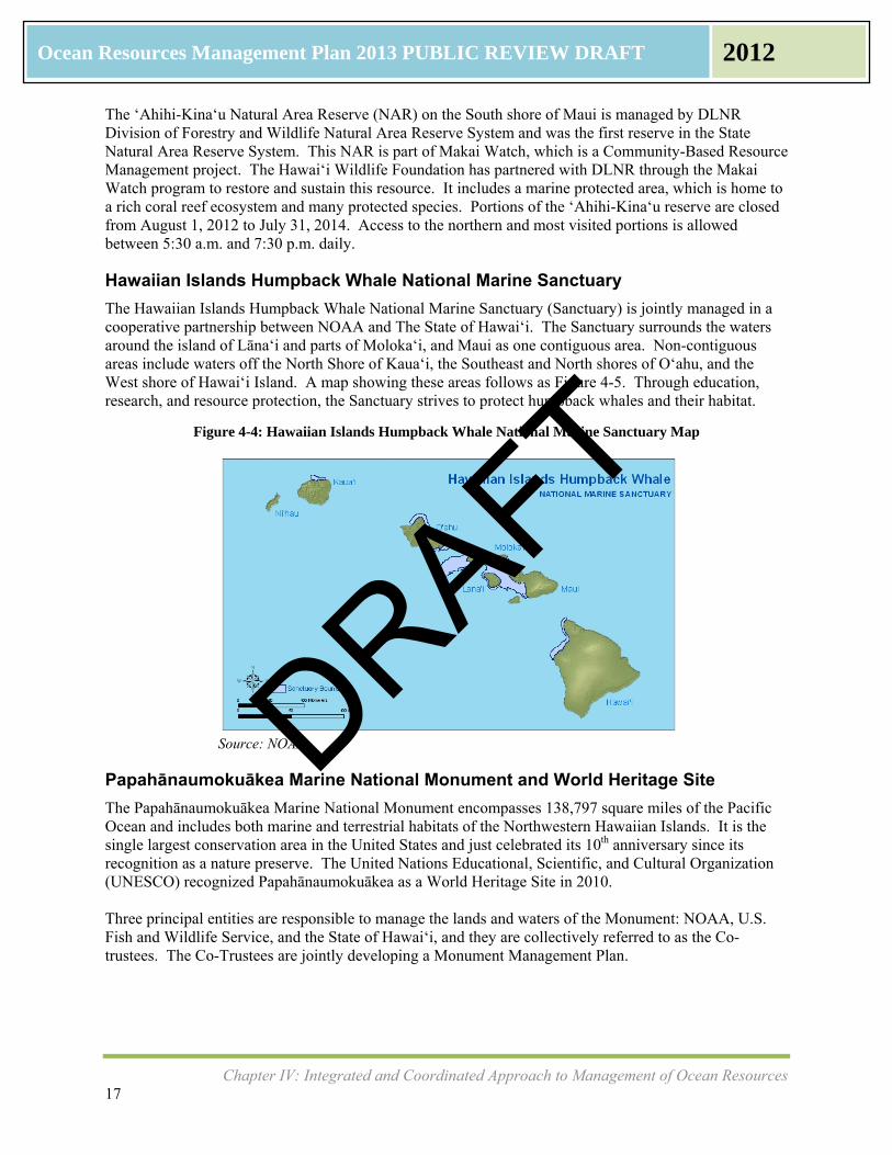
Hawaiian Islands Humpback Whale National Marine Sanctuary
The Hawaiian Islands Humpback Whale National Marine Sanctuary (Sanctuary) is jointly managed in a cooperative partnership between NOAA and The State of Hawai‘i. The Sanctuary surrounds the waters around the island of Lāna‘i and parts of Moloka‘i, and Maui as one contiguous area. Non-contiguous areas include waters off the North Shore of Kaua‘i, the Southeast and North shores of O‘ahu, and the West shore of Hawai‘i Island. A map showing these areas follows as Figure 4-5. Through education, research, and resource protection, the Sanctuary strives to protect humpback whales and their habitat.
Figure 4-4: Hawaiian Islands Humpback Whale National Marine Sanctuary Map
Source: NOAA
Papahānaumokuākea Marine National Monument and World Heritage Site
The Papahānaumokuākea Marine National Monument encompasses 138,797 square miles of the Pacific Ocean and includes both marine and terrestrial habitats of the Northwestern Hawaiian Islands. It is the single largest conservation area in the United States and just celebrated its 10th anniversary since its recognition as a nature preserve. The United Nations Educational, Scientific, and Cultural Organization (UNESCO) recognized Papahānaumokuākea as a World Heritage Site in 2010. Three principal entities are responsible to manage the lands and waters of the Monument: NOAA, U.S. Fish and Wildlife Service, and the State of Hawai‘i, and they are collectively referred to as the Co-trustees. The Co-Trustees are jointly developing a Monument Management Plan.
DRAFT
Chapter IV: Integrated and Coordinated Approach to Management of Ocean Resources 18
Ocean Resources Management Plan 2013 PUBLIC REVIEW DRAFT 2012
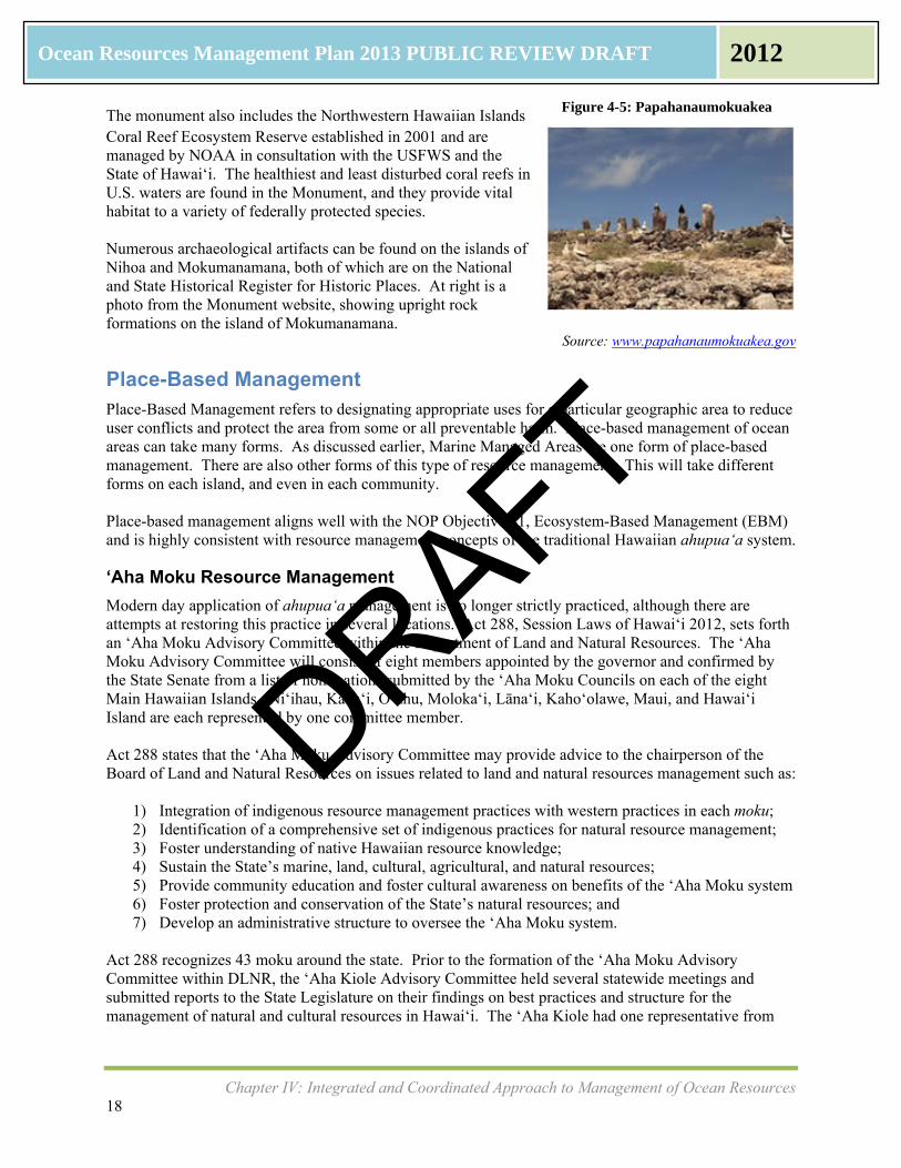
The monument also includes the Northwestern Hawaiian Islands Coral Reef Ecosystem Reserve established in 2001 and are managed by NOAA in consultation with the USFWS and the State of Hawai‘i. The healthiest and least disturbed coral reefs in U.S. waters are found in the Monument, and they provide vital habitat to a variety of federally protected species. Numerous archaeological artifacts can be found on the islands of Nihoa and Mokumanamana, both of which are on the National and State Historical Register for Historic Places. At right is a photo from the Monument website, showing upright rock formations on the island of Mokumanamana.
Source: www.papahanaumokuakea.gov
Place-Based Management Place-Based Management refers to designating appropriate uses for a particular geographic area to reduce user conflicts and protect the area from some or all preventable harm. Place-based management of ocean areas can take many forms. As discussed earlier, Marine Managed Areas are one form of place-based management. There are also other forms of this type of resource management. This will take different forms on each island, and even in each community. Place-based management aligns well with the NOP Objective #1, Ecosystem-Based Management (EBM) and is highly consistent with resource management concepts of the traditional Hawaiian ahupuaʻa system.
‘Aha Moku Resource Management
Modern day application of ahupuaʻa management is no longer strictly practiced, although there are attempts at restoring this practice in several locations. Act 288, Session Laws of Hawai‘i 2012, sets forth an ‘Aha Moku Advisory Committee within the Department of Land and Natural Resources. The ‘Aha Moku Advisory Committee will consist of eight members appointed by the governor and confirmed by the State Senate from a list of nominations submitted by the ‘Aha Moku Councils on each of the eight Main Hawaiian Islands. Ni‘ihau, Kaua‘i, O‘ahu, Moloka‘i, Lāna‘i, Kaho‘olawe, Maui, and Hawai‘i Island are each represented by one committee member. Act 288 states that the ‘Aha Moku Advisory Committee may provide advice to the chairperson of the Board of Land and Natural Resources on issues related to land and natural resources management such as:
1) Integration of indigenous resource management practices with western practices in each moku; 2) Identification of a comprehensive set of indigenous practices for natural resource management; 3) Foster understanding of native Hawaiian resource knowledge; 4) Sustain the State’s marine, land, cultural, agricultural, and natural resources; 5) Provide community education and foster cultural awareness on benefits of the ‘Aha Moku system 6) Foster protection and conservation of the State’s natural resources; and 7) Develop an administrative structure to oversee the ‘Aha Moku system.
Act 288 recognizes 43 moku around the state. Prior to the formation of the ‘Aha Moku Advisory Committee within DLNR, the ‘Aha Kiole Advisory Committee held several statewide meetings and submitted reports to the State Legislature on their findings on best practices and structure for the management of natural and cultural resources in Hawai‘i. The ‘Aha Kiole had one representative from
Figure 4-5: Papahanaumokuakea
DRAFT
Chapter IV: Integrated and Coordinated Approach to Management of Ocean Resources 19
Ocean Resources Management Plan 2013 PUBLIC REVIEW DRAFT 2012
each of the eight Main Hawaiian Islands, but they are not necessarily the same eight people to be appointed by the Governor to the newly formed ‘Aha Moku Advisory Committee in DLNR. During the Public Listening Sessions for this ORMP Update, community members gave input on what modern day ahupuaʻa management means to them. An ahupuaʻa encompasses a “slice” of land from the mountains to the sea, and the Native Hawaiian view is that the entire land division is integrated. People spoke of kumuwai, which means both the source of wealth as well as the source of a stream, and in this instance the source comes from the rain above to the tip of the mountain, traveling through the ahupuaʻa as a stream to the ocean. There is a reverence and acknowledgement that all is connected and that it is a higher power’s will that brings all water from its starting point in the heavens above to the ocean that surrounds the islands. Managing an ahupuaʻa, while similar to the term conservation, incorporates sustainability principles. The loʻi that feeds poi to the people of an ahupuaʻa also functions as a place where non-point source sedimentation occurs while also slowing down the flow of water so that it can recharge the water table below the soil. Community members expressed a need to feed their community, especially the kupuna (elders) and keiki (children) who were unable to catch or grow food for themselves. They saw traditional ahupuaʻa land management as a way to ensure food for now and sustain it for the future. A community working together can plant and maintain loʻi, reconstruct their shoreline Native Hawaiian fishponds, gather their own paa kai (salt), and keep their stream inflows to ensure a recharging of water in the entire water cycle. Many felt that they could do this without waiting for government assistance and without a statewide plan to tell them how to manage their own land. Others were organized for their entire island’s natural resources, such as on Moloka‘i, and wanted the ‘Aha Moku system to be mandatory.
Community Action and Citizen Stewardship: ORMP Implementation Projects
A primary mission of the Office of Planning, Hawai‘i Coastal Zone Management Program (OP-CZM) is to coordinate the implementation of the ORMP by promoting collaborative governance and stewardship. During the ORMP Demonstration Phase, several community groups were able to implement projects with the assistance of funds from OP- CZM. Six ORMP implementation projects were funded that involved state or county government partners working with a community-based organization partner. Six other community projects were funded through the leveraging of other funds. The twelve projects described provide important information and lessons from the ORMP Demonstration Phase.
MāhuahuaʻAioHoi(O‘ahu)The Hawai‘i Community Development Authority (HDCA) received $96,395.00 of OP-CZM funds to support a project called Māhuahua ‘Ai o Hoi. The community partners involved in this project included Kāko‘o ‘Ōiwi and the Ko‘olaupoko Hawaiian Civic Club. The project site is on Oʻahu’s windward coast at the He‘eia wetlands (Hoi), which currently lay fallow and are covered with dense vegetation. Mangrove overgrowth that was hampering the flow of the Heʻeia Stream was removed. In order to restore the He‘eia wetlands and reduce non-point source pollution at the shoreline, the partners are incorporating a traditional Hawaiian ahupua‘a concept of land management through the
interconnections of the He‘eia wetlands to the He‘eia shoreline. The He‘eia Wetland Restoration Strategic Plan 2010-2015 outlines plans, partnerships, and actions to be undertaken in the next few years. The planning and training phase of the project embodies all three perspectives of the ORMP and serves as a model demonstration project.
DRAFT
Chapter IV: Integrated and Coordinated Approach to Management of Ocean Resources 20
Ocean Resources Management Plan 2013 PUBLIC REVIEW DRAFT 2012
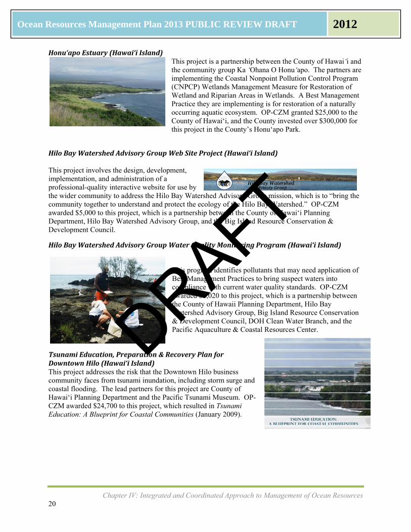
Honu‘apoEstuary(HawaiʻiIsland)This project is a partnership between the County of Hawai‘i and the community group Ka ‘Ohana O Honu‘apo. The partners are implementing the Coastal Nonpoint Pollution Control Program (CNPCP) Wetlands Management Measure for Restoration of Wetland and Riparian Areas in Wetlands. A Best Management Practice they are implementing is for restoration of a naturally occurring aquatic ecosystem. OP-CZM granted $25,000 to the County of Hawai‘i, and the County invested over $300,000 for this project in the County’s Honu‘apo Park.
HiloBayWatershedAdvisoryGroupWebSiteProject(HawaiʻiIsland) This project involves the design, development, implementation, and administration of a professional-quality interactive website for use by the wider community to address the Hilo Bay Watershed Advisory Group mission, which is to “bring the community together to understand and protect the ecology of the Hilo Bay Watershed.” OP-CZM awarded $5,000 to this project, which is a partnership between the County of Hawai‘i Planning Department, Hilo Bay Watershed Advisory Group, and the Big Island Resource Conservation & Development Council.
HiloBayWatershedAdvisoryGroupWaterQualityMonitoringProgram(Hawai‘iIsland)
This program identifies pollutants that may need application of Best Management Practices to bring suspect waters into compliance with current water quality standards. OP-CZM awarded $5,020 to this project, which is a partnership between the County of Hawaii Planning Department, Hilo Bay Watershed Advisory Group, Big Island Resource Conservation & Development Council, DOH Clean Water Branch, and the Pacific Aquaculture & Coastal Resources Center.
TsunamiEducation,Preparation&RecoveryPlanforDowntownHilo(HawaiʻiIsland)This project addresses the risk that the Downtown Hilo business community faces from tsunami inundation, including storm surge and coastal flooding. The lead partners for this project are County of Hawai‘i Planning Department and the Pacific Tsunami Museum. OP-CZM awarded $24,700 to this project, which resulted in Tsunami Education: A Blueprint for Coastal Communities (January 2009).
DRAFT
Chapter IV: Integrated and Coordinated Approach to Management of Ocean Resources 21
Ocean Resources Management Plan 2013 PUBLIC REVIEW DRAFT 2012
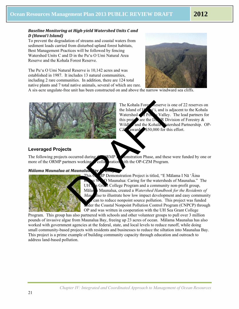
BaselineMonitoringatHigh‐yieldWatershedUnitsCandD(HawaiʻiIsland) To prevent the degradation of streams and coastal waters from sediment loads carried from disturbed upland forest habitats, Best Management Practices will be followed by fencing Watershed Units C and D in the Pu‘u O Umi Natural Area Reserve and the Kohala Forest Reserve. The Puʻu O Umi Natural Reserve is 10,142 acres and was established in 1987. It includes 13 natural communities, including 2 rare communities. In addition, there are 124 total native plants and 7 total native animals, several of which are rare. A six-acre ungulate-free unit has been constructed on and above the narrow windward sea cliffs.
The Kohala Forest Reserve is one of 22 reserves on the Island of Hawai‘i, and is adjacent to the Kohala Watershed and Pololu Valley. The lead partners for this project are the DLNR Division of Forestry & Wildlife and the Kohala Watershed Partnership. OP-CZM awarded $50,000 for this effort.
Leveraged Projects
The following projects occurred during the ORMP Demonstration Phase, and these were funded by one or more of the ORMP partners working in collaboration with the OP-CZM Program.
MālamaMaunaluaatMaunaluaBay(Oʻahu)This ORMP Demonstration Project is titled, “E Mālama I Nā ‘Āina Kumu Wai O Maunalua: Caring for the watersheds of Maunalua.” The UH Sea Grant College Program and a community non-profit group, Mālama Maunalua, created a Watershed Handbook for the Residents of Maunalua to illustrate how low impact development and easy community tools can to reduce nonpoint source pollution. This project was funded under the Coastal Nonpoint Pollution Control Program (CNPCP) through OP and was written in cooperation with the UH Sea Grant College
Program. This group has also partnered with schools and other volunteer groups to pull over 3 million pounds of invasive algae from Maunalua Bay, freeing up 23 acres of ocean. Mālama Maunalua has also worked with government agencies at the federal, state, and local levels to reduce runoff, while doing small community-based projects with residents and businesses to reduce the siltation into Maunalua Bay. This project is a prime example of building community capacity through education and outreach to address land-based pollution.
DRAFT
Chapter IV: Integrated and Coordinated Approach to Management of Ocean Resources 22
Ocean Resources Management Plan 2013 PUBLIC REVIEW DRAFT 2012
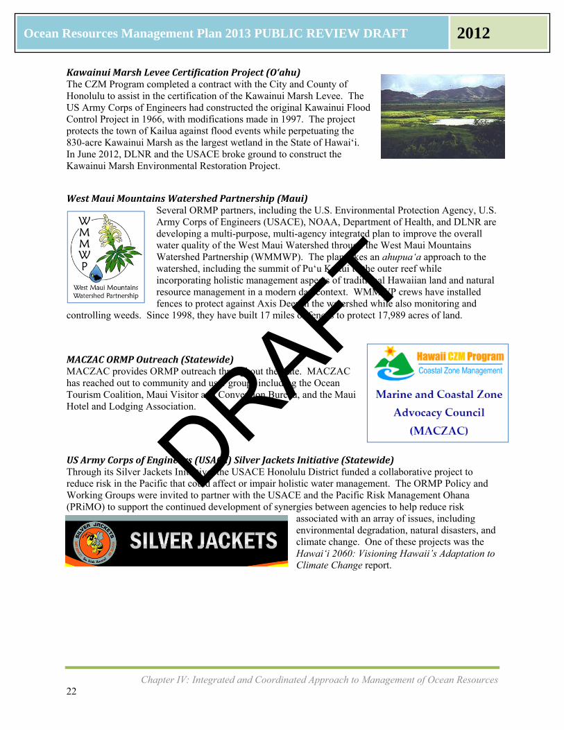
KawainuiMarshLeveeCertificationProject(O‘ahu)The CZM Program completed a contract with the City and County of Honolulu to assist in the certification of the Kawainui Marsh Levee. The US Army Corps of Engineers had constructed the original Kawainui Flood Control Project in 1966, with modifications made in 1997. The project protects the town of Kailua against flood events while perpetuating the 830-acre Kawainui Marsh as the largest wetland in the State of Hawai‘i. In June 2012, DLNR and the USACE broke ground to construct the Kawainui Marsh Environmental Restoration Project.
WestMauiMountainsWatershedPartnership(Maui)Several ORMP partners, including the U.S. Environmental Protection Agency, U.S. Army Corps of Engineers (USACE), NOAA, Department of Health, and DLNR are developing a multi-purpose, multi-agency integrated plan to improve the overall water quality of the West Maui Watershed through the West Maui Mountains Watershed Partnership (WMMWP). The plan takes an ahupua‘a approach to the watershed, including the summit of Pu‘u Kukui to the outer reef while incorporating holistic management aspects of traditional Hawaiian land and natural resource management in a modern day context. WMMWP crews have installed fences to protect against Axis Deer in the watershed while also monitoring and
controlling weeds. Since 1998, they have built 17 miles of fences to protect 17,989 acres of land.
MACZACORMPOutreach(Statewide)MACZAC provides ORMP outreach throughout the state. MACZAC has reached out to community and user groups including the Ocean Tourism Coalition, Maui Visitor and Convention Bureau, and the Maui Hotel and Lodging Association.
USArmyCorpsofEngineers(USACE)SilverJacketsInitiative(Statewide)Through its Silver Jackets Initiative, the USACE Honolulu District funded a collaborative project to reduce risk in the Pacific that could affect or impair holistic water management. The ORMP Policy and Working Groups were invited to partner with the USACE and the Pacific Risk Management Ohana (PRiMO) to support the continued development of synergies between agencies to help reduce risk
associated with an array of issues, including environmental degradation, natural disasters, and climate change. One of these projects was the Hawai‘i 2060: Visioning Hawaii’s Adaptation to Climate Change report.
DRAFT