kickoff workshop of the cis ecostat hydromorphology … · kickoff workshop of the cis ecostat...
TRANSCRIPT

Kickoff workshop of the CIS ECOSTAT hydromorphology group
13 - 14 October 2016, JRC, Ispra, Italy
Worshop Summary Report
November 2016

2
Workshop Summary Report written by Eleftheria Kampa (Ecologic Institute) on behalf of the workshop co-organisers IT, JRC and DG ENV.

3
Contents
1 Aims of the workshop .................................................................................................................. 4
2 Setting the frame of the workshop ............................................................................................. 5
3 Discussion on the draft questionnaire ....................................................................................... 7
4 Next steps - Conclusions ............................................................................................................ 9
Annex I: Workshop Agenda .............................................................................................................. 11
Annex II: List of participants ............................................................................................................. 13
Annex III: Minutes of discussion on the draft questionnaire ........................................................ 14

4
1 Aims of the workshop
The kickoff meeting of the CIS ECOSTAT hydromorphology group on river hydromorphological as-sessment and monitoring was held on 13 -14 October 2016 at the JRC, in Ispra (Italy).
The workshop focused on river hydromorphological assessment and monitoring approaches across scales, as also outlined as activity E.2 in the Terms of Reference of the Hydromorphology Ad-hoc Task Group. The main aim was to prepare an information collection exercise to get a comprehensive overview of the hydromorphological approaches in use for WFD assessment. This exercise should also lead to more common understanding on how we assess hydromorphological conditions in our national contexts, as a basis to carry out future relevant CIS activities.
A draft questionnaire to collect information from European countries on hydromorphological assess-ment and monitoring methods in a structured way was prepared for the workshop and circulated to workshop participants on 3 October 2016. The discussion at the workshop was facilitated by present-ing the different elements and questions proposed in the questionnaire with the aim to get feedback from the participants on whether the questions are appropriate to reflect their national approaches to hydromorphological monitoring and assessment. The purpose of the discussion was to agree on the way forward for a sound questionnaire, to kick-off the work of the CIS ECOSTAT hydromorphology expert group.
It was announced prior to the workshop that the questionnaire would be revised on the basis of the workshop discussions and countries would be invited to fill-in the questionnaire in the coming months.
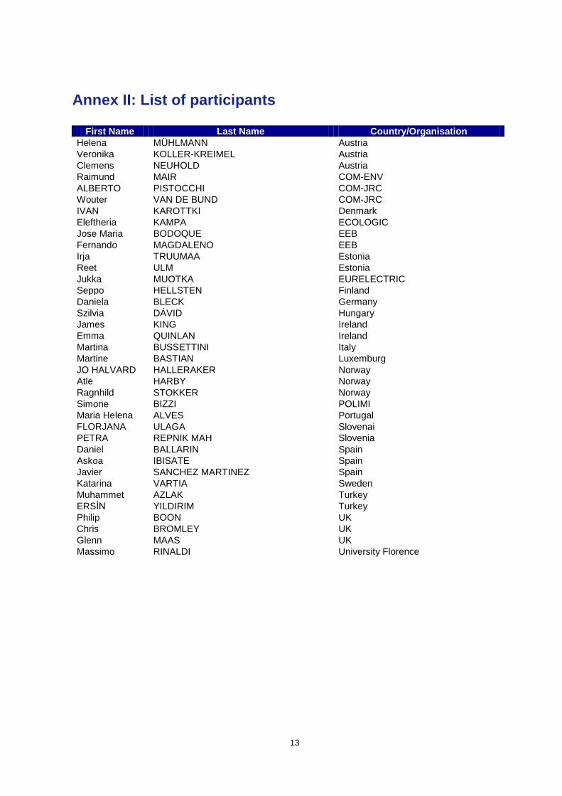
37 participants attended the workshop including participants from 16 countries and 2 stakeholder groups (see list of participants in Annex II).
The workshop presentations are available at on CIRCABC.
This Summary Report presents the key conclusions of the workshop based on the discussions in the different sessions.

5
2 Setting the frame of the workshop
In the opening session, Giovanni Bidoglio (Head of the Water Resources Unit of the Institute for Envi-ronment and Sustainability (IES) of the JRC) welcomed the participants. He emphasised that hydro-morphology is a central element for the implementation of the WFD, it has been part of the CIS for a long time and its importance was re-emphasised in the 2012 Water Blueprint. However, even though hydromorphology has been part of the CIS work-programme, it has not been addressed so far in a coherent way, therefore the tasks that the new Adhoc Task Group on Hydromorphology is called to address are very important and challenging.
After the welcome introductions, presentations were given by the co-leads of the Adhoc Task Group on Hydromorphology (DGENV, JRC, NO and IT) to describe the background and set the frame for the workshop discussions. The presentations covered:
The role of hydromorphology in WFD implementation (presented by Raimund Mair, DGENV)
Hydromorphology activities in the CIS and the role of the CIS ECOSTAT hydromorphology expert group (presented by Wouter van de Bund, JRC)
Links with the CIS activities on ecological potential (presented by Jo Halvard Halleraker, NO)
Aims and expected outcome of the workshop (presented by Martina Bussettini, IT)
An additional technical presentation was given on the 2nd
day of the workshop on Hydromorphologi-cal Assessment: Support from Remote Sensing (presented by Simone Bizzi, Politecnico di Milano).
The slides of these presentations can be viewed on CIRCABC.
Questions and discussions on the presentations addressed mainly the following:
Classification based on hydromorphology: The question was raised whether there any plans to expand the WFD obligation for classifying water bodies based on hydromorphology to all status classes (beyond high status). It was confirmed that according to existing CIS Guidance for high status also hydromorphology has to be in high status. Whether to take into account hydromorphology for classes below high also depends on the appropriateness of biological assessment methods to trace hydromorphological modifications. Such discussions could be useful to take place within the WG ECOSTAT and conclusions might also feed into the discussions for the review of the WFD.
Links to CEN standard: The output of the work of the CIS ECOSTAT hydromorphology ex-pert group will be a report on best practice in hydromorphological assessment. It was asked whether the CEN standard will take up the best practice that emerges from this group’s work. It was clarified that the CEN activity is independent from the WFD CIS activities, therefore it is not expected for the CEN standard to take up all details from the best practice report. Within the CEN group, there is expectation to carefully take account of WFD issues and consider the needs of WFD technical experts, but the CEN standard goes beyond the WFD.
Need for an agreed glossary: It was pointed out that an agreed glossary should be devel-oped (which is a difficult task) for the present CIS activity on hydromorphological assessment methods. Care should also be taken that the defined terms are not different from other defini-tions, e.g. those used for the CEN standard.
Role of different groups in the ATG Hydromorphology:
o It was made obvious from the discussion that it needs to be made clearer what the role of the different groups in the mandate of the ATG is and how contributions from different experts will be organised.
o It is at the moment unclear when hydromorphological assessment methods for lakes will be addressed.
6
o Overall, it is clear that there is need to prioritise work on certain issues, depending on the number of countries volunteering to lead a specific part of the work programme.
o There is an open request for countries to join the hydromorphology group on drain-age/agriculture issues as well as hydromorphology in coastal and transitional waters.
o For the policy-related issues in the mandate of the ATG Hydromorphology, ideas will be developed by the co-leads for policy-oriented workshops and presented to the SCG. The SCG will be asked to nominate experts for the different topics.
Working mode of CIS ECOSTAT hydromorphology expert group: It was clarified that the duration of the mandate for this group is from 2016 to 2018. The frequency of the meetings is not fixed but it will be related to the steps of delivery of its work-programme.
Linking mitigation measures to biology when defining ecological potential: The present draft reports of the GEP core group miss the connection of mitigation measures to the WFD’s emphasis on biology. It is important to discuss in the next steps the minimum requirements at GEP in terms of biological elements.
Harmonising GEP: As a reaction to the conclusion presented from the GEP activity that it is possible to harmonise GEP and identify a set of minimum requirements, disagreement was expressed that GEP can be harmonised through minimum mitigation measures set for HMWB. When applying mitigation measures for HMWB, there is potentially always a signifi-cant effect on the use. In addition, there are many different kinds of rivers and HMWB for which mitigation needs to be considered and the assessment of ecological potential should be done case-by-case. The reply to this comment was that sometimes this assessment needs to be done on a case-by-case basis but this should not always be the case. Otherwise, HMWB will be treated as an exemption and not as a water category as originally indicated in the WFD. For this reason, the GEP core group proposes that we need to have some common understanding of the minimum requirements to ensure ecosystem functioning of HMWB as well as of the definition of what is a significant effect on use.
HMWB/GEP intercomparison exercise: It was announced that a pilot intercomparison ex-ercise of HMWB and GEP will be set up. The approach will be tested with a few countries first before inviting all countries to contribute. A first workshop on this exercise will be organised in February 2017 and the invitation will be sent to the list of nominated GEP experts, especially on issues related to storage.
Potential of remote sensing to cover hydromorphological pressures: The point was raised that when using remote sensing technologies, you need to have good understanding of the kind of pressures that may be present. For some types of pressures, detection via re-mote sensing is easy, but for some other pressures (especially small-scale pressures), it is not so easy. The question was asked whether improvements in this respect can be expected in the near future. It was clarified that technology has been developing rapidly but there are still strong limitations for smaller pressures like bank protections and small barriers. By using drones, experts can see a lot but there are limitations on the locations that can be surveyed.

7
3 Discussion on the draft questionnaire
In the following sessions of the 1st day of the workshop, each section of the draft questionnaire on
hydromorphological assessment and monitoring was introduced and each entry and reply option was explained (presentation by Massimo Rinaldi, UNIFI). This was followed by discussion on how partici-pants see these particular aspects, whether certain points need to be further clarified or added in the questionnaire.
Discussions on the questionnaire were summarised on the 2nd
day of the workshop (by Eleftheria Kampa, Ecologic Institute) and some concluding discussions on the draft questionnaire took place.
Overall, many of the discussions on the draft questionnaire revealed some of the challenges ahead for the upcoming collection of information on hydromorphological assessment methods at European level. It was pointed out that it is not the intention to use the questionnaire results in order to evaluate good and bad examples, but to use the country responses as a basis and as a point of reference for future discussions.
According to feedback given by workshop participants, the text introducing the questionnaire should emphasise the following points:
- The aim of the questionnaire is not to record every single method available but to focus on the methodologies which are used for the WFD and for the River Basin Management Plans.
- Some methods may be combining or clustering different aspects (e.g. hydrology, morphology, continuity) and guidance should be given on how to use the questionnaire for these cases.
- Some of the first entries in the questionnaire should be indicated as obligatory. Other parts of the questionnaire may not have to be filled in if they are not applicable.
- Experts should read the whole questionnaire first, before replying to individual sections - The experts filling in the questionnaire should be aware that the filled-in questionnaires will be
made available on CIRCABC.
The following comments concerned the revision of the entire questionnaire:
- Each entry and reply option of the questionnaire should be explained & examples given to the extent possible.
- The revised questionnaire should include the list of terms and definitions presented in Ispra (de-lineation, characterisation, assessment, classification and monitoring). For the term “classifi-cation” related to hydromorphology, it is better to find another appropriate wording, to avoid confusion with status classification.
- Some terms used in the questionnaire are included in the WFD, e.g. sediment composition. The questionnaire should include the definition of these terms according to WFD agreed terminol-ogy or link the definitions to the WFD ones.
- The following tick-boxes should be added throughout the entries for more flexibility in replies: o Other o Not applicable
- Each section of the questionnaire should include a free text entry (feedback entry) to explain if and why a country could not fill in a particular section or part of a section of the questionnaire.
- The final format in which the questionnaire will be distributed needs to be clarified. Options are as Excel spreadsheet or a web-based questionnaire. Decision needs to be taken based on the pros and contras of each option and the resources available to design the questionnaire.
- A webinar (online guided tour) should be organised to give guidance how to fill in the question-naire to the relevant experts.
The full record of the issues raised and modifications discussed for each section of the ques-tionnaire are presented in Annex III to this Summary Report. Notes in Annex III are either:
Direct track-changes in the text of the questionnaire, when it was relatively clear what modifi-cation was requested, or

8
Further notes below each entry of the questionnaire (in red font), which need to be consid-ered when revising the particular section. These notes mainly summarise comments which need further thinking and elaboration by the authors of the questionnaire.
It was agreed that a separate section of the questionnaire will be developed to address hydrol-ogy and circulated for comments together with the revised questionnaire on hydromorphological as-sessment methods. A proposal on the elements that the section on hydrology could cover was pre-sented on the 2
nd day of the workshop by Martina Bussettini (IT). Discussions taking place on the
hydrology part of the questionnaire addressed the following:
- It is important to ask whether a method is considering the five components of the flow relevant for ecological processes (magnitude, duration, frequency, rate of change, timing), especially if all components are considered or some of them.
- Additional Information on the rate of change at the sub-hourly resolution is not needed, because this is not the only aspect that is important, e.g. for hydropeaking. It is more important to ask about the temporal scale. All the five components of flow should be considered at the rele-vant time scales.
- Questionnaire options should differentiate between ordinary and extreme flows (as well as low flows)
- Questions on the temporal scales and duration of flow are important (time resolution, minimum length of time series)
- Hydrological alteration is not only about hydropeaking. There are many different pressures and drivers, e.g. urbanisation and land use changes have severe impacts on hydrology. The questionnaire should ask about pressure-impact based types of hydrological assessment.
- The questionnaire should give the option to indicate which pressures are addressed (tick-boxes): abstraction, discharge, hydropeaking, water level change e.g. artificial waves from navigation, etc
- Questionnaire should include aspect of connection to groundwater; it should be asked whether the method picks up low-water and surface-groundwater interactions.
- A specific question could be included linking to the CIS Guidance on eflows (Do you have a method to define ecological flow requirements in your country?)

9
4 Next steps - Conclusions
Next steps as follow-up to this workshop
In the final session, the possible next steps as a follow-up to this workshop on hydromor-phological assessment were presented by Raimund Mair, DGENV, and discussed with participants. The following steps and timeline were agreed:
Update of questionnaire and drafting of workshop summary report by mid November 2016
Circulation of revised questionnaire and workshop summary report to workshop participants for comments and feedback in mid November 2016 (comments should be sent back by early December 2016). The questionnaire should be finalised by the expert group attending the Is-pra workshop.
Finalisation of questionnaire in December 2016
Circulation of questionnaire for data provision to MS around 2nd
week of December 2016. The questionnaire will be circulated to the experts nominated for the CIS ECOSTAT hydromor-phology expert group (cc to ECOSTAT)
Country responses to questionnaire by end of January 2017
Compilation of responses and provision of summary two weeks before the next workshop (planned for spring 2017)
Next workshop of CIS ECOSTAT hydromorphology expert group
The following issues should be considered in the planning of the next workshop of the CIS ECOSTAT hydromorphology expert group:
The basis for discussion will be the compilation of different methods
Key questions for the discussion will be proposed; the key questions will become more ap-parent after evaluating the country responses to the questionnaire
Some practical examples from different countries should be presented
Breakout sessions on specific topics should take place.
Potential issues for future discussion
In the closing session of the workshop, some potential issues for further discussion (food for thought) were presented, in order to collect ideas from the participants on the issues that could be discussed in the next workshop of the CIS ECOSTAT hydromorphology expert group:
Are results from different HYMO assessment methodologies directly applicable for different steps of WFD implementation?
Can results be directly used for water body and HMWB designation, pressures/impacts as-sessment, status assessment, risk assessment, design of PoM, …?
Are additional assessments required, e.g. to cover the biological aspects? If yes, how do they look like?
How efficiently can different HYMO assessment methodologies be applied for the whole river network?
Cost-efficiency aspects?
Which detail of assessment is required for which step of WFD implementation?
Are we able draw general conclusions and provide recommendations for HYMO assessment methodologies for WFD implementation?

10
Discussions on the potential issues for the next workshop addressed mainly the following:
It would be valuable if the report compiling country responses to the questionnaire on hydro-morphological assessment methods is not only a compilation of different methods but also addresses linkages with the different steps of WFD implementation. Recommendations could be formulated on what might be best practice on the different hydromorphological aspects of the WFD.
It would also be useful to report on the outcome of method testing exercises in different coun-tries. For example, NO is testing different methods on hydromorphological characterisation and is applying these methods on the same scale to compare their strength and weaknesses. The question is whether these methods provide the right information for WFD implementa-tion. A similar comparative exercise of different hydromorphological assessment methods is being done in the UK.
It is important to highlight the direct relevance of the work of the hydromorphology expert group to the WFD. This will have to be related with activities that address the linkages of hy-dromorphology to biology. As an example, minimum requirements for some species could be expressed in terms of hydromorphological parameters (e.g. minimum flow velocities and/or minimum possibilities for fish migration) and/or biological parameters.
We should follow a stepwise approach in the work programme, i.e. first compile the methods being used, assess what are the needs for WFD implementation and then take the next step. We should not ignore linkages to other Directives, but first we should tackle the gaps to achieve the requirements of the WFD and then tackle the hydromorphology needs of other EU legislation.

11
Annex I: Workshop Agenda
Kickoff meeting of the CIS ECOSTAT hydromorphology group
13 October 2016 - 14 October 2016
JRC, Ispra, Italy
Thursday 13 October 2016 (9:00 - 18:00)
9:00-9:10 Welcome JRC
9:10-9:30 Role of hydromorphology in WFD implementa-tion
Raimund Mair, DGENV
9:30-9:50 Hydromorphology activities in the CIS, role of the CIS ECOSTAT hymo expert group
Wouter van de Bund, JRC
9:50-10:10 Links with the CIS activities on ecological po-tential
Jo Halvard Halleraker, NO
10:10-10:30 Aims and expected outcome of the meeting Martina Bussettini, IT
10:30-11:00 Discussion
11:00-11:30 Coffee break
11:30-13:00
Hydromorphological monitoring and assess-ment questionnaire:
- Presentation of the main sections
- MS example
- Discussion section-wise
Masssimo Rinaldi (UNIFI) and Martina Bussettini (IT)
1.General Information
13:00-14:00 Lunch
14:00-15:30
2. General characteristics
3. Recorded hydromorphological features
4. Consideration of processes
15:30-16:00 Coffee Break
16:00-18:00
5. Recorded artificial elements
6. Scoring
20:00 Social dinner

12
Friday 14 October (9:00 – 12:30)
9:00-10:00 Summary outcome of first day on the hydromorphological monitoring and as-sessment questionnaire
Eleftheria Kampa (ECOLOGIC) & Massimo Rinaldi (UNIFI)
10:00-10:20 Hydromorphological assessment: Sup-port from Remote Sensing
Simone Bizzi (Politecnico di Milano)
10:30-11:00 Coffee Break
11:00-12:00 Presentations from MS on hydromorphological monitoring and as-sessment
12:00-12:30 Conclusions and next steps
12:30 End of the workshop
13
Annex II: List of participants
First Name Last Name Country/Organisation
Helena MÜHLMANN Austria
Veronika KOLLER-KREIMEL Austria
Clemens NEUHOLD Austria
Raimund MAIR COM-ENV
ALBERTO PISTOCCHI COM-JRC
Wouter VAN DE BUND COM-JRC
IVAN KAROTTKI Denmark
Eleftheria KAMPA ECOLOGIC
Jose Maria BODOQUE EEB
Fernando MAGDALENO EEB
Irja TRUUMAA Estonia
Reet ULM Estonia
Jukka MUOTKA EURELECTRIC
Seppo HELLSTEN Finland
Daniela BLECK Germany
Szilvia DÁVID Hungary
James KING Ireland
Emma QUINLAN Ireland
Martina BUSSETTINI Italy
Martine BASTIAN Luxemburg
JO HALVARD HALLERAKER Norway
Atle HARBY Norway
Ragnhild STOKKER Norway
Simone BIZZI POLIMI
Maria Helena ALVES Portugal
FLORJANA ULAGA Slovenai
PETRA REPNIK MAH Slovenia
Daniel BALLARIN Spain
Askoa IBISATE Spain
Javier SANCHEZ MARTINEZ Spain
Katarina VARTIA Sweden
Muhammet AZLAK Turkey
ERSİN YILDIRIM Turkey
Philip BOON UK
Chris BROMLEY UK
Glenn MAAS UK
Massimo RINALDI University Florence

14
Annex III: Minutes of discussion on the draft questionnaire
CIS ECOSTAT hydromorphology group
European country Questionnaire on Hydromorphological Assessment and Monitoring
Context
The purpose of this questionnaire is to collect information from European countries on hydromor-phological assessment and monitoring methods in a structured way.
The process of developing and filling in the questionnaire will pave the way towards a more common understanding on hydromorphological assessment methods being used in European countries.
The information collected will be used to prepare a report on best practices on hydromorphological assessment across scales as part of the work programme of the CIS Ad-hoc group on Hydromor-phology.
This information collection exercise focuses on the surface water category of rivers.
If a country has more than one method in place (e.g. on hydromorphological assessment and on monitoring), one questionnaire should be filled-in for each method.
1. General information
Overall comment on this section of the questionnaire:
- Section 1 is quite WFD-focused relatively quickly; we should follow a more flexible approach with options for free text to report on methods that do not fit this frame
Name of the method / ac-ronym or abbreviation of method
Country
Contact person
Do you have an official methodology for tracking:
- hydrology
- morphology
- continuity
Explanation (free text)

15
Comments on entry “do you have an official methodology for...”:
- Explain which parts of the questionnaire should be filled in and which are relevant, depending on which tick-box is chosen
- some methods may be combining or clustering different aspects – give guidance on how to use the questionnaire for these cases
- some methods may only concentrate on the assessment of pressures, and in these cases, mainly the section on artificial elements will be filled in while the other parts are not applicable
Aims of the method
Tick-boxes (more than one reply possible):
- hydromorphological classification (WFD-related)
- supporting ecological classification
- used as proxy to (i.e. replacing) biological quality elements
- hydromorphological monitoring
- hydromorphological assessment (non-WFD)
- diagnosis for informing designing measures (e.g. rehabilitation, miti-gation, etc.)
- as prognostic tool (used for environmental impact assessments)
- Other
Explanation (free text)
Further comments on entry “Aims of the method”:
- Entry “Aims of the method” should be renamed to “Use of method”, as the use can be different from the aims originally set out
- Add examples to explain the tick boxes - Hymo assessment has been used for a long time and for other purposes, many methods are not
aiming for classification
Use for WFD Tick-boxes (only more than one reply possible):
- used for high status only
- used for high status and water bodies at risk of not achieving good status or risk of deterioration
- used for all status classes
- used for all steps of the WFD planning process where hydromor-phological information is required
- used for some steps of the WFD planning process where hydromor-phological information is required (please indicate for which WFD steps the method is used from the list below):
Water body delineation
Typology
Pressures & impacts analysis
Monitoring
Status classification (used for definition of high status only)
Status classification (used for classification in all status classes)
Risk analysis
HMWB designation
Definition of Good Ecological Potential

16
Design of program of measures
Exemptions
Other
- Not applicable
Explanation (free text)
Comments on entry “Use of the method”:
- Tick boxes should be replaced with all relevant steps of the WFD planning process where hy-dromorphological assessment is potentially relevant
- There is potential overlap with the previous entry “Aims of the method” . Clarification is needed on what is meant with “Aims” and “Use for” in these two entries of the questionnaire. “Use of the method” entry could be renamed to “Scope of method”
Biological considerations (is method developed also for biological considera-tions?)
- Yes and it addresses fish continuity directly (e.g. it assesses whether a barrier is passable for fish)
- Yes and it addresses fish continuity indirectly (e.g. barrier passability is assessed indirectly by measuring the height of the barrier which is translated into continuity for fish)
- Yes but it does not address fish continuity
- No
Explanation (free text)
Use of method for other Directives (except WFD)
- Habitats Directive
- Floods Directive
- Other
- Not applicable
Explanation (free text)
Status of method Tick-boxes (only multiple one repliesy possible):
- in place (indicate since when)
used in the 1st RBMPs
- used in the 2nd
RBMPs
- in development / emerging method but not yet practically applied
- Other
- Not applicable
Explanation (free text)
Level of application Tick-boxes (multiple replies possible):
- applied in the whole country (national level)

17
- applied in part of the country (regional level)
- aims to assess the whole river network (i.e. every m of the river net-work)
- aims to assess specific sites in the river network
- Other
- Not applicable
Explanation (free text)
Extent of application - % of WBs in the river network to which the method is applied to: please indicate the %
- information not available
- Not applicable
Explanation (free text)
Inclusion in legislation - method is included in national legislation
- method is included in regional legislation
- method is included in national guidelines (non-binding)
- method is included in regional guidelines (non-binding)
- Other
- Not applicable
Explanation (free text)
Relevance for specific pressures
- Method is relevant for specific types of pressures (please indicate which)
- Method is relevant for all types of pressures
- Other
- Not applicable
Explanation (free text)
Key reference Indicate reference (available report, scientific paper, web page, etc.)
Explanation (free text)
Available supporting mate-rial
Tick-boxes (more than one reply possible):
- guidebook
- field sheet forms
- compilation sheet forms

18
- databases
- software
- other (specify)
Explanation (free text)
Users qualification Please describe the specific expertise required to apply the specific method (e.g. expertise in fluvial geomorphology, specific level of edu-cation etc)Tick-boxes (only one reply possible):
- training course required
- specific expertise required (e.g., in fluvial geomorphology)
- no specific expertise requirements
Explanation (free text)
Requirement for accredita-tion (specific certificate or specific training)
Tick-boxes (only one reply possible):
- Accreditation required
- Accreditation not required
- Other
- Not applicable
Explanation (free text)
Resource intensity (how resource intensive is it to apply the method?)
The focus is not on monetary costs but on human resource intensity, e.g. hours needed to apply the method per km
- high resource-intensity
- medium resource-intensity
- low resource-intensity
Explanation (free text)
Comments on new entry “Resource intensity”:
- Provide an explanation how high, medium, low resource intensity should be interpreted - A big obstacle is often the size and type of the river, so what is the cost and efficiency for differ-
ent types - Cost-efficiency is also different if we use different methods for the different WFD steps or a
method that is used for all steps. - At this stage, a simple question on the qualitative assessment of the extent of costs can be in-
cluded; later on, we can develop additional questions e.g. for resources needed to be spent on deskwork, in the field etc.
Feedback on this part of the questionnaire
If you were not able to fill in this section or part of this section of the questionnaire, please explain briefly why
Explanation (free text)

19
2. General characteristics of method
Source of information / data collection
Tick-boxes (more than one reply possible):
- maps
- remote sensing
- GIS
- field survey
- existing databases
- modelling
- Other
- Not applicable
Explanation (free text)
Comments on entry “Source of information/data collection”:
- Remote sensing should be further refined: aerial photography? satellite images? drones? Other?
- For GIS, please explain whether this refers to existing GIS data or GIS as a tool to measure some parameters
Longitudinal spatial scale Tick-boxes (only one reply possible):
- fixed length (indicate length in m/km)
- length scaled to channel width
- variable length
- Exact location of alteration (exact length, e.g. related to a barrier)
- Other
- Not applicable
Explanation (free text)
Further comments on entry “Longitudinal spatial scale”:
- Tick box “length scaled to channel width”: define what the “channel” refers to - Difference between tick boxes “length scaled to channel width” and “variable length” needs to be
explained
Criteria for selection of assessment length
Tick-boxes (more than one reply possible):
- morphological segmentation
- homogeneity of some specific characteristics (indicate which one)
- accessibility
- random
- Other

20
- Not applicable
Explanation (free text)
Comments on entry “Criteria for selection of assessment length”:
- Tick box “morphological segmentation”: please explain what this means
Lateral spatial scale Tick-boxes (more than one reply possible):
- stream channel
- banks
- /riparian zone
- floodplain
- hillslopes
- fixed width (indicate width in m)
- width scaled to channel width
- Other
- Not applicable
Explanation (free text)
Comments on entry “Lateral spatial scale”:
- explain how hillslopes are defined
Longitudinal upscaling to water body (i.e. how the score of the site/reach is extended to the water body)
Tick-boxes (only one reply possible):
- upscaling based on one (or more) representative sites/reaches
- complete coverage of water body and weighted average
- Other
- Not applicable
Explanation (free text)
Comments on entry “Longitudinal upscaling to water body”:
- This question needs further elaboration and explanation - This question on longitudinal upscaling should be asked before asking questions on the scale;
this order would allow easier understanding of questions on scaling issues - Method does not always refer to a water body, even in the context of the WFD. In addition, up-
scaling to water body is not done in all cases. - “weighted average”: Does it have to be a weighted average?
Use of hymo types (i.e. whether some kind of hymo classification is used to classify the site/reach)
Tick-boxes (only one reply possible):
- attribution of a hymo type to the assessment site/reach
- no consideration of hymo types
- Other
- Not applicable

21
Explanation (free text)
Comments on entry “Use of hymo types”:
- The word “type“ in this next and in next entries is confusing. It should be explained what is a morphological type.
- Type refers to current morphology, not to reference condition - Other options for this term could be hydromorphological pattern, hydromorphological condition,
present hydromorphological condition
Criteria/parameters for definition of hymo types
Tick-boxes (more than one reply possible):
- size (e.g., stream order, catchment size, distance from source)
- gradient
- geology
- geographical location
- altitude
- hydrological regime
- confinement
- channel morphological pattern (based on sinuosity, braiding, ana-branching indices)
- Other
- Not applicable
Explanation (free text)
Comments on entry “Criteria/parameters for definition of hymo types”:
- What is meant by “confinement”?
Type-specific Tick-boxes (only one reply possible):
- the method uses type-specific protocol/indicators
- the method is applied in the same way to all types
- Other
- Not applicable
Explanation (free text)
Comments on entry “type-specific”:
- What does type-specific mean? - For example, Sweden has a different protocol for an alluvial and a different protocol for a water
fall - It is not clear what tick-box to select if some of the features of the method are type-specific. For
example, Austria applies its method to all rivers but it does not apply every criterion in the same way
Type-limitations Tick-boxes (only one reply possible):
- the method is applicable to any river type

22
- the method is not applicable to some specific type
- Other
- Not applicable
Explanation (free text)
Temporal dimension Tick-boxes (only one reply possible):
- some consideration of past channel morphology/conditions
- no consideration of past channel morphology/conditions
- Other
- Not applicable
Explanation (free text)
Significance Severity of hydromorphological pres-sures
Tick-boxes (only one reply possible):
- the method attempt to evaluate or account for the significance sever-ity of hydromorphological pressures
- no attempt to evaluate or account for the significance severity of hy-dromorphological pressures
- the method attempts to evaluate or account of the ecological signifi-cance of hydromorphological pressures
- Other
- Not applicable
Explanation (free text)
Further comments on entry “Significance of hydromorphological pressures”:
- Please add the aspect of HMWB identification linked to this question
Reference conditions Tick-boxes (more than one reply possible):
- empirical/statistical (indicate which parameters are used for assess-ing deviation from reference)
- natural/historical morphology (indicate which period, from historical maps or aerial photos)
- reference morphological type
- current present conditions in absence of pressures
- modelled reference conditions
- expert judgement
- objective-based
- no reference conditions
Explanation (free text)

23
Comments on entry “Reference conditions”:
- Write out which question is being asked: What is the method to derive the reference conditions? Which information is used?
- For better understanding of the questionnaire, it was requested to move question on reference conditions before asking about the present condition (see questions above on type)
- If tick boxes are maintained, please add examples of what the tick boxes mean - A simpler solution would be to simplify this entry into a Yes/No question; if yes, please describe
the method - Tick box “natural/historical morphology”:what is the difference between natural and historical? - Tick box “current conditions in absence of pressures” can also be changed to “undisturbed or
nearly undisturbed conditions”
Feedback on this part of the questionnaire
If you were not able to fill in this section or part of this section of the questionnaire, please explain briefly why
Explanation (free text)
3. Recorded hydrological features
New section on recorded hydrological features will be developed and added in this part of the ques-tionnaire
3.4. Recorded hydromorphological features
Overall comment on this section of the questionnaire:
- Provide guidance how to use the free text/explanation option, e.g. to give information on the temporal /spatial scale for recording specific hymo features, whether only visual assessment is done or measurement etc.
- This seems to be the preferred option instead of adding subquestions on scale for some of the entries in this section. The questionnaire should not become too complicated.
Hydrological regimeChan-nel forming discharge
Tick-boxes (only more than one reply possible):
- Is feature recorded?
- Do you use feature to evaluate river conditions?
- Is recording and/or evaluation done periodically?- assessed
- monitored
- not considered
- not relevant
Explanation (free text)
Planform pattern (e.g., sinuous, meandering, etc.)
Tick-boxes (more than only one reply possible):
- Is feature recorded?
- Do you use feature to evaluate river conditions?

24
- Is recording and/or evaluation done periodically?
- not considered
- not relevant
- assessed
- monitored
- not considered
Explanation (free text)
Longitudinal profile / gradi-ent
Tick-boxes (more than only one reply possible):
- Is feature recorded?
- Do you use feature to evaluate river conditions?
- Is recording and/or evaluation done periodically?
- not considered
- not relevant
- assessed
- monitored
- not considered
Explanation (free text)
Variability of cross-section by depth / width
Tick-boxes (more than only one reply possible):
- Is feature recorded?
- Do you use feature to evaluate river conditions?
- Is recording and/or evaluation done periodically?
- not considered
- not relevant
- assessed
- monitored
- not considered
Explanation (free text)
Erosion/depositional fea-tures (bars, eroding banks)
Tick-boxes (more than only one reply possible):
- Is feature recorded?
- Do you use feature to evaluate river conditions?
- Is recording and/or evaluation done periodically?
- not considered
- not relevant

25
- assessed
- monitored
- not considered
Explanation (free text)
Fluvial landforms in the floodplain
Tick-boxes (more than only one reply possible):
- Is feature recorded?
- Do you use feature to evaluate river conditions?
- Is recording and/or evaluation done periodically?
- not considered
- not relevant
- assessed
- monitored
- not considered
Explanation (free text)
Bed substrate Tick-boxes (more than only one reply possible):
- Is feature recorded?
- Do you use feature to evaluate river conditions?
- Is recording and/or evaluation done periodically?
- not considered
- not relevant
- assessed
- monitored
- not considered
Explanation (free text)
Bed configuration (e.g., riffle, pool, etc.)
Tick-boxes (more than only one reply possible):
- Is feature recorded?
- Do you use feature to evaluate river conditions?
- Is recording and/or evaluation done periodically?
- not considered
- not relevant
- assessed
- monitored
- not considered
Explanation (free text)
Comments on entry “Bed configuration”:
- There was request to add a new feature to this section of the questionnaire on Natural barriers, e.g. water falls. At the same time, it was discussed whether this could be captured in the con-

26
text of hydromorphological patterns in the entry “bed configuration”
Sediment flows Tick-boxes (more than one reply possible):
- Is feature recorded?
- Do you use feature to evaluate river conditions?
- Is recording and/or evaluation done periodically?
- not considered
- not relevant
Explanation (free text)
Flow pattern (e.g., rippled, smooth, etc.)
Tick-boxes (more than only one reply possible):
- Is feature recorded?
- Do you use feature to evaluate river conditions?
- Is recording and/or evaluation done periodically?
- not considered
- not relevant
- assessed
- monitored
- not considered
Explanation (free text)
Flow velocities (m/s) Tick-boxes (more than one reply possible):
- Is feature recorded?
- Do you use feature to evaluate river conditions?
- Is recording and/or evaluation done periodically?
- not considered
- not relevant
Explanation (free text)
In-channel large wood Tick-boxes (more than only one reply possible):
- Is feature recorded?
- Do you use feature to evaluate river conditions?
- Is recording and/or evaluation done periodically?
- not considered
- not relevant
- assessed
- monitored
- not considered
Explanation (free text)
Macrophytes Tick-boxes (more than only one reply possible):

27
- Is feature recorded?
- Do you use feature to evaluate river conditions?
- Is recording and/or evaluation done periodically?
- not considered
- not relevant
- assessed
- monitored
- not considered
Explanation (free text)
Comments on entry “macrophytes”:
- It should be specified that we look at vegetation and not macrophyte species as a hymo feature
Vegetation lateral / longitu-dinal extension in the river corridor
Tick-boxes (more than only one reply possible):
- Is feature recorded?
- Do you use feature to evaluate river conditions?
- Is recording and/or evaluation done periodically?
- not considered- assessed
- monitored
- not considered
- not relevant
Explanation (free text)
Comments on entry “Vegetation lateral / longitudinal extension in the river corridor”:
- It should be specified what is meant by vegetation. It includes wood and shrub vegetation but herbaceous vegetation will also influence geomorphic processes. Herbaceous vegetation should not be excluded as it is important in lowland rivers
Vegetation type / structure in the river corridor
Tick-boxes (more than only one reply possible):
- Is feature recorded?
- Do you use feature to evaluate river conditions?
- Is recording and/or evaluation done periodically?
- not considered
- not relevant
- assessed
- monitored
- not considered
Explanation (free text)
Comments on entry “Vegetation type / structure in the river corridor”:
- Please make a distinction between riparian vegetation and vegetation in corridor

28
Feedback on this part of the questionnaire
If you were not able to fill in this section or part of this section of the questionnaire, please explain briefly why
Explanation (free text)
4.5. Consideration of processes
Overall comment on this section of the questionnaire:
The aim of this section, compared to other sections, should be explained. It aims to understand the response of the system to pressures. This is to avoid the impression that some elements in this sec-tion are redundant due to overlap with other sections.
Consideration of geomor-phic processes
Tick-boxes (only one reply possible):
- The method explicitly includes consideration of the occurrence of ex-pected geomorphic processes
- The method does not explicitly include consideration of geomorphic processes
- Other
- Not applicable
Explanation (free text)
Longitudinal continuity / alteration in sediment and wood flux
Tick-boxes (only one reply possible):
- Is feature recorded?
- Do you use feature to evaluate river conditions?
- Is recording and/or evaluation done periodically?
- not considered
- not relevant
- assessed
- monitored
- not considered
Explanation (free text)
Longitudinal alteration of flow discharge
Tick-boxes (only one reply possible):
- Is feature recorded?
- Do you use feature to evaluate river conditions?

29
- Is recording and/or evaluation done periodically?
- not considered
- not relevant
- assessed
- monitored
- not considered
Explanation (free text)
Lateral continuity of flows Tick-boxes (only one reply possible):
- Is feature recorded?
- Do you use feature to evaluate river conditions?
- Is recording and/or evaluation done periodically?
- not considered
- not relevant
- assessed
- monitored
- not considered
Explanation (free text)
Connectivity between hill-slopes and river corridor
Tick-boxes (only one reply possible):
- Is feature recorded?
- Do you use feature to evaluate river conditions?
- Is recording and/or evaluation done periodically?
- not considered
- not relevant
- assessed
- monitored
- not considered
Explanation (free text)
Occurrence of bank ero-sion processes
Tick-boxes (only one reply possible):
- Is feature recorded?
- Do you use feature to evaluate river conditions?
- Is recording and/or evaluation done periodically?
- not considered
- not relevant
- assessed
- monitored
- not considered
Explanation (free text)

30
Presence of a potentially erodible corridor
Tick-boxes (only one reply possible):
- Is feature recorded?
- Do you use feature to evaluate river conditions?
- Is recording and/or evaluation done periodically?
- not considered
- not relevant
- assessed
- monitored
- not considered
Explanation (free text)
Alteration of bed morpho-logical units
Tick-boxes (only one reply possible):
- Is feature recorded?
- Do you use feature to evaluate river conditions?
- Is recording and/or evaluation done periodically?
- not considered
- not relevant
- assessed
- monitored
- not considered
Explanation (free text)
Comments on entry “Alteration of bed morphological units”:
- This entry should be further explained. If it refers to artificial barriers, it should be clear in the de-scription
- A separate entry on bank morphological units (similar to bed morphological units) should be added. At the same time, bank issues are considered in entry “occurrence of bank erosion processes”
Alteration of bed structure / vertical continuity (e.g. armouring, clogging)
Tick-boxes (only one reply possible):
- Is feature recorded?
- Do you use feature to evaluate river conditions?
- Is recording and/or evaluation done periodically?
- not considered
- not relevant
- assessed
- monitored
- not considered
Explanation (free text)
Comments on entry “Alteration of bed structure / vertical continuity”:
- Integrate the keywords „substrate composition“ and „sediment“

31
Consideration of temporal changes and dynamics
Tick-boxes (only one reply possible):
- The method explicitly includes consideration of temporal changes and dynamics (indicate time scale considered)
- The method does not explicitly include consideration of temporal changes and dynamics
- other
- not applicable
Explanation (free text)
Comments on entry “Consideration of temporal changes and dynamics”:
- This needs further explanation
Adjustments in channel pattern
Tick-boxes (only one reply possible):
- Is feature recorded?
- Do you use feature to evaluate river conditions?
- Is recording and/or evaluation done periodically?
- not considered
- not relevant
- assessed
- monitored
- not considered
Explanation (free text)
Adjustments in channel width (e.g. narrowing, wid-ening)
Tick-boxes (only one reply possible):
- Is feature recorded?
- Do you use feature to evaluate river conditions?
- Is recording and/or evaluation done periodically?
- not considered
- not relevant
- assessed
- monitored
- not considered
Explanation (free text)
Bed-level adjustments (e.g. incision, aggradation)
Tick-boxes (only one reply possible):
- Is feature recorded?
- Do you use feature to evaluate river conditions?
- Is recording and/or evaluation done periodically?
- not considered
- not relevant

32
- assessed
- monitored
- not considered
Explanation (free text)
Feedback on this part of the questionnaire
If you were not able to fill in this section or part of this section of the questionnaire, please explain briefly why
Explanation (free text)
5.6. Recorded artificial elements
Structures impacting longitudinal continuity
Dams Tick-boxes (only one reply possible):
- Is feature recorded?
- Do you use feature to evaluate river conditions?
- Is recording and/or evaluation done periodically?
- not considered
- not relevant
- assessed
- monitored
- not considered
Explanation (free text)
Check dams/abstraction weirs
Tick-boxes (only one reply possible):
- Is feature recorded?
- Do you use feature to evaluate river conditions?
- Is recording and/or evaluation done periodically?
- not considered
- not relevant
- assessed
- monitored
- not considered
Explanation (free text)
Comments on entry “Check dams”:
- Explain in instructions what was described at the workshop on the basis of photos.

33
Bridges/fords/culverts Tick-boxes (only one reply possible):
- Is feature recorded?
- Do you use feature to evaluate river conditions?
- Is recording and/or evaluation done periodically?
- not considered
- not relevant
- assessed
- monitored
- not considered
Explanation (free text)
Retention basins for flood mitigation
Tick-boxes (only one reply possible):
- Is feature recorded?
- Do you use feature to evaluate river conditions?
- Is recording and/or evaluation done periodically?
- not considered
- not relevant
Explanation (free text)
Spillways (artificial canal to divert flow during flood)
Tick-boxes (only one reply possible):
- Is feature recorded?
- Do you use feature to evaluate river conditions?
- Is recording and/or evaluation done periodically?
- not considered
- not relevant
Explanation (free text)
Structures impacting lateral continuity
Bank protections Tick-boxes (only one reply possible):
- Is feature recorded?
- Do you use feature to evaluate river conditions?
- Is recording and/or evaluation done periodically?
- not considered
- not relevant
- assessed
- monitored
- not considered
Explanation (free text)
Artificial levées Tick-boxes (only one reply possible):

34
- Is feature recorded?
- Do you use feature to evaluate river conditions?
- Is recording and/or evaluation done periodically?
- not considered
- not relevant
- assessed
- monitored
- not considered
Explanation (free text)
Comments on entry “Artificial levées”:
- Artificial levees was not a term known to everyone. More familiar terms are dykes and embank-ments
Structures impacting channel morphology and/or substrate
Artificial changes of river course
Tick-boxes (only one reply possible):
- Is feature recorded?
- Do you use feature to evaluate river conditions?
- Is recording and/or evaluation done periodically?
- not considered
- not relevant
- assessed
- monitored
- not considered
Explanation (free text)
Bed structures (sills, ramps, revetments)
Tick-boxes (only one reply possible):
- Is feature recorded?
- Do you use feature to evaluate river conditions?
- Is recording and/or evaluation done periodically?
- not considered
- not relevant
- assessed
- monitored
- not considered
Explanation (free text)
Maintenance and removal interventions
Sediment removalman-agement (includes removal and addition)
Tick-boxes (only one reply possible):
- Is feature recorded?

35
- Do you use feature to evaluate river conditions?
- Is recording and/or evaluation done periodically?
- not considered
- not relevant
- assessed
- monitored
- not considered
Explanation (free text)
Wood removaldebris man-agement (includes removal and addition)
Tick-boxes (only one reply possible):
- Is feature recorded?
- Do you use feature to evaluate river conditions?
- Is recording and/or evaluation done periodically?
- not considered
- not relevant
- assessed
- monitored
- not considered
Explanation (free text)
Land use in the river corri-dor
Tick-boxes (only one reply possible):
- Is feature recorded?
- Do you use feature to evaluate river conditions?
- Is recording and/or evaluation done periodically?
- not considered
- not relevant
Explanation (free text)
Vegetation management removal (including land use in the river corridor)
Tick-boxes (only one reply possible):
- Is feature recorded?
- Do you use feature to evaluate river conditions?
- Is recording and/or evaluation done periodically?
- not considered
- not relevant
- assessed
- monitored
- not considered
Explanation (free text)

36
Off-site in-channel pres-sures (e.g. dams upstream the assessed site/reach)
Tick-boxes (only one reply possible):
- Is feature recorded?
- Do you use feature to evaluate river conditions?
- Is recording and/or evaluation done periodically?
- not considered
- not relevant
- assessed
- monitored
- not considered
Explanation (free text)
Comments on entry “Off-site in-channel pressures”:
- An off-site in-channel pressure can also be a weir downstream
Off-site catchment pres-sures (e.g. land use in the sub-catchment)
Tick-boxes (only one reply possible):
- Is feature recorded?
- Do you use feature to evaluate river conditions?
- Is recording and/or evaluation done periodically?
- not considered
- not relevant
- assessed
- monitored
- not considered
Explanation (free text)
Feedback on this part of the questionnaire
If you were not able to fill in this section or part of this section of the questionnaire, please explain briefly why
Explanation (free text)
6.7. Scoring Assessment output
Type of assessment output Tick-boxes (more than one reply possible):
- scoring
- establishment of a typology
- maps
- report

37
- Other
- Not applicable
Explanation (free text)
Type of evaluation Tick-boxes (more than one reply possible):
- qualitative evaluation
- quantitative scoring
- assessment resulting in a qualitative class
- assessment resulting in one or more quantitative indices
- Other
- Not applicable
Explanation (free text)
Comments on entry “type of evaluation”:
- The entry “type of evaluation” could be changed to abiotic classification (morphological quality classification or hydrological classification)
- “qualitative” is for example good/moderate or when the output is a typology - “quantitative” is any output which involves numbers
Scoring information Tick-boxes (only one reply possible):
- scores and algorithms are unencryptedtransparent
- scores and algorithms are not transparentencrypted
- Other
- Not applicable
Explanation (free text)
Comments on entry “scoring information”:
- Further entries could be added to address the following: - How are classes, e.g. class 1 to class 5, defined? - How is the weighting of parameters being done?
Degree of confidence Tick-boxes (only one reply possible):
- some indication about the degree of confidence (uncertainties) is in-cluded
- no information on the degree of confidence
- Other
- Not applicable
Explanation (free text)
Comments on entry “Degree of confidence”:
- Describe what is meant with degree of confidence; which are possible ways of indicating confi-

38
dence, e.g. confidence indicated separately from a class, or both indicated in the same metric
Feedback on this part of the questionnaire
If you were not able to fill in this section or part of this section of the questionnaire, please explain briefly why
Explanation (free text)
7.8. Lessons learned
Lessons learned from the application of this method in WFD implementation
Free text
Strengths of the method Free text
Weaknesses of the method Free text