lago di garda sport & fun - climbing
DESCRIPTION
Lago di Garda Sport & Fun - ClimbingTRANSCRIPT
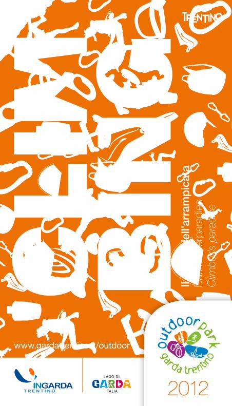
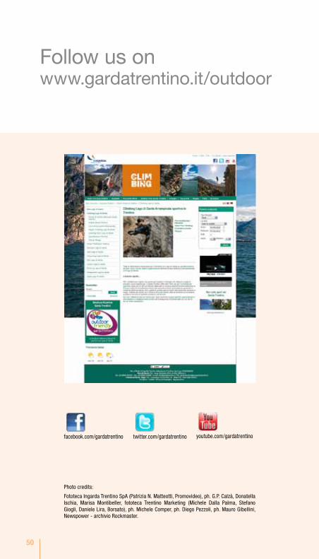
www.gardatrentino.it/outdoor
2012
Il re
gno
del
l’arr
amp
icat
aD
as K
lette
rpar
adie
s C
limbe
r’s p
arad
ise
3
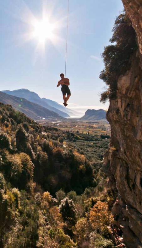
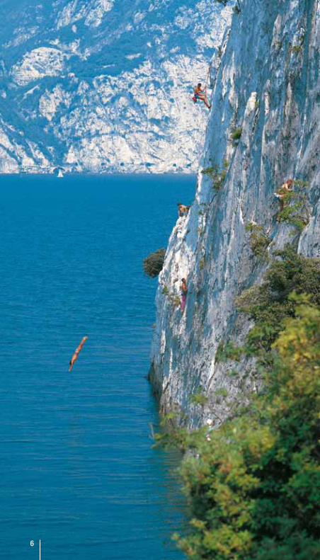
Per i climbers più esperti, ma anche per bambini e famiglie che abbiano voglia di provare nuove esperienze, il Garda Trentino offre oltre 1000 vie per l’arrampicata sportiva. Sono più di 500 gli itinerari attrezzati su incarico della Provincia Autonoma di Trento e delle Amministrazioni Comunali, periodicamente controllati. Arco, patria di questo sport a livello internazionale assieme a Nago, Torbole sul Garda, Dro, Drena e Riva del Garda, offre agli appassionati non solo incredibili arrampicate su ottima roccia ma anche un gran numero di “vie ferrate”. Ad Arco, cittadina nota nel mondo per i suoi numerosi negozi sportivi, specializzati in attrezzature e abbigliamento tecnico all’avanguardia, troverete tutto ciò che serve per le vostre prestazioni.
Der nördliche Gardasee bietet Sportkletterern, aber auch Familien, Kindern oder denen, die mal etwas Neues ausprobieren möchten, perfekte Voraussetzungen: griffigen Fels und mehr als 1.000 Sportkletterrouten.Mehr als 500 Routen wurden im Auftrag der Autonomen Provinz Trient und der Kommunalverwaltungen geschaffen. Sie werden regelmäßig kontrolliert. Arco, Brennpunkt der internationalen Kletterszene, und die Nachbargemeinden Nago, Torbole sul Garda, Dro, Drena und Riva del Garda bieten den Begeisterten nicht nur atemberaubenden Klettermöglichkeiten auf sehr gutem Gestein, aber auch zahlreichen “ Via Ferratas”. Darüber hinaus ist Arco bekannt für seine große Anzahl an Sportgeschäften, die immer modernste Ausrüstungen und technische Bekleidung für alle Outdoor-Abenteuer anbieten.
For the more daring climbers, but also for anyone, even families and kids, Garda Trentino offers more than 1000 different trails for sports climbing. The Autonomous Province of Trento and local authorities have had over 500 bolted climbing routes fitted out and these are subject to periodic controls. Not only Arco, the internationally- famed fatherland of this sport, but also Nago, Torbole sul Garda, Dro, Drena and Riva del Garda offer to all sportfans not only breathtaking climbing choices on good rock, but also a great variety of “ Via ferratas” . In Arco, renowned throughout the world for its many specialist sports equipment and quality high tech clothing shops, you will find everything you need for your climbs.
A braccia aperteMit offenen ArmenWith open arms
4
Parc Hotel Flora s RivA Del GARDA Tel. +39 0464 571571 www.parchotelflora.it
Du lac et Du Parc GranD resort RivA Del GARDA Tel. +39 0464 566600 www.dulacetduparc.com
FeelinG Hotel luise RivA Del GARDA Tel. +39 0464 550858 www.hotelluise.com
GarDa sPortinG club Hotel RivA Del GARDA Tel. +39 0464 552072 www.gardasportinghotel.it
GranD Hotel liberty RivA Del GARDA Tel. +39 0464 553581 www.grandhotelliberty.it
MiraGe RivA Del GARDA Tel. +39 0464 552671 www.mirageriva.it
Park Hotel il ViGneto s ARCo Tel. +39 0464 514787 www.parkhotelilvigneto.com
Villa Franca s ARCo Tel. +39 0464 505162 www.hotelvillafranca.net
Villa stella s ToRbole Sul GARDA Tel. +39 0464 505354 www.villastella.it
al Frantoio ARCo Tel. +39 0464 518317 www.garnialfrantoio.it
aMbassaDor suite Hotel RivA Del GARDA Tel. +39 0464 550358 www.ambassadorsuite.it
caMPaGnola RivA Del GARDA Tel. +39 0464 521103 www.hotelcampagnola.com
FaMily Hotel aDriana leDRo Tel. +39 0464 591184 www.hotel-adriana.it
Hotel santoni ToRbole Sul GARDA Tel. +39 0464 505966 www.hotelsantoni.com
oliVo ARCo Tel. +39 0464 516430 www.hotelolivo.it
Villa Gloria ToRbole Sul GARDA Tel. +39 0464 505712 www.villagloria.info
Ospitalità Outdoor Friendly.Una vacanza a misura di sportivo.
www.gardatrentino.it/outdoorfriendly
5
aGritur GirarDelli RivA Del GARDA Tel. +39 0464 521642 Cell. +39 333 1245937 www.agriturgirardelli.it
VeccHio borGo ARCo Cell. +39 349 6507213 Cell. +39 328 5447266 Tel. +39 0464 519549 www.agriturvecchioborgo.it
4liMoni aPartMent resort RivA Del GARDA Cell. +39 320 2503620 Cell. +39 328 0619040 www.4limoni.com
aPPartaMenti leon D’oro RivA Del GARDA Tel. +39 0464 557631 Cell. +39 347 5312574 www.leondororiva.it
aPPartaMenti Villa rosa RivA Del GARDA Cell. +39 329 6724119 www.villarosariva.it
caMPinG MaroaDi ARCo Tel. +39 0464 505175 www.campingmaroadi.it
5
66
7
SHOP & MOUNTAIN GUIDE SERVICE
MOUNTAIN GUIDE arco Mountain GuiDeArco Cell. +39 330 [email protected] www.arcomountainguide.com pag. 19
Free alP Mountain GuiDe serViceArcoCell. +39 327 6639300Cell. +39 347 [email protected] - www.freealp.com pag. 25
FrienDs oF arcoArco - c/o Travel Agency “la Palma” Tel. +39 0464 532828Cell. +39 335 5628862 [email protected] - www.friendsofarco.it pag. 22
ViVa la VitaTrue Adventureoutdoor sports experienceCell. +39 380 [email protected] - www.vivalavita.cz pag. 9
SHOP Gobbi sPortArco - via Segantini, 72-49Tel. e Fax +39 0464 [email protected] - www.gobbisport.it pag. 14
Vertical centro VacanZeSarche - P.zza valussi, 5Tel. +39 0461 565029 pag. 38
saleWa Mountain kiDs sHoPArco - via Segantini, 28Tel. +39 0464 514842www.salewa.it pag. 31

8
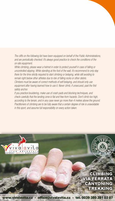
le falesie di seguito elencate sono state attrezzate su incarico delle Amministrazioni Pubbliche e vengono periodicamente controllate. verificare comunque lo stato delle attrezzature a dimora.Anche in falesia è buona regola l’uso del casco per proteggersi dalla caduta di pietre e cadute incontrollate.È consigliato stazionare ai piedi della falesia solo per lo stretto necessario ad arrampicare o assicurare, evitando comunque di restare sulla verticale di altri atleti impegnati in parete: rischio caduta pietre e materiale.Chi pratica l’arrampicata deve essere a conoscenza delle corrette regole di assicurazione ed utilizzare l’attrezzatura adatta dopo averne appreso l’uso.Non arrampicate mai slegati oltre il primo ancoraggio di sicurezza.Se praticate il bouldering adottate il crash pad e le tecniche di parata, controllate attentamente che l’area di “atterraggio” sia piana e priva di pericoli, limitate l’altezza di arrampicata in funzione del terreno e comunque non salite mai oltre mt 4,00.
Die nachstehend aufgeführten Klettergärten wurden im Auftrag der öffentlichen Verwaltungen ausgebaut und werden regelmäßig kontrolliert. Es hat sich jedoch bewährt, die Strecken vor Ort zu überprüfen. Auch im Klettergarten ist es sinnvoll, einen Helm zu tragen, um sich bei Steinschlag und unkontrollierten „Flügen“ zu schützen. Es ist ratsam, sich am Fuß der Wand nur so lange aufzuhalten, wie es für Klettern und Sichern notwendig ist und in jedem Fall die Vertikale anderer Athleten in der Wand zu meiden: es könnten Steine oder Material herunterfallen. Wer klettert, muss auch sichern können und genau wissen, wie die Ausrüstung die er benutzt, funktioniert. Klettert ungesichert nie weiter als bis zum ersten Sicherungshaken.Verwendet beim Bouldern Crashpads und nutzt Falltechniken. Achtet darauf, dass der „Landeplatz“ eben und frei von Hindernissen ist und klettert nur in geringer Höhe, je nach Bodenbeschaffenheit, aber auf keinen Fall höher als 4 m. Wer klettert, ist sich bewusst, dass es sich um eine Aktivität handelt, bei der immer ein gewisses Restrisiko bleibt, für das jeder selbst verantwortlich ist.
ARRAMPICATA SPORTIVASPORT CLIMBINGKLETTERN
9
The cliffs on the following list have been equipped on behalf of the Public Administrations, and are periodically checked. It’s always good practice to check the conditions of the on-site equipment. While climbing, please wear a helmet in order to protect yourself in case of falling or uncontrolled slipping. While standing at the foot of the wall, it’s recommend to only stay there for the time strictly required to start climbing or belaying, while still avoiding to remain right below other athletes due to risk of falling rocks or other debris. Climbers must be aware of correct methods of self-belaying, and should only use equipment after having learned how to use it. Never climb, if unsecured, past the first safety anchor. If you practice bouldering, make use of crash pads and blocking techniques, and check carefully that the landing zone is flat and free from hazards. Don’t climb too high, according to the terrain, and in any case never go more than 4 metres above the ground.Practitioners of climbing are to be fully aware that a certain degree of risk is unavoidable in this sport, and assume full responsibility on every action taken.
9
10
Nell’ambito del Garda Trentino si trovano numerose altre falesie attrezzate dagli appassionati. Queste falesie non sono soggette a nessuna forma di controllo e manutenzione.
ATTeNZioNe!
il livello di sicurezza delle pareti e delle attrezzature a dimora è vario: la valutazione delle condizioni e del grado di rischio è lasciato ai praticanti che se ne assumono la più completa responsabilità. la maggior parte di queste falesie sorge su terreno privato: verificare in loco la presenza di eventuali divieti di accesso.
Im Garda Trentino gibt es zahlreiche andere Klettergärten, die von Anhängern dieses Sports ausgebaut wurden. Diese Klettergärten unterliegen in keiner Weise einer Kontrolle oder Instandhaltung.
ACHTUNG!
Das Sicherheitsniveau der Wände und der Sicherungssysteme vor Ort ist unterschiedlich: die Beurteilung der Bedingungen und des Risikogrades bleibt den Sportlern überlassen, die die volle Verantwortung übernehmen.Der größte Teil dieser Klettergärten steht auf privatem Boden: überprüft vor Ort, ob das Betreten eventuell verboten ist.
There are many other cliffs in Garda Trentino area, fully equipped thanks to the fans of climbing. These cliffs are not subject to any kind of regular monitoring or maintenance.
WARNING!
The level of security of the mountain walls and the one of the equipment that you can find on place is never the same: the evaluation of their conditions and the level of risk connected to them is up to each climber, who take on the full responsibility for it. The most part of these cliffs is located on private properties: check on the spot if there are any access restrictions.
NotaBeachtenNote
11
localizzazioneLageLocation
CoordinateKoordinatenCoordinates
lunghezzaLängeLength
vedi Cartina escursionistica siehe Wanderkarte see hiking map
esposizioneRichtungAspect
TipoArtType
AccessoZustiegAccess
Kid Friendly
Falesia di facile accesso e con larga area pianeggiante alla base, ideale anche per famiglie con bambini. Attenzione!!! evitare in ogni caso che i bambini stazionino al piede della parete, possono sempre verificarsi cadute di pietre.
Leicht erreichbarer Klettergarten, mit einem großen ebenen Bereich, der auch für Familien mit Kindern ideal ist. Achtung!!! Es ist wegen der Steinschlaggefahr in jedem Fall zu vermeiden, dass sich Kinder am Fuß der Wand aufhalten.
Easy access cliff with a wide flat area at the base, ideal for families with kids. Warning!!! Keep kids away from the base of the wall since there is always a risk of rocks falling.
LegendaZeichenerklärungKey to symbols
PlACCHe Di bAoNe arco FAleSiA CAlvARio arco FAleSiA MuRo Dell’ASiNo arco MASSi Di PRAbi (boulders) arco FAleSiA PoliCRoMuRo (Massone) arco FAleSiA AbiSSi (Massone) arco MASSi Di GAGGiolo (boulders) Dro belveDeRe nago FAleSiA PASSo SAN GiovANNi nago SeGRoM nago CoRNo Di bo’ torbole sul Garda SPiAGGiA Delle luCeRTole torbole sul Garda PiAZZole arco
1
5
10
3
7
11
2
6
11
4
9
8
12
1212
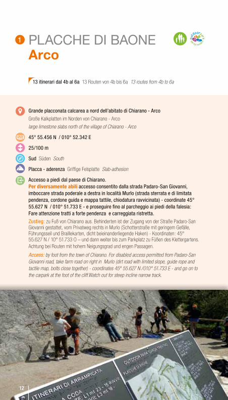
PLACCHE DI BAONE Arco
Grande placconata calcarea a nord dell’abitato di Chiarano - Arco
Große Kalkplatten im Norden von Chiarano - Arco
large limestone slabs north of the village of Chiarano - Arco
45° 55.456 N / 010° 52.342 e
25/100 m
Sud Süden South
Placca - aderenza Griffige Felsplatte Slab-adhesion
Accesso a piedi dal paese di Chiarano. Per diversamente abili accesso consentito dalla strada Padaro-San Giovanni, imboccare strada poderale a destra in località Murlo (strada sterrata e di limitata pendenza, cordone guida e mappa tattile, chiodatura ravvicinata) - coordinate 45° 55.627 N / 010° 51.733 e - e proseguire fino al parcheggio ai piedi della falesia: Fare attenzione tratti a forte pendenza e carreggiata ristretta.
Zustieg: zu Fuß von Chiarano aus. Behinderten ist der Zugang von der Straße Padaro-San Giovanni gestattet, vom Privatweg rechts in Murlo (Schotterstraße mit geringem Gefälle, Führungsseil und Braillekarten, dicht beieinanderliegende Haken) - Koordinaten: 45° 55.627 N / 10° 51.733 O – und dann weiter bis zum Parkplatz zu Füßen des Klettergartens. Achtung bei Routen mit hohem Neigungsgrad und engen Passagen.
Access: by foot from the town of Chiarano. For disabled access permitted from Padaro-San Giovanni road, take farm road on right in Murlo (dirt road with limited slope, guide rope and tactile map, bolts close together) - coordinates 45° 55.627 N /010° 51.733 E - and go on to the carpark at the foot of the cliff.Watch out for steep incline narrow track.
13 itinerari dal 4b al 6a 13 Routen von 4b bis 6a 13 routes from 4b to 6a
12
1
13
PARETE NATURALE PER PARACLIMBINGPrima falesia senza barriere al mondo: attrezzata con mappa tattile, permette anche ai non vedenti di apprezzare lo sviluppo dei 6 itinerari di arrampicata, il numero e il tipo di anelli di sicurezza, nonché la difficoltà. Alla base della parete una targhetta braille fornisce informazioni sui percorsi. un parcheggio riservato ai soli disabili, un nuovo itinerario di avvicinamento - a fondo liscio e con manovia - rendono facile l’accesso; a completare l’area, innovativi tavoli e panchine adatti alle carrozzine e servizi igienici per portatori di disabilità. inaugurata nel 2011 dagli atleti del primo mondiale Paraclimbing.
Natürliche KletterwaNd fürs ParaclimbiNg Es ist der erste Klettergarten ohne Grenzen in der Welt: Eine Karte in Brailleschrift erlaubt es auch Blinden, den Verlauf der 6 Kletterrouten, Zahl und Art der Sicherungsringe sowie den Schwierigkeitsgrad einzuschätzen. Am Fuß der Wand gibt ein Schild in Brailleschrift Informationen über die Routen. Ein Parkplatz nur für Behinderte, ein neuer Zugangsweg - auf ebenem Untergrund und mit Handlauf - macht den Zugang einfach. Zusätzlich neue Tische und Bänke, die für Rollstühle geeignet sind, ebenso wie die sanitären Anlagen. Die Einweihung erfolgte 2011 durch die Athleten der 1. Weltmeisterschaft im Paraclimbing.
Natural paraclimbiNg wall The first no frontiers climbing wall in the world: equipped with a tactile map, so that also the blind or visually impaired can understand the development of 6 climbing routes, the number and type of bolts, as well as the level of difficulty. A braille pla-que at the base of the wall provides information on routes. And to facilitate access there is a car park exclusively reserved for the disabled and a new approach route with smooth road surface and hand-drag. Finally, the area is fitted out with innovative tables and benches designed to accommodate wheelchairs as well as bathroom facilities for the disabled. Inaugurated in 2011 by the competitors in the first World Paraclimbing Championship.
14
FALESIA CALVARIO Arco
Destra orografica della valletta che sale da Arco a laghel.
Orographisch rechts des kleinen Tals, das von Arco nach Laghel hinaufführt.
Orographic right side of the valley which leads up from Arco to Laghel.
45° 55.596 N / 010° 53.088 e
15/25m
est Osten East
Da muro leggermente appoggiato a strapiombo, spioventi, piccole prese
Von leicht geneigt bis überhängend, Schrägen, kleine Griffe
From a fairly steep wall to overhanging, sloping, small holds
A piedi lungo la strada (via Crucis) che sale a loc. laghel, la falesia è sulla sinistra salendo, nell’oliveto.
Zu Fuß entlang der Straße (Via Crucis), die nach Laghel hinaufführt. Die Kletterwand liegt bergauf links im Olivenhain.
On foot along the road (Via Crucis) which leads from Laghel, the cliff is on the left coming up the hill in an olive grove.
20 itinerari dal 5b all’8a 20 Routen von 5b bis 8a 20 routes: from 5b to 8a
2
15
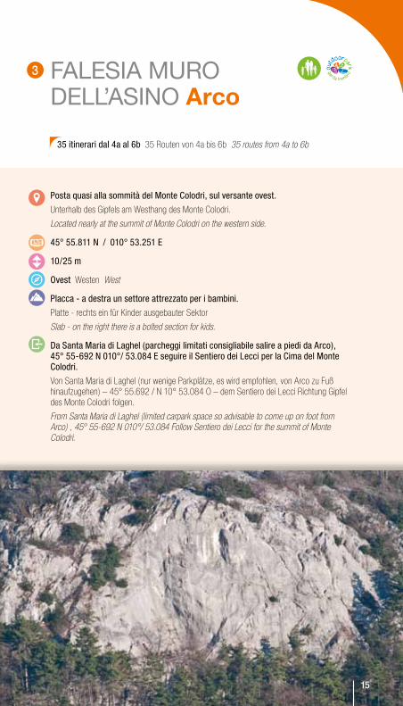
FALESIA MURO DELL’ASINO Arco
Posta quasi alla sommità del Monte Colodri, sul versante ovest.
Unterhalb des Gipfels am Westhang des Monte Colodri.
Located nearly at the summit of Monte Colodri on the western side.
45° 55.811 N / 010° 53.251 e
10/25 m
ovest Westen West
Placca - a destra un settore attrezzato per i bambini.
Platte - rechts ein für Kinder ausgebauter Sektor
Slab - on the right there is a bolted section for kids.
Da Santa Maria di laghel (parcheggi limitati consigliabile salire a piedi da Arco), 45° 55-692 N 010°/ 53.084 e seguire il Sentiero dei lecci per la Cima del Monte Colodri.
Von Santa Maria di Laghel (nur wenige Parkplätze, es wird empfohlen, von Arco zu Fuß hinaufzugehen) – 45° 55.692 / N 10° 53.084 O – dem Sentiero dei Lecci Richtung Gipfel des Monte Colodri folgen.
From Santa Maria di Laghel (limited carpark space so advisable to come up on foot from Arco) , 45° 55-692 N 010°/ 53.084 Follow Sentiero dei Lecci for the summit of Monte Colodri.
35 itinerari dal 4a al 6b 35 Routen von 4a bis 6b 35 routes from 4a to 6b
15
3
16
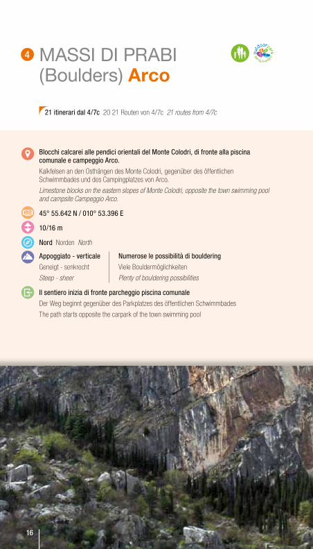
MASSI DI PRABI (Boulders) Arco
blocchi calcarei alle pendici orientali del Monte Colodri, di fronte alla piscina comunale e campeggio Arco.
Kalkfelsen an den Osthängen des Monte Colodri, gegenüber des öffentlichen Schwimmbades und des Campingplatzes von Arco.
Limestone blocks on the eastern slopes of Monte Colodri, opposite the town swimming pool and campsite Campeggio Arco.
45° 55.642 N / 010° 53.396 e
10/16 m
Nord Norden North
Appoggiato - verticale
Geneigt - senkrecht
Steep - sheer
il sentiero inizia di fronte parcheggio piscina comunale
Der Weg beginnt gegenüber des Parkplatzes des öffentlichen Schwimmbades
The path starts opposite the carpark of the town swimming pool
21 itinerari dal 4/7c 20 21 Routen von 4/7c 21 routes from 4/7c
16
Numerose le possibilità di bouldering
Viele Bouldermöglichkeiten
Plenty of bouldering possibilities
4
17
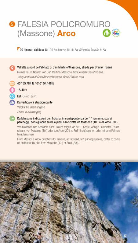
FALESIA POLICROMURO (Massone) Arco
valletta a nord dell’abitato di San Martino/Massone, strada per braila/Troiana
Kleines Tal im Norden von San Martino/Massone, Straße nach Braila/Troiana.
Valley northern of San Martino/Massone, Braila/Troiana road.
45° 55.784 N / 010° 54.148 e
15/40m
est Osten East
Da verticale a strapiombante
Vertikal bis überhängend
Sheer to overhanging
Da Massone indicazioni per Troiana, in corrispondenza del 1° tornante, scarsi parcheggi, consigliabile salire a piedi o bicicletta da Massone (10’) o da Arco (20’).
Von Massone den Schildern nach Troiana folgen, an der 1. Kehre, wenige Parkplätze. Es ist ratsam, von Massone (10’) oder von Arco (20’) zu Fuß hinaufzugehen oder mit dem Fahrrad hinaufzufahren.
From Massone follow directions for Troiana, at 1st bend, few parking spaces, better to come up on foot or by bike from Massone (10’) or Arco (20’).
90 itinerari dal 5a al 8a 90 Routen von 5a bis 8a 90 routes from 5a to 8a
1717
5
18
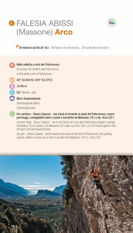
FALESIA ABISSI (Massone) Arco
Nella valletta a nord del Policromuro
Im kleinen Tal nördlich des Policromuro
In the valley north of Policromuro
45° 55.845 N / 010° 54.275 e
12/40 m
est Westen East
Muro strapiombante
Überhängende Wand
Overhanging wall
Per sentiero - bosco Caproni - che inizia al tornante ai piedi del Policromuro, scarsi parcheggi, consigliabile salire a piedi o bicicletta da Massone (10’) o da Arco (20’)
Auf dem Weg - Bosco Caproni - der in der Kehre am Fuss des Policromuro beginnt, wenige Parkplätze. Es ist ratsam, von Massone (10’) oder von Arco (20’) zu Fuß hinaufzugehen oder mit dem Fahrrad hinaufzufahren.
By path - Bosco Caproni - which starts at the bend at the feet of Policromuro, few parking spaces, better to come up on foot or by bike from Massone (10’) or Arco (20’)
38 itinerari dal 6b all’ 8a+ 38 Routen von 6b bis 8a+ 38 routes from 6b to 8a+
6
18

19
MASSI DI GAGGIOLO (Boulders) Dro
Nella pineta in loc. Gaggiolo
Im Kiefernwald in Gaggiolo
In the pinewood in Gaggiolo
45° 59.502 N / 010° 55.556 e
oltre a tre massi attrezzati con brevi e facili itinerari ( fino a 10/12 m) adatti ai principianti ed ai bambini, possibilità di bouldering nella pineta.
Mehr als drei ausgebaute Felsen mit kurzen und leichten Routen (bis 10/12 m), geeignet für Anfänger und Kinder, Bouldermöglichkeit im Kiefernwald.
Apart from three boulders bolted with short easy routes (up to 10/12 m) suitable for beginners and kids, other bouldering possibilities in the pinewood.
Parcheggio in loc. Gaggiolo - 45° 59,734 N / 010° 55,582 e, ritornare in direzione sud per 350 m, fino ad un grande prato, al termine del quale si incontra la strada sterrata di accesso.
Parkplatz Gaggiolo - 45° 59,734 N / 010° 55,582 E, 350 m zurück Richtung Süden bis zu einer großen Wiese, an deren Ende die Schotterstraße beginnt, die zu den Felsen führt.
Parking in loc. Gaggiolo - 45° 59,734 N / 010° 55,582 E, then backtrack south for about 350 m, as far as a wide meadow at the end of which the access road starts.
19
7
20
BELVEDERE Nago
Fascia rocciosa a nord dell’abitato di Nago, sulle pendici meridionali del Monte Corno
Felsband im Norden von Nago, an den südlichen Hängen des Monte Corno
Stretch of rock north of the village of Nago on the southern slopes of Monte Corno
45° 52.841 N / 010° 53.264 e
12/24 m
Sud Süden South
Da appoggiato a verticale e strapiombante
Von geneigt bis senkrecht und überhängend
From steep to sheer and overhanging
il nuovo itinerario di accesso parte dalla rotonda prima della discesa su Torbole, cartello segnavia. Coordinate 45° 52.726 N / 010° 53.332 e Settore basso attrezzato per principianti, chiodatura ravvicinata.
Die neue Zustiegsroute beginnt am Kreisverkehr vor der Abfahrt nach Torbole, Wegweiser. Koordinaten: 45° 52.726 N / 10° 53.332 O. Der untere Sektor ist für Anfänger ausgebaut, dicht beieinanderliegende Haken.
The new access route starts at the roundabout before the hill down into Torbole, signposted. coordinates 45° 52.726 N / 010° 53.332 E Lower section bolted for beginners, bolts close together.
46 itinerari dal 3c al 7b+ 46 Routen von 3c bis 7b+ 46 routes from 3c to 7b+
20
8
21
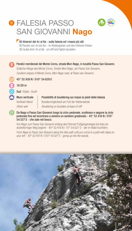
FALESIA PASSO SAN GIOVANNI Nago
Pendici meridionali del Monte Corno, strada Mori-Nago, in località Passo San Giovanni.
Südliche Hänge des Monte Corno, Straße Mori-Nago, am Passo San Giovanni.
Southern slopes of Monte Corno, Mori-Nago road, at Passo san Giovanni.
45° 52.438 N / 010° 54.628 e
10/28 m
Sud Süden South
Muro verticale
Vertikale Wand
Sheer wall
Da Nago a Passo San Giovanni lungo la ciclo-pedonale, scollinare e seguire la ciclo pedonale fino ad incontrare a sinistra un sentiero gradonato - 45° 52.416 N / 010° 54.527 e - che sale nel bosco.
Von Nago zum Passo San Giovanni entlang des Fahrrad-Fußgängerweges bis links ein stufenförmiger Weg beginnt - 45° 52.416 N / 10° 54.527 O - der im Wald hochführt.
From Nago to Passo San Giovanni along the bike path until you come to a path with steps on your left - 45° 52.416 N / 010° 54.527 E - going up into the woods.
36 itinerari dal 4c al 8a - sulla falesia ed i massi più alti36 Routen von 4c bis 8a – im Klettergarten und den höheren Felsen 36 routes from 4c al 8a - on cliff and higher boulders
Possibilità di bouldering sui massi ai piedi della falesia
Bouldermöglichkeit am Fuß der Kletterwände
Bouldering on boulders at base of cliff
2121
9
22
SEGROMNago
Ad est dell’abitato di Nago, lungo la strada per Monte baldo - Altissimo.
Im Osten von Nago, entlang der Straße zum Monte Baldo-Altissimo
East of Nago, along the road for Monte Baldo-Altissimo.
45° 52.107 N / 010° 53.790 e
15/40 m
Sud Süden South
verticale
Vertikal
Sheer
Parcheggiare negli appositi spazi lungo la strada che sale al Monte Altissimo. Sul tornante 45° 51.925 N / 010° 53.794 e, parte il sentiero che segue tutta la base della falesia.
Parken auf den gekennzeichneten Flächen entlang der Straße zum Monte Altissimo. In der Kehre – 45° 51.925 N / 10° 53.794 O – beginnt der Weg, der am Fuß der ganzen Kletterwand entlangführt.
Park in the parking spaces along the road that leads up to Monte Altissimo. On the bend 45° 51.925 N / 010° 53.794 E, the path starts and goes along the base of the cliff.
120 itinerari dal 5a all’8a 120 Routen von 5a bis 8a 120 routes from 5a to 8a
22
10
23
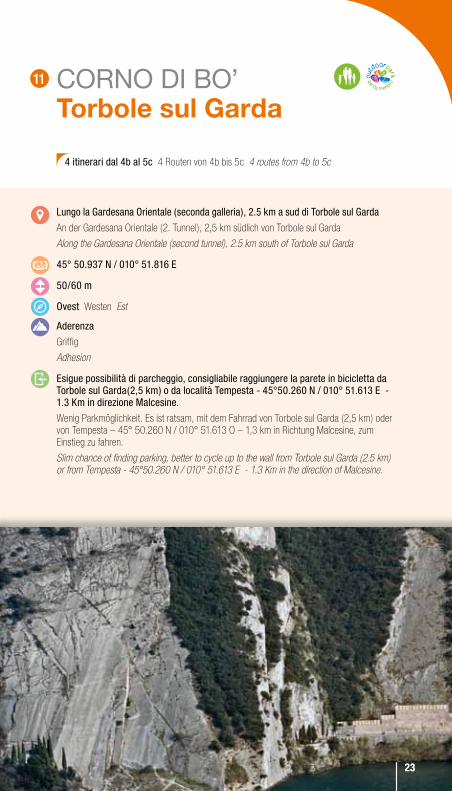
CORNO DI BO’ Torbole sul Garda
lungo la Gardesana orientale (seconda galleria), 2.5 km a sud di Torbole sul Garda
An der Gardesana Orientale (2. Tunnel), 2,5 km südlich von Torbole sul Garda
Along the Gardesana Orientale (second tunnel), 2.5 km south of Torbole sul Garda
45° 50.937 N / 010° 51.816 e
50/60 m
ovest Westen Est
Aderenza
Griffig
Adhesion
esigue possibilità di parcheggio, consigliabile raggiungere la parete in bicicletta da Torbole sul Garda(2,5 km) o da località Tempesta - 45°50.260 N / 010° 51.613 e - 1.3 Km in direzione Malcesine.
Wenig Parkmöglichkeit. Es ist ratsam, mit dem Fahrrad von Torbole sul Garda (2,5 km) oder von Tempesta – 45° 50.260 N / 010° 51.613 O – 1,3 km in Richtung Malcesine, zum Einstieg zu fahren.
Slim chance of finding parking, better to cycle up to the wall from Torbole sul Garda (2.5 km) or from Tempesta - 45°50.260 N / 010° 51.613 E - 1.3 Km in the direction of Malcesine.
4 itinerari dal 4b al 5c 4 Routen von 4b bis 5c 4 routes from 4b to 5c
2323
11
24
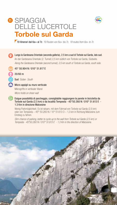
SPIAGGIA DELLE LUCERTOLETorbole sul Garda
lungo la Gardesana orientale (seconda galleria), 2.5 km a sud di Torbole sul Garda, lato sud.
An der Gardesana Orientale (2. Tunnel) 2,5 km südlich von Torbole sul Garda, Südseite.
Along the Gardesana Orientale (second tunnel), 2.5 km south of Torbole sul Garda, south side.
45° 50.904 N / 010° 51.817 e
20/60 m
Sud Süden South
Micro appigli su muro verticale
Mikrogriffe in vertikaler Wand
Micro holds on sheer wall
esigue possibilità di parcheggio, consigliabile raggiungere la parete in bicicletta da Torbole sul Garda (2,5 km) o da località Tempesta - 45°50.260 N / 010° 51.613 e - 1.3 Km in direzione Malcesine
Wenig Parkmöglichkeit. Es ist ratsam, mit dem Fahrrad von Torbole sul Garda (2,5 km) oder von Tempesta – 45° 50.260 N / 10° 51.613 O – 1,3 km in Richtung Malcesine zum Einstieg zu fahren.
Slim chance of parking, better to cycle up to the wall from Torbole sul Garda (2.5 km) or Tempesta - 45°50.260 N / 010° 51.613 E - 1.3 Km in the direction of Malcesine.
19 itinerari dal 6a+ al 7c 19 Routen von 6a+ bis 7c 19 routes from 6a+ to 7c
24
11
25
PIAZZOLE Arco
Pendici meridionali del Monte biaina / Padaro
Pendici meridionali del Monte Biaina / Padaro
Pendici meridionali del Monte Biaina / Padaro
45° 55.872 N / 010° 51.607 e
12/22 m
Sud-est Süden-Westen South-East
Muro in leggero strapiombo e placca leggermente appoggiata
Muro in leggero strapiombo e placca leggermente appoggiata
Muro in leggero strapiombo e placca leggermente appoggiata
Sulla strada che da varignano sale a Padaro, in loc. San Rocco parcheggiare le primo largo spiazzo sulla sinistra 45° 55.649 N / 010° 51.763 e, poco oltre prendere la carrereccia che sale a sinistra ripida, seguire i segnavia ed in 25’ raggiungere la falesia.
Sulla strada che da Varignano sale a Padaro, in loc. San Rocco parcheggiare le primo largo spiazzo sulla sinistra 45° 55.649 N / 010° 51.763 E, poco oltre prendere la carrereccia che sale a sinistra ripida, seguire i segnavia ed in 25’ raggiungere la falesia.
Sulla strada che da Varignano sale a Padaro, in loc. San Rocco parcheggiare le primo largo spiazzo sulla sinistra 45° 55.649 N / 010° 51.763 E, poco oltre prendere la carrereccia che sale a sinistra ripida, seguire i segnavia ed in 25’ raggiungere la falesia.
19 itinerari dal 5c al 7b 19 itinerari dal 5c al 7b 19 itinerari dal 5c al 7b
12
2626
27
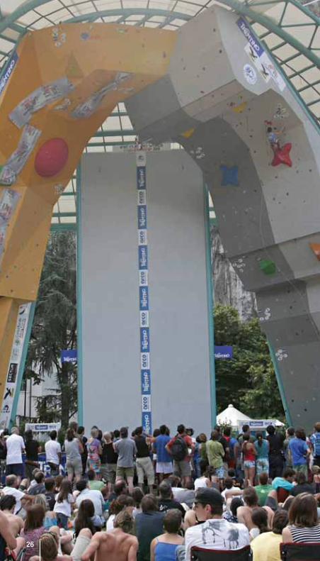
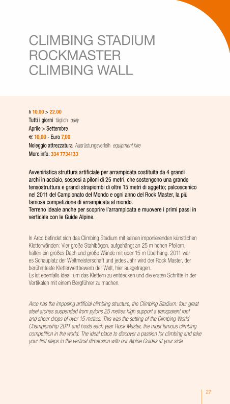
CLIMBING STADIUM ROCKMASTER CLIMBING WALL
h 10.00 > 22.00
Tutti i giorni täglich daily Aprile > Settembre € 10,00 - euro 7,00 Noleggio attrezzatura Ausrüstungsverleih equipment hire
More info: 334 7734133
Avveniristica struttura artificiale per arrampicata costituita da 4 grandi archi in acciaio, sospesi a piloni di 25 metri, che sostengono una grande tensostruttura e grandi strapiombi di oltre 15 metri di aggetto; palcoscenico nel 2011 del Campionato del Mondo e ogni anno del Rock Master, la più famosa competizione di arrampicata al mondo. Terreno ideale anche per scoprire l’arrampicata e muovere i primi passi in verticale con le Guide Alpine.
In Arco befindet sich das Climbing Stadium mit seinen imponierenden künstlichen Kletterwänden: Vier große Stahlbögen, aufgehängt an 25 m hohen Pfeilern, halten ein großes Dach und große Wände mit über 15 m Überhang. 2011 war es Schauplatz der Weltmeisterschaft und jedes Jahr wird der Rock Master, der berühmteste Kletterwettbewerb der Welt, hier ausgetragen. Es ist ebenfalls ideal, um das Klettern zu entdecken und die ersten Schritte in der Vertikalen mit einem Bergführer zu machen.
Arco has the imposing artificial climbing structure, the Climbing Stadium: four great steel arches suspended from pylons 25 metres high support a transparent roof and sheer drops of over 15 metres. This was the setting of the Climbing World Championship 2011 and hosts each year Rock Master, the most famous climbing competition in the world. The ideal place to discover a passion for climbing and take your first steps in the vertical dimension with our Alpine Guides at your side.
28
Nel Garda Trentino sono centinaia gli itinerari alpinistici che salgono su pareti di qualche decina di metri fino ad oltre 1.200 m. Si tratta di itinerari attrezzati dagli appassionati, con i più diversi livelli di attrezzatura, non soggetti a nessuna forma di controllo e manutenzione, dove è quindi necessario saperne valutare lo stato ed eventualmente integrare le attrezzature di sicurezza in posto. la lunghezza, le difficoltà di ritirata, le possibili cadute di pietre, li riserva a chi possiede attrezzature, capacità e conoscenze tecniche alpinistiche, diversamente è consigliabile avvalersi di una Guida Alpina.
Im Garda Trentino befinden sich hunderte alpine Routen in Wänden von wenigen Metern bis über 1.200 m. Die Routen sind von Anhängern dieses Sports auf unterschiedlichstem Niveau ausgebaut worden und unterliegen in keiner Weise einer Kontrolle oder Instandhaltung. Deshalb muss jeder den Zustand und die eventuell vor Ort zu ergänzende Sicherheitsausrüstung beurteilen können. Die Länge, der schwierige Rückweg und möglicher Steinschlag machen diese zu Routen für diejenigen, die über die entsprechende Ausrüstung, das Können und das technische Wissen verfügen. Sollte dies nicht der Fall sein, ist es ratsam, sich an einen Bergführer zu wenden.
Garda Trentino has hundreds of mountaineering routes that climb walls ranging from a few dozen metres to over 1,200 m. These routes have been bolted by climbers, with all levels of safety equipment, and are not subject to any kind of inspection or maintenance. This means you have to be able to assess the state of the route and, where necessary, compensate with security anchors of your own. The length of the routes make it hard to bail, and this, combined with the risk of rock falls, makes them routes that should only be considered by climbers with the gear and mountaineering skills and knowledge. Otherwise it is better to go with an Alpine guide.
Zone di arrampicata in terreno d’avventuraKlettergebiete in AbenteuerlandschaftClimbing areas on adventurous terrain
292929
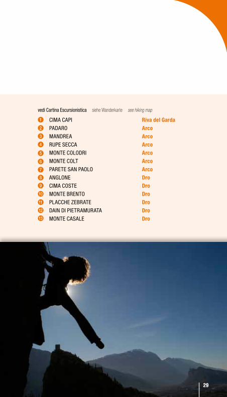
vedi Cartina escursionistica siehe Wanderkarte see hiking map
CiMA CAPi riva del Garda PADARo arco MANDReA arco RuPe SeCCA arco MoNTe ColoDRi arco MoNTe ColT arco PAReTe SAN PAolo arco ANGloNe Dro CiMA CoSTe Dro MoNTe bReNTo Dro PlACCHe ZebRATe Dro DAiN Di PieTRAMuRATA Dro MoNTe CASAle Dro
1
5
10
3
7
12
2
6
11
4
9
8
13

30
Percorsi attrezzati in parete che richiedono specifiche attrezzature (imbragatura, set di sicurezza per ferrata, casco) e specifiche conoscenze tecniche e allenamento. Prima di intraprenderli informarsi sulla percorribilità www.sat.tn.it (commissione sentieri)
Ausgebaute Routen in Wänden, die eine spezielle Ausrüstung – Gurt, Klettersteigset, Helm – Können und gutes Training verlangen. Vor der Tour sollten Informationen über die Begehbarkeit unter www.sat.tn.it bei der für die Wanderwege zuständigen Kommission eingeholt werden.
Equipped routes on mountain walls. These routes require specific equipment - harness, safety set for climbing routes, helmet – and climbing skills. Before setting out, inform yourself about the practicability of each path: www.sat.tn.it (Commissione Sentieri-office)
FerrateKlettersteige“Via Ferrata” EEA
30
31
Punto di partenzaAusgangsortDeparture point
Punto di arrivoZielArrival point
Sentiero Cai-SatWegPath
DislivelloHöhenunterschiedAscent
DurataZeitDuration
esposizioneRichtungAspect
PeriodoJahreszeitPeriod
DifficoltàSchwierigkeitsgradDifficulty
LegendaZeichenerklärungKey to symbols
32
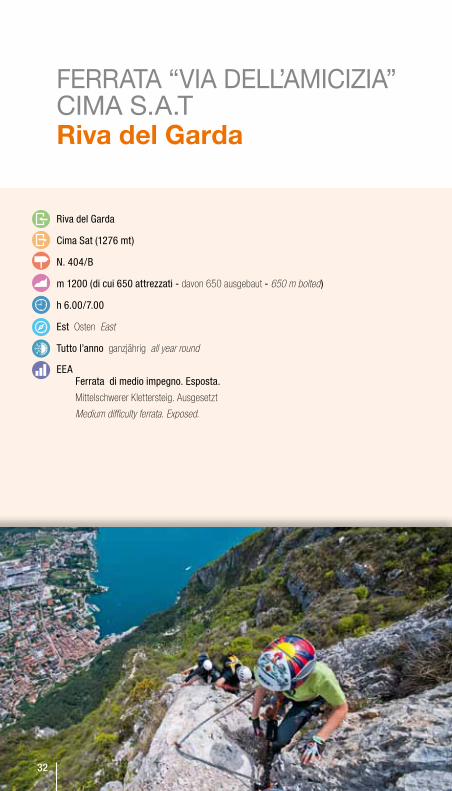
FERRATA “VIA DELL’AMICIZIA” CIMA S.A.T Riva del Garda
Riva del Garda
Cima Sat (1276 mt)
N. 404/b
m 1200 (di cui 650 attrezzati - davon 650 ausgebaut - 650 m bolted)
h 6.00/7.00
est Osten East
Tutto l’anno ganzjährig all year round
eeAFerrata di medio impegno. esposta.
Mittelschwerer Klettersteig. Ausgesetzt
Medium difficulty ferrata. Exposed.
32
33
FERRATA “VIA DELL’AMICIZIA” CIMA S.A.T Riva del Garda
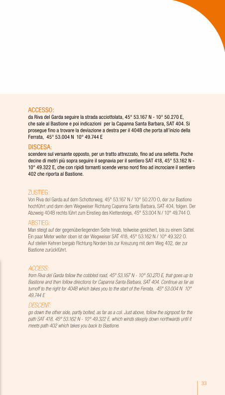
ACCeSSo: da Riva del Garda seguire la strada acciottolata, 45° 53.167 N - 10° 50.270 e, che sale al bastione e poi indicazioni per la Capanna Santa barbara, SAT 404. Si prosegue fino a trovare la deviazione a destra per il 404b che porta all’inizio della Ferrata, 45° 53.004 N 10° 49.744 e
DiSCeSA: scendere sul versante opposto, per un tratto attrezzato, fino ad una selletta. Poche decine di metri più sopra seguire il segnavia per il sentiero SAT 418, 45° 53.162 N - 10° 49.322 e, che con ripidi tornanti scende verso nord fino ad incrociare il sentiero 402 che riporta al bastione.
ZUSTIEG: Von Riva del Garda auf dem Schotterweg, 45° 53.167 N / 10° 50.270 O, der zur Bastione hochführt und dann dem Wegweiser Richtung Capanna Santa Barbara, SAT 404, folgen. Der Abzweig 404B rechts führt zum Einstieg des Klettersteigs, 45° 53.004 N / 10° 49.744 O.
ABSTIEG: Man steigt auf der gegenüberliegenden Seite hinab, teilweise gesichert, bis zu einem Sattel. Ein paar Meter weiter oben ist der Wegweiser SAT 418, 45° 53.162 N / 10° 49.322 O. Auf steilen Kehren bergab Richtung Norden bis zur Kreuzung mit dem Weg 402, der zur Bastione zurückführt.
ACCESS: from Riva del Garda follow the cobbled road, 45° 53.167 N - 10° 50.270 E, that goes up to Bastione and then follow directions for Capanna Santa Barbara, SAT 404. Continue as far as turnoff to the right for 404B which takes you to the start of the Ferrata, 45° 53.004 N 10° 49.744 E
DESCENT: go down the other side, partly bolted, as far as a col. Just above, follow the signpost for the path SAT 418, 45° 53.162 N - 10° 49.322 E, which winds steeply down northwards until it meets path 402 which takes you back to Bastione.
34
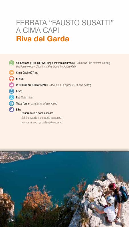
FERRATA “FAUSTO SUSATTI” A CIMA CAPI Riva del Garda
val Sperone (3 km da Riva, lungo sentiero del Ponale - 3 km von Riva entfernt, entlang des Ponalewegs – 3 km from Riva, along the Ponale Path)
Cima Capi (907 mt)
n. 405
m 900 (di cui 300 attrezzati - davon 300 ausgebaut - 300 m bolted)
h 5/6
est Osten East
Tutto l’anno ganzjährig all year round
eeAPanoramica e poco esposta
Schöne Aussicht und wenig ausgesetzt
Panoramic and not particularly exposed
3434
35
FERRATA “FAUSTO SUSATTI” A CIMA CAPI Riva del Garda
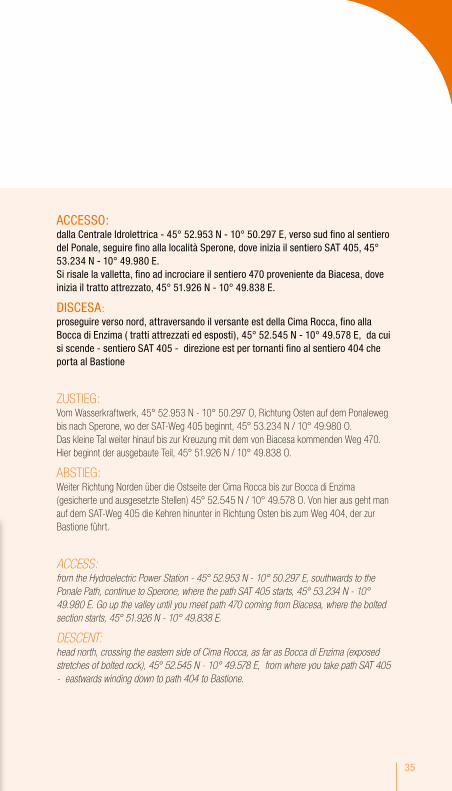
ACCeSSo: dalla Centrale idrolettrica - 45° 52.953 N - 10° 50.297 e, verso sud fino al sentiero del Ponale, seguire fino alla località Sperone, dove inizia il sentiero SAT 405, 45° 53.234 N - 10° 49.980 e. Si risale la valletta, fino ad incrociare il sentiero 470 proveniente da biacesa, dove inizia il tratto attrezzato, 45° 51.926 N - 10° 49.838 e.
DiSCeSA: proseguire verso nord, attraversando il versante est della Cima Rocca, fino alla bocca di enzima ( tratti attrezzati ed esposti), 45° 52.545 N - 10° 49.578 e, da cui si scende - sentiero SAT 405 - direzione est per tornanti fino al sentiero 404 che porta al bastione
ZUSTIEG: Vom Wasserkraftwerk, 45° 52.953 N - 10° 50.297 O, Richtung Osten auf dem Ponaleweg bis nach Sperone, wo der SAT-Weg 405 beginnt, 45° 53.234 N / 10° 49.980 O.Das kleine Tal weiter hinauf bis zur Kreuzung mit dem von Biacesa kommenden Weg 470. Hier beginnt der ausgebaute Teil, 45° 51.926 N / 10° 49.838 O.
ABSTIEG: Weiter Richtung Norden über die Ostseite der Cima Rocca bis zur Bocca di Enzima (gesicherte und ausgesetzte Stellen) 45° 52.545 N / 10° 49.578 O. Von hier aus geht man auf dem SAT-Weg 405 die Kehren hinunter in Richtung Osten bis zum Weg 404, der zur Bastione führt.
ACCESS: from the Hydroelectric Power Station - 45° 52.953 N - 10° 50.297 E, southwards to the Ponale Path, continue to Sperone, where the path SAT 405 starts, 45° 53.234 N - 10° 49.980 E. Go up the valley until you meet path 470 coming from Biacesa, where the bolted section starts, 45° 51.926 N - 10° 49.838 E.
DESCENT: head north, crossing the eastern side of Cima Rocca, as far as Bocca di Enzima (exposed stretches of bolted rock), 45° 52.545 N - 10° 49.578 E, from where you take path SAT 405 - eastwards winding down to path 404 to Bastione.
36
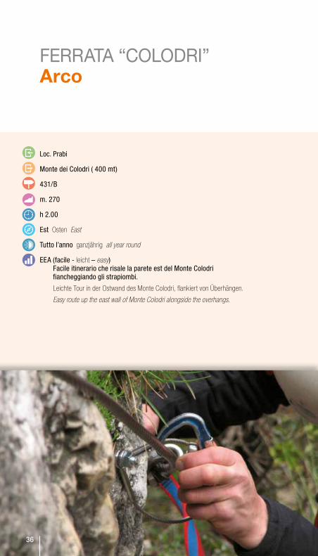
FERRATA “COLODRI” Arco
loc. Prabi
Monte dei Colodri ( 400 mt)
431/b
m. 270
h 2.00
est Osten East
Tutto l’anno ganzjährig all year round
eeA (facile - leicht – easy)Facile itinerario che risale la parete est del Monte Colodri fiancheggiando gli strapiombi.
Leichte Tour in der Ostwand des Monte Colodri, flankiert von Überhängen.
Easy route up the east wall of Monte Colodri alongside the overhangs.
36
37
FERRATA “COLODRI” Arco
ACCeSSo: parcheggio Piscina Comunale, 45° 55.620 N - 10° 53.507 e, attraversare la strada e imboccare il sentiero che sale alla base della parete est del Monte Colodri, in pochi minuti si raggiunge il punto più alto dove parte la ferrata, 45° 55.655 N - 10° 53.309 e.
DiSCeSA: proseguire fino alla Cima del Monte Colodri, 45° 55.760 N - 10° 53.310 e, seguendo le tracce sui banconi calcarei, da qui per il Sentiero dei lecci scendere in direzione ovest fino in loc.laghel, 45° 55.698 N - 10° 53.091 e, da qui si rientra ad Arco (15 min).
ZUSTIEG: Parkplatz am öffentlichen Schwimmbad, 45° 55.620 N / 10° 53.507 O. Man überquert die Straße und nimmt den Weg, der am Fuß der Ostwand des Monte Colodri beginnt. In wenigen Minuten ist man am höchsten Punkt und am Einstieg zum Klettersteig. 45° 55.655 N / 10° 53.309 O.
ABSTIEG: Man geht weiter bis zum Gipfel des Monte Colodri, 45° 55.760 N / 10° 53.310 O, den Spuren auf den Kalkplatten folgend, dann auf dem Sentiero dei Lecci hinunter Richtung Westen bis nach Laghel, 45° 55.698 N / 10° 53.091 O und kehrt von hier aus nach Arco (15 Min.) zurück
ACCESS: Municipal Swimming Pool carpark, 45° 55.620 N - 10° 53.507 E, cross the road and take the path which leads up to the base of the east wall of Monte Colodri, and in a few minutes you find yourself at the highest point where the ferrata starts, 45° 55.655 N - 10° 53.309 E.
DESCENT: go the summit of Monte Colodri, 45° 55.760 N - 10° 53.310 E, following the tracks on the limestone slabs, and then take the Sentiero dei Lecci downhill in a westward direction as far as Laghel, 45° 55.698 N - 10° 53.091 E, and from here back to Arco (15 min).

38
SENTIERO ATTREZZATO DEGLI SCALONI Dro
Ceniga/Ponte Romano (Roman bridge)
n. 428 - 428b - 425
m. 3858
h 4.00
est/sud-est Osten/Süd-Osten East/south-east
tutto l’anno(evitando i giorni più caldi) ganzjährig (außer an sehr heißen Tagen) all year round (avoid hot days)
eeA (facile - leicht – easy)Facile sentiero attrezzato con scale e funi di acciaio risale la parete calcarea.
Leichte Tour mit Treppen und Stahlseilen in einer Kalkwand
Easy path fitted with ladders and steel cables to climb the limestone wall.
39
ACCeSSo: dal Ponte Romano di Ceniga, 45° 57.000 N - 10° 53.873 e, seguire verso nord la strada lungo il fiume Sarca fino a Maso lizzone (No parcheggio). Salire a sinistra per il sentiero 428, poco oltre il maso si svolta a destra e per ghiaione si sale alla base della parete rocciosa dell’Anglone. Qui inizia il facile percorso attrezzato, 45° 57.341 N - 10° 53.682 e
DiSCeSA: seguire verso nord il sentiero delle Cavre SAT 428b. Giunti all’incrocio con il sentiero SAT 425, 45° 58.261 N - 10° 54.538 e, si segue direzione est (valle del Sarca) scendendo la parete rocciosa - alcuni tratti attrezzati con fune metallica. Si raggiunge loc. oltra, 45° 58.168 N - 10° 54.730 e. Da qui verso sud per la strada sterrata dei Molinei fino al ponte sul Fiume Sarca a Dro. Seguire la sterrata di Campagnola in destra Sarca, fino a tornare al ponte di Ceniga.
ZUSTIEG: Von der Ponte Romano in Ceniga, 45° 57.000 N / 10° 53.873 O, Richtung Norden auf der Straße entlang des Sarcaflusses bis nach Maso Lizzone (KEIN Parkplatz). Links hinauf auf dem Weg 428, kurz hinter dem Hof rechts abbiegen und über die Geröllhalde zum Fuß der Felswand des Anglone hinaufgehen. Hier beginnt der leichte Klettersteig, 45° 57.341 N / 53.682 O.
ABSTIEG: Weiter Richtung Norden auf dem Sentiero delle Cavre, SAT 428B. An der Kreuzung mit dem SAT-Weg 425, 45° 58.261 N / 10° 54.538 O, weiter Richtung Osten (Sarcatal) an der Felswand hinunter. Einige Stellen sind mit Metallseilen gesichert. Man erreicht Oltra, 45° 58.168 N / 10° 54.730 O. Von hier aus Richtung Süden auf der Schotterstraße der Molinei bis zur Sarcabrücke in Dro. Man folgt der Schotterstraße von Campagnola rechts der Sarca bis zur Brücke in Ceniga.
ACCESS: from the Roman Bridge in Ceniga, 45° 57.000 N - 10° 53.873 E, follow the road along the River Sarca northwards to Maso Lizzone (NO carparking). Take path 428 up to the right, shortly after the farmstead turn right and head up the moraine to the base of the rocky wall Anglone. This is where the easy bolted route starts, 45° 57.341 N - 10° 53.682 E
DESCENT: head north along the path sentiero delle Cavre SAT 428B. Where it meets the path SAT 425, 45° 58.261 N - 10° 54.538 E, head east (Valle del Sarca) climbing down the rocky wall – some sections are fitted with metal cable – as far as Oltra, 45° 58.168 N - 10° 54.730 E. From here go south on the dirt track strada dei Molinei as far as the bridge on the River Sarca in Dro. Follow the Campagnola trail to the right of the Sarca until you return to the bridge in Ceniga.
40
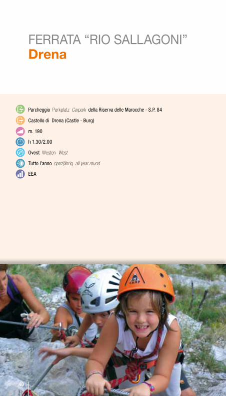
FERRATA “RIO SALLAGONI” Drena
Parcheggio Parkplatz Carpark della Riserva delle Marocche - S.P. 84
Castello di Drena (Castle - burg)
m. 190
h 1.30/2.00
ovest Westen West
Tutto l’anno ganzjährig all year round
eeA
40
41
ACCeSSo: dal parcheggio delle Marocche, lungo la strada provinciale che sale a Drena, nei pressi del Campo di Tiro al Piattello, 45° 58.294 N - 10° 56.016 e . Scendere lungo la strada per 200mt fino alla freccia che indica la Ferrata a sinistra.Dopo alcune centinaia di metri si raggiunge l’imbocco della forra, 45° 58.206 N - 10° 56.069 e. Caratteristico percorso lungo la forra del Rio Salagoni, scavato nella parete calcarea. Particolari ambienti naturali caratterizzati da grandi felci.
DiSCeSA: Raggiunto il Castello di Drena, scendere lungo il vecchio tracciato acciottolato - broza - che riporta al parcheggio.
ZUSTIEG: Vom Parkplatz an der Marocche an der Provinzstraße, die nach Drena hinaufführt und in der Nähe des Tontaubenschießplatzes, 45° 58.294 N / 10° 56.016 O, geht man die Straße 200 m hinunter bis zum Pfeil, der auf den Klettersteig links verweist. Nach einigen hundert Metern erreicht man den Eingang der Schlucht, 45° 58.206 N / 10° 56.069 O. Charakteristische Strecke in der vom Rio Salagoni in den Kalkstein gegrabenen Schlucht, natürliches Ambiente mit großen Farnen.
ABSTIEG: An der Burg von Drena geht man auf dem alten Schotterweg – Broza – hinunter bis zum Parkplatz.
ACCESS: from the carpark at the Marocche Reserve, along the provincial road that leads up to Drena, near the Clay Pigeon Shooting, 45° 58.294 N - 10° 56.016 E . Come down along the road for 200 metres until you see the arrow on your left to the Ferrata. After a few hundred metres you come to the entrance to the gorge, 45° 58.206 N - 10° 56.069 E. A spectacular route along the Rio Salagoni gorge, delved into the limestone wall with a particular ecosystem notable for its large ferns.
DESCENT: Once you have reached Drena Castle, take the old cobbled path - Broza – which takes you back to the carpark.
42
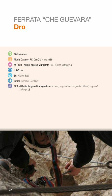
FERRATA “CHE GUEVARA” Dro
Pietramurata
Monte Casale - Rif. Don Zio - mt 1630
m 1400 - m 800 approx via ferrata - ca. 800 m Klettersteig
h 7/8 ore
est Osten East
estate Sommer Summer
eeA (difficile, lunga ed impegnativa - schwer, lang und anstrengend - difficult, long and challenging)
42
43
FERRATA “CHE GUEVARA” Dro
ACCeSSo: all’uscita da Pietramurata, parcheggiare ed imboccare la strada, 46° 01.754 N - 10° 56.733, che costeggia a sinistra la cava alla base della parete del Monte Casale. Per ripido sentiero nel bosco si raggiunge il primo tratto attrezzato. l’itinerario risale l’enorme parete del Monte Casale, una delle più alte dell’Arco Alpino. Richiede allenamento fisico, evitare le giornate estive a causa dell’esposizione in pieno sole. Magnifici panorami.
DiSCeSA: Dal Rif. Don Zio, 46° 01.798 N - 10° 55.477 e, scendere per il sentiero SAT 427 verso l’abitato di Sarche, 46° 02.674 N - 10° 56.924 e, da cui si raggiunge Pietramurata (circa 3 ore)
ZUSTIEG: Am Ortsausgang von Pietramurata parken und der Straße folgen, 46° 01.754 N / 10° 56.733, die links am Steinbruch vorbei und anschließend als steiler Waldweg zu den ersten Stahlseilen am Wandfuß führt. Die Route überwindet die enorme Wand des Monte Casale, eine der höchsten im Alpenraum. Sie verlangt eine gute Kondition und wegen der sonnigen Lage sollten Sommertage vermieden werden. Fantastisches Panorama.
ABSTIEG: Von der Schutzhütte Don Zio, 46° 01.798 N / 10° 55.477 O, geht man auf dem SAT-Weg 427 hinunter Richtung Sarche, 46° 02.674 N / 10° 56.924 O, und erreicht von hier Pietramurata (ca. 3 Std.)
ACCESS: Leaving Pietramurata, park the car and take the road 46° 01.754 N - 10° 56.733 which goes to the left of the quarry at the base of the Monte Casale wall. A steep path through the woods takes you to the first bolted section. The route climbs the enormous Monte Casale wall, one of the highest in the Alps. This ferrata requires serious fitness levels and avoid summer days because of the sunny aspect. Breathtaking views.
DESCENT: From Rif. Don Zio, 46° 01.798 N - 10° 55.477 E, take the path SAT 427 down towards Sarche, 46° 02.674 N - 10° 56.924 E, and from there to Pietramurata (about 3 hours)
44
MORE INFO
CONDIZIONI DEI PERCORSIdie beschaffeNheit der wege
tHE cONDitiON OF rOutES info aggiornate Alle aktuelle Informationen gibt es unter All the latest info on
Commissione Sentieri della SAT - Società Alpinisti Tridentini: http://test-sat.newdata.biz/sns/12/ sentieri/stato_percorribilita.htm
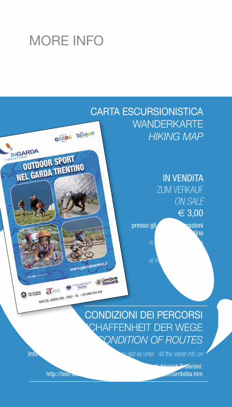
CARTA ESCURSIONISTICA waNderKarte
HikiNg map
iN veNDiTA ZUM VERKAUF
ON SALE € 3,00
presso gli uffici informazioni ingarda Trentino
in den Informationsbüros von Ingarda erhältlich
at Ingarda tourist offices
45
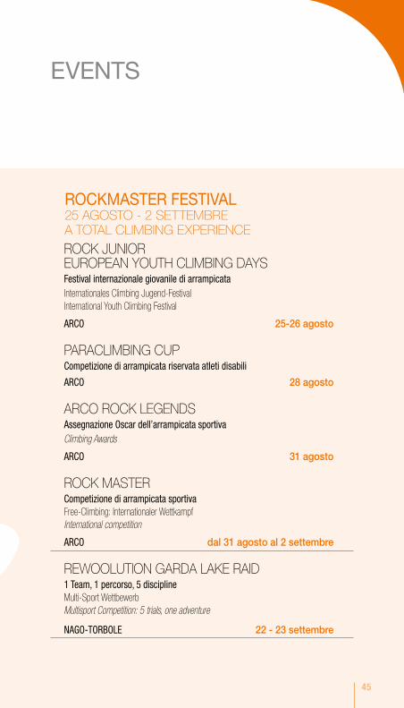
ROCK JUNIOR EUROPEAN YOUTH CLIMBING DAYSFestival internazionale giovanile di arrampicataInternationales Climbing Jugend-FestivalInternational Youth Climbing Festival
ARCo 25-26 agosto
PARACLIMBING CUPCompetizione di arrampicata riservata atleti disabili
ARCo 28 agosto
ARCO ROCK LEGENDSAssegnazione oscar dell’arrampicata sportivaClimbing Awards
ARCo 31 agosto
ROCK MASTERCompetizione di arrampicata sportivaFree-Climbing: Internationaler WettkampfInternational competition
ARCo dal 31 agosto al 2 settembre
REWOOLUTION GARDA LAKE RAID1 Team, 1 percorso, 5 disciplineMulti-Sport WettbewerbMultisport Competition: 5 trials, one adventure
NAGo-ToRbole 22 - 23 settembre
EVENTS
ROCKMASTER FESTIVAL25 AGOSTO - 2 SETTEMBREA TOTAL CLIMBING EXPERIENCE
46
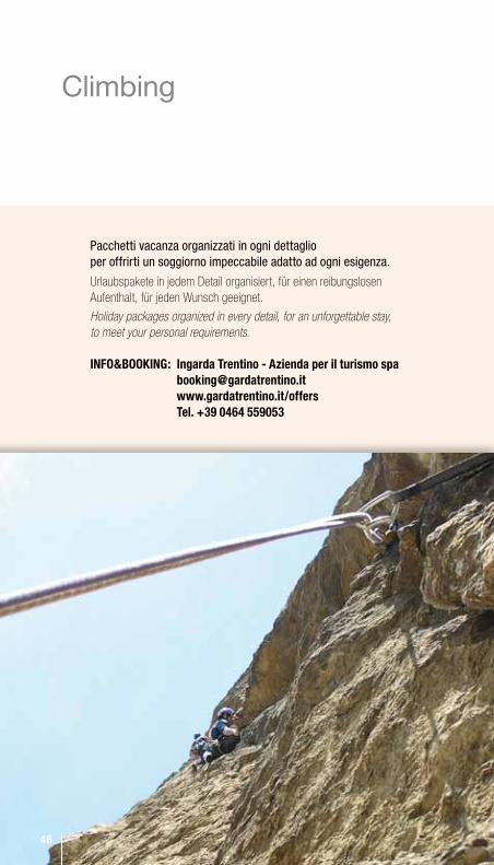
inFo&bookinG: ingarda trentino - azienda per il turismo spa [email protected] www.gardatrentino.it/offers tel. +39 0464 559053
Climbing
Pacchetti vacanza organizzati in ogni dettaglio per offrirti un soggiorno impeccabile adatto ad ogni esigenza.
Urlaubspakete in jedem Detail organisiert, für einen reibungslosen Aufenthalt, für jeden Wunsch geeignet.
Holiday packages organized in every detail, for an unforgettable stay, to meet your personal requirements.
46
47
sceGli il tuo Mix Vincente nella Più sPettacolare Palestra a cielo aPerto• 3 notti in hotel, pernottamento e colazione• cena tipica in ristorante selezionato• 1 t-shirt del Garda Trentino• 2attivitàoutdoordi½giornata:
- trekking, free climbing*, via ferrata* con guida alpina, - bike o MTb - Noleggio bici professionale da e 20,00, - canyoning* con supplemento di e 20,00
da € 239,00 per persona in camera doppia
Das scHönste Fitness-stuDio unter FreieM HiMMel aM GarDasee: Dein sPort, Deine WaHl• 3 Nächte im Hotel ÜF• 1 typisches Abendessen in einem ausgewählten Restaurant• 1 T-shirt des Garda Trentino• 2HalbtageunterfolgendenHalbtag/Outdoor-Aktivitäten: - Trekking, Free Climbing*, Via Ferrata* mit Alpenführer - Canyoning*mit 20,00 Zuschlag, - Bike oder MTB - Professional Bike Verleih ab 20,00
ab € 239,00 pro Person im DZ
at lake GarDa tHe Most sPectacular outDoor traininG GrounD: your sPort, your cHoice• 3 nights in hotel Bed and Breakfast • 1 typical dinner in a selected restaurant• 1 t-shirt of Garda Trentino• 2half-dayoutdooractivityaccordingtotheweeklyprogrammeselected:
- trekking, free climbing*, via ferrata* with a professional guide- canyoning *with a supplement of 20,00 - bike or MTB - professional bike hire from 20,00
from € 239,00 per person in double room
* Attrezzatura inclusa i * Mit Ausrüstungsverleih i * Equipment included
Garda Trentino: sport selection

48
laGo Di GarDa... ViVere l’aVVentura• la quota comprende:• 3 notti in hotel, pernottamento e colazione • 2 attività sportive a scelta tra trekking, climbing,
canyoning (+ 20 euro di supplemento), via Ferrata, Nordic walking
da € 219,00 per persona in camera doppia
GarDasee... rein ins abenteuer!• Im Preis inbegriffen:• 3 Nächte im Hotel ÜF • 2 Sportaktivitäten, gewählt zwischen Trekking, Climbing,
Canyoning (+20 euro Zuschlag), Via Ferrata, Nordic Walking
ab € 219,00 pro Person im DZ
lake GarDa...tHe exPerience oF Pure aDVenture• Price includes:• 3 nights in hotel Bed and Breakfast • 2 Sport activities selected among trekking, climbing,
canyoning (+20 euro extra charge), via ferrata, Nordic walking
from € 219,00 per person in double room
100% Nature
49
laGo Di GarDa... insieMe!• 3 notti in hotel in camera 4 letti, mezza pensione • Adventure Park • escursione di mezza giornata fun climbing per la famiglia
(incl. nolo attrezzatura) • gita in battello sull’Alto Garda • entrata al museo o rettilario Note: età minima per attività sportive: vela e Climbing: anni 6 compiuti.
Prezzo per famiglia: 2 adulti + 2 bambini fino a 12 anni.
da € 710,00 per famiglia 4 persone
aM GarDasee... alle ZusaMMen!• 3 Nächte im Hotel im Vierbettzimmer - Halbpension • Halbtagesausflug Fun Climbing für die Familie (inkl. Ausrüstungsverleih)• Besuch beim Adventurepark • Bootsfahrt auf dem nördlichen Teil des Gardasees • Eintritt zum Museum
Anmerkungen: Mindestalter für Sportaktivitäten: Segeln + Climbing : 6 Jahre. FAMILY PRICE: 2 Erwachsene + 2 Kinder unter 12 Jahren.
ab € 710,00 Familienpreis 4 Personen
lake GarDa... all toGetHer!• 3 nights in hotel in 4-bed room - halfboard• half-day fun climbing for the family (equipment included)• entrance to adventure park • entrance to the museum • boat trip on the northern part of the lake
Notes: Min. age for sportaktivities: Sailing+ Climbing 6 years. FAMILY PRICE: 2 adults + 2 kids up to 12.
from € 710,00 Family price 4 people
Family active!
50
Photo credits:
Fototeca ingarda Trentino SpA (Patrizia N. Matteotti, Promovideo), ph. G.P. Calzà, Donatella ischia, Marisa Montibeller, fototeca Trentino Marketing (Michele Dalla Palma, Stefano Giogli, Daniele lira, borsato), ph. Michele Comper, ph. Diego Pezzoli, ph. Mauro Gibellini, Newspower - archivio Rockmaster.
youtube.com/gardatrentinotwitter.com/gardatrentinofacebook.com/gardatrentino
Follow us onwww.gardatrentino.it/outdoor
51
43
21
7
5
6
Torino
Genova
Firenze
Bologna
Modena
Trieste
Trento
Bolzano
Brennero
VeneziaVeronaBresciaMilano
BergamoLAGO DI GARDA
comune di riva del Garda
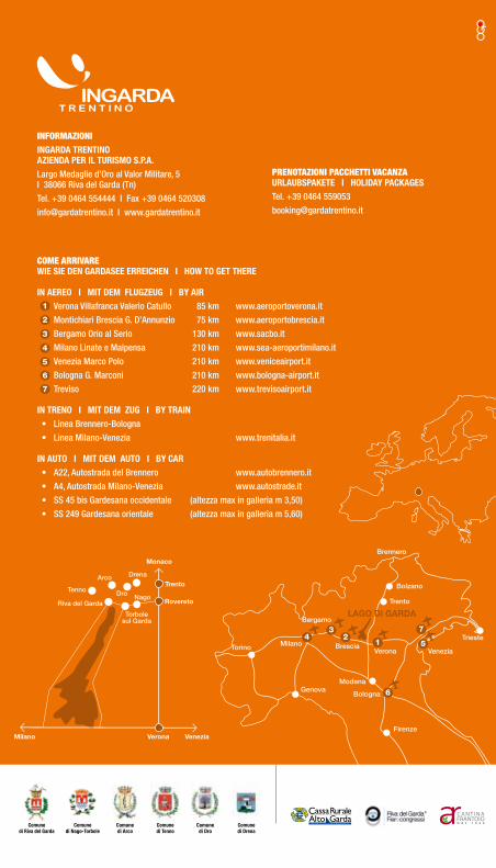
COME ARRIVARE Wie sie Den GarDasee erreicHen i HoW to Get tHere
in aereo i Mit DeM FluGZeuG i by air Verona Villafranca Valerio Catullo 85 km www.aeroportoverona.it
Montichiari Brescia G. D’Annunzio 75 km www.aeroportobrescia.it
Bergamo Orio al Serio 130 km www.sacbo.it
Milano Linate e Malpensa 210 km www.sea-aeroportimilano.it
Venezia Marco Polo 210 km www.veniceairport.it
Bologna G. Marconi 210 km www.bologna-airport.it
Treviso 220 km www.trevisoairport.it
in treno i Mit DeM ZuG i by train • Linea Brennero-Bologna
• Linea Milano-Venezia www.trenitalia.it
in auto i Mit DeM auto i by car • A22, Autostrada del Brennero www.autobrennero.it
• A4, Autostrada Milano-Venezia www.autostrade.it
• SS 45 bis Gardesana occidentale (altezza max in galleria m 3,50)
• SS 249 Gardesana orientale (altezza max in galleria m 5,60)
4
3
2
1
7
5
6
VeronaMilano
Tenno
Torbole sul Garda
Arco Drena
NagoDro
Riva del Garda
Venezia
Monaco
Rovereto
Trento
comune di Dro
comune di arco
comune di nago-torbole
comune di Drena
comune di tenno
PRENOTAZIONI PACCHETTI VACANZAurlaubsPakete i HoliDay PackaGesTel. +39 0464 559053
INFORMAZIONI inGarDa trentino aZienDa Per il turisMo s.P.a.Largo Medaglie d’Oro al Valor Militare, 5 I 38066 Riva del Garda (Tn)
Tel. +39 0464 554444 I Fax +39 0464 520308
[email protected] I www.gardatrentino.it