lake hamilton & lake catherine - entergy | we … · lake hamilton & lake catherine ......
TRANSCRIPT

September 2015
Shoreline Activity Permit ApplicationLake Hamilton & Lake CatherineHot Springs, Arkansas

-1-
This application booklet is for shoreline facilities that accommodate Single-Family Dwellings ONLY. To apply for facilities at Multi-Family dwellings (condos, townhouses, apartments, etc.)
and commercial operations you will need to go to Entergy Arkansas’ Hydro Operations website at www.entergy.com/hydro and select the proper packet or contact us at 501-844-2148.
What Requires a Permit?
All shoreline facilities, structures and activities on Entergy Arkansas’ Project 271 lands or water require a permit from the Company prior to installation or placement. Some of the most common types of facilities,
structures and activities that require a permit include, but are not limited to: Piers Floating Platforms Boat Docks Roof Overhang and/or Lean-to PWC Ramps/Docks/Lifts Seawalls Boardwalks Fill Decks Dredge Inflatable Platforms (e.g. trampoline) Riprap Full Coverage Automatic Boat Covers Excavation Boat Lifts (when outside the facility’s slip) Water Withdrawal Steps Roads Heat/Air Exchange Piping Vegetation Removal Waterlines Bridges Utility Facilities Regulatory Buoys Landscape Plantings Mooring Buoys
NOTE: In addition, permits are required for the modifications, replacement and
additions to existing facilities, structures or activities and may cause you to bring the facility into compliance with current guidelines. This includes but is
not limited to: any changes to an existing facility’s footprint, roof, roof footprint facility support structure, or location.

-2-
Letter to Applicant from the Lakes & Property Coordinator Dear Applicant: Before Remmel and Carpenter Dams were built almost a century ago to form Lakes Hamilton and Catherine, nobody could have imagined the amount of lakefront development that we see now. Through this evolution of the Carpenter-Remmel Project 271, regulations and processes have been duly established by local, state, and federal agencies to help protect the lakes for everyone’s enjoyment. This application booklet has been created to help you understand how the shoreline may be developed within the limits established to protect or enhance the recreational, aesthetic, and other environmental values of the lakes. Your understanding of the Company’s guidelines and completion of all required documentation will aide us in permitting a facility or activity for you. There is a checklist on the back cover of this booklet to help you submit all the required information. Mail your completed application to:
Entergy Arkansas, Inc. Hydro Operations 141 W. County Line Rd.
Malvern, AR 72104 When we receive your application, we will evaluate it in accordance with our guidelines and Shoreline Management Plan requirements. Most applications can be processed in two or three weeks, but some can take up to six months, especially if additional agency reviews are required. We accept applications starting March 15th and no later than November 30th of each year. If your request is permitted we will issue you a copy of the permit as well as a permit tag, if needed, to hang on the facility. I recommend filing the permit documents and this booklet with the ownership records for your property as they will be needed if you ever sell the property. When considering a contractor we recommend using one from the list provided with this booklet - they have attended training and demonstrated a willingness to comply with our guidelines and standards. If you have any questions or wish to discuss your application further, please feel free to contact us at 501-844-2197. Sincerely, Your Lakes & Property Coordinator www.entergy.com/hydro www.facebook.com/LifeontheLakes
Table of Contents What requires a permit................................ 1 General Information .................................... 2 Application Instructions ............................... 5 Sample Drawings ........................................ 6 Shoreline Management Plan Info................ 8 Guidelines & Specifications for Docks ........ 9 Facility Application .................................... 12 Neighbor Comment Forms........................ 14 Bank Stabilization Application ................... 18 Neighbor Comment Forms........................ 20 Understanding Property Boundaries ......... 24 Guidelines & Specifications for Bank Stabilization, Dredging and Boat Ramps .. 25
Corps of Engineers Permit Information ..... 27 Trash Bash, Vegetation and Drawdown ... 28 Permit Fee Schedule ................................ 29 Grandfather Rule ...................................... 29 Permit Conditions...................................... 30 Application Check List................. Back Cover

-3-
General Information Hydroelectric Project 271-AR
Lakes Hamilton and Catherine are part of Project 271, a hydroelectric project licensed by the Federal Energy Regulatory Commission (FERC). The pools of these reservoirs, associated Carpenter and Remmel Dams and project lands are managed by Entergy Arkansas, Inc., pursuant to a license granted by FERC. This license authorizes Entergy Arkansas to issue permits for certain private facilities and activities for use by single-family dwellings along the shoreline land and on Lakes Hamilton and Catherine. Request for private facilities that are to accommodate more than 10 watercrafts and/or are to be used by multi-family dwellings or commercial operations will not only require Entergy Arkansas approval but additional regulatory review and approval from FERC. All facilities must conform to the Company’s general specifications, which are subject to revisions without notice.
The installation of any permitted facilities or structure in
the reservoir or on the shoreline is to be considered as temporary. All facilities or structures are to be constructed of such materials and in such a manner that would allow easy removal and restoration of the shoreline. All permits are conditional and may be revoked at the discretion of Entergy Arkansas. All unpermitted facilities must be removed at the owner’s expense.
Private use of Project lands and waters or access
across Entergy Arkansas’ shoreline lands is a privilege granted by the Company. In exchange for this privilege, adjoining lakefront property owners must comply with all permit conditions (see inside back cover of this booklet), regulations, specifications and requirements, as well as, all applicable Federal, State and local regulations. Other Permits, Licenses, Approvals, Reviews, Certifications, Etc…
In the event Entergy Arkansas agrees to allow a private facility on Project 271 land and waters, the applicant must obtain all other required approvals. For instance, fill and dredging activities may require a U.S. Army Corps of Engineer wetlands permit and other facilities may require the approval of a property owner association or subdivision developer.
Applications for private ramps, private developments, “cut-in” type boat slips and other shoreline activities
requiring cutting and active disturbance of bank/shoreline areas will require a 30 day review/comment period by several State and Federal Agencies. Even if Entergy Arkansas grants a private facility permit, the responsibility remains with the applicant to obtain other Federal, State and local authorizations or permits as required by law and to comply with any property owners association or subdivision bill of assurances, covenants or bylaws and all applicable building codes.
Entergy Property & Water Rights
Associated with the formation of Lakes Hamilton and Catherine, the Company acquired shoreline lands and lands underlying the reservoirs. Generally the Company owns property rights to the 400-ft. contour elevation on Lake Hamilton and to the 307-ft. contour on Lake Catherine. Normal pool level for Lake Hamilton is the 399.70-ft. elevation. Normal pool level for Lake Catherine is the 304-ft. elevation. It should be noted that the extent of ownership of shoreline land does vary. Also, in many locations, the Company possesses flowage easements extending beyond our property ownership. Please carefully check ownership records for your property.
Through its license from the FERC, Entergy Arkansas has exclusive right to
the waters of Lakes Hamilton and Catherine for hydroelectric purposes. The Company must authorize the use of this water. Any use other than simple water withdrawal for single-residence grounds irrigation also requires the Company and possibly FERC approval. Please note that Submersible Pumps are NOT ALLOWED on either Lake Hamilton or Lake Catherine.

-4-
General Information
Your responsibilities as a Shoreline Property Owner
Your facility must conform to the location, specifications, and all other conditions (see inside back cover) of your permit. In addition to all specifications, requirements and conditions which Entergy Arkansas may determine to be appropriate subsequent to permitting of your facility.
Dock flotation must be securely attached and the dock properly anchored and secured at all times. Loose flotation material and loose or derelict docks present a serious hazard to water recreation (See Enforcement and Inspections information below).
It is the responsibility of the dock owner to ensure that the dock is properly maintained and when the dock is constructed, modified or replaced that the waste material is disposed of in an environmentally acceptable manner.
Dock owners are to ensure their permitted facilities and structures are not constructed or maintained, and activities are not performed, on project lands or reservoirs that would be detrimental to navigation or endanger health, create a nuisance, or otherwise be incompatible with overall project recreational use. Please note that Submersible Pumps are NOT ALLOWED on either Lake Hamilton or Lake Catherine.
Permits are required for modifications, replacements and additions to existing facilities, structures or activities. This includes but is not limited to: any changes to an existing facility’s footprint, roofline, roof footprint, facility support structure, or location. Any of these changes will require a new permit and may cause this facility to be required to be brought into compliance with current guidelines.
Garland County Ordinance requires all shoreline property owners to identify their street address with a sign on their dock facility or in their yard along the water’s edge.
Permit Transfers
Permits do not automatically transfer. Once ownership of a lakefront property changes, a new permit for all facilities is required to be issued in the new owner’s name. This typically is handled at closing with a local title company but can be done by contacting Entergy Hydro for the necessary paperwork. If done within 60 days of purchase, the processing fee is reduced by 50%.
New owners can obtain a permit for a previously permitted facility so long as:
a) the facility has been maintained in good repair and complies with all applicable State and local health and safety standards, and b) the facility is in compliance with the current permit conditions and regulations.
Enforcement and Inspections
All facilities and activities are subject to periodic inspection by Entergy Arkansas personnel during construction and/or assembly as well as after a permit is issued to ensure compliance with permit conditions. Unpermitted facilities, derelict docks, or any other facility that creates a public hazard will not be tolerated.
In the event the permittee fails to comply with any of the conditions and requirements of their permit, Entergy Arkansas may revoke the subject permit. In some cases all rights and privileges will be revoked for future facilities. If the Company revokes any permit and the permittee fails to remove said facilities, the Company may, and hereby has permittee’s permission and authorization, to remove said facility/facilities at the permittee’s expense. If litigation is required by the Company to enforce any of its rights related to this process, the permittee shall be responsible to the Company for its legal fees and all expenses incurred by in connection with its enforcement of said rights.
In the event a facility is constructed or placed on the Company’s shoreline property without a proper permit, the Company will take appropriate action to assure that the facility is either permitted, or removed, from Lakes Hamilton or Catherine. Any cost incurred by the Company, including, but not limited to legal costs, removing cost, towing cost, storage cost, or any disposition cost, will be costs for which you are responsible, and for which legal action may be taken to recover same. Any application submitted after the fact will be subject to an increased processing fee.

-5-
Application Instructions The Permitting Process It is important that you provide complete information in the requested format. This information is used to evaluate your proposal for approval. For any specific information concerning the evaluation process, the application forms, or the status of your application, contact Hydro Operations at 501-844-2148.
Applications with incomplete information or lack of required documents will be returned
Instructions for Preparing an Application Step 1: Application There are two types of applications:
1) applications for non-commercial docks, piers, decks and other facilities 2) applications for bank stabilization, dredging and boat ramps
Be sure you have the appropriate application and complete all requested information. The application must be signed by the lakefront property owner/Applicant requesting the permit. The applicant’s signature must also be notarized.
Step 2: Drawings/Maps You must attach detailed drawings showing the Plan View, Profile (front & side) View and Site View (drawing/plat of your property) showing the proposed location of the facility/activity. The Site View should include distances the proposed facility is from adjacent property lines and all other facilities along the shoreline of your property.
Step 3: Photographs Include a shoreline photo of all existing facilities with every application. Photos for bank stabilization, dredging and boat ramp applications must place grade stakes with flagging tape along the outer extremity of the proposed facility or activity and provide photographs of the entire shoreline showing the location of the proposed facility or activity. Step 4: Adjacent Lakefront Property Owner Comment Form To assist Entergy Arkansas in evaluating your application the comment form is to be completed and presented to the lakefront property owner on each side of your property for their signature. (Regardless of whether the landowner lives at this location or not.) In some situations the Company may request the comment forms be completed and presented to additional lakefront property owners. All drawings of the proposed facilities are to be illustrated on the back of the comment form in the designated areas or separate pages that are to be initialed by your neighbors. Any change in the configuration or design of a facility after the submittal of the comment form to the adjacent property owner, may require resubmittal of the comment form showing the proposed changes. An objection by an adjacent lakefront property owner is not absolute cause for denial, but will be considered in Entergy Arkansas’ decision whether to grant approval of an application. The Company does not typically consider “obstruction of view” when determining the placement of Facilities.
Step 5: Deed and Survey Plat The applicant must be the legal owner of said property or have a long-term lease on said property. Attach a survey plat and a copy of the deed or lease for the lakefront property that the proposed facility or activity will be located on. Be sure to “Like” us on Facebook to stay informed on any news, guideline changes or topics of concern
www.facebook.com/LifeontheLakes

-6-
Property Line
Lot 7Mr. & Mrs. H.L Owner
Shoreline
155'
New Bulkhead/Wall
Reservoir
Hay Drive
House
N
Site Drawing
20" - 24 "
3'
1'
dead-man
Rock Wallelev.398
elev.399
elev.400
12"
2'
Seawall Profile Drawing
Reservoir
House
70'B B
A
A
60'
Lot 7
Mr. & Mrs. H.L. Owner
Section A-A
399'397'395'
Section B-B
395'
399'
1'
1'N
Area to be dredged
(dock)
Dredging Site Drawing
Site Drawing Lake Hamilton
Lot 7, Shore Subdivision
Lot 6 Lot 8
15'
Extended Side Property Line
45" 28'
15'
101 Star Bright Road
Proposed 32'x29' Dock
20' walk
Existing 10' wide Boat Ramp
Proposed 4'x 20' Pier
30'
N
Dock Plan Drawing
20' WALK
34'
29' 3' wide
3' wide
3' wide
4'
10' 4'
9'
29'
12'
18"
8'
20'
Guard Rail Height= 42"
Profile Drawing
Drawings Three types of detailed drawings – Plan, Profile and Site – are required to accurately depict a facility or activity.
Submit one original, or good quality copy, of all drawings on 8 ½ x 11-inch white paper. Drawings do not have to be prepared by an engineer, but professional assistance may become necessary if the project is large and/or complex. Drawings also need to be provided to your Adjacent Property Owner with their comment forms.
Each page should have a title block identifying the address of the proposed activity and the name of applicant. The drawings are to show all existing facilities owned by the applicant and a dimensioned footprint of any proposed roof on a facility – can use dashed box/line on plan drawing.
SAMPLE DRAWINGS
NOTE: Applicants will need to illustrate their facility or activity on the back of the neighbor comment forms and get those initialed by their neighbors. You also will need to turn in a full sized (8½” x 11”), fully dimensioned drawings with your application.

-7-
Bank Stabilization
Rip-rap Installation Placement of large rock, usually referred to as “rip-rap”, is the preferred form of shore protection over seawalls.
Seawall Installation Natural undisturbed shoreline provides valuable nursery habitat and food
source for newly spawned fish. To mitigate the impact to the environment caused by the construction of retaining walls, riprap (rock 4” to 12” in diameter) is required along the entire length of all new walls constructed after the winter of 2002/2003, up to or just above the surface of normal summer time pool levels with a ratio of 1:1. In addition to protecting the environment, riprap absorbs wave action that causes erosion and damages docks. While a permit is required, there is no permit fee to place rip-rap along the base of existing walls.
Failure to abide by this new requirement may result in revocation of all shoreline facility permits issued to the permittee/owner of the wall. If you have any questions concerning this new requirement, please feel free to contact Hydro Operations at 501-844-2148.
NOTE: Seawalls or any other disturbance of the shoreline or the excavation of the lakebed, is not allowed in areas classified as “Sensitive Spawning and Nursery Area” in Entergy Arkansas’ Shoreline Management Plan. The only bank stabilization option available for these areas is rip-rap or bio-engineering. If needed, support of the rip-rap toe area is to be done by the placement of larger rock.
-8-
General Guidelines & Specifications For Private Facilities / Activities
Introduction The Company is required by FERC License to manage all use and occupancy of project lands and waters to ensure that all facilities are properly permitted, meet current guidelines and requirements, are maintained in good repair and comply with applicable state and local health and safety requirements. The Company allows lakefront property owners the privilege to use and occupy the Company’s shoreline lands and waters, and has developed the following minimum guidelines for it to interpret and use to assure compliance with its FERC license and to support the Company’s FERC approved Shoreline Management Plan. These requirements and specifications for private recreation facilities (boat docks, piers, decks or other floating or stationary facilities) have been developed to encourage fair division of shoreline space among adjacent property owners and the general public, and to minimize environmental and cultural impacts and navigation hazards along the shoreline and reservoirs. Entergy Arkansas considers installation of any permitted facility or structures in the reservoirs and the shoreline to be temporary. Accordingly, the Company requires that all facilities, including, but not limited to, piers, docks, ramps and stairs, be constructed of such materials and in such a manner that allow easy removal and restoration of the shoreline to previous conditions. All construction work by the permittee or his agents must conform to good construction practices by conforming to applicable portions of the Southern Standard Building Code and appropriate state and local codes. A copy of the Southern Standard Building Code is available for viewing at the Garland County Public Library. In some cases, the Company may require that “Facility” designs be approved by a Professional Engineer licensed in the State of Arkansas.
Entergy’s Shoreline Management Plan (SMP) The SMP is a required comprehensive plan to manage the multiple resources and uses of the shorelines on Lakes Hamilton & Catherine in a manner that is consistent with its FERC license requirement (Article 412) to protect and/or enhance the environmental, recreational and aesthetic value of the Project and to address the needs of the public. The SMP identified four (4) distinct Shoreline Use Categories:
1. Residential Area is shoreline adjacent to existing developed areas with predominantly residential use and character. 2. Commercial Area is shoreline adjacent to or in existing areas supporting commercial activities. 3. Public Area is shoreline utilized by municipalities and utilities for infrastructure such as road, utilities, parks and other
areas currently being managed as areas accessible to the general public. 4. Multipurpose Area is shoreline that has no definable use pattern. These shoreline areas are normally large
undeveloped wooded areas which may or may not have scattered residential and/or commercial use.
The SMP also classifies all shoreline into three (3) Management Classifications:
1. General Use Shoreline is typically along areas with a significant heavy level of existing development with few significant environmental resources. These shorelines have been identified as the most appropriate areas to support new shoreline facilities and activities.
2. Limited Use Shoreline is along areas that require special considerations for proposed new facilities and activities. This determination was made in an effort to protect certain unique environmental resources, provide fish and wildlife habitat and provide particular aesthetic value and integrity to Project 271 lands and waters. Specific resource concerns addressed in this classification include: Archaeologically Sensitive Areas, Steep Slopes, Unique and Sensitive Fish Spawning and Nursery Areas, Existing Wetlands Areas, and Natural Rock Shorelines. Only certain types of shoreline facilities and activities are allowed along these shorelines.
3. Resource Management Shoreline is along shoreline adjacent to areas developed and managed for particular public purposes such as parks, forestlands, nature preserves and recreational areas.
To determine what Use Category and Management Classification a property is adjacent to and to obtain more specifics on the types of facilities allowed, you can view and/or download the complete Shoreline Management Plan at www.entergy.com/hydro. Allowable facilities for General Use and Limited Use Shoreline are explained in general on the following pages under “General Guidelines and Specifications”. For more information on the above contact the Company’s Hydro Operations at 501-844-2148.

-9-
General Guidelines & Specifications for Docks, Piers, Decks & Boardwalks
The following are for proposed non-commercial shoreline facilities along shoreline categorized as “Residential” or “Multipurpose” areas as mapped in the Company’s Shoreline Management Plan: (Subject to revision without notice) SECTION I: FACILITIES INTENDED USE & SLIP DENSITY A) General Use Guidelines
1) “Facilities” are not to be used for the docking, mooring or launching of houseboats or seaplanes (or other aircraft). Boats are not to extend more than three (3) feet outside its permitted slip. Ski courses are not allowed on any portion of lakes Hamilton & Catherine unless it is part of an authorized Special Event.
2) The placement of commercial advertising signs, other than for the dock builder, is not allowed on non-commercial “Facilities”. Dock builder advertising signs are limited to 8.5” x 11”.
3) The outsides of a “Facility” are not to be used as a permanent mooring location (“boat slip”) unless that area has been specifically permitted as a “boat slip”. The perimeters of a dock, boardwalk, or pier may be used for temporary mooring of boats (“boat tie-up”) for up to 14 consecutive days in any 30 day period, and no more than 60 days/year.
4) Docks to accommodate more than 10 vessels require additional agency consultation and FERC approval. 5) Boat docks, piers, decks or other facilities (“Facility/Facilities”) are intended to accommodate lakefront dwellings
only. A lakefront dwelling is defined as an applicant’s primary or vacation residence that is located on lakefront property that is: owned/leased by the applicant, adjoins the Company’s shoreline property, is not segregated, divided or impaired by any roadway and has a direct line-of-sight view of the shoreline.
B) Single-Family Dwellings 1) A single family dwelling is defined as a single building for occupancy by a single family unit. 2) For older developments, subdivisions or lots platted and recorded in the appropriate county court records prior to
January 1, 2006, an applicant must have at least 45 feet of lake frontage to be eligible for a single-slip dock and 90 feet for a two-slip dock.
3) For newer developments, subdivisions or lots platted and recorded in the appropriate county court records in 2006 or later, an applicant must have at least 75 feet of lake frontage to be eligible for a single-slip dock and 100 feet for a two-slip dock.
4) The max. number of boat slips to accommodate a single-family residence is two regardless of lake frontage. 5) The max. number of personal watercraft ramps/lifts/slips is two per residence regardless of lake frontage. 6) All adjoining lots under common deed or ownership, for use as a single residence, are considered to be one tract.
C) Single-Family Dwelling “Off-Lake Lot Option”
For new developments of undeveloped lakefront areas located along shoreline categorized as “Residential” or “Multipurpose”, docking for off-lake lots will be considered under the following terms & conditions: 1) The development’s lakefront property is platted with lots that adjoin at least 100 feet of the Company’s shoreline
property. 2) Only community multi-slip boat docks are allowed and must be located along shoreline adjacent to common
use lot(s) that are at least the same depth of the average lakefront lots or deeper. Common use lots must have enough shoreline to accommodate a community dock consistent with Section V “Facility Location/Position” of these guidelines Common use lots must only be for the purpose of providing access to the community dock.
3) Individual boat docks are not allowed in front of lakefront lots. Swim docks/decks or boardwalks will be considered.
4) Total slip density does not exceed one (1) slip per 75 feet of development shoreline. Total “PWC dock” density does not exceed two (2) PWC’s per 75 feet of development shoreline.
5) Community docks over six slips must be uncovered. 6) Lakefront lots are reserved only one slip in the community dock. The remaining will be for off-lake lot use. 7) Permits will only be issued to the original developer or a legally formed property owner’s association (POA) with
jurisdiction over the common use lot (s). The developer will assure that a POA is created and that any permits issued are transferred to the POA.
8) Community docks over 10 slips (this is a combination of boat and PWC slips) require, in addition to the Company agreement, prior agency consultation and FERC approval.
For Multi-Family Residences (Private Marina) Guidelines & Specifications please visit our website to obtain the most current Multi-Family Facility/Activity Application
www.entergy.com/hydro

-10-
General Guidelines & Specifications for Docks, Piers, Decks & Boardwalks SECTION II: ALLOWABLE FACILITIES A) Along shoreline classified as Fish Spawning and Nursery areas, only fixed/stationary facilities will be allowed (excl. PWC). B) Only fixed/stationary facilities are allowed in water depths of 7 feet or less (excluding PWC). C) A lakefront property owner’s dwelling, dwelling’s porch, deck/patio is not to extend over or on the Company’s shoreline. D) Concrete or Masonry slabs, footers, support piers, and/or patios are not allowed. E) Only wood or metal support structures will be allowed on fixed or stationary facilities. F) Facilities enclosed with rigid sides are not allowed. Transparent fabric material may be used on ONLY ONE SIDE of
a dock facility as long as it does not deter visibility for boaters. Full stall fabric boat covers are NOT ALLOWED – examples of these are The Touchless Cover.
G) Vertical storage lockers are no longer allowed to be installed on facilities (See Section III C below for alternative option). H) Boat lifts or PWC docks located along the perimeter of, or outside of, a permitted Facility require a permit
request to be approved by the Company prior to placement or it will be subject to an “After the Fact” permit. SECTION III: FACILITY SIZE & CONFIGURATION A) The overall length or width of a single family boat dock shall not exceed 38 feet. This includes the slip(s), walkways, and
any attached decks (excluding boardwalks). Swim decks may only be on one side of the dock. B) No more than 50% of the shoreline adjacent to an applicant’s lakefront property can be used for the placement of any
kind of facilities (includes PWC ramps/lifts, piers, decks, boat docks, floating platforms, etc.), excluding boardwalks. C) Horizontal/chest style storage lockers should be located on the shore side and shall be no taller than 2.5 feet and
occupy no more than 30 sq. ft. of the deck. D) Excluding an adjoining boardwalk, the width of the boat dock’s walkways (ramp and fingers) shall be at least 3 feet, but
no more than 6 feet and the width of the boat dock’s head walkway is to be at least 4 feet. Exception: A bump board of no more than one foot in width may be used in place of a finger when necessary. Only up to 6 feet of a finger or head walkway associated with a boat stall may be roofed.
E) The maximum size of a pier/ramp is 6 feet wide by 38 feet long. F) A boardwalk shall not extend more than 6 feet out from the shoreline over water. G) The overall length or width of a stand-alone deck, swim dock or floating platform is not to exceed 20 feet. H) The maximum height of a deck is 5 feet above water.
SECTION IV: FACILITY LOCATION/POSITION A) Facilities (including vessels permanently moored to them, PWC docks, lift, etc.) should be located between the property
owner's side lot lines so as to provide at least a 15 foot off-set from the extended lot line projected into the water. B) Facilities are to be placed as close to the shoreline as possible. Extensions into the lake of a dock are limited to:
1) 55 feet in a direction perpendicular to the shoreline, 2) a distance that would not create a hazard to safe navigation, 3) one-fourth the distance across a cove,
4) a distance that allows the property owner sufficient water depth. C) Facilities must not interfere with navigation, ingress, or egress to adjoining
properties or existing shoreline facilities. D) Facilities should be at least 30 feet from any other existing dock. E) If the proposed Facility’s slip is parallel to the shoreline, the slip-
opening end should be at least 1.5 times the length of the longest slip from the owner’s projected property line. (See Figure)
F) Variances for the above location guidelines may be allowed at the Company’s sole discretion whenever practical. The use of extended property lines for the placement of Facilities is a management tool used at the Company’s sole discretion. In some instances, due to unique lot and/or shoreline configuration, the Company may choose to alter the angle of the projected lot lines to create more fair usage along a particular shoreline. Facilities may be allowed closer than 15 feet from a property’s projected lot line if in the Company’s sole opinion, the construction/placement will not unduly affect the adjacent property owner’s use of their lakefront or create a nuisance and/or hazard to safe navigation. The Company may also vary from these positioning guidelines for reasons such as insufficient water depth or irregular shoreline contours when conditions warrant. The Company does not typically consider “obstruction of view” when determining the placement of Facilities.

-11-
General Guidelines & Specifications for Docks, Piers, Decks & Boardwalks SECTION V: FACILITY COLOR A facility’s roof and frame should be a neutral color that blends into the natural shoreline or matches the color scheme of the residence that it serves. Pastel colors such as yellow, pink, or purple are not allowed. Along shorelines classified as Steep Slopes, as designated in the Company’s Shoreline Management Plan, a Facility’s roof is to be dark green, dark gray or dark brown and visible structural members are to be black, dark gray or dark brown. SECTION VI: FLOATATION & ANCHORAGE A) Closed cell polystyrene or approved encapsulated foam bead poly-styrene is required on all floating Facilities. B) Hollow containers, metal covered or injected drum floatation will not be allowed. C) All Facilities must be securely anchored and connected to shore with a walkway. The Company considers any
unattended dock that floats away from shore as a public hazard. The Company will have loose docks secured or removed at the dock owner’s expense, as it deems practical for the circumstances. The Company expects the facility owner to have the dock put back at its permitted location within 2 weeks of it breaking loose.
D) Docks using pipe stem anchoring systems should be properly designed to prevent the pipe from breaking or sliding out through the pipe stem’s sleeve, especially during high-water events.
E) Stiff-arms connected to a concrete dead-man on the shore may be required in locations with steep slopes, swift water and/or fluctuating levels.
SECTION VII: ROOFS / AWNINGS / ROOF EXTENSIONS / LEAN-TOO / HANDRAILS / GUARDRAILS A) Roofs are only allowed over the slip area of a boat stall and up to 6’ of those fingers directly associated with the stall. B) Decks and PWC ramps/lifts must be uncovered. C) Deck/roof combinations, second floors, or elevated platforms are not allowed. Roofs may be gabled or single-pitched. D) Metal roofing must be baked enamel coated. Wood or shingled roofs are not allowed on floating Facilities. E) The maximum height of a Facility’s roof (peak) is not to exceed 15 feet above the normal water level. F) Roof eaves are not to extend more than 12 linear inches beyond the footprint of the roof-able area of the facility. G) Awnings, roof extensions or lean-too’s installed to increase a docks permitted roofline, stall size, or number of stalls will
require a permit prior to installation. H) Handrails, 32 in. high with a 16 in. mid-rail, are required on both sides of the ramp/walkway leading to the Facility. I) Guardrails, 41 in. high with a 20-24 in. mid-rail, should be provided on perimeter areas not used for mooring.
SECTION VIII: ELECTRICAL, LIGHTING A) All electrical work shall be in accordance with the current version of the
National Fire Protection Association Standards for Marinas and Boatyards and the National Electrical Code and all other federal, state and local codes.
B) It is exclusively and specifically the responsibility of the applicant/permittee to ensure that all electrical work so complies.
C) Only low-watt yellow-colored lighting that does not create a hazard to boaters is allowed on any type of Facilities. All lights are to be pointed downward and shielded so to prevent visibility of the bulb within 50' of the lake side of the facility. Motion activated lighting is preferred. Two-inch diameter blue reflectors placed at 10-foot intervals along the docks sides are recommended. Red, green or white lights shall not be used as they could be confused as navigational lights.
D) Lighting that is judged to be a nuisance or hazard by Company or law enforcement shall be removed at the owner' expense.
E) The placement of sump pumps, or submergible pumps, is PROHIBITED.
SECTION IX: SAFETY & IDENTIFICATION Image provided by www.lariat.org/LASSO/countyregs.html
A) All Facilities should have a throwable personal flotation device and a properly sized fully charged A-B-C fire extinguisher B) Lake addresses shall be labeled on either the shoreline or the lakeside of a shoreline facility according to Garland
County Ordinance. Every property with a dock facility should also have a permit tag attached to their facility.

-12-
1) First Name: Last Name:
Mailing Address: City: State: Zip:
Day Telephone: Night Telephone:
E-mail Address:
2. Lake Address:
3. Check lake and county: Lake Hamilton Lake Catherine / Garland County Hot Spring County 4. Legal description of my property: (Using your deed, complete below item “a” and either “b” or “c”) (Attach copy of deed. Only the legal owner of the property may submit a permit.) a) Grantee Name on Deed: County RPID #: b) Quarter Section Section Township Range ____________ c) Lot Block Subdivision/Development Name________________________________
5. Description of my (circle one) PROPOSED or EXISTING facility/facilities: (as outlined on attached drawings)
6. Description of any other proposed activity or facility (including water withdrawal):
7. Contractor (Name and Telephone Number)
8. Do you have any other existing structures on or along the shoreline (including water withdrawal)? If so, please describe:
Print or type all information requested below and return original to: Entergy, Hydro Operations, 141 West County Line Rd, Malvern, AR 72104
Attach: 1. Survey Plat, 2. Deed, 3. All required Drawings 4. Adjacent Property Owner Review Forms, 5. Processing Fee.
Facility #1
A) Type of Facility: (check one) _____ boat dock, _____ swim dock, _____ boardwalk, _____ pier, other (describe) ______________________
B) Facility Size: feet by feet
C) Height: (from water to top of facility, max. 15’)
D) Number of Slips:
E) Length of Walkway to Dock:
F) (Yes/No) Answer the following questions:
1) Will it have a roof? 2) Will it be floating? 3) Will it be on fixed piers?
G) Complete the following statement:
My facility is/will be ft down the shoreline from my property’s (north, south, west or east) side property line.
H) Water Depth at land side of facility: ____________ (must be 7 feet or more if floating)
Facility #2
A) Type of Facility: (check one) _____ boat dock, _____ swim dock, _____ boardwalk, _____ pier, other (describe) ______________________
B) Facility Size: feet by feet
C) Height: (from water to top of facility, max. 15’)
D) Number of Slips:
E) Length of Walkway to Dock:
F) (Yes/No) Answer the following questions:
1) Will it have a roof? 2) Will it be floating? 3) Will it be on fixed piers?
G) Complete the following statement:
My facility is/will be ft down the shoreline from my property’s (north, south, west or east) side property line.
H) Water Depth at land side of facility: (must be 7 feet or more if floating)
June 2014 Rev. 21

-13-
APPLICANT’S AGREEMENT TO TERMS AND CONDITIONS FOR A NON-COMMERCIAL SINGLE-FAMILY PRIVATE FACILITY/ACTIVITY
I understand and agree to the conditions of a non-commercial private facility/activity permit as listed on the inside of the back page of this application booklet and the requirements and
specifications as set forth in Entergy Arkansas’ “General Information” and “General Guidelines & Specifications” for lakes Hamilton and Catherine hereby incorporated by reference which I hereby
acknowledge having received and reviewed. I further agree not to begin construction, placement or use until a “Permit” is issued by the Company.
Sign Here: _ Date (Applicant’s Signature Must Be Notarized Below)
NOTICE: VIOLATION OF THIS PERMIT IS SUBJECT TO A “NON-COMPLIANCE PENATY FEE” AND/OR REVOKING OF PERMIT IN ADDITION TO ANY AND ALL COSTS INCURRED TO ENFORCE THE VIOLATION.
NOTARY PUBLIC ACKNOWLEDGMENT
STATE OF __________________
COUNTY OF ________________ On this day, before me personally appeared ________________________________________and ______________________________________, known to me to be the persons whose names are subscribed to the instrument and acknowledged that they had executed the same for the purposes therein contained. IN WITNESS WHEREOF I hereunto set my hand and official seal on this ________ day of _________________________________, 20 ______.
Notary Public __________________________________________ My Commission Expires ___________________________
(Below is to be completed by Entergy)
NON-COMMERCIAL SINGLE-FAMILY FACILITY PERMIT PERMIT NUMBER: _____________
Entergy Arkansas Inc. hereby issues the above applicant a conditional and revocable permit to construct and/or maintain the afore described facilities to accommodate single-family dwellings only as shown on plans on record with Entergy Arkansas and subject to the current requirements and specifications of the Company and the conditions at time of issuance hereof is hereby granted.
Entergy By: Date: _________________ Permit is granted as requested. Permit is granted in accordance with attached drawing.
ADDITIONAL CONDITIONS:

-14-
June 2014 Rev. 17
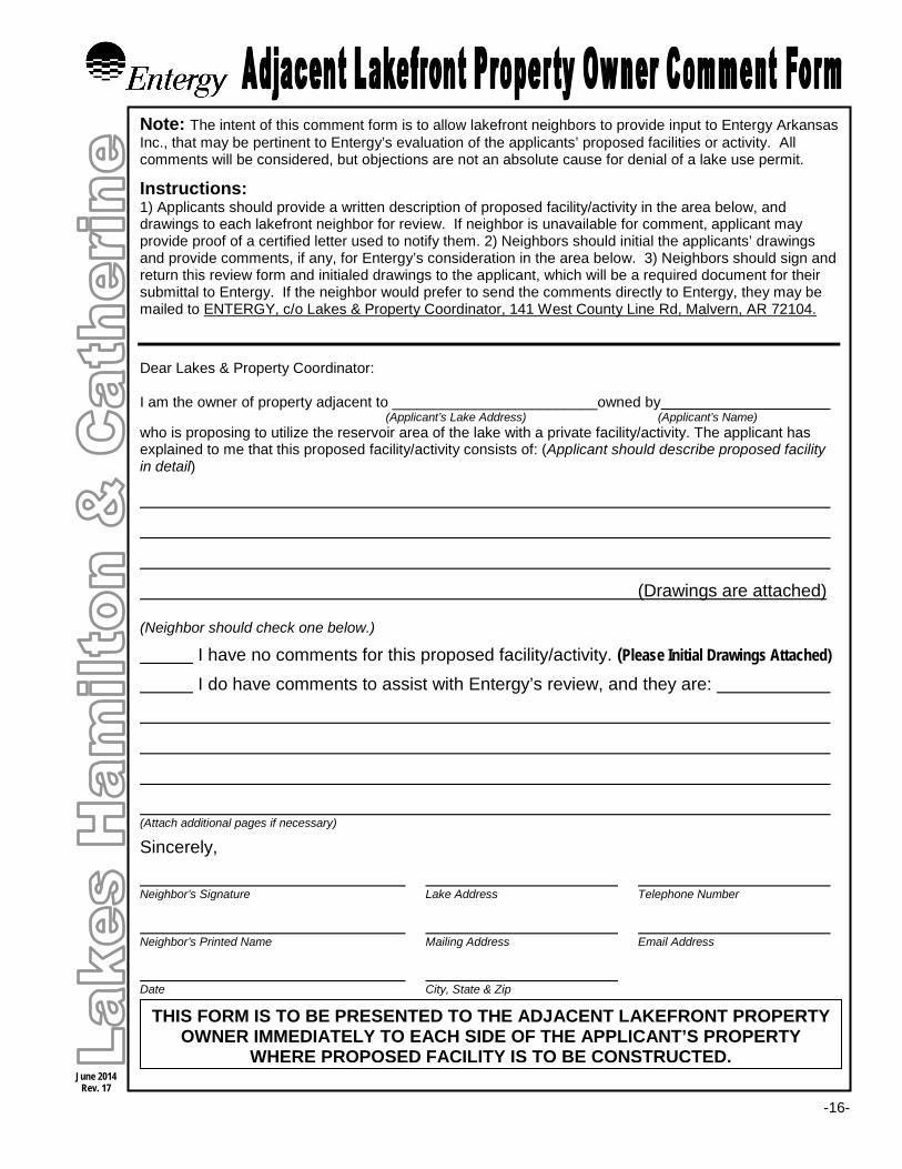
Note: The intent of this comment form is to allow lakefront neighbors to provide input to Entergy Arkansas Inc., that may be pertinent to Entergy’s evaluation of the applicants’ proposed facilities or activity. All comments will be considered, but objections are not an absolute cause for denial of a lake use permit.
Instructions: 1) Applicants should provide a written description of proposed facility/activity in the area below, and drawings to each lakefront neighbor for review. If neighbor is unavailable for comment, applicant may provide proof of a certified letter used to notify them. 2) Neighbors should initial the applicants’ drawings and provide comments, if any, for Entergy’s consideration in the area below. 3) Neighbors should sign and return this review form and initialed drawings to the applicant, which will be a required document for their submittal to Entergy. If the neighbor would prefer to send the comments directly to Entergy, they may be mailed to ENTERGY, c/o Lakes & Property Coordinator, 141 West County Line Rd, Malvern, AR 72104. Dear Lakes & Property Coordinator: I am the owner of property adjacent to _________________________owned by (Applicant’s Lake Address) (Applicant’s Name) who is proposing to utilize the reservoir area of the lake with a private facility/activity. The applicant has explained to me that this proposed facility/activity consists of: (Applicant should describe proposed facility in detail)
(Drawings are attached)
(Neighbor should check one below.)
I have no comments for this proposed facility/activity. (Please Initial Drawings Attached)
I do have comments to assist with Entergy’s review, and they are:
(Attach additional pages if necessary)
Sincerely,
Neighbor’s Signature Lake Address Telephone Number Neighbor’s Printed Name Mailing Address Email Address Date City, State & Zip
THIS FORM IS TO BE PRESENTED TO THE ADJACENT LAKEFRONT PROPERTY OWNER IMMEDIATELY TO EACH SIDE OF THE APPLICANT’S PROPERTY
WHERE PROPOSED FACILITY IS TO BE CONSTRUCTED.

-15-
Illustrate drawings of proposed facilities (use additional pages as needed)
Plan View Profile View Site View
-16-
June 2014 Rev. 17
Note: The intent of this comment form is to allow lakefront neighbors to provide input to Entergy Arkansas Inc., that may be pertinent to Entergy’s evaluation of the applicants’ proposed facilities or activity. All comments will be considered, but objections are not an absolute cause for denial of a lake use permit.
Instructions: 1) Applicants should provide a written description of proposed facility/activity in the area below, and drawings to each lakefront neighbor for review. If neighbor is unavailable for comment, applicant may provide proof of a certified letter used to notify them. 2) Neighbors should initial the applicants’ drawings and provide comments, if any, for Entergy’s consideration in the area below. 3) Neighbors should sign and return this review form and initialed drawings to the applicant, which will be a required document for their submittal to Entergy. If the neighbor would prefer to send the comments directly to Entergy, they may be mailed to ENTERGY, c/o Lakes & Property Coordinator, 141 West County Line Rd, Malvern, AR 72104. Dear Lakes & Property Coordinator: I am the owner of property adjacent to _________________________owned by (Applicant’s Lake Address) (Applicant’s Name) who is proposing to utilize the reservoir area of the lake with a private facility/activity. The applicant has explained to me that this proposed facility/activity consists of: (Applicant should describe proposed facility in detail)
(Drawings are attached)
(Neighbor should check one below.)
I have no comments for this proposed facility/activity. (Please Initial Drawings Attached)
I do have comments to assist with Entergy’s review, and they are:
(Attach additional pages if necessary)
Sincerely,
Neighbor’s Signature Lake Address Telephone Number Neighbor’s Printed Name Mailing Address Email Address Date City, State & Zip
THIS FORM IS TO BE PRESENTED TO THE ADJACENT LAKEFRONT PROPERTY OWNER IMMEDIATELY TO EACH SIDE OF THE APPLICANT’S PROPERTY
WHERE PROPOSED FACILITY IS TO BE CONSTRUCTED.

-17-
Illustrate drawings of proposed facilities (use additional pages as needed)
Plan View Profile View Site View

©A) BuLKHEADIWALL — Type of Material: (check one): Concrete, z Rock, Block, Other:
_________________________
Shoreline Length:
___________
ft. Full Height:
_______________ft.
Width/Thickness:
_____________
ft. Wall height above water
______
ft.Note: Riprap is required in front ofthe entire length of all new seawalls up to the surface ofthe water at normal summertime
OOl level. You must also complete section B be/ow.
s) RiPRP — Shoreline length:
____________
ft.
Height:
________ft.,
Distance into Water:
_______
ft.
Note: See diagram to right for explanation on information needed.
c) BOAT RAMP — Type: (check one): :z concrete !Grav!el, Other:Length:
_________________
ft, Width:
____________ft,
Base material thickness for concrete ramp wUl he
______________________ ___________
Width:
___________
ft,o) DREDGE — Area Dimensions: Length:
__________
ft.
__________ __________
Note: You must calculate cubic yards of material to be removed
Cubic Yards to be removed from the lake: cubic yards. (cubic yards z length x width x depth I 27)
Equipment to he Used P!urpose
Shoreline Activity Permit‘Entergy Bank Stabilization, Dredging, and Boat Ramps
Attach: 1 . Survey Flat, 2. Deed, 3. All required Drawings Frint or type all informafion requested below and return original to:4. Adjacent Froperty Owner Cornrnent Forrns, 5. Frocessing Fee. Entergy, Hydro Operations. 141 West Oounty Line Road, Malvern, AR 72104
1) First Name:
_____________________________
Last Name:_________________________________________________
MailingAddress:________________________________ City:___________________ State:_____ Zip:____________
Day Telephone:______________________________ Night Telephone:
________________________________________________
EmaiiAddress:
2. Lake Address:
3. Check lake and county: z Lake Hamilton z: Lake Catherine I z Garland County z Hot Spring County
4. Legal description !of my property: (Using your deer, complete be/ow item a” and either Y or “c)(Attach copy ofdeed. Applicant must have /egal ownership ofadjoining lakefront propert.)
a) ‘Grantee Name on Deed:
______________________________________________________County
RPiD #:
______________
b) Quarter Section
_____________________________________
Section
________
Township
_________
Range
_________
c) Lot
_____________________
Block
_____________
Subdivision/Development Name__________________________________
5. Description of my proposed facility/facilities: (as outlined on attached drawings)
DESCRIPTION OF FACILITY
oI’
c3
rt
‘9
Distance into Water:
____________
ft.inches Slab Thickness
___________
inches
Depth:__________ ft,
6. Description of any other proposed activity or facility (including water withdrawal):
7. Cortractor (Name and Telephone Number)
________________________________________________________________
8. Do you have any other existing structures on or along the shoreline (including water withdrawal)? If so, please
describe:
June 2014Rev. ,21
-18-

-19-
APPLICANT’S AGREEMENT TO TERMS AND CONDITIONS FOR A SHORELINE ACTIVITY PERMIT
I understand and agree to the conditions of a shoreline activity permit as listed on the inside of the back page of this application booklet and the requirements and specifications
as set forth in Entergy Arkansas’ “General Information” and “General Guidelines & Specifications” for Lakes Hamilton and Catherine hereby incorporated by reference which I hereby acknowledge having received and reviewed. I further agree not to begin
construction, placement or use until a “Permit” is issued by the Company.
Sign Here: _ Date (Applicant’s Signature Must Be Notarized Below)
NOTICE: VIOLATION OF THIS PERMIT IS SUBJECT TO A “NON-COMPLIANCE PENATY FEE” AND/OR REVOKING OF PERMIT IN ADDITION TO ANY AND ALL COSTS INCURRED TO ENFORCE THE VIOLATION.
NOTARY PUBLIC ACKNOWLEDGMENT
STATE OF __________________
COUNTY OF ________________ On this day, before me personally appeared ________________________________________and ______________________________________, known to me to be the persons whose names are subscribed to the instrument and acknowledged that they had executed the same for the purposes therein contained. IN WITNESS WHEREOF I hereunto set my hand and official seal on this ________ day of _________________________________, 20 ______.
Notary Public __________________________________________ My Commission Expires ___________________________
(Below is to be completed by Entergy) SHORELINE ACTIVITY PERMIT
Entergy Arkansas Inc. hereby issues the above applicant a conditional and revocable permit to construct and/or maintain the afore described activity(s) only as shown on plans on record with Entergy Arkansas and subject to the current requirements and specifications of the Company and the conditions at time of issuance hereof is hereby granted.
Entergy By: Date: _________________ Permit is granted as requested. Permit is granted in accordance with attached drawing.
ADDITIONAL CONDITIONS:
The face of all walls shall be on the approved location of the flagging. RipRap is to be placed in front
of all new walls no matter the distance of the wall’s length.

-20-
June 2014 Rev. 17
Note: The intent of this comment form is to allow lakefront neighbors to provide input to Entergy Arkansas Inc., that may be pertinent to Entergy’s evaluation of the applicants’ proposed facilities or activity. All comments will be considered, but objections are not an absolute cause for denial of a lake use permit.
Instructions: 1) Applicants should provide a written description of proposed facility/activity in the area below, and drawings to each lakefront neighbor for review. If neighbor is unavailable for comment, applicant may provide proof of a certified letter used to notify them. 2) Neighbors should initial the applicants’ drawings and provide comments, if any, for Entergy’s consideration in the area below. 3) Neighbors should sign and return this review form and initialed drawings to the applicant, which will be a required document for their submittal to Entergy. If the neighbor would prefer to send the comments directly to Entergy, they may be mailed to ENTERGY, c/o Lakes & Property Coordinator, 141 West County Line Rd, Malvern, AR 72104. Dear Lakes & Property Coordinator: I am the owner of property adjacent to _________________________owned by (Applicant’s Lake Address) (Applicant’s Name) who is proposing to utilize the reservoir area of the lake with a private facility/activity. The applicant has explained to me that this proposed facility/activity consists of: (Applicant should describe proposed facility in detail)
(Drawings are attached)
(Neighbor should check one below.)
I have no comments for this proposed facility/activity. (Please Initial Drawings Attached)
I do have comments to assist with Entergy’s review, and they are:
(Attach additional pages if necessary)
Sincerely,
Neighbor’s Signature Lake Address Telephone Number Neighbor’s Printed Name Mailing Address Email Address Date City, State & Zip
THIS FORM IS TO BE PRESENTED TO THE ADJACENT LAKEFRONT PROPERTY OWNER IMMEDIATELY TO EACH SIDE OF THE APPLICANT’S PROPERTY
WHERE PROPOSED FACILITY IS TO BE CONSTRUCTED.

-21-
Illustrate drawings of proposed facilities (use additional pages as needed)
Plan View Profile View Site View

-22-
June 2014 Rev. 17
Note: The intent of this comment form is to allow lakefront neighbors to provide input to Entergy Arkansas Inc., that may be pertinent to Entergy’s evaluation of the applicants’ proposed facilities or activity. All comments will be considered, but objections are not an absolute cause for denial of a lake use permit.
Instructions: 1) Applicants should provide a written description of proposed facility/activity in the area below, and drawings to each lakefront neighbor for review. If neighbor is unavailable for comment, applicant may provide proof of a certified letter used to notify them. 2) Neighbors should initial the applicants’ drawings and provide comments, if any, for Entergy’s consideration in the area below. 3) Neighbors should sign and return this review form and initialed drawings to the applicant, which will be a required document for their submittal to Entergy. If the neighbor would prefer to send the comments directly to Entergy, they may be mailed to ENTERGY, c/o Lakes & Property Coordinator, 141 West County Line Rd, Malvern, AR 72104. Dear Lakes & Property Coordinator: I am the owner of property adjacent to _________________________owned by (Applicant’s Lake Address) (Applicant’s Name) who is proposing to utilize the reservoir area of the lake with a private facility/activity. The applicant has explained to me that this proposed facility/activity consists of: (Applicant should describe proposed facility in detail)
(Drawings are attached)
(Neighbor should check one below.)
I have no comments for this proposed facility/activity. (Please Initial Drawings Attached)
I do have comments to assist with Entergy’s review, and they are:
(Attach additional pages if necessary)
Sincerely,
Neighbor’s Signature Lake Address Telephone Number Neighbor’s Printed Name Mailing Address Email Address Date City, State & Zip
THIS FORM IS TO BE PRESENTED TO THE ADJACENT LAKEFRONT PROPERTY OWNER IMMEDIATELY TO EACH SIDE OF THE APPLICANT’S PROPERTY
WHERE PROPOSED FACILITY IS TO BE CONSTRUCTED.

-23-
Illustrate drawings of proposed facilities (use additional pages as needed)
Plan View Profile View Site View

-24-
Understanding Shoreline Property Boundaries
In the summertime, the normal shoreline for Lake Catherine is near the 304-ft contour, and Lake Hamilton’s is approximately 399.70-ft. Along the lakes, the Company’s Property Lines or Flowage Easements vary along contour lines above the normal shoreline. The FERC Licensed Project Boundary Line is predominately set at the 400-ft contour line around Lake Hamilton, and the 307-ft contour around Lake Catherine. Project property falls under FERC license requirements for Project 271 and is reserved for public recreational use.
As shown in the example below, a homeowner’s property may end a considerable distance away from
the water. The Company often allows the use of the shoreline between Extended Lot Lines for docking facilities, bank stabilization, etc. Lot Lines are used in the permitting purposes and are in general a direct extension of the lot lines at the same angle at which they approach the shoreline. But, the Company reserves the right to determine how the line may be interpreted for the permitting process.
It is important for the lakefront property owner to understand where their deeded property ends and the
Company’s property begins. Property descriptions and surveys are the tools to determine the actual boundary at a particular location. Entergy Arkansas has ownership/property rights of the lakebed as well as lands of varying amounts above the shoreline. Access across, or use of, Entergy’s ribbon lands above the shoreline is granted at the sole discretion of Entergy and requires written approval. Any vegetation removal or construction activities planned on Company property, on land or in the water, require the Company’s permission. If you need help determining where your deeded property is, contact a licensed surveyor or your title company.

-25-
General Guidelines & Specifications for Bank Stabilization, Dredging and Boat Ramps
The following guidelines are for proposed non-commercial shoreline facilities along shoreline categorized as “Residential” or “Multipurpose” areas as mapped in the Company’s Shoreline Management Plan (SMP): (Subject to revisions without notice.)
SECTION I: BANK STABILIZATION Bank stabilization may require additional permits from the U.S. Army Corp of Engineers.
A) The preferred methods of bank stabilization are through the use of bioengineering (vegetation planting) or riprap (the placement of large rock along the shoreline).
B) Seawalls are only allowable along “General Use Shorelines” as designated in the Company’s SMP, but riprap is required in front of the entire length of all new seawalls, up to the surface of the water for habitat restoration and wave reduction.
C) Only riprap and/or bioengineering will be allowed along shorelines that have been classified in the Company’s Shoreline Management Plan as “Limited Use” due to wetlands or sensitive fish spawning/nursery areas.
D) Bank stabilization will not be allowed along shorelines that have been classified in the Company’s Shoreline Management Plan as “Limited Use” due to natural rock shorelines.
E) A seawall’s height should not exceed what is needed to stabilize the shoreline from erosion. The top of the wall shall not be higher than 403’ elevation on Lake Hamilton & 307’ elevation on Lake Catherine. This is typically 3 feet above normal summertime lake level.
F) Walls and riprap must follow the normal shoreline (399 foot elevation - Lake Hamilton & 304 foot elevation - Lake Catherine). Photographs showing grade stakes with flagging tape along the outer extremity of the proposed wall or riprap must be submitted before the application can be reviewed. (See page 5 for additional picture of proper staking.) Staking must remain until permit is issued.
G) Concrete block walls should be filled with concrete.
H) Crossties and other wood timbers treated with "Penta" or "Creosote" will not be allowed.
I) All structures must be constructed between the property owner's side lot lines extended into the water.
J) All shoreline structures are to be constructed so as to not adversely affect the shoreline contours or slopes of lands owned by the Company.
K) Construction of the wall or placement of riprap must be completed prior to any backfilling. All backfill material must be obtained from an upland source.
L) Structures made of tires, rubble, petroleum-based products, scrap machinery, tree trunks or limbs are not allowed.
M) Wood, metal or vinyl type structures must be structurally tight and driven into the lakebed a depth sufficient to prevent seepage of backfill material. All nuts, bolts, nails, cables, straps, etc. used to secure and support the structure must be galvanized or similarly plated to prevent premature corrosion.
N) No excavation or dredging for bank stabilization is permitted except for that specifically required for installation of the structure.
A permit processing fee is NOT required to place riprap along existing retaining walls

-26-
SECTION II: DREDGING/EXCAVATION (Dredging/excavation activities may require additional permits from the U.S. Army Corps of Engineers.)
Entergy Arkansas Inc. defines dredging/excavating as the removal of lake bed material or sediment (including naturally decaying debris) by hand or by mechanical methods. Exclusions to this are
manmade materials or logs/trees that create a navigational hazard.
A) Dredging/excavation will not be allowed along shorelines that have been classified in the Company’s Shoreline Management Plan as “Limited Use” due to wetlands or sensitive fish spawning/nursery areas.
B) Due to the potentially negative impact to the environment, the Company discourages excavating large areas of the lakebed. In order to preserve the natural and riparian habitats found along the reservoir shorelines, dredging of the lakebed is restricted to a maximum of 25 cubic yards. Variances for this limit may be allowed at the Company’s sole discretion for removing deposited silt material.
C) Entergy may allow dredging over 25 cubic yards in order to enhance public access or public recreation. D) Placing fill or dredging boat channels landward of the “normal” water level is no longer allowed. E) No equipment, excluding a hand operated auger, is allowed in the lake bed without prior approval. F) Boat slips dredged landward of the "normal" water level are to be
according to U.S. Army Corps of Engineer guidelines. No “keyhole” or rectangular shaped cut-in slips will be allowed. Indented slips are required to prevent stagnation of water in the slip. All dredged slips are required to be properly stabilized by either a vertical wall or the use of riprap.
G) Dredging must be accomplished in such a manner that if the lake were drained, water would not be trapped within the dredged area.
H) All dredged excavation must not have a slope steeper than 1 to 1. I) All dredged spoils, whether held temporarily or permanently must be
contained by approved erosion and sedimentation control methods. Spoil is not to be located on the Company property.
SECTION III: PRIVATE BOAT RAMPS (Boat ramps may require additional permits from the U.S. Army Corps of Engineers.
A) Boat ramps are not allowed along shorelines that have been classified in the Company’s Shoreline Management Plan as “Limited Use” due to wetlands or sensitive fish spawning and nursery areas.
B) Maximum width for boat ramps is twelve (12) feet. C) Boat ramps must be at least 15’ from the applicant’s side property lines. D) Dredging for boat ramps is limited to only what is needed for the installation of the facility. The location where a
boat ramp is being proposed must already have sufficient depth for the boat ramp to be usable. E) Dredging channels out from the boat ramp is not allowed.
IMPORTANT, PLEASE READ CAREFULLY
Applications for bank stabilization and boat ramps may require a minimum 60-day processing period. Dredging and excavation applications may take up to 4 months. These should be submitted to the Company as early as possible if the proposed construction activities are to be performed during the winter drawdown. The deadline for applications is
November 30th for activities to be worked for that winter’s drawdown.

-27-
Facilities/Activities Involving Ground Disturbance (e.g. stationary boat docks, dredging, seawalls, boat ramps, excavation)
Pursuant to the Company’s license from the Federal Energy Regulatory Commission, additional regulatory review may be required for certain types of proposals requiring cutting and active disturbance of the lakebed or bank/shoreline areas (e.g. stationary boat docks, dredging, seawalls, boat ramps, excavation). Before issuing permits for such activities, the Company is required to provide those applications to the Arkansas State Historical Preservation Office (SHPO) and the Caddo and Quapaw Indian Tribes for a 30-day review period. This additional review is to assure that any archeological sites and Historical Properties inside the Project Boundary of Lakes Hamilton & Catherine are afforded reasonable protection as required by the National Historic Preservation Act.
If the SHPO, Caddo Tribe and Quapaw Tribe make a determination of no concern or no effect, or if after 30 days the Company has not received a response from them - either for additional time or providing a determination, the Company may proceed to grant authorization for the requested action.
For those actions proposed by others (applicant) that have been determined by the SHPO to adversely affect archeological sites or Historic Properties, the applicant must choose to either:
1. Not implement the proposed action and terminate their application. 2. Modify the proposed action to the satisfaction of the SHPO so that there is no longer an adverse effect to the
Historic Property. 3. Implement the action as proposed with requirements as specified by the SHPO or implement the action as
proposed with mitigation as specified in a Treatment Plan prescribed by SHPO.
Entergy can require any entity/applicant that is proposing activities requiring cutting and active disturbance of the lakebed or bank/shoreline areas within the Project Boundary of Lakes Hamilton & Catherine to undertake the appropriate level of investigation, monitoring, and any subsequent mitigation found to be required by SHPO for reasonable protection of Historic Properties. To facilitate the review process, application should include:
• all requested information; • photographs of the area where the proposed work is to be performed (with flagging
marking the work area); • survey plat; • detailed construction plans; • an area map showing the general location of the proposed work.
Facilities/Activities Requiring U.S. Army Corps of Engineer Permits
R e q u i r e d U . S . A r m y C o r p s o f E n g i n e e r s P e r m i t s The Corps of Engineers is directed by Congress under Section 404 of the Clean Water Act (33 U.S.C 1344) to
regulate the discharge of dredged and fill material into all waters of the United States, including their adjacent wetlands. Typical activities requiring permits include, but are not limited to: manmade canals and islands, boat ramps, bulkheads/retaining walls, ditches, dams, dikes, weirs, filling, intake structures, levees, outfalls structures, riprap, road fills and similar activities. Penalties for violations can range from being required to remove the structures and material to substantial fines or even imprisonment.
Most activities on Lake Hamilton & Catherine will fall under a General Permit. A copy of the Programmatic general permit can be accessed from: www.entergy.com/hydro. If you are planning any of the above activities at or below the 304 foot elevation contour on Lake Catherine and at or below the 400 foot elevation contour on Lake Hamilton, or if you are uncertain whether or not your activity requires a permit, please contact Entergy Arkansas, Inc., or the Corps of Engineers Regulatory Branch:
Vicksburg District, Corps of Engineers
ATTN.: CEMVK-OD-F 4155 Clay Street, Room 233
Vicksburg, Mississippi 39180-3435 Telephone: (601) 631-5147 or (601) 631-5853
Web Site: www.mvk.usace.army.mil E-mail:[email protected]
-28-
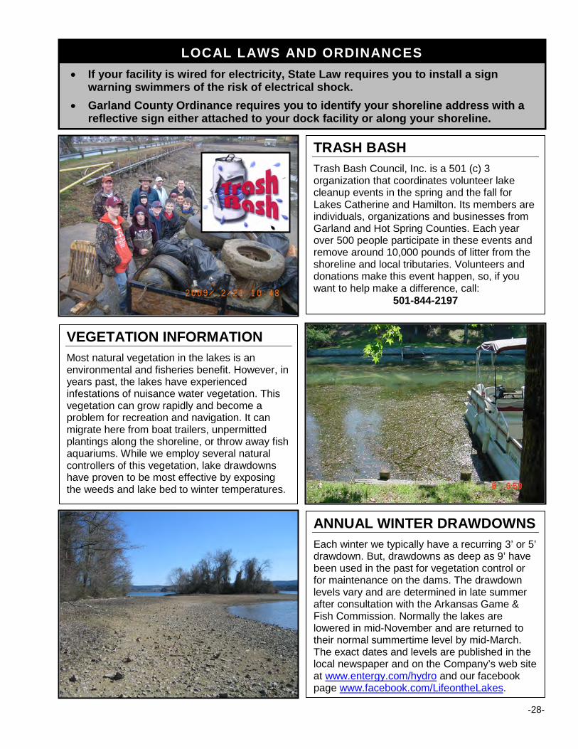
TRASH BASH
Trash Bash Council, Inc. is a 501 (c) 3 organization that coordinates volunteer lake cleanup events in the spring and the fall for Lakes Catherine and Hamilton. Its members are individuals, organizations and businesses from Garland and Hot Spring Counties. Each year over 500 people participate in these events and remove around 10,000 pounds of litter from the shoreline and local tributaries. Volunteers and donations make this event happen, so, if you want to help make a difference, call:
501-844-2197
VEGETATION INFORMATION
Most natural vegetation in the lakes is an environmental and fisheries benefit. However, in years past, the lakes have experienced infestations of nuisance water vegetation. This vegetation can grow rapidly and become a problem for recreation and navigation. It can migrate here from boat trailers, unpermitted plantings along the shoreline, or throw away fish aquariums. While we employ several natural controllers of this vegetation, lake drawdowns have proven to be most effective by exposing the weeds and lake bed to winter temperatures.
ANNUAL WINTER DRAWDOWNS
Each winter we typically have a recurring 3’ or 5’ drawdown. But, drawdowns as deep as 9’ have been used in the past for vegetation control or for maintenance on the dams. The drawdown levels vary and are determined in late summer after consultation with the Arkansas Game & Fish Commission. Normally the lakes are lowered in mid-November and are returned to their normal summertime level by mid-March. The exact dates and levels are published in the local newspaper and on the Company’s web site at www.entergy.com/hydro and our facebook page www.facebook.com/LifeontheLakes.
LOCAL LAWS AND ORDINANCES • If your facility is wired for electricity, State Law requires you to install a sign
warning swimmers of the risk of electrical shock.
• Garland County Ordinance requires you to identify your shoreline address with a reflective sign either attached to your dock facility or along your shoreline.

-29-
Life Jackets They FLOAT You DON’T
PERMIT PROCESSING FEE SCHEDULE
The Federal Energy Regulatory Commission license for Project 271-Lakes Hamilton & Catherine allows the Company to charge reasonable fees to cover the cost of administering its shoreline permitting program. The Company, at this time, only charges a one-time, non-refundable permit processing fee which only helps defray the costs. Fees are frequently reviewed and are subject to change to reflect the actual cost of implementing the Company’s permit program.
• NON-COMMERCIAL PRIVATE FACILITY PERMITS INTENDED FOR SINGLE-FAMILY DWELLINGS: $ 400 (Includes, but is not limited to, permits for new and the modifying of or transferring* of permits for existing docks, swim decks, piers, boardwalks, landings, and circulating geothermal loops.)
*Permit transfer processing fees will be discounted to $200 if the transfer application is submitted within 60 days from purchase of property. For this discount to apply, the transfer must be of a valid permit from the Seller (not a previous owner) that properly identifies all the existing facilities. Otherwise, the normal processing fee is at least $400.
• SEAWALLS, BOAT RAMPS, DREDGING AND CONCRETE STEPS: $ 550 (This fee applies for both new construction and the modification of existing structures)
• RIP RAP, TRAMPOLINES, WOODEN STEPS, PWC RAMPS/LIFTS $ 200 (This fee applies for both new construction and the modification of existing structures)
• AFTER THE FACT PERMITTING: 2X REGULAR FEE (Facilities that are built without prior authorization but meet current guidelines may be permitted but processing fees will be twice the current processing fee and may incur an additional non-compliance processing fee as well.)
Applications that require extensive review, expediting, or require additional inspections may be assessed additional fees based on the time required to process the application.
GRANDFATHERING
“Existing Facilities” permitted prior to the adoption of the Company’s current permitting general Guidelines & Specifications and SMP may remain for their useful lives, as long as they are in good condition and in compliance with the size, location and type requirement set forth in the Company’s requirements in effect at the time the “Facility” was originally permitted. A permit is required prior to any modifications to such facilities (see page 4 - bullet # 5) and may require said facility to be brought into compliance with current guidelines and specifications. If any structure is removed, significantly modified, destroyed, or damaged by fire, natural disasters or other means, a permit is required prior to the replacement of the structure and it must be rebuilt in compliance with the Company’s current guidelines & specifications and SMP.
MISCELLANEOUS RESERVOIR USES
Since every possible scenario cannot be anticipated, the Company reserves the right to make special rulings in cases not specifically covered by the Shoreline Management Guidelines. Solar Panels – may only be mounted flush with the roof of an existing roofed-structure or incorporated into the roof of a planned roofed-structure. They may not be mounted as free-standing structures connected to, or adjacent to, pier or other lake access facilities or within the Project boundary. Facility owners must contact Entergy Hydro Operations prior to any solar panel installation. In addition, these installations must comply with all applicable local, state, and federal regulations. The panels may not block cross vision or be utilized to enclose a structure and as a courtesy to adjoining property owners and as a public safety measure, solar panels must be positioned so reflected light does not interfere with navigation or intrude onto adjoining properties. Geothermal (Heat Exchange) Loops – are allowed on lakes Hamilton and Catherine but require a permit (special conditions apply) from Entergy Hydro Operations to be approved prior to installation. Please contact our office at 501-844-2148 to obtain the geothermal permit application or go online to www.entergy.com/hydro and look under Private Facility Permitting.

-30-
CONDITIONS OF ENTERGY PERMIT FOR PRIVATE FACILITY/ACTIVITY
Applicant understands and agrees that this instrument conveys no property rights in real estate. The consent of Entergy (Company) permit is based on Article 412 to the License for Federal Energy Regulatory Commission (FERC) Project No. 271.
Permittee agrees to the following conditions: 1. THIS PERMIT MAY BE REVOKED BY COMPANY AT ANY TIME. In the event the permittee fails to comply with any of the conditions and requirements of this permit, Entergy may revoke the subject permit as well as all rights and privileges, both current and future, associated with said permit. In the event Entergy revokes any permit and permittee fails to remove said facilities, Entergy may, and hereby has permittee’s permission and authorization, to remove said facilities at permittee’s expense. In the event litigation is required by Entergy to enforce any of its rights related to this process, permittee shall be responsible to Entergy for Entergy’s legal fees and all expenses incurred by Entergy in connection with its enforcement of said rights. 2. This permit applies only to the facilities and structures described within the permit application. Any alterations, additions, relocations, or other physical changes to the facilities or structures must be approved by the Company prior to such changes. This includes but is not limited to: any changes to an existing facility’s footprint, roofline or roof footprint, facility support structure, or location. Any unapproved alterations, additions, relocations, or other physical changes to the facility or structures may result in revocation of the permit and removal of the facility in accordance with the preceding paragraph. 3. The facilities shall not be used for human habitation, nor shall any vessel of any description moored thereto have toilet facilities located thereon or therein, unless such toilet facilities shall meet the applicable city, county, state and federal standards for such facilities. 4. Permittee agrees to defend, indemnify and hold harmless Company from and against all claims, losses, expenses, including attorney fees, or any other liability claimed against or incurred by the Company, including, but not limited to, property damages, personal injury, or loss of life arising out of the construction, maintenance, condition, or use of the facilities or structures covered by this permit. Further, permittee assumes all risks of damages to said facilities or structures or to the property used or stored in connection therewith, resulting from lake level fluctuations or changes, waves caused by wind or vessels, or any other cause. 5. All facilities allowed by this permit are subject to inspection by Company. If such an inspection reveals conditions that deviate from the approved plans, such conditions will be corrected immediately by the Permittee upon notification in writing, which will be sent to Permittee by certified mail or process server. Failure by the permittee to immediately take action to correct the conditions of which notification has been given by the required date as set forth in the notification will result in revocation of the permit and removal of the facility in accordance with Paragraph 1 of this page. 6. Permittee agrees not to install any buoys, floats or other objects tied or anchored in a fixed position or location within the reservoir without obtaining approval from the proper regulatory authorities. Permittee also agrees not to cut/remove trees, brush or vegetation on Company property or along the shoreline without prior written approval from the Company. 7. A permit tag provided by Company shall be posted on the facility at a place designated by Company. 8. Permittee shall complete and present, the Company furnished "Comment Form" to adjoining property owners for review of the proposed facilities described on the application. 9. It is understood by Permittee that all or a portion of the facilities herein described lies within the boundaries of FERC Project No. 271. Permittee covenants and agrees that the use of the facilities or adjoining premises shall not endanger health, create a nuisance, or otherwise be incompatible with the overall Project recreational use. This permit is also subject to the condition that the Permittee's use of the facilities or adjoining premises shall not adversely affect the environmental qualities, including aesthetic values of the area. Any breach of the aforesaid covenant or condition shall be sufficient cause for the Company's termination of the permit herein granted. 10. This permit reserves to the Company and its successors and assigns the right to use the project area for all Project purposes. Further, this permit is made subject to any order, regulation or rule of the FERC or any other governmental agency which now is in effect or may hereafter be made affecting the reservoir or facilities herein described, and Permittee hereby waives and releases any claim or action at law or equity that it may have against Company as the result of the compliance by Company with such order, rule or regulation. 11. Permittee agrees that no drainage, including sewage from the premises, docks or boats moored to said docks or shoreline will contaminate or pollute the waters of the Lake and that he will control all drainage at all times so that it will comply with all applicable city, county, state and federal laws or regulations. If at any time violations of the above occur, the applicant agrees to immediately correct same. 12. Permittee agrees to immediately notify Entergy and stop all work if any historical or archeological resources are discovered during the construction or installation of the permitted facility or activity. Permittee will be required to consult with the Arkansas State Historical Preservation Office to determine what treatment, if any, is appropriate. Permittee agrees not to resume construction or installation until approved, in writing, by the Company. 13. All work associated with shoreline stabilization/retaining walls, boat ramps, dredging/excavation and cut-in boat docks to be performed must also comply with the conditions of General Permit 60, which was issued by the U.S. Army Corps of Engineers, Vicksburg District to Entergy Arkansas, Inc. on September 18, 2009. A copy of the General Permit 60 can be obtained from: www.entergy.com/hydro 14. This permit is non-transferable. If the permitted facility is sold or if the ownership is transferred, the Permittee shall promptly notify the new owner and Entergy Hydro Operations at 501-844-2148. 15. This permit is void and null if the permitted facility or activity as described on the front of this permit is not completed within 12 months from the issue date of permit.

PRIVATE FACILITYAPPLICATION
CHECK LIST
Have you included the following required information?
Permit Form/ApplicationLocation AddressMailing AddressFull Legal DescriptionComplete Facility DescriptionNotarized signature
Processing Fee (See page 29)Fully Dimensioned Site Drawing with Proposed and/or All Existing FacilitiesFully Dimensioned Profile DrawingFully Dimensioned Plan DrawingCompleted Neighbor Comment FormsCopy of Survey and DeedPhotos of the Proposed or Existing Facility’s Location
Please mail permit application to:
Entergy Hydro Operations141 West County Line Rd
Malvern, AR 72104www.entergy.com/hydro
www.facebook.com/LifeontheLakes